Mackay, DonaldMareMagnum

4 134 résultats
160 pages including footnotes, bibliography and index. Numerous black and white reproductions of fascinating archival photos. "Tells the story of Anticosti and its people from the discovery by Jacques Cartier to the present day." - dust jacket. Book unmarked with average wear. Above-average wear to dust jacket which is now preserved in archival-grade Brodart. A sound copy. Book
8vo. (20), 211, (1), 129-487, (1) pp. Contemporary full calf with giltstamped arms of Michel Le Tellier. Leading edges gilt. Edges red. First edition. - Correspondence between the Oratorian Jean Morin (1591-1659) and Cardinal Barberini (and others) regarding the project of Pope Urban VIII to unite all schismatic churches of the orient with the Roman church, in which the learned orientalist Morin was instrumental. As such, this constitutes an early and important attempt to systematically address the relations between the Rome and the Christian communities established in Lebanon, Syria and in the rest of the Middle East, containing valuable observations on the Druze, Copt, and other local religious communities. Several portions printed in Greek, Hebrew, Arabic, and Syriac characters. The editor, R. Simon (1638-1712), has prefixed a Life of Morin which "amounts to a diatribe against not only Morin, but the entire Oratorian Congregation" (cf. Wetzer/W.). - From the library of the French statesman Michel III Le Tellier, marquis de Barbezieux (1603-85), minister of state after Mazarin, Chancellor and Keeper of the Seals of France. It was he who counter-signed (with Louis XIV) the Edict of Fontainebleau, revoking the Edict of Nantes and driving the Huguenots from France; he died but a week later. ESTC R5020. Wing M2764 & S3795. Arber's Term cat. I, 473. Jöcher/A. IV, 2125, 11. Wetzer/W. VIII, 1919. Hoefer XXXVI, 594. OCLC 26431901. Cover arms: Olivier pl. 1753, fer no. 4.
4to (227 x 163 mm). 1 bl. f., 66 pp. (counted as 43; numerous errors in pagination; some parts included in two variants). With woodcut title vignette. Contemporary limp vellum with ms. title to spine. Very rare polemical work, printed throughout in Arabic and Latin, that aims to compare and contrast Christian and Muslim scripture and doctrines. Dedicated to Cardinal Barberini. The editor Dominicus (1585-1670) taught Arabic at the Congregatio de Propaganda Fide since 1636 and collaborated on their Bible project. His magnum opus, one of the first literal Quran translations, was not rediscovered and published until 1883. In 1636 he published an Arabic grammar (the first publication of the Congregatio de Propaganda Fide press to use Arabic type); in 1639 he would produce a dictionary of vernacular Arabic. Four years in the Middle East had convinced him that a missionary must before everything else know the vernacular language (cf. Fück, p. 78). The present work was considered lost quite recently by Antonio García Masegosa in his study "Germán de Silesia, Interpretatio Alcorani Litteralis, Parte I: La traducción latina" (Madrid, 2009): "Por la misma época, publicó un tratado religioso en árabe y en latín titulado Antitheses fidei, que se encuentra perdido en la actualidad, o que al menos no ha podido ser localizado para este trabajo" (p. 14). - Marked brownstaining throughout with waterstain to upper corner. Still an appealing copy. Schnurrer 248. Encyclopaedia of the Qur'an IV, 237. OCLC 491545005, 54509800.
4to (180 x 236 mm). Arabic manuscript on polished oriental paper. 546 ff. (foliated in a somewhat later hand), 23 lines per extensum, written in black naskh, with chapter headings and emphases in red. Contemporary blindstamped full calf, restored and spine rebacked. Rare, complete late 16th century Arabic manuscript of the "Anwar al-Tanzil wa-Asrar al-Ta'wil" ("The Lights of Revelation and the Secrets of Interpretation"), better known as "Tafsir al-Baydawi". One of the most popular classical Sunni Qur'anic interpretational works (tafsir), it was composed by the 13th-century Muslim scholar al-Baydawi (d. 1319?), who flourished in Persia. The "Tafsir al-Baydawi" is considered to contain the most concise analysis of the Qur'anic use of Arabic grammar and style to date and was hailed early on by Muslims as the foremost demonstration of the Qur'an's essential and structural inimitability ("i'jaz ma'nawi wa-lughawi") in Sunni literature. Due to its fame and influence, the work has been selected by scholars as being culturally important and significant, and many commentaries have been written on Baydawi's work. According to the contemporary Islamic scholar Gibril Fouad Haddad, the work "became and remained for seven centuries the most studied of all tafsirs" and it is to be regarded as "the most important commentary on the Qur'an in the history of Islam". - Paper rather browned; some waterstaining to margins of the first 70-odd leaves and occasionally beyond. The first 130 pages are closely annotated in the margins by a near-contemporary owner with several additional annotated sheets (some folding) pasted in. Old waqf stamps to recto of first leaf. Restored binding uses original cover material, showing traces of worming. Removed from the Kutub Khana-i-Sultani (Sultani Library), one of the libraries the Nawabs of Bahawalpur, established in 1926 at Dera Nawab Sahib in south Punjab. GAL I, 417.
4to. (12), 607, (1) pp. Contemporary vellum with handwritten spine title. First edition of this important polemical work by Guadagnoli (1596-1656), the first Italian to teach Arabic and Syriac at La Sapienza and one of the correctors for the enormous Arabic Bible which the Propaganda Fide press began work on in 1632. The present piece of theological disputation was "launched against the Safavid scholar Ahmad b. Zayn al-'Abidin. This fascinating dispute was provoked in the first instance by the anti-Muslim tract penned by the Navarrese Jesuit Jerónimo Javier [...] That work found its way to Safavid Persia, where Ahmad b. Zayn al-'Abidin wrote a polemic response that refuted Christianity; he sent it to Rome in hopes that his arguments would convince the Pope. Scholars in Rome, among them Guadagnoli, studied the Safavid text and prepared their own refutation of it, which was published in the Roman presses of the Congregation [...] The work enjoyed wide circulation and reached the Muslim East; we known that it was wielded as a tool of religious propaganda at the court of the Great Mughal, and that years later, in the eighteenth century, an occasional Christian missionary would study it as a valuable resource for religious disputation with Muslims [...] The 'Apologia' contains, for example, quotations from the Qur'an that are written in Arabic and always accompanied by Guadagnoli's own Latin translation [...] The 1631 [first] edition is intensely anti-Islamic and full of ad hominem attacks on the Prophet, while curiously the 1637 version shows an evolution toward a somewhat greater respect for the religion" (García/Rodríguez). - Binding a little loosened. Lightly browned and brownstained throughout, title-page somewhat more strongly. Lacks the lower margin of a2; repairs to the inner and outer margins of A3 (insignificant loss to text). M. García-Arenal and F. Rodríguez Mediano, The Orient in Spain [Leiden: Brill, 2013], p. 302f.
(8), 92 pp. With woodcut vignette to title-page. Modern green marbled wrappers. 4to. Second, expanded edition of this rare linguistic treatise by the Dutch oriental scholar Johannes van den Driesche (Drusius, 1550-1616): a collection of Hebrew and Arabic wisdom literature in Latin translation. The first edition had been produced by the same publisher in 1591; the present edition preserves the dedication to Thomas Bodley, dated 1 August 1591. - "In 1577 the University of Leiden entrusted Driesche with the chair of Hebrew, Chaldaean, and Syriac, which he relinquished in 1585 in favour of the better-endowed chair in Franeker. For thirty years he discharged his duties with great assiduity" (cf. ADB V, 489). - Occasional insignificant browning. OCLC 45974008.
Folio (212 x 333 mm). Publisher's original blue printed boards, black cloth spine hand-lettered. Appendices to the annual "Administration Report" on the Gulf region which the British Political Residents submitted to the Indian Viceroy and Governor. The bland official title belies the true value of the series, which has been called "a mine of information on the development of the modern Gulf" (Cambridge Archive Editions). Regularly the reports contain political details of the local sheikhdoms as well as trade information. - The present appendix volume contains the meteorological tables for the year 1896/97 as well as, crucially, the year's trade reports for the entire Gulf region. The issue notes widespread lower trade revenues, which it diagnoses as due to an Indian plague and subsequent quarantines of port cities, as well as ongoing political unrest in Qajar Iran following the assassination of the Shah, Naser al-Din Shah Qajar, the previous year. The volume provides carefully detailed charts of imports and exports for Bushire, Lingah, Bunder Abbas, Bahrain, the Arab Coast of the Gulf, and Shiraz. Though most exports dropped, the value of Bahrain's in fact had gone up since the previous year, with its most valuable exports being coffee, rice, and printed cottons to Turkey and the especially valuable export of pearls to India. On the Arabian Gulf Coast, principal exports were, again, pearls, though these were largely bound to "Persian ports". Those on the Arab Coast also benefitted from the mother o' pearl shell trade, one of the least impacted by the upheavals of India and Qajar Iran. - The "Administration Report on the Persian Gulf" was published under various titles annually between 1875 and 1957. Original specimens are almost unobtainable in the trade. - Provenance: removed from the London Library, with their printed label on the upper cover and their stamps (in blind and printed) on title-page and final leaf, accompanied by cancel stamps. Macro, p. xii (s.v. "RAPA": Report on the Administration of the Persian Gulf Political Residency and Muscat Political Agency). OCLC 224558510. ZDB-ID 768652-3. Cf. the 1989 Cambridge Archive Editions reprint.
Standard issue, 700 x 1024 mm. Scale 1:50,000. Detailed nautical chart of the approaches to Mina Salman, the primary cargo port and customs point of Bahrain, prepared by the British Admiralty. Undoubtedly one of the better antiquarian maps of northern Bahrain. - The chart details the approaches to Mina Salman as well as the Sitra anchorage. Approach channels to Mina Salman were built in 1954, and a pier was constructed in 1956, mainly used by dhows. In 1958 it became a free port, and in 1962 a deep water wharf composed of six berths was constructed. The wharf allowed cargo to be directly loaded onto the port for the first time. In the 1960s, the port had refrigeration, storage facilities and equipment for handling large ships. - The map includes the cities of Muharraq and Manama, showing numerous minarets. Bahrain Fort, the Portuguese Fort, Abu Mahur Fort, and the Sheikh's palace are labelled. Another prominent site is Muharraq Airfield, a military base established by the Royal Air Force in April 1943 as RAF Bahrain (later RAF Muharraq) that remained in use until 1971, when Bahrain declared independence. - The British Admiralty has produced nautical charts since 1795 under the auspices of the United Kingdom Hydrographic Office (HO). Its main task was to provide the Royal Navy with navigational products and service, but since 1821 it has also sold charts to the public. The present chart was composed after Admiralty surveys from 1932 to 1960. The 1951 first edition saw revisions and corrections in 1962-65. - Very well preserved with a single fold. Provenance: stamps of Maria K. Iatrou, seller of nautical charts, books and instruments in Piraeus, Greece.
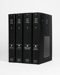
121943Cambridge Cambridge Archive Editions 2020. . 4 vols 8vo 25.5. x 16.5 cm; publisher's original black cloth lettered in silver a fine set.<br /> A valuable collection of records detailing the development and growth of the cities of Kuwait Manama Doha Abu Dhabi Dubai Sharjah Muscat and Mattrah from as early as 1818 right the way through until the mid-1960s before the Gulf War. Chapters are divided into: topography municipality water electricity health education communication lines urban development port development and social history with many royal decrees reproduced.<br /> Cambridge, Cambridge Archive Editions, 2020. hardcover
388 x 470 mm. Framed and glazed. Needlepoint picture after Théodore Géricault.
4to. X, 188 pp. Publisher's cloth. Dustjacket. Traces Arab awareness of the West, which began in embryonic form when the French forces under Napoleon occupied Egypt in 1798. Examines the works of Arab writers who helped to formulate a new image of the West and to shape Arab response to the challenge raised by cultural contact between disparate worlds. Treats developments up to 1870. - Excellent copy in very good price-clipped dustjacket.
Half-tone photographic postcard. A beautiful image of sail-makers labouring over a large sheet of sailcloth, stretched out before a picturesque backdrop of beach, dhows and ocean. The Times Press, alongside the main business of printing newspapers, issued a number of postcards of Western India and Mesopotamia in the first decades of the 20th century. The present postcard is one of the few illustrated with photographs of Kuwait. - Very light rounding to corners, otherwise very good.
8vo. X, 273, (1 blank) pp. With two black and white maps on the endpapers. Brown cloth with publisher's illustrated dust jacket. First and only edition of a thorough description of the history of the nine Arab states of the Lower Gulf, that gained independence in 1971, just four years before the publication of this book. The author has managed to discuss the individual politics of each state and that of the bigger picture, making this a handbook for all who wish to learn more about Bahrain, Qatar and the United Arab Emirates (Ajman, Dubai, Fujairah, Ras Al Khaimah, Sharjah and Umm Al Quwain). The several infographics that are used to explain the political structures are very helpful in this respect. Oil plays a key role in the relationship between the individual states and this is intricately laid out by the American author. Because this book was written in such a key moment in the history of the region, it has gained much importance. The author Dr. John Duke Anthony is a leading figure in United States-Arab relations and has held many influential government positions in this field. Amongst others, he is the founder and president of the National Council on U.S.-Arab Relations and he is part of the United States Department of State Advisory Committee on International Economic Policy's Subcommittee on Sanctions. He holds a Ph.D. in International Relations and Middle East Studies at the School of Advanced International Studies. In the years leading up to this publication the author has conducted first-hand research on the Lower Gulf region's political and socio-economic structures, obviously with oil playing a major role. The fruits of this research are presented in this book, offering the reader a comprehensive overview of a complex subject. This book was published in The James Terry Duce Memorial Series, which started in 1966. The first and second volumes were on North Africa and Jerusalem respectively, this is the final volume of the series. - Ink annotations in the margins throughout. A good copy with the original dustjacket well preserved. OCLC 1700964.
Folio (212 x 335 mm). (2), 276, IX, (1) pp., final blank, with one folding plate (counted as p. 152). Contemporary half cloth with original printed boards, issued thus. Gertrude Bell's personal copy of this excessively rare manual on the social, political and economic structures of the Arab tribes living in the Baghdad Vilayet (Province) as drawn up in July 1918, only months before the partitioning of the Ottoman Empire ended the old administrative divisions and led to the formation of several new states - indeed, to the creation of the modern Arab world. - Arranged alphabetically by the names of the tribes, this handbook - essentially a carefully compiled and redacted British intelligence file printed for the use of British Political Officers and their assistants in a region then undergoing dramatic upheavals - offers surprisingly detailed information on the tribes' origins, loyalties and internal quarrels, the locations of their settlements, strength of their possessions, economic and bargaining power, as well as their kinships, often including genealogical tables. The names of the tribes' leaders are given in full, frequently also in the original Arabic. - Gertrude Bell (1868-1926), who had firsthand experience among the tribes, signed her name in pencil ("Gertrude Lowthian Bell") on the front free endpaper. Several neatly pencilled additions to some of the entries are likewise in her hand: next to the name Fahad ibn Hadhdal she notes that he died and the name of a "rival" (this underlined), apparently a "bin Dughaiyin" (p. 16). In another entry she notes that Jazza' ibn Mijlad "blockaded Turks in North for allies in 1st war" (p. 17) and that the A'marat prefer to winter near al-Hafan. There are several references to her fellow political officer, St John Philby, and a correction that the Al-Dulaim are "all Sunnis" (p. 265), and none Shi'ahs. - Gertrude Bell was a traveller, political actor, and archaeologist who was a key player in the nation-building after World War I, especially in Iraq. She founded the Iraq Museum, translated Persian poetry, and advised the British government's foreign policy at nearly the highest level. It is little surprise that she would have owned one of the few copies of this important source, containing otherwise nearly unobtainable population statistics as well as details on the political history of a region in which traditional tribal feuds became mingled with international high politics. Considering the limited scope of intended distribution and the sensitive nature of the information contained, it is safe to say that this invaluable compendium never had more than a very limited press-run; indeed; only three copies are known today in libraries worldwide, and none with such unique provenance. - Covers rubbed, title-page brittle and reinforced with two library stamps carefully removed but still faintly visible. A closed tear to the folding map. Later in the collection of the American missionary turned political biographer Harry J. Almond (1918-2007), with his handwritten ownership in ink next to Bell's own. In all very well preserved. No copy in auction records. OCLC: 921927074, 729268761.
42 x 100 cm. Five-tone lithographic map with illustration by Harraz. Constant ratio linear horizontal scale 1:7,500,000. Road map also showing railways, populated places, boundaries, rivers, wadis, and possible flood areas. Includes inset map: Diagrammatic map of the Arab world. Folded. First edition of this large, decorative map, showing the highways that linked countries under Arabian influence in the early 1970s. It stretches as far north as Turkey, south to the Sudan, west to Mauritana and east beyond the Strait of Hormuz, capturing the whole of the Arabian Gulf including Kuwait, Bahrain, Muscat, Oman, Saudi Arabia and the People's Republic of Southern Yemen. The verso contains an index of main travel routes through these various countries. - The United Arab Republic, as it is here referred to, was formed through a political union of Egypt and Syria. It was instigated by the Egyptian Prime Minister Gamal Abdel Nasser (1918-1970) and was seen as an expression of pan-Arab sentiment. Syria broke aways from the union in 1961 (and is here shown as an independent country), but Egypt continued to use the name until 1972. The People's Republic of Yemen, the only communist state to be established in the Arab world, was formed in late 1967, to last until 1990. - Some nicks and small tears, a single mark to the covers, a 1 cm tear on the left side of the map. In very good condition for a fragile map. Scarce: LibraryHub does not locate any holdings whilst Worldcat adds just eight institutional copies worldwide. OCLC 5403988.
Colour printed map, 540 x 400 mm. Map of the Arabian Peninsula and parts of the USSR, Turkey, Iran and the British, French and Italian colonies in Africa, possibly coming form an edition of the "Commercial atlas of the world". Printed in yellow are oil fields and pipelines, including the legendary Kirkuk-Haifa/Tripoli oil pipeline. Detailed maps of Iran and of British controlled Palestine are printed on the other side. - With a few small holes near the inner margin.
Large folding heliozincographed colour map, 2 (of 4) sheets, each measuring 940 x 700 mm (lacking the eastern sections). Both sections with original printed covers. Two sections of Hunter's large and extremely detailed map of the Arabian Peninsula and Gulf, showing the Red Sea coast of Saudi Arabia with the 'Asir, Hejaz and Nejd regions, as well as most of Yemen, with Kuwait and Southern Iraq. The two eastern sections, which covered Oman, the UAE, Qatar, Bahrain and part of eastern Saudi Arabia, are not present. - The Canadian-born Hunter later became a major figure in British India's Intelligence Service. He initially compiled the map between 1905 and 1908, to accompany J. G. Lorimer's "Gazetteer of the Persian Gulf". As the author recalls in his 1919 "Reminiscences", "a great deal of the information on the map was from sources considered secret at the time" (p. 357). Special surveys of the country's interior areas were carried out to achieve a hitherto unprecedented degree of accuracy: "The map was a distinct advance on anything which existed, as in 1908 no general map of Arabia on such a large scale existed" (p. 360). The "Hunter" map was used (and praised) by St John Philby during his journey across Arabia. - Such was the detail of Hunter's map that the Survey of India reissued it, with corrections, several times during the First World War and interwar period. As the maps were issued in parts and used on active service it is not unusual for sections to be missing. Many of the surviving copies show signs of official use; this issue bears a flight route, sketched out in red ink, along the southern Gulf coast to Baghdad. - Some light browning, several small tears to folds, otherwise very good. - Scarce. OCLC locates complete copies at the Library of Congress, University of Wisconsin, National Library of Israel and the BNF. Cf. Macro 1228.
Large folding heliozincographed colour map, 1 sheet (of 4), measuring 940 x 700 mm. Original printed covers. Separate section of Hunter's large and extremely detailed map of the Arabian Peninsula and Gulf, showing southern Oman with the eastern tip of Yemen. - The Canadian-born Hunter later became a major figure in British India's Intelligence Service. He initially compiled the map between 1905 and 1908, to accompany J. G. Lorimer's "Gazetteer of the Persian Gulf". As the author recalls in his 1919 "Reminiscences", "a great deal of the information on the map was from sources considered secret at the time" (p. 357). Special surveys of the country's interior areas were carried out to achieve a hitherto unprecedented degree of accuracy: "The map was a distinct advance on anything which existed, as in 1908 no general map of Arabia on such a large scale existed" (p. 360). The "Hunter" map was used (and praised) by St John Philby during his journey across Arabia. - Such was the detail of Hunter's map that the Survey of India reissued it, with corrections, several times during the First World War and interwar period. As the maps were issued in parts and used on active service it is not unusual for sections to be missing. Many of the surviving copies show signs of official use; this issue bears a flight route, sketched out in red ink, from Ghaidhah (Al Ghaydah) in southeast Yemen toward Muscat. - Some light browning, several small tears to folds, otherwise very good. Ownership inscription in red ink to cover, "H. R. Tidd. F/O", by Flight Officer Herbert Richard Tidd (1912-42), proving that the maps were still issued to RAF personnel in the early 1930s. - Scarce. OCLC locates complete copies at the Library of Congress, University of Wisconsin, National Library of Israel and the BNF. Cf. Macro 1228.
230:325 mm. Engraved map. "A blown-up copy of the map designed by Gastaldi in 1548" (Al Ankary). The Gastaldi map "was the first modern map of the Arabian peninsula"; for the first time it "clearly shows the island of Bahrain and Qatar" (ibid.). Al Ankary 136.Tibbetts 27. Cf. Sultan Bin Muhammad Al-Qasimi 19 (the small version only).
190 x 260 mm. Ruscelli's modern map of Arabia from his 'La Geographi di Claudio Tolomeo'. A feature of this first state is that no map has a platemark at top: two maps were engraved on the same plate and the resulting sheet halved. Tibbetts 27.
8vo. XXIX, (3), 397, (1) pp. With 2 maps, 74 photo illustrations on plates, and 7 text illustrations. Publisher's gilt red cloth with dustjacket. First American edition, published simultaneously with the London one. The preface was contributed by T. E. Lawrence. Among the many photograph illustrations is one of the earliest portraits of the Qatar royal family (facing p. 298). "In this book, Bertram Thomas relates some aspects of his journey in which he crossed the Rub' Al Khali (Empty Quarter) from Oman to Qatar, and provides geographical information about the peninsula of Qatar, especially the southern part. He also recorded his observations of the region stretching from the Gulf of Salwa to Al-Rayyan, where he met Sheikh Abdullah bin Jassim Al Thani, Emir of Qatar at the time (1930). The book includes photographs he took of Sheikh Abdullah, Mohamed bin Abdul-Latif bin Mani', and his brother Saleh bin Abdul-Latif bin Mani'. He gives some concise information about Al-Nuaija, Doha towers, and the castle" (Fikri). - Inscribed "to Crosby" by "the Shorts" (12 March 1933) on the flyleaf. A fine copy. Macro 2185. M. H. Fikri, Qatar in the Heart and in History (2011), p. 46f. (illustrated).
8vo. XXIX, (3), 397, (1) pp. With 3 maps (one a large folding map of the Empty Quarter at the end of the volume), 74 photo illustrations on plates, and 7 text illustrations. Publisher's brown cloth with title in gilt to spine. First edition, published simultaneously with the New York one. The preface was contributed by T. E. Lawrence. Among the many photograph illustrations is one of the earliest portraits of the Qatar royal family (facing p. 298). "In this book, Bertram Thomas relates some aspects of his journey in which he crossed the Rub' Al Khali (Empty Quarter) from Oman to Qatar, and provides geographical information about the peninsula of Qatar, especially the southern part. He also recorded his observations of the region stretching from the Gulf of Salwa to Al-Rayyan, where he met Sheikh Abdullah bin Jassim Al Thani, Emir of Qatar at the time (1930). The book includes photographs he took of Sheikh Abdullah, Mohamed bin Abdul-Latif bin Mani', and his brother Saleh bin Abdul-Latif bin Mani'. He gives some concise information about Al-Nuaija, Doha towers, and the castle" (Fikri). - Provenance: armorial bookplate of Arthur Garrard to front pastedown. Later in the collection of the Dutch traveller Ruud Verkerk. Macro 2185. M. H. Fikri, Qatar in the Heart and in History (2011), p. 46f. (illustrated).
Large 8vo. X, 213, (3) pp. With 3 maps and 18 plates, some containing multiple images. Red cloth, blind-tooling on covers, title information in gold on spine. First edition of G. W. Bury's account of Yemen on the eve of WWI. Bury (1874-1920) was a British naturalist, explorer, Arabist and political officer in the British army, who spent most of his life in the Aden-Yemen borderlands. As a young man, he spent a year with the Abdali tribe in the Aden protectorate; he learned their language and even received the name Abdulla Mansur. Later in life, he was able to pass himself off as a local, because of his looks and command of colloquial Arabic. The British government made use of this by employing Bury as a political officer in the region and even escorting the British part of the Boundary Commission in the Dhala region of Yemen. - "At the outbreak of World War I, Bury's unique knowledge of the Arab tribesmen and the Turkish administration commended him to the British intelligence service, and in 1915 he was made 'political officer' to the Red Sea Northern Patrol with the rank of lieutenant in the Royal Navy Volunteer Reserve" (Howgego). - Very slight browning, small tear in the contents-page (outer margin). Overall in good condition. Howgego IV, B99. Macro 642. Shapero, The Islamic World (2003), 163. Smith, The Yemens, 59. Sotheby's, Burrell sale, lot 136. Cf. Canton, From Cairo to Baghdad British travellers in Arabia, pp. 170-176.
4to. 3 in 4 vols. With 2 folding maps and one folding panorama. Numerous illustrations and plans. Original wrappers. First edition of this standard work on the region: the first scientific account of the Nabataean antiquities, including the ruins of Petra. The Bohemian scholar Alois Musil (1868-1944) was fluent in 35 Arabic dialects. In 1898 he had rediscovered the lost desert castle of Qusayr Amra (built ca. 715 A.D.) in the Jordanian desert north of Amman. During WWI he was sent to the Middle East to thwart British operations against the Ottoman Empire, thus becoming the opponent of T. E. Lawrence. In 1827 he helped establish the Oriental Institute of the Academy of Sciences in Prague. - With contemp. ownership "Dr. Zweig" on wrapper covers (in Hebrew and German). Some pages uncut; professional repairs to edges. Rare with all 4 volumes; no complete copy recorded at auction during the past decades. Macro, Bibliography of the Arabian Peninsula, 1667. Howgego III, M103 (p. 664). Fück 262. NYPL Arabia coll. 171. OCLC 3114451.
Hand-coloured engraved map (510 x 405 mm). Includes excellent detail in along the west coast of the Red Sea and in Egypt and Nubia. The Route of the Persian Caravans across Arabia is shown, as is a second route. - In good condition. Not in Tibbetts, Al Ankary or Al-Qasimi.