Vandermaelen, PhilippeBiblio.com
948 résultats
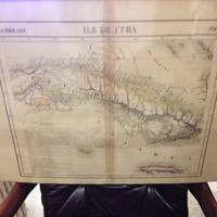
182736244Brussels Belgium: Lithographed By H. Ode. Very Good. 1827. Map. Map # 67 A Very Good primitive and early map of the Island of Cuba also shows Jamaica and Grande Cayman. There is an inset in French with the history of Cuba. Latitude of the map is 18 degrees to 24 degrees and longitude is 78 degrees to 86 degrees. Of course almost all localities shown are French or Indian names. The atlas from which this is extracted is extremely rare and originally composed 6 volumes this map being from the North America volume. Lithographer Ode and Cartographer Vandermaelen produced the first lithographed atlas ever done. Condition is overall Very Good. Browning to the centerfold crease caused by glue used in attaching the tab to the original volume the two page spread measures 21" x 26 1/2" when opened out. Topigraphical features are accentuated see image. Shipping will require extra care and cost due to insurance. Photo available upon request. ; 21" x 26 1/2"; 1 pages . Lithographed By H. Ode unknown
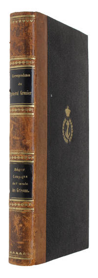
180157625Paris Treuttel et Wurtz 1801 1802. Bound in one Contemp. hcalf. Gilt spine. Titlelabels with gilt lettering. Stamp on title-page. IVXVI248 pp. 120 pp. <br/><br/><em>Both first edition. </em> unknown
180157625Paris, Treuttel et Wurtz, 1801 (+) 1802. Bound in one Contemp. hcalf. Gilt spine. Titlelabels with gilt lettering. Stamp on title-page. IV,XVI,248 pp. + 120 pp.
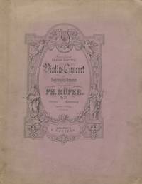
188122022Leipzig: C.F. Peters PN 6440 1881. Folio. Original publisher's lavender wrappers. 1 title within decorative border 2 blank 3-57 pp. Engraved. <br/><br/>With a signed presentation inscription from the composer to his friend the Belgian violinist Martin Marsick 1847-1924 to title dated Berlin October 14 1881. <br/><br/>Wrappers somewhat worn faded and soiled. Slightly worn; edges to several leaves slightly frayed. First Edition. <br/><br/>Rüfer a pianist and composer settled in Berlin in 1871 and taught at the Stern Conservatory Kullak's Akademie der Tonkust and later at the Scharwenka Conservatory see Baker 8 p. 1560. C.F. Peters [PN 6440] unknown books
183115547à Paris: Chez Dentu 1831. Fine. Chez Dentu à Paris 1831 22 x 13.50 cm broché First edition We have found no trace of this work in electronic catalogues in France and the United Kingdom. Original pamphlet in pink paper wrappers. History of Louis Philippe Joseph d'Orléans from a slanderous and denunciatory perspective. The author presents and depicts the man as a skillful and unscrupulous hypocrite. As epigraph a quotation from Cicero: « Je ne crois pas qu'il ait jamais existé sur terre un pareil monstre. » I do not believe that such a monster has ever existed on earth. The author appears to be a witness to the Revolution as numerous revolutionary scenes are described from his viewpoint. Chez Dentu unknown
18879196Paris Baudoin 1887. 1st Edition . Hardcover. . ~ ~ NOTE: THE PRICE OF THIS BOOK IS CURRENTLY REDUCED! ~ ~ . Octavo. Pp. vii 389. Plus folding map bound at end. With text figures sketch maps and tables. HARDCOVER bound in contemporary half cloth and marbled boards spine lettered in gilt old shelf ticket to spine old military institutional stamp to title; inner hinges slightly cracked slight wear to head of spine. Foxed else in a very good condition. ~ FIRST EDITION. Alfred Philippe Delambre 1833-1909. The Encyclopaedia Britannica 11th edition 1910 has described this book as "one of the more important works on the subject of fortification and siege war" and the book has been listed as such together with the works of the great fortification theoreticians Dürer de Ville Coehoorn Vauban Noizet as well as Delambre's contemporaries Plessix and Legrand Ritter von Brunner and Deguise. Extremely rare. Jordan 0862. H-5 IN <br/> <br/> Paris, Baudoin hardcover
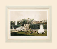
186164186Paris. 1861. Wonderful view of the Park of St Cloud on the outskirst of Paris published in 'Paris Dans Sa Splendeur' by Henri Charpentier Size: 250 x 360 mm. Original lithograph. Hand coloured. Mounted size: 490 x 570 mm. Fine condition. unknown
1827202217Brussels: Vandermaelen Philippe Marie 1827. unbound. very good. Map. Large format lithograph of West Africa with original hand coloring. Image measures 18.5" x 22.25".<br/> <br/> Includes the Congo Congo River and Gabon. Double page with centerfold. From Vandermaelen's 6 volume "Atlas universel de geographie physique politique statistique et mineralogique sur l'echelle de 1/16411836". Can be combined as gores to form an immense globe. The atlas was the first to map the world on a uniform scale.<br/> <br/> Vandermaelen, Philippe Marie unknown
182736263Brussels Belgium: Lithographed By H. Ode. Very Good. 1827. Map. Map # 15 A Very Good primitive and early map showing the southern Yukon Territory and the southwestern part of the Northwest Territory. Includes the Great Slave lake depicted in black white and gray shades. Latitude of the map is 60 degrees to 65 degrees and longitude is 114 degrees to 130 degrees. Of course almost all localities shown are French or Indian names. The atlas from which this is extracted is extremely rare and originally composed 6 volumes this map being from the North America volume. Lithographer Ode and Cartographer Vandermaelen produced the first lithographed atlas ever done. Condition is overall Very Good. Browning to the centerfold crease caused by glue used in attaching the tab to the original volume the two page spread measures 21" x 26 1/2" when opened out. Topigraphical features are accentuated see image. Shipping will require extra care and cost due to insurance. Photo available upon request. ; 21" x 26 1/2"; 1 pages . Lithographed By H. Ode unknown
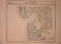
1827205010Brussels: Phillippe Marie Vandermaelen 1827. unbound. very good. Map. Lithograph with original hand outline. Image measures 19" x 22.5".<br/> <br/> Map of Denmark with rail lines. Map includes both Schleswig and Holstein while today part of the former and all of the latter are northern Germany. Also shows portion of Sweden and Norway. Double page with centerfold. From Vandermaelen's 6 volume "Atlas universel de geographie physique politique statistique et mineralogique sur l'echelle de 1/16411836". Can be combined as gores to form an immense globe. The atlas was the first to map the world on a uniform scale.<br/> <br/> Phillippe Marie Vandermaelen unknown
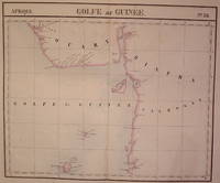
1827202223Brussels: Phillippe Marie Vandermaelen 1827. unbound. very good. Map. Large format lithograph of West Africa with original hand coloring. Image measures 18.5" x 22.25".<br/> <br/> Includes Nigeria and Cameroon. Double page with centerfold. From Vandermaelen's 6 volume "Atlas universel de geographie physique politique statistique et mineralogique sur l'echelle de 1/16411836". Can be combined as gores to form an immense globe. The atlas was the first to map the world on a uniform scale.<br/> <br/> Phillippe Marie Vandermaelen unknown
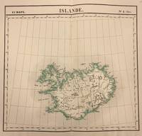
1827321604Brussels: Phillippe Marie Vandermaelen 1827. unbound. Map. Lithograph with original hand outline. Image measures 20 x 18.5 inches<br/> <br/> This is a unique circa 1827 map of Iceland by Phillipe Marie Vandermaelen. Identifies cities towns glaciers and rivers. Reykjavik Hafnarfjordur Akureyri and Mt. Hekla are all located. Issued in the 'Atlas Universel de Geographie Physique Politique Statistique et Mineralogique'.<br> <br> This is a double page map with original centerfold and wide margins as issued. In good condition. <br> <br> Phillippe Marie Vandermaelen 1795-1869 was a Belgian cartographer and publisher. His Atlas universal was both the first lithograph atlas and the first atlas to map the world on a uniform scale. The maps were meant to join together to form a huge globe. This map is a fine example of his work.<br/> <br/> Phillippe Marie Vandermaelen unknown
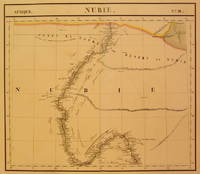
1827202375Brussels: Phillippe Marie Vandermaelen 1827. unbound. very good. Map. Large format lithograph with original hand coloring. Image measures 18.5" x 22.25".<br/> <br/> Includes Nubia Sudan and cities along the Nile River. Double page with centerfold. From Vandermaelen's 6 volume "Atlas universel de geographie physique politique statistique et mineralogique sur l'echelle de 1/16411836". Can be combined as gores to form an immense globe. The atlas was the first to map the world on a uniform scale.<br/> <br/> Phillippe Marie Vandermaelen unknown
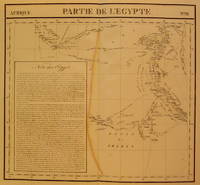
1827202377Brussels: Phillippe Marie Vandermaelen 1827. unbound. very good. Map. Large format lithograph with original hand coloring. Image measures 18.5" x 22.25".<br/> <br/> Includes northern Egypt and the northern section of the Nile as well as an inset with information on the area. Double page with centerfold. From Vandermaelen's 6 volume "Atlas universel de geographie physique politique statistique et mineralogique sur l'echelle de 1/16411836". Can be combined as gores to form an immense globe. The atlas was the first to map the world on a uniform scale.<br/> <br/> Phillippe Marie Vandermaelen unknown
1827202376Brussels: Phillippe Marie Vandermaelen 1827. unbound. very good. Map. Large format lithograph with original hand coloring. Image measures 18.5" x 22.25".<br/> <br/> North Eastern coast of Africa and the Mediterranean Sea including the northern coast of Egypt the Nile delta and Crete. Double page with centerfold. From Vandermaelen's 6 volume "Atlas universel de geographie physique politique statistique et mineralogique sur l'echelle de 1/16411836". Can be combined as gores to form an immense globe. The atlas was the first to map the world on a uniform scale.<br/> <br/> Phillippe Marie Vandermaelen unknown
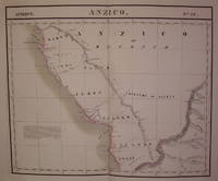
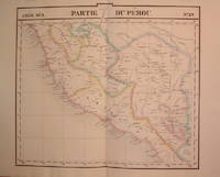
1827204788Brussels: Phillippe Marie Vandermaelen 1827. unbound. very good. Map. Lithograph with original hand outline. Image measures 19" x 21.5".<br/> <br/> Beautiful map of southern portion of Peru with Lake Titicaca in great detail. Also included is Cuzco the historic capital city of the Incan Empire where Machu Picchu was "discovered" in 1911. Double page with centerfold. From Vandermaelen's 6 volume "Atlas universel de geographie physique politique statistique et mineralogique sur l'echelle de 1/16411836". Can be combined as gores to form an immense globe. The atlas was the first to map the world on a uniform scale.<br/> <br/> Phillippe Marie Vandermaelen unknown
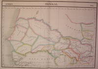
1827202219Brussels: Vandermaelen Philippe Marie 1827. unbound. very good. Map. Large format lithograph of West Africa with original hand coloring. Image measures 18.5" x 22.25".<br/> <br/> Includes Senegal and Gambia. Double page with centerfold. From Vandermaelen's 6 volume "Atlas universel de geographie physique politique statistique et mineralogique sur l'echelle de 1/16411836". Can be combined as gores to form an immense globe. The atlas was the first to map the world on a uniform scale.<br/> <br/> Vandermaelen, Philippe Marie unknown
186046403015Paris, Poulet-Malassis, 1860 ; in-12, broché, couverture jaune imprimée. 2 ff., frontispice, VI pp., 1 f. de faux-titre, 272 pp., 1 f. de table, 1 f. avec le caducée – Titre en rouge et noir. "EDITION ORIGINALE tirée à 100 exemplaires, plus quelques très rares exemplaires sur vergé de Hollande. Exemplaire sur papier de l’édition. Frontispice de Jules BUISSON, tiré en noir sur un papier vélin blanc très fort. Ce Jules Buisson, surtout connu comme écrivain d’art est né à Carcassonne en 1822. On connaît 4 pièces gravées par lui pour des livres d’amis comme Levavasseur, Prarond et Chennevières (Voir Fonds français III, 512). Il fit aussi un portrait du marquis de Chennevières qui parut dans «l’Artiste» de 1899 (mort de l’auteur). L’eau-forte de ce volume (elle existe en divers tirages), montre Chennevières étendu sous un pommier chargé de fruits. Quatre petits génies l’entourent: l’un d’eux tient une pancarte sur laquelle on lit: «La paresse a tué Jean de Falaise». Dans le catalogue Monselet (1871) on peut lire: «Ce Jean de Falaise, que ses amis regardaient – et qui se regardait lui aussi – comme le plus insouciant et le plus paresseux de la création, est aujourd’hui inspecteur des Musées. Jules Buisson a beau jeu à nous le présenter endormi tout de son long dans l’herbe; c’est monté sur une échelle, au palais des Champes-Elysées, qu’il fallait le faire voir». Quelques contes de ce recueil avaient paru dans le «Corsaire» de 1846-47. Launay précise: «En lui envoyant les textes réunis pour cet ouvrage, Chennevières avait averti Malassis: «Votre conscience (en) portera la responsabilité dans tous les siècles des siècles…». En fait, c’est peut-être le modèle des éditions alençonnaises; c’est d’une qualité classique si discrète, si achevée, qu’elle ne se remarque pas. C’est aussi un livre témoin. Témoin d’une amitié et d’une époque. Chennevières, Le Vavasseur, Prarond – et Baudelaire – s’étaient connu dans les années 40 à la pension Bailly et avaient participé à la fondation de cette «Ecole» dite «Normande» qu’évoque la dédicace, et à laquelle Buisson avait réservé son talent avant d’en faire profiter, beaucoup plus tard, ses collègues députés…». Les feuillets liminaires portent un poème de l’auteur à ses amis J. Buisson, G. Le Vavasseur et E. Prarond et des réponses en vers de ces deux derniers. Launay 113 – Vicaire 360. Bel exemplaire."
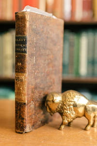
18409900031220Philadelphia: Haswell Barrington et al. 1840. Leather Bound. 8vo. Bound in original tree calf leather with gilt spine lettering. Stamped on the top spine label is: 'Select Medical Library' '23'. The boards are bumped soiled & quite worn. The hinges and joints are tight. The contents are a bit foxed: good condition. The four titles are: 1 Phillippe Ricord 'A PRACTICAL TREATISE ON VENEREAL DISORDERS: and More Especially on the History and Treatment of Chancre' 1840 pp. 58. First published in Paris 1838. Ricord 1800-1889 proved that syphilis and gonorrhoea were separate diseases contradicting the great English authority John Hunter. This is the first English language edition taken from '.a series of articles from the Edinburgh Medical and Surgical Journal: Nos. 135 136 and 139.' which were translated from the French by George Bell. It does not contain the full text of Ricord's magnum opus which was not published in English in its entirety until 1843 see G&M #2381 & #5202. Signature and date 1840 of Robert Randolph M.D. at top right of title page. 2 James Macartney M.D. 'A TREATISE ON INFLAMMATION' 1840 pp. 117. 3 A. Petit ed. translated from the French by James P. Jervey M.D. 'Amussat's Lectures on RETENTION OF URINE caused by STRICTURES OF THE URETHRA and on the Diseases of the Prostrate' 1840 with three copper engravings pp. 103. Jean Zulema Amussat performed the first lumbar colostomy for obstruction of the colon G&M #3442. 4 Thomas Henderson M.D. 'HINTS ON THE MEDICAL EXAMINATION OF RECRUITS FOR THE ARMY; and on the Discharge of Soldiers from the Service on Surgeon's Certificate. Adapted to the Service of the United States.' 1840 pp. 44 1st edition. Haswell, Barrington et al. unknown
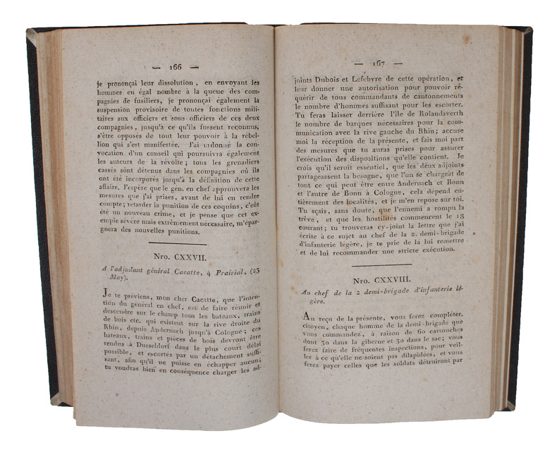
185455649Paris Paul Dupont 1854. Contemp. hcloth. Titlelabel with gilt lettering. Stamp on title-page. XVI2262 pp. 3 large folded engraved maps. hardcover
185654683Paris Paul Dupont 1856. Contemp. hcloth. Wear to top of spine. Stamps on title-page. XVII2216 pp. 3 large folded engraved maps. hardcover
185455649Paris, Paul Dupont, 1854. Contemp. hcloth. Titlelabel with gilt lettering. Stamp on title-page. XVI,226,(2) pp., 3 large folded engraved maps.
185654683Paris, Paul Dupont, 1856. Contemp. hcloth. Wear to top of spine. Stamps on title-page. XVII,(2),216 pp., 3 large folded engraved maps.
1887918P51Neuchatel: Attinger Freres 1887. First edition. Leather. Near Fine. 7" by 5.5". None. A smartly bound limited edition work on the autograph collection of Alfred Bovet signed by Bovet himself. The first edition of this scarce limited edition. Limited to six hundred copies of which this is numbered five hundred and eighty. Signed by Alfred Bovet to the limitation page. In the original French.Bound by V. Champs.Original wraps are bound in.An interesting study on the autographs held in the impressive collection of Alfred Bovet a passionate bibliophile who amassed a great collection during his life.This work is comprised on three articles originally published in 'Bibliotheque Universelle' in 1884 and 1885. Whilst looking at Bovet's collection.Written by Philippe Godet. In a half straight grain morocco with marbled paper to the boards bound by V. Champs. Extermally smart. very light rubbing and fading to the spine. Minor bumping to the extremities. A few small marks and patches of rubbing to the boards. Internally firmly bound. Pages are lightly age-toned and clean. Near Fine Attinger Freres hardcover
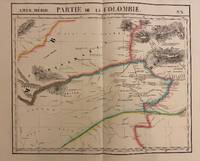
1827302381Brussels: Phillippe Marie Vandermaelen 1827. unbound. Map. Lithograph with original hand outline. Image measures 19" x 22.5".<br/> <br/> Exquisite map of the Amazon region at the borders of Colombia Venezuela and Brazil. Shows important rivers - Orinoco Guaviare Inirida and Rio Negro. Many native indigenous groups are labeled. Notations on the map describe the terrain the native peoples and colonial activities in the region. Double page with centerfold. From Vandermaelen's 6 volume "Atlas universel de geographie physique politique statistique et mineralogique". Can be combined as gores to form an immense globe. The atlas was the first to map the world on a uniform scale.<br/> <br/> Phillippe Marie Vandermaelen unknown