COMMYNES, Philippe de ; CHANTELAUZE, R.Livre Rare Book

948 résultats
188151962Nouvelle édition revue sur un manuscrit ayant appartenu à Diane de Poitiers, et à la famille de Montmorency-Luxembourg, par R. Chantelauze. Edition illustrée d'après les manuscrits originaux de quatre chromolithographies et de nombreuses gravures sur bois, 1 vol. in-4 reliure de l'édteur demi-maroquin à coins rouge, dos à 5 nerfs richement orné des armoiries de Philippe de Commynes, Librairie de Firmin-Didot, Paris, 1881, 789 pp. avec nomb. ill. et 4 chromolithographies
181311337A Paris, de l'imprimerie et dans la librairie de Madame Huzard, 1813. In-8 de XXIV-251 pages, demi-veau bond, dos lisse orné de filets, roulettes, fleurons et titre dorés, pièce de tite bordeaux, tranches mouchetées, "Bibliothèque de V. Perdonnet" doré au premier plat. Quelques rares rousseurs.
184128560Nantes 1841 une liasse de 2 documents reliés ensemble par un ruban bleu-roi scellé par un cachet de cire rouge : 1ER DOCUMENT : une lettre à en-tête du BRITISH CONSULAT - LOIRE-INFÉRIEURE ET VENDÉE "aux Armoiries royales du Royaume-Uni" gravées en noir, Texte pré-imprimé en noir en anglais et manuscrit en anglais à l'encre brune sur papier crème, format : 25 x 19,5 cm, signature du consul HENRY NEWMAN, CERTIFICAT DE DÉCÈS de PHILIPPE VAUVERCY AUTENTIFIÉ PAR LE CONSULAT BRITANNIQUE DE NANTES (VU QUE L'ILE MAURICE EST DEVENUE BRITANNIQUE) au vu du certificat de décès avec la signature du Président du Tribunal Civil de Nantes : Mr COLOMBEL, Nantes, le 17 Septembre 1841, 2EME DOCUMENT : un document Original de 4 pages, constitué d'1 grande page pliée en deux , manuscrite à l'encre brune sur papier vergé crème ligné filigrané "TIMBRE ROYAL" avec en haut à gauche un "TIMBRE ROYAL - 1f 25c GALLE" illustré gravé en noir dans un cercle + un timbre royal illustré gauffré à froid dans un cercle à froid + en 4ème Page : un timbre gauffré illustré à froid du notaire Nantais ESMAIN + cachet noir illustré du tribunal civil de Nantes, CERTIFICAT DE DÉCÈS ATTESTÉ DEVANT NOTAIRE, AVEC TÉMOINS + VERIFIÉ AU REGISTRE DES DÉCÈS DE LA VILLE DE NANTES ET CONTROLÉ PAR MR COLOMBEL, PRÉDIDENT DU TRIBUNAL CIVIL DE NANTES, NANTES le 17 SEPTEMBRE 1841,
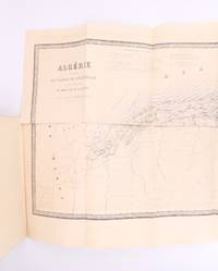
187089229Paris: Michel Lévy 1870. Fine. Michel Lévy Paris 1870 16 x 24.5 cm Broché First edition illustrated with a large folding map of Algeria outside the text together with a portrait frontispiece. Gay 938: ""le fait capital du volume est la prise de Constantine."" Pleasing copy. Michel Lévy unknown
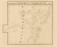
1827143929Brussells: P.M.G. Vandermaelen 1827. Very Good. Brussells P.M.G. Vandermaelen 1827. A lithographed map printed surface 471 × 547 mm sheet size 533 × 665 mm printed in black and blue. Vertical centrefold crease as issued; remnants of hinge mounts and an old guard on the verso; paper lightly tanned and foxed; in excellent condition. Plate 55 from Vandermaelen's monumental 'Atlas Universel' showing the New South Wales coast from around Batemans Bay to the Solitary Islands. Sydney the Blue Mountains and hinterland are shown including much of the Lachlan River. Vandermaelen's atlas was 'the first world atlas on a uniform scale. The sixth volume covered "Océanique" and it included seventeen maps of Australia. All the sheets were made on the same scale and projection and they were so constructed that they could form a globe of about 1000 gores 7.775 metres in diameter' Clancy: 'The Mapping of Terra Australis' 1995. P.M.G. Vandermaelen unknown
1819SS11081Paris:: Chez Belin-Leprieur 1819. 1819. Second Edition. Two volumes. 8vo. 4 xiv 2 316; 4 362 pp. Scattered foxing throughout not diminishing legibility. Extremely infrequent contemporary ink notations especially a page of notes at p. 356 Vol. II in an unknown hand. Quarter black leather over blue marbled paper-backed boards; bindings carefully repaired. Near fine. Deleuze 1753-1835 a prominent member of the "Mesmer movement" discusses in this work "aspects such as the magnetic fluid healing problems and dangers of mesmerism and personally observed phenomena" Alvarado 116. "Deluze sic is a central figure in the history of animal magnetism. . . He was impressed with the demonstration of somnambulism and began to pursue his own study of animal magnetism. . . The Histoire is Deluze's first work on animal magnetism and is one of the most important ever written on the subject. . . The Histoire is about as balanced a treatment as one could find from a man who was engaged in a daily practice of that art" Crabtree 267. / An excerpt trans.: "The magnetiser can communicate his fluid to many objects and these objects become either the conductors of his action or proper instruments of its transmission and produce magnetic effects upon persons with whom he is in communication" Deleuze 212 in Alvarado 121. REFERENCES: Alvarado Carlos S. "MESMERISM ONLINE: A BIBLIOGRAPHIC REVIEW." Australian Journal of Clinical and Experimental Hypnosis. 36.2 2008: 115-29; Crabtree Adam. Animal Magnetism Early Hypnotism and Psychical Research 1766-1925. White Plains NY: Kraus International 1988; Crabtree 243 1818 edition; Caillet 2933; Tinterow Maurice M. Foundations of hypnosis From Mesmer To Freud 1970 p. 575. Chez Belin-Leprieur, 1819. hardcover books
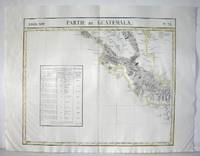
1827M2904Bruselles 1827. Excellent. Size : 464x557 mm 18.25x21.875 Inches Coloring: Original Outline Coloring Category: ; Maps Central America unknown
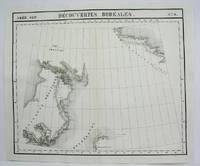
182736261Brussels Belgium: Lithographed By H. Ode. Very Good. 1827. Map. Map # 17 A Very Good primitive and early map showing the North Hampton Bay area. Includes the Welcome Strait. Latitude of the map is 60 degrees to 66degrees and longitude is 82 degrees to 98 degrees. Of course almost all localities shown are French or Indian names. The atlas from which this is extracted is extremely rare and originally composed 6 volumes this map being from the North America volume. Lithographer Ode and Cartographer Vandermaelen produced the first lithographed atlas ever done. Condition is overall Very Good. Browning to the centerfold crease caused by glue used in attaching the tab to the original volume the two page spread measures 21" x 26 1/2" when opened out. Topigraphical features are accentuated see image. Shipping will require extra care and cost due to insurance. Photo available upon request. ; 21" x 26 1/2"; 1 pages . Lithographed By H. Ode unknown
1825M4489Brussels 1825. Excellent. Notes: The first atlas of the world on a uniform scale. If assembled as a globe gores forms a very large globe. Size : 480x575 mm 18.875x22.625 Inches Coloring: Original Outline Coloring Category: Maps Canada North; unknown
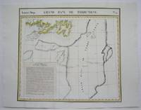
1825M4527Brussels 1825. Very Good minor worming to the lower portion of the map on along the central fold proficiently repaired. Notes: The first atlas of the world on a uniform scale. If assembled as a globe gores forms a very large globe.<br><br>This map shows the are of southern Newfoundland and the Grand Banks Size : 470x524 mm 18.5x20.625 Inches Coloring: Original Outline Coloring Category: Maps Canada East Newfoundland unknown
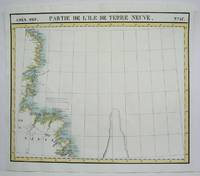
1825M4479Brussels 1825. Excellent. Notes: The first atlas of the world on a uniform scale. If assembled as a globe gores forms a very large globe. Size : 475x570 mm 18.75x22.375 Inches Coloring: Original Outline Coloring Category: Maps Canada East Newfoundland unknown
1840LBW-5673[circa 1840]. 390 x 280 mm.
182623457Paris, Imprimerie de Gaultier-Laguionie / chez l'auteur, 1826 [1827 au premier plat de la couverture papier originelle]. Un fort vol. au format in-8 (203 x 131 mm) de 1 f. n.fol., xi - 255 pp. Reliure légèrement postérieure de plein veau glacé fauve, dos à nerfs orné de filets gras à froid, doubles filets dorés, larges fleurons dorés, pièce de titre de maroquin marine, titre doré, tranches mouchetées, premier plat de couverture conservé.
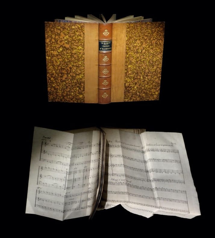
1826234571826. Paris Imprimerie de Gaultier-Laguionie / chez l'auteur 1826 1827 au premier plat de la couverture papier originelle. Un fort vol. au format in-8 203 x 131 mm de 1 f. n.fol. xi - 255 pp. Reliure lÂŽgÂrement postÂŽrieure de plein veau glacÂŽ fauve dos ˆ nerfs ornÂŽ de filets gras ˆ froid doubles filets dorÂŽs larges fleurons dorÂŽs piÂce de titre de maroquin marine titre dorÂŽ tranches mouchetÂŽes premier plat de couverture conservÂŽ. Edition originale rare ; ici revÂtue d'une ÂŽlÂŽgante reliure. L'ouvrage s'agrÂŽmente de nombreuses planches dÂŽpliantes gravÂŽes de partitions. ''Pierre Galin s'est occupÂŽ de la thÂŽorie de la Musique ; il a portÂŽ dans cette science le flambeau de l'analyse et de la logique. M. de Geslin don digne ÂŽlÂve a recueilli son hÂŽritage ; se montrant dans ce TraitÂŽ l'ÂŽmule de son ma”tre. La thÂŽorie de Galin concernait seulement la mÂŽlodie il restait l'harmonie ˆ traiter. Une thÂŽorie nouvelle fruit des mÂŽditations de de Geslin rendra cette science accessible ˆ toutes les intelligences''. Le Bibliographe musical 88. Quelques rousseurs dans le texte et papier parfois oxydÂŽ. Plusieurs planches brunies ; pouvant en outre prÂŽsenter des cernes. Nonobstant bonne condition. Rare. b42961 unknown
182288740Paris, chez J.-B. Baillière, 1822, in-8, 30 ff, 433 pp, Demi-basane fauve, dos lisse orné (rel. de l?époque). Quelques rousseurs, Edition originale. Rare ouvrage dans lequel on indique les précautions que doivent prendre, sous le rapport de la salubrité publique et particulière, les fabricants, les manufacturiers, les chefs d'ateliers, les artistes, et toutes les personnes qui exercent des professions insalubres Couverture rigide
1812758861812 Paris, Chanson, et Fournier, 1812, 2 volumes in 8° reliés demi-veau havane, dos lisses ornés, tranches marbrées, IV-434 et 558 pages ; quelques piqûres, mouillure angulaire en pied des 20 premières pages du tome 1, menus défauts et petits frottis d'usage.
189128709A. Cherbuliez G. Fischbacher | Genève & Paris 1891 | 9.50 x 16.50 cm | relié
18033603192Madrid.: Imprenta Real. 1803. Hardcover. Cubierta deslucida. Good. 19 cm. 438 p. Encuadernación en tapa dura artesanal en plena piel con tejuelo. Pinel Philippe 1745-1826. Traducida al castellano por el Dr. D. Luis Guarnerio y Allavena. Nosografía filosófica . Cubierta deslucida. Imprenta Real. hardcover
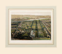
186164184Paris. 1861. Wonderful bird's eye view of the Jardin de Plantes the main botanical gardens of Paris published in 'Paris Dans Sa Splendeur' by Henri Charpentier Size: 250 x 360 mm. Original lithograph. Hand coloured. Mounted size: 490 x 570 mm. Fine condition. unknown
18438783Paris: Firmin Didot Freres Editeurs 1843. 1st Edition. Half morocco. Very good. 45253pp. Double column text. Publisher's woodcut device on title. Illustrated with 86 plates and 3 large folding maps found following the text. 19th century red morocco gilt over red pebbled cloth. Light faded water stain at fore-edge of last ten plates. Part of the publisher's series "L'Univers Histoire et Description de Tous les Peuples." Firmin Didot Freres, Editeurs unknown books
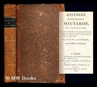
1809271796Paris : Chez Desenne Lenormant Au bureau des Annales de l'impr. d'A. Égron 1809. First Edition. Softcover. Poor copy in the original stiff-card wrappers; wear and tear as with age. Text remains in fine condition and without blemish. Physical description; xvi 490 p. ; 22 cm. Subjects; Suvorov Aleksandr Vasil evich kni az Itali ski 1730-1800. Suvorov Aleksandr Vasil evich kni a z Itali ski 1730-1800. Russia — History — Catherine II 1762-1796. Genre; Biography. Paris : Chez Desenne, Lenormant, Au bureau des Annales, de l'impr. d'A. Égron paperback
182736262Brussels Belgium: Lithographed By H. Ode. Very Good. 1827. Map. Map # 37 A Very Good primitive and early map showing Newfoundland present day and eastern part includes the city of Bonavista. Nice color depiction of the coastline. Latitude of the map is 48 degrees to 54 degrees and longitude is 47 degrees to 59 degrees. Of course almost all localities shown are French or Indian names. The atlas from which this is extracted is extremely rare and originally composed 6 volumes this map being from the North America volume. Lithographer Ode and Cartographer Vandermaelen produced the first lithographed atlas ever done. Condition is overall Very Good. Browning to the centerfold crease caused by glue used in attaching the tab to the original volume the two page spread measures 21" x 26 1/2" when opened out. Topigraphical features are accentuated see image. Shipping will require extra care and cost due to insurance. Photo available upon request. ; 21" x 26 1/2"; 1 pages . Lithographed By H. Ode unknown
182736259Brussels Belgium: Lithographed By H. Ode. Very Good. 1827. Map. Map # 70 A Very Good primitive and early map showing the southwest Mexico coastline with portions of Guerrrero Province. Includes Acapulco. Has nice multi-color contrasts also includes a large geological diagramatic illustration. Map is based on the excursion of nautralist Alexander Humboldt in 1802. Latitude of the map is 15 degrees to 18 degrees and longitude is 100 degrees to 108 degrees. Of course almost all localities shown are French or Indian names. The atlas from which this is extracted is extremely rare and originally composed 6 volumes this map being from the North America volume. Lithographer Ode and Cartographer Vandermaelen produced the first lithographed atlas ever done. Condition is overall Very Good. Browning to the centerfold crease caused by glue used in attaching the tab to the original volume the two page spread measures 21" x 26 1/2" when opened out. Topigraphical features are accentuated see image. Shipping will require extra care and cost due to insurance. Photo available upon request. ; 21" x 26 1/2"; 1 pages . Lithographed By H. Ode unknown
1827202378Brussels: Phillippe Marie Vandermaelen 1827. unbound. very good. Map. Large format lithograph with original hand coloring. Image measures 18.5" x 22.25".<br/> <br/> Double page with centerfold. From Vandermaelen's 6 volume "Atlas universel de geographie physique politique statistique et mineralogique sur l'echelle de 1/16411836". Can be combined as gores to form an immense globe. The atlas was the first to map the world on a uniform scale.<br/> <br/> Phillippe Marie Vandermaelen unknown
1827278526Brussels: Phillippe Marie Vandermaelen 1827. unbound. Map. Lithograph with original hand outline. Image measures 18.5" x 22.25".<br/> <br/> Minimal yet beautiful map of east-central portion of the Argentine coast just south of Buenos Aires. Includes notes in French on the capital city. Double page with centerfold. From Vandermaelen's 6 volume "Atlas universel de geographie physique politique statistique et mineralogique sur l'echelle de 1/16411836". Phillippe Marie Vandermaelen 1795-1869 was a Belgian cartographer and publisher. His Atlas universal was both the first lithograph atlas and the first atlas to map the world on a uniform scale. The maps were meant to join together to form a huge globe. This map is a fine example of his work.<br/> <br/> Phillippe Marie Vandermaelen unknown