Vandermaelen, Philippe Marie GuillaumeBiblio.com
948 résultats
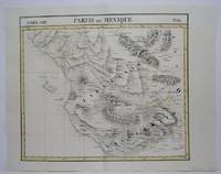
1827M3736Bruxelles 1827. Very Good. Size : 465x550 mm 18.25x21.625 Inches Coloring: Original Hand Coloring Category: ; Maps Central America unknown
1825M4520Brussels 1825. Very Good minor worming on upper and lower portion of the map along the central fold proficiently repaired. Notes: The first atlas of the world on a uniform scale. If assembled as a globe gores forms a very large globe. Size : 460x535 mm 18.125x21 Inches Coloring: Original Outline Coloring Category: Maps Central America Mexico unknown
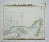
1825M4510Brussels 1825. Excellent. Notes: The first atlas of the world on a uniform scale. If assembled as a globe gores forms a very large globe.<br><br>This map shows the area of the Gulf of St. Lawrence and the surrounding coastlines such as the district of Gaspe and the west coast of Newfoundland. Size : 480x565 mm 18.875x22.25 Inches Coloring: Original Outline Coloring Category: Maps Canada East Quebec unknown
1801411181Lyon : Chez A. Leroy 1801. New edition. Hardcover. Good copies only in the original full tree aniline calf with gilt-blocked titles to spines. Spine bands and panel edges rubbed and bumped as with age. Hinges starting. Internally bright and clean. Physical description; 4 v. Subjects; Technology French. Industrial arts ; Dictionaries 18th century. Lyon : Chez A. Leroy hardcover
1825438106Livorno : Dalla Stamperia 1825. First Edition. Hardcover. Very good copy bound in contemporary 1/2 leather over cloth. Gilt-blocked leather label to spine with spine bands uniformly tooled in gilt. Spine bands and panel edges slightly rubbed and dulled as with age. Remains particularly well-preserved overall; tight bright clean and strong. Subjects; Biographie. Frankreich. Geschichte. Ségur Paul Philippe de 1780-1873. Livorno : Dalla Stamperia hardcover
184849472(Paris, Bachelier), 1848. 4to. No wrappers. In: ""Comptes Rendus Hebdomadaires des Séances de L'Academie des Sciences"", Tome 26, No 8. Pp. (233-) 264. (Entire issue offered). Semmelweis's paper: pp. 254-255. Clean and fine.
184849472Paris Bachelier 1848. 4to. No wrappers. In: "Comptes Rendus Hebdomadaires des Séances de L'Academie des Sciences" Tome 26 No 8. Pp. 233- 264. Entire issue offered. Semmelweis's paper: pp. 254-255. Clean and fine. <br/><br/><em>First French announcement of this epochal event in the history of medicine the discovery of the etiology and prevention of childbed fever. First announce by Ferdinand von Hebra in December 1847 then followed only 2 months after by the French announcement."Although Semmelweis's importent discoveries were made in the 1840s he did not publish them immediately. The first printed reports of his findings were written by his collegues and were published in various German French or English Journals. Semmelweis himself gave three lectures before the Imperial and Royal Medical Society of Vienna in 1850 but did not publish his complete discussion of "The etiology concept and prophylaxis of childbeed fever" until 1861 having previously contributed several shorter accounts to Hungarian medical journals."Norman "One Hundred Books famous in Medicine" p. 265.Semmelweis demonstrated that puerperal fever also known as childbed fever was contagious and that this incidence could drastically be reduced by appropriate hand washing by medical care-givers. He made this discovery in 1847 while working in the Maternity Department of the Vienna Lying-in Hospital. His failure to convince his fellow doctors led to a tragic conclusion. However he was ultimately vindicated. While employed as assistant to the professor of the maternity clinic at the Vienna General Hospital in Austria in 1847 Semmelweis introduced hand washing with chlorinated lime solutions for interns who had performed autopsies. This immediately reduced the incidence of fatal puerperal fever from about 10 percent range 5-30 percent to about 1-2 percent.Toward the end of 1847 accounts of Semmelweis's work began to spread around Europe. Semmelweis and his students wrote letters to the directors of several prominent maternity clinics describing their recent observations. Ferdinand von Hebra the editor of a leading Austrian medical journal announced Semmelweis's discovery in the December 1847 and April 1848 issues of the medical journal. Hebra claimed that Semmelweis's work had a practical significance comparable to that of Edward Jenner's introduction of cowpox inoculations to prevent smallpox.Garrison & Morton: 6275 German version. </em> unknown
1869WRCAM54043Paris 1869. viii334pp. Publisher's printed wrappers. Wrappers and spine chipped front wrapper detached 20th- century bookplate on verso of front wrapper light occasional foxing. Good. A unique association copy of Louis Philippe d'Orléans' work in favor of trade unions inscribed by him to former Union General George B. McClellan. Prince Philippe volunteered for the Union Army during the Civil War and served on McClellan's staff for almost a year. His friendly inscription reads "Au General McClellan souvenir de son ancien aide de camp Louis Philippe D'Orleans." <br> <br> Prince Philippe a historian and author wrote several works of history including the present example and a multi-part history of the Civil War titled A HISTORY OF THE CIVIL WAR IN AMERICA. His experiences on the staff of Gen. McClellan greatly informed Prince Philippe's work generally considered a standard text on the War. The present work is a nice association copy between Prince Philippe and his one-time boss during the early years of the conflict. unknown books
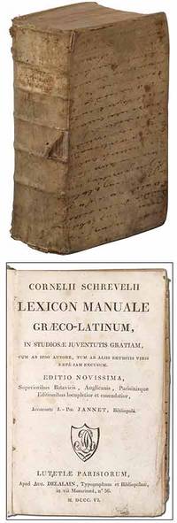
1806326029Lutetiae Parisiorum Paris: Aug. Delalain 1806. Hardcover. Very Good. New edition. Edited by Jean Philippe Jannet. Thick octavo. 4 viii 1251pp. Bound in contemporary boards covered with an old vellum manuscript with the hand written text running horizontally across the front and back boards. Small owner's name in pencil on the front pastedown. Soiling and scattered small tears to the vellum lacking a rear free endpaper very good. Aug. Delalain hardcover
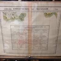
182736245Brussels Belgium: Lithographed By H. Ode. Very Good. 1827. Map. Map # 61 A Very Good primitive and early map showing the mouth of the Mississippi river shows the New Orleans delta area and also Appalachee Bay of Florida with Port St. Joseph. There is an inset in French with Tables of Population for 1823. Latitude of the map is 24 degrees to 30 degrees and longitude is 86 degrees to 94 degrees. Of course almost all localities shown are French or Indian names. The atlas from which this is extracted is extremely rare and originally composed 6 volumes this map being from the North America volume. Lithographer Ode and Cartographer Vandermaelen produced the first lithographed atlas ever done. Condition is overall Very Good. Browning to the centerfold crease caused by glue used in attaching the tab to the original volume the two page spread measures 21" x 26 1/2" when opened out. Topigraphical features are accentuated see image. Shipping will require extra care and cost due to insurance. Photo available upon request. ; 21" x 26 1/2"; 1 pages . Lithographed By H. Ode unknown
182736260Brussels Belgium: Lithographed By H. Ode. Very Good. 1827. Map. Map # 66 A Very Good primitive and early map showing the Yucatan Penninsula coastline. Includes present day provinces of Yucatan Ouintara Roo Compecha and Tobasco. Also includes a small portion of Northern Belize. Cities include Merida Compeche Chetumal and Cuido del Carmen eastern tip of Cuba is shown. Latitude of the map is 18 degrees to 24 degrees and longitude is 86 degrees to 94 degrees. Of course almost all localities shown are French or Indian names. The atlas from which this is extracted is extremely rare and originally composed 6 volumes this map being from the North America volume. Lithographer Ode and Cartographer Vandermaelen produced the first lithographed atlas ever done. Condition is overall Very Good. Browning to the centerfold crease caused by glue used in attaching the tab to the original volume the two page spread measures 21" x 26 1/2" when opened out. Topigraphical features are accentuated see image. Shipping will require extra care and cost due to insurance. Photo available upon request. ; 21" x 26 1/2"; 1 pages . Lithographed By H. Ode unknown
182736264Brussels Belgium: Lithographed By H. Ode. Very Good. 1827. Map. Map # 75 A Very Good primitive and early map showing the lesser Antilles shows St. Croix on the north and Grenada on the south. Includes the island of St. Croix St. Bartholome St Christophe-Nevis Antigue Barbude Guadeloupe Dominica Martinque St. Lucia Grenade Barbados and others. Very nice color contrasts. Latitude of the map is 12 degrees to 18 degrees and longitude is 60 degrees to 68 degrees. Of course almost all localities shown are French or Indian names. The atlas from which this is extracted is extremely rare and originally composed 6 volumes this map being from the North America volume. Lithographer Ode and Cartographer Vandermaelen produced the first lithographed atlas ever done. Condition is overall Very Good. Browning to the centerfold crease caused by glue used in attaching the tab to the original volume the two page spread measures 21" x 26 1/2" when opened out. Topigraphical features are accentuated see image. Shipping will require extra care and cost due to insurance. Photo available upon request. ; 21" x 26 1/2"; 1 pages . Lithographed By H. Ode unknown
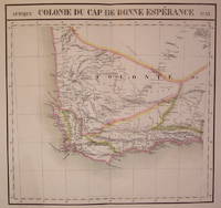
1827202230Brussels: Phillippe Marie Vandermaelen 1827. unbound. very good. Map. Large format lithograph of South Africa with original hand coloring. Image measures 18.5" x 22.25".<br/> <br/> Double page with centerfold. From Vandermaelen's 6 volume "Atlas universel de geographie physique politique statistique et mineralogique sur l'echelle de 1/16411836". Can be combined as gores to form an immense globe. The atlas was the first to map the world on a uniform scale.<br/> <br/> Phillippe Marie Vandermaelen unknown
1827802Brussels: Vandermaelen Phillipe 1827. 20 1/2 x 18 1/2 inches. Very good condition. This map shows the West Coast inward into the Tonto Apache territories. Also shown is the land of the Papagos which also includes western Arizona and southern Arizona. Located on the east side of the map is Tumacacori site of a cluster of mission buildings indicating the long arm of religious colonialism. On the west coast is Cape Loma and San Diego. Above this is San Juan Capistrano located in present day Orange County California. This antique map rare map is an original artifact of a period oof little direct knowledge of the area. Vandermaelen, Phillipe unknown
189247343Paris: Librairies-Imprimeries réunies 1892. Fine. Librairies-Imprimeries réunies Paris 1892 14.50 x 21.50 cm relié The first edition of which there were no deluxe copies. Half cherry red sheep binding spine with four raised bands with gilt fillets marbled paper boards marbled endpapers and pastedowns. Work illustrated with numerous wood-engraved vignettes in the text. Librairies-Imprimeries réunies hardcover
1814ZB527446Paris: Chez les Marchands de Noiuveautes 1814. first edition; 36 pp an attempt to neutralize the pamphlet that Louis XVIII thought was worth an army to him; sewn into plain paper wrappers one leaf damp stained at tip a few leaves dog eared but a very good and untrimmed copy. - If you are reading this this item is actually physically in our stock and ready for shipment once ordered. We are not bookjackers. Buyer is responsible for any additional duties taxes or fees required by recipient's country. Photos available upon request. Paris: Chez les Marchands de Noiuveautes, unknown
1885B2398Épinal, Fricotel, 1885 ; in-8, environ 500 pp. pour chaque volume, brochés. Les 8 volumes. Le premier volume est de André Philippe, les 7 autres de Ferry.Nous avons ici le tome 2: Administration communale 1525-1790 Série BB. Le tome 3: Administration municipale 1303-1789 1er et deuxième partie Série CC. La table de la série CC. Le tome cinq. Le tout imprime sur un très beau papier vélin des Vosges. Tampons de bibliothèque démantelée sur le premier volume. Bon état.
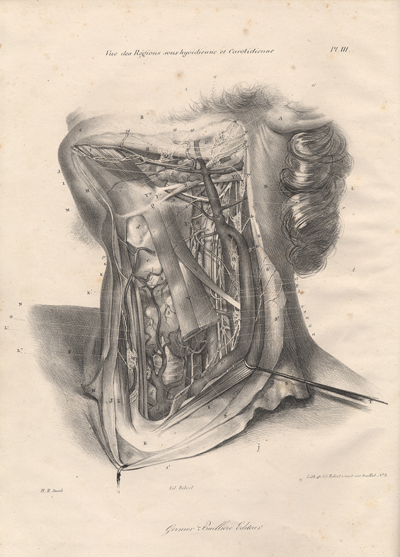
183416909Paris, Germer-Baillière, 1834 ; in-folio, cartonnage gris-bleu de l'éditeur ; (4) pp. , 20 planches lithographiées en recto sur vélin et 10 ff. d'explication des planches, imprimés recto-verso sur vergé ; quelques planches sont réhaussées de rouge ou de bleu ou des deux.
1863ln615Lacroix Eugène, Librairie scientifique, industrielle et agricole Relié 1863 Deux volumes in-8 (14x22.5 cm), reliés demi-basane, titre, tomaison et auteur dorés, dos lisses décorés de liserés dorés, (XVI)-556-506 pages, couvertures conservées, préface de Ch. Laboulaye, table des matières en début d'ouvrage, ouvrage illustré de 300 gravures dans le texte et de cartes gravées sur cuivre par Jacobs et Carré, 1 planche dans le premier volume et 4 dans le second ; dos insolés, coiffes légèrement frottées, bel exemplaire. Livraison a domicile (La Poste) ou en Mondial Relay sur simple demande.
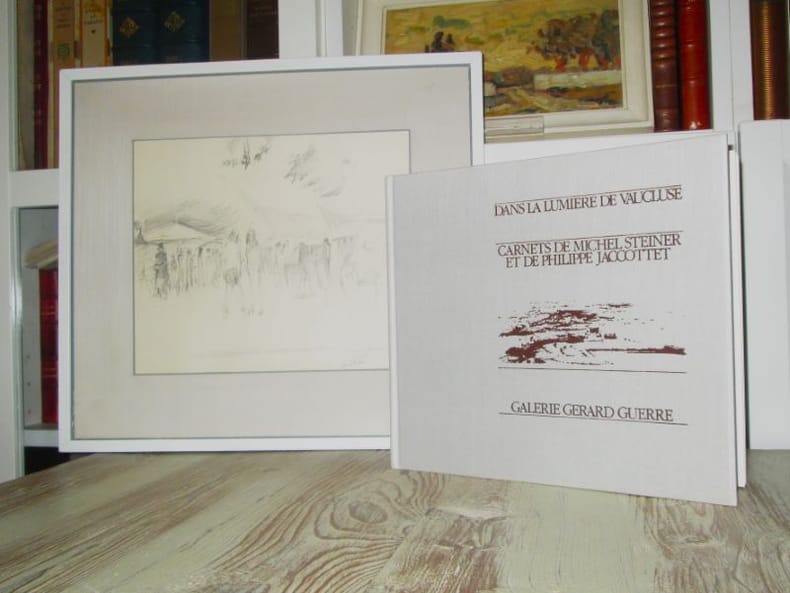
184032624Avignon, Galerie G. Guerre, 1983. In-4 relié à l'italienne (24,4 x 28 cm), cartonnage de pleine toile avec titre et dessin en noir au premier plat, 158 p. Les textes de P. Jaccottet sont extraits de "Paysages avec figures absentes" et de "La Semaison". Nombreux dessins et aquarelles de Michel Steiner Tirage de tête, l'un des quarante exemplaires, le n° 44 signé et numéroté par le poète et par l'artiste, accompagné d'un dessin original inédit et signé de M.Steiner, intitulé : "Le marché de Malaucène". Très bon état.
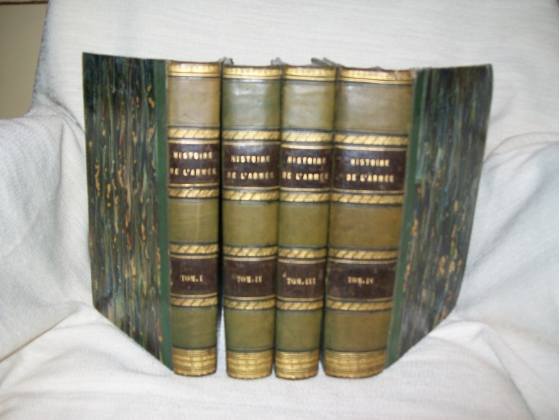
1847GITa602Paris A Barbier 1847. 4vol in-8 479 491 464 XXXV 460 CXXXIVpp. Demi basane vert olive, dos lisse orné de filets et frises dorés, pièces de titre et de tomaison noires, rel époque. Bel ouvrage illustré de 126 planches hors texte dont 103 d'uniformes de régiments français en couleurs par Philippoteaux, Charpentier, Bélanger, De Moraine, Morel-Fatio, Sorieul etc. Complet de toutes ses planches, la table des illustrations, dans le Tome IV, faisant foi. Dos uniformément passé mais bel exemplaire.
184044796Paris, Carillan-Goeury, 1840, in-8, 2 vol. de I. VIII, XXIX, (1bl), 466pp. - II. (5), de 468 à 750pp, 6pl, demi-basane rouge, dos à nerfs orné (Rel. de l'ép.), 6 planches dépliantes gravées par Adam. PREMIERE EDITION. Ouvrage peu commun "destiné aux personnes peu versées dans l'étude des sciences mathématiques et qui désirent acquérir, sans leur secours, des notions exactes sur la constitution de l'univers". Gustave Doulcet, comte de Pontécoulant, après Polytechnique embrassa la carrière militaire qu'il quitta pour se livrer entièrement à son goét pour les sciences. Livre de prix de l'école St-Michel à Saint-Etienne. Accroc sur le dos du t.1, mais néanmoins bon exemplaire Couverture rigide
184080123Paris, Carillan-Goeury, 1840, in-8, 2 parties en 1 volume, VIII-XXIX-750 pp. en numérotation continue, 6 pl. dépliantes, demi-basane tabac de l'époque, dos lisse, pièce de titre rouge, 6 planches dépliantes gravées par Adam. Première édition. Ouvrage peu commun "destiné aux personnes peu versées dans l'étude des sciences mathématiques et qui désirent acquérir, sans leur secours, des notions exactes sur la constitution de l'univers". Gustave Doulcet, comte de Pontécoulant (1764-1853), après Polytechnique embrassa la carrière militaire qu'il quitta pour se livrer entièrement à son goût pour les sciences. Envoi signé de l'auteur en tête du faux titre : "Témoignage de l'amitié de l'auteur à M. ?" Cachets de l'Institut catholique de Paris et étiquette en pied du dos. Dos épidermé. Houzeau & Lancaster, 9287 Couverture rigide
182561054<p>original hand-colour lithograph with a text vignette on Borneo. This important map for the Philippines shows Southern Mindanao and the area between Sulawesi Mindanao and Gilolo today: Halmahera part of the Moluccas. From 'Atlas Universel de Geographie…' Oceanique no. 6; This 6 vol. Atlas contains 382 lithographed mapsheets and 40 plates of statistical data by Henri Ode mostly hand-coloured in outline and was published in instalments over 3 years. The maps in the atlas make up the first map of the world on a uniform scale and the first lithograph atlas created on a modified conical projection and if assembled form a globe with a diameter of 7.75m although only one such was known to have been assembled by the author himself and requiring a specially designed room. A text box gives extensive information on Borneo. Reference: Reference: NOT in Quirino atlas: Koeman III Vdm 1; Phillips Atlases 749; National Maritime Museum 179; Wellens-De Donder L. Philippe Vandermaelen 1795-1869 4-5; DavidRumseydotcom with cpl. Info. Condition: very good example with some age-toning and a few faint spots wide margins.</p> published in Brussels.
180921600NANTES 1809 1 document, préimprimé et manuscrit à l'encre brune d'une page sur papier vergé bleuté ligné filigrané "Bureau", format 22 centimètres de large par 33,5 centimètres de haut, timbre fiscal "département de la loire-inférieure 1 F" en haut à droite en noir et cachet "Timbrer à l'extraordinaire" en haut à gauche en noir, papier à en-tête "DEPARTEMENT DE LA LOIRE INFERIEURE, 4ème ARRONDISSEMENT", ACTE DE SUBSTITUTION : ENTRE LE SIEUR PAUL BASCHER DE NANTES, CONSCRIT DE 1810 QUI VEUT SE FAIRE SUBSTITUER PAR MAURICE OLLIVIER, BOULANGER A VIGNEUX, Admis du consentement des parties, le remplacement du sieur pierre Paul Bascher, conscrit de l'an 1810 par le sieur Maurice ollivier, fait à Nantes, LE 3 FEVRIER 1809, signature Manuscrite du réfer DE CELLES,