BUACHE, Philippe and DELISLE, GuillaumeBiblio.com
155 résultats
17452430061745. Map. Engraving with hand coloring. Image measures 19 x 25.5".<br/> <br/> This beautiful map depicts the Neuchatel region of Switzerland showing the town of Neuchatel as well as Lake Neuchatel. It is based on a 1710 original by David Francois de Merveilleux redone by Guillaume de L'Isle and published by Philippe Buache. The map is is finely detailed with abbeys and priories castles battlefields mineral springs and forests. An elegant compass rose is shown in Lake Neuchatel and a decorative title cartouche at the top of the map is flanked on either side by historical and geographical text in French. The map dates to the reign of Frederick I of Prussia who presided over Neuchatel's golden age and ushered in a period of expansion in commerce banking and industry such as watchmaking and lace. The map is in excellent condition with wide margins as issued and no chips or tears. Minor stains in margins not affecting the image. Philippe Buache 1700--1773 was a French geographer who trained under the geographer Guillaume De L'Isle 1675--1726 a French cartographer known for his popular and accurate maps of Europe and the newly explored Americas and Africa. He is important as the first "scientific" cartographer who incorporated the most current information on exploration and topography into his maps.<br/> <br/> unknown
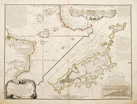
173755258Atlas de Geographie. Sept 1737. An interesting geo-hydrographic map of the Atlantic Ocean and its islands. It is divided into two with one side showing the Atlantic Ocean and the coasts of Africa and Brazil and the other side a detailed examination of the archipelago of Fernando de Noronha. A note top left explains the purpose of the map which in brief is to give an idea of the variety of islands in the Atlantic Ocean. Another note top right explains a little about the cartographers and expedition members. Another explains about an embankment between islands on the archipelago. A cartouche top right contains a cross-section diagram of what is below sea level. Another below sea-level cross-section shows the particulars of Fernando de Noronha lower right corner. Copper engraving. Very good condition - slight dark patches to lower corners and repair to lower left margin. Some offsetting. Original colour. Size: 65 x 49.5 cm. 25½ x 19½ inches unknown
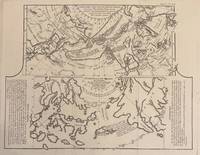
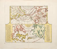
1772331985Paris: Academie des Sciences 1772. Map. Engraving. Image measures 12.25" x 15.5".<br/> <br/> This fascinating sheet contains two maps-- a French map of Western discoveries in Russia and the Northwest Passage area and a Japanese map of the same area taken from Japan by German explorer Englebert Kaempfer. Both maps contain notes on discoveries and speculations islands land masses and bodies of water. This map offers an interesting comparison between Eastern and Western perspectives and achievement in cartography and on the first mapping of Russia and the Northwest Passage. This was published as a supplement to Diderot's Encyclopedie. In very good condition wiith some scattered light foxing. <br> <br> Robert de Vaugondy 1688-1766 was an important French mapmaker during the 18th century. His "Atlas Universel" was one of the most significant atlases of the period integrating older sources with more modern surveyed maps in order to convey correct geographical and political information. <br> <br> Philippe Buache 1700--1773 was a French geographer who trained under the geographer Guillaume Delisle. This map of Lake Geneva is a fine example of his work.<br/> <br/> Academie des Sciences unknown
1752523481752. A fascinating map showing two early maps of the American north-west. the upper map shows the new discoveries in the northern Pacific. The coastline of Asia is more or less correctly drawn but America is wildly inaccurate. The lower part is an extract from a Japanese map brought back to Europe by Kaempfer for the collection of Hans Sloane. This shows the same area even more fancifully. The lower map is flanked by texts - an 'Avertissement'. and an extract from Kaempfer's travels. Worm hole in bottom margin not affecting the image Copper engraving. Fine condition good margins. Later colouring. Size: 40 x 32 cm. 15½ x 12½ inches. unknown
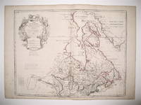
1783242998Dezauche 1783. Map. Engraving with hand coloring. Image measures 19.75 x 25.5". Sheet measures 21.5 x 30".<br/> <br/> This map of Canada and the northern United States extends north from around the latitude of Baltimore all the way up to Baffin Bay along the shore of Greenland. Published by Jean-Claude Dezuache in 1783 it is the eighth revision of a map originally published by De L'Isle in 1703. The map is notable as the first to include "Etats-Unis" in the title coming as it did on the heels of the American Revolution. In fact this appearance is one of the earliest appearances of the name United States Etats-Unis on a printed map. The map is compelling in its accuracy particularly with regard to the Great Lakes depicting them as fully enclosed and properly placed in longitude and latitude. There is also excellent detail around the Hudson and Mississippi Rivers. The elaborate cartouche is decorated with a beaver natives one of whom is bearing a scalp and Jesuit explorers. Furthermore the fleurs-de-lis that previously adorned the shield at the top of the cartouche has been erased and the crown converted into a halo suspended above an orb a response to the execution of the king following the French Revolution Below a table of colors delineates the boundaries of the United States and European possessions. Indian nations are also labeled. The map is in excellent condition with wide margins as issued. Guillaume De L'Isle 1675--1726 was a French cartographer known for his popular and accurate maps of Europe and the newly explored Americas and Africa. He is important as the first "scientific" cartographer who incorporated the most current information on exploration and topography into his maps. Philippe Buache 1700--1773 was a student of De L'Isle and became one of the most active proponents of the so-called school of theoretical cartography active in mid-18th century France. This map is fascinating record from a remarkable moment in North American history.<br/> <br/> Dezauche unknown
176910715Paris: P. Vente 1769. Contemporary gilt-ruled polished tan calf rubbed flat spine gilt à la grotesque with a gilt-lettered morocco label red edges blue silk marker. <p>A talented sculptor and frame-maker Cayeux 1688-1769 collected for six decades: “his cabinet was renowned for its examples of ‘our talented modern artists’†like Boucher van Loo and Cochin Bailey. Many lots have eighty or more drawings or prints. One copy in the U.S. In good condition contemporary title inscription On behalf of your most humble servant Cayeux tr. — penned by the deceased collector’s son Louis-Philippe d. 1776.<br /> ¶Bailey Patriotic Taste: Collecting Modern Art in Pre-Revolutionary Paris 21-22; Advielle Notice sur Philippe Cayeux passim; Lugt Répertoire des catalogues des ventes 1793.</p> P. Vente unknown
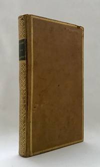
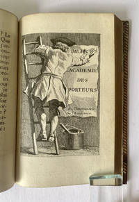
17485611<p><em>Book Pedlars</em></p><p>CAYLUS Anne Claude Philippe comte de. Memoires de l'Academie des Colporteurs. Paris l'Imprimerie ordinaire de l'Academie 1748.£1500</p><p>8vo engraved frontispiece pp. viii 319 with 8 unsigned engraved plates in the text one an engraved title title printed in red and black with attractive title vignette; contemporary full red morocco flat spine ruled lettered and dated directly to spine sides with triple gilt fillet a.e.g. from the collection of Andre Langlois and his red morocco book plate to front pastedown; a fine copy.</p><p>First edition of this unusual and attractively illustrated work on Paris street pedlars hawkers and distributors of pamphlets and books allegedly published under the auspices of the Paris Guild of Booksellers and Printers. Caylus 1692-1765 was an amateur engraver antiquarian and writer from a well-off aristocratic family which allowed him to follow his lifelong interest in the arts and antiquities. He played a prominent role in the Société du Bout du Banc an informal group of writers and aristocrats who met at the home of the actress Quinault. They published a whole series of oeuvres badins licentious and playful stories mostly published under Caylus' name and in fact mostly written by him. This appears to be in the same vein a collection of histories and sketches relating to the exploits and experiences of book pedlars and hawkers. Each anecdote is illustrated with an appealing and competent engraving executed possibly by Caylus himself. The particularly attractive engraved title showing a billposter putting up a poster or placard with the title and partly obscuring it in the process is according to Cohen possibly by Ch. N. Cochin.</p><p>The work is also interesting in that the section beginning on p. 188 Le Malebosse describes and illustrates a scheming poet i.e. Voltaire who is duped by a fake book pedlar. This is in fact one of the first anti-Voltaire caricatures Apgar.</p><p>Cioranescu XVIII 16265; Cohen c 210; see Apgar Trois siècles d'iconographie voltairienne.</p>
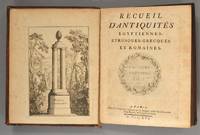
1761891021761. CAYLUS Anne Claude Philippe de Tobieres de. RECUEIL D'ANTIQUITES Egyptiennes Etrusques Grecques et Romaines. Paris Chez Duchesne 1761-1767. Seven volumes. Second edition of Volume I with two title pages dated 1756 and 1761. First edition of Volumes II-VII dated 1756 1759 1761 1762 1764 and 1767. Xix 3 348pp. 104ff. plates; viii4293pp. 129ff. plates; xxxvi448pp. 121ff. plates; xx4181pp. 125ff. plates; xxvi2348pp. 121FF. PLATES; XX 132ff. plates; 4xxviii336pp. 85ff. plates. Lacking only 4 out 107 plates to Volume I one plate out of 121 to Volume III and seven out of 97 to Volume VII leaving 818 of 830 numbered platesand 829 in total including four unnumbered plates and seven frontispieces. Several plates are out of order or misnumbered. A compendious and learned account of a formidable collection of antiquities with over 800 plates each with up to five objects depicted plus headpieces and initials. Each object is discussed in detail in the text. Le Comte de Caylus was noted for many reasons not all of them reputable but primarily as a pioneer in the study of ancient objects focussing on their subject matter and style with a critical eye. He left his collection to the King. He also studied the archaeological remains of the Gauls and Volumes III-VII are titled "Recueil d'Antiquites Egyptiennes Etrusques Grecques Romaines et Gauloises." Bound in full calf the spines in six compartments gilt with rococo floral tools and two morocco lettering-pieces. Wear to extremities; one board detached from each of Volumes III and III; rear board of VII loose; some superficial splits to hinges and abrasions to boards. Light spotting here and there faint dampstain to margins of two volumes discoloration to tops of a few boards but on the whole internally clean. An extraordinary record of early antiquarian scholarship. unknown
1753123403Sans mention d'éditeur 1753. Bonded Leather. <b>Livre en français</b>. Couverture rigide. Sans mention d'éditeur ni d'auteur. Reliure plein veau d'époque. 365 12 pages. Un mors fendu. <i>ref. 123403</i> Sans mention d'éditeur hardcover
171283746BB1712 . Editio Novissima. Lugduni Leiden: Petri Thened 1712. Kl.-8°. 12 Bll. 416 S. 40 Bll. 1 Stempelvignette auf Titelblatt mit Bordüren im Text. Leder auf 5 Bünden. Rotes Rückenschild mit Goldbuchstaben und reichem floralem Schmuck. Umlaufender roter Schnitt. altersmässig gebräunt und stockfleckig; Besitzereintrag mit Datum auf Vorsatz; Deckel innen frühere Besitzereiträge von alter Hand unkenntlich gemacht; Titelseite am Rand kleiner Einriss und kleine Fehlstelle; einige Seiten mit Randläsuren Einband beschabt; Kanten berieben; Ecken bestossen Philippe Chifflet 1597-1657 Theologe und Domherr. unknown
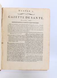
178791319Paris: Veuve Ballard 1787. Fine. Veuve Ballard Paris 1787 19.6 x 25.5 cm Relié Complete year for 1787 with 50 issues of this health journal with continuous pagination pagination error between nos. 48 and 49. Contemporary half marbled sheep smooth spine bronze sheep lettering-piece rubbing to the spine domino-patterned paper boards a few scuffs to the boards corners worn and small nicks to the edges red edges contemporary binding. The journal founded in 1773 by Jean-Jacques Gardane doctor-regent of the Faculty of Medicine of Paris would run for 17 years with one volume per year except for the years 1773-1774. Jean-Jacques Gardane distinguished himself in the establishment in Paris of treatment houses for the poor and in the diffusion of fumigation boxes intended to revive the drowned and the asphyxiated of all kinds. From 1776 onwards the journal would be written by a society of physicians and Pinel was probably among the new editors from the end of 1784. The journal then played an important bibliographical role; scientific news was carefully reported but the periodical is especially notable at this stage for its declared fight against charlatanism and the section devoted to hygiene is particularly well represented; it is not impossible that it was written by Pinel himself see Roselyne Rey in Dictionnaire des journaux. Manuscript annotations in black ink on the verso of the front board. Veuve Ballard hardcover
172325971Brussel Chez Francois Fopens 1723. 8vo. 5 nice cont. uniform full mottled calf w. 5 raised bands on backs backs richly gilt. Vol. 1 w. small loss of leather on back and a few small wormholes on back. 2 capitals worn. Internally minor brownspotting. W. frontispiece to vol. 1 woodcut title-vignettes 2 folded tables and 12 engr. plates portraits one w. a repaired tear. In vol. 1 a leaf w. a portrait cut from a newspaper inserted. hardcover
1706kb758G.016Francois Foppens Brusselle 1706. FRENCH TEXT. Title page in red and black with vignette. Folding pedigree. 442 pages. 1464-1483. Title page worn. Plate of Comies has significant loss to top corner. Text is quite tight but with soem spotting and bronwing to edges. In old white vellwum with self number at base of spine. Good reading copy. . Hardback. Good. Francois Foppens (Brusselle) Hardcover
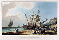
179713514London: Published by P. J. de Loutherbourg and Sold by V. & R. Green No 14 Percy Street Bedford Square 1797. Coloured aquatint. Printed on wove paper watermarked 1794. In excellent condition. Image size: 9 1/2 x 15 3/4 inches. A wonderful early separately published impression of Loutherbourg's celebrated image of fishermen on Brighton Beach.<br/> <br/> This delicate aquatint is an early separately published state of a print which was later included in Phillip Jacques Loutherbourg's seminal work "Picturesque Scenery of Great Britain." The print which was re-engraved in 1801 by J. C. Stadler was enlarged and re-titled "Brighthelmstone Fishermen Returning." This early example of Loutherbourg's work wonderfully shows his skill as an artist. The composition and arrangement of the image provides a fluidity to the picture that is truly compelling and demonstrates Loutherbourg's abilities as a draftsman. The son of a court painter in Darmstadt the versatile artist Philippe Jacques Loutherbourg was born in Fulda Germany and was a pupil of J. H. Tischbein and Carle Vanloo and Francis Casanova the elder in Paris. His romantic landscapes battle scenes portraits and biblical subjects were highly esteemed and lauded by influential colleagues such as Diderot. He frequently exhibited at the Salon and became a venerated member of the Académie Royale in 1767. In 1771 he moved to England where he was employed as the principal scenery designer at London's Drury Lane Theatre. His creative and minutely detailed sets revolutionized the genre of scene painting and he soon began dabbling in costume design. Loutherbourg once again astounded contemporaries in 1782 with his pioneering invention of the "Eidophusikon" a novel variety of moving panorama that was accompanied by music. His substantial and varied oeuvre also included book illustrations and a series of aquatints of British scenery that was published in 1801 and 1805. Aside from a brief trip to Switzerland in 1782 he remained in London for the duration of his life and became heavily engrossed in mysticism. Published by P. J. de Loutherbourg, and Sold by V. & R. Green, No 14 Percy Street, Bedford Square unknown
17501230617.23<p>Petrum Mortier Amsterdam 1750. Hardcover. Fair. 8vo hardcover. No dj. Fair condition. Missing front cover rear board much worn barely attached. pages 233 - 788 books 3 through 8 plus Index and errata. Lacking any title page: text begins with Book 3. Text free of writing or marking binding intact cover issues nothwithstanding.</p> Petrum Mortier, Amsterdam hardcover
1777001671Utrecht: G.T. van Paddenburg and J. Visch 1777. Hardcover. Very Good/No Jacket. Folio. Etc. en Andere Voornaame Gebouwen van dit Hertogdom. Four volumes in one Vols. 2-4 dated 1770. Second Edition. Four volumes in one. Separate title pages and pagination. Full vellum binding with decorative blind tooling on front and rear boards. Raised bands and red leather spine label. In tan custom slipcase. Vol. 1: 3 39 p.p. 1 9 leaves of engravings showing castles and countrysides 1 folding; Vol. 2: 43 p.p. with 40 leaves of engravings 3 folding. Vol. 3: 30 p.p. 1 35 engravings 3 folding. Vol. 4: 24 p.p. errors to pagination 13 engravings 2 folding. A historical and genealogical description of the villages cities and prominent buildings in the province of Brabant Netherlands. Illustrations of castles architectural buildings countrysides and coats of arms. Upper front joint cracked and rear joint starting. Some scuffs and black smudges to boards and spine. Light soiling to upper rear board. Pages and endpapers lightly foxed. Otherwise a very good copy with nicely detailed engravings. G.T. van Paddenburg and J. Visch hardcover
178038197Paris: Dezauche 1780. A stunning map of Arabia and northeastern Africa from Libya and Egypt in the north to Somalia and the Gulf of Guinea in the south. 50 x 62 cm plate 55 x 76 cm sheet. Arabia Egypt Sudan and Abyssinia Ethiopia are wonderfully detailed; the interior much less so with some marvelously cryptic comments "Desert de Berdoa d'une grande sécheresse où il n'y a pas de sûreté pour les marchands à cause de voleurs"; "Royaume de Témian dont les habitans sont à ce qu'on dit Antropophages." Printed on fine thick watermarked laid paper. Original outline color. Reverse blank. A fine impression. Three small faint stains in the upper margin that could easily be removed and that in any case would be invisible were the map matted and framed else A PRISTINE EXAMPLE with the paper FINE AND BRIGHT. Very scarce in such fine condition. <br/><br/> Dezauche unknown
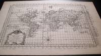
1787159181787. Ca. 1787. Very detailed map of the world on a flattened Mercator projection. With the hypothetical east coast of Australia showing New Guinea attached to Carpentaria. Despite the fact that the map was published after Captain James Cook's explorations only Tasman's west coast of New Zealand is shown. With great detail in the oceans and with recent discoveries noted in the south and north Pacific Canada and Greenland. The prime meridian runs through Paris; with an elaborate title cartouche and compass rose. Uncolored on laid paper. Image size: 16 1/2 x 11 1/2". Paper size: 20 x 13 1/4". Pin hole at center fold otherwise very good. unknown
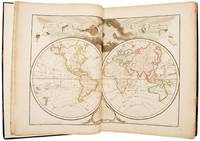
178951612Paris: chez Dezauche 1789. Updating the work of "one of the key figures in the development of French cartography" First edition thus and uncommon with just four listings on WorldCat three of these for the BnF and no complete copy at auction for 30 years; an excellent complete and inclusive French atlas of the 18th century. Jean-Claude Dezauche 1745-1824 was one of the geographer-publishers most influential in the establishment of the French theoretical approach to cartography. This movement which downplayed the decorative elements valued by the Dutch school in favour of scientific rigour and accuracy can be traced back to the work of Guillaume Delisle - "one of the key figures in the development of French cartography" Tooley - who had studied under Jean-Dominique Cassini director of the Paris observatory. Delisle's business was inherited by his son-in-law Philippe Buache who had studied with him and who entered the Depôt des Cartes et Plans de Marine in 1721 in 1729 being appointed "premier géographe du roi" a position previously held by his father-in-law. On Buache's death his widow sold his work to Jean Nicholas Buache de la Neuville Philippe's nephew and in 1780 Dezauche bought it from him together with work by Delisle Jaillot and others. He in turn made his own alterations and improvements to the maps and then re-issued them in a revised form. For example the twin- and four-hemispheric world maps in volume I the former dated 1792 have been revised to include the latest discoveries from Cook's voyages. 2 vols folio 453 x 375 mm. Engraved allegorical title page and contents leaves to each and 151 double-page or folding maps all coloured in outline. Contemporary calf rebacked red morocco labels. Somewhat rubbed and with some restoration at the corners light dampstain in the lower margin of vol. I slightly heavier at the title page which has been reinforced with archival tissue map of Paris shaved to the ruled border at the upper margin a few minor splits and chips in the margins but overall very good. unknown
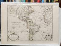
1763159241Paris: Chez l'Auteur Sur le Quay de l'Horloge 1763. Seventh state. Very good. 55 x 78 cm handcoloured map. Centrefold. A few spots. <br/><br/>Originally issued by Guillaume Delisle in 1722 this was one of the most popular maps of the Western Hemisphere in the 18th century and was printed in numerous editions. This is the important seventh state of the map notable because it depicts the mythical "Sea of the West" north of California. An inset in the top left features Buache's elaborate Northwest Passage theories including a conjectural Lac de Valasco. In Labrador is another hypothetical inland sea Mer Nouvellement Decouverte. In South America Brazil is separated from the Pays des Amazones. The map is decorated with a garland-draped title cartouche "Avertissement" cartouche and compass rose. Buache's imprint is in both the title cartouche dated 1722 and at bottom right with the nearly-illegible date of 1745. <br /> <br />Tooley America #7 p. 14. McGuirk #111. Wagner NW #523. Chez l'Auteur Sur le Quay de l'Horloge unknown
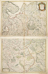
170655266Atlas de Geographie. Guillaume Delisle Quai de Horloge. 1706. The map is in two parts north and south they are both of equal size. The northern map has a decorated cartouche and shows the north of white Russia and part of the arctic coast reaches as far south as the Principality of Galicz. The southern map stretches to the northern tip of the Black Sea the Volga in the East and a tiny bit of the Baltic Coast in the North West. There are some text on the map about the inhabitants rivers etc A very handsome pair of maps. The plates were originally made by Delisle around 1700. Covens and Mortimer reissued them in the Atlas Novissimo 1730-40. Phillipe Buache de l'Isle's successor and son in law continued to reissue Delisle's maps in the later eighteenth century. The price is for the pair. Copper engraving. Very good condition slightly browned margins some sporadic spotting. Some nicks lower margins. Original colour. Size: 66 x 50 cm. 26 x 19½ inches unknown
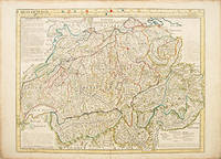
175052843Paris. c.1750. A large clear and detailed map of Switzerland outlining the cantons with their coats of arms at upper border alongside title. 'Avertissement' at at top left with description of the area. Atlas Geographique des Quatre Parties du Monde. Copper engraving. Very good condition a few waterstains at the slightly darkened edges not affecting map 2cm closed tear at lower centrefold Original colour. Size: 64 x 49 cm. unknown
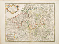
178052801Paris. 1780. Ornamental cartouche seven different national scales a good clear map showing the regions of Holland Belgium and Luxembourg. The plates were originally made by De l'Isle around 1700. Covens and Mortimer reissued them in the Atlas Novissimo 1730-40. Phillipe Buache de l'Isle's successor and son in law continued to reissue de l'Isle's maps in the later eighteenth century Copper engraving. The map itself is in fine condition there are a couple of faint watermarks at top and left hand margins there is a small tear at top right margin with a little loss not affecting map Original colour. Size: 62 x 47.5 cm. unknown