Cayeux, Claude PhilippeBiblio.com
314 résultats
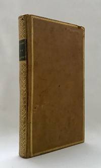
176910715Paris: P. Vente 1769. Contemporary gilt-ruled polished tan calf rubbed flat spine gilt à la grotesque with a gilt-lettered morocco label red edges blue silk marker. <p>A talented sculptor and frame-maker Cayeux 1688-1769 collected for six decades: “his cabinet was renowned for its examples of ‘our talented modern artists’†like Boucher van Loo and Cochin Bailey. Many lots have eighty or more drawings or prints. One copy in the U.S. In good condition contemporary title inscription On behalf of your most humble servant Cayeux tr. — penned by the deceased collector’s son Louis-Philippe d. 1776.<br /> ¶Bailey Patriotic Taste: Collecting Modern Art in Pre-Revolutionary Paris 21-22; Advielle Notice sur Philippe Cayeux passim; Lugt Répertoire des catalogues des ventes 1793.</p> P. Vente unknown
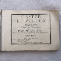
175417<p>Jean-Philippe RAMEAU CASTOR ET POLLUX</p><p>First edition of the definitive version very different from the first attempt of 1737 of the most important and successful opera of Jean-Philippe Rameau. A very good clean copy.</p><p>TrageÌdie mise en Musique par Mr. Rameau repreÌsenteÌe pour la premieÌ€re fois par l'AcadeÌmie Royale de Musique Le 24 Octobre 1737. Refondu Et remis au TheÌaÌ‚tre au Mois de DeÌcembre 1754. GraveÌe par Le Sr. Hue. A Paris Chez l'Auteur Rue des bons Enfans Et aux adresses ordinaires AÌ€ la Porte de l'OpeÌra.</p><p>In-4 aÌ€ l'italienne 1â„2 veÌlin ivoire aÌ€ coins pieÌ€ce de titre papier en forme de cÅ“ur colleÌe au 1er plat tranches rouges Reliure ancienne très légèrement postérieure. 1 f. de titre 163 pages.</p><p>Bel exemplaire de l'édition originale du plus important opéra de J.Ph Rameau et son plus grand succès qui connut plus de 250 représentations à Paris avant la Révolution française. Après une première version créée en 1737 l'opéra fut entièrement refondu pour atteindre à un équilibre exceptionnel dans sa version définitive très différente de la première : le livret est devenu parfaitement limpide et l'ensemble d'une concision et d'une variété admirables. Le coup de génie des fameuses trois notes faisant la transition entre la plainte du chÅ“ur des Spartiates Que tout gémisse et le célébrissime tristes Apprêts apparaît ici pour la première fois. Le déchirant Prélude du cinquième Acte est aussi une nouvelle version caractéristique de la plus grande maîtrise de Rameau au sommet de son art parmi bien d'autres exemples possibles.</p><p>Exemplaire de toute fraicheur imprimé sur vergé fort en excellent état de conservation. Menus défauts à la reliure coiffe inférieure frottements. Tache brune au dernier feuillet. Page de titre un peu salie.</p><p>On trouve relieÌs aÌ€ la suite : <br />Chant de guerre pour l'ArmeÌe du Rhin deÌdieÌe au MareÌchal Lukner. A Paris chez Bignon sans date. 3 pp. <br />Cinq airs d'Estelle et un deÌtacheÌ avec Accompagnement de ForteÌ-Piano. par Daniel Steibelt Paris chez Naderman sans date. 1 f. de titre 15 pp. Signature autographe de J.H. Nadermann 1734-1799 luthier et eÌditeur en marge du f. de titre. Rousseurs sur la pièce de Steibelt.</p><p>Photos supplémentaires sur demande.</p><p>Envoi avec suivi et assurance</p> hardcover
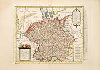
178753093Paris. 1787. Map of the whole of Germany which at the time included the Netherlands cartouche at lower right scales at lower left. Published in the Atlas Universal. Copper engraving. Fine condition Later colour. Size: 37 x 28.5 cm. unknown
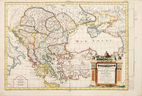
178765677Paris. c.1787. An interesting map of those countries that comprised the Turkish Empire in Europe. Each separate country is coloured in outline. A handsome and very decorative title cartouche is viewed in lower left corner. Size: 290 x 430 mm. Copperplate engraving with later additional hand colour. Good condition. Some minor foxing. unknown
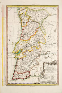
177353884Cosmographie Universal. 1773. Attractive map of Portugal. Title and scales at lower right. Copper engraving. Fine condition. Original outline colour. Size: 270 x 375 mm. 10½ x 15 inches. unknown
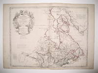
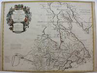
1783242998Dezauche 1783. Map. Engraving with hand coloring. Image measures 19.75 x 25.5". Sheet measures 21.5 x 30".<br/><br/> This map of Canada and the northern United States extends north from around the latitude of Baltimore all the way up to Baffin Bay along the shore of Greenland. Published by Jean-Claude Dezuache in 1783 it is the eighth revision of a map originally published by De L'Isle in 1703. The map is notable as the first to include "Etats-Unis" in the title coming as it did on the heels of the American Revolution. In fact this appearance is one of the earliest appearances of the name United States Etats-Unis on a printed map. The map is compelling in its accuracy particularly with regard to the Great Lakes depicting them as fully enclosed and properly placed in longitude and latitude. There is also excellent detail around the Hudson and Mississippi Rivers. The elaborate cartouche is decorated with a beaver natives one of whom is bearing a scalp and Jesuit explorers. Furthermore the fleurs-de-lis that previously adorned the shield at the top of the cartouche has been erased and the crown converted into a halo suspended above an orb a response to the execution of the king following the French Revolution Below a table of colors delineates the boundaries of the United States and European possessions. Indian nations are also labeled. The map is in excellent condition with wide margins as issued. Guillaume De L'Isle 1675--1726 was a French cartographer known for his popular and accurate maps of Europe and the newly explored Americas and Africa. He is important as the first "scientific" cartographer who incorporated the most current information on exploration and topography into his maps. Philippe Buache 1700--1773 was a student of De L'Isle and became one of the most active proponents of the so-called school of theoretical cartography active in mid-18th century France. This map is fascinating record from a remarkable moment in North American history.<br/><br/> Dezauche unknown books
1783242998Dezauche 1783. Map. Engraving with hand coloring. Image measures 19.75 x 25.5". Sheet measures 21.5 x 30".<br/> <br/> This map of Canada and the northern United States extends north from around the latitude of Baltimore all the way up to Baffin Bay along the shore of Greenland. Published by Jean-Claude Dezuache in 1783 it is the eighth revision of a map originally published by De L'Isle in 1703. The map is notable as the first to include "Etats-Unis" in the title coming as it did on the heels of the American Revolution. In fact this appearance is one of the earliest appearances of the name United States Etats-Unis on a printed map. The map is compelling in its accuracy particularly with regard to the Great Lakes depicting them as fully enclosed and properly placed in longitude and latitude. There is also excellent detail around the Hudson and Mississippi Rivers. The elaborate cartouche is decorated with a beaver natives one of whom is bearing a scalp and Jesuit explorers. Furthermore the fleurs-de-lis that previously adorned the shield at the top of the cartouche has been erased and the crown converted into a halo suspended above an orb a response to the execution of the king following the French Revolution Below a table of colors delineates the boundaries of the United States and European possessions. Indian nations are also labeled. The map is in excellent condition with wide margins as issued. Guillaume De L'Isle 1675--1726 was a French cartographer known for his popular and accurate maps of Europe and the newly explored Americas and Africa. He is important as the first "scientific" cartographer who incorporated the most current information on exploration and topography into his maps. Philippe Buache 1700--1773 was a student of De L'Isle and became one of the most active proponents of the so-called school of theoretical cartography active in mid-18th century France. This map is fascinating record from a remarkable moment in North American history.<br/> <br/> Dezauche unknown
1718M9192Paris c. 1718. Very Good. Notes: Fifth State. Scarce. "De l'Isle's map of Canada is one of the most outstanding maps of Canada of the 17th and early 18th centuries. Typical of all of his work the information that went into his map of Canada was the result of careful and painstaking research. It thus seems somewhat surprising that the dubious discoveries of Lahontan should have been so readily accepted and included on his map of Canada. De l'Isle's careful research resulted in the first map of Canada to present the whole of the Great Lakes correctly. In addition the position of the lakes relative to Hudson Bay is also correct and the Avalon Peninsula is shown much more realistically than in previous maps of Canada. Of considerable significance the geography of the coastal regions of James and Hudson Bays together with their major river systems is presented b De l'Isle with a surprising degree of accuracy."-Kershaw I page 275. Size : 497x645 mm 19.57x25.39 Inches Coloring: Hand Colored Reference: Karpinski p.40 and XXXI Tooley p.20 Kershaw 310 Schwartz pl. 80. Category: Maps Canada; Maps North America Great Lakes; unknown
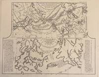
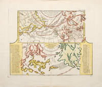
1772331985Paris: Academie des Sciences 1772. Map. Engraving. Image measures 12.25" x 15.5".<br/> <br/> This fascinating sheet contains two maps-- a French map of Western discoveries in Russia and the Northwest Passage area and a Japanese map of the same area taken from Japan by German explorer Englebert Kaempfer. Both maps contain notes on discoveries and speculations islands land masses and bodies of water. This map offers an interesting comparison between Eastern and Western perspectives and achievement in cartography and on the first mapping of Russia and the Northwest Passage. This was published as a supplement to Diderot's Encyclopedie. In very good condition wiith some scattered light foxing. <br> <br> Robert de Vaugondy 1688-1766 was an important French mapmaker during the 18th century. His "Atlas Universel" was one of the most significant atlases of the period integrating older sources with more modern surveyed maps in order to convey correct geographical and political information. <br> <br> Philippe Buache 1700--1773 was a French geographer who trained under the geographer Guillaume Delisle. This map of Lake Geneva is a fine example of his work.<br/> <br/> Academie des Sciences unknown
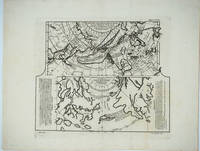
1752523481752. A fascinating map showing two early maps of the American north-west. the upper map shows the new discoveries in the northern Pacific. The coastline of Asia is more or less correctly drawn but America is wildly inaccurate. The lower part is an extract from a Japanese map brought back to Europe by Kaempfer for the collection of Hans Sloane. This shows the same area even more fancifully. The lower map is flanked by texts - an 'Avertissement'. and an extract from Kaempfer's travels. Worm hole in bottom margin not affecting the image Copper engraving. Fine condition good margins. Later colouring. Size: 40 x 32 cm. 15½ x 12½ inches. unknown
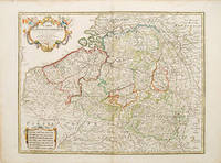
178052801Paris. 1780. Ornamental cartouche seven different national scales a good clear map showing the regions of Holland Belgium and Luxembourg. The plates were originally made by De l'Isle around 1700. Covens and Mortimer reissued them in the Atlas Novissimo 1730-40. Phillipe Buache de l'Isle's successor and son in law continued to reissue de l'Isle's maps in the later eighteenth century Copper engraving. The map itself is in fine condition there are a couple of faint watermarks at top and left hand margins there is a small tear at top right margin with a little loss not affecting map Original colour. Size: 62 x 47.5 cm. unknown
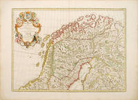
178852804Dezauche Paris. 1788 French. Fine elaborate cartouche although the title suggests a map of Denmark this handsome map shows the northern halves of Sweden Norway and Finland. The plates were originally made by De l'Isle around 1700. Covens and Mortimer reissued them in the Atlas Novissimo 1730-40. Phillipe Buache de l'Isle's successor and son in law continued to reissue de l'Isle's maps in the later eighteenth century Copper engraving. Fine condition good margins a little browned Original colour. Size: 62 x 45 cm. 24½ x 17½ inches unknown
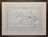
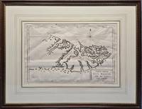
1787026741Paris: Privately Printed. 1st thus n.d. 1787; originally published in 1771. 360 x 240mm 540 x 420mm framed. Copperplate engraving; mounted with gilt border and framed in gilt decorated wood with glass. This map shows no west coast on the western island and other than Is. Sebaldes gives only two place-names. Point A indicates "Lieu ou étoit l'établissement François occupe aujourd'hui par les Espagnols." and Point B "Ou l'on soupçone que les Anglois sont établis." Appears in Bougainville's "Voyage autour du Monde" 1771 and 1772 in "Receuil des Cartes pour l'Histoire Moderne" par l'Abbé de Marsy et M. Richer extrait de "l'Atlas Universel" par Philippe de Pretot 1787 &c. Fordham 18. Framed by The Parker Gallery London BADA. VG condition with very slight fold as issued . Very Good. No Binding. 1787. Privately Printed unknown
177925866Livourne 1779. Maps. A map of Asia Canada Japan and the Arctic regions with two maps on one sheet. The upper map shows the European view of the northern Pacific showing western North America from New Orleans west with a clearly depicted Mer de l'Ouest to Kamchatka and northern Japan. The lower map shows the Japanese perception of the same region with very sketchy and inaccurate features in North America and a larger showing of the Japanese islands. The Japanese map has no depiction of Alaska.<br /> <br /> Copper engraving with two maps on one sheet. Includes text. Upper margin: "Suppl. 6e carte." Lower margin: "189 190"; "R. Spadaccini Sculp." This conforms with the edition at the Univ. of British Columbia mccormick_174. According to UBC "This atlas map removed from source: Robert de Vaugondy Didier. Recueil de 10 cartes.traitant particulierement de l'Amerique du Nord et des regions arctiques d'apres les relations les plus authentiques depuis le commencement du 17 siecle reproduites. 1 p.l. 10 fold. maps. 8. Livourne 1779."<br /> <br /> The title translates - Map of new discoveries prepared by Phil. Buache the King's Geographer presented to the Academy of Science August 9 1752 and approved in its meeting on the 6th of September following. and Excerpt from a Japanese map of the universe brought to Europe by Kaempfer and deposited in the cabinet of the late Mr. Han-Sloane president of the Royal Society of London. <br /> <br /> The map also appeared in a supplement to Diderot and d'Alembert's "Encyclopédie" without the lower margin text.<br /> <br /> Printed area measures 12 1/2 x 14" on paper 15 3/4 x 20 1/4". Very good overall with some unevenness in paper production causing the lower margin to look somewhat mottled. unknown
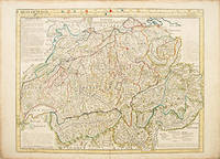
175052843Paris. c.1750. A large clear and detailed map of Switzerland outlining the cantons with their coats of arms at upper border alongside title. 'Avertissement' at at top left with description of the area. Atlas Geographique des Quatre Parties du Monde. Copper engraving. Very good condition a few waterstains at the slightly darkened edges not affecting map 2cm closed tear at lower centrefold Original colour. Size: 64 x 49 cm. unknown
178778676Paris. c.1787. Sheet size: 332 x 472 mm Plate size: 264 x 393 mm. Copper engraving. Hand colouring. In fine condition. unknown
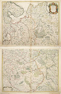
170655266Atlas de Geographie. Guillaume Delisle Quai de Horloge. 1706. The map is in two parts north and south they are both of equal size. The northern map has a decorated cartouche and shows the north of white Russia and part of the arctic coast reaches as far south as the Principality of Galicz. The southern map stretches to the northern tip of the Black Sea the Volga in the East and a tiny bit of the Baltic Coast in the North West. There are some text on the map about the inhabitants rivers etc A very handsome pair of maps. The plates were originally made by Delisle around 1700. Covens and Mortimer reissued them in the Atlas Novissimo 1730-40. Phillipe Buache de l'Isle's successor and son in law continued to reissue Delisle's maps in the later eighteenth century. The price is for the pair. Copper engraving. Very good condition slightly browned margins some sporadic spotting. Some nicks lower margins. Original colour. Size: 66 x 50 cm. 26 x 19½ inches unknown
17452430061745. Map. Engraving with hand coloring. Image measures 19 x 25.5".<br/><br/> This beautiful map depicts the Neuchatel region of Switzerland showing the town of Neuchatel as well as Lake Neuchatel. It is based on a 1710 original by David François de Merveilleux redone by Guillaume de L'Isle and published by Philippe Buache. The map is is finely detailed with abbeys and priories castles battlefields mineral springs and forests. An elegant compass rose is shown in Lake Neuchatel and a decorative title cartouche at the top of the map is flanked on either side by historical and geographical text in French. The map dates to the reign of Frederick I of Prussia who presided over Neuchatel's golden age and ushered in a period of expansion in commerce banking and industry such as watchmaking and lace. The map is in excellent condition with wide margins as issued and no chips or tears. Minor stains in margins not affecting the image. Philippe Buache 1700--1773 was a French geographer who trained under the geographer Guillaume De L'Isle 1675--1726 a French cartographer known for his popular and accurate maps of Europe and the newly explored Americas and Africa. He is important as the first "scientific" cartographer who incorporated the most current information on exploration and topography into his maps.<br/><br/> unknown books
17452430061745. Map. Engraving with hand coloring. Image measures 19 x 25.5".<br/> <br/> This beautiful map depicts the Neuchatel region of Switzerland showing the town of Neuchatel as well as Lake Neuchatel. It is based on a 1710 original by David Francois de Merveilleux redone by Guillaume de L'Isle and published by Philippe Buache. The map is is finely detailed with abbeys and priories castles battlefields mineral springs and forests. An elegant compass rose is shown in Lake Neuchatel and a decorative title cartouche at the top of the map is flanked on either side by historical and geographical text in French. The map dates to the reign of Frederick I of Prussia who presided over Neuchatel's golden age and ushered in a period of expansion in commerce banking and industry such as watchmaking and lace. The map is in excellent condition with wide margins as issued and no chips or tears. Minor stains in margins not affecting the image. Philippe Buache 1700--1773 was a French geographer who trained under the geographer Guillaume De L'Isle 1675--1726 a French cartographer known for his popular and accurate maps of Europe and the newly explored Americas and Africa. He is important as the first "scientific" cartographer who incorporated the most current information on exploration and topography into his maps.<br/> <br/> unknown
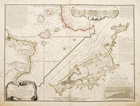
173755258Atlas de Geographie. Sept 1737. An interesting geo-hydrographic map of the Atlantic Ocean and its islands. It is divided into two with one side showing the Atlantic Ocean and the coasts of Africa and Brazil and the other side a detailed examination of the archipelago of Fernando de Noronha. A note top left explains the purpose of the map which in brief is to give an idea of the variety of islands in the Atlantic Ocean. Another note top right explains a little about the cartographers and expedition members. Another explains about an embankment between islands on the archipelago. A cartouche top right contains a cross-section diagram of what is below sea level. Another below sea-level cross-section shows the particulars of Fernando de Noronha lower right corner. Copper engraving. Very good condition - slight dark patches to lower corners and repair to lower left margin. Some offsetting. Original colour. Size: 65 x 49.5 cm. 25½ x 19½ inches unknown
178038197Paris: Dezauche 1780. A stunning map of Arabia and northeastern Africa from Libya and Egypt in the north to Somalia and the Gulf of Guinea in the south. 50 x 62 cm plate 55 x 76 cm sheet. Arabia Egypt Sudan and Abyssinia Ethiopia are wonderfully detailed; the interior much less so with some marvelously cryptic comments "Desert de Berdoa d'une grande sécheresse où il n'y a pas de sûreté pour les marchands à cause de voleurs"; "Royaume de Témian dont les habitans sont à ce qu'on dit Antropophages." Printed on fine thick watermarked laid paper. Original outline color. Reverse blank. A fine impression. Three small faint stains in the upper margin that could easily be removed and that in any case would be invisible were the map matted and framed else A PRISTINE EXAMPLE with the paper FINE AND BRIGHT. Very scarce in such fine condition. <br/><br/> Dezauche unknown
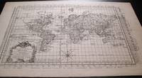
1787159181787. Ca. 1787. Very detailed map of the world on a flattened Mercator projection. With the hypothetical east coast of Australia showing New Guinea attached to Carpentaria. Despite the fact that the map was published after Captain James Cook's explorations only Tasman's west coast of New Zealand is shown. With great detail in the oceans and with recent discoveries noted in the south and north Pacific Canada and Greenland. The prime meridian runs through Paris; with an elaborate title cartouche and compass rose. Uncolored on laid paper. Image size: 16 1/2 x 11 1/2". Paper size: 20 x 13 1/4". Pin hole at center fold otherwise very good. unknown
17792092902138100218Not Available 1779. Soft Cover. Fine. Size: 55.5cmx73.5cm Number of books: 1 Not Available paperback
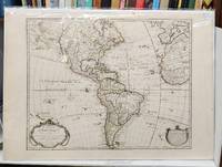
1763159241Paris: Chez l'Auteur Sur le Quay de l'Horloge 1763. Seventh state. Very good. 55 x 78 cm handcoloured map. Centrefold. A few spots. <br/><br/>Originally issued by Guillaume Delisle in 1722 this was one of the most popular maps of the Western Hemisphere in the 18th century and was printed in numerous editions. This is the important seventh state of the map notable because it depicts the mythical "Sea of the West" north of California. An inset in the top left features Buache's elaborate Northwest Passage theories including a conjectural Lac de Valasco. In Labrador is another hypothetical inland sea Mer Nouvellement Decouverte. In South America Brazil is separated from the Pays des Amazones. The map is decorated with a garland-draped title cartouche "Avertissement" cartouche and compass rose. Buache's imprint is in both the title cartouche dated 1722 and at bottom right with the nearly-illegible date of 1745. <br /> <br />Tooley America #7 p. 14. McGuirk #111. Wagner NW #523. Chez l'Auteur Sur le Quay de l'Horloge unknown
1775026742Venice: Vincenzo Formaleoni. 1st thus n.d. 1775; originally published in 1771. 360 x 240mm 540 x 420mm framed. Copperplate engraving; mounted with gilt border and framed in gilt decorated wood with glass. Printed by Vincenzo Formaleoni. Unrecorded in Fordham's "Falkland Islands: A bibliography of 50 examples of printed maps bearing specific reference to the Falkland Islands." Framed by The Parker Gallery London BADA. VG condition with very slight folds as issued . Very Good. No Binding. 1775. Vincenzo Formaleoni unknown