1 372 résultats
188316075New York: Dodd Mead 1883. First Edition. hardcover. very good. 6 plates 295 text illustrations. 766pp. Tall 8vo original gilt decorative rust cloth joints expertly rehinged; ex-lib. New York: Dodd Mead 1883. Very good.<br/><br/> Dodd Mead unknown books
1860RW1181London:: Routledge Warne and Routledge 1860. 1860. Sm. 8vo. viii 304 8 pp. Engraved frontis. half-title 9 color blue-printed plates figs. 6 additional blue-printed plates at rear depicting nebulae. Original brown blind- and gilt-stamped cloth. Ownership signatures of Mrs. Jay Winterslow nr. Salisbury U.K. and Henry E. Ravenhill Buchland Newton embossed stamps of Ellis Bookseller Sherborne. Very good. "New Edition with numerous illustrations." First issued in 1851 which was issued with 6 pls. not the 15 total in the present 1860 printing thus this has added plates that enhance this edition. While primarily known as an astronomer and the builder of the Cincinnati Observatory Mitchell also lectured in mathematics and philosophy and studied law he was instrumental in establishing Cincinnati College's law school. A graduate of West Point where he was a classmate of Robert E. Lee Mitchell served as a Major General in the Union Army during the Civil War. Routledge, Warne, and Routledge, 1860. hardcover books
1888264109London: John Murray 1888. viii 571p. plus publisher's appended ads: "Murray's Handbook Advertiser 1890-1891 containing Useful Information for Travellers Railway and Steamboat Companies Hotels and Miscellaneous Advertisements 48p. The familiar Murray's format similar to the Baedeker formula 7x4.5 inch semi-flexible red cloth boards gilt-titled. This copy was given a lot of use by one Edith Howell Perkins datelining "Berlin Oct. 1890". Edith boldly pencilled her itinerary all over the preliminaries erased spottily from titlepage cast checkmarks and brackets at other points. Her copy's spine panel is badly sunned with titling near illegible the head is pulled a half-inch at both joints expect general edgewear both hinges are expertly reinforced with white paper tape both feel sound to our touch as is the large folded map of Russia which didn't need it in rear pocket both hinges feel sound. Sounds like a mess but isn't: the textblock is square and tight the hinges really are "repaired" the small folded maps are all unmolested the endpocket map unfolds clean and sound and re-folds without problems: a good well good-only copy. John Murray unknown books
1843rbr1-at11Age toned and light foxing throughout. Digest-like compilation of statistics. "Containing an index of the various counties districts parishes townships towns &c. together with an index of the rivers; by which any county district township &c. or river may be found on the map without difficulty; also an accurate synopsis of the population of the union according to the census of 1840 alphabetically arranged; besides statements of the aggregate amount of the different classes of the inhabitants and their pursuits the value of the producer themes agriculture manufactures and commerce lists of the universities and colleges canals railroads. &c." S. Augustus Mitchell hardcover
1834rbr1-at18<p>Bumped corners light edge wear. Age toned and light foxing to paper. Bookplate and names inked on inside front board and ffep. Hinge cracked. Digest-like compilation of geographical data. 324 pages.</p> Mitchell and HInman hardcover
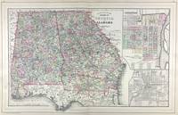
188645713Philadelphia: W.M. Bradley & Bro. 1886. Very good faint toning. Hand colored map. 22 x 14 inches. Plates 54 & 55: County Map of the States of Georgia and Alabama with insets of Savannah Georgia; and the City of Atlanta the capitol of Georgia. Copyright by S. Augustus Mitchell 1884. <br /> <br /> From: Mitchell's New General Atlas Containing Maps Of The Various Countries Of The World Plans Of Cities Etc. Embraced In Ninety-Three Quarto Maps Forming A Series Of One Hundred and Forty-seven Maps and Plans Together With Valuable Statistical Tables. Also A List Of Post-Offices Of The United States And Territories And Also Census Of 1880 For States Territories And Counties Also Of Cities Of Over 10000 Inhabitants. Philadelphia: Published By Wm. M. Bradley & Bro. No. 1026 Arch Street. 1886. [W.M. Bradley & Bro.] unknown
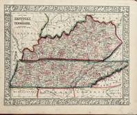
1860130Philadelphia: Mitchell S. Augustus 1860. 13 1/4 x 10 1/2 inches. Very good-. This Mitchell map is an ante-bellum artifact on the cusp of the Civil War. The states of Kentucky were pivotal in the Civil War. This presentation sets the visual reference for those actions occurring in both states. It does not take much imagination to picture the period participants garnering a look at this map in Mitchell's atlas. Mitchell, S. Augustus unknown
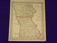
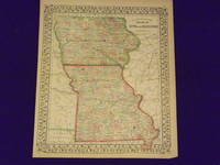
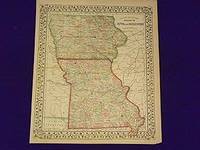
1870106744<p>Mitchell Samuel Augustus Jr. County Map of Iowa and Missouri. Philadelphia 1870. Unbound colored engraved map decorative border 14"x 11". Slight toning and aging a couple of margin nicks or slight tears one edge fold; overall bright and clear and in very good shape. Maps are wrapped with acid free board or in rigid sleeves. The Mitchell family started to produce atlases in 1846 and continued into the early 1890s. Around 1860 S. Augustus Mitchell Jr. took over and the atlas would be called Mitchell's New General Atlas. This is an attractive map of Iowa and Missouri from the 1870 installment of that atlas. An inset provides a smaller map of Mobile. Ristow 311-313.</p>
1869106177<p>Unbound colored engraved map decorative border 14"x 11 1/2". Slight toning and aging margins a litle narrow; otherwise very good and overall bright and clear. Maps are wrapped with acid free board or in rigid sleeves. The Mitchell family started to produce atlases in 1846 and continued into the early 1890s. Around 1860 S. Augustus Mitchell Jr. took over and the atlas would be called Mitchell's New General Atlas. This is very colorful version of the Iowa and Missouri map from the 1869 installment of this atlas. Ristow 311-313.</p>
1864101033<p>Philadelphia: 1864. Unbound colored engraved map decorative border 14"x 11 1/2". Slight toning and aging a little browing and staining in the margins; otherwise very good and overall bright and clear. Maps are wrapped with acid free board or in rigid sleeves. The Mitchell family started to produce atlases in 1846 and continued into the early 1890s. Around 1860 S. Augustus Mitchell Jr. took over and the atlas would be called Mitchell's New General Atlas. This is very colorful version of the Iowa and Missouri map from an early installment of this atlas. Ristow 311-313</p>
188952772Boston: Small Maynard & Company. Good. 1889. Hardcover. An edition in Good condition with scuffing fraying and other boardwear. Spine hinge is starting to separate; Previous owner's name penciled on front flyleaf ; This book is a history of England from the Celts to the Tudors. It covers the development of the English language and the monarchy.; 327 pages . Small, Maynard & Company hardcover
18971376652New York: The Century Co 1897. Hardcover. Octavo Two volumes 306 pages ; 261 pages. In Fair plus condition. Spines are grey with brown print. Boards in grey cloth with brown print heraldry. Wear to spine caps and corners cocked spines toning to spines smudging/shelf wear. Text block for first volume has cracked rear hinge spine break at p. 192; second volume has name in ink on front flyleaf small stain to fore edge. Illustrated: b&w frontispiece in each volume.<br /> <br /> <br /> NOTE: Shelved in Netdesk office Case #4. 1376652. FP New Rockville Stock. The Century Co hardcover
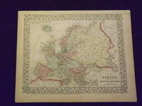
186716Philadelphia: Mitchell S. Augustus 1867. 1867 edition. 13 1/4 x 10 3/4. Very good. Mitchell S. Augustus. Contemporary hand colored atlas map recapping the complex political divisions of a monarchical Europe. This beautiful map is suitable for matting framing and hanging on the wall. Mitchell, S. Augustus unknown
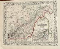
186719Philadelphia: Mitchell S. Augustus 1867. 1867 edition. 13 1/4 x 10 3/4 inches. Very good condition. Contemporary color graces this lithograph done two years after the close of the Civil War. The territory includes the lower and middle St. Lawrence River with an inset map of Montreal. Mitchell, S. Augustus unknown
1869103234<p>Unbound colored engraved map decorative border 14"x 11". Slight toning and aging; overall bright and clear and in very good shape. Maps are wrapped with acid free board or in rigid sleeves. The Mitchell family started to produce atlases in 1846 and continued into the early 1890s. Around 1860 S. Augustus Mitchell Jr. took over and the atlas would be called Mitchell's New General Atlas. This is a nice map of Europe from the 1869 installment of that atlas. Despite the large area the map covers there is still a decent amount of detail. Extra postage may be required. Ristow 311-313. # 103234</p>
1870106799<p>Unbound colored engraved map decorative border 14" x 11". Slight toning browning and aging a little soiling in upper margin a couple of chips in upper margin; otherwise bright and clean. Maps are wrapped with acid free board or in rigid sleeves. The Mitchell family started to produce atlases in 1846 and continued into the early 1890s. Around 1860 S. Augustus Mitchell Jr. took over and the atlas would be called Mitchell's New General Atlas. This is an attractive colorful map of Ontario from the 1870 installment of that atlas. The map provides good county detail and part of Quebec New York and Pennsylvania are visible. Extra postage may be required. Ristow 311-13.</p>
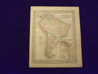
1864106805<p>Unbound colored engraved map decorative border 14" x 11". Slight toning and aging some darkening in lower margin; otherwise bright and clear and in very good condition. Maps are wrapped with acid free board or in rigid sleeves. The Mitchell family started to produce atlases in 1846 and continued into the early 1890s. Around 1860 S. Augustus Mitchell Jr. took over and the atlas would be called Mitchell's New General Atlas. This is an attractive colored map of South America from the 1864 installment of that atlas. The map shows a "New Granada" in an inset. Extra postage may be required. Ristow 311-313. </p>
1869103176<p>Unbound colored engraved map decorative border 14" x 11". Slight toning and aging small tear repaired with archival tape in bottom margin; overall bright and clear and in very good condition. Maps are wrapped with acid free board or in rigid sleeves. The Mitchell family started to produce atlases in 1846 and continued into the early 1890s. Around 1860 S. Augustus Mitchell Jr. took over and the atlas would be called Mitchell's New General Atlas. This is an attractive colored map of South America from the 1869 installment of that atlas. The map shows a "New Granada" in an inset. Extra postage may be required. Ristow 311-313.</p>
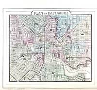
188645711Philadelphia: W.M. Bradley & Bro. 1886. Very good faint toning. Hand colored map. Plate 45: Plan of Baltimore Copyright by S. Augustus Mitchell 1884. 11.25 x 9.5 inches.<br /> <br /> On verso Plates 46 & 47:County Map of the States of Delaware Maryland Virginia and West Virginia with two insets. Copyright by Wm. M. Bradley & Bro. 1884. 22.25 x 14.5 inches.<br /> <br /> On adjacent Plate 48: Plan of the City of Washington The Capitol of the United States of America Copyright by S. Augustus Mitchell 1884. Drawn & engraved by W.H. Gamble. 13.75 x 11.5 inches.<br /> <br /> From: Mitchell's New General Atlas Containing Maps Of The Various Countries Of The World Plans Of Cities Etc. Embraced In Ninety-Three Quarto Maps Forming A Series Of One Hundred and Forty-seven Maps and Plans Together With Valuable Statistical Tables. Also A List Of Post-Offices Of The United States And Territories And Also Census Of 1880 For States Territories And Counties Also Of Cities Of Over 10000 Inhabitants. Philadelphia: Published By Wm. M. Bradley & Bro. No. 1026 Arch Street. 1886. [W.M. Bradley & Bro.] unknown
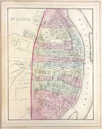
188645719Philadelphia: W.M. Bradley & Bro. 1886. Very good faint toning. Hand colored map. Plate 73: St. Louis. Copyright by S. Augustus Mitchell 1884. 11 x 14 inches.<br /> <br /> On verso Plates 74 & 75: County & Township Map of the States of Iowa and Missouri. Copyright by S. Augustus Mitchell 1884. 21.5 x 14.5 inches.<br /> <br /> From: Mitchell's New General Atlas Containing Maps Of The Various Countries Of The World Plans Of Cities Etc. Embraced In Ninety-Three Quarto Maps Forming A Series Of One Hundred and Forty-seven Maps and Plans Together With Valuable Statistical Tables. Also A List Of Post-Offices Of The United States And Territories And Also Census Of 1880 For States Territories And Counties Also Of Cities Of Over 10000 Inhabitants. Philadelphia: Published By Wm. M. Bradley & Bro. No. 1026 Arch Street. 1886. [W.M. Bradley & Bro.] unknown
1881020528Philadelphia PA: J. H. Butler and Co. 1881. Book. Good-VG. Hardcover. 4to - over 9¾" - 12" tall. Original binding with burgundy cloth library tape neatly mounted along all edges and binding providing durability. Ex-library typically marked and stamped perforation stamp to title page all maps unmarked and intact. Contents somewhat thumbed a bit toned by age. 12 pp. 6 hand-colored map pages containing a total of 11 maps lacking #5 Roman Empire. Rather surprising given incomplete state that this copy has not yet been sacrified to the plate-breakers. J. H. Butler and Co. Hardcover
1867406583New York: Charles Scribner & Co 1867. A near fine copy with some light wear to gilt at foot of spine and pale discoloration to endpapers. 8vo 18.8 x 12 cm. 295 pages. 3-page advertisements at end. Original green cloth gilt-lettered on spine. FIRST EDITION BAL's first state with final page of Preface paged iv. The book's aim according to its preface "is to stimulate those who live in the country or who love the country to a fuller and wider range of thinking about the means of making their homes enjoyable. I have especially sought to excite the ambition of those holders of humbler estates who believe that nothing can be done in the way of adornment of country property except under the eye of accomplished gardeners." BAL 13944. Charles Scribner & Co unknown
1862243Philadelphia: S. Augustus Mitchell 1862. 13 3/4 x 11 1/4. Very good. Very nice bright contemporary outline color. The counties are delineated by different full wash color. A very nice specimen of the mapmakers art during the Civil War. S. Augustus Mitchell unknown
1898909Z7None stated: The Society of Antiquaries of Scotland 1898. Leather. Very Good. 9" by 7". None. A scarce collection of chapters from the 'Proceedings of the Society of Antiquaries of Scotland' written by Arthur Mitchell describing the Scottish tours of Robertson and Loch. Segments from 'The Proceedings of the Society of Antiquaries of Scotland Volume 32'. Bound in quarter calf with cloth to the boards. A scarce work. This volume features a selection of chapters on the Scottish tours of James Robertson and David Loch written by Arthur Mitchell an antiquarian and doctor of mental illness. The chapters are taken from the yearly journal of 'The Society of Antiquaries of Scotland'. Bound in quarter calf with cloth to the boards. Externally generally smart with fading to the spine slight rubbing and bumping to the extremities and small closed tears to the tail of the spine. Offsetting to the endpapers. Internally firmly bound with clean and generally bright pages. Very Good The Society of Antiquaries of Scotland hardcover
18950176691895. Hardcover. Near Fine. New York: The Century Company 1895. Hardcover. Book Condition: Near Fine with minor edge wear. No Jacket. 1st Edition second or third printing unknown. Scarce first edition of this elusive Mitchell title. Original embossed leather with marbled endpapers and gilt edges and 1897 date on title and copyright pages with no addditional printings listed. <br/> <br/> hardcover