1 361 résultats
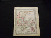
1870106797<p>Unbound colored engraved map decorative boarder 14"x 11". Slight toning browning and aging a few small chips and holes in left margin; overall very bright and clear and in very good shape. Maps are wrapped with acid free board or in rigid sleeves. The Mitchell family started to produce atlases in 1846 and continued into the early 1890s. Around 1860 S. Augustus Mitchell Jr. took over and the atlas would be called Mitchell's New General Atlas. This is a colorful map of a portion of eastern Canada from the 1870 installment of that atlas. The map is bright and crisp and includes a small inset map of Halifax. Extra postage may be required. Ristow 311-313.</p>
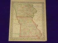
1861107225<p>Unbound colored engraved map decorative border 14"x 11". Slight toning and aging overall bright and clear and in really good condition. Maps are wrapped with acid free board or in rigid sleeves. The Mitchell family started to produce atlases in 1846 and continued into the early 1890s. Around 1860 S. Augustus Mitchell Jr. took over and the atlas would be called Mitchell's New General Atlas. This is an attractive map of Iowa and Missouri from the 1861 installment of that atlas made at the start of the Civil Waar. Ristow 311-313.</p>
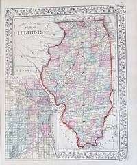
186791Philadelphia: Mitchell S. Augustus 1867. 10 3/4 x 13 1/4 inches. Very Good. Mitchell S. A. This is a superbly colored map of Illinois and its counties designated with the use of two colors and no color for the third designator. The inset plan of Chicago is also designated with color by ward. Taken from an 1867 edition of Mitchells General Atlas it would look excellent framed an on the wall! Mitchell, S. Augustus unknown
1870106775<p>Unbound colored engraved map decorative boarder 11x 14". Slight toning and aging some chips in upper margin; bright and clear and in otherwise very good shape. Maps are wrapped with acid free board or in rigid sleeves. The Mitchell family started to produce atlases in 1846 and continued into the early 1890s. Around 1860 S. Augustus Mitchell Jr. took over and the atlas would be called Mitchell's New General Atlas. This is an attractive colorful double page map of Kentucky and Tennessee from the 1870 installment of that atlas. Ristow 311-313 Phillips 907</p>
1869103218<p>Unbound colored engraved map decorative boarder 14"x 11". Slight toning browning and aging; overall very bright and clear and in very good shape. Maps are wrapped with acid free board or in rigid sleeves. The Mitchell family started to produce atlases in 1846 and continued into the early 1890s. Around 1860 S. Augustus Mitchell Jr. took over and the atlas would be called Mitchell's New General Atlas. This is a colorful map of a portion of eastern Canada from the 1869 installment of that atlas. The map is bright and crisp and includes a small inset map of Halifax. Extra postage may be required. Ristow 311-313.</p>
1870106163Unbound colored engraved map decorative boarder 14" x 11". Slight toning darkening and aging margins somewhat narrow slight tear in lower margin; overall bright and clean and in very good condition. Maps are wrapped with acid free board or in rigid sleeves. The Mitchell family started to produce atlases in 1846 and continued into the early 1890s. Around 1860 S. Augustus Mitchell Jr. took over and the atlas would be called Mitchell's New General Atlas. This is an attractive single page map of Virginia and West Virginia from the 1870 installment of that atlas. Extra postage may be required. Ristow 311-313.
1869106168<p>Unbound colored engraved map decorative boarder 14"x 11". Slight toning and aging some margin chips top margin narrow and with a couple of chips touching the neat line; still bright and clear and in otherwise good condition. Maps are wrapped with acid free board or in rigid sleeves. The Mitchell family started to produce atlases in 1846 and continued into the early 1890s. Around 1860 S. Augustus Mitchell Jr. took over and the atlas would be called Mitchell's New General Atlas. This is an attractive colorful single page map of the states of Massachusetts Connecticut and Rhode Island from the 1869 installment of that atlas. Good detail and Portland is featured in an inset. Ristow 311-313.</p>
1870106170<p>Unbound colored engraved map decorative boarder 14"x 11". Slight toning and aging margins narrow; still bright and clear and in otherwise good condition. Maps are wrapped with acid free board or in rigid sleeves. The Mitchell family started to produce atlases in 1846 and continued into the early 1890s. Around 1860 S. Augustus Mitchell Jr. took over and the atlas would be called Mitchell's New General Atlas. This is an attractive colorful single page map of the states of Massachusetts Connecticut and Rhode Island from the 1870 installment of that atlas. Good detail and Portland is featured in an inset. Ristow 311-313.</p>
1882101037Unbound colored engraved map decorative boarder 22 1/2"x 14 1/2". Slight toning and aging small repair at center fold; bright and clear and in otherwise very good shape. Maps are wrapped with acid free board or in rigid sleeves. The Mitchell family started to produce atlases in 1846 and continued into the early 1890s. Around 1860 S. Augustus Mitchell Jr. took over and the atlas would be called Mitchell's New General Atlas. This is an attractive colorful double page map of Kentucky and Tennessee from the 1882 installment of that atlas. Ristow 311-313 Phillips 907 Bradley
1882101020Philadelphia: Bradley 1882. Unbound colored engraved map decorative border 14"x 11". Slight toning and aging; overall bright and clear and in very good shape. Maps are wrapped with acid free board or in rigid sleeves. The Mitchell family started to produce atlases in 1846 and continued into the early 1890s. Around 1860 S. Augustus Mitchell Jr. took over and the atlas would be called Mitchell's New General Atlas. This is an attractive colored map of England and Wales from the 1882 installment of that atlas. Ristow 311-313 Phillips 907 Bradley unknown
1869101050<p>Philadelphia 1867. Unbound colored engraved map decorative boarder 14"x 11 1/2". Some toning and aging; otherwise bright and clear. Maps are wrapped with acid free board or in rigid sleeves. The Mitchell family started to produce atlases in 1846 and continued into the early 1890s. Around 1860 S. Augustus Mitchell Jr. took over and the atlas would be called Mitchell's New General Atlas. This is a colorful and attractive map of New Jersey and Maryland & Delaware from the 1867 installment of that atlas. This is a split map with New Jersey in one section and Maryland & Delaware in the other.</p>
1869101043Philadelphia 1869. Unbound colored engraved map decorative boarder 14 1/2"x 11". Slight toning and aging; overall bright and clear and in very good shape. Maps are wrapped with acid free board or in rigid sleeves. The Mitchell family started to produce atlases in 1846 and continued into the early 1890s. Around 1860 S. Augustus Mitchell Jr. took over and the atlas would be called Mitchell's New General Atlas. This is an attractive single page map of Michigan and Wisconsin from the 1869 installment of that atlas. Map has nice detail and good color. Ristow 311-313 unknown
18631418Philadelphia: : S. Augustus Mitchell 1863. 10-1/2" x 13-1/4" - 26.6 x 33.6 cm. Lithograph with original hand colouring. Minor chips and browning to margins lower right corner lightly creased else very good. A detailed and decorative map of Michigan Wisconsin and parts of Iowa and Illinois with scrolling foliate border. Shows the Great Lakes towns cities ports rivers and railroad lines. S. Augustus Mitchell, unknown
18631417Philadelphia: : S. Augustus Mitchell 1863. 10-1/2" x 13-1/4" - 26.6 x 33.6 cm. Lithograph with original hand colouring. Minor chips and browning to margins else very good. A detailed and decorative map of Pennsylvania New Jersey Maryland and Delaware with scrolling foliate border. Shows towns cities ports rivers and railroad lines. Inset maps of Philadelphia and Baltimore. S. Augustus Mitchell, unknown
189363362Boston:: Houghton Mifflin and Company 1893. publisher's gilt white cloth t.e.g. Old ink ownership notation; a few spots of foxing to edges; light soiling / tanning to cloth; tight and sound. . 8vo. Signed by S. Weir Mitchell on the title page. Houghton, Mifflin and Company, hardcover
1839106601<p>Engraved colored map 9" x11 1/2" Box like cartouche with map information. Some slight soiling toning and browning right margin a little uneven small holes in upper margin where it was bound not affecting image; otherwise very good. Not a bad looking little map with plenty of detail and some decent color. Small insert box featuring a map of Palestine. From a school and family geography. </p> S. Augustus Mitchell,
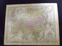
1865101007Philadelphia 1865. Unbound colored engraved map decorative border 14"x 11". Slight toning and aging a little minor staining or soling in left margin; overall bright and clear and in very good shape. Maps are wrapped with acid free board or in rigid sleeves. The Mitchell family started to produce atlases in 1846 and continued into the early 1890s. Around 1860 S. Augustus Mitchell Jr. took over and the atlas would be called Mitchell's New General Atlas. This is an attractive single page colored map of Asia from the 1865 installment of that atlas. The map features China Hindostan Turkestan Persia and part of Arabia. Ristow 311-313 unknown
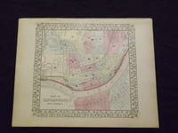
1869103224Unbound colored engraved map decorative boarder 14" x 11". Slight browning and aging; otherwise bright and clean and in very good shape. Maps are wrapped with acid free board or in rigid sleeves. The Mitchell family started to produce atlases in 1846 and continued into the early 1890s. Around 1860 S. Augustus Mitchell Jr. took over and the atlas would be called Mitchell's New General Atlas. This is an attractive and rather early single page map of Cincinnati from the 1869 installment of this atlas. The map has nice color and good street detail. Part of Covington and Newport are also visible on the other side of the Ohio River. May require extra postage. Ristow 311-313.
1870103227Unbound colored engraved map decorative boarder 14" x 11". Slight browning and aging; otherwise bright and clean and in very good shape. Maps are wrapped with acid free board or in rigid sleeves. The Mitchell family started to produce atlases in 1846 and continued into the early 1890s. Around 1860 S. Augustus Mitchell Jr. took over and the atlas would be called Mitchell's New General Atlas. This is an attractive and rather early single page map of Cincinnati from the 1870 installment of this atlas. The map has nice color and good street detail. Part of Covington and Newport are also visible on the other side of the Ohio River. May require extra postage. Ristow 311-313.
1861101018Philadelphia 1861. Unbound colored engraved map decorative boarder 13"x 11". Slight toning and aging a little light staining in the margins; still rather bright and clear and in very good shape. Maps are wrapped with acid free board or in rigid sleeves. The Mitchell family started to produce atlases in 1846 and continued into the early 1890s. Around 1860 S. Augustus Mitchell Jr. took over and the atlas would be called Mitchell's New General Atlas. This is an attractive and rather early single page map of Cincinnati from the 1861 installment of this atlas. Ristow 311-313 unknown
1861101017Philadelphia 1861. Unbound colored engraved map decorative boarder 13"x 11". Slight toning and aging a little light staining in the margins; still rather bright and clear and in very good shape. Maps are wrapped with acid free board or in rigid sleeves. The Mitchell family started to produce atlases in 1846 and continued into the early 1890s. Around 1860 S. Augustus Mitchell Jr. took over and the atlas would be called Mitchell's New General Atlas. This is an attractive and rather early single page map of Cincinnati from the 1861 installment of this atlas. Ristow 311-313 unknown
1882103242<p>Unbound colored engraved map decorative border 14"x 11". Slight browning and aging a little foxing in margins; still overall bright and clear and in very good shape. Maps are wrapped with acid free board or in rigid sleeves. The Mitchell family started to produce atlases in 1846 and continued into the early 1890s. Around 1860 S. Augustus Mitchell Jr. took over and the atlas would be called Mitchell's New General Atlas. This is a nice map of Europe from the 1882 installment of that atlas. Despite the large area the map covers there is still a decent amount of detail. Extra postage may be required. Ristow 311-313. # 103242</p>
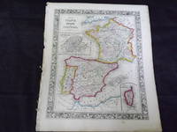
1861103243<p>Map of France Spain and Portugal. Philadelphia: 1861. Unbound colored engraved map decorative border 14" x 11". Slight browning and aging some chips and nicks at the left edge; overall bright and clean and in very good condition. Maps are wrapped with acid free board or in rigid sleeves. The Mitchell family started to produce atlases in 1846 and continued into the early 1890s. Around 1860 S. Augustus Mitchell Jr. took over and the atlas would be called Mitchell's New General Atlas. This is a very colorful map of France Spain and Portugal from the 1864 installment of that atlas. An inset illustrates Switzerland and the Island of Corsica. Extra postage may be required. Ristow 311-313.</p>
1882101026<p>Philadelphia 1882. Unbound colored engraved map decorative border 14"x 11". Slight toning and aging; overall bright and clear and in very good shape. Maps are wrapped with acid free board or in rigid sleeves. The Mitchell family started to produce atlases in 1846 and continued into the early 1890s. Around 1860 S. Augustus Mitchell Jr. took over and the atlas would be called Mitchell's New General Atlas. This is a colorful map of France Spain and Portugal from the 1882 installment of that atlas. An inset illustrates Switzerland and the Island of Corsica. Extra postage may be required. Ristow 311-313</p>
1870101304Unbound colored engraved map decorative boarder 14"x 11". Slight toning and aging some staining and soiling in margins; otherwise bright and clear and in very good shape. Maps are wrapped with acid free board or in rigid sleeves. The Mitchell family started to produce atlases in 1846 and continued into the early 1890s. Around 1860 S. Augustus Mitchell Jr. took over and the atlas would be called Mitchell's New General Atlas. This is colorful attractive map of France Spain and Portugal from the 1869 installment of that atlas. Nicely presented color and detail. Ristow 311-313 Phillips 907 S. Augustus Mitchell,