Mitchell, Samuel Augustus JrBiblio.com
1 361 résultats
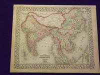
1869103250<p>Unbound colored engraved map decorative border 14" x 11". Slight browning and aging; otherwise bright and clean. Maps are wrapped with acid free board or in rigid sleeves. The Mitchell family started to produce atlases in 1846 and continued into the early 1890s. Around 1860 S. Augustus Mitchell Jr. took over and the atlas would be called Mitchell's New General Atlas. This is a nice colorful map of India and parts of the Far East from the 1869 installment of that atlas. While this is not a large map there is still a considerable amount of detail. Extra postage may be required. Ristow 311-313.</p>
1861101027<p>Philadelphia 1861. Unbound colored engraved map decorative border 14"x 11". Slight toning and aging a little browning at edges; overall bright and clear and in very good shape. Maps are wrapped with acid free board or in rigid sleeves. The Mitchell family started to produce atlases in 1846 and continued into the early 1890s. Around 1860 S. Augustus Mitchell Jr. took over and the atlas would be called Mitchell's New General Atlas. This is a nice colorful map of India and parts of the far east from the 1861 installment of that atlas. While this is not a large map there is still a considerable amount of detail. Ristow 311-313</p>
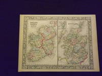
1864103236<p>Unbound colored engraved map decorative border 14" x 11". Slight toning and aging; overall generally bright and clean and in very good shape. Maps are wrapped with acid free board or in rigid sleeves. The Mitchell family started to produce atlases in 1846 and continued into the early 1890s. Around 1860 S. Augustus Mitchell Jr. took over and the atlas would be called Mitchell's New General Atlas. This is an attractive two panel map of Ireland and Scotland from the 1864 installment of that atlas. While the map presents two countries it does provide a fair amount of county level detail. Extra postage may be required. Ristow 311-313. </p>
1861101038Philadelphia 1861. Unbound colored engraved map decorative boarder 14"x 11". Slight toning and aging a few small holes in the outer margin; bright and clear and in otherwise very good shape. Maps are wrapped with acid free board or in rigid sleeves. The Mitchell family started to produce atlases in 1846 and continued into the early 1890s. Around 1860 S. Augustus Mitchell Jr. took over and the atlas would be called Mitchell's New General Atlas. This is an attractive colorful map of Louisiana Mississippi and Arkansas from the 1861 installment of that atlas. Good detail and a fairly early map from this series. Ristow 311-313 unknown
1864101039Philadelphia 1864. Unbound colored engraved map decorative boarder 14"x 11". Slight toning and aging a few small holes in the outer margin; bright and clear and in otherwise very good shape. Maps are wrapped with acid free board or in rigid sleeves. The Mitchell family started to produce atlases in 1846 and continued into the early 1890s. Around 1860 S. Augustus Mitchell Jr. took over and the atlas would be called Mitchell's New General Atlas. This is an attractive colorful map of Louisiana Mississippi and Arkansas from the 1861 installment of that atlas. Good detail and a fairly early map from this series. Ristow 311-313 unknown
1844106605Engraved double-page colored map 11 ½" x17 1/2" Box like cartouche with map information. Some soiling aging and browning a little creasing at fold; otherwise very good. Nice early map of New England with two inserts for Boston and Providence. From a school and family geography. S. Augustus Mitchell,
1882106158Unbound colored engraved map decorative boarder 14" X 11". Slight toning and agin some writing in right margin; overall bright and clear and in very good shape. Maps are wrapped with acid free board or in rigid sleeves. The Mitchell family started to produce atlases in 1846 and continued into the early 1890s. Around 1860 S. Augustus Mitchell Jr. took over and the atlas would be called Mitchell's New General Atlas. This is an attractive and colorful map of North and South Carolina from the 1882 installment. The map has a fair amount of detail and an inset of Charleston Harbor and another of Charleston. Ristow 311-313.
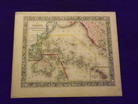
1861103166<p>Unbound colored engraved map decorative border 14" x 12". Slight toning and aging top edge a little rough some staining or browning in top margin; but still bright and clean. Maps are wrapped with acid free board or in rigid sleeves. The Mitchell family started to produce atlases in 1846 and continued into the early 1890s. Around 1860 S. Augustus Mitchell Jr. took over and the atlas would be called Mitchell's New General Atlas. This is a very attractive colorful single page map of the Pacific islands including Australia Japan and New Zealand. The Sandwich Islands is shown in a small inset. This map is from the 1861 installment of the Mitchell atlas. Some extra postage may be required. Ristow 311-313. </p>
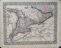
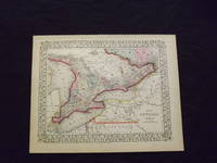
18691846Philadelphia: S. Augustus Mitchell Jr. 1869. Map no binding. Near fine. MAP. Mitchell's New General Atlas. 10 ¾" x 13 1/2" 9 1/8" x 11 7/8"; engraved map showing the Canadian province of Ontario vining border; hand-colored; light age-toning of paper; near fine. A nicely detailed hand-colored map of Ontario showing Lake Huron to the west Quebec to the north and east and bordered by Lake Erie in the southwest and Lake Ontario in the south. New York state Pennsylvania and Ohio all in the U.S. lie to the south of Lakes Erie and Ontario. Michigan lies to the far west. Georgian Bay Saginaw Bay Manitoulin Bay and Nottawasaga Bay are identified. Lake Nipissing and Lake St. Clair are labeled. S. Augustus Mitchell, Jr. unknown
1869103217<p>Unbound colored engraved map decorative border 14" x 11". Slight toning browning and aging; otherwise bright and clean. Maps are wrapped with acid free board or in rigid sleeves. The Mitchell family started to produce atlases in 1846 and continued into the early 1890s. Around 1860 S. Augustus Mitchell Jr. took over and the atlas would be called Mitchell's New General Atlas. This is an attractive colorful map of Ontario from the 1869 installment of that atlas. The map provides good county detail and part of Quebec New York and Pennsylvania are visible. Extra postage may be required. Ristow 311-313.</p>
1870106798<p>Unbound colored engraved map decorative border 14"x 11". Slight toning and aging finger smudge in lower margin; otherwise bright and clear and in very good shape. Maps are wrapped with acid free board or in rigid sleeves. The Mitchell family started to produce atlases in 1846 and continued into the early 1890s. Around 1860 S. Augustus Mitchell Jr. took over and the atlas would be called Mitchell's New General Atlas. This is an fairly colorful map of Quebec from the 1870 installment of that atlas. The map includes an inset featuring Montreal. Ristow 311-313. Phillips 907. </p>
1882101075<p>Philadelphia 1882. Unbound colored engraved map decorative border 14"x 11". Slight toning and aging; overall bright and clear and in very good shape. Maps are wrapped with acid free board or in rigid sleeves. The Mitchell family started to produce atlases in 1846 and continued into the early 1890s. Around 1860 S. Augustus Mitchell Jr. took over and the atlas would be called Mitchell's New General Atlas. This is an fairly colorful map of Quebec from the 1882 installment of that atlas. The map includes an inset featuring Montreal. Ristow 311-313 Phillips 907</p>
1869101074<p>Philadelphia 1869. Unbound colored engraved map decorative border 14"x 11". Slight toning and aging; overall bright and clear and in very good shape. Maps are wrapped with acid free board or in rigid sleeves. The Mitchell family started to produce atlases in 1846 and continued into the early 1890s. Around 1860 S. Augustus Mitchell Jr. took over and the atlas would be called Mitchell's New General Atlas. This is an fairly colorful map of Quebec from the 1869 installment of that atlas. The map includes an inset featuring Montreal. Ristow 311-313. Phillips 907</p>
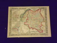
1864106121<p>Unbound colored engraved map decorative border 14"x 11". Slight toning and aging; overall bright and clear and in very good shape. Maps are wrapped with acid free board or in rigid sleeves. The Mitchell family started to produce atlases in 1846 and continued into the early 1890s. Around 1860 S. Augustus Mitchell Jr. took over and the atlas would be called Mitchell's New General Atlas. This is a colorful single page map of Russia and some Scandinavian countries from the 1864 installment of that atlas. The map includes insets featuring Denmark and Holland and Belgium. Ristow 311-313.</p>
1861101076<p>Philadelphia 1861. Unbound colored engraved map decorative border 14"x 11". Slight toning and aging; overall bright and clear and in very good shape. Maps are wrapped with acid free board or in rigid sleeves. The Mitchell family started to produce atlases in 1846 and continued into the early 1890s. Around 1860 S. Augustus Mitchell Jr. took over and the atlas would be called Mitchell's New General Atlas. This is a colorful single page map of Russia and some Scandinavian countries from the 1861 installment of that atlas. The map includes insets featuring Denmark and Holland and Belgium. Ristow 311-313</p>
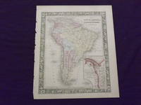
1882101079<p>Philadelphia: Bradley 1882. Unbound colored engraved map decorative border 14 1/2"x 11 1/2". Slight toning and aging; overall bright and clear and in very good shape. Maps are wrapped with acid free board or in rigid sleeves. The Mitchell family started to produce atlases in 1846 and continued into the early 1890s. Around 1860 S. Augustus Mitchell Jr. took over and the atlas would be called Mitchell's New General Atlas. This is an attractive colored map of South America from the 1882 installment of that atlas. The map shows a "New Granada" in an inset. Extra postage may be required. Ristow 311-313 Phillips 907</p> Bradley
1865101078<p>Philadelphia 1865. Unbound colored engraved map decorative border 14"x 11". Slight toning and aging a few small chips at the left edge; overall bright and clear and in very good shape. Maps are wrapped with acid free board or in rigid sleeves. The Mitchell family started to produce atlases in 1846 and continued into the early 1890s. Around 1860 S. Augustus Mitchell Jr. took over and the atlas would be called Mitchell's New General Atlas. This is an attractive colored map of South America from the 1865 installment of that atlas. The map shows a "New Granada" in an inset. Extra postage may be required. Ristow 311-313</p>
1861101077<p>Philadelphia 1861. Unbound colored engraved map decorative border 14"x 11". Slight toning and aging a little minor staining in margins; overall bright and clear and in very good shape. Maps are wrapped with acid free board or in rigid sleeves. The Mitchell family started to produce atlases in 1846 and continued into the early 1890s. Around 1860 S. Augustus Mitchell Jr. took over and the atlas would be called Mitchell's New General Atlas. This is an attractive colored map of South America from the 1861 installment of that atlas. The map shows a "New Granada" in an inset. Extra postage may be required. Ristow 311-313</p>
1869101080Philadelphia 1869. Unbound colored engraved map decorative border 14 "x 11 ". Slight toning and aging; overall bright and clear and in very good shape. Maps are wrapped with acid free board or in rigid sleeves. The Mitchell family started to produce atlases in 1846 and continued into the early 1890s. Around 1860 S. Augustus Mitchell Jr. took over and the atlas would be called Mitchell's New General Atlas. This is a fairly detailed map of St. Louis from the 1882 installment of that atlas. Ristow 311-313 unknown
1870106735Unbound colored engraved map decorative boarder 14"x 12". Slight toning and aging margin chips; otherwise bright and clear and in very good shape. Maps are wrapped with acid free board or in rigid sleeves. The Mitchell family started to produce atlases in 1846 and continued into the early 1890s. Around 1860 S. Augustus Mitchell Jr. took over and the atlas would be called Mitchell's New General Atlas. This is colorful attractive map of New Hampshire and Vermont from the 1870 installment of that atlas. Nicely presented color and detail. Ristow 311-313 Phillips 907.
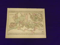
1882106130<p>Unbound colored engraved map decorative border 14"x 11". Slight toning and aging; overall bright and clear and in very good shape. Maps are wrapped with acid free board or in rigid sleeves. The Mitchell family started to produce atlases in 1846 and continued into the early 1890s. Around 1860 S. Augustus Mitchell Jr. took over and the atlas would be called Mitchell's New General Atlas. This somewhat unusual map of the Roman Empire is from the 1882 edition of the Mitchell series. In addition to an attractive rendering of the Roman Empire there is a large section of the map that presents Ancient Greece. Ristow 311-313. Phillips 907.</p>
1882101301Unbound colored engraved map decorative boarder 14"x 11". Slight toning and aging minor chip in margin; otherwise bright and clear and in very good shape. Maps are wrapped with acid free board or in rigid sleeves. The Mitchell family started to produce atlases in 1846 and continued into the early 1890s. Around 1860 S. Augustus Mitchell Jr. took over and the atlas would be called Mitchell's New General Atlas. This is fairly colorful map of North and South Carolina the 1882 installment of that atlas. Nicely presented color and detail. Ristow 311-313 Phillips 907 S. Agustus Mitchell.
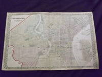
1872105050<p>Unbound colored engraved map lined boarder 23"x 15". Some toning darkening and aging a couple of small margin tears three with archival tape repairs slight corner crease; overall a nice impression about very good. Maps are wrapped with acid free board or in rigid sleeves. The Mitchell family started to produce atlases in 1846 and continued into the early 1890s. Around 1860 S. Augustus Mitchell Jr. took over and the atlas would be called Mitchell's New General Atlas. This is a fairly colorful double page map of the city of Philadelphia from the 1872 installment. W.H. Gamble is credited for this map. Unlike previous Mitchell maps this one does not have the traditional decorative boarder. The Camden portion of the map is to the side and almost set up as an inset. Ristow 311-313. Phillips 907.</p>
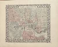
187025Philadelphia: Mitchell S. Augustus 1870. 1870 edition. 11 1/4 x 9 1/2 inches. Very Good. Single page map with contemporary hand color. This plan of Baltimore show the town and its railroad network. Mitchell S. Augustus unknown
1882101044Philadelphia: Bradley 1882. Unbound colored engraved map decorative boarder 14"x 11 1/2". Some toning and aging a couple of minor nicks at left edge; otherwise very good and bright and clean. Maps are wrapped with acid free board or in rigid sleeves. The Mitchell family started to produce atlases in 1846 and continued into the early 1890s. Around 1860 S. Augustus Mitchell Jr. took over and the atlas would be called Mitchell's New General Atlas. This is an attractive single page map ofthe city of Milwaukee from the 1882 installment of that atlas.Map has some decent color and good detail on city streets. Ristow 311-313 Phillips 907 Bradley unknown