MITCHELL Jr, S AugustusBiblio.com
1 372 résultats
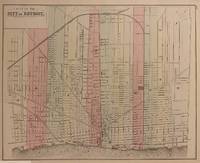
1884310762Philadelphia: Mitchell Samuel Augustus Jr. 1884. unbound. Map. Engraving with original hand coloring. Image measures 11" x 13 7/8"<br/> <br/> Beautiful city plan of Detroit Michigan hand colored to show wards. Streets notable buildings parks and railroads are labeled. The map is in very good condition with two small closed tears to upper margin not affecting the image. <br> <br> Samuel Augustus Mitchell Sr. 1792-1868 was one of the leaders in American cartography of the 19th century and pioneered the conversion of engraved map plates to more affordable lithographic plates. His son Samuel Augustus Mitchell Jr. continued his father's successful mapmaking and publishing business and was one of the most prolific and renowned 19th century American publishers.<br/> <br/> Mitchell, Samuel Augustus Jr. unknown
1862296638Philadelphia: Mitchell Samuel Augustus Jr. 1862. unbound. WILLIAMS Wellington. Map. Engraving with original hand coloring. Image measures 13" x 15 5/8"<br/><br/> This vibrantly colored city plan or town plan of Philadelphia Pennsylvania is one of the most beautiful maps of Philadelphia to be included in a 19th century atlas. Map features center city Philadelphia between the Delaware and Schuylkill Rivers and extending from Norris Avenue in the north to Morris Avenue in the south along the Delaware River. Shows streets notable buildings parks railroads and ferry and steamboat routes. The map is in good condition. <br><br>Samuel Augustus Mitchell Sr. 1792-1868 was one of the leaders in American cartography of the 19th century and pioneered the conversion of engraved map plates to more affordable lithographic plates. His son Samuel Augustus Mitchell Jr. continued his father's successful mapmaking and publishing business and was one of the most prolific and renowned 19th century American publishers.<br/><br/> Mitchell, Samuel Augustus Jr. unknown books
1898D17740Philadelphia: The Philadelphia Medical Journal 1898. 8vo. 10 pp. Side-stapled printed wrappers. Near fine. BAL 14185 A scarce offprint from the Philadelphia Medical Journal of January 22 1898. Mitchell made many original contributions to the study of chorea. <br/><br/> The Philadelphia Medical Journal unknown
1900Gaelicmdph<p><b>Gaelicmdph</b> Mitchell Dugald M. D. <b>A popular history of the Highlands and Gaelic Scotland: from the earliest times till the close of the 'Forty-five.</b> Paisley: Alexander Gardner 1900 15 707 pages index front. 3 maps 1 folding – all present. Blue cloth top edge gilt as well as gilt lettering on spine. Some expected wear for such a heavy volume but not as much as one would expect. All in all a good to very good copy of a very uncommon book. <b>$100.00 Box 70</b></p><p><b>Contents:</b> <i>Early notices of Britain -- Invasion in reign of Claudius -- Northward advance of the Romans -- The campaigns of Julius Agricola -- Details from Tacitus -- Advance to the Tay -- Erection of chain of Forts between the Forth and Clyde -- Agricola's reconnaissance in Kintyre -- Night attack by the Caledonians -- Confederacy of the tribes -- Battle of Mons Granpins -- Recall of Agricola -- 84 AD -- Erection of Hadrian's wall -- Earliest reference to the "Picts" -- Constantius Chlorus passes beyond the northern wall -- Civilising influence of the Romans -- -- Province invaded by Picts and Scots in 360-- Invasion in 364 by Picts Scots Atacotts and Saxons -- Picts grouped into Dicalidonae and Vecturiones -- -Roman remains in Scotland -- -Introduction of Christianity -- The Early Races -- The Stone Age and the Iberians -- -The Bronze Age and the Celt -- -The Early Iron Age -- -The Brochs their Character and Use--Crannogs or Lake Dwellings -- Hill Forts -- Vitrified Forts -- Underground House -- The Kingdom of Bernicia founded by the Saxons -- The British Kingdom of Strathclyde -- Early Pictish Kings -- The Kingdom of Dalriada founded by the Scots -- Contemporary Christianity in Scotland -- Arrival of St Columba -- The Celtic Monasteries-- Columba receives gift of Iona from King Conall--Evangelisation of northern Pictland -- The paganism of early Scotlsnd -- -Anointing of Aidan by Columba -- Aidan's vigorous reign -- Death of Columba -- Rivalry of the Eochadh Buidhe--The Celtic Church in Northrthumbria -- -Events in Pictavia -- -Battle of Duin-Nechtain and its results -- Political influence of Adamnan -- The Culdees -- Early stone churches and bee-hive dwellings -- -Battle of Droma Cathmail--Aeda Find king of Dalriada -- Arrival of the Norsemen- -- Dunkeld and the reliquaries of St Columba -- The Lia Fail or Stone of Destiny--Kenneth's struggles with Saxons and Britons-- Sigurd the Powerful -- The Round Towers of Abernethy and Brechin--Battle of Luncarty--Caithness attached to earldom of Orkney- -- The last plundering of Inna by the Danes -- -The Norwegians Christianised -- -Invasion of Cumberland by Aethelred king of England- -- The struggles of Malcolm II with the Danes -- Assimilation of the Scottish Church to the Church of Rome -- The literary productions of the Celtic Church--The earliest specimens of Gaelic writing -- Celtic crosiers bells and brooches- -- Celtic art as applied to memorial stones -- The earliest form of cross -- Curious enigmatic symbols peculiar to Scotland -- -Norse burials and Norse art in Scotland --The career of Somerled Regulus of Argyll--Revolt of the six Earls -- Liberties of the kingdom surrendered by William the Lion--Some leading characteristics of Clan organisation -- Septs sprung from the Clan proper -- King James holds his Court at Campbelltown in l498--Argyll's relations with Mary Mac Leod the heiress of Harris -- The Hebridean Scots in Ireland -- -Miserable intrigues of the Earl of Caithness -- The Highlanders at the Battle of Langside -- Issue of the first book printed in a Celtic tongue- -- Battle of Tippermuir -- Battle of Aberdeen -- Battle of Fyvie -- Battle of Philiphaugh -- Slaughter of the Campbells at Stirling- -- Rising in the north in favour of Charles II -- Attempt by William to purchase the support of the clans -- The Massacre of Glencoe --The Rebellion of 1715 -- Jacobite rising with Spanish aid in 1719- -- Attempt to capture Charles -- The cruelties of butcher Cinnberlund -- Proscription of tartan and the Highland garb -- The bagpipe and the harp -- -The music of the Highlander- -- Modern Gaelic poetry -- Some Highland poets</i><i>.</i></p> : Alexander Gardner, hardcover
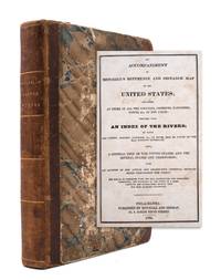
1834324793Philadelphia: Mitchell and Hinman 1834. First edition. 324pp. 12mo. Contemporary half morocco and marbled paper boards. Mapseller and publisher's label on blue paper on front pastedown. Provenance: Henry Coffin Nantucket signature. First edition. 324pp. 12mo. Sabin 49715; Clark III:72; Howes M684. Sabin 49715; Clark III:72; Howes M684 <br/><br/> Mitchell and Hinman hardcover
1882101090Philadelphia: Bradley 1882. Unbound colored engraved map 22 1/2"x 14 1/2". Slight toning and aging; overall bright and clear and in very good shape. Maps are wrapped with acid free board or in rigid sleeves. The Mitchell family started to produce atlases in 1846 and continued into the early 1890s. Around 1860 S. Augustus Mitchell Jr. took over and the atlas would be called Mitchell's New General Atlas. This is an attractive double page map of the western part of the country from the 1882 installment. An Indian Reservation is highlighted and a small inset featuring southern Nevada is also present. Ristow 311-313 Phillips 907 Bradley unknown
1869101088Philadelphia 1869. Unbound colored engraved map decorative boarder 14"x11". Slight toning and aging; overall bright and clear and in very good shape. Maps are wrapped with acid free board or in rigid sleeves. The Mitchell family started to produce atlases in 1846 and continued into the early 1890s. Around 1860 S. Augustus Mitchell Jr. took over and the atlas would be called Mitchell's New General Atlas. This is an attractive map of the western part of the country from the 1869 installment of that atlas. Ristow 311-313 unknown
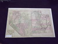
1882101006<p>Philadelphia: Bradley 1882. Unbound colored engraved map 22 1/2"x 14 1/2". Slight toning and aging; a little darkening in lower portion of fold; overall bright and clear and in very good shape. Maps are wrapped with acid free board or in rigid sleeves. The Mitchell family started to produce atlases in 1846 and continued into the early 1890s. Around 1860 S. Augustus Mitchell Jr. took over and the atlas would be called Mitchell's New General Atlas. This is an attractive double page map of two western states from the 1882 installment. The Mohave Desert Yuma and Apache Territory are featured in this map. Ristow 311-313 Phillips 907</p> Bradley
1882101036Philadelphia: Bradley 1882. Unbound colored engraved map decorative border 22 1/2"x 14 1/2". Slight toning and aging; overall bright and clear and in very good shape. Maps are wrapped with acid free board or in rigid sleeves. The Mitchell family started to produce atlases in 1846 and continued into the early 1890s. Around 1860 S. Augustus Mitchell Jr. took over and the atlas would be called Mitchell's New General Atlas. This is a very colorful and attractive double page map of Kansas and Nebraska from the 1882 installment. The map includes a little of Colorado and Iowa. Ristow 311-313 Phillips 907 Bradley unknown
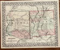
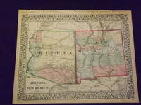
1874104Philadelphia: Mitchell S. Augustus 1874. 11 1/2 x 14 5/8 inches. Very good. Mitchell S. Augustus. Very nice original antique map of Arizona and New Mexico by Mitchell. Coloring is very crisp. A superb example of the cartographers art. Mitchell, S. Augustus unknown
1869101213Philadelphia 1869. Unbound colored engraved map decorative border 14"x 11". Slight toning and aging; overall bright and clear and in very good shape. Maps are wrapped with acid free board or in rigid sleeves. The Mitchell family started to produce atlases in 1846 and continued into the early 1890s. Around 1860 S. Augustus Mitchell Jr. took over and the atlas would be called Mitchell's New General Atlas. This is a colorful and attractive map of Florida from the 1869 installment of that atlas. An inset provides a smaller map of Mobile. Ristow 311-313 unknown
186691485New York: Scribner 1866. First. hardcover. fine. By the author of "My Farm in Edgewood". 2 vols. green cloth. N.Y.: Scribner 1866. First Edition. Fine.<br/> <br/> The author's name appears on the spines of the two volumes but not on the title page.<br/> <br/> Scribner unknown
189856210NY: Century 1898. Volume one is in good condition. Volume 2 is complete but binding is loose & some pages are loose. Signed & Inscribed by Author. Hardbacks. Century Paperback
18631457Philadelphia: : S. Augustus Mitchell 1863. 10-3/4" x 13-1/2"- 27.3 x 34.2 cm. Lithograph with original hand colouring. Minor browning and chipping o margins else very good. A detailed and decorative map of Africa including parts of Arabia and Persia with scrolling foliate border. Inset map of the Island of St. Helena in the Atlantic Ocean. Shows towns cities topographical features etc. Some of the interior is still marked "unknown S. Augustus Mitchell, unknown
1870101005<p>Unbound colored engraved map decorative boarder 14 "x 11". Slight toning and aging a few small chips in margins; overall bright and clear and in very good shape. Maps are wrapped with acid free board or in rigid sleeves. The Mitchell family started to produce atlases in 1846 and continued into the early 1890s. Around 1860 S. Augustus Mitchell Jr. took over and the atlas would be called Mitchell's New General Atlas. This is a bright and attractive map of two western states from the 1870 installment of that atlas. A little of the Colorado river can be seen and the Apache Territory is featured in this map. Ristow 311-313</p>
1882101016Philadelphia: Bradley 1882. Unbound colored engraved map 23"x 15". Slight toning and aging a little staining or soiling in the margins a few chips at edge; still rather bright and clear and in very good shape. Maps are wrapped with acid free board or in rigid sleeves. The Mitchell family started to produce atlases in 1846 and continued into the early 1890s. Around 1860 S. Augustus Mitchell Jr. took over and the atlas would be called Mitchell's New General Atlas. This is a nice colorful double page map of Chicago from the 1882 installment of this atlas. The map includes Chicago street guide in the lower portion of the map. Ristow 311-313 Phillips 907 Bradley unknown
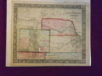
1865106068<p>Unbound colored engraved map decorative border 14"x 11". Slight toning and aging; a few chips and tears on top margin overall bright and clear and in very good shape. Maps are wrapped with acid free board or in rigid sleeves. The Mitchell family started to produce atlases in 1846 and continued into the early 1890s. Around 1860 S. Augustus Mitchell Jr. took over and the atlas would be called Mitchell's New General Atlas. This is a very colorful and attractive map of Kansas and a couple of western states from the 1865 installment of that atlas. While the map shows mostly Kansas Nebraska and Colorado it also presents a portion of Dakota and Wyoming. For some of these territories this is an early representation. Ristow 311-313. </p>
1869101135<p>Philadelphia 1969. Unbound colored engraved map decorative border 14"x 11". Slight toning and aging; overall bright and clear and in very good shape. Maps are wrapped with acid free board or in rigid sleeves. The Mitchell family started to produce atlases in 1846 and continued into the early 1890s. Around 1860 S. Augustus Mitchell Jr. took over and the atlas would be called Mitchell's New General Atlas. This is a very colorful and attractive map of Kansas and a couple of western states from the 1869 installment of that atlas. While the map shows mostly Kansas Nebraska and Colorado it also presents a portion of Dakota and Wyoming. Ristow 311-313</p>
1865101130<p>Philadelphia 1865. Unbound colored engraved map decorative boarder 22 1/2"x 14 1/2". Slight toning and aging; overall bright and clean and in very good condition. Maps are wrapped with acid free board or in rigid sleeves. The Mitchell family started to produce atlases in 1846 and continued into the early 1890s. Around 1860 S. Augustus Mitchell Jr. took over and the atlas would be called Mitchell's New General Atlas. This is an attractive double page map of Central America from the 1865 installment of that atlas. Bermuda Jamaica a map of the Panama Railroad and a map of Cuba are highlighted within insets. May require extra postage.Ristow 311-313 Phillips 907</p>
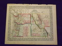
1870103161<p>Unbound colored engraved map decorative boarder 14" x 11". Slight toning and aging margins show a little darkening some chips in upper margin; otherwise very bright and clear. Maps are wrapped with acid free board or in rigid sleeves. The Mitchell family started to produce atlases in 1846 and continued into the early 1890s. Around 1860 S. Augustus Mitchell Jr. took over and the atlas would be called Mitchell's New General Atlas. This is a very colorful and attractive map of a still relatively early view of Oregon Washington and Idaho from the 1870 installment of that atlas. The map also shows part of British America and Montana. Ristow 311-313. # 103161</p><p>$100</p>
1865101200<p>Philadelphia 1865. Unbound colored engraved map decorative boarder 14 1/2"x 11". Slight toning and aging; otherwise very bright and clear. Maps are wrapped with acid free board or in rigid sleeves. The Mitchell family started to produce atlases in 1846 and continued into the early 1890s. Around 1860 S. Augustus Mitchell Jr. took over and the atlas would be called Mitchell's New General Atlas. This is a very colorful and attractive map of a still relatively early view of Oregon Washington and Idaho from the 1865 installment of that atlas. The map also shows part of British America and Montana. Ristow 311-313</p>
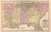
1852322878Philadelphia: S. Augustus Mitchell 1852. unbound. Williams. Map. Lithograph with hand coloring. Sheet measures 11 1/2" x 18".<br/> <br/> Map displaying the southeastern United States including Arkansas Louisiana Mississippi Alabama Tennessee North Carolina South Carolina Florida and Georgia. Towns railroads canals battle sites and more are noted. A wonderfully detailed and clear map with flags noting remarkable battles. In very good condition with some surface dirt and minimal toning. <br> <br> Samuel Augustus Mitchell Sr. 1792-1868 was one of the leaders in American cartography of the 19th century and pioneered the conversion of engraved map plates to more affordable lithographic plates. His son Samuel Augustus Mitchell Jr. continued his father's successful mapmaking and publishing business and was one of the most prolific and renowned 19th century American publishers.<br/> <br/> S. Augustus Mitchell unknown
1852206414Philadelphia: Thomas Cowperthwait & Co 1852. Hardcover. G: Significant wear to the edges and corners with the top and bottom of the spine missing. Stains and smudges to the covers. Break in the front end pages. Name on front free end page. Tanning and foxing to the pages which overall remain readable. A large brown casebound book with a green spine. Unpaginated. Profusely illustrated with black-and-white images; contains color maps. Thomas, Cowperthwait & Co hardcover
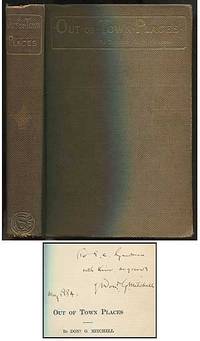
1884399069New York: Charles Scribner's Sons 1884. Hardcover. Very Good. First edition thus a re-issue of "Rural Studies". Brown cloth stamped in gilt top edge gilt. Bookplate removed from front pastedown spine darkened spine ends and corners worn still a very good copy. Inscribed by the author on the half-title. Charles Scribner's Sons hardcover
1882101009Philadelphia: Bradley 1882. Unbound colored engraved map decorative border 23"x 15". Some toning and aging small tape repair in margin; otherwise very good. Maps are wrapped with acid free board or in rigid sleeves. The Mitchell family started to produce atlases in 1846 and continued into the early 1890s. Around 1860 S. Augustus Mitchell Jr. took over and the atlas would be called Mitchell's New General Atlas. This is a detailed double page map of Boston from the 1882 installment of this atlas. The map includes a small inset illustrating Boston Harbor & Islands. Ristow 311-313 Phillips 907 Bradley unknown