1 361 résultats
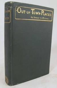
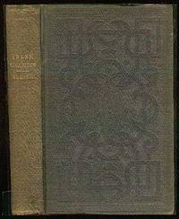
18950769964New York: Century Co. Good/No Jacket. 1895. First Edition. Full Leather. 16mo - over 5¾" - 6¾" Used Publisher's deluxe binding full brown suede heavily embossed in blind with designs of bottles glasses bowls and arabesque motifs all edges gilt marbled endpapers binding split spine separated and chipped boards rubbed some foxing to blanks. . Century Co. hardcover
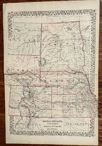
1882101022Philadelphia: Bradley 1882. Unbound colored engraved map 14"x 11 1/2". Slight toning and aging; overall bright and clear and in very good shape. Maps are wrapped with acid free board or in rigid sleeves. The Mitchell family started to produce atlases in 1846 and continued into the early 1890s. Around 1860 S. Augustus Mitchell Jr. took over and the atlas would be called Mitchell's New General Atlas. This is a colorful and attractive map of Dakota from the 1882 installment of that atlas. Often presented with other states or territories this map neatly highlights all the counties of the state. Ristow 311-313 Phillips 907 Bradley unknown
1888000364Philadelphia and London: J B Lippincott 1888. 2nd Edition . Hardcover. Good/None. Small. Blue boards with gilt lettering. Spine ends slightly worn. Small lighter blue patch on front cover.This little book 177 pp. is composed of 6 essays primarily for women. No markings. a gem from a physician and humanist a writer of fiction and fact. <br/> <br/> J B Lippincott hardcover
1888blb05448<p>Philadelphia: J.B. Lippincott Company 1888. 5th . Hardcover. Near Fine. Brown cloth on boards with bright gilt lettering to front and slightly less bright to spine. Book is tight square relatively sharp-cornered and free of major flaws or markings other than very minor spotting to front and some minor rubbing to edges. Dark blue endpapers. States ""Fifth Edition"" on title page - with 1888 date. Very Good or Near Fine copy of this scarce book.</p> J.B. Lippincott Company hardcover
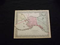
1870103216<p>Unbound colored engraved map decorative boarder 14" x 11". Slight toning browning and aging some chips and tears at top edge bottom margin somewhat narrow; overall very bright and clear and in very good shape. Maps are wrapped with acid free board or in rigid sleeves. The Mitchell family started to produce atlases in 1846 and continued into the early 1890s. Around 1860 S. Augustus Mitchell Jr. took over and the atlas would be called Mitchell's New General Atlas. This is a colorful map of Alaska is from the 1870 installment of that atlas. The map is bright and crisp and shows part of Siberia and the Aleutian Islands and part of Prince Albert Island is also visible. Extra postage may be required. Ristow 311-313.</p>
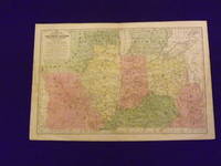
1839102173Engraved colored map 11" x17" cartouche with map information. Some slight soiling toning and browning small archival tape repair on reverse near split insignificant perhaps faint staining in the lower left margin decent margins; map is generally bright and clean. This is an interesting early Mitchell map of the Western States and Territories from the Mitchell's School & Family Geography. The states furthest west at this point are Illinois and Indiana. Iowa and Wisconsin are still shown as territories. S. Augustus Mitchell,
1888012751Charles Scribner's Sons New York 1888. Edition Unstated. Hardcover. Good Condition/No Dust Jacket. Signed by Author. Size: Octavo standard book size. Text body is clean and free from previous owner annotation underlining and highlighting. Binding is sound. This copy is signed and inscribed by Donald G. Mitchell on the front free end paper. Gilt-stamped green cloth over boards top edge gilt vi 295 pages. "A Re-Issue of 'Rural Studies'". Corners and spine ends bumped and lightly worn covers rubbed. Quantity Available: 1. Shipped Weight: 2 lbs 4 oz. Category: Farming & Rural Life; Signed by Author. Pictures of this item not already displayed here available upon request. Inventory No: 012751. . Charles Scribner's Sons hardcover
1900D17723New York: The Century Co 1900. First Edition. Hardcover. Near Fine. Small 8vo. 8 47 pp. Publisher's dark green cloth stamped in gold. A near fine copy. BAL 14191. First edition inscribed on the front free endpaper: "Dear Mrs Hamill I venture to contribute this volume as my personal gift. S. Weir Mitchell." <br/><br/> The Century Co hardcover
1872275Philadelphia: S. Augustus Mitchell 1872. 20 x 15 1/4. Very good. Regional map of the then developing frontier areas of the United States. Prominent are the railroads of the period. County delineation by individual coloring is nicely executed. This is a very nice presentation of the cartographers state of the art in 1872. S. Augustus Mitchell unknown
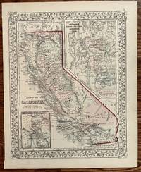
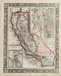
1867319Philadelphia: S. Augustus Mitchell 1867. 13 1/2 x 10 3/4 inches. Very good. Nice single page map of California from Mitchell's General Atlas. Inset map of San Francisco in the Upper Right. Small scale map of San Francisco Bay and Vicinity in the lower left. The Central Pacific is shown running east of Sacramento. The Southern Pacific Railroad is shown as proposed and under construction heads south out of San Jose to the border with Arizona. The main line runs through San Bernardino and is attached to Los Angeles through a branch line. San Diego is avoided altogether. S. Augustus Mitchell unknown
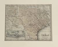
1870630Philadelphia: S. Augustus Mitchell 1870. 10 3/4 x 8 1/4 unches. Very good-. This is a very nice small format map of Texas. It has an inset of Galveston area and an inset of the Panhandle laid out in non-conforming sections. The single color includes all the counties. It would make a very nice addition to your collection. It is matted for framing. S. Augustus Mitchell unknown
18542222704<p>Eleventh edition. Octavo. 8 page preface by IK: Marvel. Frontispiece and full page illustrations and small vignettes by Darley and others. Original ribbed gilt stamped blue cloth with gilt stamped blue thistle on the front and back covers and four thistles on the spine yellow endpapers t.e.g. No dust jacket. Very good. 294 pages. No signatures or bookplates.</p><p><strong>Volume I only.</strong></p><p><strong>Printed by R. Craighead.</strong></p><p><strong>See BAL 13926 and 13991.</strong></p> Charles Scribner hardcover
1890mon0000002088Univ. of PA Press 1890-01-01. Hardcover. Acceptable. in x in x in. Heavily chipped cover edges as well as bottom corner tips. Some small nicks to top page edges. Laid in is a 1 page promotional piece for the University Medical Magazine. From the Front Cover: Reprinted from the University Medical Magazine April 1890. Univ. of PA Press hardcover
1886mon00000020871886-01-01. Unknown Binding. Very Good. in x in x in. Stapled binding. No markings in booklet. Binding is tight. On the title page: Extracted from the American Journal of Medical Sciences for October 1886. unknown
189931149New York: E. R. Herrick & Co 1899. First Edition; First Printing. Hardcover. Very Good in red board. A tear to page 87 owner stamp to FEP. A very bright clean copy. E. R. Herrick & Co hardcover
1845016759New York: Gates & Stedman 1845. Ex-Library. Fine. Half-Leather. First Edition. Two volumes recently rebound binding rates fine. Interior rates very good with modest foxing and minimal ex lib markings. A nice set. Gates & Stedman Hardcover
1848016476London: Hippolyte Bailliere 1848. Book. Reading Copy. Rebound. First Edition. Book is missing spine soiled boards soiled endpapers. 334 pages plus catalogue dated April 1848 Scarce and deserves to be rebound. Hippolyte Bailliere Hardcover
18603Philadelphia: S. Augustus Mitchell 1860. 1860. 13 1/2 x 10 3/4 inches. Very good/003 M008. S. A. Mitchell. Map of California printed by lithography and finished with very nice hand coloring in outline and wash. S. Augustus Mitchell unknown
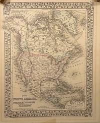
187414149Philadelphia: S. A. Mitchell Jr. 1874. Later Edition. Very Good. 13.5x10.5in 34.3x26.7cm neatline 15x12in 38.1x31cm sheet; Hand colored map of North and Central America with part of South America with settlements rivers and mountains by hachures meridian of Washington and Greenwich route of the Investigator Captain McClure. on discovery of the Northwest passage from the Bering strait route of Dr. Kane voyage to west coast of Greenland; a strong impression with overall age toning of map some offset shadows in top and bottom margin. Rumsey 3801.008 CS. Samuel Augustus Mitchell Jr. --- was a publisher of maps and atlases. His Father 1790-1880 was a teacher geographer and publisher of maps atlases travel guides textbooks and other related geography works. The publishing company was transferred to his son in 1860 and Mitchell continued to publish popular atlases. In 1860 the "New General Atlas" was published with 81 colored maps on 47 plates. He continued to update almost annually the atlas with additional maps and narratives.<br /> <br /> This map was from the library of Dr. G. Warren Smith 1941-2021 of Pennsylvania. He had a long career as university professor and administrator and was a collector of over 6000 books maps illustrations and artifacts relating to the Arctic Alaska and Pacific Northwest. S. A. Mitchell Jr. unknown
1864183477New York: Charles Scribner 1864. Very Good. First edition. One signature slightly sprung else Very good. Charles Scribner unknown
184737619New York: Harper and Brothers 1847. Hardcover. Very Good. First edition. Boards clean and tight gilt spine lettering fresh light to moderate foxing throughout text contemporary pencil notations on the front pastedown two preliminary blanks apparently torn one preliminary blank and both half-title and title pages are present overall a very good copy of the popular sentimental author's first book. Harper and Brothers hardcover