MitchellBiblio.com
1 372 résultats
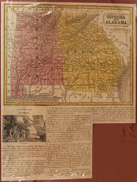
1853M8558USA c. 1853. Very Good. Notes: A charming map of Alabama and Georgia.<br><br>A short excerpt below gives details about these States with a small picture that depicts Gold Mining. Size : 275x208 mm 10.83x8.19 Inches Coloring: Hand Colored Category: Maps United States South States; unknown
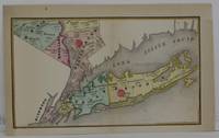
1846M5599Philadelphia: Mitchell 1846. Very Good upper and left margin have been extended. Laid on acid free paper for long term preservation. Size : 105x175 mm 4.125x6.875 Inches Coloring: Hand Colored Category: ; Maps United States East New York Long Island Mitchell unknown
1867WRCLIT71244New York: Charles Scribner 1867. 4vii229513pp. Green gilt cloth boards ruled in blind. Illustrated with engravings and maps. Spine very slightly cocked short snag at toe of spine neatly closed otherwise a very good or slightly better copy. First edition BAL's first state printing with the final page of the preface paginated 'iv'. Inscribed on the front blank the month after publication "To Dr. T. R. Flagg with the kind regards of Dond. G. Mitchell Edgewood July 26th 1867." BAL 13944. Charles Scribner hardcover books
18706040121870. "Donl Mitchell" in black fountain pen ink n.d. ca. 1870. 4 1/8" x 6 1/2"; 1 page recto only. Very good tape on upper margin not affecting the text. Together with a vintage halftone portrait of Mitchell. In part: ".please find place for this within a week Truly.". No Binding. Very Good. unknown books
1890D17725Boston: Houghton Mifflin 1890. First Edition. Hardcover. Near Fine. 8vo. 6 70 pp. Original white cloth-backed green paper-covered boards paper spine label. Boards soiled wear to label internally fine. BAL 14141. First edition inscribed on the f.f.e.p.: "My dear Ned If you find anything within to interest I shall be glad Weir". One of 322 copies printed. Loosely inserted is a 12 line poem of Mitchell's printed on a card with a botanical illustration at top printed Corell Press from its Mount Washington Mass. shop 1917. <br/><br/> Houghton Mifflin hardcover books
1869101011<p>Philadelphia 1869. Unbound colored engraved map decorative boarder 14"x 11". Normal aging and toning; overall bright and clean. Maps are wrapped with acid free board or in rigid sleeves. The Mitchell family started to produce atlases in 1846 and continued into the early 1890s. Around 1860 S. Augustus Mitchell Jr. took over and the atlas would be called Mitchell's New General Atlas. This is an attractive map of California from the 1869 installment of that atlas. The city of San Francisco is shown in an inset. Ristow 311-313</p> books
1882101082Philadelphia: Bradley 1882. Unbound colored engraved map decorative boarder 22 1/2"x 14 1/2". Slight toning a little staining in margins slight darkening in bottom part of crease at center fold; overall bright and clear and in very good shape. Maps are wrapped with acid free board or in rigid sleeves. The Mitchell family started to produce atlases in 1846 and continued into the early 1890s. Around 1860 S. Augustus Mitchell Jr. took over and the atlas would be called Mitchell's New General Atlas. This is an attractive map of Texas from the 1882 installment. The city of Galveston is highlighted in an inset. Ristow 311-313 Phillips 907 Bradley unknown books
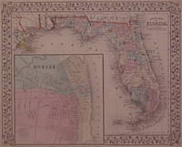
1867202924Philadelphia: Mitchell Samuel Augustus Jr. 1867. unbound. very good. Map. Steel engraving with original hand coloring. Image measures 11" x 13.25".<br/><br/> Nicely detailed map of Florida divided into counties showing towns major routes and geographical features. Includes a large inset town plan of Mobile Alabama. Minor chipping to corners. S. Augustus Mitchell Jr. continued his father's successful mapmaking and publishing business and was one of the most prolific and renowned 19th century American publishers.<br/><br/> Mitchell, Samuel Augustus Jr. unknown books
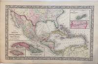
1866297675Philadelphia: Mitchell Samuel Augustus Jr. 1866. unbound. W. Williams. Map. Engraving with original hand coloring. Image measures 13.25" x 21".<br/><br/> Beautiful map of Mexico published in 1866. centered on the Gulf of Mexico. Includes four inset maps; Jamaica Cuba Bermuda and Panama. Samuel Augustus Mitchell Sr. 1792-1868 is one of the leaders in American cartography of the 19th century and pioneered the conversion of engraved map plates to more affordable lithographic plates.<br/><br/> Mitchell, Samuel Augustus Jr. unknown books
1871203192Philadelphia: Mitchell Samuel Augustus Jr. 1871. unbound. very good. Map. Engraving with original hand coloring. Image measures 10.75" x 13.25".<br/><br/> S. Augustus Mitchell Jr. continued his father's successful mapmaking and publishing business and was one of the most prolific and renowned 19th century American publishers.<br/><br/> Mitchell, Samuel Augustus Jr. unknown books
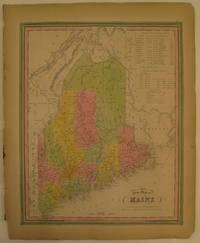
1846232149Philadelphia: H. N. Burroughs 1846. First. unbound. Map. Lithograph with original hand coloring. Image measures 14 7/8" x 12".<br/><br/> Excellent map of Maine showing all counties railroads major routes and waterways. Two tables at the top of the page list population over time. Small chips to lower margin not affecting the image. Samuel Augustus Mitchell Sr. 1792-1868 is one of the pioneers in American cartography of the 19th century. From the first edition of Mitchell's seminal New Universal Atlas.<br/><br/> H. N. Burroughs unknown books
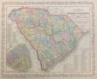
1856293171Philadelphia: S. Augustus Mitchell 1856. unbound. Map. Lithograph with original hand coloring. Image measures 11 1/4" x 14 1/4".<br/><br/> Beautifully detailed first edition map of South Carolina divided into counties. The map delineates towns waterways railroads and major routes as explained in a small key at the bottom right. Canals and railroads are marked. Also included are insets of Charleston and a table of distances. The map is in good condition.<br><br>Samuel Augustus Mitchell Sr. 1792-1868 published this map as part of the 1856 edition of his seminal New Universal Atlas. Mitchell is one of the pioneers in American cartography of the 19th century and led the conversion of engraved map plates to more affordable lithographic plates.<br/><br/> S. Augustus Mitchell unknown books
1852298736Philadelphia: Thomas Cowperthwait & Co 1852. unbound. Map. Lithograph with original hand coloring. Image measures 11 1/2" x 14".<br/><br/> Beautifully detailed map of Arabia and surrounding Countries. The map delineates important towns and major routes as explained in a small key at the bottom center. This particular map comes from the 1848 edition of Mitchell's seminal "New Universal Atlas" published by Thomas Cowperthwait & Co. The map is in good condition with some margin staining and some edge wear not affecting printed image. <br><br>Samuel Augustus Mitchell Sr. 1792-1868 is one of the leaders in American cartography of the 19th century and pioneered the conversion of engraved map plates to more affordable lithographic plates. His son Samuel Augustus Mitchell Jr. continued his father's successful mapmaking and publishing business and was one of the most prolific and renowned 19th century American publishers.<br/><br/> Thomas Cowperthwait & Co unknown books
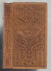
1895E10088New York: Century 1895. First edition. Leather_bound. Very Good. First edition. 24mo. in full suede tan leather with incised lettereing and design of botles glasses etc; marbled endpapers. Frontispiece rose- tinted photograph of wine bottles and decanters; title page printed in rose and plack. All edges gilt. 165 pp. Tight occasional staining to some of the first 20 or so leaves. some modest rubbing to the suede covers. Overall a very good quite acceptable example of a scarce title. Century unknown
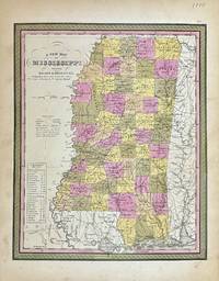
1848327877Philadelphia: S. Augustus Mitchell 1848. unbound. Map. Lithograph with original hand coloring. Image measures 11 1/2" x 14 1/4"<br/> <br/> Beautifully detailed first edition map of Mississippi divided into counties. The map delineates towns waterways railroads and major routes. Steamboat routes and distances are listed in a table. Canals and railroads are indicated. In very good condition with some toning to margins.<br> <br> Samuel Augustus Mitchell Sr. 1792-1868 published this map as part of the 1848 edition of his seminal New Universal Atlas. Mitchell is one of the pioneers in American cartography of the 19th century and led the conversion of engraved map plates to more affordable lithographic plates.<br/> <br/> S. Augustus Mitchell unknown
18706040121870. "Donl Mitchell" in black fountain pen ink n.d. ca. 1870. 4 1/8" x 6 1/2"; 1 page recto only. Very good tape on upper margin not affecting the text. Together with a vintage halftone portrait of Mitchell. In part: ".please find place for this within a week Truly.". No Binding. Very Good. unknown
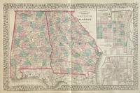
1877309695Philadelphia: S. Augustus Mitchell 1877. unbound. Map. Lithograph with original hand coloring. Image measures 13 3/4" x 21 1/4"<br/> <br/> Interesting double-page map of Georgia and Alabama showing all counties railroads major routes and waterways. Two insets show town plans for the cities of Savannah Georgia and Atlanta the capitol of Georgia. In excellent condition. One small closed tear to left margin. <br> <br> Samuel Augustus Mitchell Sr. 1792-1868 is one of the leaders in American cartography of the 19th century and pioneered the conversion of engraved map plates to more affordable lithographic plates. His son Samuel Augustus Mitchell Jr. continued his father's successful mapmaking and publishing business and was one of the most prolific and renowned 19th century American publishers.<br/> <br/> S. Augustus Mitchell unknown
1882101082Philadelphia: Bradley 1882. Unbound colored engraved map decorative boarder 22 1/2"x 14 1/2". Slight toning a little staining in margins slight darkening in bottom part of crease at center fold; overall bright and clear and in very good shape. Maps are wrapped with acid free board or in rigid sleeves. The Mitchell family started to produce atlases in 1846 and continued into the early 1890s. Around 1860 S. Augustus Mitchell Jr. took over and the atlas would be called Mitchell's New General Atlas. This is an attractive map of Texas from the 1882 installment. The city of Galveston is highlighted in an inset. Ristow 311-313 Phillips 907 Bradley unknown
1869101011<p>Philadelphia 1869. Unbound colored engraved map decorative boarder 14"x 11". Normal aging and toning; overall bright and clean. Maps are wrapped with acid free board or in rigid sleeves. The Mitchell family started to produce atlases in 1846 and continued into the early 1890s. Around 1860 S. Augustus Mitchell Jr. took over and the atlas would be called Mitchell's New General Atlas. This is an attractive map of California from the 1869 installment of that atlas. The city of San Francisco is shown in an inset. Ristow 311-313</p>
18631453Philadelphia: : S. Augustus Mitchell 1863. 13-1/2" x 10-3/4"- 34.2 x 27.3 cm. Lithograph with original hand colouring. Minor browning and chipping o margins else very good. A detailed and decorative map of California with scrolling foliate border. Two inset maps of Great Salt Lake Country Utah and the San Francisco Bay & Vicinity. Shows towns cities mountain passes topographical features etc. S. Augustus Mitchell, unknown
1888011314Philadelphia: J. B. Lippincott 1888. First Edition. Original Cloth. Very Good. J. B. Lippincott Hardcover
1878D17718Philadelphia: J. B. Lippincott Company 1878. Hardcover. Very Good. 8vo. 109 pp 10 page publisher's catalog at back. Original brown limp cloth stamped in gilt dark green endpapers. Some rubbing to extremities very good. Provenance: Egerton L. Crispin noted American physician bookplate and ownership signature. <br/><br/>Second edition revised of a work much admired and positively reviewed by Freud who was significantly influenced by Mitchell's ideas and who himself undertook Mitchell's rest cure. J. B. Lippincott Company hardcover
1898816711898. MITCHELL S. Weir. A Madeira Party. New York: Century Co. 1895. In orig. stamped leather binding a.e.g. Minor wear to the spine ends and light rubbing to the front joint. A very good copy or better. First edition. BAL 14166. unknown
18631455Philadelphia: : S. Augustus Mitchell 1863. 10-3/4" x 13-1/2"- 27.3 x 34.2 cm. Lithograph with original hand colouring. Minor browning and chipping o margins else very good. A detailed and decorative map of Idaho Nebraska Colorado and Kansas with scrolling foliate border. Shows towns cities mountain passes Native Indian reservations topographical features etc. S. Augustus Mitchell, unknown
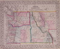
1871203192Philadelphia: Mitchell Samuel Augustus Jr. 1871. unbound. very good. Map. Engraving with original hand coloring. Image measures 10.75" x 13.25".<br/> <br/> Classic map of the northwestern states showing Washington Oregon Idaho and part of Montana. At the time of publication Oregon was the only territory pictured that had official statehood status having been admitted into the union in 1859. As the gold rush drew increasing populations Montana was admitted in 1889 followed by Washington the same year and Idaho in 1890. The map includes towns rivers lakes mines forts missions and extensive topographical features. Emigrant roads are also shown. This map is in very good condition. <br> <br> Samuel Augustus Mitchell Sr. 1792-1868 was one of the leaders in American cartography of the 19th century and pioneered the conversion of engraved map plates to more affordable lithographic plates. His son Samuel Augustus Mitchell Jr. continued his father's successful mapmaking and publishing business and was one of the most prolific and renowned 19th century American publishers.<br/> <br/> Mitchell, Samuel Augustus Jr. unknown