Mitchell, S AugustusBiblio.com
1 372 résultats
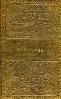
183812214Philadelphia: S. Augustus Mitchell 1838. Ephemera. Otherwise very good condition. Folding pocket map 17 x 21" with full period color. Bound in 16mo brown gilt & blind stamped cloth boards stamped "New - York." on the front board. A beautiful colored copy with county divisions and relief shown pictorially. Inset Vicinity of Rochester Vicinity of Albany Vicinity of New York and Map of the Hudson River from New York to Albany. OCLC: 45669426 cites only the NY Public & NY State Library. Boards in very good condition the map with a few corner cracks as onion paper is prone to do. S. Augustus Mitchell unknown
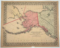
186827693Philadelphia: Samuel Augustus Mitchell 1868. Early edition. Maps. Very good condition. This 1867 map is notable for showing the purchase of Alaska from Russia for $7.2 million known as "Seward's Folly" after the Secretary of State who organized the transfer. It was included in the 1868 Mitchell's New General Atlas and subsequent printings of Mitchell's atlas.<br /> <br /> Colored map of Alaska with part of British America Northwest and Russia Asia Siberia with the Arctic and North Pacific Oceans relief in hachures with Greenwich prime meridian detailed features of rivers mountain ranges Russian and native settlements and geographic features wide border design copyright date of map 1867 no plate number on map verso blank; some age-toning along edges and mild toning in general with a few soiling spots Rumsey 0579.000. <br /> <br /> Mitchell Samuel Augustus Jr. --- Father was a teacher geographer and publisher of maps atlases travel guides textbooks and other related geography works. The Publishing company was transfered to his son in 1860 and Augustus continued to publish popular atlases. In 1860 the "New General Atlas" was published with 8i colored maps on 47 plates. He continued to update almost annually the atlas with additional maps and narratives.<br /> <br /> 15 1/4 x 12 1/4" period color one chip in lower margin not affecting map detail. Samuel Augustus Mitchell unknown
186311342Washington DC / New York: Smithsonian Institution / D. Appleton 1863. Hard Cover. Formal label attached to original cover saying " Presented by the Smithsonian Institution to Prof. Quatrefages Paris". The original large softcover with printed wrappers which except for a little wear on the front wrap is a finely preserved copy has been bound in modern cloth covered boards with new endpapers. BOARDS AND ENDPAPERS FINE ORIGINAL IN WRAPS IS NEAR-FINE. UNCOMMON IN THIS CONDITION. Smithsonian Institution / D. Appleton unknown
186610405Philadelphia: E. H. Butler 1866. Entered according to an act of congress in 1865. Hardcover. Small folio pp.24. Lacks end-papers. Externally fair condition. maps in very good condition. E. H. Butler hardcover
189829532New York: Century Co 1898. Very Good/Very Good. New York: Century Co. 1898. First Edition. Octavo; publisher's cloth in cream pictorial dust jacket printed in orange; x4321pp.; frontispiece 14 full-page illus. collated complete. Moderate wear to jacket margins including a few tiny chips and wrinkling spine panel significantly toned with orange titling difficult to read corners bumped spine slightly cocked endpapers toned else a Very Good sound copy in the uncommon and early jacket. Century Co unknown
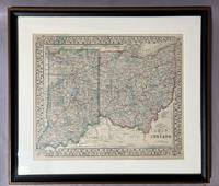
1871007174Philadelphia: Samuel Augustus Mitchell Jr. 1871. No Binding. Very Good. Hand-colored engraved map framed visible size: 12 x 14.5 inches. frame size: 17 x 19 inches. An attractive 1871 county map of Ohio and Indiana from the atlas of S.A. Mitchell Jr. one of the leading American cartographic publisher's of the 19th century. Finely engraved and detailed the map shows counties townships cities rivers and an extensive network of railroads reflecting the rapid post-Civil War expansion of transportation infrastructure throughout the Midwest. Original outline hand-coloring in soft pastels distinguished county boundaries with Lake Erie and the Ohio River prominently delineated. The map is enclosed within Mitchell's characteristic ornamental floral border with the title cartouche at lower right reading "County Map of Ohio and Indiana" accompanied by a printed explanation key. Mitchell's 1871 atlas is especially noted for their clarity of engraving and decorative appeal making them desirable examples of American commercial cartography. Expected light toning consistent with 19th-century paper. Some light scattered foxing. Hand-coloring remains fresh and well-preserved. No visible tears or losses. Overall condition: very good attractively presented. <br/> <br/> Samuel Augustus Mitchell Jr. unknown
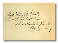
1850WRCLIT85259New York: Baker & Scribner 1850. Plum brown cloth stamped in blind and gilt t.e.g. Engraved frontis and vignette title. Typical foxing and slight tanning tidemark in upper fore-quadrants of pp.177-275 cloth a bit sunned and dust marked some small spots along the joints; still a good sound average copy. First edition BAL's presumed first printing without type-wear in indicated places on pp. 29 and 43 BAL's binding A. Where this copy may stumble in terms of cosmetics is partially compensated for by the gift inscription on the front free endsheet: "Miss Holly B. Hart / with the best love / of her attached friend / LH Sigourney." A pleasant Connecticut association copy. BAL 13927. Baker & Scribner hardcover books
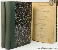
182844072Oxonii Oxford : E Typographeo Clarendoniano Clarendon Press 1828. 3 vols. Later blind half cloth hardcovers. iv424ii425-868 pp. & iv336 pp.; 22x14 cm. - new bindings paper sl. browned some spots/ foxing Although still very good see picture. More pictures on request E Typographeo Clarendoniano ( Clarendon Press ) hardcover
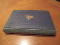
1888000453Philadelphia: J B Lippincott 1888. 1st Edition . Hardcover. Near Fine/None. Blue boards with gilt lettering. Decorative end papers . Minor bumping to ends of spine. Six essays written by a doctor who was a literary man. Most essays written for women. a little gem. <br/> <br/> J B Lippincott hardcover
1900000529New York: Century C. 1900. 1st Edition . Hardcover. Fine/None. Small. Small volume in black boards with gilt lettering to the front board and spine. Spine also decorated with tine gilt stars. The pages are bright. There is an inside crack to the front hinge but fine on the outside. On the front flyleaf in black ink "Presented to Kate L. Hooker May 27.1902 by the author" followed by a paste down paper with typed "yours truly" and signed by SWeir Mitchell <br/> <br/> Century C. hardcover
18605429Philadelphia: Augustus Mitchell 1860. Folio double-page from Mitchell's New General Atlas extending from southern US to northern South America. 34x54cm in the image with about 2.5 cm on all edges. Engraved by Williams of Philadelphia. There are four inset detailed maps of Cuba Jamaica Bermudas and the Panama Railroad. Brightly colored very attractive. Center fold split about 6 cm at bottom closed. Very good condition <br/><br/> Augustus Mitchell unknown books
1881036304Henry C. Lea's Son & Co. Very Good. 1881. Hardcover. A little bit must and some staining/soiling to the boards along the front and rear bottom half. Otherwise in pretty good shape. Not Ex-lib. . Henry C. Lea's Son & Co. hardcover
1851041715New York: Charles Scribner 1851. 1st Edition . Hardcover. Near Fine. Vii 286 Pp. Dark Green Cloth Gilt And Blind Stamped Top Edge Gilt. First Edition First State With 1851 Date On Title Page Stereotyper's Slug On The The Copyright Page Five Dots Before 56 On Page V And The Word "World" In Broken Type On Contents Page Vi. Near Fine Slight Wear Small Tear Between "Dream" And "Life" On Spine Spine Cloth A Little Faded; Endpapers Clean Small Foxing Dots At Top And Right Of Second Front Free Endpaper Otherwise Clean And Fresh Throughout. Bookplate Of Emily Dickinson Collector Margaret Jane Pershing Printed In Green With Floral Frame Her Collection Now At Princeton. Additional Plain Ownership Stamp Of Horace T Cook Who Was The Treasurer Of Cayuga County Ny. <br/> <br/> Charles Scribner hardcover
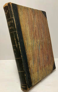
18702231537New York: Hearth & Home 1870. 1st. Hardcover. Good/None. 864 pages. Hardcover without dust jacket. Marbled covers with three quarters leather. All editions of Hearth & Home: Vol II no. 1 through no. 54 Dec. 1869 through Dec. 1870. Some minor chipping in some pages. Large water stains to lower gutters on both end papers but does not extend into text. Moderate to significant rubbing and scuffing to covers. Sticker from previous bookseller in front end papers. Domestic shipping only. Record # 2231537 Hearth & Home hardcover
1853LTH28-C-6London: C. H. Clarke c1853. Leather. Good. 6.5" by 4". Unamed. A interesting work by the american author and essayist Donald Grant Mitchell illustrated throughout. Binder's label of Pring and Price to rear pastedown. Illustrated throughout with engraved plates. A work from American author Donald Grant Mitchell published under the pseudonym Ik Marvel. Reveries of a Bachelor contained a series of essay which theorises on the themes of boyhood life and dreams. This book was the favourite book of the American poets Emily Dickinson. In a calf binding. Externally sound though rubbed with some slight wear to the extremities. Tipped-in illustrations of a butterfly to the rear pastedown. Internally generally firmly bound although strained in places. Pages are bright though with some handling marks and instances of foxing throughout. Good C. H. Clarke hardcover
1890014414Washington City: Smithsonian Institution 1890 1886 1889. Discussion of the Magnetic and Meteorological Observations. . . . Part II III IV V VI. Records and Results of a Magnetic Survey of Pennsylvania. . . . Researches upon the Anatomy and Physiology of Respiration in the Chelonia. Rebound in sturdy green library buckram with white title volume number and year and dewey decimal number on white spine label. Ex-library with library stamps on top bottom and fore-edges. No other library markings such as cardholder due date slip etc. Heavy tape mending of Smithsonian advertisement leaves with title page chipped and adhering to blank this section only Fair. Articles and cover in Very Good condition with slight edge tanning to leaves a few very small edge tears and an occasional smudge. Original wrappers not bound in. Large quarto nearly folio. xiv 82 xii 5 146 iii 29 26 14 76 82 viii 42 pp. All 4 plates and 3 maps called for are present and pristine. . Very Good. Hardcover. First Edition. 1890. Smithsonian Institution, 1890, 1886, 1889. hardcover
1816018292New-York: Collins & Co. A rare copy of the first edition of early 19th century Pharmacopoeia from New York Hospital. Gilt ruled lettered brown leather spine and tips marbled boards with some wear. x 181 pp. . Very Good. Hardcover. First Edition. 1816. Collins & Co. hardcover
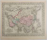
1879221209Pennsylvania. 1879. Lithographed maps on two sides of a single leaf with original hand-colouring 27 x 34 cms map size 31.1 x 37.1 cms sheet with a finely-engraved foliated border margins age-toned one margin tide-marked at the edge not affecting the maps a handsome pair of maps in very good condition. A most attractive pair of late 19th Century maps on two sides of a single leaf: Asia as a whole polar projection with Europe and parts of Africa and New Guinea. Scale 1:1000 miles. It includes steamship routes and mileages from London to destinations in Asia: Zhoushan Chusan Island Hong Kong Manilla Sarawak Bombay etc. along with political and geographical details; and on the verso the map covers the regions of Persia Iran Arabia including parts of the Arabian Peninsula Turkey in Asia Anatolia Afghanistan and Beloochistan parts of Iran Afghanistan and Pakistan and marks key settlements rivers and geographic features. . unknown
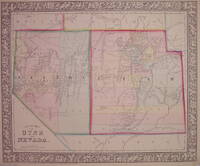
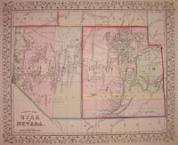
1866203707Philadelphia: Mitchell Samuel Augustus Jr. 1866. unbound. very good. Map. Engraving with original hand coloring. Image measures 11.5" x 13.75".<br/><br/> Classic map of Utah and Nevada divided into counties. Shows towns waterways major routes topographical details and Indian reservations. Light scattered foxing. S. Augustus Mitchell Jr. continued his father's successful mapmaking and publishing business and was one of the most prolific and renowned 19th century American publishers.<br/><br/> Mitchell, Samuel Augustus Jr. unknown books
1867203706Philadelphia: Mitchell Samuel Augustus Jr. 1867. unbound. very good. Map. Engraving with original hand coloring. Image measures 11.5" x 13.75".<br/><br/> Classic map of Utah and Nevada divided into counties. Shows towns waterways major routes topographical details and Indian reservations. Small spot of foxing in northeast Nevada. S. Augustus Mitchell Jr. continued his father's successful mapmaking and publishing business and was one of the most prolific and renowned 19th century American publishers.<br/><br/> Mitchell, Samuel Augustus Jr. unknown books
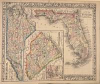
1866332076Philadelphia: Mitchell Samuel Augustus Jr. 1866. unbound. Map. Steel engraving with original hand coloring. Image measures 11.5" x 14".<br/> <br/> Nicely detailed map of Florida showing counties towns geographical features major routes. Features sideways maps of North Carolina and South Carolina with an inset of Charleston. Minor scattered foxing but otherwise in good condition. Samuel Augustus Mitchell Sr. 1792-1868 was one of the leaders in American cartography of the 19th century and pioneered the conversion of engraved map plates to more affordable lithographic plates. His son Samuel Augustus Mitchell Jr. continued his father's successful mapmaking and publishing business and was one of the most prolific and renowned 19th century American publishers.<br/> <br/> Mitchell, Samuel Augustus Jr. unknown
1867203706Philadelphia: Mitchell Samuel Augustus Jr. 1867. unbound. very good. Map. Engraving with original hand coloring. Image measures 11.5" x 13.75".<br/> <br/> Classic map of Utah and Nevada divided into counties. Shows towns waterways major routes topographical details and Indian reservations. Small spot of foxing in northeast Nevada. <br> <br> Samuel Augustus Mitchell Sr. 1792-1868 was one of the leaders in American cartography of the 19th century and pioneered the conversion of engraved map plates to more affordable lithographic plates. His son Samuel Augustus Mitchell Jr. continued his father's successful mapmaking and publishing business and was one of the most prolific and renowned 19th century American publishers.<br/> <br/> Mitchell, Samuel Augustus Jr. unknown
1866203707Philadelphia: Mitchell Samuel Augustus Jr. 1866. unbound. very good. Map. Engraving with original hand coloring. Image measures 11.5" x 13.75".<br/> <br/> Classic map of Utah and Nevada divided into counties. Shows towns waterways major routes topographical details and Indian reservations. Light scattered foxing. <br> <br> Samuel Augustus Mitchell Sr. 1792-1868 was one of the leaders in American cartography of the 19th century and pioneered the conversion of engraved map plates to more affordable lithographic plates. His son Samuel Augustus Mitchell Jr. continued his father's successful mapmaking and publishing business and was one of the most prolific and renowned 19th century American publishers.<br/> <br/> Mitchell, Samuel Augustus Jr. unknown
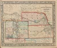
1866308737Philadelphia: Mitchell Samuel Augustus Jr. 1866. unbound. Map. Steel engraving with original hand coloring. Image measures 11.5" x 14".<br/> <br/> Classic 1866 map of the west with Kansas Nebraska Colorado part of the Dakotas. Counties major towns and cities routes railroads waterways and Indian tribes and reservations are carefully noted. A few stains and narrow margins but otherwise in good condition. <br> <br> Samuel Augustus Mitchell Sr. 1792-1868 was one of the leaders in American cartography of the 19th century and pioneered the conversion of engraved map plates to more affordable lithographic plates. His son Samuel Augustus Mitchell Jr. continued his father's successful mapmaking and publishing business and was one of the most prolific and renowned 19th century American publishers.<br/> <br/> Mitchell, Samuel Augustus Jr. unknown
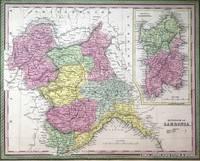
18507181Philadelphia:: Thomas Cowperthwait & Co. 1850. First edition. Near Fine. Near Fine Condition. Original hand-colored lithograph. Folio image size: 40 x 32 cm. Sheet size: 43 x 35 cm. French matted in Ivory Rag board to 56.5 x 49.5 cm. A brightly hand-colored detailed map of the Kingdom of Sardinia with an inset of the Island of Sardinia all set within a decorative border from A New Universal Atlas produced by one of America's most prolific cartographic firms of the nineteenth century: Samuel Augustus Mitchell Connecticut 1792-1868 and his son S. Augustus Mitchell Jr. Although uncredited this map is most likely by J.H. Young the chief engraver for the Mitchell family throughout their publishing decades. The map is in near fine condition with minor edge repairs. Single sheet matted in rag board Thomas, Cowperthwait & Co. , unknown