Sanson, NicolasBiblio.com
3 880 résultats
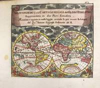
1697M11198Antwerp Belgium: Jan Duren c.1697. Very Good. Notes: Rare miniature World map.<br>California is depicted as an island.<br>There are symbols for the four continents: dangerous America strong Europe exotic Asia and wild Africa. Size : 140x160 mm 5.51x6.30 Inches Coloring: Hand Colored Reference: Shirley #553. Category: Maps World; Jan Duren unknown
1998DBS-9780124759787Academic 1998. 1st. Hardcover. New. Academic hardcover
1998DBS-9780124759787Academic 1998. 1st. Hardcover. New. Academic hardcover
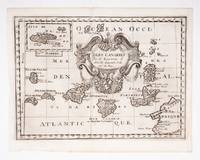
53608c.1700. Original engraved map 19 x26.5 cm. overall sheet size 22 x 29 cm. of the Canaries with inset of Madeira. Central vertical fold. [c.1700] unknown
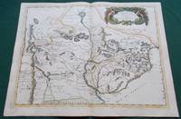
1668014632Paris: Cartes Generales de Toutes les Parties du Monde. 1668. Hand coloured. Map measures 55x40.cm plus margin. Some light surface wear or dust marking. Map in good condition. Boldly engraved map of the region of present day Paraguay Uruguay northern Argentina and parts of Chile and Brazil. The Rio de la Plata is the main feature of the map which extends north to the mythical Lago de los Xarayes. The mountains and volcanoes of the Cordillera de los Andes are also prominently shown. There is good detail of topography missions and villages. The decorative title cartouche is adorned with two female figures fruit and flowers. Very Good. Cartes Generales de Toutes les Parties du Monde.. unknown
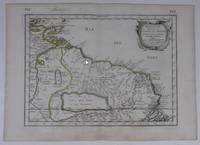
170054043Nicolas Bion: L'Usage des Globes. Amsterdam: Francois Halma. 1700. Map showing north-east South America from Trindad to the mouth of the Amazon - modern day Guyana and Surinam. Several large fictitious lakes make up much of the unexplored interior. Maps by Sanson in original colour are rare. Nicolas Sanson was founder of the French school of mapmakers at a time when the leadership in European cartography passed from the Low Countries to France. This map was published in Bion's treatise on globes. Nicolas Bion was a famous French mathematical and scientific instrument maker. Copper engraving. Very good condition. Small 1cm. very faint library stamp on border not affecting map. Original colour. Size: 27.5 x 20 cm. 11 x 8 inches. unknown
1652YRG-392Carte géographique originale réalisée par Sanson d’Abbeville et gravée à la cuve par R. Cordier, (57,5 x 43,5 cm). Rehaussée de couleur, d'époque.
1670110701Paris, Libraire juré au Palais, dans la salle des Merciers, à la Palme, et aux armes de Hollande 1670 Selon la page de privilège imprimé la première fois en 1678. In-12 relié veau brun 16,5 cm sur 9,5. Dos à nerfs orné des caissons et fers dorés. Frontispice-2pp de privilège-13 d’épistre-8 de préface-17 d’avis au lecteur-LXX-545-45pp de table des matières-1f. Complet des deux gravures dont le frontispice et une planche dépliante représentant la traversée du Rhin légèrement froissée et tachée. Ex-libris manuscrits sur pages de garde signés “François le Comte” et “Antoine Dumur” et sur dernier feuillet blanc est noté “Fut présent en sa personne, Antoine Dumur 1752”. Texte orné de jolis bandeaux, lettrines et culs-de-lampe. Reliure frottée, craquelures au dos, manques aux coiffes, fendillements aux mors, coins émoussés avec manques de cuir angulaires et petit trou de ver sans atteinte au texte en pied de dos, quelques taches d’encre. Petites déchirures aux pages 99-100, 173-174 sans atteinte au texte. Rares auréoles d’humidité sans atteinte au texte. Assez bon état d’occasion.
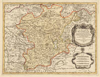
169633637Paris 1696. Schönes tadelloses Exemplar. . 803 by 560mm 31 by 22 inches. Hand-Colored Original Copperplate Engraving by Alexis-Hubert Jaillot & N. Sanson depicting Le Duché De Westphalie ainsi qu`il est presentement possedé par L`Eslecteur De Cologne. Tiré des Memoires les pl. recents Par le Sr. Sanson Geographe Ordinaire du Roy A Paris. Published Paris 1696. Sheet: 803 by 560mm 31 by 22 inches. A fine and original hand-colored example of Jaillot's celebrated cartographic work documenting this region of Germany with the precision and decorative artistry characteristic of the 16900s. Alexis-Hubert Jaillot c.1632-1712 was one of the foremost French cartographers of the late 17th and early 18th centuries. Working in Paris he produced magnificent large-format maps of European territories often in collaboration with Nicolas Sanson -- considered the father of French cartography. Jaillot's maps are known for their striking decorative cartouches generous size and fine hand coloring representing the pinnacle of French Baroque cartography.This original copperplate engraving with original hand coloring depicts the region of Le Duché De Westphalie ainsi qu`il est presentement possedé par L`Eslecteur De Cologne. Tiré des Memoires les pl. recents Par le Sr. Sanson Geographe Ordinaire du Roy A Paris. published in Paris 1696. The map records the political and geographic boundaries of the region as understood in 1696 offering a fascinating window into the history of German territorial organization. Sheet measures 803 by 560mm 31 by 22 inches. In good condition consistent with its age of over 320 years. Ready to frame. unknown
18528000Paris: Chez L'un des Auteurs et Chez Ledoyen Libraire 1852. 1st. Very Good. 1st edition. Pamphlet in original wraps bound in limp paper covered boards. A beautiful copy. <br/><br/> Chez L'un des Auteurs et Chez Ledoyen Libraire hardcover books
#[37942]Paris Pierre Mariette 1656. Engraved map of Suriname coloured in outline with fine cartouche. Ca. 245 x 345 cm. A reduced derivative of the famous Sanson map of 1650 published in an early edition of the small Sanson atlas L'Europe Dediée a Monseigneur . . . Le Tellier Secret. D'Estat &c. Engraved by A. Peyrounin. unknown
2006x-0754640876Ashgate Pub Co 2006. Hardcover. New. illustrated edition. 243 pages. 9.25x6.25x0.75 inches. Ashgate Pub Co hardcover
2021x-0367521067CRC Pr I Llc 2021. Hardcover. New. 321 pages. 9.50x6.25x1.00 inches. CRC Pr I Llc hardcover
2015x-1138793795Routledge 2015. Hardcover. New. 218 pages. 9.30x6.30x0.70 inches. Routledge hardcover
1991x-0333516028Palgrave Macmillan 1991. Hardcover. New. 480 pages. 9.49x6.42x1.42 inches. Palgrave Macmillan hardcover
171282342Parisiis, Delineabat Petrus Moullart-Sanson , 1712, 55x75cm, Carte colorisée. Pliure centrale. Bon état.
1670LBW-7226Paris, P. Mariette, 1670. 367 x 423 mm.
169998233Paris chez l'auteur 1699-1690 1 vol. relié 2 parties reliées en un vol. in-18, basane havane écailles de tortue, dos à nerfs, pièces de titre de basane bordeaux, caissons ornés de fleurons et dentelles dorées, tranches rouges, (22) + 144 et 178 + (12) + 48 pp. (cat. éd.), 4 cartes dépliantes sur les 6 (reliure de l'époque usée mais solide). Nicolas Sanson (1600-1667) né à Abbeville est cartographe célèbre du XVIIe siècle. Sa première carte importante est "Les Postes de France", en 1632.
169998233Paris chez l'auteur 1699-1690 1 vol. relié 2 parties reliées en un vol. in-18, basane havane écailles de tortue, dos à nerfs, pièces de titre de basane bordeaux, caissons ornés de fleurons et dentelles dorées, tranches rouges, (22) + 144 et 178 + (12) + 48 pp. (cat. éd.), 4 cartes dépliantes sur les 6 (reliure de l'époque usée mais solide). Nicolas Sanson (1600-1667) né à Abbeville est cartographe célèbre du XVIIe siècle. Sa première carte importante est "Les Postes de France", en 1632.
3253Americas: Amsterdam Francois Halma 1705. Copper engraved map of Peru by N. Sanson from Halma's Algemeene Werelde Beschryving Vol. 3 Black and white; title in Dutch; verso blank; strapwork title cartouche. Small map of Tierra del Fuego showing both the Strait of Magellan and Le Maire Strait. Inland detail is confined to a mountain range and several rivers and the mythical Destroit de Browers is labeled at far right. This map appeared in Algemeene Weereld-Beschryving nae de Rechte Verdeeling der Landschappen Plaetsen Zeeën Rivieren &c. Geographisch Politisch Historisch Chronologisch en Genealogisch a Dutch edition of A. Phérotée de la Croix's Nouvelle Methode Pour Apprendre Facilement la Geographie Universelle which first appeared in 1690. Dark impression. Nicolas Sanson d'Abbeville.1600-67 ' father of the French cartography' and founder of the Sanson firm. Atlas ' Cartes générales de toutes les parties du Monde' 1658-70 and a pocket atlas in 4 parts 1652-1705. Sanson's small maps from A. Phérotée de la Croix's Nouvelle Methode Pour Apprendre Facilement la Geographie Universelle. first published in 1652 and engraved by A. Peyrounin were copied several times by various map publishers. Johann David Zunners made copies of Sanson's maps for his German translation of Die Gantze Erd-Kugel in 1679. Johannes Ribbius and Simon de Vries published copies in 1682 and 1683 with new maps engraved by Antoine d'Winter. The plates were later sold to Francois Halma who used them in 1699 and then again in 1705 with the titles re-engraved in Dutch. François Halma 1653 - 1722 Dutch publisher/printer; dealer/auction house. Cartographer and publisher of maps active in Utrecht Amsterdam Franeker and Leeuwarden. Published 'Description de l'Univers' 1700; 'Algemene Wereldtbescrijving' 1705; 'Corpus Inscriptionum' 1707 and 'Lexicon Philosophicum' 1713. Halma acquired many of the plates for Algemeene Weereld-Beschryving from Joannes Ribbius who had enlisted the services of engraver Antoine de Winter to make copies of the maps in Nicolas Sanson's quarto atlases of the four continents. De Winter made very few geographical changes and maintained the attribution to Sanson on the newly engraved plates. Halma supplemented the Sanson maps with about a dozen new maps engraved in the same style as Sanson's without any attribution on the maps as well as 23 panoramic views of famous cities around the world. Keoman: Hal 1; Phillips 528. Americas South America Tierra del Fuego Magellanica Strait of Magellan Amsterdam Francois Halma 1705 unknown
LBW0416fAmsterdam, Pierre Schenk, [circa 1700]. 472 x 575 mm.
1679LBW-7225Paris, chez l'auteur, 1679. 397 x 484 mm.
1658LBW-3423Paris, chez l'auteur, 1658. 403 x 573 mm.
1661LBW-3670Paris, P. Mariette, 1661. 418 x 521 mm.