187 résultats
Frontespizio del Theatrvm statvvm regiæ celsitvdinis Sabavdiæ dvcis, Pedemontii principis, Cypri regis pubblicato per la prima volta ad Amsterdam Amstelodami, apud. hæredes Ioannis Blaev, 1682. L’opera venne successivamente ristampata da Pierre Mortier. Acquaforte, in ottimo stato di conservazione. Title page of Theatrvm statvvm regiæ celsitvdinis Sabavdiæ dvcis, Pedemontii principis, Cypri regis first published in Amstelodami, apud. hæredes Ioannis Blaev, 1682. The work was later reprinted by Pierre Mortier. Etching, in excellent condition.
Frontespizio del terzo volume dell'Atlas Major di Blaeu. Willem Janszoon Blaeu, avviò nel 1599 la sua attività di costruttore di globi e strumenti astronomici ad Amsterdam. Nel 1630, dopo aver comprato alcune lastre dell’atlante del Mercator da Jodocus Hondius II, fu in grado di pubblicare un volume di 60 mappe con il titolo di Atlantis Appendix. Cinque anni dopo, pubblicò i primi due volumi del suo atlante Atlas Novus o Theatrum Orbis Terrarum, in sei libri. Dopo la sua morte, Joan (Johannes) continuò l’opera paterna, completando l’intera serie di sei volume dell’Atlas Novus intorno al 1655. Fu inoltre autore di un Atlas Maior sive Cosmographia Blaviana, in 12 volumi pubblicati nel 1662 -72. Incisione in rame, bella coloritura coeva, in ottimo stato di conservazione. Title page from Blaeu's Atlas Major. Willem Janszoon Blaeu, started in 1599 his business as a builder of globes and astronomical instruments in Amsterdam. In 1630, after buying some plates of the Mercator atlas from Jodocus Hondius II, he was able to publish a volume of 60 maps under the title Atlantis Appendix. Five years later, he published the first two volumes of his atlas Atlas Novus or Theatrum Orbis Terrarum, in six books. After his death, Joan (Johannes) continued his father's work, completing the entire six-volume Atlas Novus series around 1655. He was also the author of an Atlas Maior sive Cosmographia Blaviana, in 12 volumes published in 1662 -72. Copperplate with fine original hand colour, in very good conditions.
Frontespizio dell'edizione francese dell'Atlas Novus di Blaeu. Willem Janszoon Blaeu, avviò nel 1599 la sua attività di costruttore di globi e strumenti astronomici ad Amsterdam. Nel 1630, dopo aver comprato alcune lastre dell’atlante del Mercator da Jodocus Hondius II, fu in grado di pubblicare un volume di 60 mappe con il titolo di Atlantis Appendix. Cinque anni dopo, pubblicò i primi due volumi del suo atlante Atlas Novus o Theatrum Orbis Terrarum, in sei libri. Dopo la sua morte, Joan (Johannes) continuò l’opera paterna, completando l’intera serie di sei volume dell’Atlas Novus intorno al 1655. Fu inoltre autore di un Atlas Maior sive Cosmographia Blaviana, in 12 volumi pubblicati nel 1662 -72. Incisione in rame, bella coloritura coeva, in ottimo stato di conservazione. Title page of the French edition of Blaeu's Atlas Novus. Willem Janszoon Blaeu, started in 1599 his business as a builder of globes and astronomical instruments in Amsterdam. In 1630, after buying some plates of the Mercator atlas from Jodocus Hondius II, he was able to publish a volume of 60 maps under the title Atlantis Appendix. Five years later, he published the first two volumes of his atlas Atlas Novus or Theatrum Orbis Terrarum, in six books. After his death, Joan (Johannes) continued his father's work, completing the entire six-volume Atlas Novus series around 1655. He was also the author of an Atlas Maior sive Cosmographia Blaviana, in 12 volumes published in 1662 -72. Copperplate with fine original hand colour, very good condition.
Frontespizio dell'edizione olandese dell’Atlas Novus di Blaeu. Willem Janszoon Blaeu, avviò nel 1599 la sua attività di costruttore di globi e strumenti astronomici ad Amsterdam. Nel 1630, dopo aver comprato alcune lastre dell’atlante del Mercator da Jodocus Hondius II, fu in grado di pubblicare un volume di 60 mappe con il titolo di Atlantis Appendix. Cinque anni dopo, pubblicò i primi due volumi del suo atlante Atlas Novus o Theatrum Orbis Terrarum, in sei libri. Dopo la sua morte, Joan (Johannes) continuò l’opera paterna, completando l’intera serie di sei volume dell’Atlas Novus intorno al 1655. Fu inoltre autore di un Atlas Maior sive Cosmographia Blaviana, in 12 volumi pubblicati nel 1662 -72. Incisione in rame, bella coloritura coeva, in ottimo stato di conservazione. Title page of the Dutch edition of Blaeu's Atlas Novus. Willem Janszoon Blaeu, started in 1599 his business as a builder of globes and astronomical instruments in Amsterdam. In 1630, after buying some plates of the Mercator atlas from Jodocus Hondius II, he was able to publish a volume of 60 maps under the title Atlantis Appendix. Five years later, he published the first two volumes of his atlas Atlas Novus or Theatrum Orbis Terrarum, in six books. After his death, Joan (Johannes) continued his father's work, completing the entire six-volume Atlas Novus series around 1655. He was also the author of an Atlas Maior sive Cosmographia Blaviana, in 12 volumes published in 1662 -72. Copperplate with fine original hand colour, very good condition.
Illustrazione tratta dall'opera "The Gentlemans Recreation in Three Parts", di Richard Blome, pubblicata per la prima volta a Londra nel 1686. Le numerose iscrizioni descrivono l'arte e la tecnica dell'orologeria; in basso, due figure e un angelo con compassi, quadranti e altri strumenti di misura. Incisione in rame, colorata a mano, in buone condizioni. Taken from 'The Gentlemans Recreation in Three Parts' by Richard Blome, London: S. Roycroft, 1686. Large oval with inscriptions explaining the various parts of the art of horology; below, two figures and an angel with compasses, quadrant, and other measuring instruments. Copper engraving, hand-coloured, in very good conditions.
Mm 155x220 Prima edizione. Collana "Saggi" - Brossura editoriale con bandelle, xxx-250 pagine con figure in nero nel testo e tavole a colori fuori testo. Tracce di polvere alla copertina, peraltro esemplare in perfette condizioni, mai letto. SPEDIZIONE IN 24 ORE DALLA CONFERMA DELL'ORDINE.
Frontespizio del secondo volume dell'edizione francese del "Civitates Orbis Terrarum", il primo atlante devoto esclusivamente alle piante e vedute delle principali città del mondo. Stampato in sei volumi tra il 1572 ed il 1617 ebbe grande fortuna e diffusione, tanto che ne furono stampate diverse edizioni tradotte in latino, tedesco e francese. Il primo volume delle Civitates Orbis Terrarum fu pubblicato a Colonia nel 1572. Il sesto e ultimo volume apparve nel 1617. Questo grande atlante di città – cartografia urbana - curato da Georg Braun e inciso in gran parte da Franz Hogenberg, conteneva 546 prospettive, vedute a volo d'uccello e vedute cartografiche di città di tutto il mondo. Franz Hogenberg realizzò le tavole dei primi quattro volumi e Simon van den Neuwel (Novellanus, attivo dal 1580) quelle dei volumi V e VI. Georg Braun (1541-1622), un ecclesiastico di Colonia, fu il principale redattore dell'opera e fu molto aiutato nel suo progetto dalla vicinanza e dal continuo interesse di Abraham Ortelius, il cui Theatrum Orbis Terrarum del 1570 fu, come raccolta sistematica e completa di mappe di stile uniforme, il primo vero atlante. Le Civitates, in effetti, erano destinate ad accompagnare il Theatrum, come indicato dalla somiglianza dei titoli e dai riferimenti contemporanei sulla natura complementare delle due opere. Tuttavia, le Civitates erano progettate per avere un approccio più popolare, senza dubbio perché la novità di una raccolta di piante e vedute di città rappresentava un'impresa commerciale più rischiosa di un atlante mondiale, per il quale c'erano stati diversi precedenti di successo. Franz Hogenberg (1535-1590) era figlio di un incisore di Monaco che si era stabilito a Malines. Incise la maggior parte delle tavole del Theatrum di Ortelius e la maggior parte di quelle delle Civitates, e potrebbe essere anche indicato come il responsabile dell'origine del progetto. Oltre un centinaio di artisti e cartografi diversi, il più importante dei quali fu l'artista di Anversa Georg Hoefnagel (1542-1600), fornirono i disegni per le tavole delle Civitates. Hoefnagel non solo contribuì alla maggior parte del materiale originale per le città spagnole e italiane, ma rielaborò e modificò anche quello di altri collaboratori. Dopo la morte di Hoefnagel, il figlio Jakob continuò il lavoro per le Civitates. Gli autori della raccolta si proponevano di raffigurare "non icones et typi urbium", cioè non immagini generiche e tipizzate, "sed urbes ipsae admirabili caelaturae artificio, spectantium oculis subiectae appareant": non intendeva alludere o idealizzare, ma rappresentare fedelmente sulla carta, riprodurre esattamente, e in tempo reale, ciò che l'occhio vede, come annunciato nella prefazione al primo volume delle Civitates Orbis Terrarum. Incisione in rame, magnifica coloritura a mano, in ottimo stato di conservazione. Title page of the second volume of the French edition of Civitates Orbis Terrarum, the first atlas devoted exclusively to plans and views of the world's major cities. Printed in six volumes between 1572 and 1617 it was so successful and widespread that several editions translated into Latin, German and French were printed. The first volume of the Civitates Orbis Terrarum was published in Cologne in 1572. The sixth and the final volume appeared in 1617. This great city atlas, edited by Georg Braun and largely engraved by Franz Hogenberg, eventually contained 546 prospects, bird-eye views and map views of cities from all over the world. Fransz Hogenberg produced the plates for the first four books, and Simon van den Neuwel (Novellanus, active since 1580) those for volumes V and VI. Georg Braun (1541-1622), a cleric of Cologne, was the principal editor of the work, and was greatly assisted in his project by the close, and continued interest of Abraham Ortelius, whose Theatrum Orbis Terrarum of 1570 was, as a systematic and comprehensive collection of maps of uniform style, the first true atlas. The Civitates, indeed, was intended as a companion for the Theatrum, as indicated by the similarity in the titles and by contemporary references regarding the complementary nature of two works. Nevertheless, the Civitates was designs to be more popular in approach, no doubt because the novelty of a collection of city plans and views represented a more hazardous commercial undertaking than a world atlas, for which there had been a number of successful precedents. Franz Hogenberg (1535-1590) was the son of a Munich engraves who settled in Malines. He engraved most of the plates for Ortelius's Theatrum and the majority of those in the Civitates, and may have been responsible for originating the project. Over a hundred of different artists and cartographers, the most significant of whom was Antwerp artist Georg Hoefnagel (1542-1600), engraved the cooper-plates of the Civitates from drawings. He not only contributed most of the original material for the Spanish and Italian towns but also reworked and modified those of other contributors. After Hoefnagel's death his son Jakob continued the work for the Civitates. The author set out to depict "non icones et typi urbium," that is, not generic and typified images, "sed urbes ipsae admirabili caelaturae artificio, spectantium oculis subiectae appareant": not intended to allude or idealize but to represent faithfully on paper, to reproduce exactly, and in real time, what the eye sees, as announced in the preface to the first volume of Civitates Orbis Terrarum. Copperplate with fine clouring, very good conditions.
Classici italiani, collezione fondata da Ferdinando Neri, diretta da Mario Fubini n, 40 - Introduzione - Nota biografica - Nota bibliografica - Scritti di Leonardo: I.-XXIII - Appendice: Date - Lettere - Libri e persone - Luoghi - Particolarit? della lingua di Leonardo - Glossario 1 23x14,5 cm., legatura in piena tela verde, fregi e titoli in oro su tasselli al dorso, sopraccoperta in acetato, frontespizio incorniciato-filettato con fregi, titolo in verde, pp. 792, 16 tavole con illustrazioni in nero - autoritratto, scoperte, disegni, congegni, macchine... - su carta patinata, fuori testo, ristampa della seconda edizione del 1966, in italiano, ottime condizioni.
1115408Paderborn, Germany : Ferdinand Schöningh, 2018. 309 Seiten ; 24 cm, kart.
8vo., on laid paper, with 2 woodcut frontispieces and 16 woodcut illustrations (a number full-page) in the text, endpapers very lightly browned; original brown cloth, boards with elaborate floral roll in blind, back with four flat bands, second compartment with label lettered in gilt, red edges, backstrip lightly pulled at head else a very good, crisp, clean copy. With the contemporary binder's ticket of Smith Brothers of Paternoster Row on rear paste-down. Bunyan's allegory was first published in 1678, less than a handful of copies are known to exist. This much-needed facsimile includes the frontispieces and titles to both parts, the 14 woodcut illustrations of the first part and the 2 woodcut illustrations of the second part. All marginalia (comprising arguments and biblical references) are faithfully retained. The work was not divided into chapters until Burder's edition of 1786. A notable and very scarce facsimile edition.
8vo., with illustrations and facsimiles in the text; original dove-blue cloth, upper board blocked in blind, gilt back, red top, pictorial endpapers, a very good, bright, clean copy in unclipped dustwrapper, the latter lightly age-soiled and frayed (without material loss) at extremities. With 16pp series catalogue bound in at end. First published in Everyman's Library in 1907. EL 204; Seymour 142.0.
1967851451967. Blattfüllende Darstellung in grau-violett Tönen mit aquarellierter Rahmenbordüre. 24,6 x 16 cm.
1975205716Wien: Europaverlag, 1975. 308 S., 21 cm kart. , broschiert.
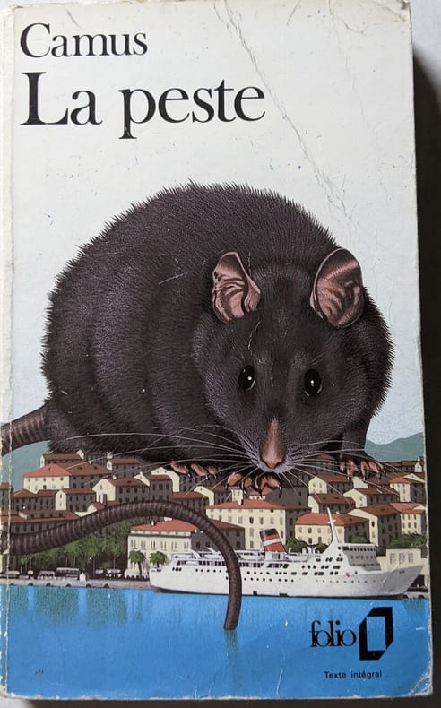
500307679folio Sans date. La Peste d'Albert Camus raconte l'histoire de la ville d'Oran frappée par une épidémie de peste obligeant ses habitants à faire face à l'isolement à la mort et à la solidarité. À travers cette allégorie Camus explore des thèmes comme l'absurde la révolte et la condition humaine face au mal et à l'adversité
8574presentato e PARTENOPE accennato dal SEBETO, dalle SIRENE, e dalle Régia Villa di PORTICI-La Fede l’accoglie in Seno, l’éduca ASTREA,l’ornano Le Grazie, Pallade l’istruisce per la pace,e Marte per la guerre, onde La Fama la consacra all’immortalita.Gravure allégorique par Carlo GREGORI 370x500mm à la cuvette, marges courtes, Une restauration ancienne et maladroite au bas à droite
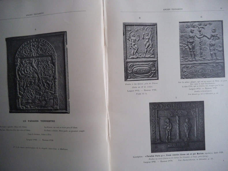
9197in 4 cartonné, premier de couverture avec titre, contrecollé. Faux-titre, titre, 474 pages, 1 page erratum, portrait de l’auteur, de profil 1912 en dernière page. 1290 plaques reproduites par la photo avec leurs descriptions, non rogné. Histoire des plaques- Ancien Testament-Nouveau Testament-Décor-allégories-divers-Armes de France-Armoiries déterminées-mythologie-histoire. En vente chez l’auteur. Chez J FLORANGE expert en médailles Paris 1912.Edition originale, numérotée et tirée à 225 exemplaires sur papier des papeteries du Marais. Tome 1er. Le second n’est jamais paru. Très bon état, pas de rousseurs. Fort rare
- EDIZIONE ORIGINALE, COLORITURA COEVA -Frontespizio del terzo volume del "Nuovo Atlante Geografico Universale delineato sulle ultime osservazioni", edito a Roma dal 1792 fino al 1801, opera che la Calcografia Camerale commissionò al Cassini al fine di sostituire l’ormai obsoleto "Mercurio Geografico".Giovanni Maria Cassini, Chierico Regolare Somasco fu geografo e cartografo, ma anche intagliatore di architetture e prospettive - uno dei migliori discepoli di Giovanni Battista Piranesi - Cassini fu uno degli ultimi sferografi italiani del Settecento ed i suoi globi ebbero una notevole diffusione, come pure questo "Nuovo Atlante Geografico".Incisione in rame, coloritura coeva dei contorni, leggere bruniture, per il resto in ottimo stato di conservazione. L'Atlante del Cassini fu ristampato dalla Calcografia Camerale nel primo quarto del XIX secolo, prima del 1839. Solo gli esemplari di prima edizione come questo sono stampati su carta vergata coeva e sono colorati a mano in epoca. Le tirature del XIX secolo sono già su carta meccanica, priva di vergelle, e generalmente in bianco e nero. - FIRST EDITION, CONTEMPORARY OUTLINE COLOUR -Title page of the third book of Nuovo atlante geografico universale delineato sulle ultime osservazioni. Roma, Calcografia camerale, 1792-1801.Cassini was geographer and cartographer but he was also good at engraving architectural items and perspectives – he was one of the best disciples Giovanni Battista Piranesi had. Moreover, Cassini was one of the last artists to engrave spheres in the XVIII century and his globes were quite famous and widespread, and realized the most important Italian Atlas of the XVIII century; his maps always bear a cartouche, extremely rich in colours and details. Copperplate with fine original hand colour, some foxing, otherwise in very good condition.The Cassini's Atlas was reprinted by the Calcografia Camerale in the first quarter of XIXth century (before 1839). Only the first edition of the atlas is printed on contemporary laid paper, while the late issue are on XIXth century paper and often without colour.
- EDIZIONE ORIGINALE, COLORITURA COEVA -Frontespizio del secondo volume del "Nuovo Atlante Geografico Universale delineato sulle ultime osservazioni", edito a Roma dal 1792 fino al 1801, opera che la Calcografia Camerale commissionò al Cassini al fine di sostituire l’ormai obsoleto "Mercurio Geografico".Giovanni Maria Cassini, Chierico Regolare Somasco fu geografo e cartografo, ma anche intagliatore di architetture e prospettive - uno dei migliori discepoli di Giovanni Battista Piranesi - Cassini fu uno degli ultimi sferografi italiani del Settecento ed i suoi globi ebbero una notevole diffusione, come pure questo "Nuovo Atlante Geografico".Incisione in rame, coloritura coeva dei contorni, leggere bruniture, per il resto in ottimo stato di conservazione. L'Atlante del Cassini fu ristampato dalla Calcografia Camerale nel primo quarto del XIX secolo, prima del 1839. Solo gli esemplari di prima edizione come questo sono stampati su carta vergata coeva e sono colorati a mano in epoca. Le tirature del XIX secolo sono già su carta meccanica, priva di vergelle, e generalmente in bianco e nero. - FIRST EDITION, CONTEMPORARY OUTLINE COLOUR -Title page of the second book of Nuovo atlante geografico universale delineato sulle ultime osservazioni. Roma, Calcografia camerale, 1792-1801.Cassini was geographer and cartographer but he was also good at engraving architectural items and perspectives – he was one of the best disciples Giovanni Battista Piranesi had. Moreover, Cassini was one of the last artists to engrave spheres in the XVIII century and his globes were quite famous and widespread, and realized the most important Italian Atlas of the XVIII century; his maps always bear a cartouche, extremely rich in colours and details. Copperplate with fine original hand colour, some foxing, otherwise in very good condition.The Cassini's Atlas was reprinted by the Calcografia Camerale in the first quarter of XIXth century (before 1839). Only the first edition of the atlas is printed on contemporary laid paper, while the late issue are on XIXth century paper and often without colour.
- EDIZIONE ORIGINALE, COLORITURA COEVA -Frontespizio del primo volume del "Nuovo Atlante Geografico Universale delineato sulle ultime osservazioni", edito a Roma dal 1792 fino al 1801, opera che la Calcografia Camerale commissionò al Cassini al fine di sostituire l’ormai obsoleto "Mercurio Geografico".Giovanni Maria Cassini, Chierico Regolare Somasco fu geografo e cartografo, ma anche intagliatore di architetture e prospettive - uno dei migliori discepoli di Giovanni Battista Piranesi - Cassini fu uno degli ultimi sferografi italiani del Settecento ed i suoi globi ebbero una notevole diffusione, come pure questo "Nuovo Atlante Geografico".Incisione in rame, coloritura coeva dei contorni, leggere bruniture, per il resto in ottimo stato di conservazione. L'Atlante del Cassini fu ristampato dalla Calcografia Camerale nel primo quarto del XIX secolo, prima del 1839. Solo gli esemplari di prima edizione come questo sono stampati su carta vergata coeva e sono colorati a mano in epoca. Le tirature del XIX secolo sono già su carta meccanica, priva di vergelle, e generalmente in bianco e nero. - FIRST EDITION, CONTEMPORARY OUTLINE COLOUR -Title page of the first book of Nuovo atlante geografico universale delineato sulle ultime osservazioni. Roma, Calcografia camerale, 1792-1801.Cassini was geographer and cartographer but he was also good at engraving architectural items and perspectives – he was one of the best disciples Giovanni Battista Piranesi had. Moreover, Cassini was one of the last artists to engrave spheres in the XVIII century and his globes were quite famous and widespread, and realized the most important Italian Atlas of the XVIII century; his maps always bear a cartouche, extremely rich in colours and details. Copperplate with fine original hand colour, some foxing, otherwise in very good condition.The Cassini's Atlas was reprinted by the Calcografia Camerale in the first quarter of XIXth century (before 1839). Only the first edition of the atlas is printed on contemporary laid paper, while the late issue are on XIXth century paper and often without colour.
Mm 170x 240 Brossura editoriale di pp. 120 con centinaia di illustrazioni in bianco e nero fuori testo. Picola piegatura alla poertina. Opera in buone condizioni. SPEDIZIONE IN 24 ORE DALLA CONFERMA DELL'ORDINE.
025-Ao.J. Vier Radierungen im Hochoval, nach Ann. Carracci (1560-1609), auf Bütten. 13,8:10 cm. Literatur: Bartsch 54-57. - Ausgezeichnete Abdrucke der 4-Blatt-Folge. Etwas stockfleckig und gebräunt, bei einem Blatt linke obere Ecke schräg geschnitten, bei zwei weiteren Blättern eine bzw. zwei Ecken mit Fehlstellen.
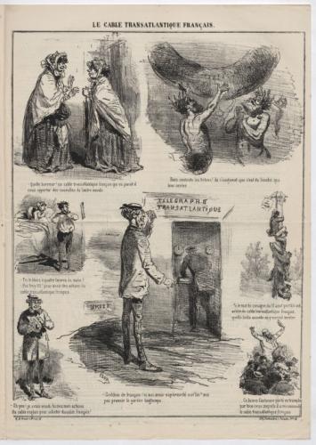
25446Le Charivari, trente-septième année, lundi 10 août 1868 - Hauteur: 43.8cmx Largeur: 30.8cm - Trait carré : Hauteur: 38.9cmx Largeur: 29.1cm- illustration page 3.- Au-dessus de l'image, au centre : "LE CABLE TRANSATLANTIQUE FRANÇAIS." ; signé dans l'image en bas à gauche : "CHAM", sous l'image à gauche : "A.de Vresse, r. Rivoli, 55." et à droite : "Lith Destouches, r. Paradis Pre 28",texte imprime au dos,bon etat.
Opera tratta dall’Isolario dell’Atlante Veneto del P. Coronelli, In Venetia MDCXCVI. Coronelli visse un periodo di straordinaria fecondità editoriale a partire dal 1689, quando ebbe la cattedra di geografia presso l'Università alle Procuratie, con la pubblicazione, nel 1690, del primo volume dell'Atlante Veneto. In effetti sotto il nome di Atlante Veneto va tutta la raccolta di tredici opere composte nell'arco del decennio successivo, dall'Isolario allo Specchio del mare. L'Isolario mira, con una barocca e minuziosa ricerca del dettaglio, alla celebrazione dei possedimenti della Serenissima. Monumentale raccolta di carte e vedute di isole, rappresenta l'ultimo degli “isolari” concepiti, che, tra la fine del XVII e l'inizio del XVIII secolo, vennero progressivamente soppiantati dagli atlanti di moderna concezione, opere a stampa caratterizzate da crescente precisione scientifica e da sempre minore pregio artistico. Sulla scia delle nuove conquiste coloniali le rappresentazioni cartografiche vennero ad assumere un carattere sempre più tecnico, fino ad allora piuttosto arbitrario. Incisione in rame, in perfette condizioni. A finely engraved allegorical frontispiece by the eminant cartogapher Vincenzo Maria Coronelli.This highly attractive composition features the Royal Arms of England, including a garter featuring the motto: 'Honi Soit Mal Qui Pense' (Evil to him who thinks Evil). Below is the allegorical figure of Hercules bearing a tablet with another English royal motto: 'Dieu et Mon Droit' (God and my Right). To the right is the personification of the Enlgish Empire, 'Britannia', bearing the sceptre and orb of royal authority. To the right is St. George, the patron saint of England, slaying a Dragon. Likwise, Britannia and Hecules are shown to be vanquishing Britain's enemies below. The rhetoric is one of unadulterated Anglo power during a period when England was engaged in a long series of wars with Louis XIV's France. The map is taken from Isolario dell’Atlante Veneto del P. Coronelli, In Venetia MDCXCVI. Coronelli lived a period of extraordinary editorial fecundity starting from 1689, when he had the chair of geography at the University at the Procuratie, with the publication, in 1690, of the first volume of the Atlante Veneto. Under the name of Atlante Veneto goes the entire collection of thirteen works composed over the next decade, from the Isolario to the Specchio del mare. The Isolario aims, with a baroque and meticulous search for detail, to celebrate the possessions of the Serenissima. Monumental collection of maps and views of islands, represents the last of the "isolarios" conceived, which, between the end of the seventeenth and the beginning of the eighteenth century, were gradually supplanted by modern atlases, printed works characterized by increasing scientific precision and less and less artistic value. In the wake of the new colonial conquests, cartographic representations came to assume an increasingly technical character, until then rather arbitrary. Copperplate in very good condition.
Affascinante incisione che mostra strumenti cartografici e simboli allegorici, con un Globo Terrestre orientato verso il Polo al centro. Esemplare tratto dall’ Atlante Veneto, Nel quale si contiene la Descrittione Geografica, Storica, Sacra, Profana e Politica degli Imperi, Regni, Provincie, e Santi dell’Universo […] In Venetia MDCXC. Coronelli visse un periodo di straordinaria fecondità editoriale a partire dal 1689, quando ebbe la cattedra di geografia presso l'Università alle Procuratie, con la pubblicazione, nel 1690, del primo volume dell'Atlante Veneto. In effetti sotto il nome di Atlante Veneto va tutta la raccolta di tredici opere composte nell'arco del decennio successivo, dall'Isolario allo Specchio del mare. L'opera era intesa come un'estensione dell'Atlas Maior di Blaeu. Non è una semplice raccolta di mappe, ma piuttosto "un compendio di informazioni geografiche, cosmografiche e scientifiche... sulla scienza e la geografia italiana contemporanea" (Scammell). Oltre alle mappe, il primo volume include molte delle celebri tavole navali di Coronelli, molte con i bordi "farnesiani" stampati separatamente e commissionati appositamente dal patrono di Coronelli, Ranuccio II Farnese, duca di Parma. Incisione in rame, magnifica prova con pieni margini, in perfetto stato di conservazione. Bibliografia Ermanno Armao, Vincenzo Coronelli (Firenze, 1944), nn.59-60, p.237. Fascinating engraving showing cartographic instruments and allegorical symbols, with a globe oriented toward the Pole at the center. Example taken form Corenelli’s Atlante Veneto, Nel quale si contiene la Descrittione Geografica, Storica, Sacra, Profana e Politica degli Imperi, Regni, Provincie, e Santi dell’Universo […] In Venetia MDCXC. Coronelli lived a period of extraordinary editorial fecundity starting from 1689, when he had the chair of geography at the University at the Procuratie, with the publication, in 1690, of the first volume of the Atlante Veneto. Under the name of Atlante Veneto goes the entire collection of thirteen works composed over the next decade, from the Isolario to the Specchio del mare. The work was intended as an extension of Blaeu’s Atlas Maior. It is no mere collection of maps, but rather “a compendium of geographical, cosmographical, and scientific information... on contemporary Italian science and geography” (Scammell). As well as maps, the first volume includes several of Coronelli’s celebrated naval plates, many with the separately-printed “Farnese” borders especially commissioned by Coronelli’s patron, Ranuccio II Farnese, Duke of Parma. Copperplate, with full margins, very good condition. Very rare. Literature Ermanno Armao, Vincenzo Coronelli (Florence, 1944), no.59, no.60 and p.237.
Galeone con vessillo recante il titolo “Idrografia”. Esemplare tratto dall’ Atlante Veneto, Nel quale si contiene la Descrittione Geografica, Storica, Sacra, Profana e Politica degli Imperi, Regni, Provincie, e Santi dell’Universo […] In Venetia MDCXC. Coronelli visse un periodo di straordinaria fecondità editoriale a partire dal 1689, quando ebbe la cattedra di geografia presso l'Università alle Procuratie, con la pubblicazione, nel 1690, del primo volume dell'Atlante Veneto. In effetti sotto il nome di Atlante Veneto va tutta la raccolta di tredici opere composte nell'arco del decennio successivo, dall'Isolario allo Specchio del mare. L'opera era intesa come un'estensione dell'Atlas Maior di Blaeu. Non è una semplice raccolta di mappe, ma piuttosto "un compendio di informazioni geografiche, cosmografiche e scientifiche... sulla scienza e la geografia italiana contemporanea" (Scammell). Oltre alle mappe, il primo volume include molte delle celebri tavole navali di Coronelli, molte con i bordi "farnesiani" stampati separatamente e commissionati appositamente dal patrono di Coronelli, Ranuccio II Farnese, duca di Parma. Incisione in rame, magnifica prova, con pieni margini, in perfetto stato di conservazione. Bibliografia Ermanno Armao, Vincenzo Coronelli (Firenze, 1944), nn.59-60, p.237. Galleon with banner with the title “Idrografia”. Example taken form Corenelli’s Atlante Veneto, Nel quale si contiene la Descrittione Geografica, Storica, Sacra, Profana e Politica degli Imperi, Regni, Provincie, e Santi dell’Universo […] In Venetia MDCXC. Coronelli lived a period of extraordinary editorial fecundity starting from 1689, when he had the chair of geography at the University at the Procuratie, with the publication, in 1690, of the first volume of the Atlante Veneto. Under the name of Atlante Veneto goes the entire collection of thirteen works composed over the next decade, from the Isolario to the Specchio del mare. The work was intended as an extension of Blaeu’s Atlas Maior. It is no mere collection of maps, but rather “a compendium of geographical, cosmographical, and scientific information... on contemporary Italian science and geography” (Scammell). As well as maps, the first volume includes several of Coronelli’s celebrated naval plates, many with the separately-printed “Farnese” borders especially commissioned by Coronelli’s patron, Ranuccio II Farnese, Duke of Parma. Copperplate, with full margins, very good condition. Very rare. Literature Ermanno Armao, Vincenzo Coronelli (Florence, 1944), no.59, no.60 and p.237.