VAN LINSCHOTEN Jan Huygen (1563 - 1610)MareMagnum

187 résultats
Frontespizio del celebre Itinerario, voyage ofte schipvaert van J.H. van Linschoten naar Oost ofte Portugaels Indien. L’opera fu pubblicata nel 1596 al ritorno in Olanda dopo anni spesi nelle Indie, in particolare nella colonia portoghese di Goa, dove tra il 1583 ed il 1589 fu al servizio dell’Arcivescovo del Portogallo. Le carte del Linschoten sono basate su accurati portolani portoghesi del XVI secolo, e oltre a fornire le rotte più semplici e vantaggiose per il raggiungimento delle Indie. Incisione in rame, in ottimo stato di conservazione. Title page of the famous Itinerario, voyage ofte schipvaert van J.H. van Linschoten naar Oost ofte Portugaels Indien. St Helena was an important early re-supply point for the Portuguese from the late 1400s, particularly on their return voyages from Asia. This plate appeared in Linschoten's book in 1596, once he came back from the Indies. The engraver for this plate was Baptista van Doetechum. Schilder, Gunter, Monumenta Cartographica Neerlandica, vol VII.
0124-Bo.J. 2 Aquatintaradierungen in Braundruck, 1816, Darstellungen im Hochoval, mit 3zeiligem Text unter den Darstellungen, auf cremefarbenem Velin. Je 24,1:18,4 cm. Literatur: Nagler 17 und 18. - Sehr gute Abdrucke mit Rändchen um die Plattenkanten, 1 Blatt mit sorgfältig restauriertem Einriß oben.
Illustrazione tratta dall'opera "The Gentlemans Recreation in Three Parts", di Richard Blome, pubblicata per la prima volta a Londra nel 1686. Le numerose iscrizioni descrivono l'arte e la tecnica dell'orologeria; in basso, due figure e un angelo con compassi, quadranti e altri strumenti di misura. Incisione in rame, colorata a mano, in buone condizioni. Taken from 'The Gentlemans Recreation in Three Parts' by Richard Blome, London: S. Roycroft, 1686. Large oval with inscriptions explaining the various parts of the art of horology; below, two figures and an angel with compasses, quadrant, and other measuring instruments. Copper engraving, hand-coloured, in very good conditions.
180519625Leipzig, Leo, (1805). 232 (recte 132) SS., 33 Kupfertafeln von P. J. Laminit, T. J. Richter und Schnorr-Gründer. Kl.-8°, zeitgen. rote Pappe, etw. Rückenvergoldung, doppelte Deckelfilten, Goldschnitt, grüne Vorsätze, im grünen Pappschuber, dieser stärker berieben und bestoßen. Der Einband an den Ecken und Kapitalen berieben.
1659ALDR0606Amstelodami, Apud. Ioh. Ianßonium Iuniorem (Amsterdam, Jan Jansson) 1659. 12°. Gest. Titelbl., 11 nn. Bll., 831 S., 2 nn. Bll., mit 104 gestochenen Illustrationen. Pergamentband d. Zeit, mit Rückenbeschriftung von alter Hand, verfärbt und braunfleckig, Pergament entlang des hinteren Gelenkes aufgeplatzt, vorderer Innendeckel mit frischem Blatt, hinterer mit letztem bedruckten Blatt überklebt. Seiten nur wenig gebräunt, teilw. wasserrandig, einzelne tintenfleckig oder randrissig, mit etwas Wurmfraß in den Schlussblättern. Mit einem Siegelabdruck und Resten von Siegellack am Titelblatt, sowie e. Besitzvermerk von alter Hand (Jos. Sandor) auf der Rückseite des Titelblatts. Graesse 6,200. Vgl. Praz 483ff. Jöcher/Adelung 4,3 - lateinische Fassung des ursprünglich in spanischer Sprache verfassten, 1640 erstmals erschienenen 'emblematischen Fürstenspiegels' des spanischen Autors und Diplomaten Diego de Saavedra-Fajardo (1584-1648). Das über Jahrhunderte immer wieder neu aufgelegte, vielfach übersetzte Emblembuch - "Im thematischen Bereich der politischen Emblematik ist der Fürstenspiegel des spanischen Diplomaten Diego de Saavedra Fajardo ? keineswegs das erste, aber wohl doch das erfolgreichste Werk." - enthält 101 Text-Bild Kombinationen, welche die moralischen und politischen Ansprüche, die aus christlicher Sicht an einen idealtypischen Prinzen gestellt werden, veranschaulichen. Auch in dieser Ausgabe findet sich Saavedras mit 'Wien, 10 Juli ? 1640' datiertes, an den spanischen Prinzen gerichtetes, Vorwort zu seinem, nach eigenen Angaben in Intervallen auf seinen diplomatischen Reisen durch Deutschland, verfasstem Werk. (Vgl. auch Peil. Emblematische Fürstenspiegel im 17. u. 18. Jahrhundert. In: Frühmittelalterliche Studien. Jg. 20,55f.) [2 Warenabbildungen]
Galeone con vessillo recante il titolo “Idrografia”. Esemplare tratto dall’ Atlante Veneto, Nel quale si contiene la Descrittione Geografica, Storica, Sacra, Profana e Politica degli Imperi, Regni, Provincie, e Santi dell’Universo […] In Venetia MDCXC. Coronelli visse un periodo di straordinaria fecondità editoriale a partire dal 1689, quando ebbe la cattedra di geografia presso l'Università alle Procuratie, con la pubblicazione, nel 1690, del primo volume dell'Atlante Veneto. In effetti sotto il nome di Atlante Veneto va tutta la raccolta di tredici opere composte nell'arco del decennio successivo, dall'Isolario allo Specchio del mare. L'opera era intesa come un'estensione dell'Atlas Maior di Blaeu. Non è una semplice raccolta di mappe, ma piuttosto "un compendio di informazioni geografiche, cosmografiche e scientifiche... sulla scienza e la geografia italiana contemporanea" (Scammell). Oltre alle mappe, il primo volume include molte delle celebri tavole navali di Coronelli, molte con i bordi "farnesiani" stampati separatamente e commissionati appositamente dal patrono di Coronelli, Ranuccio II Farnese, duca di Parma. Incisione in rame, magnifica prova, con pieni margini, in perfetto stato di conservazione. Bibliografia Ermanno Armao, Vincenzo Coronelli (Firenze, 1944), nn.59-60, p.237. Galleon with banner with the title “Idrografia”. Example taken form Corenelli’s Atlante Veneto, Nel quale si contiene la Descrittione Geografica, Storica, Sacra, Profana e Politica degli Imperi, Regni, Provincie, e Santi dell’Universo […] In Venetia MDCXC. Coronelli lived a period of extraordinary editorial fecundity starting from 1689, when he had the chair of geography at the University at the Procuratie, with the publication, in 1690, of the first volume of the Atlante Veneto. Under the name of Atlante Veneto goes the entire collection of thirteen works composed over the next decade, from the Isolario to the Specchio del mare. The work was intended as an extension of Blaeu’s Atlas Maior. It is no mere collection of maps, but rather “a compendium of geographical, cosmographical, and scientific information... on contemporary Italian science and geography” (Scammell). As well as maps, the first volume includes several of Coronelli’s celebrated naval plates, many with the separately-printed “Farnese” borders especially commissioned by Coronelli’s patron, Ranuccio II Farnese, Duke of Parma. Copperplate, with full margins, very good condition. Very rare. Literature Ermanno Armao, Vincenzo Coronelli (Florence, 1944), no.59, no.60 and p.237.
8574presentato e PARTENOPE accennato dal SEBETO, dalle SIRENE, e dalle Régia Villa di PORTICI-La Fede l’accoglie in Seno, l’éduca ASTREA,l’ornano Le Grazie, Pallade l’istruisce per la pace,e Marte per la guerre, onde La Fama la consacra all’immortalita.Gravure allégorique par Carlo GREGORI 370x500mm à la cuvette, marges courtes, Une restauration ancienne et maladroite au bas à droite
19891065799Reinbek bei Hamburg : Rowohlt, 1989. 495, [48] S. Abb. Fadengehefteter Originalpappband mit Schutzumschlag.
163087241630 Lugdunum Batavorum, Ex Officina Elzeviriana, 1630; in-12, plein veau fauve, double filet doré encadrant les plats, dos à nerfs , caissons de double filet doré ornés d'une rosace dorée, titre doré, tranches mouchetées de rouge; 690,(6)pp.; titre orné.
Frontespizio allegorico del L’Italia a cura di Fabio Magini, edito a Bologna nel 1620, tre anni dopo la prematura morte del padre. Inciso da Oliviero Gatti. Composto da un breve testo descrittivo di sole 24 carte, l’opera è corredata di 61 carte geografiche della penisola, e costituisce il primo esempio di atlante italiano. L’opera è per intero di mano del Magini, che iniziò la realizzazione delle carte nel 1594 circa, dando alla luce per prima nel 1595 la carta del territorio di Bologna. Tutte le carte vennero alle stampe quindi prima del 1620, nelle loro stesure provvisorie, successivamente corrette ed aggiornate per l’edizione definitiva. Per la realizzazione delle lastre il Magini si servì di due dei più famosi intagliatori dell’epoca: il belga Arnoldo Arnoldi e l’inglese Benjamin Wright. Decorative titlepage of L'Italia edited by Fabio Magini, published in Bologna in 1620, three years after the untimely death of his father. Composed of a short descriptive text of only 24 pages, the work is accompanied by 61 maps of the peninsula, and is the first example of an Italian atlas. The work is entirely by the hand of Giovanni Antonio Magini, who began the realization of the maps in 1594 or so; the first dated map (1595) the map of the territory of Bologna. All the maps were printed before 1620, in their provisional drafts, later corrected and updated for the final edition. For the realization of the plates Magini used two of the most famous engravers of the time: the Belgian Arnoldo Arnoldi and the English Benjamin Wright. Copperplate, in good condition.
Frontespizio decorativo con titolo e dedica da L’Italia a cura di Fabio Magini, edito a Bologna nel 1620, tre anni dopo la prematura morte del padre. Composto da un breve testo descrittivo di sole 24 carte, l’opera è corredata di 61 carte geografiche della penisola, e costituisce il primo esempio di atlante italiano. L’opera è per intero di mano del Magini, che iniziò la realizzazione delle carte nel 1594 circa, dando alla luce per prima nel 1595 la carta del territorio di Bologna. Tutte le carte vennero alle stampe quindi prima del 1620, nelle loro stesure provvisorie, successivamente corrette ed aggiornate per l’edizione definitiva. Per la realizzazione delle lastre il Magini si servì di due dei più famosi intagliatori dell’epoca: il belga Arnoldo Arnoldi e l’inglese Benjamin Wright. Incisione in rame, bella coloritura coeva, in ottimo stato di conservazione. Decorative allegoric titlepage of from L'Italia edited by Fabio Magini, published in Bologna in 1620, three years after the untimely death of his father. Composed of a short descriptive text of only 24 pages, the work is accompanied by 61 maps of the peninsula, and is the first example of an Italian atlas. The work is entirely by the hand of Giovanni Antonio Magini, who began the realization of the maps in 1594 or so; the first dated map (1595) the map of the territory of Bologna. All the maps were printed before 1620, in their provisional drafts, later corrected and updated for the final edition. For the realization of the plates Magini used two of the most famous engravers of the time: the Belgian Arnoldo Arnoldi and the English Benjamin Wright. Copperplate with fine original hand colour, very good condition.
Frontespizio allegorico di Italia, Sclavoniae et Graeciae tabula geographicae (Duisburg, 1589) che comprende 22 carte geografiche della penisola, dei Balcani e della Grecia. Successivamente le carte sono ristampate nell’Atlantis Pars Altera (1595) pubblicato postumo alla morte del Mercatore, dallo stampatore di Duisburg Albert Buys, sotto la supervisione del figlio Rumold Mercator. Composto da sei parti – pubblicate separatamente tra il 1589 e il 1594 – comprende 107 mappe, tutte tranne la carta del mondo di Rumold, firmate da Gerard Mercator. Le lastre vennero poi acquistate da Jodocus Hondius, che tra il 1606 e il 1630 le utilizzò per il suo Atlas Sive Cosmographicae Meditationes de Fabrica Mundi, integrandole ed aggiornandole con proprie “nuove” carte. Delle mappe di Mercator sono note anche ristampe curate da Johannes Janssonius. Le edizioni Hondius e Janssonius ebbero un grande successo commerciale e furono stampate in più lingue, con il testo al verso della carta in latino, francese, tedesco e olandese. Incisione in rame, coloritura coeva, in buono stato di conservazione. Bibliografia cfr. Koeman II Me 11 e Koeman II Me 13A, 1595); Van der Krogt 1:002; J. Keuning, The History of an Atlas, in “Imago Mundi” IV (1947) pp. 37-43; World Encompassed p. 134. Title page of Italia, Sclavoniae et Graeciae tabula geographicae (Duisburg, 1589), which includes an allegorical frontispiece and 22 maps of Italy, the Balkans and Greece. Later, the maps are reprinted in the Atlantis Pars Altera (1595) published posthumously after the death of Mercator, by the Duisburg printer Albert Buys, under the supervision of his son Rumold Mercator. Composed of six parts - published separately between 1589 and 1594 - it includes 107 maps, all except Rumold's map of the world, made by Gerard Mercator. The plates were then purchased by Jodocus Hondius, who between 1606 and 1630 used them for his Atlas Sive Cosmographicae Meditationes de Fabrica Mundi, integrating and updating them with his own "new" maps. Of Mercator's maps are also known reprints edited by Johannes Janssonius. The Hondius and Janssonius editions had a great commercial success and were printed in several languages, with the text on the back of the map in Latin, French, German and Dutch. The map is engraved with the typical connotations of Mercatorian work. The mountains are aligned in a mountainous area concept, not to indicate true chains or valleys, and have a structure with some differences in size, but similar in shape, with vertical slopes and flat tops. The cities are shown through more or less large castles characterized by slender and pointed roofs, similar to wizard hats. Copper engraving, in good condition. Bibliografia cfr. Koeman II Me 11 e Koeman II Me 13A, 1595); Van der Krogt 1:002; J. Keuning, The History of an Atlas, in “Imago Mundi” IV (1947) pp. 37-43; World Encompassed p. 134
192322758München, Hirth, 1923. 2 n.n. Bll., 164 SS., mit 157 großformatigen Abbildungen nach den orig. Textholzschnitten. 8°, illustr. orig.-Halbpergament. Der Rücken angegraut, Einbandüberzug papierbedingt gebräunt
Derla, Luigi L' isola, il velo, l'ara : allegoria e mito nella poesia di Ugo Foscolo. Genova, E.C.I.G. 1984 - TS.3 italian, 283 Opera con copertina morbida in brossura. 283 p. ; 21 cm. \\I. TS.3
in-16 broché Bon etat [LP-8]
Mm 170x240 "Centro Internazionale di Studi di Architettura Andrea Palladio" - Volume nella sua brossura originale con bandelle, 342 pagine con numerose tavole in nero nel testo. Opera in condizioni di nuovo, spedizione in 24 ore dalla conferma dell'ordine.
Collana Saggi 289 - Traduzione di Carlo Sgorlon - Julius von Schlosser, Personalit? metodo di lavoro. Otto Kurz - Introduzione - Elenco delle tavole a colori e delle illustrazioni, prima edizione italiana, buone condizioni. 1 20,5x14,5 cm., legatura in piena tela rossa, sopraccoperta tutta illustrata, pp. XXVIII, 134 (8), VI tavole a colori e 118 illustrazioni in nero su tavole fuori testo, prima edizione italiana, un leggera grinza al piatto e normali segni del tempo, buon esemplare. Allegati 2 ampi ritagli stampa ...che significato abbia avuto nel Medioevo la 'rappresentazione della realt?' e, pi? precisamente, quale sia stato l'esatto valore conferito ai due termini 'realt?' e 'presentazione'. Jiulius von Schlosser ha proposto, per questi interrogativi, una sua, ormai classica, risposta.
20086Genève, Paris, Chez tout les libraires, 1887 [et] 1886. Plaquette grand in-8 oblong de 8 feuillets et une planche sous couverture jaune d'éditeur imprimée en rouge. La seconde publication à 12 pages.
192227320Paris La Connaissance 1922 In-4 illustré de nombreuses vignettes en noir et de 8 lithographies demi-ton hors-texte, 390p. Couverture illustrée.
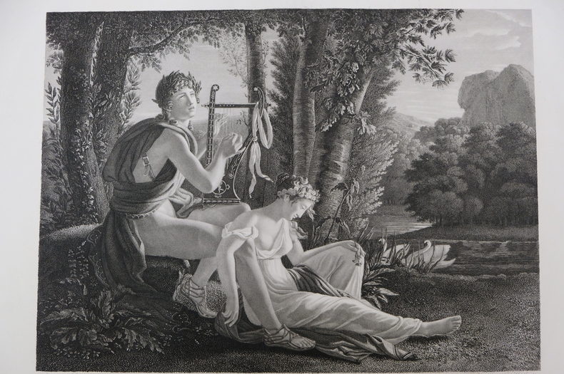
est164t3Dimension extérieur 44,5 x 55,5 cm, cuvette 43 x 53,5 cm. Très belle gravure, d'après Jean-Louis Ducis (1775-1847) et gravée par Jean Marie Gudin (1782-18..), représentant Orphée et Eurydice. En excellent état, épreuve réalisée peu de temps après le tableau de Ducis (1826).
est165t3Dimension extérieur 44,5 x 55 cm, cuvette 42,5 x 53 cm. Très belle gravure, d'après Jean-Louis Ducis (1775-1847) et gravée par Jean Marie Gudin, représentant le mythe de Boutadès, raconté par Pline qui dit que Callirrhoé avait imaginé de tracer l'ombre de son amant au charbon sur une pierre. En excellent état, épreuve réalisée peu de temps après le tableau de Ducis (1826).
0447-Bo.J. Altkolor. Kupferstich, auf Bütten. 22,5:16,6 cm. Literatur: Schuster 130 a und b. - Sehr guter Abdruck mit vollem Rand. - Mit altem Kolorit selten!
500316236Sans date. Le roman suit la vie du lieutenant Giovanni Drogo qui passe son existence à la Fortezza Bastiani en attente d'une invasion des Tartares qui n'arrive jamais. À travers cette attente vaine Buzzati explore le désenchantement humain la routine et la perception du temps qui passe dans une allégorie de la condition humaine
Inc. su rame, mm. 325x230 alla battuta, margini in barbe (con ombreggiature e aloni di muffa). Tenue coloritura coeva.
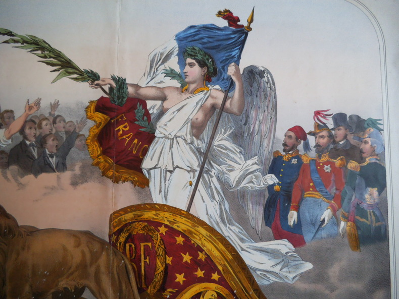
8433Elle Est acclamée par tous le Peuples.Lithographie originale en couleurs,rehaussée à la gomme arabique.Format 610x785mm et 470x610mm hors marges.Paris Vve Gosselin imp. Editeur.Vve Gadola éditeur Lyon. Une trace de pliure, petites rousseurs avec de petites déchirures réparées, en marge. Coloris frais. Peu courant.