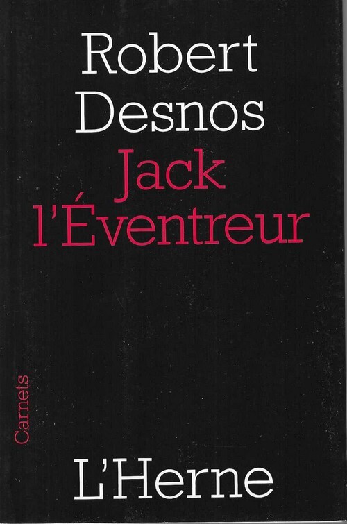
( Jack l'éventreur - Jack the Ripper ) - Robert Desnos.Livre Rare Book
587 résultats
199932624Editions de l'Herne / Collection Carnets 2009. In-16 broché de 44 pages au format 16,5 x 11 cm. Couverture à rabats avec titre imprimé. Dos carré. Plats et intérieur frais. Textes et articles consacrés à Jack l'éventreur, publiés à l'origine dans les Cahiers de L'Herne Robert Desnos n° 54 de 1987. Edition originale, séparée, en état de neuf.
2911188373.Gmass_market. Good. Access codes and supplements are not guaranteed with used items. May be an ex-library book. unknown
2003R200036394ALLIA. 2003. In-16. Broché. Bon état, Couv. convenable, Dos satisfaisant, Intérieur frais. 60 pages.. . . . Classification Dewey : 364-Criminologie
8747N° 21. Janvier-février 1924. Jules Supervielle, Marcel Jouhandeau, Michel Leiris, Adrien Copperie Critique de " Clair de Terre " d'André Breton, par Paul Eluard. Critique de " Choléra " de Joseph Delteil, par Robert Desnos. Très propre.
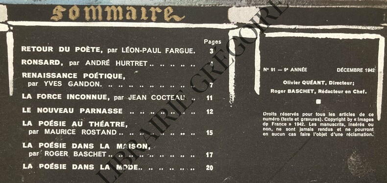
1942ABE-1727555620059SOMMAIRE AVEC COMPOSITION DE J.-A.BONNAUD-RETOUR DU POETE, PAR LEON-PAUL FARGUE, ILLUSTRATION PAR J.-A. BONNAUD-RONSARD, PAR ANDRE HURTRET, 3P-RENAISSANCE POETIQUE (1940-1942), PAR YVES GANDON, 4 PAGES, ILLUSTRATIONS DE MARCEL CHASSARD-LA FORCE INCONNUE, PAR JEAN COCTEAU, DESSINS DE JEAN COCTEAU, 1P-LE NOUVEAU PARNASSE, POEME DE MAURICE FOMBEURE, DESNOS, DESSINS DE SERGE IVANOFF (LEON-PAUL FARGUE, AUDIBERTI, GEORGES HUGNET, DESNOS, LE GROUPE DE LA NOUVELLE ORIGINE, RENE FAUCHOIS, JEAN COCTEAU, LES POPULISTES, CHEZ RAYMOND DUNCAN, RAYMOND DUNCAN, ROGER PILLET, WILLIAM BERTEVAL), 3 PAGES-LA POESIE AU THEATRE, PAR MAURICE ROSTAND, DESSIN PAR SERGE IVANOFF, PROJET DE DECOR POUR CHANTECLAIR, PAR EDMOND ROSTAND-LA POESIE DANS LA MAISON, PAR ROGER BASCHET, 3 PAGES, 8 PHOTOS (ASSIETTE EDITEE PAR CHRISTOFLE, TERRE CUITE COLETTE GUEDEN,.)-LA POESIE DANS LA MODE, 2 PAGES, 2 PHOTOS-LES TISSUS D'AMEUBLEMENT CREENT LE CHARME DE LA MAISON-(E924)
1950002243Paris La Nef 1950 In-8 Broché, couv. illustrée Edition originale
10719Editions du Sagittaire, "La Nef" n°71-72, décembre 1950-janvier 1951 (numéro spécial). In-8 broché, 224 pages, couverture illustrée par Miro. Le dos de la couverture est consolidée avec du scotch, sans manque, intérieur en bon état.
033232012X.Gpaperback. Good. Access codes and supplements are not guaranteed with used items. May be an ex-library book. paperback
0428435092.Ghardcover. Good. Access codes and supplements are not guaranteed with used items. May be an ex-library book. hardcover
2678Éditions françaises de Musique, paris, sans date.Un volume broché (24,5 x 32 cm) de 14 pages. Exemplaire en parfait état. Partition.
2678Éditions françaises de Musique, paris, sans date.Un volume broché (24,5 x 32 cm) de 14 pages. Exemplaire en parfait état. Partition.
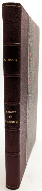
1914101547Paris, Doin, 1914, in-8, 294 pp, 9 pl, Demi-chagrin grenat, couvertures conservées, Première édition en librairie de ce mémoire qui fut publié dans l'Encyclopédie française d'urologie que dirigeait l'auteur Ernest Desnos (1852-1925). Nombreuses figures dans le texte et 9 planches en couleurs sous serpentes, dont une dépliante. Envoi signé de l'auteur. Très bon exemplaire. Couverture rigide
77326Paris, Octave Doin 1901, 180x130mm, 918pages, reliure percaline de l’éditeur. Tranches marbrées. du possesseur sur la haut de la page de garde supérieure. Dos insolé. Bel exemplaire.
190177326Paris : Octave Doin 1901. 180x130mm. reliure percaline de lÕditeur. Tranches marbres. du possesseur sur la haut de la page de garde suprieure. Dos insol. Bel exemplaire. 738 Octave Doin unknown
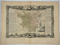
1766LBW-4498Paris, Sr. Desnos, 1765 [1766]. 357 x 247 mm.
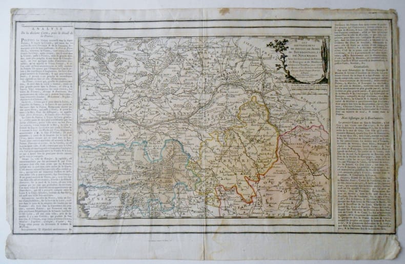
17711663091771 GOUVERNEMENS DE POITOU , DE BERRI , DE BOURBONNOIS ET DE NIVERNOIS . Avec les Généralités de Poitiers de Bouges et de Moulins & subdivisés en petits pays, avec toutes les Routes et les Distances en Lieues d'usage dans chaque province A Paris , 1771 , chez le Sr Desnos ,Rue St Jacques au Globe Carte de 50x29 , feuille 52x33 coloriée à l'époque .Texte encadrant la cartePetits trous de vers marge supérieure , bords légèrement effrangés.Très bon état par ailleurs.
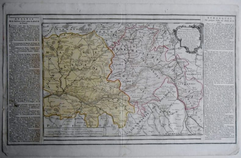
166123GOUVERNEMENS d'Orléanois, de Touraine, du Maine, d'Anjou, et du Saumur; Avec les Généralités d'Orléans et de Tours, Subdivisés en petits pays, avec toutes les Routes et les Distances en Lieues d'usage dans ces Pays, A Paris chez le Sr Desnos Ing Geog Rue St Jacques au Globe Carte de 50x29 , feuille 52x33 coloriée à l'époque .Petits trous de vers marge supérieure , bords légèrement effrangés.Très bon état par ailleurs.
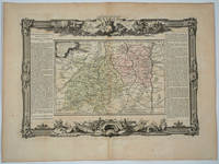
176818497Paris: Desnos 1768. Attractive map of this famed wine area of France. Includes Besancon Baumes Bourg Charillon Langres Tonnerre Dijon Auxonne. Long columns of descriptive text along the left and right of the map. Map measure 17 x 15.5" with large border. Attractive "military" motif border original color on the map. Very good condition. Desnos unknown
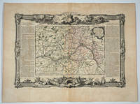
176820082Paris: Desnos 1768. Attractive map of this famed Loire River and chateaux area of France. Includes Angers Saumur Tours Blois Orleans and Sancerre. Long columns of descriptive text along the left and right of the map. Map measure 17 x 15.5" with large border. Attractive "military" motif border original color on the map. Very good condition. Desnos unknown
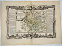
176820083Paris: Desnos 1768. Attractive map of this famed area of France. Includes the area from Normandie in the west to the champagne region of Rhiems in the east. Long columns of descriptive text along the left and right of the map. Map measure 17 x 15.5" with large border. Attractive "military" motif border original color on the map. Very good condition. Desnos unknown
176818494Paris: Desnos 1768. Attractive map of this area of southern France. Long columns of descriptive text along the left and right of the map. Map measure 17 x 15.5" with large border. Attractive "military" motif border original color on the map. Desnos unknown
176818496Paris: Desnos 1768. Attractive map of this area of France. Includes Beaujolais Clermont Riom Aurillac Roanne Montbrison. Long columns of descriptive text along the left and right of the map. Map measure 17 x 15.5" with large border. Attractive "military" motif border original color on the map. Very good condition. Desnos unknown
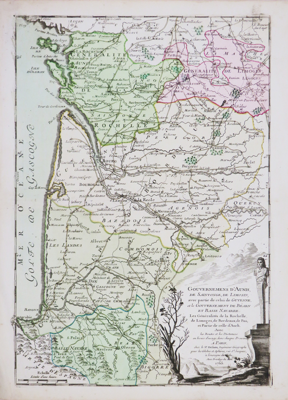
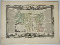
176818498Paris: Desnos 1768. Attractive map of this area of France. Includes Bordeaux La Rochelle Bayonne Limoges Angouleme Bourg. Long columns of descriptive text along the left and right of the map. Map measure 17 x 15.5" with large border. Attractive "military" motif border original color on the map. Very good condition. Desnos unknown
1770910503CG[Um 1770]. Altkolorierter Kupferstich 28,5 x 31 cm, Blattgröße 29 x 39,5 cm.
46572Dressé sur les Relations les plus nouvelles de Mrs. de l'Académie Royale des Sciences par L. C. Desnos et J. B. Nolin Géographe. Se fait et se vends chez Desnos rue St. Jacque St. Severin Quartier de la Place Maubert. Paris 1760 avec privilége du Roy. Dedié au Roy par son trés humble trés obéissant et fidel sujet Desnos et monté par lui. Terrestrial globe 265 mm in diameter; engraved gores and two polar calottes with original hand-colouring over plaster base a few old sealed tears without loss; graduated equator tropics of Cancer and Capricorn ecliptic and Premiere Meridian fixe de l'isle de fer the prime meridian on the island of El Hierro which Louis XIII decreed in 1634; two cartouches - including the dedication to the King sometimes found removed during the French Revolution - decorative vignettes of exotic fauna indigenous peoples and maritime vessels numerous coloured tracks of historical and contemporary explorers including Ferdinand Magellan Jacob Le Maire and Willem Schouten Louis de l'Isle de la Croyere Nicolas de Frondat Aleksei Ilyich Chirikov Jean-Baptiste Charles Bouvet de Lozier and Admiral George Anson; papier-mâché meridian ring with printed declination and elevation engraved calendrical papier-mâché horizon ring with zodiac; edges painted red; supported on four papier-mâché quadrant arcs with the printed names of towns and their longitude and latitudes; turned wooden base and finial; total dimensions 600 x 390 mm; a few discreet signs of old restoration including at the North Pole; warm patina; a fine example of this rare terrestrial globe. A vividly illustrated French table globe from the mid-eighteenth century rich in geographical detail that includes the voyages and discoveries of French English Dutch and Russian explorers. Created during the reign of Louis XV by the partnership of Desnos and Nolin two great mapmakers of the period it is a tremendously evocative artefact from the Age of Enlightenment. The globe shows the discoveries made in the Pacific by the early European expeditions prior to those of Cook and the grands voyages of La Perouse Baudin Freycinet and Duperrey. It depicts the newly charted territory of Nouvelle Hollande as it was known from the most recent discoveries: the western coastline as well as the partial coastlines of Van Diemen's Land and New Zealand are based on the discoveries of the Dutch. Also marked are Dampier's Passage separating New Guinea from New Britain and Terre de S. Esprit Australia del Espíritu Santo the island in the New Hebrides originally mistaken by Quiros for the Australian continent. Louis-Charles Desnos 1725-1805 was one of the most prolific and influential map and globe makers of his age at a time when Paris was the major centre for map production in Europe. He married the widow of Nicolas Hardy the son of Jacques Hardy a globe maker active in the years 1738-1745. Desnos acquired Hardy's inventory and tools and expanded the company further through the acquisition of the inventories of the Jaillot family and of Nicolas de Fer. Desnos would be appointed Royal Globemaker to King Christian VII of Denmark and continued publishing throughout the late eighteenth century. Jean-Baptiste Nolin 1686-1762 continued the established business of his father the famous French cartographer engraver publisher and map dealer Jean-Baptiste Nolin 1657-1708. Collections: The only globe by Desnos recorded in Australian public collections is in the National Gallery of Victoria acquired from us in 2023. Another example of this globe is held in Libraries and Archives Canada. Provenance: Jean R. Perrette his bookplate pasted under the base of the globe. Jean R. Perrette's important collection of rare travel and exploration books was sold through Christie's New York in 2016 Sale 12259 Important Travel Exploration and Cartography April 5 2016. The globe is photographed in the catalogue in situ in Mr. Perrette's Library. Reference: van der Krogt Old globes in The Netherlands 1984 pp. 104-105 unknown