SECOND ANGLO-BOER WARBiblio.com
11 490 résultats
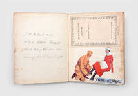
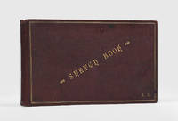
1899182470South Africa: 1899-1902. A unique snapshot of Boer War Cape Town A highly unusual accomplished series of pen-and-ink and watercolour sketches - landscapes and social and military subjects - covering many aspects of life both high and low in Cape Town during the conflict including depictions of indigenous people Malays and Boers. These attractive well-finished sketches in an unusual and flamboyant style seem professional and illustrative rather than "fine art" and captioned in a decorative and very well-formed hand. The artist may well have been a working illustrator: his captions are certainly in the manner used by such periodicals as the Black & White and The Graphic and the style is that employed for lightly "humoresque" reportage. However we have been unable to trace any published versions and of course he may have been simply an observant talented well-placed amateur. The captioning reveals him to be probably British but possibly American - he makes references to the British soldier as "Tommy" and refers to "Australian and Canadian" troops. The album opens with a bird's eye view of Cape Town from Leeuwen Street and is followed by three military subjects. "Poor Tommy passes in his check" shows a British soldier struck in the head by a bullet as fellow infantrymen take cover behind rocks. "Passed in his check" was a slang expression for dying used mainly in America where there was considerable sympathy for the Boer cause and the unsentimental rendering of a Tommy's death may indicate that the artist is indeed American. Similarly the following picture "An intercepted despatch" shows a mounted courier being picked off by a Boer marksman. This is followed by "Cronje's barkers at Green Point - captured at Paardeberg" with a British sentry guarding artillery and a Maxim gun taken at that hard-fought battle 18-27 February 1900. The camp at Green Point Common was established for British troops before being used to house Boer prisoners of war. Of the dozen appealing watercolours five are landscapes the remainder portraits except for "On the Terrace Dix's" which shows a well-to-do trio seated at a table at Dix's Café the place to be seen in fin de siècle Cape Town it's "leading café during the South African War. When the Duke and Duchess of Cornwall and York later King George V and Queen Mary visited Cape Town the Mayor's banquet was held at Dix's" Green. Particularly striking is the very nicely rendered full-length portrait of a young black woman entitled "The girl aint coloured she was born that way". This is much more of a likeness than a "type" and is echoed to some extent in the preceding image "Tommy's substitute for Maria" which shows a British soldier conversing with two well-dressed black women. These may well be "sly girls" a term for women who supplemented their income with occasional sex work. At home and among the higher echelons of the Army there was deep concern about the loose morals of troops in South Africa and "one problem was considered to be their preference for black prostitutes" Kuitenbrouwer p. 203. The artist's rendering of horses is particularly adept as illustrated by "Every man his own horse breaker - Buckjumbers sic from Argentina" a buckjumper is a horse that habitually bucks; many British cavalry mounts were imported from Argentina during the war and an untitled sketch showing a Yeomanry trooper on a prancing mount. Around nine subjects are military including Boer prisoners being escorted under guard at Green Point and soldiers carousing in a mule cart entitled "When the Canadians and Australians went home". Local scenes include several images of refugees from the fighting a nicely rendered portrait of a smartly dressed Indian trader drunks on Bree Street and "doppers" members of the Reformed Churches in South Africa. "Ricksha" is a spirited sketch showing a young Zulu rickshaw-puller fancifully dressed and adorned with horns and wings - an outfit intended to attract custom and often seen in tourist album photographs into the 20th century - pulling a fashionably dressed lady. The artist's eye for costume is also notable even when a little exaggerated for effect giving the images the hallmark of verisimilitude. The album closes on a humorous note with "Our friends the enemy: the mosquito the bug and the nimble flea the African horrors" showing a trio of anthropomorphized insects. Landscape octavo 145 x 245 mm. With 39 original pen-and-ink drawings and 12 watercolours of scenes and people. Contemporary dark brown hard-grain morocco gilt lettered "Sketch Book" on front cover and initialled "A.H." or "F.H." within border of gilt paired fillets gilt milled edge roll gold-veined Double Marble pattern endpapers. Custom brown quarter morocco solander box. Some abrasions to covers a few pale stains to back cover inner hinges cracked but firm expert repairs to edges of first 8 leaves general toning and finger soiling. Overall in very good condition. Lawrence Green Tavern of the Seas 1947; Vincent Kuitenbrouwer War of Words: Dutch Pro-Boer Propaganda and the South African War 1899-1902 2010. unknown
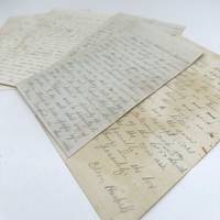
1865353265Vp New York South Carolina Georgia and Virginia 1865. Approx. 260pp. Variously written in pencil or ink on a variety of paper but generally quite legible. A few with original envelopes. With: Haskell's manuscript discharge dated Nov. 18 1864 partly-printed discharge of the same date a cdv of Maj. Gen. Hunter and Haskell's 1865 marriage certificate. 8vo or 4to. Usual folds. Approx. 260pp. Variously written in pencil or ink on a variety of paper but generally quite legible. A few with original envelopes. With: Haskell's manuscript discharge dated Nov. 18 1864 partly-printed discharge of the same date a cdv of Maj. Gen. Hunter and Haskell's 1865 marriage certificate. 8vo or 4to. Haskell 1836-1877 enlisted at Canandaigua Ontario County New York on November 18 1861 and mustered for a three year enlistment in Company F of the 1st New York Engineers. At the start of the war the Army Corps of Engineers was severely underpopulated; Civil Engineer Edward Serrell began recruiting for the specialized service in October 1861 with promises of pay one-third greater than infantry service.<br /> <br /> The first five letters of this archive are written by Haskell from Camp Washington on Staten Island as the regiment was formed trained and awaited orders. The letters describe his daily routine quarters the batteries and harbor and relate news that he has passed as an engineer. Among the most interesting of these letters is one dated January 22 1862 in which he details a visit to Central Park with a lengthy description of the landscape and ongoing construction. <br /> <br /> The 1st New York was deployed to Port Royal Sound and was formed as the 10th Corps Engineers in the Department of the South. Haskell and his company are sent to Hilton Head arriving at the end of February 1862. The next six months are spent on the island working on its wharves and fortifications. He describes his quarters and rations inspection and drills his work on a powder magazine flood gate and surveying for new fortifications. <br /> <br /> He writes at length about the number "contrabands" i.e. the freed or escaped slaves from Confederate plantations coming to Hilton Head. He writes on March 1 1862 soon after arriving: "There are a plenty of contrabands slaves here. They chop and raft logs for the wharves that they are building. The women & children are around among the soldiers selling sweet potatoes oysters and such to them. There are a good many soldiers here on the island and there was a good many that have just left on an expedition and they keep coming." On April 1 1862 he adds: "The government is making preparation to put in a cotton crop here. The negroes are preparing the ground. Contrabands come in every day. Two came in yesterday who said that they had nothing to eat for 4 days." On May 10 1862: "There is a good many contrabands and they keep coming in all the time. When they first arrived they are very ragged both men and women but they are all provided with suitable clothes. The soldiers are down on them because the negroes are used better than they are and have more privilege granted to them by the authorities. And the soldier vents his spite on the negro every chance he can get. Most of the negroes are employed. General Hunter has just commenced getting up a negro regiment of 1500 men to do guard duty through the night and to garrison some of the forts. The officers are to be white men and are to be taken from our regiment. There is quite an effort by some northern society to educate them to work; a job which they have but a slight idea." On October 5 1862 he notes the work General Mitchel among the formerly enslaved: "I went yesterday Sunday to the ordination of the Negro Church Baptist. Our chaplain read the ordination service of the Episcopal church and made a few remarks but General Mitchell done most of the talking . He told them that he was going to have them time by themselves and was going to educate them and make them good citizens. He has a squad of 50 men building houses for them about 3 miles from head quarters called the negro villages."<br /> <br /> In April 1862 he participates in the Battle of Fort Pulaski giving a lengthy account on April 15: "We fell in and marched through the rain to the docks stood in the rain all of an hour and then went on board pretty well soaked. At 9 o'clock the steamboat started. About noon we anchored off Tybee Island in full sight of Fort Pulaski . at seven o'clock the next morning the bombardment of Fort Pulaski commenced. Before the firing commenced Gen. Benham sent a flag of truce and demanded the surrender of the fort in the name of the U.S. " After describing the bombardment he continues: "At sunset the firing ceased on both sides and the two companies of engineers was divided into squads of 8 or 10 men each and sent out to repair the batteries. We worked all night. " He details the work of mounting two 10-inch columbiads "which dismounted themselves the very first shot they made. One of these guns the boys mounted after sunrise and as soon as they discovered from the fort what they was about they directed all of the guns which they could bring to bare upon that particular place. But the boys stuck to their gun and mounted it while the cannon balls was flying over their heads. A feat which they received considerable praise for. " <br /> <br /> In November 1862 Haskell's company is transferred to Fort Pulaski where they work on repairing the damage to the fort remounting the artillery and building a new magazine. He tells news of the war related to his department including a November expedition to destroy railroad bridges between Charleston and Savannah and the death of General Mitchel: "Our Generals called it a partial result and considerable gained by it. But it was such results as I do not believe in for we got tremendously whipped and lost 225 men in killed wounded and missing. But our company succeeded in tearing up some 200 feet of rails on the reach and cutting the telegraph while they were guarded by a few companies of infantry and they all barely escaped being taken prisoner. They found the bridges all guarded by strong batteries. Just as our company and 4 companies of infantry came up to tracks there was a train of open cars going pass loaded with troops. Our men hid behind the fence and when the train came up fired into it and they think they killed a good many. Since then General Mitchel has died and two or three of the other head men . some think that they had yellow fever . others think they was poisoned by eating fish that they bought of the negroes."<br /> <br /> Much of his war commentary during his nine months on Fort Pulaski includes descriptions of the iron clads and monitors. On March 5 1863 for example he writes: "The rebel steamer Nashville was destroyed last Saturday by one of the Monitors The Passaic. She ran by a 13 gun battery and run up the river where she lay and fired two shots into her the first went clear through and the second a shell burst in the magazine and this blew the Nashville to atoms." On June 21 1863 he writes: "The rebel ram Fingal i.e. CSS Atlanta that was built at Savannah and which has kept us in a sweat for nearly a year here and at Hilton Head was captured by one of our monitors last Tuesday without firing a shot." He details the action and movements of the ships before continuing sarcastically: ".The means for building the ram was furnished by the ladies of Savannah and there was two boat loads of them followed the ram down to see her destroy our battery and gun boats but they went back closely followed by one of our gun boats and you must imagine their joy." <br /> <br /> Haskell provides news of the Battle of Fort Wagner on Morris Island including the role of African American troops. He writes on July 15 1863: ". Gen. Gilmour is working his way toward Ft. Sumter and Charleston. There has been some hard fighting on Morris Island." On the 24th he writes: ". our forces had taken eleven batteries on Morris Island and there was two that they had not got possession of yet and that our forces had taken 700 prisoners . yesterday it was reported by some fellows that came from the head that there had been more fighting on Morris Island that the two remaining batteries had been stormed three times and our forces had been repulsed each time with tremendous slaughter. The 55 i.e. 54th Mass. color reg. was one of the storming parties. They were 1200 strong. They lost 700 in killed wounded and missing and the NY 48 was another." Interestingly that same letter includes a commentary on the New York draft riots: "I see by the late NY papers that there is a riot in NY city to resist the draft . I should say that it was to burn buildings murder and to plunder the city. I hope that they will be put down."<br /> <br /> At the end of July 1863 his company is transferred to Morris Island South Carolina to participate in the shelling of Fort Sumter and Charleston where he remains until February 1864. His letters provide great detail of the shelling his work on the artillery and the condition of Fort Sumter. For example: "We are hard at work building batteries and mounting guns . We have just finished a three gun battery on a small island about two miles from our camp. All of the material except the sand had to be boated guns and all. The guns are pointed toward Charleston and the city may feel the effects of them . Two sides of Ft. Sumter are knocked down and the other sides are full of holes and badly shattered & she has not fired a gun in a number of days but we cannot get possession of her until our forces take Fort Wagner . Our regiment is what is called sapping Fort Wagner that is digging trenches in the ground and they are within 100 ft of the fort. We have some killed by grape and canister and by the sharp shooters . The rebels had rifle pits outside of the fort and from these pits they annoyed our boys very much. The 24 Reg. Mass. made a charge on these pits and took 80 prisoners and drove the rest of them into the fort ."<br /> <br /> In January 1864: "You must remember that it takes a tremendous force to throw a hundred lb shell over four miles and it is with the utmost difficulty that we can elevate our guns sufficiently to do it. It requires from 36 deg. to 40 deg. and this elevation allows but little recoil to the gun and the consequence is that we are using up more guns than the damage to the city amounts to. But our Colonel has invented a new wooden gun carriage and day before yesterday one of our men with myself laid the platform and put the carriage . on it and the artillery fellows mounted the gun and tried it. It works first rate and yesterday fired 175 shells into the city and got smoke to rising in a number of places."<br /> <br /> At the end of April 1864 with the shelling of Charleston continuing his regiment is reorganized and he is sent up the James River toward Richmond to join the Army of the Potomac in the Richmond-Petersburg Campaign writing on April 27: "the second battalion which includes our regiment starts for Fortress Monroe tonight . the whole of the 10th army corps are going to operate with the army of the Potomac . The report is that there will be no movement the present season and that all but the most important places will be evacuated and that those will be garrisoned by colored troops."<br /> <br /> Arriving at Bermuda Hundred Virginia in May he writes: "The infantry landed and had a skirmish and took 600 prisoners. Then we built docks to land the cavalry and artillery. The troops advanced some 12 miles our battalion stayed at the landing until most of the stuff was landed which took 24 hours and then we followed on . built fortifications and obstructions then we again advanced and had quite a severe fight and torn up the railroad between Richmond and Petersburg . they said that in one of the battles the 25th SC Reg lost all but three men . We hear that Meade has licked Lee and that he is falling back to Richmond . We are now about 14 miles below Richmond."<br /> <br /> After fortifying the breastworks at Bermuda Hundred his company is moved to Dutch Gap to work on the canal being built to flank the Confederate battery on the river. He writes on August 13 1864: "The river here is very crooked. It runs around five miles and comes within 200 yards of meeting again. The rebels have the most of this five miles filled in with torpedoes and obstruction and a powerful battery to protect them." After describing the topography he continues: "We are digging across here so as to let the monitors go through and thus cut off the rebels battery and their obstructions. But the working party has had a rough time of it today. The rebels have shelled us from their batteries and their iron clads. There has been some killed and quite a number wounded . I think that Gen. Grant will stick to them until he fetches them out of Petersburg and Richmond . There will be some hard fighting in northern Virginia and Maryland ." He adds the following week: "We are at work on the canal. Not exactly at the canal but on the fortifications to protect the canal and are building a corduroy road across a swamp able to get to the canal. We are encamped on the opposite side of the river from the canal and have to cross the river in small boats to our work; the negroes does most of the work on the canal and it does not progress very fast." <br /> <br /> In October he is moved forward to Deep Bottom writing on the 16th: ". Our reg was in the late advance on the north side of the James toward Richmond and have seen some rather rough times . Our company are at work on the advance line. They say about 5 miles from Richmond. I am with four other engineers in charge of building a ten gun fort. We have about 300 men helping us. I have charge of 75 who are cutting away the wood around the fort and carrying timber for it and obstructions to put around it . The rebels are about a mile from this line of works . Wednesday the 12th there was quite a fight here but there was nothing materially accomplished on either side save the killing and wounding of quite a number of men . things indicate a forward movement very soon."<br /> <br /> His letters from Deep Bottom at the end of October and the beginning of November largely concern the presidential and local elections sending his father his ballot to ensure that his vote would be cast. On November 18 1864 with his 3 year term up Haskell is discharged at Varina Virginia and the archive includes both a manuscript discharge and the official partly-printed one he subsequently received. The archive includes one additional letter dated May 19 1865 written from City Point Virginia suggesting he re-upped for another shorter term. He writes: ". For the past ten days we have been busy from 4-1/2 o'clock in the morning until dark at night fitting up boats for transporting troops and horses. The twenty-fifth corps colored are going to Texas to settle the hash with Kerby Smith. One division has already gone and the boats are being fitted up as fast as possible for the rest . I have been to Richmond and Petersburg ." <br /> <br /> A very good Civil War archive of letters by an enlisted man serving as an artificer and engineer on the Georgia and Carolina coast participating in the the Battle of Fort Pulaski and the bombardment and siege of Charleston and Fort Wagner and along the James River in the Richmond-Petersburg campaign. unknown
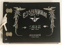
1951BBO25<p>Korean War<br /></p><p><i>Commemorative Album of Photographs on the Second Year Anniversary of the Korean War</i>.</p><p>Ministry of National Defense Republic of Korea 1951.</p><p>Oblong 4to 31 leaves with protective tissue; with commemorative text: 6.25 Korean War emblem: winged five-point star and anchor 2nd Year D.N.D. R.O.K. flanked by Birds of Paradise executed in mother of pearl woven silver silk tie. </p><p>Containing 77 original photographs documenting the events and players in the war including President Syngman Rhee Douglas MacArthur etc. with typed captions a page of dedication with presentation To Ambassador De Tervarent … Tao-Yong Shinn Minister of National Defense Republic of Korea . </p><p>An official album presented to the Belgian Ambassador and Plenipotentiary Minister in Japan Chevalier Guy de Schoutheete de Tervarent 1891-1969 Belgium being one of the 17 countries which furnished military forces in support of the United Nations Security Council resolution to defend South Korea. Most likely each of the Allied nations received such an album as a souvenir.</p><p><br /></p> Ministry of National Defense hardcover
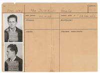
1945264850Krems Austria 1945. 4to and smaller. Some toning overall very good. 4to and smaller. Identity documents and ephemera of American Air Force tail gunner Sgt. Gerald McDowell 1923-2002. McDowell and the flight crew of the B17 nicknamed Hell's Belle survived being shot down over Germany in 1943 and were interned at Stalag 17B in Austria. At the war's end the camp guards marched American prisoners west to meet the U.S. Armored Division at Braunau and avoid the Soviet troops occupying eastern Austria. McDowell wrote a memoir of his war experiences A Tail Gunner's Tale 1991. Stalag 17 gained notoriety from the 1953 Hollywood film of the same name staring William Holden.<br /> <br /> Comprising:<br /> <br /> 1. Camp identification document for Gerald McDowell no. 100478 with two photographs side and profile with chalk board identity number. Old fold splt repaired on verso. With corresponding stamped metal badge. Illustrated at p. 114 of his book<br /> <br /> 2. Broadside: Kgf.-M.-Stammlager XVII B. Teillager der Luftwaffe. Lagerführung. Gneixendorf June 11th 1944. Warning ! 1. Any P.o.W. touching or crossing warning wire during day-time will be fired upon immediately. . Stencil printed signed in ink by "E-" above stencil legend: Hauptmann and 1st Lageroffizier. Old folds. Tipped onto card. Illustrated at p. 90 of his book. Of extreme rarity.<br /> <br /> 3. BATCH D.B. Pencil portrait of Gerald McDowell Signed and dated lower right D.B. Batch P.O.W. 13/1/45 Krems Austria. 9 x 6 inches. Tipped onto card. Framed.<br /> <br /> 4. Recipes for "D-Bar Spread" "Chocolate Cream Pudding" "Gallop" and other P.O.W. dishes using D-Bars C-Rations "Jerry" sugar etc. 5 small cards closely written on versos of typed prisoner ID fiches 4 x 2 inches. Tipped onto card. Toned.<br /> <br /> with:<br /> 5. PHELPER Ben H. Kriegie Memories title from cover. Photographs and handwritten text. 64 pp. Aurora Illinois: Printed by Barker printing Co. 1946. Blue leather grained cloth upper cover titled in gilt. OCLC: 85169189 4 copies. Inscribed by the author on the first blank "Jerry: May you always be free and happy. Good luck Ben". Rare privately printed account of experiences inside Stalag 17B by "Luftgangster No. 113204" with photographs of camp life and of the march towards liberation in May 1945. With a dozen annotations by McDowell usually in red ink indicating himself or other fellow inmates in the photographs including a picture in the "Cardboard Playhouse" of McDowell in a dress captioned in the text "a glamour shot of one of our boy actors . Some of the lads sure did look good when they made up as a girl." Presentation copy of an astonishing illustrated narrative<br /> <br /> 6. MCDOWELL Gerald. E. A Tail Gunner's Tale. Vantage Press 1991. Review copy as new. unknown
19451017761945. WORLD WAR II KEYES Geoffrey Lt. Gen. Archive: Hand-colored and annotated map outlining the division of Germany; 25 contemporary V-Mail letters from Keyes to his wife. Waiblingen-bei-Stuttgart Germany: 649th Engineer Topographic Battalion June 1945. Broadside map measures 22 by 29 inches titled ""Administrative Map of Western-Germany June 4 1945."" V-Mail letters each measure 4-1/4 by 5-1/4 inches. $12000.Lieutenant General Geoffrey Keyes' unique hand-colored and annotated map outlining the division of Germany per the Berlin Declaration produced just after Germany's unconditional surrender along with 25 contemporary letters by Keyes to his wife discussing the dramatic events of these historic times.It was agreed at the Yalta Conference held in Crimea February 4-11 1945 that after the war Germany would be split into four occupied zones: American British French and Russian. On May 7 1945 Germany signed an unconditional surrender at Allied headquarters in Reims France to take effect the following day. The Berlin Declaration of June 5 1945 confirmed the division of Allied-occupied Germany into four occupation zones according to the Yalta Conference. The map is titled ""Administrative Map / Western-Germany"" dated ""4 June 1945"" printed by the 649th Engineer Topographic Battalion 649th Engr. Top. Bn 1945"" in Waiblingen-bei-Stuttgart. The landkreise rural district stadtkreis urban district within landkreis and land boundaries made up of adjoining stadtkreis are noted. Identified with flags there are three Region Headquarters Darmstadt Marburg Stuttgart and five R.B. Headquarters Frankfurt Kassel Wiesbaden Mannheim Karlsruhe.Eight areas are outlined by hand in various colors. There are 17 landkreis at the western and southern borders of this map which are not outlined. These areas are in the French occupied zone. France was not represented at Yalta and Russia would only agree to a separate French occupation zone ""within the British and American zones."" It is possible that when this map was printed it was not yet determined if the 17 non-outlined landkreis were American. The four divisions were not confirmed until the Berlin Declaration on June 5 1945 the day after this map was published. The French zone includes the stadtkreis Baden-Baden and Bavaria. The French zone bordered mostly France and Switzerland but also small parts of Belgium Luxembourg and Austria. Included is a color photocopy of the four occupied zones indicating the area depicted in the Administrative Map of Western-Germany here offered.Also present are 25 pages of V-mail each 4-1/2 by 5-1/4 inches from Lieutenant General Keyes to his wife May-August 1945. She was living at the Hotel Tayer West Point. V-Mail used standardized stationery and microfilm processing to produce lighter smaller airplane cargo making space available for war supplies. V-Mail was used from mid-1942 to the end of 1945. Excerpts: ""The capitulation of the Germans yesterday has us all on the humpjust as much so as while we were still fighting We are still awfully busy even if the fighting has ceased on this front VE Day!! Now if we can quickly wind up the Jap affair we can really relax We move to Salzburg this week Well here we are installed in the Archbishop's Palace sweetheart each room is large enough for a battalion almost flew to 3d Army to attend the homecoming ceremonies for Gen. Patton. It really was a great show and he was in rare form Had a nice visit with him With the approaching end of the Jap war it will certainly be open season on generals! Sunday is to be a gala day All the High Commissioners of Austria are gathering and Gen Clark's guests and others are going to the music Festival just had a call and a concert by the Vienna Boys Choir This afternoon the No 1 British French & Russian VIPs are coming to Salzburg as Gen Clark's guests and big festivities are slated "" From the estate of Lieutenant General Geoffrey Keyes.Map folded into quarters with a few minor wrinkles pinholes at corners from posting it on a wall or bulletin board. Near-fine condition an exceptional archive. unknown
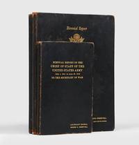
1943190146Washington: United States Government Printing Office 1943-45-46. Presentation copies from General George Marshall to his "miracle worker" General Brehon B. Somervell A complete set of the original official US Army wartime reports handsomely produced the personal copies of General Brehon Burke Somervell 1892-1955 George Marshall's commander of Services of Supply the first two being presentation copies from Marshall the cover of each volume gilt lettered with Somervell's name and rank. Services of Supply was one of the three "superagencies" organized by the US Army after the United States's entry into the war in December 1941 - the other two being Army Ground Forces and Army Air Forces - and gathered under its overarching aegis Quartermaster Corps Chemical Warfare Service Signal Corps Corps of Engineers Ordnance Department Medical Corps and Transportation Corps. "General George C. Marshall the army's chief of staff during World War II held Somervell in high regard for his ability to perform monumental tasks and was willing to overlook his penchant for antagonizing others. "What he did was a miracle" said Marshall in a postwar interview. The U.S. Army in World War II was probably the best-supplied army that had ever gone to war. Much of the credit for that accomplishment goes to Somervell who provided the "sinews of war" for a military effort that literally spanned the globe" American National Biography. Somervell is mentioned directly by Marshall in his concluding remarks to the first volume where he notes "The requirements of logistics are seldom understood. The burdens they impose on the responsible military authorities are rarely appreciated. The conflicting demands of our theater commanders of Allied sovereign powers and of the home front pose difficulties never before approximated in war. The necessity for a high degree of efficiency in management is evident and it has been found in the coordination of all the various supplies and administrative departments of the Army under the command and leadership of Lt. Gen. Brehon B. Somervell. "Published at two-year intervals these reports provide a comprehensive picture of global war as seen from the perspective of the Chief of Staff. The first report describes the race to mobilize an unprepared country and Marshall's appeal on the eve of war for the renewal of Selective Service a reminder of how far the U.S. Army had to come to meet the Axis challenge. The second recounts the initial defeats after Pearl Harbor and the ultimately successful efforts of the United States and its Allies to turn the tide. The final report describes the drive to victory and outlines Marshall's analysis of the reasons for the Allied triumph. Summaries give an overall view of the progress of the war but the scholar and military professional will find most interesting Marshall's comments on such topics as technology the "90-division gamble" the replacement system troop morale and the citizen-soldier and demobilization. These comments and the other material presented in the reports provide not only a fresh perspective on the myriad problems of conducting a global war at the highest levels but also renewed appreciation for the man whom Churchill appropriately called 'the organiser of victory'" Brigadier-General John W. Mountcastle foreword to the 1996 Center of Military History edition. This is a set of the scarce original edition produced by the United States Government Printing Office in Washington; trade editions were also produced by the Infantry Journal Press in the US and HMSO in Britain. The set comprises: Biennial Report of the Chief of Staff of the United States Army July 1 1941 to June 30 1943 to the Secretary of War. Octavo pp. v 56. 6 folding maps and 19 folding charts. Presentation copy from General George Marshall inscribed on a preliminary blank: 'To General Somervell with appreciation and warm regard G. Marshall". Biennial Report of the Chief of Staff of the United States Army to the Secretary of War July 1 1943 to June 30 1945 to the Secretary of War' Quarto pp. iii 123. bound with the supplementary Atlas of World Battle Fronts in Semimonthly Phases to August 15 1945 pp. 101. Presentation copy from General George Marshall inscribed on a preliminary blank: "Dear Somervell - Please accept this copy of my final report as Chief of Staff with appreciation of your tremendous service to the army and support of me with my affectionate regards - G. Marshall October 5 1945". Report by the Supreme Commander to the Combined Chiefs of Staff on the Operations in Europe of the Allied Expeditionary Force 6 June 1944 to 8 May 1945. Quarto pp. x 123. Several colour maps. 3 vols one octavo 232 x 135 mm 2 quarto 305 x 210 mm. Contemporary black pebble-grained skiver gilt lettered on front covers first 2 vols with dark blue vertical-rib cloth endpapers third with white moiré silk-effect endpapers. Bindings a little worn at extremities some mottling to covers scattered foxing otherwise very good. hardcover
185521630Washington D. C.: Gpo. Very Good. 1855-1857. First Edition. Hardcover. The first 8 volumes are uniformly bound in contemporary three-quarter red leather. The last four volumes have been rebound to match in red cloth. Volumes 2 6 & 7 have some damp-staining. Moderate foxing. ; 4to 11" - 13" tall . Gpo hardcover
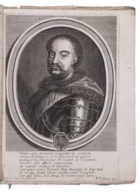
168722346Bordeaux: Pierre Abegou 1687. Marbled wrappers. 4to. With an inserted latter engraved frontispiece portrait of the Polish King Jan III Sobieski engraved by F. Jollain. Very rare pamphlet published during the European wars against Turkey with a frontispiece portrait of the Holy Roman Emperor Léopold I 1640-1705 Archduke of Austria and King of Bohemia and Hungary. He succeeded his father Ferdinand III in 1657 and immediately had to fight against the Turks in the Great Turkish War also known as the War of the Holy League 1683-1699. This war finally led to the Peace of Karlowitz in 1699.This work gives directions and arrangements for ritual processions that the Turkish Sultan Suleiman III ordered after his victories during the so-called Holy Wars against the Christians. It is of great importance for our understanding of the problematic Turkish-European relations during the 17th century especially as an interesting example of counter-propaganda. One of Suleiman IIIs directions presented in the book for example ordered that one Christian slave or one Jew was to be killed every fifteen minutes as part of the procession. One can imagine the reaction of a Christian reading this text: although the crusades were over this could provoke war and violence between the parties.Wrappers worn and somewhat frayed a few worm holes but still in good condition.l Bibliotheca bibliographica Aureliana CX XVIIe siècle XIV Bordeaux 2176 not mentioning the portrait; cf. Desgraves Bordeaux 1580. Pierre Abegou, unknown
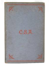
1882H-104A very rare signed edition of privately printed 100 copies of Captain Francis W Dawson's memoir by The News and Courier Book Press. Blue-gray cloth binding decorated with red stamped C.S.A and embellishments. 240 x 150 mm. 9 3/8 x 5 7/8". 180 pp.Author signed: "Mr. W.L. Daggett from F.W. Dawson Jan 1883". The author inscribed this book to William L. Daggett 1824-1889 a printer working for the Charleston's News and Courier with Dawson. Presumably Mr. Daggett was responsible for printing this book making this a presentation copy.This very rare book is a remarkable account of an Englishman traveling to the American South to join the Southern Confederacy. His book includes 18 wartime letters to his friends and family in England.Note: A few pages pp 9-16 inside are loosening from spine not completely detached there is also no loss to text or tear hence we have adequately reduced the price. Overall this book is in great condition and would be a beautiful addition to the library of someone passionate about the American Confederacy. hardcover
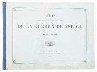
54197Madrid 1861. FIRST EDITION. Large oblong folio. 52 x 70 cm. Original printed blue boards. Complete with title index first part title and 12 text leaves second part title and 20 plates lithographs with hand-colourof battle plans &c. inc 6 double page and third part title and 12 very fine tinted lithographs by J. Donon after Hurrel and Velasco Madrid 1861 hardcover
1904150900Berlin: Kartographische Abteilung der Königlich Preußischen Landesaufnahme 1904. One of just two known complete sets An exceedingly rare large 15-sheet map of China's strategically pivotal Liaodong Peninsula printed for senior German military commanders during the Russo-Japanese War and the Japanese siege of Port Arthur. We have traced one complete set at the Berlin State Library and the University and State Library Darmstadt has an incomplete set of six sheets. For the German army possessing up-to-date information on Liaodong was pressingly essential. Despite being officially neutral during the conflict Germany had significant geopolitical interests in north-eastern China having acted with Russia and France in 1895 to curtail Japanese expansion in East Asia after the First Sino-Japanese War. Russian-Japanese hostilities in particular the gruelling engagements around Port Arthur also threatened to spill over into Germany's nearby maritime territorial concession Qingdao. This highly detailed cartographic production printed at a scale of 1:42000 from Russian military maps from 1898-99 shows settlements of every size topography and spot-heights roads railway lines and other information of use in any potential military operation. 16 untrimmed photolithographed sheets 670 x 630 mm to 170 x 510 mm colour and black and white including 15 map sheets combining to form one large map as well as one key sheet with contemporary supplementary annotations. Generally clean and bright several sheets with fraying in margins 1 sheet with few tape repairs on verso 2 sheets with small loss at head in 1 case just crossing neatline occasional creases. A well-preserved set. unknown
1910138398London: His Majesty's Stationery Office 1910-20. With over 100 maps and plans First edition one of only 250 possible complete sets with the bookplate of Thomas Beaumont Hohler Second Secretary at the British Embassy in Tokyo from 1902 to 1905. During the Russo-Japanese War Hohler visited the front as an observer and enjoyed a strong relationship with the commander of the Japanese navy Vice-Admiral Saito Makato. The last complete set to appear at auction sold at Sotheby's in 1982. "As record of what actually happened this is probably the best account of the Russo-Japanese War produced by any general staff in Europe. Reports of the British observers and the official accounts of Austria Germany the United States Russia and Japan were all consulted; Russian authorities provided much useful information and the proofs were 'very carefully revised' by Japanese military officers in Tokyo" Higham. The volumes were compiled by a team led by Sir Ernest Swinton 1861-1951 the head of Historical Section of the Committee of Imperial Defence and the future inventor of the tank while Russian documents were translated by Archibald Wavell 1883-1950 later Viceroy of India. Swinton's group completed the series by 1914 but the outbreak of war delayed the printing of the third volume until 1920. Of Volume II only 250 copies were printed compared to 2000 for Volume I and 1500 for Volume III. Working under the leadership of Sir Claude Macdonald Hohler 1871-1946 monitored the course of the war and advised Britain's Japanese allies. Re-assigned in 1906 he later served as Secretary of Legation Mexico 1910-17 and was the diplomat responsible for intercepting the Zimmerman Telegram. Further postings took him to the US Turkey Hungary and Denmark. His describes his time in Japan in his Diplomatic Petrel 1942. Together 3 vols and 3 map cases octavo. vols with half-tone frontispieces 20 plates 18 folding views sketch 17 maps/plans 16 folding 7 folding tables 2 folding diagrams; 4 folding tables in appendices vol.; 95 folding maps and plans 1 on wax linen housed across 3 map cases. Original blue cloth spines lettered in gilt. Vol. III map case with appendices volume in original printed wrappers as issued. Ownership signature in each volume and case of one G. D. Dixon stating that set was purchased on 17 November 1951 on the Charing Cross Road London. Cloth soiled in places extremities worn; Vol. I front inner hinge tender Vol. II with professional repairs to spine joints and hinges Vol. III with old and crude brown tape repairs to front inner hinge frontispiece and first few leaves; Vols II & III map cases repaired and strengthened a little lettering re-touched; a few folding illustrations creased or proud where sometime incorrectly refolded several maps plans and views with old and crude tape repairs occasional negligible stub tears a few items in Vol. III map case with losses at corners and several annotated with numbers: a very good set. Higham p. 492. hardcover
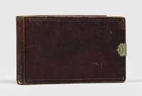
1861152570Tientsin: 1861. Peace reigns in Tianjin after the bloody taking of the Taku Forts Highly engaging album the core of which comprises 26 sketches of Tientsin Tianjin in 1861 sketched by Ensign Francis Sadleir Brereton the year following the conclusion of the Second Opium War; with additional views of Singapore and Java. A unique visual record of Qing dynasty Tianjin as seen through the eyes of a young British army officer. Brereton 1838-1911 was commissioned ensign in the Royal North Gloucestershire Militia in November 1855 transferring to the 2nd Battalion 60th Rifles in December of the same year. Even among sharpshooters he was clearly a crack shot serving as inspector of musketry and winning both the Ladies' Purse and Challenge Prize. In 1857 he sailed with his battalion to South Africa. Following service in India during the Rebellion and in China during the Second Opium War he resigned his commission in 1865. He afterwards practised as an architect with his father-in-law Frederick Beeston then independently as an architect and surveyor. In 1889 he was elected to serve on the first London County Council. During the 18th century drawing masters were established at the military training centres at Woolwich Chatham High Wycombe and Addiscombe with the aim of instructing officer cadets in drawing and watercolour. Although there is no record of Brereton having studied in this way his sketchbook comprises an accomplished series of views very much in the tradition of the soldier-artist. In light of his subsequent career his interest in architectural detail is evident in a number of highly worked and painstaking sketches of temples and cityscapes occasionally employing dense hachures and some interesting compositional framing. To the modern eye they have a haunted quality reminiscent of the deserted vistas of Giorgio de Chirico. Views are in the main captioned on verso some at lower right of image all of Tientsin each dated 1861 and initialled unless otherwise noted: View of traditional roundhouses in a landscape "Head Quarters Square 2/60th Royal Rifles" "South West angle Tien Tsin Wall" "Mahomedan Temple" "Bell Temple" "Treaty Joss House" "Pallisir's Grave" Lieut. John R. Palliser 2. Battalion 1st Royal Foot died of fever after taking part in the capture of the Taku Forts "Old Castle near Tien Tsin" View of wall and fort View of fortified tower Three temples "South Forts" double-sheet panorama "Angles of Treaty Joss House" "Treaty Joss House" "Tien Tsin from West Gate" "West Gate from the Wall" "Tien Tsin from East Gate" "Tien Tsin from North Gate" "North Gate Tien Tsin from street" "Tien Tsin from South Gate" "English burial ground & Treaty Joss House from South Gate" "Chinese Graves French Side Tien Tsin" "South Forts Tien Tsin" "South Taku Fort" "2nd North Taku Fort" "Chinamans Houses French Side Tien Tsin" 59th Regiment graveyard "Singapore" seascape "Singapore Nov. 16 1861" double-sheet panorama of the coastline showing junks and ships Java double-sheet panorama with shipping in the foreground View of palm trees in a mountainous landscape Plus another 26 views and sketches 6 double-sheet executed later with appealing panoramas in the west of Scotland Dunoon Tarbert Dumbarton Bowling and elsewhere. The album is accompanied by a typed letter by the popular boys author Lt.-Col. F. S. Brereton 1872-1957 reading in full: "These sketches were made by my father Ensign Frank Sadleir Brereton 2nd Battn. 60th Rifles when on service with his regiment in China 1861. The first action in which he was engaged was I believe an attack on the Taku Forts when he and a small command went over the side and waded ashore" undated personal stationery. Albums such as this are certainly not common on the open market and this is a particularly attractive exemplar. Landscape octavo 105 x 182 mm. Contemporary dark red roan sketchbook by Henry Penny metal clasp stamped with his name label to front pocket gilt patterned endpapers marbled edges; some 60 leaves in all 26 with views of Tientsin and environs plus blanks one of two leaves toward the end excised. Housed in a burgundy cloth flat-back box by the Chelsea Bindery. Loss of leather at foot of spine minor scuffing expected rubbing and signs of handling otherwise remarkably well preserved. hardcover
1417131561At sea: 1914-17. Including an eyewitness account of the war's first British-Ottoman military engagement A detailed firsthand account of naval operations in the Middle Eastern theatre during the war's formative first year. HMS Minerva saw action at the 1 November Battle of Akaba the first British attack on Turkish forces after Mehmed V joined the Central Powers and later at Gallipoli. The log substantially enriches the publicly available captain's record. Its author John Robert Butland 1869-1932 joined the Royal Navy at 18 served until 1912 and was recalled in August 1914 when reserves and pensioners were mobilised by royal proclamation. As Minerva's master-at-arms he served aboard the Eclipse-class cruiser from 1914 to 1917 before two further years on HMS Victory and final discharge in February 1919. Minerva joined Admiral de Robeck's 9th Cruiser Squadron in August 1914. A meticulous diarist Butland devotes extended entries to 1914-15. The diary opens on 2 August 1914 the day of his recall and follows Minerva to Port Said where passage through the Suez Canal was delayed by mine-sweeping amid fast-moving diplomacy. "30 October. About noon we got the news that England and Turkey would be at war in a few hours. That means plenty of fighting out this way". On 1 November the ship was ordered to Akaba: "On arrival at Akaba we at once commenced bombarding. 4 pm exactly as forts would not surrender. Turks made escape to the mountains our small guns firing Lyddite shell at them. A lot did not get far". Subsequent entries describe landing parties skirmishes ashore and include a translation of a British proclamation of friendship posted in the town. Akaba remained central to operations. The ship patrolled the gulf landed troops and countered renewed Turkish activity: "29 Nov. Arrived 'Akaba' 12 noon. Visited the town and found that the Turks had been back and had started rebuilding some of the places up again. No doubt their scouts on the high hills each side of the gulf saw us coming and gave the alarm." A French hydroplane was landed for reconnaissance and on 16 December the ship was attacked at night by Turkish forces who had secretly emplaced guns on the beach. A later landing turned into a desperate rescue vividly recorded: "The order was given to land a large party to rescue the few Marines that had been landed Some severe rifle fire took place. The Turks finally left their position and left for the hills being shelled from the ship they lost heavily." In 1915 Minerva operated at El Tor and Abu Zenima and took part in the raid on the Suez Canal. On 16 April she intercepted and destroyed a Turkish torpedo boat threatening a troop transport: "Seeing that she was cornered she turned to port and ran up on the shore We sent a party over with explosives and blew her up glad to know we had done a little more for King and Country." The ship then supported the Gallipoli landings with sustained bombardments later joining the action at Suvla Bay "This is the hottest engagement the Minerva has been in so far" - 7 August. In 1916 Minerva patrolled from Suez refitted at Singapore and later returned to Aden to survey landing points near Rabigh. As the focus of operations shifted to Mesopotamia she was redeployed to Africa and paid off at Simonstown. Quarto 235 x 190 mm. Mimeographed slips naval signal forms sketch map and other ephemera tipped in. Original black boards recently rebacked with purple cloth with 121 leaves completely filled in neat manuscript a few blank leaves at end. Binding sturdy usual rubbing and evidence of use: very good. hardcover
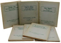
1946140941373Washington D.C.: U.S. Government Printing Office 1946. First Edition. Very Good. First edition first printings. Seven titles: Wartime Exile 167pp.; Impounded People 239pp.; The Relocation Program 105pp; Administrative Highlights of the WRA Program 82pp.; Token Shipment 104pp.; The Evacuated People 200pp.; People in Motion 270pp. Good. Wraps worn some soiled foxed chipped or stained; People in Motion has a long tear to the rear cover. Handwritten titles on spines which are also creased and chipped with loss to spine ends. Pages toned sometimes creased. <p><br /> <br /> Rare documents of the American government's official record of its WWII internment of people of Japanese descent one of the most controversial official programs in American history as reported by the War Relocation Authority. The WRA managed the forced confinement of people of Japanese ancestry in America during World War II as well as their return to civilian life with the commencement of the war. U.S. Government Printing Office unknown
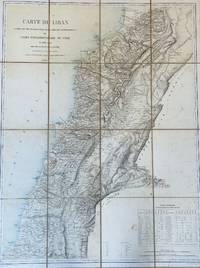
18622737Paris: Imp. Lemercier rue de Seine 57. Gravée per Erhard Schièble rue Bonaparte 42 1862. Color lithograph map in 16 sections mounted with linen. Bookseller’s vignette on verso A. Corion Succ.r de H. Dorlin Paris. Map somewhat tanned with few stains and light foxing. Linen tanned worn at the two outer foldings of the upper section. Overall in very good condition. Color lithograph map in 16 sections mounted with linen. Bookseller’s vignette on verso A. Corion Succ.r de H. Dorlin Paris. 74 × 96.5 cm. First edition of the most important map in the history of Lebanon the first scientific map of the country.<br /> A highly detailed separately issued large-format lithograph scientific map of Lebanon “based on surveys conducted by French military topographers during their Lebanon-Syria Expedition of 1860–1861. This map defined the notion of ‘Greater Lebanon’ the basis for the creation of modern Lebanon in the wake of the 1919 Paris Peace Conference. Lebanon was at that time part of the Ottoman Empire. The cartographic part of the mission was headed by Captain Charles Gelis who led teams that made advanced systematic trigonometric surveys of the countryside representing the first time that Lebanon had ever been accurately topographically mapped. Map extends into parts of Israel and Syria. Showing cities towns villages Christian monasteries mosques fortified places windmills aqueducts landmarks roads rivers mountains districts which are labeled with their names. Includes Table of population. Relief shown by hachures formlines and spot heights.†David Rumsey Map Collection The statistical table in the bottom right gives the population of the major towns and cities in Lebanon by religion. <br /> Scarce no records on RBH. Imp. Lemercier, rue de Seine 57. (Gravée per Erhard Schièble rue Bonaparte 42) unknown
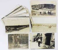
19216158Various places in Mexico Texas and Arizona 1921. Overall about very good. 106 real photo postcards including six duplicates. Varying sizes but most approximately 3.5 x 5.5 inches. Scattered contemporary and later manuscript annotations. Light wear at edges occasionally a bit heavier. Some scattered damp and dust soiling. A substantial collection of over 100 real photo postcards that depict scenes from the Mexican Revolution and the related border war interventions of the United States Army. The images included here some quite violent in nature are dated from 1913 to 1922; most are captioned in the negative. They show ruined buildings military encampments injured soldiers and corpses on both sides of the U.S.-Mexican border and in Veracruz. Also included are identified portraits of individuals such as Francisco Madero Pancho Villa on his deathbed and American General John Pershing. Many of the images are by El Paso photographer W.H. Horne who was one of the most prominent photographers of Border War incidents captured the Columbus Raid in New Mexico and photographed skirmishes near his home in El Paso. Also present are a short series of images by Cal Osborn who documented border incidents near Douglass Arizona and a group by William Hadsell William Hadsell an American resident of Veracruz who ran a Kodak store and was a prolific recorder of events there. Several Mexican photographers are represented as well. Many of the photos are quite gruesome in nature and show corpses in various states of decomposition as well as the aftermath of battles and executions but in all provide an arresting visual document of the interventions by the United States in Mexico during the 1910s. Powerful images of the Mexican Revolution and the resulting upheaval there and along the border with the United States. unknown
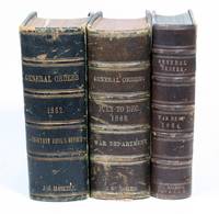
18622923Washington D.C.: War Department 1862. Calf marbled boards. Very Good. FIRST OBTAINABLE PRINTING OF THE PRELIMINARY EMANCIPATION PROCLAMATION setting a date for the freedom of more than three million enslaved in the United States and reframing the Civil War as a fight against slavery. Issued by the War Department to regimental commanders in the field during the Civil War in the week after the completion of President Lincoln’s official manuscript version. Contained is a set of three volumes of General Orders covering the full year 1862 July-Dec 1863 and the full year 1864. History of the Emancipation Proclamation:<br /> <br /> “The proclamation has been called by responsible persons one of the three great<br /> documents of world history ranking with Magna Carta and the Declaration of<br /> Independence†– Eberstadt<br /> <br /> “From the first days of the Civil War slaves had acted to secure their own liberty. The Emancipation Proclamation confirmed their insistence that the war for the Union must become a war for freedom. It added moral force to the Union cause and strengthened the Union both militarily and politically. As a milestone along the road to slavery’s final destruction the Emancipation Proclamation has assumed a place among the great documents of human freedom†– National Archives<br /> <br /> Following the Seven Days Battle and General McClellan’s retreat from the Peninsula at the end of June 1862 President Lincoln realized that there would be no early end to the war and found himself “as inconsolable as it was possible for a human to be and yet live.†Anxious for news from the army and needing to escape the constant interruptions at the White House he frequently visited the telegraph office in the War Department building to await dispatches. It was during one such visit early in July that he asked the chief of the telegraph staff Major Thomas Thompson Eckert for some paper to “write something special†and began the first draft of the Emancipation Proclamation completing it in a few weeks. Lincoln had long hoped to resolve the slavery issue through a congressional act of emancipation compensating slave owners for their loss of “property†but that approach was roundly rejected by representatives from the border states leaving the President who had decided upon the necessity of emancipation with a presidential proclamation as the only option. The extraordinary document he conceived would announce the liberation on January 1 1863 of all slaves in those states still in rebellion against the Union and promised compensation to slave owners in those states that returned to the fold before that time if they adopted “immediate or gradual abolishment of slavery.†This proclamation would be followed by a final proclamation issued on the 1st of January identifying those states still in rebellion and confirming the liberation of all slaves therein.<br /> <br /> On Tuesday July 22 Lincoln presented his draft to the Cabinet telling them that he had resolved firmly upon the course of action it specified and asking them not for advice but suggestions. The only observation he had not anticipated came from Secretary of State Seward who proposed that it might be best to wait for a military victory before issuing the Proclamation as it could otherwise seem like “the last measure of an exhausted government.†Immediately recognizing the wisdom of the suggestion Lincoln held back. On September 17 after an anxious wait of nearly two months he received the victory he needed at the bloody Battle of Antietam. Completing his final draft Lincoln presented it to his cabinet for refinement on September 22. Following the meeting Seward took the amended draft with him to the State Department where a formal manuscript copy was made then signed by Lincoln and Seward. The formal official “Emancipation Proclamation†was of course issued on January 1 1863 the day it became the law of the land.<br /> <br /> Printing History:<br /> <br /> This printing in the War Department’s official “General Orders†is the fourth printing overall but realistically the first obtainable printing. It is preceded by:<br /> <br /> -The first printing Eberstadt #1 a small three-page circular intended for distribution within the government and to the local press likely printed on September 22. At the time that Charles Eberstadt published his study of the Proclamation 1950 he was able to locate only one copy which he himself owned and as nearly as we have been able to determine no other copies have come to light since then.<br /> <br /> -The second printing Eberstadt #2 may be a phantom printing. Charles Eberstadt was not able to locate a copy but he inferred its existence from the standard State Department practice of printing a folio edition consisting solely of the text of the proclamation followed by another printing consisting of the text of a letter of transmittal from the Secretary of State as well as the text of the proclamation. While there may be a copy of Eberstadt #2 in the National Archives as he speculated it is not recorded in their online catalogue nor have we been able to find a copy in any other online catalogue including OCLC the Library of Congress and the Abraham Lincoln Library.<br /> <br /> -Eberstadt’s third printing is of legendary rarity. It consists of Secretary of State Seward’s one-page letter of transmittal addressed “To the Diplomatic and Consular Officers of the United States in foreign countries†and the text of the proclamation. Eberstadt located a total of only five copies in institutions at the Library of Congress the National Archives Yale the Clements Library and Brown. OCLC does not record any additional copies nor is it recorded in Monaghan. There has been one copy at auction $400000 in 2021 and that was described as the only copy in private hands. <br /> <br /> -The present copy General Orders No. 139 is Eberstadt’s fourth printing of the Preliminary Emancipation Proclamation dated in print on September 24. Eberstadt surmises that this field order printing could have been accomplished as late as September 29 or 30. Although it may have been printed in as many as 15000 copies it is very rare in commerce likely due to the ephemeral nature of the printing and distribution.<br /> <br /> Additional General Orders and Provenance:
<br /> <br /> The three volumes once belonged to John G. Haskell A.Q.M. Chief Quartermaster and contain the General Orders for the year 1862 July-December only for the year 1863 and for the full year 1864. John Gideon Haskell 1832-1907 was a resident of Kansas and joined the Union Army when the war broke out. He enlisted with the 14th Kansas Volunteer Cavalry Regiment and later served as Assistant Quartermaster General of Kansas as quartermaster of the Third Kansas and the Tenth Kansas Volunteers as Captain and Assistant Quartermaster on the staff of General James G. Blunt and as Chief Quartermaster of the Army of the Frontier. After the war Haskell was named official state architect and worked on the state house the capitol the State University and more.<br /> <br /> In addition to the preliminary Emancipation Proclamation the three volumes also contain the Acts of Congress on many other subjects including pay discharge recruitment handling of troops etc.<br /> <br /> Washington D.C.: War Department Adjutant General’s Office 1862-64. Three volumes. Small octavo contemporary three-quarter brown morocco two volumes with cloth boards one with marbled boards. Some rubbing and wear to bindings pencil notations on endpapers with collation and highlighting certain orders and some internal pages. Dampstaining to general title of 1862 volume; internal text and Emancipation Proclamation generally fine. RARE AND IMPORTANT.<br /> <br /> References:<br /> <br /> Charles Eberstadt. “Lincoln’s Emancipation Proclamation.†New York: 1950. War Department unknown
1808367005London: P. Mason at Steel's Navigation Warehouse 1808. Blue-backed sea chart. Insets of the harbor of Rio the Bay of All Saints and the Island of Fernand Noronha. Manuscript annotations by Conner plotting the course of the USS Hornet in the War of 1812. Approx. 31 x 70 inches. Tape repairs on verso some staining. Manuscript note on verso by Philip Syng Physick Conner. Blue-backed sea chart. Insets of the harbor of Rio the Bay of All Saints and the Island of Fernand Noronha. Manuscript annotations by Conner plotting the course of the USS Hornet in the War of 1812. Approx. 31 x 70 inches. Pennsylvania native David Conner joined the navy as a midshipman in 1809 and during the War of 1812 served with distinction aboard the USS Hornet where he rose to the rank of first lieutenant during the war. He participated in action aboard the Hornet against the HMS Peacock in February 1813 and in the March 1815 capture of HMS Penguin and was awarded two medals of valor. In 1817 he was commissioned first lieutenant under Captain Biddle aboard the USS Ontario for its voyage to the Pacific. He would eventually rise to the rank of Commodore commanding the blockade of the Gulf Coast during the Mexican War and responsible for landing Scott's army at Vera Cruz.<br /> <br /> On October 26 1812 the frigate USS Constitution and sloop USS Hornet left Boston to raid British shipping along the coast of South America. The Hornet sailed under the command of famed American naval captain James Lawrence best remembered for his order "Don't give up the ship" in the June 1813 battle between the Shannon and the Chesapeake. After a couple months cruising the waters off the coast of Brazil on February 24 1813 the USS Hornet engaged the HMS Peacock off the mouth of the Demerary River. Exchanging broadsides the Hornet's cannons shot true damaging the British ship. Outmaneuvering the Peacock downwind the Hornet approached from the stern firing and forced the Peacock which had lost her captain and taken heavy casualties to strike. The American ship sent on a boarding party but the Peacock quickly sank. <br /> <br /> This large sea chart oriented with north to the east depicts the coast of Brazil from Sao Luis Maranhao to the Lagoon Merim and is profusely annotated by Conner charting the cruise of the Hornet off the coast between December 1812 and February 1813 i.e. the movements of the ship prior to the engagement with the Peacock. Included in the manuscript additions is evidence of the brief blockade of the English frigate Bonne Citoyenne at Salvador where Lawrence challenged the ship to single ship combat with the Hornet but had to abandon the blockade upon the arrival of a British line of battle ship. "Running up the coast she took on January 6 1813 the schooner Ellen loaded with dry goods . On the fourth of February off Pernambuco she seized the brig Resolution ten guns carrying coffee fustic etc. from Rio to Marnaham and a nice little purse containing 23000 in specie. This the Hornet put intop her opwn pocket and then burnt the brig" Conner. After several more weeks of cruising the Hornet engaged the Peacock.<br /> <br /> On June 18 1914 auctioneer Stan V. Henkels sold the books papers journals and log books from the younger Conner's library which included Lt. David Conner's original logs of the voyage of the USS Ontario now at the Library of Congress MSS84251. The present map was not included in that sale; however it appeared within lot 71 at Parke Bernet on May 25 1971. Conner Philip Syng Physick. "The Hornet's Sting and Wing" in The New England Magazine Vol. XXIII No. 3 Nov. 1900 pp. 268-274 P. Mason at Steel's Navigation Warehouse unknown
19431050611943. WORLD WAR II. Archive: Wake Island Raid maps photographs and documents. Near Wake Island: Intelligence Center Pacific Ocean Areas October 5-6 1943. Sixteen maps photographs and documents; maps range in size from 8 by 8 inches to 18 by 21-3/4 inches; photographs range from 6-1/4 by 8 inches to 18 by 9-1/4 inches. $9500.Superb archive of rarely seen map and photographs used in planning and documenting the October 5 1943 raid on Wake Island which was taken by the Japanese only weeks after the Pearl Harbor attack.Wake Island a U.S. airbase located approximately 2200 miles west of Pearl Harbor was captured by the Japanese in late December 1941. The island remained under Japanese control until the garrison there surrendered on September 7 1945. In October 1943 a U.S. task force conducted a two-day air raid on the island. The Japanese commander Shigematsu Sakaibara convinced the raid was the beginning of an attempt to retake the island marched 98 American civilian prisoners of war to a remote corner of the island and executed them. Following the war Sakaibara was tried and executed for war crimes. Of particular interest is a large map on thick stock folded into quarters and reinforced with tape on the verso bearing copious pencil annotations documenting the second day of air raids on the island recording various points in the action from the initial takeoff from the carrier at ""0515"" through the squadron's departure around ""0745."" The pilot carefully draws the route of two bombing runs the first against the runways on the main island of Wake and the second targeting the barracks and ammunition storage on nearby Peale Island. The pilot noted the direction of anti-aircraft fire positions of guns as well as the wind and the general weather conditions: ""Cumulus @ 2500 strong vertical development Squalls to and from island."" The pilot recorded damage sighted including ""Red flame black smoke 0710"" coming from an underground storage area adjacent to Runway A. On his second run he observed ""Black smoke 0706-0715still going strong at 0725"" near the barracks on adjacent Peale Island. The archive also features four large highly detailed reconnaissance photographs of Wake island together with a large body of smaller maps all used in the planning of the October raid. Also of interest is a mimeographed document titled ""U.S.S. Yorktown Air Department Plan of the Day Tuesday 5 October 1943"" which details the schedule of the first day of operations beginning at ""0245"" and ending prior to sunset at ""1645"" noting the planned launchings and landings of seven major sorties against Wake. Several of the items are stamped ""VT-5 Air Intelligence""; VT-5 was a torpedo bomber squadron stationed on the Yorktown during the war. All items apparently from the collection of Lt. H.T. Reynolds of torpedo bomber Squadron VT-5 stationed aboard the U.S.S. Yorktown. One of the photographs of an Avenger in flight over Wake Island is captioned ""Lt. Reynolds U.S.S. Yorktown 1943.""Typical folds and other wear consistent with use though generally very well preserved in excellent condition overall. A superb collection of original materials used in the planning and subsequent reports on this historic attack. unknown
19451175421945. WORLD WAR II. Mimeographed typescript of the USS Salamaua News. No place September 3 1945. Two sheets of beige paper staple-bound as issued each measuring 8 by 13 inches; pp. 2. $9500.Original mimeographed USS Salamaua News newsletter containing detailed news of Japanese surrender preliminary reports on POWs in Japan and their treatment by the Japanese Japanese reactions to the surrender brief news from around the world and baseball standings accompanied by a black-and-white photograph of the newsletter's owner Lt. Commander Fred R. Salisbury II of the Salamaua.This newsletter was issued for crewmen on the USS Salamaua best known for being attacked on January 13 1945. This ship newsletter from nine months after the attack kept the crew of approximately 570 officers and enlisted men informed of world eventsparticularly those relevant to their service. This issue of the newsletter provides details of the Japanese surrender; initial reports on prisoners in Japanese prison camps; and other world news including standings for the National League and American League baseball teams.Notable quotations from the newsletter include: ""TOKYO BAY Japan surrendered formally and unconditionally to the United States and its allied partners today MacArthur told the Japs that 'As supreme commander for the allied powers I announce it is my firm purpose in the tradition of the countries I represent to proceed in the discharge of my responsibilities with justice and tolerance while making all necessary dispositions to insure that terms of surrender are fully promptly and faithfully complied with President Truman speaking over a radio hookup proclaimed Sunday September 2nd as 'V-J Day' The day of formal surrender by Japan Liberated allied prisoners of war Sunday recited more instances of beating hunger and humiliation There was no indication of deliberate German scale mass extermination Approximately 4200 Americans British and Dutch remain in camps in the Tokyo-Yokohama area TOKYO The Japanese said Saturday that for two days after Emperor Hirohito told his people the war was over several planes evidently flown by fanatical suicide pilots dropped pamphlets on major Japanese cities asking the people to disregard the Emperor's word and fight on ""The USS Salamaua had participated in the invasion of Lingayen Gulf in the Philippines. A kamikaze attack carried out by a Ki-84 airplane left a 16-foot by 32-foot hole in the Salamaua's flight deck. It also sparked a number of fires. The plane had carried two 551-pound bombs allowing it to penetrate deeply into the lower decks. One bomb detonated near the tank tops just above the bilge and narrowly missing the bomb stowage compartment. The blast sent debris and fuselage across the flight deck collapsing a number of bulkheads. The second bomb failed to explode and was ejected through the starboard side of the ship at the waterline. The 20-inch hole it left allowed seawater to rush into the ship. As a result the ship lost power communications and steering becoming a sitting duck.While the Salamaua sat immobile two more planes tried to strike it. One crashed into the sea while another detonated in mid-air as it approached. The failure of those pilots meant that the attack killed only 15 of the Salamaua's crew. Another 88 crewmen were injured some seriously.When Rear Admiral Calvin T. Durgin in command of a task force asked for the origin of the smoke he saw coming from the Salamaua he received the reply ""Something just went through our flight deck."" The starboard engine was submerged and the ship listed 8 degrees to starboard. Yet the crew managed to get the ship functional using only the portside engine. Ten long hours after the attack the Salamaua was able to break away to Leyte for repairs. An entire day of pumping failed to alleviate the flooding so the ship merely underwent stabilization repairs before being sent to San Francisco for two rounds of repair. The Salamaua returned to the Philippines in May and eventually was retired from service in 1946 earning the dubious distinction of being the last ship to be successfully attacked by a kamikaze. From the collection of Lt. Commander Fred R. Salisbury II of Minnesota. Salisbury worked in his father's business a furniture manufacturer until the outbreak of World War II Salisbury enlisted in the U.S. Navy in February of 1942 and was assigned to be lieutenant commander of the USS Salamaua a Casablanca-class escort aircraft carrier. Salisbury was released on inactive duty in March 1946 and became vice president of the family business. Laid-in photograph of Salisbury in Guam in 1945.A fascinating World War II artifact. unknown
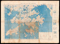
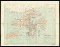
194516008London : War Office August 1945. 780 by 1050mm. 30.75 by 41.25 inches. Chromolithograph map with manuscript annotations in pencil and pen with three insets and diagrams to right margin minor browning a few nicks and tears to margins. A unique map of Hong Kong and the New Territories with contemporary manuscript annotations showing the liberation of Hong Kong from Japanese occupation. This map which shows Hong Kong Kowloon and the New Territories was first published by the British War Office in 1936. The present example a second edition was published shortly after the end of the Second World War when Britain reoccupied the islands following four years of Japanese occupation. Thick red lines across the map indicate the "all weather roads" that could be relied upon for travel and communications across the region. Extending from Lantau Island to the west to Mirs Bay in the east from the Chinese city of Shenzhen in the north to the southern Soko Islands it is generally considered one of the most detailed maps of Hong Kong made in the early twentieth century. The present example is made more interesting by the copious manuscript annotations that appear across the centre of the map. A grid has been drawn over Hong Kong in pencil marking the lines of longitude and latitude more precisely. Discolouration indicates that it this lower central portion that was the primary focus of the map during its use. Annotations in pen identify features such as "Dockyard Stores" "Canal" and "Coal Dump" and military information including "Officers Mess" and "2 AA Guns". There are also numerous annotations listing the number of Japanese soldiers in Victoria these include "3000 Japs" together with a further 200 with horses and the Japanese Officer's Mess. Japanese troop numbers are noted on Kowloon totalling just under 2000 men. More annotations can be seen further north near modern day Shenzhen marking the location of the Head Quarters for both the Hong Kong Artillery Force and the Defence Force as well as military companies and infantry divisions. A note in the upper right margin identifies it as the hand of "Capt Owens" an officer in the British Task Force that landed in Hong Kong on 30th August 1945 to take back control of the territory from the Japanese. Established in 1857 the British War Office was the governmental department responsible for the administration of the British Army until 1964 when its functions were transferred to the Ministry of Defense. During this time it produced many maps with the number of publications increasing rapidly during years of conflict. War Office, unknown
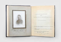
1918156559India Mesopotamia and Persia: December 1914 - July 1918. I have come to the conclusion that the war out here is much more pukka campaigning than in France An unpublished and otherwise untraced First World War album recording the experiences of an officer serving in India Mesopotamia and with Dunsterforce in Persia. It preserves his lively letters home and over 150 photographs taken on duty the final letter written only days before he was killed in action at Resht. Most letters are addressed to his mother Ada Eliza Wilkinson née Machin and the album opens with his formal portrait signed by her on the verso. Beginning with his voyage to India in December 1914 he records life in Port Said the Suez transit and his posting to Quetta where he lived comfortably but grew frustrated at being far from the fighting. Throughout 1915 he describes training frontier camps and the slow grind of the war his early enthusiasm giving way to weariness and disillusion. In late 1916 he finally volunteered for active service in the Middle East reaching Basra in October and soon taking part in mobile desert operations railway protection and frequent skirmishes with Turkish forces. His letters convey both the hardships and the relative freedom of campaigning compared with the Western Front. Wounded by a sniper in early 1917 he recuperated briefly in India before returning to the field. In December 1917 he joined Dunsterforce in Persia reporting on the weakening Ottoman position. He was killed in action at Resht on 20 July 1918 and buried with military honours at the Russian consulate. The album concludes with numerous letters of condolence from senior officers and comrades. The photographs document Bombay Quetta Delhi and daily military life in India as well as Basra Amara Beit Nama and operations in Mesopotamia and Persia including irrigation works armoured cars and troop movements. Loosely inserted are three autograph letters a postcard and a 1949 British Legion Service of Remembrance. No other manuscript or typescript copies of the letters are known. The family also compiled a memorial volume for Wilkinson's brother Geoffrey Miles Wilkinson killed later in the war. Quarto 255 x 205 mm. Occasional contemporary manuscript annotations. Together 258 typescript sheets each with text one side only 153 mounted photographs with typescript captions mostly gelatin silver snapshots photographic portrait mounted on card. Bound in contemporary black leatherette front cover monogrammed "J.G.W." Binding with some wear typescript sheets toned some photos oxidized as expected foxing and adhesive marks to opening portrait: a very good example. hardcover
192214937Hong Kong 1922. 665 by 860mm. 26.25 by 33.75 inches . Colour lithographed map dissected and mounted on linen folding map. An early attractive and detailed map of Hong Kong and the New Territories first published in 1905 and re-issued with additions in 1922. From another example of this chart we have handled it appears that the coastline from Sai Kung to Mirs Point onwards was taken from Admiralty charts; that of Deep Bay from the mouth of the Sham Chun River to South-West Point from a survey by the P.W.D.; thence northward and westward from Admiralty charts; that of Lan Tao and adjacent islands from a 1-inch map compiled by Tate; and the New Territories from a map compiled by W. J. Newland in 1903-04 with additions and revisions by P.W.D. in 1913 and 1922. As listed in the Reference table the map shows Important Villages & Market Places; Villages; Churches & Mission Stations; Pagodas & Temples; Pass; Heights in Feet above Sea Level; Bridges; Limit of Navigation for Large Junks; Cart Roads; Pack Roads & Paths; Telegraphs; Tramways; Boundary of British Territory; and Railways. "The local spelling of place-names has been followed". This map has been compiled from Existing Intelligence Division maps of Hong Kong; Admiralty Charts; Map of New Territory Kowloon compiled by Mr. Tate for Colonial Government Survey 1899 1900; Survey of Kowloon and part of New Territory 8 In. 1 Mile carried out in 1902-1903. The boundary along the Shores of Mirs Bay and Deep Bay is the High Water Mark. It has not yet been surveyed and is only shown provisionally. Geographical Section General Staff No. 1393. Additions Mar. 1922 War Office Aug. 1905. Scale 1:84480 or ¾ Inch to 1 Mile. unknown
1944188792Washington DC: Joint Intelligence Study Publishing Board 1944-46. The lead compiler's copies Classified material from the first significant US joint-intelligence programme each with the lead researcher's ownership signature "Capt. H. Kuhlenbeck" at the head of the front wrapper and all but the first identified as a "contributor's advance copy" in his hand. Established in 1943 the JANIS programme produced comprehensive reports on different strategic theatres and involved personnel from military naval and air intelligence as well as the Office of Strategic Services and the Office Chief of Engineers. For each area either a country or a subregion JANIS operatives compiled briefings on geography climate demographics communications military facilities and health and sanitation. By the end of the war the reports had become the model for all strategic intelligence work and long-term planning. In 1947 the programme was absorbed into the CIA. A naturalized American citizen Hartwig Kuhlenbeck 1897-1984 was recruited into the US Army Medical Corps in 1944 at the rank of captain. Having travelled in Asia and been a visiting professor in Tokyo in the 1920s he was assigned to the Office of the Surgeon General as an expert in health and sanitation in East Asia. His reports here on Manchuria China and parts of Japan provide assessments and recommendations concerning environmental conditions public health facilities and the spread of major diseases. For the China East Coast volume he was assisted by Dr E. A. Struthers a British medical officer in Malaya. Kuhlenbeck remained with JANIS until 1946 returning to his successful academic career shortly after a promotion to major. Loosely inserted in three of the works are memoranda from the Joint Intelligence Study Publishing Board that list the programme's participating personnel. Kuhlenbeck is identified as the lead for the health reports and reachable on a War Department landline. 7 works folio. With folding maps in 2 works illustrations and tables in text; 3 works with loosely inserted memorandum. Original buff card front covers printed in black hole-punched as issued. Housed in custom green cloth portfolio spine lettered in gilt. General signs of handling some wrappers toned: a well-preserved collection. hardcover