Ptolemy F E RobbinsBiblio.com

335 résultats
19801-0674994795Loeb Classical Library 1980. Hardcover. New. 466 pages. 6.75x4.50x1.00 inches. Loeb Classical Library hardcover
1405329637.Ghardcover. Good. Access codes and supplements are not guaranteed with used items. May be an ex-library book. hardcover
6521Ashgate/Brookfield. 1st Edition. Hardcover. Fine/Near Fine. 204 pp. Book/dust jacket condition: Fine/Near Fine light shelfwear. !st/First Ed.; likely 1st/First Printing NAP. All orders are processed and shipped from MI or WI USA. Ashgate/Brookfield hardcover
A9781138340473Hardback. New. First published in 1999 this volume examines Sir John Soane 1753-1837 who was one of Britain's most inventive architects. His achievements include the Bank of England and the world's first picture gallery at Dulwich buildings of international importance. His country estate work inspired by classical antiquity ranges in scale from the remodelling of existing country houses such as Wimpole Hall in Cambridgeshire and Aynhoe Park in Northamptonshire to simple outbuildings. Here we see the emergence of the key themes of his style and the results of his precise attention to proportion design detail and light and shade. These are among Soane's finest works. Making full use of the Soane Museum and country house archives Ptolemy Dean here examines ten country house projects reconstructing the creative transactions between client and architect architect and skilled craftsman. It is impossible to understand Soane's intentions without the drawings sketches and letters which enable us to trace the process of design. With the author's own drawings in watercolour to illustrate Soane's use of light and space and beautiful photographs by Martin Charles Sir John Soane and the Country Estate offers an enthralling insight into the work of a great architect. An illustrated inventory the first fully researched guide to Soane's country house practice details an architectural legacy that has rarely been matched. hardcover
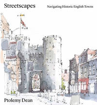
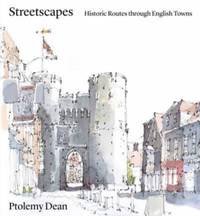
A9781848226838Hardback. New. <p>At a time of increased pressure for new urban development where there is a focus on either object-based architecture or the rolling out of developer-designed suburban sprawl there is a concern that the lessons learned about the creation of a general attractive ‘townscape’ or ‘streetscape’ have become forgotten or obscured.</p> <p>Featuring 26 of the most attractive and interesting historic town centres this book analyses key routes and the urban or visual incidents along them and explains why they might provoke different sensations of joy interest or containment for the inhabitant or passer-by.</p> <p>Each of the town studies includes two historical maps – one created by John Speed in the C16th which explains the general overall layout of a town its shape size defensive walls and river crossings and the other a first edition OS map from the late C19th which reveals the extent that medieval arrangements have survived or not. Key routes within selected towns are then selected and illustrated as a way to explaining the topography and layout of these towns and how one still experiences them. In particular there is the recurring theme about how the town might naturally draw you through to its centre the subtlety of character and placing of key buildings as markers each of which is uniquely different for each town. The drawings which illustrated the town studies are not only beautiful but can be discriminate in aspects emphasised.</p> <p>While individually the case studies are insightful and full of fascinating history and detail as the book moves through these towns themes patterns and natural groupings of towns emerge. Thus as a whole the volume allows comparisons and explores similarities and contrasts which enrich the book’s findings and lessons.</p> hardcover
46661161-nnew. unknown
46661161like new. unknown
ria9781848226838_inpHardcover. New. New Book; Fast Shipping from UK; Not signed; Not First Edition; At a time of increased pressure for new urban development where there is a focus on either object-based architecture or the rolling out of developer-designed suburban sprawl there is a concern that the lessons learned about the creati hardcover
1786RW1618Nancy:: Chez C. S. Lamort 1786. 1786. 4to. 2 vi 192 2 pp. 2 large folding zodiac maps. Title vignette full mottled calf leather gilt-stamped spine label raised bands; joints worn corners showing. Very good. Side-by-side translation of Ptolemy's Greek into French describing the position of the stars during Ptolemy's lifetime. / "Montignot has given us the original Greek and a French translation of the seventh book of Ptolemy's great work under the title of `Etat des etoiles fixes au second siecle' in quarto. He has given the designation of the same stars by Flamstead Flamsteed and Beyer and their position in the year 1786." – Thomas Jefferson to Joseph Willard. Chez C. S. Lamort, 1786. hardcover books
1956DL1160Louvain:: Bibliotheque de l'Universite Bureaux de Recueil 1956. 1956. Series: Universite de Louvain Recueil de Travaux d'Histoire et de Philologie 4th ser. fasc. 8. First edition. 8vo. 131 358 pp. 100 figs. Original printed wrappers. Ownership ink signature of David C. Lindberg. Very good. Bibliotheque de l'Universite Bureaux de Recueil, 1956. unknown books
1990154085Wigston: Magna Books 1990. 1st ed. thus. Nice copy. large folio. laminated boards xv 56pp. colour maps appends. bibliog. index With 27 fine double-page coloureed maps taken from an edition of Clavdii Ptolemaei: Cosmographia Magna Books hardcover
1936304<p>164 pages in dark blue cloth with gilt titling on spine. Second printing of this edition. Appendix contains extracts from Ptolemy's Almagest the whole of his Centiloquy and a diagram of the Zodiacal Planisphere with an explanation by J.M. Ashmand. Several diagrams and tables throughout. Previous owner's inscription on front pastedown. Hinges shaken possibly glued. One front free end paper razored out. A few check marks in the margins. Else pages are clean and unmarked. Binding is firm spine is square. Good. </p> The Aries Press hardcover
1961mon0000004890Germany: B. G. Teubner 1961. Hardcover. Very Good. No dust jacket. Orange cloth covers show some light fading and darkening from age. B. G. Teubner hardcover
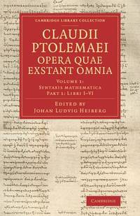
2014x-1108063667Cambridge University Press 2014. Paperback. New. 494 pages. 8.35x5.51x1.42 inches. Cambridge University Press paperback
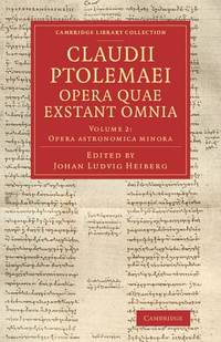
2014x-1108063659Cambridge University Press 2014. Paperback. New. 618 pages. 8.50x5.51x1.50 inches. Cambridge University Press paperback
2013x-1108063640Cambridge University Press 2013. Paperback. New. 558 pages. 8.50x5.50x1.25 inches. Cambridge University Press paperback
173076110Amsterdam:: Apud. R. & J. Wetstenios & Guil. Smith 1730. original pale blue boards; leather spine perished; sewn over tapes which are still largely intact. This copy lacks the last two leaf of the Index and the final blank leaf. . Folio. Added engraved illustrated title leaf; 28 fine maps on 56 leaves. Apud. R. & J. Wetstenios & Guil. Smith, hardcover
154795367Venice: G. B. Pedrezano 1547. First complete edition in Italian of Ptolemy's "first atlas of the new world" Nordenskiold and the most detailed and comprehensive world atlas published prior to Ortelius's Theatrum in 1570. Small octavo bound in full vellum with gilt morocco spine label all edges speckled red woodcut border to the title page woodcut initials and illustrations throughout the text including a portrait of an astronomer and 60 double-page engraved maps designed by Giacomo Gastaldi. The majority of the 34 maps of the modern world are entirely new first appearances including 7 maps of the Americas. Among the maps of the Americas is the Nueva Hispania tabula nova which shows the Mississippi and Florida area and is the first separate printed map of the region. Also included is the landmark Tierra Nueva map of the North American coast from Florida to Labrador. In fine condition. Housed in a custom cloth clamshell box. An exceptional example of this landmark work. Ptolemy's Geographia or Geography first appeared in Greek in Alexandria circa 150 C.E. as a new revision of the now non-extant atlas of Marinus of Tyre using additional Roman and Persian geographical dictionaries and principles. The Geography's translation into Arabic in the 9th century and Latin in 1406 was highly influential on the geographical knowledge and cartographic traditions of the medieval Caliphate and Renaissance Europe. No Greek manuscript of the Geography survives from earlier than the 13th century and the first Latin translations were completed circa 1406 by by Jacobus Angelus in Florence Italy under the name Geographia Claudii Ptolemaei. Published in 1547 the present small-format edition became the most comprehensive world atlas ever published prior to the publication of Ortelius's Theatrum in 1570. G. B. Pedrezano hardcover books
1562220508Venice: Vincenzo Valgrisi 1562. hardcover. very good-. Venice: Vincenzo Valgrisi 1562. 2 parts with separate pagination. Short thick 4to bound in 19th century vellum with red edges. Features 64 double page maps: 27 Ptolemaic maps showing the ancient world as Ptolemy knew it including one world map 37 "modern" maps with two world maps and several woodcut diagrams illustrations and decorative initials. Text in Latin. Staining throughout affecting some of the maps. Title page cropped .5" at right margin. Bookplate of Otto Orren Fisher and ink inscription of Charles Singer.<br/><br/> Giuseppe Moleto Josephus Moletius 1531-1588 was an Italian mathematician who based the text of this edition on the 1525 translation by Wilibald Pirckheimer. Moleto's draws upon Ruscelli's enlarged maps of his 1561 edition which in turn were based upon those by Jacopo Gastaldi. Moleto has also included some of Girolamo Ruscelli's innovations from his own edition: the double hemisphere world map and "Carta Marina Nuova Tavola" a rare sea chart of the world. Also from Ruscelli is a revised version of the Zeno map of the Arctic first published in 1558. The Zeno map describes the purported journey of the author's ancestors in the 1390s to Greenland Iceland the mythical islands of Frisland and Icaria and what is now thought to be Newfoundland and Labrador. While Zeno shows Greenland connected to Norway Ruscelli updated the map by eliminating this land bridge. Despite its inaccuracies and inclusion of mythical lands the Zeno map persisted as the prevailing map of the Arctic and Greenland for many years. Six other New World maps include the South American continent Brazil Central America and the Baja Peninsula the eastern coast of North America Cuba and Hispaniola. Moleto juxtaposes the Ptolemaic maps with the contemporary offering easy comparison between ancient and new. Claudius Ptolemy 90-168 CE was a Roman geographer and mathematician living in Egypt who compiled his knowledge and theories about the world's geography into one seminal work. Although his maps did not survive his mathematical projections and location coordinates did. During the Renaissance revival of Greek and Roman works "Geographia" was rediscovered by monks and based upon Ptolemy's detailed instructions the maps were recreated. The first printed edition of "Geographia" with maps was published in Bologna in 1477. A rare and exciting edition for any collector.<br/><br/> Vincenzo Valgrisi unknown books
1241697140.Gpaperback. Good. Access codes and supplements are not guaranteed with used items. May be an ex-library book. paperback
0332011100.Ghardcover. Good. Access codes and supplements are not guaranteed with used items. May be an ex-library book. hardcover
1020661860.Ghardcover. Good. Access codes and supplements are not guaranteed with used items. May be an ex-library book. hardcover
1390579972.Gpaperback. Good. Access codes and supplements are not guaranteed with used items. May be an ex-library book. paperback
0332683788.Ghardcover. Good. Access codes and supplements are not guaranteed with used items. May be an ex-library book. hardcover
0332286290.Ghardcover. Good. Access codes and supplements are not guaranteed with used items. May be an ex-library book. hardcover