834 résultats
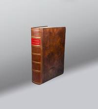
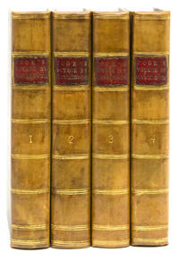
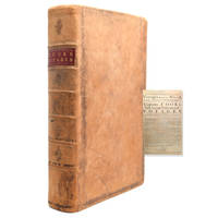
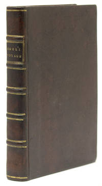
1788310845London: Printed for G. Nicol and G. G. J. and J. Robinson 1788. First edition. Frontispiece portrait. xvi 527 1 pp. 1 vols. 4to. Contemporary speckled calf boards with later morocco spine. Light foxing and offsetting to frontispiece some toning and scattered foxing but a clean copy overall. First edition. Frontispiece portrait. xvi 527 1 pp. 1 vols. 4to. FIRST BIOGRAPHY OF COOK. The first edition of this highly influential first English biography of Cook by the Anglican clergyman Kippis one of the leading biographers of his day. In addition to describing the three great voyages in depth Kippis also deals with Cook's earlier experiences including his duties aboard the Mercury during the siege of Quebec and his Newfoundland and Labrador surveys. Most of Samwell's narrative of Cook's death is included as well.<br/>While Kippis did not appear to be entirely insensitive to the long-term effects of European contact with Pacific peoples he championed Cook's humanitarian cultural and intellectual mission in the circumnavigation of the globe. In a study of European exploration of the Pacific Lynne Withey concluded that this volume by Kippis became a prominent justification for the involvement of Europeans in the Pacific islands for years after Cook's death Withey 406-407. <br/>The second appendix includes "The Moral an Ode" by the British poet novelist and religious dissenter Helen Maria Williams an old family friend of Kippis. Hill 935; Sabin 37954; Beddie 32; Holmes 69; Kroepelien 647; Lada-Mocarski 40; Howes K179 "aa."; Forbes 149. Provenance: John Thornhill armorial bookplate; The Beaufoy Library bookplate Printed for G. Nicol and G. G. J. and J. Robinson unknown books
191319686Midwest U.S. ca. 1913-1917. Very good. Oblong small 4to. Commercial string-tied album in black textured wraps. 58 cyanotype 11" by 8.25" and 55 gelatin-silver prints most 9.5" by 7.25" some 6" by 3.5" or smaller; four of the latter apparently perished. Adhesive-mounted recto and verso on black paper sheets. Very good. Some glue-bleaching to cyanotypes' edges. Many pages cleanly detatched from from perforated tabs but photos remain clean. <br/><br/>Album of storage tanks agitators and other liquid-related metal machinery photos compiled by the manufacturer which – judging by the locations of most of its clients – was located somewhere in the Midwestern United States. Majority of the photos show a single piece of equipment captioned with its order number destination e.g. "National Ice Cream Co. San Francisco" the product name e.g. "Deep Upright Closed Tank" shipment date dimensions and other relevant notes; several images show the product installed in its destination factory but most appear to have been taken before shipment. Many clients were ice-cream and other dairy processing plants and the majority were American; but a few were international including the Nestle plant in Switzerland and a Cuban brewery. Among the American non-dairy plants were the Coors brewery in Colorado a Perth Amboy chemical plant and a California paint manufacturer. Two images depict a dozen salesmen posing at the tank factory and others show factory workers in motion. Likely assembled as a salesman's book or perhaps company archive with its many cyanotypes a striking vernacular book and an informative record of industrial food preparation at the dawn of the Ford age. paperback books
4620No Binding. Very Good. Copper plate engraving 23 x 30 cm printed surface. n.d. but c. 1775. A few folds but generally excellent with a fine impression. Charming engraving of a genre scene depicting a man grating parmesan cheese by the Venetian engraver and Volpato pupil Francesco del Pedro 1749-1806 after a painting by the Venetian painter Francesco Maggioto 1750-1805. The printer has added a moralizing motto from Horace Odes III.16 on how to the fortunate man whatever material goods are at hand are enough. Benezit VIII.186 Pedro VII. 62 Maggioto. unknown books
1790E00534 of 6 volumes. Volume 1: i-ix-372 pages with 23 plates including frontispiece plate of Cook and 4 folding maps; Volume II lacking; Volume 3: 793-1184 pages with 11 plates including frontispiece of Possession Bay and 5 fold out maps; Volume IV: 1185-1546 pages with 26 plates including frontispiece of Woman Child and Man of Van Diemen's Land and 6 folding maps; Volume V: 1547-1938 pages with 30 plates including frontispiece of A View of Huaheine and 8 folding maps; Volume VI lacking. Octavo 8 1/2" x 5 1/2" bound in original full leather with red labels to spine with gilt lettering. Abridged by George William Anderson. An earlier Large folio edition by Anderson was published earlier. This edition originally issued in 80 weekly parts and also called the Large octavo edition. M K Beddie: 39 First edition of the bound edition.<br /><br />Captain James Cook RN was a British explorer navigator and cartographer ultimately rising to the rank of Captain in the Royal Navy. Cook made detailed maps of Newfoundland prior to making three voyages to the Pacific Ocean during which he achieved the first European contact with the eastern coastline of Australia and the Hawaiian Islands as well as the first recorded circumnavigation of New Zealand. Cook joined the British merchant navy as a teenager and joined the Royal Navy in 1755. He saw action in the Seven Years' War and subsequently surveyed and mapped much of the entrance to the Saint Lawrence River during the siege of Quebec. This helped bring Cook to the attention of the Admiralty and Royal Society. This notice came at a crucial moment both in his personal career and in the direction of British overseas exploration and led to his commission in 1766 as commander of HM Bark Endeavour for the first of three Pacific voyages. Cook charted many areas and recorded several islands and coastlines on European maps for the first time. His achievements can be attributed to a combination of seamanship superior surveying and cartographic skills courage in exploring dangerous locations to confirm the facts for example dipping into the Antarctic Circle repeatedly and exploring around the Great Barrier Reef an ability to lead men in adverse conditions and boldness both with regard to the extent of his explorations and his willingness to exceed the instructions given to him by the Admiralty. Cook was killed in Hawaii in a fight with Hawaiians during his third exploratory voyage in the Pacific in 1779.<br /><br />Condition:<br /><br />Lacks volume II and VI. First signature of volume one loose inner hinges cracked some interior soiling spine ends and corners of leather rubbed some scuffing to leather else a good set. Printed for A Millar, W Law, and R Cater hardcover books
1786399London: Alex. Hogg at the King's Arms No. 16 Pater-noster-Row 1786. First Edition First State. Full calf. Near fine. The Anderson Edition of Captain Cook's Voyages Round the World published in 1784. Folio 15.25 x 9.75 i title ii blank iii-iv preface 5-650pp 651-653 tables 654-655 "Concluding Remarks by the Editor" and "Contents of this Work" Directions to the Bookbinder 2pp subscribers list. First state with date 1784 appearing on title page. Expertly repaired spine raised bands gilt title over red morocco. Frontispiece portrait of Captain Cook. 150 illustrated copper plates 41 Maps/Elevations 109 Illustrations including large foldout map titled "A General Chart." Plates in near fine condition with only occasional toning. Previous owners inscription on front endpaper. Includes directions to bookbinders and 2pp list of subscribers. Forbes 61. This copy lacks the "Death of Captain Cook" illustration. Beddie 19. This important work is a compilation Captain Cook's three voyages. It also includes voyages by Carteret Anson Drank and others. This version does not include the copy of "The Death of Captain Cook" #27. An attractive copy of this rare folio. Alex. Hogg at the King's Arms, No. 16, Pater-noster-Row unknown books
17785440Paris: Hôtel de Thou 1778. Very Good/Attractive set of the French-language version of Cook's account of his second expedition A Voyage towards the South Pole and Round the World London 1777. This astonishing journey from 1772 to 1775 went around the globe as far south as possible to explore the existence or not of a postulated southern landmass. In the course of the voyage Cooks ships Resolution and Adventure crossed deeply into Antarctic waters ultimately turned back by ice barriers. Zig-zagging through the South Pacific Cooks ships also visited Easter Island the Marquesas Tahiti the Society Islands Niue the Tonga Islands the New Hebrides New Caledonia Norfolk Island Palmerston Island South Sandwich Islands and South Georgia many of which Cook named in the process. This French edition of his report was published close on the heels of the English version in two distinct formats a five-volume quarto and a six-volume octavo with a quarto atlas containing the extraordinary set of 66 engraved plates after William Hodges. The French translator Jean-Baptiste-Antoine Suard incorporated into the text a great deal of material from the rival account of the voyage that Johann Reinhold Forster published under guise of his son Georg based on a draft of Cooks own journal. In English Forsters account was published separately. A fine set. Six volumes octavo 20 cm and atlas volume in quarto 27 cm. Text volumes bound in cat's paw calf; six-panel spines tooled in gilt with red leather title labels lettered in gilt. Marbled endleaves. Minimal wear. Atlas volume bound separately in contemporary speckled calf with black leather title label. 65 copper-engraved plates including double-page folding "Carte de l'Hemisphere Austral" portraits scenes botanical representations plans and other maps. Excellent condition throughout. References: Mitchell Library p. 52; Sabin 16249 4to ed. Hôtel de Thou hardcover books
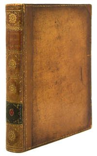
1781Embry 151275Printed for E. Newbery London: 1781. Second edition. Occasional light foxing throughout short tear to folding map overall near fine in fine but simple modern binding. Five plates including two folding and one supplied in facsimile. Folding map. Rebound in modern brown morocco spine simple gilt. Folding frontis depicts Cook's death. Printed for E. Newbery, London: 1781. Second edition. unknown books
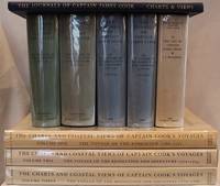
1955E01069 volumes including the three atlas volumes and portfolio volume. Volume I: <i>The Voyage of the Endeavour</i> cclxxxiv696 pages with 20 maps 25 illustrations including color frontispiece appendix and index. Reprinted with addenda and corrigenda. Volume II: <i>The Voyage of the Resolution and Adventure 1772-1775 </i>clxx1028 pages with 19 maps 63 illustrations appendixes and index. Half-title gives II as number within the set. Reprinted with addenda and corrigenda. Volume III parts 1 and 2: <i>The Voyage of the Resolution and Discovery 1776-1780</i> Part One ccxxiv718 pages with 17 maps and 64 illustrations. Half-title gives III as number within set. Admiralty instructions and the journal of the Third Voyage with supplementary extracts from journals or logs by James King Charles Clerke James Burney Richard Gilbert Thomas Edgar. Part 2: viii723-1647 with 2 maps 10 illustrations appendixes and index. Volume IV: <i>The Life of Captain James Cook</i> xi760 pages with 11 maps 38 illustrations bibliography and index. Written by J. C. Beaglehole. First separately published by A. and C. Black 1974 then for the Hakluyt Society. These volumes in royal octavo 9 1/2 x 6 1/2" bound in original publisher's deep blue cloth with blind stamped silhouette of Cook in gilt on front boards and gilt lettering to spines. Portfolio <i>Charts & Views</i> Drawn by Cook and his Officers and reproduced from the Original Manuscripts edited by R. A. Skelton. Pages viii with 58 loose maps charts plans profiles views and other illustrations some folding folio 15 3/4" x 10 1/2" in original blue cloth portfolio with gilt pictorial of cook on front in original jackets except for portfolio volume. <i>The Charts & Coastal Views</i>. Volume One: <i>The Voyage of the </i>Endeavour<i> 1768-1771</i> With a Descriptive Catalog of all the known original surveys and coastal views and the original engravings associated with them. Together with original drawings of the <i>Endeavour</i> and her boats lxiv328 pages with color frontispiece 480 half-tone plates and index. Volume Two: <i>The Voyage of the </i>Resolution<i> and </i>Adventure<i> 1772-1775</i> c332 pages with color frontispiece 23 color plates 320 half-tone plates and appendixes. Volume three: <i>The Voyage of the</i> Resolution<i> and </i>Discovery<i> 1776-1780</i> . together with the running journal of James King 1779-80 cxxxvi319 pages with color frontispiece 22 color plates 298 half-tone plates and appendixes. Volumes chief editor Andrew David. Assistant Editors for the Views Rudiger Joppien and Bernard Smith. Folios 17 1/4" x 11" bound in original publisher's deep blue cloth with gilt lettering to spine and pictorial representation of the ship <i>Victoria</i> embossed in gilt on front covers. Hakluyt Society Extra Series 34a 34b 35 36a 36b 37 43 44 and 46. First printings. Condition: Lacks jacket for portfolio volume and the spine head is bumped. Jackets: Volume one volume three part two price clipped some jackets spines toned Charts & Coastal Views with some edge wear and closed tears else a near fine set in like jackets. Hakluyt Society hardcover books
193654291Chicago: Walter Hill 1936. Each signed with initials of the Artist. Matted with the corresponding captioned illustrations. 1 vols. Various Sizes 13.5 x 11 inches to 3 x 7 inches matted on 14.5 x 22 inch boards . In worn and split cloth drop box morocco label. Each signed with initials of the Artist. Matted with the corresponding captioned illustrations. 1 vols. Various Sizes 13.5 x 11 inches to 3 x 7 inches matted on 14.5 x 22 inch boards . Bitting p. 13: "Fully annotated. The name was synonymous with gourmandise and among the ancients was given to choice dishes the name of the author was probably Coelius who gave the name Apicius to his book"; Vicaire p. 277 Walter Hill unknown books
1862WRCAM54585Washington D.C.: War Department Adjutant General's Office 1862. Three volumes with over 300 individual imprints. 12mo. Uniformly bound in contemporary three- quarter roan and marbled boards gilt leather labels. Wear to leather and edges boards somewhat rubbed front hinges tender. Contemporary ownership inscriptions and binder's tickets on front endpapers of second and third volumes; later bookplate on front pastedown of first volume. Light toning in places otherwise internally clean. Very good. A uniformly-bound set of General Orders issued by the Adjutant General's Office of the War Department in Washington D.C. previously owned by Brig. Gen. John Pope Cook. The orders cover 1861 and 1862 and comprise a nearly complete run of orders for the Union Army during the first two years of the Civil War. Undoubtedly the most significant General Order in this collection is a preliminary printing of the Emancipation Proclamation. <br> <br> A handful of the orders are signed in ink by the various adjutant generals. The Emancipation Proclamation bound in the third volume is as follows: <br> <br> GENERAL ORDERS No. 139. THE FOLLOWING PROCLAMATION BY THE PRESIDENT IS PUBLISHED FOR THE INFORMATION AND GOVERNMENT OF THE ARMY AND ALL CONCERNED: BY THE PRESIDENT OF THE UNITED STATES OF AMERICA A PROCLAMATION caption title. Washington D.C.: War Department Adjutant General's Office ca. September 24 1862. 3pp. This work is one of the earliest printings of the Preliminary Emancipation Proclamation issued to regimental commanders in the field during the Civil War in the week after President Lincoln's official manuscript version was finished. Here the third paragraph rings out with Lincoln's timeless words: "That on the first day of January in the year of our Lord one thousand eight hundred and sixty- three all persons held as slaves within any State or designated area of a State the people whereof shall then be in rebellion against the United States shall be then thenceforward and forever free." <br> <br> Following the Seven Days Battle and Gen. McClellan's retreat from the Peninsula at the end of June 1862 President Lincoln realized that there would be no early end to the war and found himself "as inconsolable as it was possible for a human to be and yet live." Anxious for news from the army and needing to escape the constant interruptions at the White House he frequently visited the telegraph office in the War Department building to await dispatches. It was during one such visit early in July that he asked the chief of the telegraph staff Maj. Thomas Thompson Eckert for some paper to "write something special" and began the first draft of the Emancipation Proclamation completing it in a few weeks. <br> <br> Lincoln had long hoped to resolve the slavery issue through a congressional act of emancipation compensating slave owners for their loss of "property" but that approach was roundly rejected by representatives from the border states leaving the President who had decided upon the necessity of emancipation with a presidential proclamation as the only option. The extraordinary document he conceived would announce the liberation on January 1 1863 of all slaves in those states still in rebellion against the Union and promised compensation to slave owners in those states that returned to the fold before that time if they adopted "immediate or gradual abolishment of slavery." This proclamation would be followed by a final proclamation issued on the 1st of January identifying those states still in rebellion and confirming the liberation of all slaves therein. <br> <br> On Tuesday July 22 Lincoln presented his draft to the Cabinet telling them that he had resolved firmly upon the course of action it specified and asking them not for advice but suggestions. The only observation he had not anticipated came from Secretary of State Seward who proposed that it might be best to wait for a military victory before issuing the Proclamation as it could otherwise seem like "the last measure of an exhausted government." Immediately recognizing the wisdom of the suggestion Lincoln held back. On September 17 after an anxious wait of nearly two months he received the victory he needed at the bloody Battle of Antietam. Completing his final draft Lincoln presented it to his cabinet for refinement on September 22. Following the meeting Seward took the amended draft with him to the State Department where a formal manuscript copy was made then signed by Lincoln and Seward. <br> <br> The first edition of the Preliminary Emancipation Proclamation Eberstadt #1 a small three-page circular intended for distribution within the government and to the local press was likely printed on September 22. At the time that Charles Eberstadt published his study of the Proclamation 1950 he was able to locate only one copy which he himself owned and as nearly as we have been able to determine no other copies have come to light since then. <br> <br> Eberstadt #2 is a supposed second edition no copy of which Charles Eberstadt was able to locate whose existence he inferred from the standard State Department practice of printing a folio edition consisting solely of the text of the proclamation followed by another printing consisting of the text of a letter of transmittal from the Secretary of State as well as the text of the proclamation. While there may be a copy of Eberstadt #2 in the National Archives as he speculated it is not recorded in their online catalogue nor have we been able to find a copy in any other online catalogue including OCLC the Library of Congress and the Abraham Lincoln Library. <br> <br> Eberstadt's third printing of the Preliminary Emancipation Proclamation is without a doubt the earliest obtainable printing. It consists of Secretary of State Seward's one-page letter of transmittal addressed "To the Diplomatic and Consular Officers of the United States in foreign countries" and the text of the proclamation. Eberstadt located a total of only five copies in institutions at the Library of Congress the National Archives Yale the Clements Library and Brown. OCLC does not record any additional copies nor is it recorded in Monaghan. This firm sold a copy several years ago. <br> <br> The present copy of GENERAL ORDERS No. 139 is Eberstadt's fourth printing of the Preliminary Emancipation Proclamation dated in print on September 24. Charles Eberstadt surmises that this field order printing could have been accomplished as late as September 29 or 30 and produced in as many as 15000 copies. It is however rather uncommon in the market and this is the first copy of this printing of the Preliminary Emancipation Proclamation offered by this firm. <br> <br> "From the first days of the Civil War slaves had acted to secure their own liberty. The Emancipation Proclamation confirmed their insistence that the war for the Union must become a war for freedom. It added moral force to the Union cause and strengthened the Union both militarily and politically. As a milestone along the road to slavery's final destruction the Emancipation Proclamation has assumed a place among the great documents of human freedom" - National Archives. "The proclamation has been called by responsible persons one of the three great documents of world history ranking with Magna Carta and the Declaration of Independence" - Eberstadt. <br> <br> Besides including about 300 orders on all manner of Union military activity at the outset of the Civil War the present collection also contains the 1861 printing of REGULATIONS FOR THE UNIFORM AND DRESS FOR THE ARMY OF THE UNITED STATES. Set out in GENERAL ORDERS No. 6 this twenty-four-page printing of the Army dress regulations was the first to set out uniform requirements for the Union during the conflict. The first sentence of the first section requires officers to "wear a frock coat of dark blue cloth." Thus the Blue and the Gray begins. <br> <br> This set was collected and bound by John Pope Cook who began the Civil War as a colonel in command of the 7th Illinois Volunteer Regiment. He was promoted to brigadier general after his troops played a key role in the Union victory at Fort Donelson early in 1862. After his promotion he was transferred to a command in the Department of Iowa and Dakota Territory where he remained until early 1863 conducting campaigns against the Sioux from his base in Sioux City Iowa. These orders must have been bound near the end of this period since contemporary labels note the binder one William F. Kiter as being from relatively close by Council Bluffs. <br> <br> A very early printing of one of the most important political acts in the Civil War and indeed in American history contained in a set of General Orders contemporaneously assembled by a significant Union Army commander. EBERSTADT LINCOLN'S EMANCIPATION PROCLAMATION 4. War Department, Adjutant General's Office hardcover books
1774WRCAM15266Paris 1774. Four volumes. ivxvi2xxxii388pp. plus sixteen folding maps and plates; 2536pp. plus sixteen maps and plates mostly folding; 2394pp. plus seventeen maps and plates mostly folding; viii367pp. plus three maps and plates two folding. Quarto. Modern half mottled calf and marbled boards spines gilt leather labels. Some scattered foxing and tanning. Overall very good. The first French edition after the original English edition of the previous year. Hawkesworth was commissioned by the Admiralty to edit this collection of voyages which includes Cook's first voyage to Tahiti to observe the transit of Venus across the sun determine the distance between the sun and the earth and continue Byron's explorations. During this voyage Cook visited Tahiti and made the necessary calculations named and charted the Society Islands explored and surveyed New Zealand and charted the eastern coast of Australia naming it New South Wales finally returning to England in 1771. Other narratives are of Byron's voyage to the Gilbert and Tuamoto Islands Wallace's discovery of Tahiti and Moorea and Carteret's discovery of Pitcairn Island after his separation from Capt. Wallis in a storm. The handsome plates depict the natives landscapes and seascapes and the maps show the routes of the ships and areas charted. An early and important compilation. This French edition is not listed in Hill. Sabin calls for only 361 pages in the fourth volume and states that the French editions "should be accompanied by an Atlas entitled: CARTES ET FIGURES a Paris Chez Saillant et Nyon. M.DCC.LXXIV. 4to." The NUC makes no mention of an atlas but the set cited there is imperfect lacking the third volume. SABIN 30940. hardcover books
1781310852Dublin: Price Whitestone Chamberlain et al. 1781. First Dublin edition. Complete with 5 engraved plates including frontispiece plate of the Death of Cook and large folding map. 4 xlvii 1 396 pp. 1 vols. 8vo. Contemporary calf rebacked to style marbled endpapers. Occasional spotting and dustsoiling better than very good. First Dublin edition. Complete with 5 engraved plates including frontispiece plate of the Death of Cook and large folding map. 4 xlvii 1 396 pp. 1 vols. 8vo. First Dublin edition. The first Dublin edition of the first full account in English of Cook's third and final voyage. Rickman was a second lieutenant aboard the Discovery. "It provides an important supplement to the official account of the Third Voyage published in 1784" Forbes. Howes R-276 "aa"; Forbes 36; Wickersham 6555a; Davidson p 64; Kroepelien 1078; Beddie 1608 Price, Whitestone, Chamberlain, et al. unknown books
1785310841London: W. Strahan and T. Cadell 1785. Third edition. Large folding general chart of the expedition folding chart of the Island of Otaheite and 9 folding plates. lvi 362; 10 447; 8 416; 6 429 3 pp. 4 vols. 8vo. Modern calf over marbled paper boards. Occasional foxing and minor offset a very clean copy. Third edition. Large folding general chart of the expedition folding chart of the Island of Otaheite and 9 folding plates. lvi 362; 10 447; 8 416; 6 429 3 pp. 4 vols. 8vo. Cook's first voyage. Third edition of this chronicle of important English south-seas expeditions including Cook's monumental first voyage which is covered in volumes 2-4. The aim of Cook's first voyage was to sail to Tahiti to observe the transit of Venus; having done so Cook left Tahiti and discovered the Society Islands explored New Zealand at great length as well as the eastern coast of Australia which he charted for 2000 miles and named New South Wales. The expedition lasted from 1768-1771 and resulted in the annexation of both Australia and New Zealand by Britain won Cook fame and led to his two subsequent voyages. Beddie 665; ESTC T165111 W. Strahan and T. Cadell unknown books
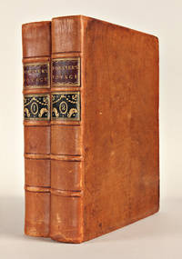
1777WRCAM54751London 1777. Two volumes. xviii26021; 4607pp. including errata leaf plus large folding map. Quarto. Contemporary speckled calf rebacked with original gilt leather labels preserved raised bands corners renewed. Minor shelf wear one contemporary and one modern bookplate on pastedowns institutional bookplates on verso of titlepages. Minor occasional foxing some penciled marginalia and underlining to text. Very good. Forster's important account of Cook's second voyage and an essential component of the record of that great expedition. Forster and his father John Reinhold served as official botanists during the expedition. When the Admiralty decided to prevent the elder Forster from contributing to the official report George produced his own publication preceding the official account by several weeks. <br> <br> The Admiralty commissioned Cook to undertake his second voyage in the wake of the great success of the first expedition. The purpose of the second voyage was to circumnavigate the globe as far to the south as possible searching for any southern land masses previously unknown. Cook proved that "Terra Australis" which was supposed to lie between South America and New Zealand was nonexistent; but the party became the first to traverse the Antarctic Circle and discovered and rediscovered islands in the Pacific. <br> <br> "For all the controversy A VOYAGE ROUND THE WORLD is an interesting and important account that complements the official one with facts and astute observations on the human side of the voyage" - Rosove. Davidson describes this account as "an important work and a necessary supplement to the official account." HILL 625. BEDDIE 1247. HOLMES 23. SABIN 25130. SPENCE 464. DAVIDSON pp.61-62. ROSOVE ANTARCTIC 132. hardcover books
1782310848London: G. Robinson J. Sewell and J. Debrett 1782. First edition. Engraved folding map and 21 engraved plates. x 358 2 pp; 6 347 pp. Half-title volume 1 instructions to binder at end of volume 1. 2 vols. 8vo. Modern morocco. Faint foxing occasional toning neat repair to bound edge of title and half title a few small neat repairs to folding map with small tape ghost to bottom edge of same some mostly marginal worming at middle of vol 2 very good. First edition. Engraved folding map and 21 engraved plates. x 358 2 pp; 6 347 pp. Half-title volume 1 instructions to binder at end of volume 1. 2 vols. 8vo. Cook's Third Voyage. First edition of this account of Cook's final voyage. "Ellis was a surgeon's mate during Cook's third voyage first on the Discovery and later on the Resoultion and gives quite a good history of this expedition. This account was published two years before the official narrative . It appears that needing money Ellis sold his narrative to a bookseller for fifty guineas. The fine plates are among the earliest published on the Hawaiian Islands Alaska and the Northwest" Hill. The plates include eight of Hawaii two of Alaska and three of the Northwest Coast. Beddie 1599; Forbes 41; Hill 555; Howes E-122; Sabin 22333 G. Robinson, J. Sewell, and J. Debrett unknown books
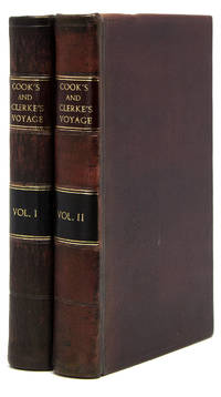
1784WRCAM43625Dublin 1784. Three volumes. 8xcviii421; 14549; 11559pp. plus frontispiece portrait eighteen folding maps and charts seven folding plates and folding table. Contemporary calf spines gilt leather labels. Extremities lightly worn slight wear to spine ends and hinges first volume expertly rebacked with original spine laid down. Minor occasional foxing. A very good set. First Dublin edition of the official account of Cook's third and final voyage including text on the exploration of Hawaii and the west coasts of America Canada and Alaska. The third voyage was undertaken to continue the British survey of the Pacific but most particularly to search for a northwest passage from the western side. Sailing in 1776 the expedition called at Kerguelen Island Tasmania New Zealand and the Cook Tonga and Society islands then sailed north and discovered Christmas Island and the Hawaiian Islands. They then thoroughly explored and charted the Northwest Coast from the Bering Straits along the coast of Alaska and Canada as far south as present northern California. Returning to Hawaii in 1778 the expedition was at first received warmly; but after departing and being forced to return to repair a mast trouble developed which led to a tragic series of events in which the great navigator was killed. However the expedition pressed on under Clerke and then Gore and explored the coasts of Siberia and Kamchatka before returning to England in 1780. Forbes calls this work "arguably the single most important book on the Hawaiian islands." The Dublin edition was issued both with and without the plates; this copy is the issue with the plates which is considerably more desirable and difficult to come by. HOWES C729a. SABIN 16250. BEDDIE 1546. London edition: HILL 361. FORBES 62. LADA-MOCARSKI 37. REESE BEST OF THE WEST 14 ref. hardcover books
177725578London: W. Strahan and T. Cadell 1777. 2 volumes quarto. 11 x 9 inches. Engraved portrait of Cook by J. Basire after Wm. Hodges 63 engraved plates maps and charts 15 folding 16 double-page 1 folding letterpress table. A few plates trimmed close as usual. Contemporary calf covers with decorative borders tooled in blind expertly rebacked to style spine with raised bands in six compartments red and black morocco labels in the second and fourth the others with a repeat decoration in gilt<br/> <br/>First edition of Cook's second voyage on which he was directed to circumnavigate the globe as far south as possible to search for any southern continent.<br/> <br/>"Cook earned his place in history by opening up the Pacific to western civilization and by the foundation of British Australia. The world was given for the first time an essentially complete knowledge of the Pacific Ocean and Australia and Cook proved once and for all that there was no great southern continent as had always been believed. He also suggested the existence of antarctic land in the southern ice ring a fact which was not proved until the explorations of the nineteenth century" Printing and the Mind of Man p.135. "The success of Cook's first voyage led the Admiralty to send him on a second expedition described in the present work which was to circumnavigate the globe as far south as possible in search of any southern continents . the men of this expedition became the first to cross the Antarctic Circle. Further visits were made to New Zealand and on two great sweeps Cook made an astonishing series of discoveries and rediscoveries including Easter Island the Marquesas Tahiti and the Society Islands Niue the Tonga Islands the New Hebrides New Caledonia Norfolk Island and a number of smaller islands. Rounding Cape Horn on the last part of the voyage Cook discovered and charted South Georgia after which he called at Cape Town St. Helena and Ascension and the Azores . This voyage produced a vast amount of information concerning the Pacific peoples and islands proved the value of the chronometer as an aid to finding longitude and improved techniques for preventing scurvy" Hill p.123 "This the official account of the second voyage was written by Cook himself . In a letter dated June 22nd 1776 to his friend Commodore William Wilson Cook writes: - 'The Journal of my late Voyage will be published in the course of the next winter and I am to have the sole advantage of the sale. It will want those flourishes which Dr. Hawkesworth gave the other but it will be illustrated and ornamented with about sixty copper plates which I am of the opinion will exceed every thing that has been done in a work of this kind; . As to the Journal it must speak for itself. I can only say that it is my own narrative .'" Holmes pp.35-36.<br/> <br/>Beddie 1216; Hill 2004 358; Holmes 24; Printing and the Mind of Man 223; Rosove 77.A1. W. Strahan and T. Cadell unknown books
1786320931London: Alexander Hogg 1786. First one-volume collected edition of the three Voyages. With engraved portrait frontispiece large folding map and 155 copper engraved maps charts and plates. Pp. iv 5-655 656 directions to binder 4 list of subscribers. 1 vols. Folio. Contemporary reversed calf red morocco spine label. Ownership signature of Joshua Baskitt. Title page shaved along foot with loss of part of a line in imprint minor marginal paper flaws to plates facing 45 450 546 643 not affecting image. A sound and clean copy. Very good plus to near fine. First one-volume collected edition of the three Voyages. With engraved portrait frontispiece large folding map and 155 copper engraved maps charts and plates. Pp. iv 5-655 656 directions to binder 4 list of subscribers. 1 vols. Folio. First one volume edition of Cook's voyages begun soon after the publication of the official account of the Third Voyage and issued in eighty serial parts with plates. The volume also includes accounts of the voyages of Drake Anson Byron Carteret Phipps and Wallis. The page of directions to the bookbinder lists the engravings 157 in all which accompany the text. A few plates are bound out of order; the plate of the Death of Captain Cook a frequent casualty is present here at p. 587.<br/><br/>An attractive copy in original condition. Beddie 19; Hill 18; Forbes 61; Sabin 52455 Alexander Hogg unknown books
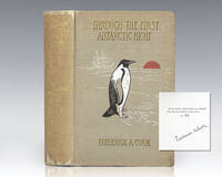
1900111201New York: Doubleday & McClure Co 1900. Signed limited edition of American arctic explorer Frederick Cook's narrative of the first expedition to winter in the Antarctic region in which he saved numerous lives as the ship's surgeon. Octavo original illustrated cloth tissue-guarded frontispiece in color illustrated. One of one thousand numbered copies signed by the author on the limitation page opposite a tissue-guarded engraved portrait this is number 92. From the library of James Stephen "Steve" Fossett with his bookplate to the pastedown. American businessman and record-setting aviator Steve Fossett became the first person to fly solo nonstop around the world in 2002 in his 10-story high balloon Spirit of Freedom. He completed the 2002 trip in 13 days 8 hours and 33 minutes and set records for both the Longest Distance Flown Solo in a Balloon and Fastest Balloon Flight Around the World. Fossett was also one of sailing's most prolific distance record holders set the Absolute World Speed Record for airships with a Zeppelin NT in 2004. He received numerous awards and honors throughout his career including aviation's highest award the Gold Medal of the Federation Aeronautique Internationale FAI which he was awarded in 2002. Fossett disappeared on September 3 2007 while flying a light aircraft over the Great Basin Desert between Nevada and California. In near fine condition. American physician Frederick Albert Cook was the surgeon on Robert Peary's Arctic expedition of 1891-1892 and on the Belgian Antarctic Expedition of 1897-1899. He contributed to saving the lives of its crew members when their ship--the Belgica--was ice-bound during the winter as they had not prepared for such an event. It became the first expedition to winter in the Antarctic region. To prevent scurvy Cook went hunting to keep the crew supplied with fresh meat. "His narrative is certainly one of the finest and most interesting from any Antarctic expedition" Rosove and the first to contain an extensive photographic record of the region. Doubleday & McClure Co hardcover books
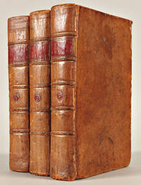
177325577London: printed for W. Strahan and T. Cadell 1773. 3 volumes quarto. 11 x 8 5/8 inches. 51 engraved plates maps and charts 41 folding. Some small repaired tears. Contemporary calf gilt border to covers expertly rebacked to style spine with raised bands in six compartments red and green morocco lettering pieces in the second and fourth compartments the others with a repeat decoration in gilt period marbled endpapers<br/> <br/>Provenance: Earl Fitzwilliam Milton House Cambridgeshire book label armorial bookplate<br/> <br/>The Fitzwilliam set of the first edition first issue of Hawkesworth's account of the most important mid-18th century English voyages of exploration to the southern hemisphere including the official account of Cook's first voyage. A fascinating narrative intended to "embellish England's prestige as a maritime power" Hill and describing events that were to be major factors in the shaping of Pacific exploration.<br/> <br/>The first volume contains accounts edited by Hawkesworth of the voyages of Byron Wallis and Carteret with the remaining volumes dedicated wholly to Cook's first voyage. "The first voyage under . Captain Cook's command on the Endeavour was primarily of a scientific nature. The expedition was to sail to Tahiti in order to observe the transit of Venus across the disk of the sun to determine the earth's distance from the sun and also to carry on the geographical discovery that John Byron had started. Entering the Pacific around Cape Horn Cook reached Tahiti in 1769 and carried out the necessary astronomical observations . Sir Joseph Banks and Daniel C. Solander carried out extensive ethnological and botanical research. Leaving Tahiti in July Cook discovered named and charted the Society Islands and then heading southwest explored New Zealand which resulted in . a detailed survey of the country. Cook then headed toward Australia and discovered and charted the eastern coast for 2000 miles naming the area New South Wales . Both Australia and New Zealand were annexed by the British as a result of this voyage which began in 1768 and ended in 1771. Cook had charted upwards of 5000 miles of coastline under great difficulties. Cook's discoveries won him prominence promotion and the opportunity to sail again. They also ensured John Hawkesworth's position in maritime literary history as the official chronicler of Cook's first voyage. Hawkesworth an eminent London author was chosen by Lord Sandwich and commissioned by the Admiralty to prepare these narratives for publication . He was expected to add polish to the rough narratives of sea men and to present the accounts in a style befitting the status of the voyages as official government expeditions intended to embellish England's prestige as a maritime power" Hill. This copy is bound without the "Directions for placing the cuts" or the "Chart of the Strait of Magellan" in vol. I both not required in the earliest issues.<br/> <br/>Beddie 648; Hill p.139; Holmes 5; Sabin 30934. printed for W. Strahan, and T. Cadell unknown books
17831851Hartford CT: Printed and sold by Nathaniel Patten 1783. First edition. Octavo in fours 6 5/8 x 4 3/8 inches; 169 x 111 mm. 1-208 pp. Map absent as is almost always the case see note. Contemporary full brown sheep. Red morocco spine label lettered in blind. Original stab holes present indicating that this copy was once in original wrappers with seemingly original endpapers. Boards with some rubbing and edges bumped. Inner hinges with some minor professional repairs. Date "1783" in blue ink on title-page. Front free endpaper with old ink notes. A bit of toning and staining however considerably clean and bright unusual for an American book of this period. In a custom oatmeal cloth clamshell. Overall a very good copy. <br/><br/>The first American book on the Northwest Coast and likely the first American book on Hawaii written by a significant figure in the history of American contact narratives in the South Seas. This edition "preceded publication of the official London narrative by more than a year. The author a corporal of the marines aboard the Resolution was one of several Americans on the voyage but the only one to publish an account. As all hands were ordered at Macao to ‘deliver up their journals and every writing remark or memorandum on pain of the severest punishment in case of concealment' for forwarding to the Admiralty. Ledyard relied in great part on a copy of the Rickman narrative in drawing up this account. He however includes details of the voyage not available elsewhere. The account of his stay at Hawaii including his inland expedition and the death of Captain Cook at Kealakekua Bay occupies 64 pages of the text" Forbes. An enthusiastic and detailed account of Cook's voyage.<br/><br/>Concerning the absence of the map we read in the Hawaiian National Bibliography: "The map is particularly rare and is almost always lacking even in otherwise very good copies. Due to the erratic nature of American printing of the period it may well be that the map was not produced until the work was well under way or that it cost extra to purchasers as some copes show no evidence that it was ever present as is the case with this copy. In the American Antiquarian Society copy the map is bound on a stub at page 161 the beginning of Part III. This appears to be added evidence that the map did not appear until the last part of the publication was issued" 44. <br/><br/>Evans 17998. Hawaiian National Bibliography 52. Hill I pp. 176-177. Sabin 39691. Lada-Mocarski 36. Kroepelin 717. Howes L-178. Printed and sold by Nathaniel Patten unknown books
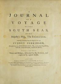
1773310853London: Printed for Stanfield Parkinson 1773. First edition with the very rare "Explanatory Remarks" by Fothergill and postscript. Complete with frontispiece and 27 engraved plates including 1 map. xxiv 22 212 2 pp. Imperial 4to. Contemporary tree calf finely rebacked with gilt spine to period style. Fine. First edition with the very rare "Explanatory Remarks" by Fothergill and postscript. Complete with frontispiece and 27 engraved plates including 1 map. xxiv 22 212 2 pp. Imperial 4to. With The Rare Explanatory Remarks by Fothergill. First edition of this important account of Cook's first voyage based on the journal of Parkinson who had been engaged by Sir Joseph Banks to serve as natural history draughtsman aboard the Endeavour. Parkinson died of dysentery on the homeward voyage and his account was transcribed and published by his brother Stanfield Parkinson who was forced by injunction to delay publication until Hawkesworth's official account appeared. "Parkinson made numerous drawings of botanical and other subjects including landscapes and portraits of native chiefs . Banks spoke highly of his 'unbounded industry' in making for him a much larger collection of drawings than he anticipated. His observations too were valuable and the vocabularies of South Sea languages given in his journal are of great interest" Hill. <br/>This copy includes the rare "Explanatory Remarks" by John Fothergill a Parkinson family friend who mediated an agreement between Stanfield Parkinson and Banks both of whom laid claim to the journal which would allow for the publication of the book. When Stanfield Parkinson included a scurrilous preface attacking Banks and misrepresenting his actions an offended Fothergill purchased the remaining copies inserting into them these 22 pages of remarks which sought to set the record straight. In 1784 he brought out a new edition of Parkinson's account which included the remarks but copies of the first edition which include them are scarce on the market. Beddie 712; Hill 1308; Holmes 7; Howgego C173; Du Rietz 944; Sabin 58787 Printed for Stanfield Parkinson unknown books
1783310851Hartford: Nathaniel Pattern 1783. First edition lacking the map as in almost all copies. 208 pp. 1 vols. 8vo. Contemporary sheep over boards finely rebacked with period spine to style. Highest quality conservation repairs to edges of first four leaves of text and to corner margins on last two leaves. Very good copy in a handsome binding. First edition lacking the map as in almost all copies. 208 pp. 1 vols. 8vo. Rare. "This is not only the first American book on the Northwest Coast but also the first American book on Hawaii" Streeter. <br/><br/>Ledyard is distinguished in many respects he was the only American to sail on Cook's third voyage which explored Alaska and discovered Hawaii. He was also in the boat that carried Cook ashore on the morning of his death. Indeed this work contains a detailed account of Cook's death "distinguished by its evident authority" Hill.<br/>The purpose of Cook's third voyage was twofold. Ostensibly it was to return Omai to his homeland in French Polynesia but the main purpose was to search for the Northwest Passage. The Resolution and Discovery departed Plymouth in 1776 and made their way via the Cape to New Zealand and Tahiti. It was from there that Cook discovered Hawaii which he regarded as his greatest achievement. The boats then proceeded to the Pacific Northwest and commenced their search for a route to the Atlantic. They returned to Hawaii for the winter of 1778-9. Their initial warm welcome soon wore off and tensions between the Hawaiians and the British resulted in Cook being killed on the shore of Kealakekua Bay on February 14 1779. Charles Clerke assumed command of the expedition and proceeded north once again to pursue the voyage's objective. The two ships returned to England in 1780.<br/>A Connecticut native after the voyage Ledyard remained in England until 1782 when he was posted to the North American station - the Revolutionary War was ongoing. He promptly deserted and returned to Hartford where this account was published. This work preceded Rickman's by a matter of months though in fact Ledyard made "liberal use of the first English edition of Rickman's account in his own narrative" Hill. This is not to deride Ledyard unnecessarily; in addition to his account of Cook's death his keen observations on the fur trade in the Pacific northwest are of great value.<br/><br/>Ledyard's account is one of the rarest works on Cook's third's voyage and Hill confirms that "only a few copies still have the map." It was wanting in both the Streeter and Brooke-Hitching copies. Beddie 1603; Evans 17998; Sabin 39691; Forbes 52; Hill 991; Howes L-181 "d"; Lada-Mocarski 36; Smith 5797; Streeter Sale VI:3477 Nathaniel Pattern unknown books
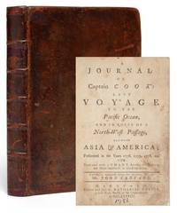
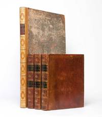
17842022London: printed for G. Nicol bookseller to His Majesty in the Strand; and T. Cadell 1784. First edition. Three quarto volumes 11 7/16 x 9 inches; 290 x 230 mm. plus large folio atlas volume 21 3/4 x 15 15/16 inches; 552 x 405 mm. 8 xcvi 421 1 blank; 12 549 1 blank; 12 558 1 advertisement 1 blank pp. Volume III bound with the final leaf of advertisements for Cook's First and Second Voyages. Three text volumes with twenty-four engraved plates and charts thirteen of which are folding and appendix with 1 folding letterpress table facing p. 528 in Volume III. Sixty-three large plates and charts one folding one double-page in the folio atlas volume eighty-seven total. With tissue guards. The text volumes bound in contemporary tree calf. Spines each with two black leather spines labels lettered in gilt. Spines stamped and ruled in gilt. A bit of rubbing and flaking to leather. Volume one rebacked with the original spine laid down. Each volume with some minor offsetting. Trivial foxing generally to preliminary leaves. Charts occasionally causing some offsetting. Publisher's advertisement in volume three with lower corner torn but not affecting text. Overall text is extremely clean. Atlas in contemporary marbled paper boards. Rebacked and recornered with half polished calf. Spine tooled in gilt. Generally the plates are exceptionally clean. Overall a very good set with beautifully clean text and plates. <br/><br/>"Cook's third voyage was organized to seek the Northwest Passage and to return the islander Omai to Tahiti. Officers of the crew included William Bligh James Burney James Colnett and George Vancouver. John Webber who was appointed artist to the expedition. After calling at Kerguelen Island Tasmania New Zealand and the Cook Tonga and Society Islands the expedition sailed north and discovered Christmas Island and the Hawaiian Islands which Cook named the Sandwich Islands. Cook charted the American west coast from Northern California through the Bering Strait as far north as latitude 70 degrees 44 minutes before he was stopped by pack ice" Hill. printed for G. Nicol, bookseller to His Majesty, in the Strand; and T. Cadell unknown books
178519946London: H. Hughs for G. Nicol and T. Cadell 1785. 4 volumes Text: 3 vols. quarto 11 3/8 x 9 1/4 inches; Atlas vol. of plates: 1 vol. large folio 22 x 16 inches. Text: Engraved medallion vignette on each title 1 folding letterpress table 24 engraved maps coastal profiles and charts 13 folding. Atlas vol.: 63 engraved plates plans and maps one double-page one folding. Text: contemporary calf expertly rebacked at an early date incorporating the original labels; atlas: expertly bound to style in half speckled calf over contemporary marbled paper-covered boards spine in eight compartments with raised bands each band flanked by triple gilt fillets red morocco lettering-piece in the second compartment green morocco in the fourth the others with simple repeat decoration in gilt<br/> <br/>A fine copy of the second and best edition of the official account of Cook's third and last voyage including images of and text on the exploration of Hawaii and the west coast of America Canada and Alaska.<br/> <br/>"The famous accounts of Captain Cook's three voyages form the basis for any collection of Pacific books. In three great voyages Cook did more to clarify the geographical knowledge of the southern hemisphere than all his predecessors had done together. He was really the first scientific navigator and his voyages made great contributions to many fields of knowledge" Hill. The typography of the second edition text of the third voyage is generally considered superior to the first Hughs took over the printing from Strahan and re-set all the text. Contemporary support for this view is reported by Forbes who quotes an inscription in a set presented by Mrs. Cook to her doctor Dr. Elliotson which notes ".the second edition being much superior to the first both in paper & letterpress." "Cook's third voyage was organized to seek the Northwest Passage and to return the islander Omai to Tahiti. Officers of the crew included William Bligh James Burney James Colnett and George Vancouver. John Webber was appointed artist to the expedition. After calling at Kerguelen Island Tasmania New Zealand and the Cook Tonga and Society Islands the expedition sailed north and discovered Christmas Island and the Hawaiian Islands which Cook named the Sandwich Islands. Cook charted the American west coast from Northern California through the Bering Strait as far north as latitude 70 degrees 44 minutes before he was stopped by pack ice. He returned to Hawaii for the winter and was killed in an unhappy skirmish with the natives over a boat. Charles Clarke took command and after he died six months later the ships returned to England under John Gore. Despite hostilities with the United States and France the scientific nature of this expedition caused the various governments to exempt these vessels from capture. The voyage resulted in what Cook judged his most valuable discovery - the Hawaiian Islands" Hill pp.61-62.<br/> <br/>Cf. Beddie 1543; cf. Forbes Hawaiian National Bibliography 62; cf. Lada-Mocarski 37; cf.Printing and the Mind of Man 223; cf. Sabin 16250. H. Hughs for G. Nicol and T. Cadell unknown books