Abraham OrteliusBiblio.com
213 résultats
1584672Antwerp: Abraham Ortelius 1584. 19 3/4 x 14 1/2 inches. Very good condition. This is a well designed and compose map of the central Netherlands bounded primarily by German episcope and Belgium. Ortelius the father of the modern atlas included this map in his 1584 edition. The Zyder Zwee has two ships with full canon fire. There is an attractive cartouche that was hand colored at a later date. Abraham Ortelius unknown
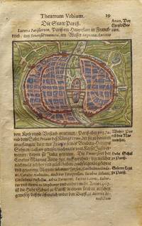
15956645<p>This original hand-colored engraving is from an early edition of Abraham Saur's <em>Theatrum Urbium</em>. The work featured early town views and maps. Many of the cities shown were some of the earliest printed views available. Abraham Saur 1545-1593 was a German lawyer and historian. He published several legal books in addition to his famous <em>Theatrum Urbium</em>. Map size: 3.75 x 2.75 in.; Paper: 4.625 x 7.25 in.</p> Nicolaum Basseum
159533635Antwerpen 1595. In sehr gutem Zustand. Leichte Bräunung im Mittelfalz. 34.5 x 497 cm 13.5 x 195 inches. Hand-Colored Original Copperplate Engraving by Abraham Ortelius depicting Westphaliae Totius Finitimarumque Regionum Accurata Descriptio. Published Antwerpen 1595. Sheet: 34.5 x 497 cm 13.5 x 195 inches. A fine and original hand-colored example of Ortelius's celebrated cartographic work documenting this region of Germany with the precision and decorative artistry characteristic of the 15900s. Abraham Ortelius 1527-1598 was a Flemish cartographer and geographer from Antwerp widely regarded as the creator of the first modern atlas. His landmark publication Theatrum Orbis Terrarum 1570 set the standard for atlas-making for the next century presenting uniform copper-engraved maps with scholarly commentary. By Ortelius's death the Theatrum had appeared in 25 editions in seven languages. In 1575 King Philip II of Spain appointed him Royal Geographer. His maps engraved with extraordinary precision are among the most sought-after in antique cartography held in collections including the Plantin-Moretus Museum in Antwerp the Library of Congress and the British Library.This original copperplate engraving with original hand coloring depicts the region of Westphaliae Totius Finitimarumque Regionum Accurata Descriptio. published in Antwerpen 1595. The map features a decorative Baroque cartouche containing the title inscription. A distance scale is incorporated within the cartouche or alongside it. The map records the political and geographic boundaries of the region as understood in 1595 offering a fascinating window into the history of German territorial organization. Sheet measures 34.5 x 497 cm 13.5 x 195 inches. In good condition overall with minor signs of age appropriate for a 16th-century engraving. Ready to frame. Koe. Ort 23 / #46 85. Broe. 91. unknown
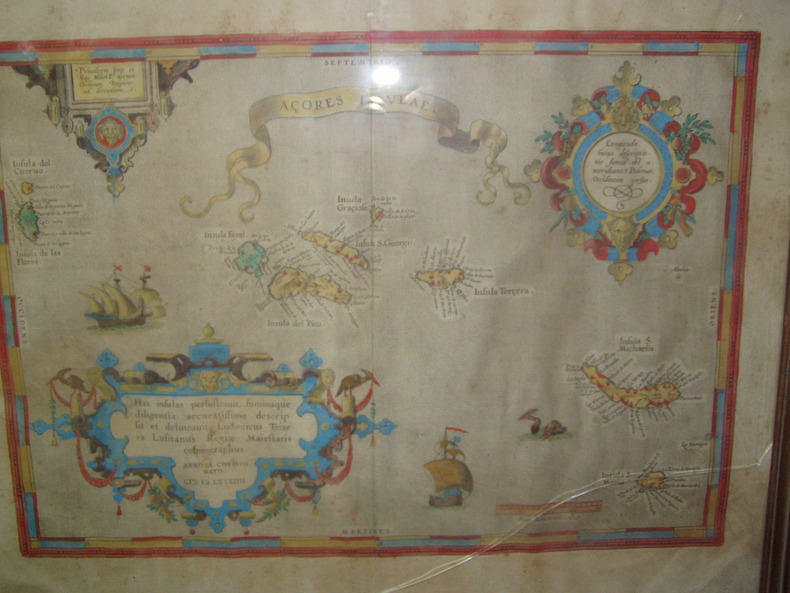
1584224251584 Orig. copper-engraving. Published by A. Ortelius after to L. Teixeira's map of the Açores. Dated 1584. Coloured. With title in decorative border, 3 ornamental cartouches, 2 ships, sea-monster and "Scala Leucarum". 32,5:46,5 cm (12 3/4 x 18 1/4 inch.) 2,5 x 46,5 cm Van der Krogt, Koeman's Atlantes Neerlandici, Vol. III B, 6350:31; Van den Broecke, Ortelius Atlas Maps, Nr. 24. - Stammt aus einer von fünf lateinischen Ausgaben, die in den Jahren 1595 - 1612 erschienen. Alle tragen das Datum 1584 in der großen Kartusche.A splendid sea chart of the Azores with three scrollwork cartouches; the ocean is decorated with sailing vessels. A fresh example of this scarce sea chart, based on Teixeira's single sheet map of Terceira from 1582, and a later manuscript atlas of the Azores islands. The Azores played a significant role in international sea trade as a victualling stop and shelter for ships sailing into the South Atlantic. In very good condition. The map was first issued in an edition of 100 examples in the Additamentum to the 1583 edition of Ortelius' Theatrum Orbis Terrarum, which is widely referred to as the first modern atlas and a landmark in the history of Western map making. Beginning in 1570, Abraham Ortelius and his successors published (and continuously added to) this monumental work for a period of over 40 years (not including the very rare edition of 1641), with text on the verso in Latin, Italian, German, Dutch, French, Spanish and English.References: Van Den Broecke 24. Meurs p 253-254.
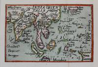
1588M8273Antwerp c. 1588. Very Good backed on acid free tissue paper for long term preservation. Notes: Miniature map of South East Asia published in Antwerp around c. 1588 by Philip Galle. This map comes from a pocket version of Abraham Ortelius’ folio atlas of China published in 1584. It is from the second series of plates in his atlas which were improved upon in terms of spatial dimension by its predecessors. Size : 75x115 mm 2.95x4.53 Inches Coloring: Hand Colored Category: Maps Asia Central India & Sri Lanka / Ceylon; Maps Asia South East; unknown
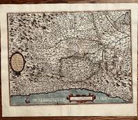
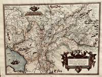
1584673Antwerp: Abraham Ortelius 1584. 19 1/2 x 14 1/2 inches. Very good condition. This is an exquisite map of Italy with Monaco in the west. and Milano in the Northeast. It shows the coast of the Mediterranean Sea at the borrow/ There is an extensive river network flowing throughout a mountainous terrain.The Po river dominates the central portion of the maps. This is an example of the best of the mapmakers art. This is nicely colored in a later than issued application. Abraham Ortelius unknown
1571M10736Antwerp 1571. Very Good. Notes: Dutch text on verso. <br>16th century map of Germany by Abraham Ortelius published in his atlas; Theatrum Orbis Terrarum. Size : 342x508 mm 13.46x20.00 Inches Coloring: Hand Colored Reference: Marcel P. R. van den Broecke #93. Category: Maps Europe Germany; unknown
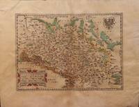
15793004<p>Paper size: 392 x 500 mm. Plate size: 278 x 386 mm. 16th century map in original hand-coloring. Depicts rivers forests ranges monasteries and towns/cities including Prague and Frankfurt. Latin text regarding Silesia to verso. Please see image. Ortelius 102. ; 392 x 500 mm ; All shipments through USPS insured Priority Mail.</p> Abraham Ortelius
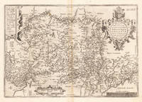
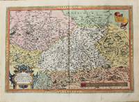
158437541Antwerpen 1584. In excellent condition. . 345 by 503mm 13 by 19 inches. Hand-Colored Original Copperplate Engraving by Abraham Ortelius depicting Saxoniae Misniae Thuringiae Nova Exactissimaq Descriptio. Published Antwerpen 1584. Sheet: 345 by 503mm 13 by 19 inches. A fine and original hand-colored example of Ortelius's celebrated cartographic work documenting this region of Germany with the precision and decorative artistry characteristic of the 15800s. Abraham Ortelius 1527-1598 was a Flemish cartographer and geographer from Antwerp widely regarded as the creator of the first modern atlas. His landmark publication Theatrum Orbis Terrarum 1570 set the standard for atlas-making for the next century presenting uniform copper-engraved maps with scholarly commentary. By Ortelius's death the Theatrum had appeared in 25 editions in seven languages. In 1575 King Philip II of Spain appointed him Royal Geographer. His maps engraved with extraordinary precision are among the most sought-after in antique cartography held in collections including the Plantin-Moretus Museum in Antwerp the Library of Congress and the British Library.This original copperplate engraving with original hand coloring depicts the region of Saxoniae Misniae Thuringiae Nova Exactissimaq Descriptio. published in Antwerpen 1584. The map records the political and geographic boundaries of the region as understood in 1584 offering a fascinating window into the history of German territorial organization. Sheet measures 345 by 503mm 13 by 19 inches. In good condition overall with minor signs of age appropriate for a 16th-century engraving. Ready to frame. Broe. 93 unknown
157252379Antwerp. c.1572. Ortelius published this map in his now famous atlas The Theatrum Orbis Terrarum basing it on the earlier 1548 map by Jacques and Jean Surhon according to the reference book of van der Broecke there were only one hundred copies of this map printed. Strapwork cartouche coats of armstwo scales beadwork border. This is a highly decorative inexpensive sixteenth century map. Copper engraving. Fine condition good margins. Original colour. Size: 50 x 38 cm. van den Broecke 69 unknown
15842101091584. Auf Bütten mit Wasserzeichen "Zwei gekreuzte Pfeile". 35 x 19,7 cm (Plattengröße) 43,5 x 26 cm (Papier).
15739404Antwerp 1573. Three engraved maps on one sheet 38.5 x 50 cm black and white very faintly red-ruled slight marginal soiling Latin text on verso; old tabs on verso where previously mounted. An early example of this particular map which was first printed in Dutch German and Latin editions of Ortelius Theatrum in the same year 1573. Pomerania running along the Baltic coast between Rostock and Gdansk is now divided between Germany and Poland; Livonia covers much of modern Latvia and Estonia; the Duchies of Oswiecim and Zator were two of the Duchies of Silesia in modern Poland. Ortelius's Theatrum Orbis Terrarum is generally considered the first modern atlas of the world originally published in 1570. Ortelius gathered the best available cartographic knowledge and presented it in a consistent style in a single volume with text. The Theatrum was very decorative and hugely popular amongst the wealthy and educated running into over forty editions in Latin and the major European languages. Marcel Van den Broecke Ortelius Atlas Maps no. 158. Map unknown
158464215Antwerp.: Abraham Ortelius. circa1584. Two engraved maps on laid paper each 30.3 x 19.5 cm printed on the one sheet 48 x 60 cm original fold attractive hand colour with related French text on verso slight toning and spotting to the margins but the maps in very good condition preserved in a modern window mount. Attractive maps of the German coast published in Ortelius' great atlas "Theatrum Orbis.". The left-hand map showing the mouths of the Elbe complete with sea monster and Eider Rivers and the coast of Schleswig-Holstein; the right-hand map of the Baltic coast with the Pomeranian islands of Rugen and Usedom. . (Abraham Ortelius). unknown
159040297N.p. 1590. Image area 19-1/2" x 12-7/8" in 28" x 23" mat. 1 vols. Imperfectly colored along crease down center small and unobtrusive dampstain in one corner. Still a nice piece. Image area 19-1/2" x 12-7/8" in 28" x 23" mat. 1 vols. Abraham Ortelius 1527-98 was a Flemish geographer of German origin. His major work Theatrum Orbis Terrarum 1570 with later revisions and addendums was the first modern atlas. It was based on contemporary charts and maps and contained a collection of plates engraved by Frans Hagenberg in a uniform size and format. The Theatrum preceded the first atlas of Ortelius' good friend Gerardus Mercator. In fact popular sentimental legend has it that Mercator delayed publication of his own work so that his younger friend's would appear first. Although this simply isn't true Mercator wasn't ready the legendary cartographer did complement Ortelius for the "care and elegance" he had put into the Theatrum. unknown
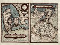
1584671Antwerp: Abraham Ortelius 1584. 9 3/4 x 13 1/4 inces Oleburg is 9 3/4 x 13 1/4 inches total including gutter is 19 5/8 x 13 1/4 inches. Very good condition. There are two well composed maps for the viewer to behold. Denmark in its entiretyy. It fingers into the ocean with several islands to the East. Further east is the nation of Sweden. The map with Oldenburg is detailed given the proximity to simple Frisia Orien Pares. Prominently shown is Bremen Episcoc. with the town on the extreme right. This is the epitome of the map makers art. Abraham Ortelius unknown
1584803Antwerp: Abraham Ortelius 1584. 17 x 22 inches. Excellent condition for its age. This is a map showing the Adriatic Ocean and neighboring villages of Croatia Bosnia HerzegovinaHungary to the north and Slovenia. Nicely colored by hand at a date later than time of publication the map contains a contemporary layout of the Balkans region. Abraham Ortelius unknown
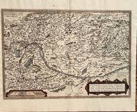
1584687Antwerp: Abraham Ortelius 1584. 19 3/4 x 13 1/2 inches. Very good but for a harpsichord shaped wormhole at the upper centerfold which is relatively of little consequence. This is a handsomely executed map of the Danube River Basin starting on the left at Vienna and passing through Austria Serbia and Romania. Belgrade is prominently displayed near the cartouche. In the lower left is a mileage scale. This is a very nice example of late 16th century mapmakers art. Abraham Ortelius unknown
159040297N.p. 1590. Image area 19-1/2" x 12-7/8" in 28" x 23" mat. 1 vols. Imperfectly colored along crease down center small and unobtrusive dampstain in one corner. Still a nice piece. Image area 19-1/2" x 12-7/8" in 28" x 23" mat. 1 vols. Abraham Ortelius 1527-98 was a Flemish geographer of German origin. His major work Theatrum Orbis Terrarum 1570 with later revisions and addendums was the first modern atlas. It was based on contemporary charts and maps and contained a collection of plates engraved by Frans Hagenberg in a uniform size and format. The Theatrum preceded the first atlas of Ortelius' good friend Gerardus Mercator. In fact popular sentimental legend has it that Mercator delayed publication of his own work so that his younger friend's would appear first. Although this simply isn't true Mercator wasn't ready the legendary cartographer did complement Ortelius for the "care and elegance" he had put into the Theatrum. unknown books
1584299318Antwerp: Abraham Ortelius 1584. unbound. Map. Engraving. Image measures 14" x 18 3/4". Light staining and toning on right margin but otherwise is good condition.<br/><br/> A representation of some islands in the Mediterranean Sea. Abraham Ortelius 1527-1598 a Flemish cartographer and geographer is widely regarded as one of the important and influential cartographers in history. He is known for his "Theatrum Orbis Terrarum" which was the first modern atlas. Van den Broecke #141<br/><br/> Abraham Ortelius unknown books
1584299318Antwerp: Abraham Ortelius 1584. unbound. Map. Engraving. Image measures 14" x 18 3/4". Light staining and toning on right margin but otherwise is good condition.<br/> <br/> A representation of some islands in the Mediterranean Sea. Abraham Ortelius 1527-1598 a Flemish cartographer and geographer is widely regarded as one of the important and influential cartographers in history. He is known for his "Theatrum Orbis Terrarum" which was the first modern atlas. Van den Broecke #141<br/> <br/> Abraham Ortelius unknown
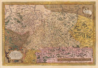
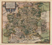
158737336Antwerp: Christopher Platin 1587. A very good example in excellent condition. 387 by 440mm 15 by 17 inches. Hand-Colored Original Copperplate Engraving by Abraham Ortelius depicting Wirtenberg Ducatus Accurata descriptio; tu qua omnia eius Opida Monasteria pagi nemora; fluminia et riuuli alicuius nominis diligentißimé exprimuntur. Auctore Georgio Gadnero. Published Antwerp Christopher Platin 1587. Sheet: 387 by 440mm 15 by 17 inches. A fine and original hand-colored example of Ortelius's celebrated cartographic work documenting this region of Germany with the precision and decorative artistry characteristic of the 15800s. Abraham Ortelius 1527-1598 was a Flemish cartographer and geographer from Antwerp widely regarded as the creator of the first modern atlas. His landmark publication Theatrum Orbis Terrarum 1570 set the standard for atlas-making for the next century presenting uniform copper-engraved maps with scholarly commentary. By Ortelius's death the Theatrum had appeared in 25 editions in seven languages. In 1575 King Philip II of Spain appointed him Royal Geographer. His maps engraved with extraordinary precision are among the most sought-after in antique cartography held in collections including the Plantin-Moretus Museum in Antwerp the Library of Congress and the British Library.This plate presents a original copperplate engraving with original hand coloring depicting the city of Wirtenberg Ducatus Accurata descriptio; tu qua omnia eius Opida Monasteria pagi nemora; fluminia et riuuli alicuius nominis diligentißimé exprimuntur. Auctore Georgio Gadnero. published in Antwerp Christopher Platin 1587. The view is framed with a decorative Baroque cartouche containing the title inscription. Such topographic views from Ortelius's workshop are primary historical documents of German urban history in the 1500s now prized equally by historians map collectors and interior decorators. Sheet measures 387 by 440mm 15 by 17 inches. In good condition overall with minor signs of age appropriate for a 16th-century engraving. Ready to frame. Broe. 113 Christopher Platin unknown
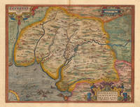
159816774Antwerp: Platin 1598. Other. A very good example a small older mended clear split in the upper centerfold. 350 by 460mm 13 by 18 inches. Original antique copper engraving published 1598 in a French textedition of the Theatrum Orbis Terrarum. Finely hand-colored in wash and outline. The map is ornated with three cartouches in the lower right corner the title cartouche in the upper right corner we find a small cartouche with privilegium and in the upper left corner a small cartouche with a milage scale. Villages and towns are shown as miniature views moreover the map is ornated with ships sea monsters and animals as well a compass rose in the sea. Ortelius was born on 14 April 1527 in the city of Antwerp which was then in the Habsburg Netherlands modern-day Belgium. The Orthellius family were originally from Augsburg a Free imperial city of the Holy Roman Empire. In 1535 the family had fallen under suspicion of Protestantism. Following the death of Ortelius's father his uncle Jacobus van Meteren returned from religious exile in England to take care of Ortelius. Abraham remained close to his cousin Emanuel van Meteren who would later moved to London. In 1575 he was appointed geographer to the king of Spain Philip II on the recommendation of Arias Montanus who vouched for his orthodoxy. He travelled extensively in Europe and is specifically known to have traveled throughout the Seventeen Provinces; in southern western northern and eastern Germany e.g. 1560 15751576; France 15591560; England and Ireland 1576; and Italy 1578 and perhaps twice or thrice between 1550 and 1558. Beginning as a map-engraver in 1547 he entered the Antwerp Guild of Saint Luke as an illuminator of maps. He supplemented his income trading in books prints and maps and his journeys included yearly visits to the Frankfurt book and print fair where he met Gerardus Mercator in 1554. In 1560 however when travelling with Mercator to Trier Lorraine and Poitiers he seems to have been attracted largely by Mercator's influence towards the career of a scientific geographer. Wikipedia Broe. 28 Platin unknown
157952409Antwerp. 1579. Based on the 1548 map by Jacques & Jean Surhonio which for security reasons was never published. Only in 1579 when Antwerp was independent for a short time did Ortelius publish it van den Broecke 70. Strapwork cartouche coats of arms two scales. Published in the wonderful Theatrum Orbis Terrarum. Copper engraving. Good condition. Some wear to lower centrefold. Narrow margins a little darkened Original colour. Size: 49 x 37 cm. Van den Broecke 70 unknown
1592LBW0251e[Anvers, 1592]. 349 x 496 mm.
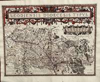
1584675Antwerp: Abraham Ortelius 1584. 19 1/2 x 14 2/4 inches. Very good condition. Ortelius was mentored by Mercator. The friendship yielded a mapmaking enterprise of great success. This map of the diocese of Liege. The main cartouche spreads across and covers the entire 2 pages. There is a secondary mileage cartouche scale. There is a major river through Liege. The Meuse runs thrash the map with primal impact showing the riverine regime as important to a large area. There is a multitude of small towns colored red. This is a very good copy with color not applied at publication. Ortelius oriented the west at the top of the map. Abraham Ortelius unknown