Ortelius, AbrahamBiblio.com
213 résultats
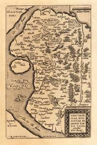
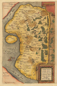
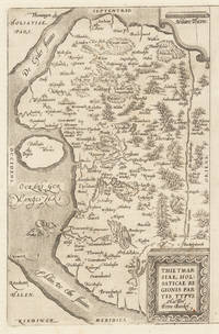
158430502Antwerpen: Platin 1584. Other. In excellent condition. 304 by 196mm 12 by 7 inches. Hand-Colored Original Copperplate Engraving by Abraham Ortelius depicting Thietmarsiae Holsaticae Regionis Partis Typus. Auctore Petro Boeckel. Published Antwerpen Platin 1584. Sheet: 304 by 196mm 12 by 7 inches. A fine and original hand-colored example of Ortelius's celebrated cartographic work documenting this region of Germany with the precision and decorative artistry characteristic of the 15800s. Abraham Ortelius 1527-1598 was a Flemish cartographer and geographer from Antwerp widely regarded as the creator of the first modern atlas. His landmark publication Theatrum Orbis Terrarum 1570 set the standard for atlas-making for the next century presenting uniform copper-engraved maps with scholarly commentary. By Ortelius's death the Theatrum had appeared in 25 editions in seven languages. In 1575 King Philip II of Spain appointed him Royal Geographer. His maps engraved with extraordinary precision are among the most sought-after in antique cartography held in collections including the Plantin-Moretus Museum in Antwerp the Library of Congress and the British Library.This original copperplate engraving with original hand coloring depicts the region of Thietmarsiae Holsaticae Regionis Partis Typus. Auctore Petro Boeckel. published in Antwerpen Platin 1584. The map records the political and geographic boundaries of the region as understood in 1584 offering a fascinating window into the history of German territorial organization. Sheet measures 304 by 196mm 12 by 7 inches. In good condition overall with minor signs of age appropriate for a 16th-century engraving. Ready to frame. Platin unknown
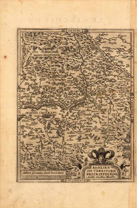
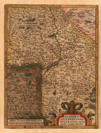
159821963Antwerp: Christopher Platin 1598. Other. A strong impression in excellent condition. 324 by 245mm 12 by 9 inches. Original copper engraving published 1598 in the famous atlas 'Theatrum Orbis Terrarum'. In French text edition. Detailed map of the Basel territory with renaissance title cartouche and scale bars. Villages and towns are shown as miniature views. Ortelius was born on 14 April 1527 in the city of Antwerp which was then in the Habsburg Netherlands modern-day Belgium. The Orthellius family were originally from Augsburg a Free imperial city of the Holy Roman Empire. In 1535 the family had fallen under suspicion of Protestantism. Following the death of Ortelius's father his uncle Jacobus van Meteren returned from religious exile in England to take care of Ortelius. Abraham remained close to his cousin Emanuel van Meteren who would later moved to London. In 1575 he was appointed geographer to the king of Spain Philip II on the recommendation of Arias Montanus who vouched for his orthodoxy. He travelled extensively in Europe and is specifically known to have traveled throughout the Seventeen Provinces; in southern western northern and eastern Germany e.g. 1560 15751576; France 15591560; England and Ireland 1576; and Italy 1578 and perhaps twice or thrice between 1550 and 1558. Beginning as a map-engraver in 1547 he entered the Antwerp Guild of Saint Luke as an illuminator of maps. He supplemented his income trading in books prints and maps and his journeys included yearly visits to the Frankfurt book and print fair where he met Gerardus Mercator in 1554. In 1560 however when travelling with Mercator to Trier Lorraine and Poitiers he seems to have been attracted largely by Mercator's influence towards the career of a scientific geographer. Wikipedia Broe: 114a Christopher Platin unknown
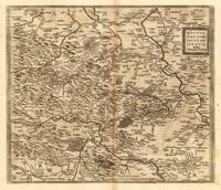
159827386Antwerpen: Moretus 1598. Other. On the sheet are two brown spots visible else in very good condition. 368 by 430mm 14 by 17 inches. Hand-Colored Original Copperplate Engraving by Abraham Ortelius depicting Mansfeldiae Comitatus Descriptio auctore Tilemanno Stella. Sig. Published Antwerpen Moretus 1598. Sheet: 368 by 430mm 14 by 17 inches. A fine and original hand-colored example of Ortelius's celebrated cartographic work documenting this region of Germany with the precision and decorative artistry characteristic of the 15900s. Abraham Ortelius 1527-1598 was a Flemish cartographer and geographer from Antwerp widely regarded as the creator of the first modern atlas. His landmark publication Theatrum Orbis Terrarum 1570 set the standard for atlas-making for the next century presenting uniform copper-engraved maps with scholarly commentary. By Ortelius's death the Theatrum had appeared in 25 editions in seven languages. In 1575 King Philip II of Spain appointed him Royal Geographer. His maps engraved with extraordinary precision are among the most sought-after in antique cartography held in collections including the Plantin-Moretus Museum in Antwerp the Library of Congress and the British Library.This original copperplate engraving with original hand coloring depicts the region of Mansfeldiae Comitatus Descriptio auctore Tilemanno Stella. Sig. published in Antwerpen Moretus 1598. The map features a decorative Baroque cartouche containing the title inscription. A distance scale is incorporated within the cartouche or alongside it. The map records the political and geographic boundaries of the region as understood in 1598 offering a fascinating window into the history of German territorial organization. Sheet measures 368 by 430mm 14 by 17 inches. In good condition overall with minor signs of age appropriate for a 16th-century engraving. Ready to frame. Broe. 94 Koeman 32 Moretus unknown
158427410Antwerpen: Platin 1584. Other. In excellent condition. 304 by 196mm 12 by 7 inches. Hand-Colored Original Copperplate Engraving by Abraham Ortelius depicting Thietmarsiae Holsaticae Regionis Partis Typus. Auctore Petro Boeckel. Published Antwerpen Platin 1584. Sheet: 304 by 196mm 12 by 7 inches. A fine and original hand-colored example of Ortelius's celebrated cartographic work documenting this region of Germany with the precision and decorative artistry characteristic of the 15800s. Abraham Ortelius 1527-1598 was a Flemish cartographer and geographer from Antwerp widely regarded as the creator of the first modern atlas. His landmark publication Theatrum Orbis Terrarum 1570 set the standard for atlas-making for the next century presenting uniform copper-engraved maps with scholarly commentary. By Ortelius's death the Theatrum had appeared in 25 editions in seven languages. In 1575 King Philip II of Spain appointed him Royal Geographer. His maps engraved with extraordinary precision are among the most sought-after in antique cartography held in collections including the Plantin-Moretus Museum in Antwerp the Library of Congress and the British Library.This original copperplate engraving with original hand coloring depicts the region of Thietmarsiae Holsaticae Regionis Partis Typus. Auctore Petro Boeckel. published in Antwerpen Platin 1584. The map records the political and geographic boundaries of the region as understood in 1584 offering a fascinating window into the history of German territorial organization. Sheet measures 304 by 196mm 12 by 7 inches. In good condition overall with minor signs of age appropriate for a 16th-century engraving. Ready to frame. Platin unknown
16001103040004Conatibus Geographicis Abrah Ortelii 1600. Map. Very Good. 17-1/4 x 22-1/2 inches. France. Black and white copperplate engraving. Decorative title cartouche in bottom left corner. Seal in top left corner contains an inscription reading "Imperator C. Iulius Caesar." The author Abraham Ortelius was a Flemish cartographer and geographer generally recognised as the creator of the first modern atlas the Theatrum Orbis Terrarum Theatre of the World. He is also believed to be the first person to imagine that the continents were joined together before drifting to their present positions. The following map is an excellent example of his attention to detail and cartographic accuracy. 2 large tears on bottom middle of print. Crease across center. Minor wear to corners. Slight age-related discoloration. Lines remain crisp and clear and lettering is easily legible. Overall a superior print in very good condition age considered. Conatibus Geographicis Abrah Ortelii unknown
1584676Antwerp: Abraham Ortelius 1584. 19 1/4. x 13 1/2 inches. Very good condition but for the scraped of nude of a woman leaving a thin paper with small hole. This is a 1584 map of the area around Cremona Italy. The map has a large cartouche. In this case the nude statue of a woman has been scraped of with the loss of paper. /It obviously offend the sensibilities of the clerics from which this map was sourced. A very nice map it has a high profile illustration of Cremona. The River Po is well illustrated in this map. There is a bounty of small towns proximate to this city. Abraham Ortelius unknown
157430110Antwerpen: Platin 1574. Other. In very good to exellent condition. 310 by 220mm 12 by 8 inches. Hand-Colored Original Copperplate Engraving by Abraham Ortelius depicting Buchauiae siue Fuldensis Ditonis Tyous. Wolfgango Regr: will auc tore. 1574. Published Antwerpen Platin 1574. Sheet: 310 by 220mm 12 by 8 inches. A fine and original hand-colored example of Ortelius's celebrated cartographic work documenting this region of Germany with the precision and decorative artistry characteristic of the 15700s. Abraham Ortelius 1527-1598 was a Flemish cartographer and geographer from Antwerp widely regarded as the creator of the first modern atlas. His landmark publication Theatrum Orbis Terrarum 1570 set the standard for atlas-making for the next century presenting uniform copper-engraved maps with scholarly commentary. By Ortelius's death the Theatrum had appeared in 25 editions in seven languages. In 1575 King Philip II of Spain appointed him Royal Geographer. His maps engraved with extraordinary precision are among the most sought-after in antique cartography held in collections including the Plantin-Moretus Museum in Antwerp the Library of Congress and the British Library.This original copperplate engraving with original hand coloring depicts the region of Buchauiae siue Fuldensis Ditonis Tyous. Wolfgango Regr: will auc tore. 1574. published in Antwerpen Platin 1574. The map records the political and geographic boundaries of the region as understood in 1574 offering a fascinating window into the history of German territorial organization. Sheet measures 310 by 220mm 12 by 8 inches. In good condition overall with minor signs of age appropriate for a 16th-century engraving. Ready to frame. Platin unknown
15791444c.1579. 15-3/4" x 19-3/4"- 40 x 50.1 cm. . Copper engraved map with original hand colouring. Laid down on board. An attractive map of Friesland and Groningen with inset of ancient Friesland. Abraham Ortelius 1527-1598 was a prominent Flemish cartographer who produced the first world atlas "Theatrum Orbis Terrarum" in 1570. This map was based on an earlier manuscript map by Sibrandus Leo whose name is featured in the title. unknown
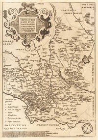
159233601Antwerpen 1592-1612. In ausgezeichnetem Zustand. Oben außerhalb des Kartenbildes ein Wasserrand. 36.2 x 25 cm 14.25 x 975 inches. Hand-Colored Original Copperplate Engraving by Abraham Ortelius depicting Monasteriensis et Osnaburgensis Episcopatus Descriptio. Auctotre Godefrido Mascop Embricense. Published Antwerpen 1592. Sheet: 36.2 x 25 cm 14.25 x 975 inches. A fine and original hand-colored example of Ortelius's celebrated cartographic work documenting this region of Germany with the precision and decorative artistry characteristic of the 15900s. Abraham Ortelius 1527-1598 was a Flemish cartographer and geographer from Antwerp widely regarded as the creator of the first modern atlas. His landmark publication Theatrum Orbis Terrarum 1570 set the standard for atlas-making for the next century presenting uniform copper-engraved maps with scholarly commentary. By Ortelius's death the Theatrum had appeared in 25 editions in seven languages. In 1575 King Philip II of Spain appointed him Royal Geographer. His maps engraved with extraordinary precision are among the most sought-after in antique cartography held in collections including the Plantin-Moretus Museum in Antwerp the Library of Congress and the British Library.This original copperplate engraving with original hand coloring depicts the region of Monasteriensis et Osnaburgensis Episcopatus Descriptio. Auctotre Godefrido Mascop Embricense published in Antwerpen 1592-1612. The map features a decorative Baroque cartouche containing the title inscription. A distance scale is incorporated within the cartouche or alongside it. The map records the political and geographic boundaries of the region as understood in 1592-1612 offering a fascinating window into the history of German territorial organization. Sheet measures 36.2 x 25 cm 14.25 x 975 inches. In good condition overall with minor signs of age appropriate for a 16th-century engraving. Ready to frame. Broe. 100b unknown
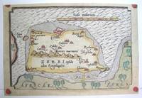
1590M3047Antwerp 1590. Excellent; narrow margins. Notes: This is the modern day island of Hawmat As Suq located about 300 kilometers southwest of Tunis on the South Western edge of the Gulf of Gabes. Size : 105x159 mm 4.125x6.25 Inches Coloring: Original Hand Coloring Category: Maps Africa North; Maps Mediterranean Sea unknown
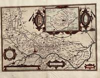
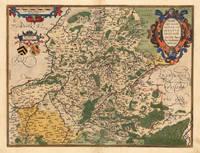
158812476Antwerpen 1588. Other. A very good copy in fine condtion a minor discoloration in the upper centerfold. . 380 by 490mm 15 by 19 inches. Original antique copper engraving published in the first Spanish edition of the 'Theatrum Orbis Terrarum by Abraham Ortelius. Finely handcolored in wash and outline when published. Detailled map of Artois with many cities and place names. The engraved cities are shown as miniature cityviews a few place names heightend in gold. Among the place names we find St. Omer Arras Renty Monstreul etc. Ornated with a large decorative title cartouch as well two further cartouches with a dedication and a milage scale. This map is in very fine original handcolor typical for a Spanish edition in that period. Abraham Ortelius engraved this map after the cartographic sketch by Iacobo Surbonio Montano. Ortelius was born on 14 April 1527 in the city of Antwerp which was then in the Habsburg Netherlands modern-day Belgium. The Orthellius family were originally from Augsburg a Free imperial city of the Holy Roman Empire. In 1535 the family had fallen under suspicion of Protestantism. Following the death of Ortelius's father his uncle Jacobus van Meteren returned from religious exile in England to take care of Ortelius. Abraham remained close to his cousin Emanuel van Meteren who would later moved to London. In 1575 he was appointed geographer to the king of Spain Philip II on the recommendation of Arias Montanus who vouched for his orthodoxy. He travelled extensively in Europe and is specifically known to have traveled throughout the Seventeen Provinces; in southern western northern and eastern Germany e.g. 1560 15751576; France 15591560; England and Ireland 1576; and Italy 1578 and perhaps twice or thrice between 1550 and 1558. Beginning as a map-engraver in 1547 he entered the Antwerp Guild of Saint Luke as an illuminator of maps. He supplemented his income trading in books prints and maps and his journeys included yearly visits to the Frankfurt book and print fair where he met Gerardus Mercator in 1554. In 1560 however when travelling with Mercator to Trier Lorraine and Poitiers he seems to have been attracted largely by Mercator's influence towards the career of a scientific geographer. Wikipedia Koe. Ort 23 / #37 115. Broe. 73. unknown
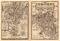
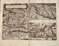
15848Antwerp: Abraham Ortelius 1584. 1584. Three maps on one sheet- Carinthiae measures 13 1/4 x 9 1/2 inches. Top right map 9 1/4 x 6 1/8 bottom right 9 1/4 x 6 inches. Overall with gutters 13 1/4 x 19. Very good with one tiny hole in Austrian map. Ortelius. Map is in very good condition with one tiny circular hole in the large map. Color is not contemporary. Overall the condition of this 440 year old map makes it suitable for framing. Abraham Ortelius unknown
159816639Antwerpen 1598. Other. In excellent condition. 370 by 485mm 14 by 19 inches. Original antique copper engraving published 1598 in a French text edition of the " Theatrum Orbis Terrarum. Uncolored copy in a strong impression. This is a map of Hannonia the Hainaut province of Belgium. Printed in the 1602 Spanish edition of Ortelius's "Theatrum Orbis Terrarum". Includes the cities of Charleroi Ath Tournay Valenciennes Maubeuge and its capital Mons. Rivers and forests have been included with towns churches and cathedrals. The title is engraved in a decorative cartouche decorated with two classicised heads. Ortelius was born on 14 April 1527 in the city of Antwerp which was then in the Habsburg Netherlands modern-day Belgium. The Orthellius family were originally from Augsburg a Free imperial city of the Holy Roman Empire. In 1535 the family had fallen under suspicion of Protestantism. Following the death of Ortelius's father his uncle Jacobus van Meteren returned from religious exile in England to take care of Ortelius. Abraham remained close to his cousin Emanuel van Meteren who would later moved to London. In 1575 he was appointed geographer to the king of Spain Philip II on the recommendation of Arias Montanus who vouched for his orthodoxy. He travelled extensively in Europe and is specifically known to have traveled throughout the Seventeen Provinces; in southern western northern and eastern Germany e.g. 1560 15751576; France 15591560; England and Ireland 1576; and Italy 1578 and perhaps twice or thrice between 1550 and 1558. Beginning as a map-engraver in 1547 he entered the Antwerp Guild of Saint Luke as an illuminator of maps. He supplemented his income trading in books prints and maps and his journeys included yearly visits to the Frankfurt book and print fair where he met Gerardus Mercator in 1554. In 1560 however when travelling with Mercator to Trier Lorraine and Poitiers he seems to have been attracted largely by Mercator's influence towards the career of a scientific geographer. Wikipedia Broe. 71. State 1/2. unknown
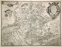
158812475Antwerpen 1588. Other. In excellent condition. 370 by 485mm 14 by 19 inches. Original copper engraving published 1588 in the first Spanish text edition of the " Theatrum Orbis Terrarum. Handcolored in outline and wash when published. The map is ornated a title cartouche in the upper right corner and a cartouche with a milage scale as well coats of arms in the upper left side. Ortelius was born on 14 April 1527 in the city of Antwerp which was then in the Habsburg Netherlands modern-day Belgium. The Orthellius family were originally from Augsburg a Free imperial city of the Holy Roman Empire. In 1535 the family had fallen under suspicion of Protestantism. Following the death of Ortelius's father his uncle Jacobus van Meteren returned from religious exile in England to take care of Ortelius. Abraham remained close to his cousin Emanuel van Meteren who would later moved to London. In 1575 he was appointed geographer to the king of Spain Philip II on the recommendation of Arias Montanus who vouched for his orthodoxy. He travelled extensively in Europe and is specifically known to have traveled throughout the Seventeen Provinces; in southern western northern and eastern Germany e.g. 1560 15751576; France 15591560; England and Ireland 1576; and Italy 1578 and perhaps twice or thrice between 1550 and 1558. Beginning as a map-engraver in 1547 he entered the Antwerp Guild of Saint Luke as an illuminator of maps. He supplemented his income trading in books prints and maps and his journeys included yearly visits to the Frankfurt book and print fair where he met Gerardus Mercator in 1554. In 1560 however when travelling with Mercator to Trier Lorraine and Poitiers he seems to have been attracted largely by Mercator's influence towards the career of a scientific geographer. Wikipedia Koe. Ort 23 / #36 111. Broe. 71. State 1/2. unknown
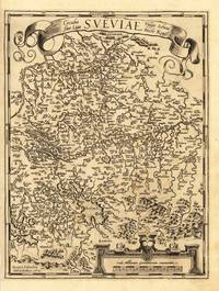
157928112Antwerpen: Platin 1579. Other. In excellent condition. 321 by 243mm 12 by 9 inches. Hand-Colored Original Copperplate Engraving by Abraham Ortelius depicting Württemberg Herzogtum. Published Antwerpen Platin 1579. Sheet: 321 by 243mm 12 by 9 inches. A fine and original hand-colored example of Ortelius's celebrated cartographic work documenting this region of Germany with the precision and decorative artistry characteristic of the 15700s. Abraham Ortelius 1527-1598 was a Flemish cartographer and geographer from Antwerp widely regarded as the creator of the first modern atlas. His landmark publication Theatrum Orbis Terrarum 1570 set the standard for atlas-making for the next century presenting uniform copper-engraved maps with scholarly commentary. By Ortelius's death the Theatrum had appeared in 25 editions in seven languages. In 1575 King Philip II of Spain appointed him Royal Geographer. His maps engraved with extraordinary precision are among the most sought-after in antique cartography held in collections including the Plantin-Moretus Museum in Antwerp the Library of Congress and the British Library.This original copperplate engraving with original hand coloring depicts the region of Württemberg Herzogtum published in Antwerpen Platin 1579. The map features a decorative Baroque cartouche containing the title inscription. The map records the political and geographic boundaries of the region as understood in 1579 offering a fascinating window into the history of German territorial organization. Sheet measures 321 by 243mm 12 by 9 inches. In good condition overall with minor signs of age appropriate for a 16th-century engraving. Ready to frame. Platin unknown
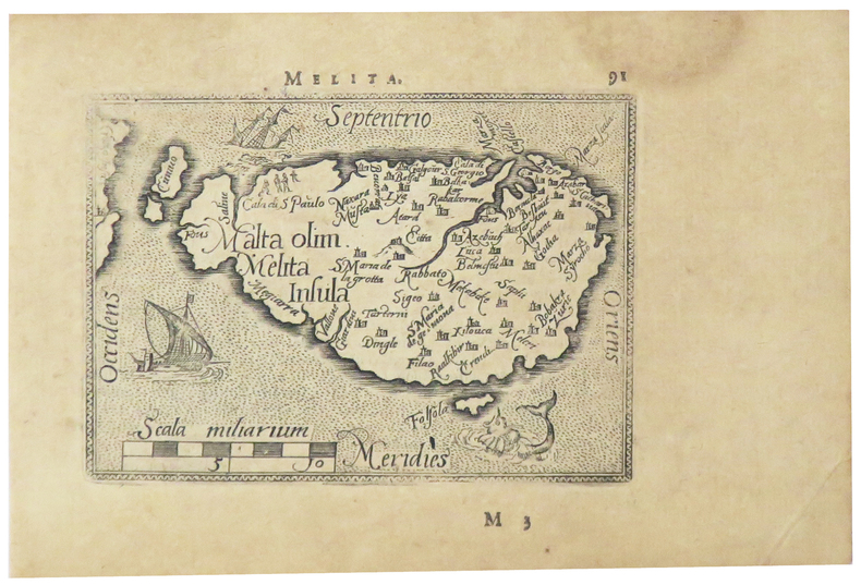
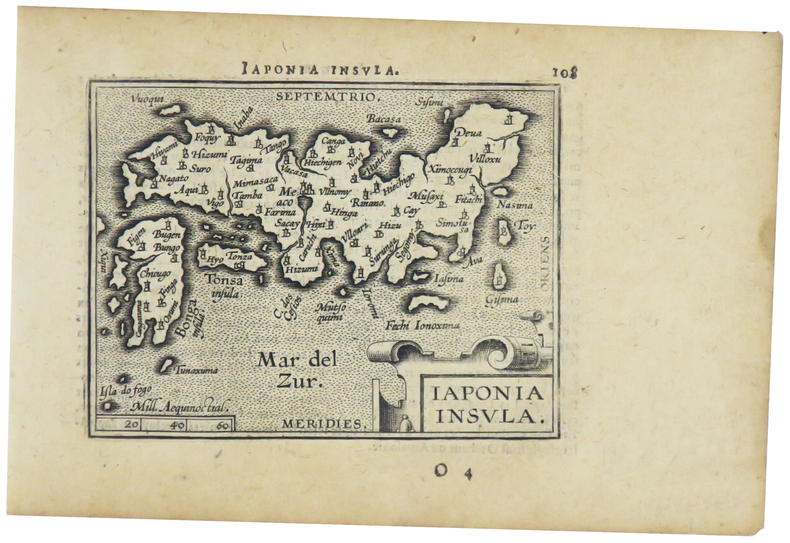
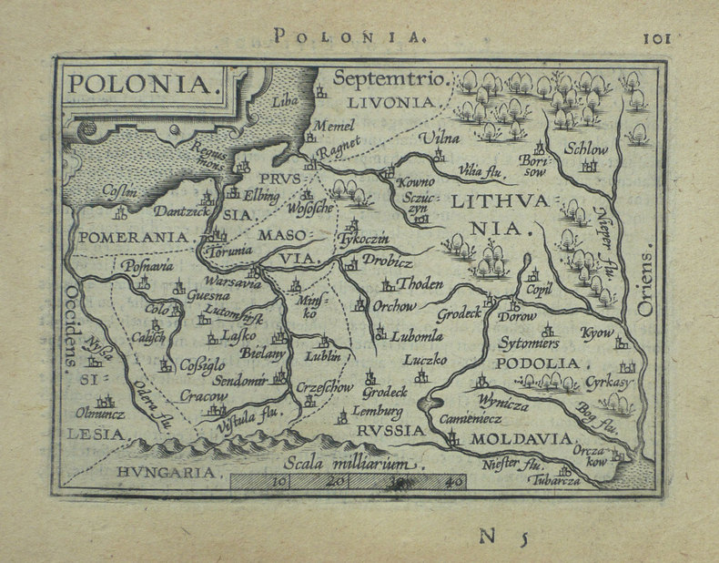
1598LBW-5386[Anvers, 1598]. 80 x 107 mm.
1598LBW-1424[Anvers, 1598]. 82 x 102 mm.
1598LBW-1390Anvers 1598 82 x 108 mm.
15923013<p>Paper size: 426 x 534 mm. Image size: 367 x 432 mm. 16th century map in original hand-coloring. Hinged to green card stock. Depicts lakes rivers heights forests and towns/cities. Ortelius 94. Van den Broecke 2nd ed. p. 303. ; 426 x 534 mm; All shipments through USPS insured Priority Mail.</p> Abraham Ortelius
159820683Antwerpen: Christopher Platin 1598. Other. In excellent condition. 370 by 485mm 14 by 19 inches. Original copper engraving published 1598 in a French text edition of the " Theatrum Orbis Terrarum. Uncolored copy in a strong impression. The map is ornated a title cartouche in the upper right corner and a cartouche with a mileage scale as well coats of arms in the upper left side. Ortelius was born on 14 April 1527 in the city of Antwerp which was then in the Habsburg Netherlands modern-day Belgium. The Orthellius family were originally from Augsburg a Free imperial city of the Holy Roman Empire. In 1535 the family had fallen under suspicion of Protestantism. Following the death of Ortelius's father his uncle Jacobus van Meteren returned from religious exile in England to take care of Ortelius. Abraham remained close to his cousin Emanuel van Meteren who would later moved to London. In 1575 he was appointed geographer to the king of Spain Philip II on the recommendation of Arias Montanus who vouched for his orthodoxy. He travelled extensively in Europe and is specifically known to have traveled throughout the Seventeen Provinces; in southern western northern and eastern Germany e.g. 1560 15751576; France 15591560; England and Ireland 1576; and Italy 1578 and perhaps twice or thrice between 1550 and 1558. Beginning as a map-engraver in 1547 he entered the Antwerp Guild of Saint Luke as an illuminator of maps. He supplemented his income trading in books prints and maps and his journeys included yearly visits to the Frankfurt book and print fair where he met Gerardus Mercator in 1554. In 1560 however when travelling with Mercator to Trier Lorraine and Poitiers he seems to have been attracted largely by Mercator's influence towards the career of a scientific geographer. Wikipedia Christopher Platin unknown
158426177Antwerp: Diesth 1584. Other. Old colored example. In excellent condition. 325 by 277mm 12 by 11 inches. Original copper engraving published 1584 in an early Latin text edition of the 'Theatrum Orbis Terrarum'. Oldcolored example in outline and wash color. Detailed map of the Basel territory with renaissance title cartouche and scale bars. Villages and towns are shown as miniature views. Ortelius was born on 14 April 1527 in the city of Antwerp which was then in the Habsburg Netherlands modern-day Belgium. The Orthellius family were originally from Augsburg a Free imperial city of the Holy Roman Empire. In 1535 the family had fallen under suspicion of Protestantism. Following the death of Ortelius's father his uncle Jacobus van Meteren returned from religious exile in England to take care of Ortelius. Abraham remained close to his cousin Emanuel van Meteren who would later moved to London. In 1575 he was appointed geographer to the king of Spain Philip II on the recommendation of Arias Montanus who vouched for his orthodoxy. He travelled extensively in Europe and is specifically known to have traveled throughout the Seventeen Provinces; in southern western northern and eastern Germany e.g. 1560 15751576; France 15591560; England and Ireland 1576; and Italy 1578 and perhaps twice or thrice between 1550 and 1558. Beginning as a map-engraver in 1547 he entered the Antwerp Guild of Saint Luke as an illuminator of maps. He supplemented his income trading in books prints and maps and his journeys included yearly visits to the Frankfurt book and print fair where he met Gerardus Mercator in 1554. In 1560 however when travelling with Mercator to Trier Lorraine and Poitiers he seems to have been attracted largely by Mercator's influence towards the career of a scientific geographer. Wikipedia Broe. 113 Diesth unknown
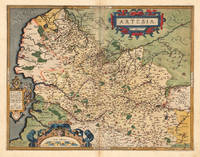
159553045Antwerp. c.1595. Splendid map of the Artois region of north eastern France from Calais to Cambrai. Magnificent strapwork title cartouche at upper right scale with strapwork decorations at lower left. The dedicatory cartouche at left identifies this plate as van den Broecke 74. Published in the famous Theatrum Orbis Terrarum by the master Flemish cartographer Abraham Ortelius. Copper engraving. Fine condition good margins. Later colour. Size: 48 x 36.5 cm. Van den BroeckeOrtelius Atlas Maps 74. unknown
1590910274CGAntwerpen:, Ortelius, nach 1590. Kupferstich 31 x 23,5 cm (hoch), Blattgröße 41,5 x 26,5 cm.
15842100981584. Auf Bütten mit Wasserzeichen "Wappen". 35 x 19,7 cm (Plattengröße) 43,5 x 26 cm (Papier).
158430501Antwerpen: Platin 1584. Other. In excellent condition. 304 by 196mm 12 by 7 inches. Hand-Colored Original Copperplate Engraving by Abraham Ortelius depicting Thietmarsiae Holsaticae Regionis Partis Typus. Auctore Petro Boeckel. Published Antwerpen Platin 1584. Sheet: 304 by 196mm 12 by 7 inches. A fine and original hand-colored example of Ortelius's celebrated cartographic work documenting this region of Germany with the precision and decorative artistry characteristic of the 15800s. Abraham Ortelius 1527-1598 was a Flemish cartographer and geographer from Antwerp widely regarded as the creator of the first modern atlas. His landmark publication Theatrum Orbis Terrarum 1570 set the standard for atlas-making for the next century presenting uniform copper-engraved maps with scholarly commentary. By Ortelius's death the Theatrum had appeared in 25 editions in seven languages. In 1575 King Philip II of Spain appointed him Royal Geographer. His maps engraved with extraordinary precision are among the most sought-after in antique cartography held in collections including the Plantin-Moretus Museum in Antwerp the Library of Congress and the British Library.This original copperplate engraving with original hand coloring depicts the region of Thietmarsiae Holsaticae Regionis Partis Typus. Auctore Petro Boeckel. published in Antwerpen Platin 1584. The map records the political and geographic boundaries of the region as understood in 1584 offering a fascinating window into the history of German territorial organization. Sheet measures 304 by 196mm 12 by 7 inches. In good condition overall with minor signs of age appropriate for a 16th-century engraving. Ready to frame. Platin unknown