26 503 résultats
1939050513Chicago: University of Chicago Press 1939. First Edition . Hardcover. Good/No Dust Jacket. An ex-library copy in heavy maroon cloth containing these five items each bound in retaining the original paper front cover but not the rear cover. All are first edition/first printings from 1944 1962 1961 1939 and 1939. The usual ex-libris markings to covers and endpapers and with accession stamps to the covers of Neurath Edel and Woodger. Kuhn has brief pencil library accession markings. All text is clean/unmarked. Cover soiling but none within. <br/> <br/> University of Chicago Press hardcover
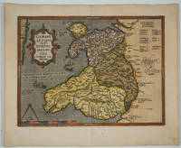
160915882Antwerp 1609. The first printed map of Wales with title translated as "Map of Wales by the author Humphrey Lhuyd the Welshman from Denbigh". Based on Mercator's 1564 wall map of the British Isles and Lhuyd's manuscript map of 1568. Ornate cartouche sailing ship and sea monsters. Latin text on verso. Van den Broecke and van den Broecke-Günzburger's Ortelius Map No. 21; 300 copies of this edition were printed. Image size: 19 1/2 x 14 1/2". Paper size: 23 x 18 3/4". Two stray printer's marks at lower margin otherwise very good. unknown
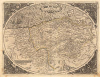
157221509Antwerpen: Platin 1572. Other. In excellent condition. 385 by 503mm 15 by 19 inches. Original antique copper engraving uncolored as published. This very decorative antique map shows Flanders from Greuelinge in the west to Brussels in the east and Schouwen in the north and Lens in the south. The corners of the oval map are engraved with the cardinal points. In the North Sea are 2 sailing ships that fire with cannons a decorative compass rose and a sea monster. The title is engraved in the center of a very nice cartoushe. Ortelius was born on 14 April 1527 in the city of Antwerp which was then in the Habsburg Netherlands modern-day Belgium. The Orthellius family were originally from Augsburg a Free imperial city of the Holy Roman Empire. In 1535 the family had fallen under suspicion of Protestantism. Following the death of Ortelius's father his uncle Jacobus van Meteren returned from religious exile in England to take care of Ortelius. Abraham remained close to his cousin Emanuel van Meteren who would later moved to London. In 1575 he was appointed geographer to the king of Spain Philip II on the recommendation of Arias Montanus who vouched for his orthodoxy. He travelled extensively in Europe and is specifically known to have traveled throughout the Seventeen Provinces; in southern western northern and eastern Germany e.g. 1560 15751576; France 15591560; England and Ireland 1576; and Italy 1578 and perhaps twice or thrice between 1550 and 1558. Beginning as a map-engraver in 1547 he entered the Antwerp Guild of Saint Luke as an illuminator of maps. He supplemented his income trading in books prints and maps and his journeys included yearly visits to the Frankfurt book and print fair where he met Gerardus Mercator in 1554. In 1560 however when travelling with Mercator to Trier Lorraine and Poitiers he seems to have been attracted largely by Mercator's influence towards the career of a scientific geographer. Wikipedia Platin unknown
158728094Antwerp: Ortelius 1587. Maps. Overall in very good condition. A very nice example of Ortelius' famous map of the Kingdom of Prester John with later hand color. It is from a Latin edition of Ortelius' Theatrum Orbis Terrarum the first modern atlas of the world. <br /> <br /> Cartographica Neerlandica Background for Ortelius Map No. 175. The map is difficult to date. The following details correspond to the aforementioned bibliography - it is consistent with 175.2 as the coastline has hatching extended from about 3 to about 6 mm signifying from 1587 & beyond. The ship in the lower left corner has a vessel attached to its mast. In the first state this vessel has vertical hatching. Now this is changed to horizontal hatching. In this copy the frame around the map has curved oval hatching around its oval ornaments. The sea was not re-engraved in later editions and as they are strongly engraved in this copy it would indicate an earlier edition. There is a watermark of two crossed arrows measuring 10 cm in length. The last line of text on the verso reads "uerit vide Jacobum Nauarchum in sua epistola Asiatica & Gerardum Mercatorem in sua universali tabula. 89". <br /> "Ortelius 1579 is penciled on the verso by an unknown person but that is unknown.<br /> <br /> The map centers on "Africva" in a strange configuration which goes from the coast of Benin and the "Mare Aethiopicum" to the Arabian Sea titled "Barbaricus Sinus". Arabia Felix covers the area of Saudi Arabia and adjoining countries with the Red Sea between the Arabian Penninsula and the coast of Africa. Mecca Medina and Jerusalem are noted with large buildings indicating their importance and colored red.<br /> <br /> Prester John was a mythical African King waging a war against the Muslim Infidels from his Kingdom in Central Africa. Add the Byzantine Patriarch Crusaders Islamic Saracens the Portuguese and a fake letter for this For centuries from the receipt of a fake letter from Prester John to the Byzantine Patriarch Europeans searched for Prester John initially in Asia and later in Africa. The Crusaders hoped that Prester John would join with Europeans in the protection of the Holy Lands from the Islamic Saracens and in the protection of all Europe from the Mongols. In the late 1400s and early 1500s the Portugese searched for Prester John in East Africa through they did eventually find a Christian kingdom in Abyssinia. A dedication to King David of the Bible is in the upper left of map. Above the dedication is the coat of arms of Prester John. Elephants and other figures adorn the map. <br /> <br /> Copper engraving with period hand color 17.5 x 15" with wide margins. Text in Latin on the verso. Two small wormholes in the top margin. Ortelius unknown
159813293451598. A map of the Holy Land by Abraham Ortelius dated 1598 first issued in 1584 as a part of Theatrum Orbit Terrarium. In Very Good condition with age toning and a central crease. Matted but not framed. w 26.5 in. x h 22 in. Shelved at Rockville PS 1101 #25. Based on material collected by the Dutch Astronomer Peter Laicksteen who travelled to the Holy Land in 1556. Christian Sgrooten here written "Schrot" royal geographer to King Phillip II of Spain produced a nine-sheet map of Palestine in 1570 from Laikstain's information. This map was condensed into the present form by Abraham Ortelius. Ortelius the creator of the first modern atlas collected and edited maps from all over Europe for his book. Many of the original mapmakers rose to fame solely through Ortelius's decision to include their maps in his atlas. Laicksteen took thorough and accurate notes and the original Laicksteen and Sgrooten map contained improvements over earlier maps. For instance the River Kishon is here shown as flowing from the mountains near the Sea of Galilee not as was previously thought from the Sea of Galilee itself. However the Levantine coastline Sgrooten and Ortelius depicted is hardly recognizable to modern eyes. The map is replete with fanciful bays and peninsulas though some of the most recognizable features of the coastline such as the outcrops of land at Haifa and Beirut are absent. Ortelius had originally used another map of the Holy Land by cartographer Tilleman Stella in the early editions of the Theatrum Orbis Terrarum. It covered a far more extensive territory including part of Egypt and Syria. Oddly the coastline in this first map was much more accurate than in the Sgrooten map. Laicksteen and Sgrooten's original map included a small inset with an extended geography. However their mapping of the Dead Sea and surrounding areas was so controversial that Ortelius chose to leave out this region completely. The strange anecdote written in the Dead Sea is Ortelius's own addition. It describes how the Dead Sea was once a fertile valley but was transformed by an act of God into a barren sea to punish the wickedness of Sodom and Gomorrah. In the bottom left hand corner is a hand colored illustration of the story of Jonah. Above the luscious cartouche Ortelius has added three miniatures featuring the Crucifixion the Nativity and the Resurrection of Christ. The French text on the verso a long-winded description with little relevance to the map was changed to a more "reader-friendly" version shortly after the publication of this edition. 525 copies were made of this edition of Ortelius's map. 1329345. Special Collections - Upstairs. unknown
169060801Cologne, Pierre Marteau, 1690. 4to. In contemporary full vellum with yapp edges and title in contemporary hand to spine. Small paper-label pasted on to top of spine. Light soiling and miscolouring to extremities. Small worm-tract on pp. 295-457, 210 far from affecting text. Worm-tract to upper outer margin of Pp. 1-47 (of 'Discours Historique de L'election') slightly touching text, otherwise a fine and clean copy. (4), 457 pp. 219, (49) pp. (2), 266, (1) pp.
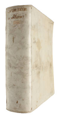
169060801Cologne Pierre Marteau 1690. 4to. In contemporary full vellum with yapp edges and title in contemporary hand to spine. Small paper-label pasted on to top of spine. Light soiling and miscolouring to extremities. Small worm-tract on pp. 295-457 210 far from affecting text. Worm-tract to upper outer margin of Pp. 1-47 of 'Discours Historique de L'election' slightly touching text otherwise a fine and clean copy. 4 457 pp.; 219 49 pp.; 2 266 1 pp. <br/><br/><em>Later expanded edition first published in 1682 of Wicquefort’s work on ambassadors and international relations in general. From 1626 to 1658 Wicquefort served as Brandenburg's envoy to the French court. However Cardinal Mazarin suspected him of involvement in a dubious correspondence and had him imprisoned in the Bastille. After a year he was released with a French pension and moved to The Hague as the representative of the Duchy of Braunschweig-Lüneburg. In 1675 he faced imprisonment again this time by the Dutch government on charges of treasonous dealings with the French. Sentenced to life and his assets confiscated he later escaped to Celle where he died. Brunet V p.1442 </em> hardcover
89118Belgium Abraham ORTELIUS 1579 Issue of 1584. Beautiful Hand Coloured Original Antique Engraved Map. Framed and mounted by “P.J. Radford Sussex.” Engraved surface approx 19 x 14 inches. Overall 28 x 23 inches. In very good condition. Beautifully coloured. Stunning bright colouring to cartouches. Good strong impression. Vertical centre fold present and correct. Some minor tanning to edges from mount. Else an excellent clean and bright map. With decorative cartouches. Later hand colouring. Belgium, Abraham ORTELIUS, 1579 (Issue of 1584) unknown
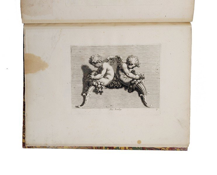
1408Paris : C. A. Jombert, 1736. ANGES, TROGNES ET MÉDUSE
1st edition. Paper Wrappers (later?), 8vo, 43 pages. Sabin 21532. Dwight here charges that The Jeffersonian party, giving itself "the title of Republican...in more correct, and definite phraseology, is called Jacobinical." The Federalists "prudently, and justly yielded" to the late presidential election, which marked their defeat. Despite the partisan rhetoric, Dwight provides a detailed perspective on the state of political parties and issues at the turn of the century. "Theodore Dwight (1764 Northampton, Mass 1846 New York City) was an American lawyer and journalist. He was the brother of Timothy Dwight, president of Yale College, and the grandson of Jonathan Edwards. He was a distinguished lawyer, a leader of the Federalist Party, and a member of Congress in 18061807, and was secretary of the Hartford Convention in 18141815. His talent as a writer made him a brilliant editor at the Hartford Mirror, the Albany Daily Advertiser, and the New York City Daily Advertiser, which he founded in 1817. Among his publications are Life and Character of Thomas Jefferson (1839) and History of the Hartford Convention (1833). He was a cousin of Aaron Burr....He was a member of the [Conn.] State council 18091815; elected as a Federalist to the Ninth Congress to fill the vacancy caused by the resignation of John Cotton Smith and served from December 1, 1806, to March 3, 1807; declined to be a candidate for renomination in 1806; secretary of the Hartford Convention in 18141815; moved to Albany, New York in 1815 and published the Albany Daily Advertiser 18151817....he died on June 12, 1846....In 1839, Dwight published The Character of Thomas Jefferson as Exhibited in His Own Writings, which Abraham Lincoln's law partner and biographer, William Herndon, claimed made Lincoln 'hate [Jefferson] as a man' for his duplicitous character and affair with Sally Hemings" (Wikipedia). Digital copy online at https://www.google.com/books/edition/An_Oration_Delivered_at_New_Haven_on_t he/xARLAAAAYAAJ?hl=en&gbpv=1&dq=%22the+title+of+Republican%22+and+%22in+mor e+correct,+and+definite+phraseology,+is+called+Jacobinical.%22&pg=PA3&print sec=frontcover SUBJECT(S): Fourth of July orations. Speeches, addresses, etc., American -- Connecticut -- New Haven. Politics and government United States. OCLC Number:558980287. OCLC lists only 1 physical copy anywhere worldwide (British Library), none in the US. Exceedingly rare; NYPL (from which the digital copy was made) is known to have discarded many originals after microfilming/digitizing. Few light stains, a beautiful copy, Very Good Condition. (AC-22-29)
18591157SAN FRANCISCO. TOWNE & BACON, PUBLISHERS AND PRINTERS. 1859. IN-8 (11,5 X 19,5 X 2 CENTIMETRES ENVIRON) DE 187 PAGES, RELIURE DE L’EDITEUR A LA BRADEL PLEINE PERCALINE VERTE, PLATS ENCADRES DE FLEURONS A FROID, TITRE DORE SUR LE PLAT SUPERIEUR. EDITION ORIGINALE. ETIQUETTE EX-LIBRIS COLLEE SUR LE CONTREPLAT SUPERIEUR. TIMBRE HUMIDE EX-LIBRIS ET SIGNATURE AUTOGRAPHE SUR UN FEUILLET BLANC DE GARDE. PETITS DEFAUTS EXTERIEURS, DONT PETIT ACCROC SUR LE PLAT INFERIEUR, SINON BON EXEMPLAIRE.
17838545Jaeger, Johann Wilhelm Abraham 58 x 50 Francfort Sur Le Mein 1783 Quatre cartes topographiques en noir de la fin du XVIIIe siècle, 1783-1784, entoilées et dépliantes, composées chacune de 8 sections (14,5 x 25,5) La feuille II "contenant Une Partie De La Province De Groeningen"; la feuille III "contenant une partie du duché d'Oldenbourg et Delmenhorst de Friesland Orient et de la prov. de Grönningen; la feuille XI contenant une partie des Provinces Unies, savoir la province de Friesland occidentale, une partie d'Overyssel, de Gueldre, d'Hollande septentrionale, de differentes isles de la meer d'Allemagne, et du Zuider See; la feuille XII contenant une partie inferieure de l'évêché de Munster, une partie du duché d'Oldenbourg, de l'évêché d'Osnabruck, de Friesland orientale de Gröningen et d'Over Yssel, les comtés de Benthem de Lingen &&. Les quatre cartes se complètent et représentent au nord la continuité du littoral. Plusieurs bateaux et barques illustrent l'espace de la mer du nord.. Echelle de deux lieux d'Allemagne. Originaire de Bavière, Jaeger a été un des grands cartographes et marchands de carte allemands au XVIIIe siècle. On lui doit le Grand atlas d'Allemagne en LXXXI feuilles, dédié a sa majesté Joseph II, empereur des Romains. Le papier de la feuille II, dont la toile est auréolée, est un peu jauni. Ensemble en très bon état. PHOTOS NUMERIQUES DISPONIBLES PAR EMAIL SUR SIMPLE DEMANDE-DIGITAL PHOTOGRAPS MAY BE AVAILABLE ON REQUEST
2484Greece: Antverpiæ"/Antwerp. " ghetruckht by Gieles van Diest." 1572. Copper engraved map of Greece after Jacob Gastaldi from Ortelius' "Theatrum Orbis Terrarum" 1571 edition; black & white; German text to verso. The map is from the first German text edition of the "Theatrum". Good dark impression; modern colour; ligtly toned and some light soiling. Abraham Ortelius 1527-1598 Flemish Cartographer . produced the first modern Atlas "Theatrum Orbis Terrarum" in 1570. printed by Aegidus Coppen Diest. There were numerous editions thereafter with texts in various languages; the printing of such was taken over by Chrstoffel Plantijn in 1579 . Ortelius himself drew all the maps in manuscript before passing them to the printers. there is conjecture that he may have engraved some of the plates as well Ortelius was Geographer Royal To Phillip II of Spain from 1575. He also worked closely with Braun & Hogenburg on the "Civitas Orbis Terarum". After his death the plates were purchased by Jan Baptiste Vrients in 1601 who published further editions until 1612. Van de Krogt :3; .Koeman: Ort 5 40; Zacherakis: 2485/1610; van den Broecke:146. Greece Continental Greece Gastaldi Antverpiæ"/Antwerp.. " ghetruckht by Gieles van Diest." 1572 unknown
196941A Paris, Chez Pierre Emery, 1710 2 vol. in-folio, [3]-787-[110] pp. et [1]-553-[58] pp., basane brune, dos à nerfs orné, tranches rouges (rel. de l'époque). Reliure défectueuse comprenant de nombreux défauts : mors en partie fendus, coiffes arrasées, coins et coupes usés.
1802102952À Freiberg, chez Craz, libraire, 1802, in-8, portrait-frontispice, XXXII-311-[] pp, Basane de l'époque, dos lisse fileté et fleuronné, tranches rouges, Première édition française de cet ouvrage très rare, mémorable dans l'histoire des théories géologiques : la traduction a été donnée par Aubuisson des Voisins, élève de Werner à la Bergakademie de Freiberg. L'exemplaire est bien complet du portrait de l'auteur, gravé d'après Vogel et reproduit ici pour la première fois. La même année a été publiée une édition parisienne (Villier) qui ne comporte pas le portrait. La Neue Theorie von der Entstehung der Gänge a été publiée à l'origine à Freiberg en 1791. Werner, père de la géognosie, y formule, définitivement et catégoriquement, ses opinions sur la formation de la terre. Celles-ci se résument en dix arguments que l'auteur utilise comme réponse aux objections qui lui sont faites (chapitre VII, 68, pp. 133 et suiv.), le premier d'entre eux étant la base de la thèse dont il est le fondateur, le neptunisme : "les montagnes primitives et secondaires ont été formées par une suite de précipités et de dépôts successifs... [qui] proviennent d'une mer qui couvroit le globe, mer toujours existante, plus ou moins générale, et renfermant les diverses substance qui s'en sont précipitées". Abraham Gottlob Werner (1749 ou 1750-1817) est sans conteste le géologue la plus influent de la fin du XVIIIe siècle. Il imposa ses convictions au monde entier, passant pour certains comme un professeur enthousiaste et zélé, pour d'autres comme un doctrinaire refusant les opinions contraires et fourvoyant ses nombreux disciples. En défendant ses thèses, il fait montre d'un dogmatisme farouche, particulièrement frappant dans cette Nouvelle théorie de la formation des filons : "It would be difficult to cite from any other modern scientific treatise a series of consecutive sentences containing a larger number of dogmatic assertions" (Geikie p. 216). Cachets et cote de l'Institut Catholique de Paris. Rousseurs claires en début et en fin de volume; autrement, bon état intérieur. Frottements et épidermures, dos passé, galeries superficielles sur le plat supérieur. Schuh II, 5006. Ward & Carozzi, 2306. Geikie, The Founders of Geology, p. 201 et suiv. DSB XIV p. 262. Norman 2206 pour l'édition originale allemande. Couverture rigide
122744London printed for R. and W. Mount and T. Page 1717. . Small 4to 22.5 x 15.5 cm; title laid down one folding diagram separate title page for the tables contemporary ownership inscription to ffep Toft Hall bookplate to front pastedown; contemporary full sprinkled calf spine rubbed with a little loss to spine caps boards ruled in gilt edges sprinkled red corners bumped and exposed a very good copy; 10 64 2 302 39 1 pp.<br /> An early edition of Mathematical Tables a comprehensive work that covers logarithms from 1 to 101000.<br /><br />Three of the four authors Briggs then Wallis then Halley consecutively held the Savilian Professorship of Geometry one of the oldest and most prestigious mathematical chairs in Britain. Briggs is known for inventing the common or indeed Briggsian logarithm Wallis is credited with the introduction of the infinity symbol and Halley's most notable achievements came in the field of astronomy having 'Halley's Comet' named after him.<br /> ESTC T93841 London, printed for R. and W. Mount, and T. Page, 1717. hardcover
16531712080008Paris: Chez ledit Bosse 1653-01-01. First Edition. Hardcover. Good. Small octavo 18.5 x 11 cm. Bound in contemporary speckled leather boards rebacked and rehinged. 5 raised bands gilt spine with loss. Speckled page ends. 1 preliminary leaf 75 1 pages. Illustrated with added engraved title and 32 leaves of plates. Two folding plates. Last few leaves and rear most plate damp stained. This copy has the final folding plate dated 1669. <br> Abraham Bosse's 1602-1676 rare sequel to Maniere universelle des principes de Mr. Desargues. Bosse applies Desargues' methods to angled and curved surfaces. "His Moyen universelle. paid particular attention to the illusionistic projection of perspective onto ceilings and vaults of various configurations" Kemp Science of Art pp. 123-4. Provenance: Early signature of Randolph Greenway of Thavies Inn Holborn London 1725. Includes card states "From the library of John Bianchi owner of the Merrymount Press Boston. Purchased from Starr bros. booksellers Cambridge Mass. in 1949." Brunet I 1127. Chez ledit Bosse hardcover
AT 9789386062017USA Edition . New. Brand New! Fast Delivery This is an International Edition and ship within 24-48 hours. Deliver by FedEx and Dhl & Aramex UPS & USPS and we do accept APO and PO BOX Addresses. Order can be delivered worldwide within 6-10 days and we do have flat rate for up to 2LB. Extra shipping charges will be requested if the Book weight is more than 5 LB. This Item May be shipped from India United states & United Kingdom. Depending on your location and availability. unknown
15703399<p>Very Good. 1570. 16th century map with original hand-colored outlines of the region of Poictou. Decorative cartouche. Some foxing most apparent to margins. Otherwise a handsome copy. Please see image. Plate size approximately 19 1/2 x 14 in. Overall size approx. 21 1/4 x 16 3/4 in 537 x 425 mm.; 1 pages; All shipments through USPS insured Priority Mail. .</p>
1587239611Antwerp: Abraham Ortelius 1587. unbound. Map. Uncolored engraving. Image measures 14" x 19.5".<br/><br/> These two maps on one sheet detail areas of western Mexico above and the Greater Antilles below. Ortelius created them from information compiled by other mapmakers such as Mercator Guttierez and Alsons de Sata Cruz. These sources allowed him to include a wealth of detailed information that is mostly if not entirely accurate. Above the map of western Mexico shows the area around Culiacan and the Spanish settlement of Villa S. Michaels which was notable in the period for its silver mines. It begins at the Yucatan and extends through the Cayman Magnus and the Caymanes. The map below illustrates the Greater Antilles including Cuba Hispaniola Jamaica St. Jois Insula St. Johns the Bahamas Virgin Islands and the Windward Islands all in impressive detail. The section of South Florida also shows suggestion of the Florida Keys which was uncommon for these period. A notable error is that the Tropic of Cancer is labelled as the Tropic of Capricorn. A highly decorative note with strapwork and foliage fills the acific Ocean to the left of Mexico and provides information about the upper map. The lower map also has a framed cartouche with birds perched atop it. Two ship illustrations float in the choppy seas around the islands. The map is a first state from the 1587 French edition of Ortelius's "Theatrum Orbis Terrarum." It is in good condition with no chips or tears. Stain at the center seam in the lower margin not affecting the image some overall stains. French text on verso. Abraham Ortelius 1527--1598 a Flemish cartographer and geographer is widely regarded as one of the important and influential cartographers in history. He is known for his "Theatrum Orbis Terrarum" which was the first modern atlas. This map is an uncommon uncolored example of this wonderful map by Ortelius.<br/><br/> Abraham Ortelius unknown books
1587239611Antwerp: Abraham Ortelius 1587. unbound. Map. Uncolored engraving. Image measures 14" x 19.5".<br/> <br/> These two maps on one sheet detail areas of western Mexico above and the Greater Antilles below. Ortelius created them from information compiled by other mapmakers such as Mercator Guttierez and Alsons de Sata Cruz. These sources allowed him to include a wealth of detailed information that is mostly if not entirely accurate. Above the map of western Mexico shows the area around Culiacan and the Spanish settlement of Villa S. Michaels which was notable in the period for its silver mines. It begins at the Yucatan and extends through the Cayman Magnus and the Caymanes. The map below illustrates the Greater Antilles including Cuba Hispaniola Jamaica St. Jois Insula St. Johns the Bahamas Virgin Islands and the Windward Islands all in impressive detail. The section of South Florida also shows suggestion of the Florida Keys which was uncommon for these period. A notable error is that the Tropic of Cancer is labelled as the Tropic of Capricorn. A highly decorative note with strapwork and foliage fills the acific Ocean to the left of Mexico and provides information about the upper map. The lower map also has a framed cartouche with birds perched atop it. Two ship illustrations float in the choppy seas around the islands. The map is a first state from the 1587 French edition of Ortelius's "Theatrum Orbis Terrarum." It is in good condition with no chips or tears. Stain at the center seam in the lower margin not affecting the image some overall stains. French text on verso. Abraham Ortelius 1527--1598 a Flemish cartographer and geographer is widely regarded as one of the important and influential cartographers in history. He is known for his "Theatrum Orbis Terrarum" which was the first modern atlas. This map is an uncommon uncolored example of this wonderful map by Ortelius.<br/> <br/> Abraham Ortelius unknown
17004027Rossiniere/ Berne/ Paris/Toulouse: Broulhiet; Leyvraz; Fabri; Deckherr etc 1700. Hardcover. Good. A cache of documents and publications concealed by the Henchoz family in the eighteenth century in the attics of the Grand Chalet Rossiniere in the Vaudois Alps - a building thought to be the biggest wooden house in Europe. Built in the 1750s by Jean David Henchoz a wealthy notary and judge the Grand Chalet was used as a hotel in the following century when it was visited by a distinguished clientele that included Victor Hugo before being bought by the painter Balthus 1908-2001. A cache of documents and publications concealed by the Henchoz family in the eighteenth century in the attics of the Grand Chalet Rossiniere in the Vaudois Alps. Built in the 1750s by Jean David Henchoz a wealthy notary and judge the Grand Chalet was used as a hotel in the following century when it was visited by a distinguished clientele that included Victor Hugo before being bought by the painter Balthus 1908-2001. The collection includes a sequence of seventeenth century documents on vellum that relate to the purchase of the land on which the Grand Chalet stands in Rossiniere. The pamphlets are in very mixed condition but include several with inscriptions by members of the Henchoz family including Gallatin's theses on the Vacuum and Chapuis on Disentery pointing to the family's scientific interests. There is a group of Berne imprints as well as a chapbook French translation of Defoe's Robinson Crusoe and a work on the Huguenot refugee crisis from 1691: MANUSCRIPTS 1. Vellum 'Acquis Fait pour sieur Abraham Henchoz' 22 May 1699 concerning the purchase of property at Rossiniere from David Massard; rodent damage including loss of signature etc 2. Vellum sixteenth century legal document possibly signed by 'Massard' lacking seal 3. Vellum 'Acquis pour Marie Martin femme d'hon David - file d'honarable Jean Jacques Pillet. Commis de Rossiniere' 1697 signed by Marie Martin etc 4. Vellum 'Acquis. Abraham Martin' small 5 Vellum 'Manifeste. Soit a tous. 1675 agreement between Marie Martin Rose Martin Joseph Martin of Rossiniere and Abraham Henchoz seal cut away. PRINTED WORKS Henchoz inscribed copy Voyage du Jeune Anacharsis en Grece dans le milieu du quatrieme siècle avant l'ere vulgaire. Tome Premier. Jean Jaques Barthelemy De Bure Paris 1789 xxiv pp384 Very good in buff coloured boards with paper spine label; worn to foot of spine but the cover is only lightly soiled as it has been protected by a paper cover with title in pen to spine. The pages are creased to the edges but clean and fresh. Neat ownership inscription 'Henchoz min:1791' to verso of upper board. Illegible inscription in pencil to paper cover. An early edition. etc - Please request full listing of titles. Good A cache of documents and publications concealed by the Henchoz family in the eighteenth century in the attics of the Grand Chalet Rossiniere in the Vaudois Alps. Built in the 1750s by Jean David Henchoz a wealthy notary and judge the Grand Chalet was used as a hotel in the following century when it was visited by a distinguished clientele that included Victor Hugo before being bought by the painter Balthus 1908-2001. The collection includes a sequence of seventeenth century documents on vellum that relate to the purchase of the land on which the Grand Chalet stands in Rossiniere. The pamphlets are in very mixed condition but include several with inscriptions by members of the Henchoz family including Gallatin's theses on the Vacuum and Chapuis on Disentery pointing to the family's scientific interests. There is a group of Berne imprints as well as a chapbook French translation of Defoe's Robinson Crusoe and a work on the Huguenot refugee crisis from 1691: MANUSCRIPTS 1. Vellum 'Acquis Fait pour sieur Abraham Henchoz' 22 May 1699 concerning the purchase of property at Rossiniere from David Massard; rodent damage including loss of signature. 2. Vellum sixteenth century legal document possibly signed by 'Massard' lacking seal 3. Vellum 'Acquis pour Marie Martin femme d'hon David - file d'honarable Jean Jacques Pillet. Commis de Rossiniere' 1697 signed by Marie Martin etc 4. Vellum 'Acquis. Abraham Martin' small 5 Vellum 'Manifeste. Soit a tous. 1675 agreement between Marie Martin Rose Martin Joseph Martin of Rossiniere and Abraham Henchoz seal cut away. PRINTED WORKS Henchoz inscribed copy Voyage du Jeune Anacharsis en Grece dans le milieu du quatrieme siècle avant l'ere vulgaire. Tome Premier. Jean Jaques Barthelemy De Bure Paris 1789 xxiv pp384 Very good in buff coloured boards with paper spine label; worn to foot of spine but the cover is only lightly soiled as it has been protected by a paper cover with title in pen to spine. The pages are creased to the edges but clean and fresh. Neat ownership inscription 'Henchoz min:1791' to verso of upper board. Illegible inscription in pencil to paper cover. An early edition. Henchoz ownership inscription Daniel Crespin Traitte de L'Education de la Jeunesse Daniel Crespin Berne 1691. 22 pp50 half of title page removed bound with Conversation entre Le Sr Daniel Crespin et un de ses Amis Refugie by Daniel Crespin Zurich 1691. 12 pp 136. Two titles bound in one volume stab sewn in original red embossed card wrappers. Covers and half of the pages have brown stains. Ownership inscription 'Henchoz' to title page partly torn away. Early annotations and corrections to 'Conversation'. An interesting title relating to the Hugenot refugee crisis at the end of the 17th century. Principes de la Literature. Par M. l'Abbe Batteux new edition volume 1. Desaint & Saillant Paris 1775. xxii pp312 Bound in speckled paper covered boards worn to edges. Paper library label to spine inscribed 'Batteux 1'. Pages clean and complete. Occasional annotations noting that the Preface has been bound in the wrong order. La Vie et les Aventures de Robinson Crusoe Daniel Defoe. Edition Orne Imprimerie de Deckherr Montbeliard. Volume 2 quarto pp92 in illustrated paper wrappers with four other full-page illustrations of the adventures of Crusoe and Friday. The upper cover and final three pages are extensively torn and creased with some loss pages 3-23 are chipped to lower corner. Nutzlicher Hilfs- Noth- Haus- und Wirthschafts Kalendar des Schweizerboten aus das Jahr 1837 nach Christi Geburt. J J Christen Aarau. Quarto in illustrated paper wrappers with attractive engravings depicting each month of the year. Disbound wrappers chipped and pages creased. Bibliotheque des Villages Troisieme partie. Pp 5-100 in red card wrappers upper cover title page and preliminaries missing leaves disbound pages chipped and stained. Includes a lengthy 'Adresse aux plaideurs de Village'. Theses Physicae de Vacuo. By Ezechiel Gallatin Isacus Gautier Fabri & Barrillot Geneva 1730 pp12 in original marbled wrappers foxed and stained throughout. Diatriba Theologica de Falsis Prophetis Decima. Jeremiae Curriti Marcus Benjaminus a Rosset Berne 1699. Very good in original marbled wrappers some wear to spine and corners pages crisp attractive woodcuts. Diatriba Prima de Veris Prophetis. Jeremiae Curritti Joan Fran Leyvraz Berne 1691. In original marbled wrappers dog-earred to corners and stained throughout. Journals Nouveau Journal Helvetique ou Annales Literaires et Politiques de L'Europe et Principalement de la Suisse. July 1771 De L'Imprimerie de la Societe Typographique Neuchatel pp259-373 in printed paper wrappers. Covers creased pages dog eared but bright and clean. Mercure Suisse ou Recueil de Nouvelles Historiques Politiques Literaires et Curieuses. Mars 1737. Daniel Wavre ed Neufchatel De L'Imprimerie des Editeurs 1737 pp136 in marbled paper covered wrappers which are well worn; the pages are browned and dog eared but crisp. Table of contents to final page with articles of interest from around Europe including a description of the funeral rites of the Tschakour Lama who died in St Petersburg in 1736. Le Nouvelliste Suisse Historique Politique Literaire et Amusant Dedie au Roi Aout 1767. Neuchatel De L'Imprimerie des Editeurs 1737 pp175-224 Very good in fleur de lis patterned paper covers pages fresh if a little dog eared. Table of contents includes an account of an attempt to discover the North East Passage. Plays Le Bourru Bienfaisant Comedie en trois actes et en prose.; De M Goldoni. Representee a la Cour le Mardi cinq November 1771. Vente Libraire des menus Plaisirs du Roi et des Spectacles de Sa Majeste Paris 1778 pp64 Stab sewn in plain paper wrappers which are lightly marked creased and chipped title neatly in pen to front cover. L'Avocat Patelin Comedie en trois actes et en prose; De Brueys et Palaprat. Nouvelle Edition. Broulhiet Toulouse 1783 pp40 stab sewn in plain paper wrappers which are lightly marked creased and torn with some loss to the final page of adverts. Le Roi et Le Fermier pp3-48 title page lacking no date or author. Pages extensively stained dogearred and chipped. Le Glorieux Comedie en vers et en cinq actes by M Nericault Destouches. Louis Chambeau Avignon 1765. Pp76 Stab sewn in printed paper wrappers extensively stained chipped and dog-earred. Les Folies Amoureuses Comedie en trois actes et en vers by Monsieur Regnard. Nouvelle edition N B Duchesne Paris 1777 pp40 stab sewn with printed title page extensively chipped creased and dog eared pages clean. Adelaide ou L'Antipathie Pour L'Amour Comedie en deux actes. Ruault Paris 1780 pp28 stab sewn with printed title page outer pages soiled others creased and dog eared but clean. Le Jugement Dernier des Rois Prophetie en un acte en prose by Sylvain Marechal. C-F Patris Paris L'An second de la Republique Francaise 1793 pp36 stab sewn in printed paper wrappers some loss to top corner of pages 1-14 but the text is still legible. The pages are browned and creased to the edges. Charles-Simon Favart L'Amitie A L'Epreuve Comedie en deux actes et en vers melee d'ariettes. N B Duchesne Paris 177. Words by MM and Favart music by M Gretry. Stab sewn in plain card wrappers title neatly in pen to front cover pp34 plus three pages of manuscript which complete the missing pages of the play bottom corner of title page missing other pages stained and dog eared. Please contact Christian White Rare Books Ltd for more information or images of this item 1700 Broulhiet; Leyvraz; Fabri; Deckherr etc hardcover
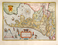
115602Antwerp Christopher Plantin for the author 1598. . Double-page copper engraved map with later hand-colouring centre fold as issued cartouches for titles and publishing privilege French text on verso; sheet size: 41.8 x 53 cm.<br /> Well-preserved example of Ortelius' map of Holland. Taken from the fifth final and most complete French edition of Theatre de l'Univers. Enriched with decorative cartouches and ships.<br /><br />Abraham Ortelius 1527-1598 was a cartographer and publisher he was born and died in Antwerp.<br /> Koeman III Ort 32. Antwerp, Christopher Plantin for the author, 1598. unknown
2278918. In zubindbarer Schutzmappe. Otto Abraham und L. Brühl gelang 1898 das Zeitminimum für die Tonempfindung Lochsirene festzustellen. F.A. Schultze konnte 1907 durch die Anwendung der Galtonpfeife die obere Hörgrenze bei 20 000 Hz festlegen und K.L. Schaefer erwarb sich bleibende Verdienste durch seine Untersuchungen über die Eigenfrequenzen des Gehörgangs. Die Briefe und die beigelegten eigenhändigen Manuskripte und Aufzeichnungen beschäftigen sich mit der Natur der Schallreize Schallreize und Hörempfinden Hörgrenzen und Hörleistungen. Dieses einmalige und höchst interessante Konvolut besteht aus folgenden Teilen: Abraham O. & L.J.Brühl: Wahrnehmung kürzester Töne und Geräusche. Zschr. Psych. Physiol. Sinnesorg. 18.Bd. 1898 S.177-217 6 Fig. OBrosch.; mit eingenh. dreizeiliger Widm. d. Verf. an F.A. Schulze. Abraham O. & K.L.Schaefer: Ueber die maximale Geschwindigkeit von Tonfolgen. Zschr. Psych. Physiol. Sinnesorg. 20.Bd. 1899 S.408-416 Fig. Tab. OBrosch.; mit eigenhändiger Widm. von K.L.Schaefer an F.A.Schulze. Abraham O.: Ueber das Abklingen von Tonempfindungen. Zschr. Psych. Physiol Sinnesorg. 20.Bd. 1899 S.417-424 2 Fig. OBrosch.; mit eingh. Widm. von K.L.Schaefer an F.A.Schulze. Abraham O.: Das absolute Tonbewußtsein. Psychologisch-musikalische Studie S.1-86 Tab. Sammelbände der Int. Musikgesellschaft. 3.Jg. 1.Heft. 1901 183 S. OBrosch.; aus dem Vorbesitz von F.A.Schulze. Beigelegt ein eingehändiger vierseitiger Brief von F.A.Schulze an seinen Vater vom 6.11.1913. Abraham O.: Töne und Vokale der Mundhöhle. Zschr. Psychol. 74.Bd. 1916 S.220-231 Tab. OBrosch: mit eigenh. Widm. d. Verf. an F.A. Schulze. Abraham O.: Zur Akustik des Knalles. Ann. Phys. IV.Folg. 60.Bd. 1919 S.55-76 4 Fig. Tab. OBrosch.; mit eignh. Widm. d. Verf. an F.A. Schulze Abraham O.: Ein zweiseitiger maschinenschriftlicher Brief in Quart mit eigenhändiger Korrektur Zeichnungen und Unterschrift vom 21.5.1917 an F.A. Schulze. Abraham O.: Ein zweiseitiger eigenhändiger Brief in Oktav mit Unterschrift vom 29.5.1917 an F.A. Schulze. Beigelegt: Sieben eigenhändige Seiten mit Tabellen Berechnungen und Anmerkungen. Abraham O.: Ein zweiseitiger eigenhändiger Brief in Oktav mit Unterschrift vom 26.06.1917 an F.A. Schulze. Abraham O.: Ein dreiseitiger Brief in Quart 1 Seite Maschine mit einigen Zeilen eigenh. Berechnungen und 2 Seiten eigenhändig mit Unterschrift vom 3.09.1917 an F.A.Schulze. Beigelegt sind ferner 12 eigenhändige Seiten von F.A. Schulze in Kl. Quart mit Berechnungen und Text zur Arbeit von O.Abraham & K.L. Schaefer "Über die maximale Geschwindigkeit der Tonfolgen. Ferner 12 zum Teil Folio große Blätter mit Berechnungen und Zeichnungen von F.A.Schulze mit Bleistift verfaßt. K.E. Rothschuh Entwicklungsgeschichte physiologischer Probleme No.1954; No.1958; No.1972; Politzer II S.56; S.252. unknown