30 490 résultats
18160886-16London, Henry Colburn 1816. 4°. 1 Bl., XIII; (3), 366 S. Mit 4 (v. 5) kolor. Aquatinta-Taf. u. 1 gefalt. Kupferkarte. Ln. m.Rückensch. In gutem Zustand. EA
1872X93276London, Longmans, Green, Reader and Dyer 1872-1893 Complete series of 9 volumes (no more published), together ca. 4700 pp., with illustrations in text and plates out of text of which quite some folding and some of them in colour (maps, plans, facsimiles, tables, diagrams), 23cm., 9 uniform hardcover bindings, spines in cloth with small label at lower end, copy from the collection of the famous French orientalist Jean-Baptiste Chabot (with his ex-libris stamp), library stamp at recto and verso of title pages, content and text is clean and bright with only few foxing, good condition, rare, [Contains numerous scholarly articles regarding oriental archaeology and history, a.o. on Assyria, Judea, Egypt, Babylonia, Chaldea, etc., With an index and a list of members in each volume. All volumes were issued in 2 parts, except for vols.7-8 each in 3 parts. Bound together with vol.4 is: "Catalogue of the Library of the Soceity of Biblical Archaeology" (London, 1876, 109pp.)], total weight: 10kg., X93276
Complete series of 9 volumes (no more published), together ca. 4700 pp., with illustrations in text and plates out of text of which quite some folding and some of them in colour (maps, plans, facsimiles, tables, diagrams), 23cm., 9 uniform hardcover bindings, spines in cloth with small label at lower end, copy from the collection of the famous French orientalist Jean-Baptiste Chabot (with his ex-libris stamp), library stamp at recto and verso of title pages, content and text is clean and bright with only few foxing, good condition, rare, [Contains numerous scholarly articles regarding oriental archaeology and history, a.o. on Assyria, Judea, Egypt, Babylonia, Chaldea, etc., With an index and a list of members in each volume. All volumes were issued in 2 parts, except for vols.7-8 each in 3 parts. Bound together with vol.4 is: "Catalogue of the Library of the Soceity of Biblical Archaeology" (London, 1876, 109pp.)], total weight: 10kg., X93276
Wear to extremities. Browning to endpapers. Occasional foxing. Blurb tipped in to front free endpaper ; Schweitzer's stay in French-controlled equitorial Africa. INSCRIBED in French by the doctor to title page. Bookplate to front pastedown of birth control pioneer Margaret Sanger; B&W Photographs; 8vo; 180 pages
Dédiée et Présentée à Monsieur le Duc de Lauzun, Colonel Propriétaire des Volontaires Etrangers, Gouverneur du Sénégal, Chevalier de l'Ordre Royal et Militaire de Saint Louis, 1 carte entoilée format 29,5 x 66 cm rehaussée en couleurs à l'aquarelle, Chez l'Auteur, rue et Collège des Cholets, près la Nouvelle Eglise de Ste Geneviève, 1779 Un long texte de "Description de la Côte Occidentale de la Guinée Septentrionale et du Cours des Fleuves du Sénégal et de la Gambie" encadre la carte, qui propose notamment le détail d'une "Vue de l'Isle de Gorée", le "Plan du Fort St Louis", le "Plan de James-Fort", le "Plan du Fort Saint Joseph" et la "Carte de l'Entrée de la Rivière du Sénégal". Le texte commence par une évocation des Normands qui "formèrent des Etablissements sur les Côtes occidentales de l'Afrique dès l'an 1364, il subsiste un traité d'association de commerce sur ces Côtes du mois de Septembre 1863 entre les Négocians de Dieppe et ceux de Rouen", cela pour introduire, sans la citer nommément,la "Compagnie normande" qui établira des comptoirs "au Sénégal, à Rufisque et sur la Gambie", depuis le "Cap Cantin jusqu'au Cap Blanc". Les Anglais s'en emparent en 1758 jusqu'à la capitulation du Fort du Sénégal au Duc de Lauzun le 28 janvier 1779 [Lauzun se distinguera deux ans plus tard en 1781 lors de la victoire de Yorktown). Il évoque la Guinée Septentrionale renferme les "Royaumes d'Ovale ou de Brae, des Foulles ou Siratiques, celui de Galam le long du Sénégal d'Orient en Occident, celui de Bambouc qui est rempli de riches Mines d'Or, mais les Princes et les Peuples qui y vivent n'y souffrent point d'Etrangers, il n'y a que les Marchands Mandingues et Sousos qui [ ... ] y conservent quelques relations". "Les Jaloffes et les Felouppes sont les principaux peuples qui habitent les environs de la Gambie [... ]". Le texte insiste sur la richesse du sol et sur la culture des épices qu'il doit être possible d'y établir : "L'Or, les Gommes, le Coton, l'Indigo, les Cuirs, la Cire, les Plumes d'Autruche, les Dents d'Eléphants, la Civette, l'Ambre gris et la Traite des Nègres ne seroient plus alors les seuls objets qui nous fixeroient sur ces parages : le Canellier, les Gérofliers et tous les autres Arbustes dont les Isles d'Amboine, de Ternate et Tidot abondent y réussiraient...". Suit l'exposé historique de la découverte de la côte et de l'établissement des forts. Bon état (qq. petites traces d'usage, étiquette manuscrite au verso : "Carte du Sénégal, de l'Isle de Gorée et Plans des Forts St Louis, St Joseph et James Fort"). A long text of "Description of the West Coast of Northern Guinea and the Course of the Rivers of Senegal and Gambia" frames the map, which offers in particular the detail of a "View of the Isle of Gorée", the " Plan of Fort St Louis", the "Plan of James-Fort", the "Plan of Fort Saint Joseph" and the "Map of the Entrance to the Senegal River". The text begins with an evocation of the Normans who "formed Establishments on the Western Coasts of Africa from the year 1364, there remains a treaty of trade association on these Coasts of September 1863 between the Negotiators of Dieppe and those of Rouen", this to introduce, without mentioning it by name, the "Compagnie normande" which will establish counters "in Senegal, Rufisque and Gambia", from "Cap Cantin to Cap Blanc". The English seized it in 1758 until the capitulation of the Fort of Senegal to the Duke of Lauzun on January 28, 1779 [Lauzun will distinguish himself two years later in 1781 during the victory of Yorktown). It evokes Northern Guinea containing the "Kingdoms of Ovale or Brae, Foulles or Siratiques, that of Galam along the Senegal from the East to the West, that of Bambouc which is filled with rich Gold Mines, but the Princes and the Peoples who live there do not suffer from Foreigners, there are only the Mandinka and Sousos Merchants who [ ... ] keep some relations there". "The Jaloffes and the Felouppes are the principal peoples who inhabit the environs of The Gambia [...]". The text insists on the richness of the soil and on the cultivation of spices that it must be possible to establish there: "Gold, Gums, Cotton, Indigo, Leather, Wax, Feathers of Ostrich, Elephant's Teeth, Civet, Ambergris and Traite des Nègres would no longer be the only objects that would fix us on these parts: the Canellier, the Gérofliers and all the other Shrubs including the Isles of Amboyna , de Ternate and Tidot abound would succeed...". This is followed by the historical account of the discovery of the coast and the establishment of the forts. Good condition (some small traces of use, handwritten label on the back: "Map of Senegal, Isle of Gorée and Plans of Forts St Louis, St Joseph and James Fort"). Français
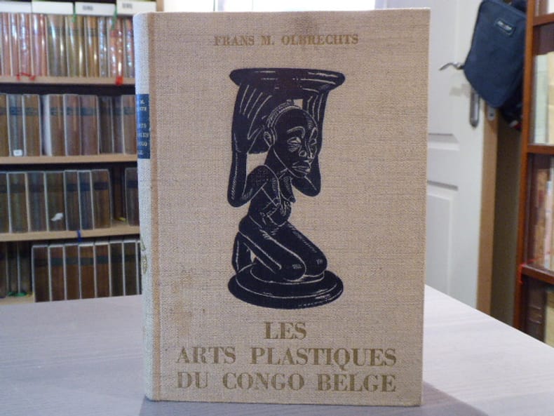
288228Editions Erasme, S.A. - S.A. Standaard-Boekhandel Bruxelles, Anvers-Amsterdam 1959 In-4 ( 270 X 190 mm ) de 161 pages + 45 planches, pleine toile écrue, motif estampé en noir sur le premier plat. 44 planches en noir, 1 planche en couleurs et 1 carte dépliante hors-texte. EDITION ORIGINALE RARE du "Maître-Livre" sur le sujet. Minimes taches claires sur la couverture, bel exemplaire, très pur.
- Imprimerie royale, Paris 1845, 9,5x15cm, 2 volumes reliés en 1. - Edition originale de la traduction française, des corrections, des additions et des éclaircissements, établis par Joseph Toussaint Reinaud en 1845, d'après le texte arabe imprimé en 1811 par les soins de Louis Langlès. Reliure à la bradel en plein papier marbré, plats de couverture conservés, reliure signée Thomas Boichot. Très rare exemplaire sans rousseur. [ENGLISH DESCRIPTION ON DEMAND]
50315aafTiguri (Zürich), typs Heideggeri, 1751, in-8vo, 7 Bl. + 241 S. (S. 213 bis 230: Jacobi Le Long, ... de scriptoribus historiae naturalis Galliae; S. 231 bis 241: Index authorum), teils etwas gebräunt, späterer Ganzlederband auf Bünden im Stil der Zeit, vergold. Titel a.d. Rücken, marmorierter Schnitt. Schönes Exemplar.
20217EDINBURGH. GAVIN ALSTON. 1776. GEORGE ANSON LATE LORD ANSON COMMANDER IN CHIEF OF A SQUADRON OF HIS MAJESTY'S SHIPS SENT UPON AN EXPEDITION TO THE SOUTH SEAS COMPILED FROM HIS PAPERS AND MATERIALS BY RICHARD WALTER M.A. CHAPLAIN TO HIS MAJESTY'S SHIP THE CENTURION IN THAT EXPEDITION. TWO VOLUMES CROWN 8vo FULL ELEGANT MOROCCO BINDINGS IN TAN GILT BY PAUL DELRUE FOLDING MAP. A VERY HANDSOME SET. EDINBURGH. GAVIN ALSTON. 1776 unknown
22088LONDON. A NICOL. 1785. SECOND EDITION THREE VOLUMES. VOLS. 1 AND 11 WRITTEN BY COOK VOL. 111 BY JAMES KING. THIS SET CONTAINS THE FULL TEXT BUT NO PLATES. VOLUME 1: TITLE PAGES; CONTENTS; INTRODUCTION lxxxix; LIST OF PLATES PLATES NOT PRESENT; 421 PAGES. VOLUME 2: TITLE PAGE; CONTENTS; 548 PAGES. VOLUME 3: CONTENTS 558 PAGES INCLUDING 7 APPENDICES. ALL VOLUMES REBOUND IN MARBLED BOARDS WITH STIFF CREAM PAPER SPINES PAPER LABELS NEW ENDPAPERS. BINDING IS TIGHT. AN EXCEPTIONALLY CLEAN SET. THE TITLE PAGE TO VOLUME 3 APPEARS TO BE A PHOTOCOPY AS IS THE FOLLOWING PAGE. SOME FOXING TO THE EARLY PAGES OF VOLS. 1 AND 11 BUT OVERALL A VERY GOOD CLEAN AND ATTRACTIVE SET OF THIS SCARCE WORK WITHOUT THE PLATES AND OFFERED AT AN ATTRACTIVE PRICE. PICTURES AVAILABLE. LONDON. A NICOL. 1785. hardcover
178325416Paris, chez le Sr Desnos, (ca 1783). 46,5x64,5 cm. Engraved map of Africa with the Mediterranean Sea at north. Contemporary handcoloured. Cartouche uncoloured. A few tears showing in right grade-scale, no loss.
178325416Paris chez le Sr Desnos ca 1783. 465x645 cm. Engraved map of Africa with the Mediterranean Sea at north. Contemporary handcoloured. Cartouche uncoloured. A few tears showing in right grade-scale no loss. <br/><br/><em>Jaillots fine impressive map of the continent of Africa from 1695 in Brion de la Tours revision from 1783 giving much new information and details of this continent. </em> unknown
179819278Voyage de F. Le Vaillant, dans l'intérieur de l'Afrique, par le cap de bonne-espérance. Ornée de 20 figures en taille-douce en 2 volumes. An VI - (1798). Sans la carte.Second voyage de F. Le Vaillant dans l'intérieur de l'Afrique par le cap de Bonne-espérance, pendant les années 1783, 1784 et 1785. Ornée de 22 planches en taille douce en 3 volumes. An XI - 1803.De l'imprimerie de Crapelet. Paris, chez Desray, rue Hautefeuille.Reliure plein veau raciné de l'époque. Roulettes sur les plats. Dos lisse orné. Pièces de titre et de tomaison en maroquin rouge. Mors du 1er plat du T1, du second voyage en partie fendu. 2 coins émoussés. Reliure homogène des 5 volumes. Pas de rousseur. Très bon état. Format in-8°(20x13).François Levaillant, parfois écrit Le Vaillant (1753-1824) est un explorateur, collectionneur et ornithologue. Il fait paraître le Voyage dans l'intérieur de l'Afrique en 1790. Il connaît un immense succès et il est rapidement traduit dans de nombreuses langues. Il poursuit l'exploitation de ses souvenirs en publiant le Second voyage dans l'intérieur de l'Afrique en 1796. Puis il publie l'Histoire naturelle des oiseaux d'Afrique en 1796-1808.Levaillant a l'immense mérite d'avoir attiré l'attention des ornithologues sur la faune de l'Afrique du sud, jusqu'alors presque inconnue.
1989VB2300310560Adesegun Johnson & Koram Publishers 1989. paperback. Very Good. 1x4x8. VERY GOOD MAY HAVE ONE PAGE OF WRITING PAGES ARE IN GREAT CONDITION USED PRODUCTS DO NOT CONTAIN ORIGINAL CONTENTS WILL HAVE SHELF WEAR AND STICKERS ON COVER. MAY HAVE MISSING CD INSERTS CODES. Adesegun, Johnson & Koram Publishers paperback
Grande carte en deux parties, format global : 69 x 99 cm, frontières rehaussées en couleur, A Paris, Chez Delamarche, Géographe, rue du Foin St Jacques, au Collège de Mtre Gervais, s.d. [circa 1787-1795 ] Très belle et grande carte d'Afrique (à ne pas confondre avec les tirages plus réduits, bien plus courants), reprise par Delamarche de la carte publiée chez Lattré en 1778. Ornée d'un cartouche très décoratif (roi africain étendu sur un lion, sous son parasol), cette carte unit des références encore mythiques sur une mystérieuse Afrique de l'intérieur encore inconnue à une très grande précision géographique, pour les zones côtières. Bon état (qq. petites mouill.) pour cette carte méritant un encadrement qui pourra la mettra en valeur. Français
1899182552Großformatige, farbig lithographierte und auf satiniertes Leinen (glazed linen) gedruckte Karte in 6 Blatt (je ca. 67 : 98,5 cm). Maßstab 1 : 476.000. London, Edward Stanford (Druck: Wurster, Randegger & Cie (J. Schlumpf), Winterthur), 1899. Zusammen in Originalpappmappe mit aufgedrucktem Blattschnitt; gebräunt u. bestoßen, eine Ecke mit ca. 3 cm langem Einriss, rückseitig Vernietung an einer Stelle ausgerissen.
1742402361Amsterdam, Cartuffe, 1742. M. 5 (teils gef.) Kpfr.-Ktn. u. 25 (1 gef.) Kpfr.-Taf. Ldrbde. d. Zt. m. Rtit. Leicht beschabt. Ecken u. Kanten etwas bestoßen.
1919276769Berlin: Reimer 1919. XII,522 S. 889 Abb. +, 129 lose Taf. in zwei Mappen 4° HLn. *Textband bestossen, Rücken mit Fehlstelle, auch die Mappen rundherum bestossen, teilw demoliert -die Taf. - bis auf 3 (diese etwas verschmutzt) alle gutem Zustand, auch der Innenteil des Textbandes ist gut*.
18756572AKassel, Fischer, 1875. Gr. 8°. VIII, 3 Bll.; 340 S. Mit 1 gefaltet., kolor. lithographischen Karte von W. Jordan, 16 aufgezogenen orig. Fotografien von Ph. Remelé, 11 lithogr. Tafeln und einigen Textholzstichen. Halbleinenband. Rücken fachmännisch unter Verwendung des original Materials erneuert. Vorsätze ebenfalls erneuert. 1. Auflage.
18431550London: J Hatchard 1843. First. Half Leather. Near Fine. with the troops under the command of General Sir William Nott and sermons delivered on various occasions during the campaign of 1842. 468 pp large folding plate frontis other ill. w tissue guards. Original front cover bound in rear. Lovely copy in fine half leather binding contrasting gilt stamped leather spine labels and gilt decorations in spine bands. Showing almost no wear on outside and crisp and clean with no foxing inside. A lovely copy. J Hatchard unknown
1894004628London: Longmans Green and Co 1894. Vol 1 - 435pp/illus maps incl large color fold-out map showing the expedition route through Equatorial Africa. Vol 2 - 397pp/illus/maps with large fold-out in rear. Narative of Count Samuel Teleki's exploring and hunting expedition in Eastern Equatorial Africa in 1887 and 1888. Set has standard library markings and rear pocket. Maps have light wear. Book is overwise clean. . First Edition. Cloth. Very Good/No Jacket Issued. 8vo - over 7¾" - 9¾" tall. Ex-Library. Longmans Green and Co hardcover
177679610Leipzig: Weygand 1776. Gebunden. Weygand unknown
large 4to [27.5 x 22 cm]; xviii, [ii, sub-title, contents], 513, [i, plate list] pp, 38 copper engraved plates, plans & maps (including 7 folding maps, folding plates), leaf of music, divisional half-titles, engraved head & tail pieces, text illus. later tan half calf, raised bands, gilt ruled, gilt title on red leather spine label, contemp marbled boards, lightly rubbed, bookplate of Peter Ward, slight foxing & offsetting from plates, sm chip to title corner, map with tear, near fine, nice binding. Cox i, p377. Pritzel 8649. Gay 391. Nissen. 3839 Casey Wood p566. Blackmer Sale 307: "His work is valuable for its accurate descriptions of antiquities, geography & natural history he observed". Gibbon praised him and "his scrupulous fidelity was vindicated by James Bruce and by later African explorers. . . a noble example of typography" (D.N.B., vol 17, p 1384). "These Travels have been universally esteemed, not only for their accuracy and fidelity, but on account of the illustrations they contain of natural history, of the classic authors, and especially of the Scriptures." (Lowndes). A handsomely printed work, the best description of North Africa of the period. The author visited Egypt, Sinai, Palestine, Cyprus and most of North Africa, and provides much material on Tunis and Algeria. A section on Lebanon is included in the description of the Levant. More than 640 species of plants are described. There is also a list of the rarer plants of Barbary, Egypt and Arabia. The plates include natural history, botany, animals, antiquities. His geological views were enlightened for his time, while his conjectures on the subject of the pyramids have been fully confirmed by later investigators. This edition has more plates and includes the material in the supplement of 1756 that was not in the first edition of 1738. There is a section on plants, birds, animals, etc, he collected.
168661137Amsterdam: Wolfgang Waesberge Boom & van Someren 1686. First Thus. First French edition. Folio in fours 37cm. Contemporary mottled calf spine divided into seven compartments each tooled in gilt all edges sprinkled red; plain endpapers; vi53422pp; engraved title page 26 of 42 double-page line-engraved plates 55 in-text line engravings. Lacking 17 maps and plates including the large folding map of Africa. Bookseller's embossed stamp of F. R. Thorold Johannesburg to front free endpaper. Text complete collating 2o: π1 2 A-3Z4 4A2 signed $1-3 2K3 not signed. Generally tight with minor edgewear lower front joint starting to split very occasional spots of foxing but overall clean: a sound but obviously defective copy.<br /> <br /> The only French translation of this important 1668 text on Africa considered authoritative in its day despite the fact that its Dutch author never visited Africa instead relying on primary accounts of voyages. Extensively illustrated with depictions of people cities flora and fauna; this copy lacking almost all the maps but serviceable. Wolfgang, Waesberge, Boom & van Someren unknown
181454002London: Longman Hurst Rees and Orme 1814. Frontispieces & Plates. 2 vols. 4to. Recently bound in half brown calf and marbled boards spine labels gilt. Ex-library with small perforated stamp on title pages some browning of leaves. A very attractive set. Frontispieces & Plates. 2 vols. 4to. Pinkerton's collection of voyages was published over the course of six years in a total of seventeen volumes. The six volumes devoted to Europe comprise the largest section of the collection. They are "of great value for its texts which are sometimes given entire and sometimes abridged with as much as possible of the traveler's own language" Hill. <br/><br/>Pinkerton was something of a character. Having apprenticed to an Edinburgh solicitor upon the death of his father and receipt of his inheritance he immediately turned his back to a legal career and dedicated himself to literary matters. Through his works as a historian poet and playwrite he made friendships with the likes of Horace Walpole Walter Scott and Edward Gibbon and through his controversial religious views and short temper he eventually lost them. Longman, Hurst, Rees, and Orme unknown books