COOK JAMES:Biblio.com
30 549 résultats
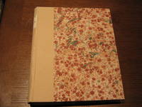
22067LONDON. STRAHAN AND CADELL. 1777. FIRST EDITION TWO VOLUMES. THIS SET CONTAINS THE FULL TEXT BUT NO PLATES. VOLUME 1: TITLE PAGES; CONTENTS; GENERAL INTRODUCTION; LIST OF PLATES PLATES NOT PRESENT; 378 PAGES. VOLUME 2: TITLE PAGES; CONTENTS; 396 PAGES. BOTH VOLUMES REBOUND IN MARBLED BOARDS WITH STIFF CREAM PAPER SPINES PAPER LABELS NEW ENDPAPERS. BINDING IS TIGHT. VOLUME 1 IS GENERALLY CLEAN WITH OCCASIONAL FOXING. IN VOL. 1 PAGE 375 HAS A SMALL HOLE WITH LOSS OF ABOUT FOUR WORDS OF TEXT. VOLUME 2 HAS EVIDENCE OF WATER STAINING UP TO PAGE 160 MAINLY IN THE WIDE MARGINS WITH LITTLE IN THE TEXT THEREAFTER A BRIGHT COPY. OVERALL A VERY GOOD CLEAN AND ATTRACTIVE SET OF THIS SCARCE WORK WITHOUT THE PLATES AND OFFERED AT AN ATTRACTIVE PRICE. PICTURES AVAILABLE. LONDON. STRAHAN AND CADELL. 1777. hardcover
22068LONDON. STRAHAN AND CADELL. 1773. FIRST EDITION VOLUME 2 ONLY OF THREE. THIS WAS COOK'S FIRST VOYAGE UNDERTAKEN IN THE DOLPHIN SWALLOW AND ENDEAVOUR. REBOUND IN MARBLED BOARDS WITH STIFF CREAM PAPER SPINES PAPER LABELS NEW ENDPAPERS. BINDING IS TIGHT. CONTAINS TITLE PAGE LIST OF CONTENTS INTRODUCTION 410 PAGES. THERE ARE NO PLATES IN THIS VOLUME. A VERY CLEAN COPY WITH SOME EVIDENCE OF WORM HOLES AT THE FOOT OF THE LAST 30 PAGES. PICTURES AVAILABE. LONDON. STRAHAN AND CADELL. 1773. hardcover
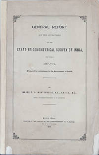
18713420Dehra Dun: Superintendent of the G T Survey 1871. First Edition. Orig Printed Wrappers. VG. Prepared for submission to the government of India. 25 pp ill lengthy appendix on extracts from the narrative reports on the executive offers in charge of the survey parties and operations. Numerous fold out maps accompany reports. Also with a report on the Trans-Himalayan Explorations in connections with the Great Trigonometrical Survey in India during 1879 by Major Montgomerie. 11 pp fold out maps. Contains a further memorandum on the surveys by Montgomerie. Internally near fine. Orig wrappers are 99% complete but show chipping closed tears folds etc more so on the accompanying report than on the original. Rare item more so because both are present. Superintendent of the G T Survey unknown
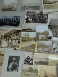
2J4001901. 72 S. original Handschrift sowie 50 original Fotografien der Reise und der Mission verschiedene Formate von 21 cm x 27 cm bis 105 cm x 6 cm Plattenfotografien meist auf Pappe oder in das Reisebuch montiert. - Beinhaltet: zahlreiche Reisaufnahmen / Das Schiff Prins Wilhelm I. / Cabenda Kirche in Maripastoon Eingeborene Kirche in Daeobkondre / Kirche in Makajapingo / Labrador Moravian Station / Emil und Emma Wurr Studioaufnahme bei Fotografia Central de E. Herburger. Guatemala / Großaufnahme des Inneren Manufakturwinkels Laden / Bruderfest / Eisfabrik / Schulkinder i. Charlottenberg Lehrer Henri Roy / Missionshaus in Moskito Nikaragua / Missionsschule Niesky Stationshügel Ost-Afrika / Gruppenaufnahme mit Lehrpersonal etc. - unknown
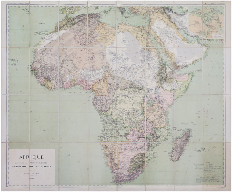
1896LBW-8146Paris, Librairie Hachette & Cie, 1896. En 32 sections montées sur toile et repliées, formant une carte de 0,90 x 1,07 m ; étiquette au dos du graveur-éditeur parisien de cartes géographiques Lanée, successeur de Longuet.
Attrattiva carta dell'Africa, pubblicata da Jodocus Hondius per le numerose edizioni del Gerardi Mercatoris Atlas sive Cosmographicae Meditationes, edite dal 1606 al 1630. La carta fa parte delle 37 nuove mappe incise da Hondius per aggiornare l’opera cartografica del Mercator. La geografia di questa mappa deriva da diverse fonti, prima fra tutte la mappa dell'Africa di Mercator del 1595, con aggiunte e modifiche, ma Hondius aveva anche accesso ai vari libri di esplorazione di Pigafetta, Ramusio e altri, integrati con le più recenti pubblicazioni olandesi, come ad esempio l'Itinerario di Van Linschoten. La mappa, dunque, costituisce una sorta di transizione tra la geografia di Ortelius e Mercator, e quella più moderna di Blaeu, Claesz e altri, dei primi decenni del '600. Questa mappa è conosciuta in un unico stato. Nel 1604, Jodocus Hondius (1563-1612) - probabilmente tramite Cornelis Claesz - acquistò le matrici in rame dell'Atlas sive cosmographicae meditationes de fabrica mundi di Gerard Mercator all’asta. Aggiunse circa 40 mappe, comprese nuove mappe dei continenti e importanti mappe regionali delle Americhe, prima di pubblicare una nuova edizione dell’opera, nel 1606, in concorrenza con il Theatrum Orbis Terrarum di Ortelius. Poiché molte delle mappe erano più aggiornate, la raccolta di Mercator & Hondius sostituì effettivamente il Theatrum di Ortelius. L’atlante del 1606 include tutte le 107 mappe dell’edizione del 1595, oltre a 37 nuove mappe, abilmente incise dallo stesso Hondius. La seconda edizione della raccolta seguì già nel 1607/08, mentre la prima edizione in un’altra lingua, il francese, fu messa sul mercato nel 1609. Apparentemente questa fu considerata come la terza edizione, perché nel 1611 apparve l'Editio Quarta, con un totale di 150 mappe. Dopo la morte di Jodocus Hondius (1612) la sua vedova e i suoi figli continuarono la stampa dell’atlante. Jodocus Junior ( o Jodocus II, 1594-1629) produsse diverse ristampe tra il 1613 e il 1619, sempre con le stesse 150 mappe; nel 1619 furono invece aggiunte sei nuove mappe. Dopo il 1620 la pubblicazione venne curata da Hendrick (Henricus) Hondius (1597-1651), il secondo figlio di Jodocus senior. Varie edizioni apparvero, nel 1623, 1628 e 1630. Hendrick fu il primo ad apportare dei veri cambiamenti: nell’edizione del 1628 firmò alcune mappe di Mercatore con il proprio nome. Nel 1630, quando probabilmente stava già collaborando con suo cognato Johannes Janssonius, aggiunse nove nuove carte. Incisione in rame, finemente colorata a mano, in ottime condizioni. This is an attractive map by Jodocus Hondius showing the continent of Africa. "Hondius map of Africa is an important transitional map, bridging the earlier work of Ortelius, Mercator and others, with the more modern maps of Willem Blaeu in 1608, Claesz. in 1617, and others. The geography for this map is taken from a variety of sources. Some of the interior of Africa is based on Mercator's 1595 map of Africa, but numerous additions and changes have been made. Hondius had access to the books of exploration of Africanus, Pigafetta (based on the travel account of Duarte Lopez), Ramusion, De Barros, and others. These were supplemented by the more recent Dutch sources such as Van Linschoten's Itinerario with the two maps of the Southern portion of Africa based on Portuguese sources. [...] This map of Africa was issued along with Gerard Mercator's 1595 map, Africa ex magna orbis terre... in the various editions of the Mercator-Hondius Atlas up to 1630." (R. Betz) In 1604, Jodocus Hondius (1563-1612) – probably trought Cornelis Claesz - bought the copperplates of Mercator’s Atlas sive cosmographicae meditationes de fabrica mundi at the auction of Gerard Jr.’s effects. He added about 40 maps, including new maps of the Continents and important regional maps of the Americas, before publishing a new edition of the Atlas, in 1606, in competition with Ortelius’ Theatrum Orbis Terrarum. As many of the maps were more up-to-date, the Mercator-Hondius Atlas effectively superseded Ortelius’ Theatrum. This atlas from 1606 include all 107 maps from the 1595 edition, as well as 37 new maps, skillfully engraved by Hondius, of various authors. The second edition of the Mercator-Hondius atlas followed as soon as 1607/08. The first edition in another language, French, was put on the market in 1609. Apparently this one was regarded as the third edition, because in 1611 Editio Quarta appeared with a total of 150 maps. After the death of Jodocus Hondius in 1612 his widow and sons continued the publication of the Atlas. For instance Jodocus Junior (1594-1629) produced several new editions of the Editio Quarta between 1613 and 1619, each with the same 150 maps. Finally in 1619 the last edition of this atlas followed, to which six new maps were added. After 1620 the publication of the Atlas was continued by Henricus Hondius (ca. 1596/97-1651), the second son of Jodocus senior. Various editions appeared, in 1623, 1628 and 1630. Henricus Hondius was the first to make some real changes: in the 1628 edition he provided some Mercator maps with his own name. In 1630, when he was probably already cooperating with his brother-in- law Johannes Janssonius, Henricus added nine new maps. R. L. Betz "The Mapping of Africa…" (2007), map 52; O. I. Norwich, "Norwich's Maps of Africa", map 27
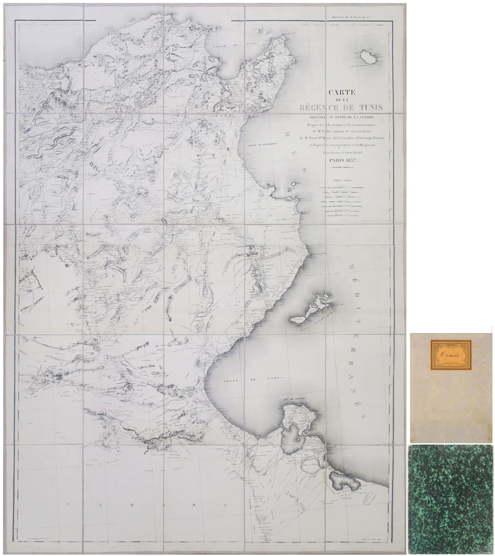
1857LBW-8912Paris, Dépôt de la Guerre, 1857-1884. En 25 sections montées sur toile et repliées, formant une carte de 1,31 x 0,98 m ; étiquette au dos du papetier et relieur nancéen René Wiener ; sous chemise et étui de papier marbré vert de l'époque.
1816biblio264<p><em>First edition. Printed for Henry Colburn Conduit Street Hanover Square. London. 1816. 4to. xiii bl. 2 370pp. Folding map 5 hand coloured tissue guarded plates. Later half calf spine in six compartments with raised banding gilt lettering and motifs marbled boards new endpapers. Short detachment of tissue guard and title page to base. Very occasional spotting. A lovely volume.</em></p><p><em>Richard Tully was the British Consul at Tripoli from 1783 to 1793 and according to the preface these letters were written by his sister; and attributed to his sister-in-law in the second and third editions. The author's identity has always been a mystery: there is no record of a sister nor of another female family member residing in Tripoli apart from Mr Tully's wife and two daughters. The final entry is dated April 30 1795 Gibraltar. It reads: "Since you must have had my letters with the journal of Tripoli". Louisa Maria Tully daughter of Richard Tully married Alexander Simpson on 19 March 1795 in Gibraltar. Her sister Anne married Gaspar Gomez de la Serna Perez de Beas having four children before his death in 1808 residing in Minorca. Both daughters were fluent in Arabic both were intimate with the court of Tripoli regarded as daughters of the Court. Mrs Tully may be discounted as the author as she is referred to in the third person. The first person authors are variably "we" or "I". I suggest that these letters were written by the Tully sisters.</em></p><p><em>Byron admitted his plagiarism of this work "by the way much of the description of the furniture in Canto Third of Don Juan is Taken from Tully's Tripoli pray note this. Remember I never meant to conceal this at all."</em></p><p>Abbey Travel 299 Blackmer 1052</p> Printed for Henry Colburn, British and Foreign Public Library hardcover
1823275434Diesbachische Buchhandlung Prag 1823. Hardcover Pappe ohne Schutzumschlag 18. Band 1.-6. Abtheilung Seite 1 bis 607. Mit Charten und 4 Kupfern. Zustand: Bei der ersten der insgesamt vier Faltkarten ist nur eine Ecke vorhanden. Keine Eintragungen. Rücken Ecken Kanten bestoßen berieben mit Abschabungen. Trotzdem insgesamt gut erhalten in allem original. Mit Kennungen einer Bibliothek Stempel Rückenschild. Diesbachische Buchhandlung, Prag, hardcover
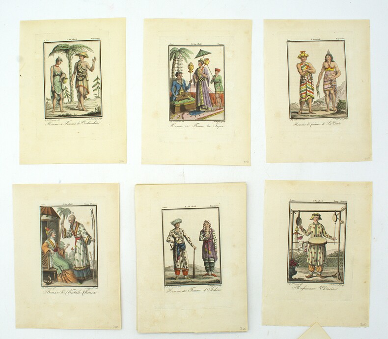
1806PHO-1894Paris, Madame veuve Hocquart, 1806, in-8, sous étui, 123 planches (160) en couleurs, gravées par Lachaussée Jeune, de costumes d'Europe (50 sur 80), d'Asie (34 sur 36), d'Afrique (18) et d'Amérique (21 sur 22), accompagnées de 5 cartes en couleurs (Amérique septentrionale, Amérique méridionale, Afrique, Asie, Europe, toutes datées de 1806, sur 6), manque les 4 frontispices, tache sur une planche sinon aucun défaut.
Carta tratta dell'Atlas sive cosmographicae meditationes de fabrica mundi curato da Hendrick Hondius. Nel 1604, Jodocus Hondius (1563-1612) - probabilmente tramite Cornelis Claesz - acquistò le matrici in rame dell'Atlas sive cosmographicae meditationes de fabrica mundi di Gerard Mercator all’asta. Aggiunse circa 40 mappe, comprese nuove mappe dei continenti e importanti mappe regionali delle Americhe, prima di pubblicare una nuova edizione dell’opera, nel 1606, in concorrenza con il Theatrum Orbis Terrarum di Ortelius. Poiché molte delle mappe erano più aggiornate, la raccolta di Mercator & Hondius sostituì effettivamente il Theatrum di Ortelius. L’atlante del 1606 include tutte le 107 mappe dell’edizione del 1595, oltre a 37 nuove mappe, abilmente incise dallo stesso Hondius. La seconda edizione della raccolta seguì già nel 1607/08, mentre la prima edizione in un’altra lingua, il francese, fu messa sul mercato nel 1609. Apparentemente questa fu considerata come la terza edizione, perché nel 1611 apparve l'Editio Quarta, con un totale di 150 mappe. Dopo la morte di Jodocus Hondius (1612) la sua vedova e i suoi figli continuarono la stampa dell’atlante. Jodocus Junior ( o Jodocus II, 1594-1629) produsse diverse ristampe tra il 1613 e il 1619, sempre con le stesse 150 mappe; nel 1619 furono invece aggiunte sei nuove mappe. Dopo il 1620 la pubblicazione venne curata da Hendrick (Henricus) Hondius (1597-1651), il secondo figlio di Jodocus senior. Varie edizioni apparvero, nel 1623, 1628 e 1630. Hendrick fu il primo ad apportare dei veri cambiamenti: nell’edizione del 1628 firmò alcune mappe di Mercatore con il proprio nome. Nel 1630, quando probabilmente stava già collaborando con suo cognato Johannes Janssonius, aggiunse nove nuove carte. Acquaforte, bella coloritura coeva, in buono stato di conservazione. This map of Africa, realized by Hendrik Hondius, is a reissue of Jodocus Hondius' map, without the decorative borders, but with the excudit of Janssonius, on lower right. While the general geography for this map is taken from Willem Blaeu’s wall map of 1608 and his 1617 folio map, this example represents a considerable advance in the detail and accuracy of Africa from Hondius’ prior maps.Geographical improvements include a more rounded southern Cape, the naming of the Rio de Spiritu Santo and of the CuamaRiver, the insertion of Zimbaos and alteration in the shape of Madagascar. The Kingdom of Monomotapa fills the entire southern tip of Africa.However, the map is also filled with fictitious rivers and mountains and shows the origin of the Nile conforming to the Ptolemaic tradition of twin lakes located below the equator, as is typical of 17th Century cartography. Map taken from the Atlas sive cosmographicae meditationes de fabrica mundi edited by Hendrick Hondius. In 1604, Jodocus Hondius (1563-1612) – probably trought Cornelis Claesz - bought the copperplates of Mercator’s Atlas sive cosmographicae meditationes de fabrica mundi at the auction of Gerard Jr.’s effects. He added about 40 maps, including new maps of the Continents and important regional maps of the Americas, before publishing a new edition of the Atlas, in 1606, in competition with Ortelius’ Theatrum Orbis Terrarum. As many of the maps were more up-to-date, the Mercator-Hondius Atlas effectively superseded Ortelius’ Theatrum. This atlas from 1606 include all 107 maps from the 1595 edition, as well as 37 new maps, skillfully engraved by Hondius, of various authors. The second edition of the Mercator-Hondius atlas followed as soon as 1607/08. The first edition in another language, French, was put on the market in 1609. Apparently this one was regarded as the third edition, because in 1611 Editio Quarta appeared with a total of 150 maps. After the death of Jodocus Hondius in 1612 his widow and sons continued the publication of the Atlas. For instance Jodocus Junior (1594-1629) produced several new editions of the Editio Quarta between 1613 and 1619, each with the same 150 maps. Finally in 1619 the last edition of this atlas followed, to which six new maps were added. After 1620 the publication of the Atlas was continued by Henricus Hondius (ca. 1596/97-1651), the second son of Jodocus senior. Various editions appeared, in 1623, 1628 and 1630. Henricus Hondius was the first to make some real changes: in the 1628 edition he provided some Mercator maps with his own name. In 1630, when he was probably already cooperating with his brother-in- law Johannes Janssonius, Henricus added nine new maps. Copperplate, fine original colouring, good condition. O. I. Norwich, "Norwich's Maps of Africa", map 34; R. L. Betz "The Mapping of Africa…" (2007), map 58; Schilder, Monumenta, volume 6, 13.
DG-39-192838884Fine. In Stock One Like New copy in like new dust jacket protected in mylar. unknown
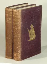
186452523London: Tinsley Brothers 1864. Second edition 2 volumes 8vo pp. xvii 3 7-386; vi 413 1; wood-engraved frontispiece in each volume; original dark purple cloth gilt-stamped on upper cover gilt lettering direct on spine; both spines sunned and spotted back cover of vol. I also spotted; all else very good and sound. In 1863 Burton went to Dahomey as a representative of the British government to persuade the King to stop his participation in the slave trade and human sacrifice. For the first edition see Spink 31; Penzer pp. 72-74; and Casada 47: "Thanks in part to the sensational nature of its subject matter this is one of the better known of Burton's works on Africa." <br/><br/> Tinsley Brothers hardcover books
164421312Romae: Andree Phaei 1644. 4to pp. 18 93 1; engraved vignette title page 4 engraved plates 2 folding 1 double-p. 12 woodcuts in the text 1 hand-colored; bound with as issued: Romano De antiquis Romanorum ritibus Rome 1644 pp. 10 95-269 20; engraved vignette title page 10 engraved plates 2 folding 1 double-p. 2 double-p. and folding 18 woodcuts in the text; bound with: Romano De veteribus christianorum ritibus Rome 1645 engraved title page pp. 18 496 71; 6 engraved plates 1 double-p. 1 folding 1 folding and double-p. 8 woodcuts in the text; printer's woodcut device on the final leaf; bound in contemporary limp vellum front hinge broken the whole rubbed and worn internally very good. Graesse p. 59; Ibrahim-Hilmy p. 120. <br/><br/> Andree Phaei hardcover books
164421312Romae: Andree Phaei 1644. 4to pp. 18 93 1; engraved vignette title page 4 engraved plates 2 folding 1 double-p. 12 woodcuts in the text 1 hand-colored; bound with as issued: Romano De antiquis Romanorum ritibus Rome 1644 pp. 10 95-269 20; engraved vignette title page 10 engraved plates 2 folding 1 double-p. 2 double-p. and folding 18 woodcuts in the text; bound with: Romano De veteribus christianorum ritibus Rome 1645 engraved title page pp. 18 496 71; 6 engraved plates 1 double-p. 1 folding 1 folding and double-p. 8 woodcuts in the text; printer's woodcut device on the final leaf; bound in contemporary limp vellum front hinge broken the whole rubbed and worn internally very good. Graesse p. 59; Ibrahim-Hilmy p. 120. Andree Phaei unknown
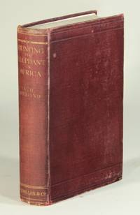
191352528London: Macmillan and Co 1913. First edition 8vo pp. xv 1 379 1 6 ads; folding table giving particulars of 25 felled elephants 27 photographic illustrations on 16 plates; some rubbing at the extremities otherwise a very good copy in original red cloth gilt-lettered spine. Czech Africa p. 156: "A pre-eminent elephant hunting title this details Stigand's big game hunting efforts primarily in British East Africa North Eastern Rhodesia Nyasaland and the Lado Enclave." <br/><br/> Macmillan and Co hardcover books
191352528London: Macmillan and Co 1913. First edition 8vo pp. xv 1 379 1 6 ads; folding table giving particulars of 25 felled elephants 27 photographic illustrations on 16 plates; some rubbing at the extremities otherwise a very good copy in original red cloth gilt-lettered spine. Czech Africa p. 156: "A pre-eminent elephant hunting title this details Stigand's big game hunting efforts primarily in British East Africa North Eastern Rhodesia Nyasaland and the Lado Enclave. Macmillan and Co unknown
191088871910 ff. 289 Schwarz-Weiß-Photographien in div. Größen (wie 8x10 cm / 9x12 cm), teils rs. mit Bleistift beschriftet (Fotograf Bauer aus Wetzlar) sowie weitere (ca. 70) 9x12 Negative in Pergamintaschen-Album
Bella e rara carta nautica, tratta dal celebre atlante di De Witt ''Orbis Maritimus ofte Zee Atlas", che mostra l'Africa occidentale con le Isole Canarie e Capo Verde nell'Oceano Atlantico. La mappa è dotata di due rose dei venti e battaglie navali. L'immagine della mappa è orientata con il Nord verso l'Est. Cartiglio ricco e dettagliato con titolo in latino, con immagini di nativi e di commercianti occidentali, oltre ad animali del luogo. "Frederick de Wit deve essere considerato uno dei più importanti editori di mappe della seconda metà del XVII secolo. La maggior parte delle sue mappe sono di ottima qualità, sono caratterizzate da un'incisione chiara e bella, dall'attualità e ricchezza dell'immagine cartografica nonché dall'equilibrio delle decorazioni cartografiche". (Lexikon der Kartographie II, p. 899), Koeman M. Wit 1, 27. Koeman, Atlantes Neerlandici, IV, pp.191 e 518-519. Shirley 444. Putnam, Early sea charts, 75.. .
184714928A. René et Cie Paris 1847 2 vol. 2 forts vol. in-8 de XVI 580 pp. et 2 ff.n.ch. 622 pp. 1 f.n.ch. (errata), demi-maroquin à coins, dos à nerfs, couverture et dos défraichis conservés (reliure milieu XXème).
18440686-22London, J. Madden 1844. 2 vols. 8°. XVI, 492 S.; VIII, 447 S. zus. mit 2 lith., getönt. Frontisp. u. 1 mehrfach. gefalt. Karte. / 2 lithographed frontispieces, engraved folding map. Ldr.-Bde. der Zeit von James Hayday, mit Stempel "Bound by Hayday", mit goldgeprägten Rahmenlinien u. je zwei goldgeprägten Rückenschildchen. Umlauf. marm. Schnitt. Kanten etwas berieben, Titelbl. je mit leichtem Abklatsch des. Frontisp., flieg. w. Bl. in Bd. 1 mit zeitgen. priv. Widmung in Tinte. EA. [6 Warenabbildungen]
189490871Friends' foreign mission association | Tananarive [Antananarivo] 1894 | 13.7 x 21.2 cm | Reliure de l'éditeur
17954352Paris, Imprimerie des Administrations Nationales, An troisième de la République [1795]. 1795 1 vol. in-4° (270 x 220 mm) de : [1] f. (titre) ; 39 pp. Cartonnage rose d'origine. (Salissures et défauts d'usage).
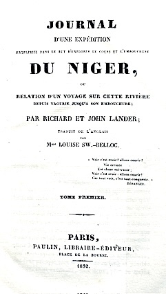
183212240Paulin Paris 1832 3 vol. 3 vol. in-8 de 354 pp., 348 pp. et 395 pp., demi-veau fauve de l'époque, dos lisse orné, tranches marbrées.
In-8 (mm. 236x146), 18 voll., mz. pelle coeva verde (picc. spacco al dorso del vol. XI), fregi e tit. oro, ornati da testate e finali xilografati, molto ben illustrati fuori testo da complessive 152 (su 156) tavv. + 2 non segnalate in Indice, inc. in acciaio da vari artisti (alc. a colori): sono vedute, carte geografiche, raffiguraz. delle popolazioni locali nei loro usi e costumi, ritratti dei vari navigatori, fatti storici, monumenti, ecc. Alcune tavole sono precedute da velina con didascalia (nel ns. esempl. per lo più brunite). La raccolta comprende le relazioni dei più importanti esploratori e viaggiatori, arricchite da documenti e note critiche, di viaggi effettuati nel Nuovo Continente - in Oriente - in Asia e in Africa. Cfr. Brunet,III,1439 che la cita solo in 15 voll. Nel ns. esemplare alcune tavv. presentano aloni al margine inferiore; circa 30 pp. del vol. X con brutti restauri, qualche fioritura. Complessivamente un buon esemplare.