ELLIS WilliamMareMagnum

30 547 résultats
- Hoddesdon Herts 28 février 1871, 13,5x21cm, 4 pages sur un double feuillet et un simple. - Lettre autographe inédite signée de William Ellis, quatre pages rédigées à l'encre noire sur un double feuillet et un feuillet simple. Intéressante lettre du révérend William Ellis, missionnaire de la London Missionary Society à Madagascar et auteur des plus anciennes photographies de l'île. Beau témoignage de l'approche ethnographique d'Ellis qui se détache de la « théorie du sauvage » portée par le regard européen. Il donne à son interlocuteur de précieuses informations sur les Vazimba, encore non identifiés au XIXe siècle et décrits par les premiers explorateurs de l'île comme des pygmées belliqueux vivant dans les montagnes malgaches. Ellis se montre très critique envers les descriptions fantasmées de ces prédécesseurs et privilégie les témoignages directs des habitants gardant le souvenir de ce peuple disparu. Auteur de plusieurs ouvrages d'histoire malgache, Ellis décrit en détails les légendes sur l'ethnie Vazimba qui faisaient encore de cet habitant premier, caractérisé par sa petite taille et sa peau cuivrée, l'occupant des hauts plateaux de l'île. Ellis doute fort des descriptions issues des expéditions de Flacourt (1648) et de l'abbé Rochon (1768) qui désignent ce peuple sous le nom de "Kimos" ou "Quimos" et les décrivent comme une "race naine" ("dwarf race"). Il se fie davantage aux témoignages des habitants de l'île qu'il recueille pendant ses séjours chez les Hovas et les Betsiles, rapportant la crainte et le respect qu'inspirait encore les esprits et les sépultures des Vazimba. La lettre rassemble et critique les connaissances de l'époque et mentionne l'expérience de son successeur, le révérend Charles Jukes de la London Missionary Society, dont il célébra la messe de départ en mission le 8 juillet 1866. Il évoque dans cette lettre une hypothèse qui sera confirmée par les recherches scientifiques modernes : les Vazimba seraient une des communautés fondatrices de l'île, à l'origine de la langue et de la culture malgache. "[...] By the Hova's & others who spoke of them, they were called Vazimba. They were said to be smaller in stature and lighter in colour than the Hovas, & to be regarded with superstitious feelings by the other inhabitants, who hold their tombs in extreme veneration & frequently offer at their tombs sacrifices or gifts to the spirits of the Vazimba. During my own intercourse with people on the coast & in the interior I made repeated enquiries, but never met with a native who had seen a Vazimba. Their graves I saw frequently in my journeys among the people in the interior. I saw also many of their tombs at which offerings had been recently presented and found that many of the people regarded them with superstitious fear and seemed exceedingly afraid of doing any thing likely offend them. The Hovas didn't appear to know anything of the name of Kimos all elapses of whom I enquired call the diminutive race Vazimba & spoke of them as the ancient or earliest inhabitants of the country. [...] My friend informed me that the Betsiles do not speak of the Vazimba as remarkable on account of their small size or light colour, many of the Hovas are of quite a light colour. [...] My own opinion is that the Vazimba are the dwarf of which early writers speak & that they are not as diminutive as they have been represented to be. As our missionaries now occupy the Betsiles country, I have no doubt we shall soon have reliable accounts of the Vazimba relating of their present condition as well as their traditions of the past. If the foregoing statements should prove in any way revocable it will be gratifying so." Passionnante étude fouillée et documentée sur les moeurs et les origines des habitants de Madagascar qui révèle, dans l'intimité de cette correspondance privée, l'évolution du regard ethnologique et les questionnements d'un des principaux historiens de l'île au XIXe siècle. [ENGLISH DESCRIPTION ON DEMAND]
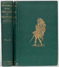
18693833London: Tinsley Brothers 1869. First Edition. Hardcover. VG. with a full account of the gold and diamond mines also canoeing down 1500 miles of the great river Sao Francisco from Sabara to the sea. First ed. Penzer pp 78-80. Two volumes: 443 & 478 pp. Plate & ill. in both volumes. Folding map opp. p 1 in vol 2. Burton was consul at Sao Paulo in 1856 and before taking his posting he went to Brazil to explore the country and sail down the river. VG in original cloth. Double blind border on covers enclosing large stamped design in gold of an India.VG very light foxing. Tinsley Brothers hardcover
1728BOOKS00671225144 contents and errata2 pages with 2 folding maps lacks frontispiece. Small Quarto 10" x 7 3/4". Rebacked in the 19th century leather retaining the original spine with raised bands and gilt decorative stamping and lettering to spine. Translated from the original Portuguese manuscripts by Jackim le Grande. First edition.<br /><br />Born in Lisbon he entered the Order of Jesus at the age of sixteen. In 1621 he was ordered as a missionary to India and in 1622 he arrived at Goa. With the intention of proceeding to Abyssinia whose Negus emperor Segued had been converted to Roman Catholicism by Pedro Páez he left India in 1624. He disembarked on the coast of Mombasa and attempted to reach his destination through the Galla country but was forced to return. In 1625 he set out again accompanied by Mendez the patriarch of Ethiopia and eight missionaries. The party landed on the coast of the Red Sea and Lobo settled in Abyssinia as superintendent of the missions in Tigre. He remained there until death deprived the Catholics of their protector the emperor Segued. Forced by persecution to leave the kingdom in 1634 Lobo and his companions fell into the hands of the Turks at Massawa who sent him to India to procure a ransom for his imprisoned fellow-missionaries. In this he was successful but could not induce the Portuguese viceroy to send an armament against Abyssinia. Intent upon accomplishing this cherished project he embarked for Portugal and after he had been shipwrecked on the coast of Natal and captured by pirates arrived at Lisbon. Neither at this city however nor at Madrid and Rome was any countenance given to Lobo's plan. He accordingly returned to India in 1640 and was elected rector and afterwards provincial of the Jesuits at Goa. After some years he returned to his native city and died there January 29 1678.<br /><br />Lobo wrote an account of his travels in Portuguese which appears never to have been printed but is deposited in the monastery of St. Roque Lisbon. Balthazar Telles made large use of the information therein in his Historia geral da Ethiopia a Alta Coimbra 1660 often erroneously attributed to Lobo see Machado's Bibliotheca Lusitana. Lobo's own narrative was translated from a manuscript copy into French in 1728 by the Abbe Joachim le Grand under the title of Voyage historique d'Abissinie. In 1669 a translation by Sir Peter Wyche of several passages from a manuscript account of Lobo's travels was published by the Royal Society translated in Melchisédech Thévenot<i>Relation des voyages</i> in 1673. An English abridgment of Le Grand's edition by Dr. Johnson was published in 1735 reprinted 1789. In a <i>Mémoire justificatif en réhabilitation des pères. Pierre Paëz et Jérôme Lobo</i> Dr. C. T. Beke maintains against Bruce the accuracy of Lobo's statements as to the source of the Abai branch of the Nile. See A. de Backer <i>Bibliothèque de la Compagnie de Jésus</i> edited by C. Sommervogel iv. 1893.<br /><br /><b>Condition:</b><br /><br />Old stamp and inscription on title page first folding map conspicuously restored second map tear restored else a very good copy notes to front end paper in period pen else about very good. La Veuve d'Antoine-Urbain Co hardcover
18773826London: Richard Bentley 1877. First Edition. Hardcover. VG to near Fine. with notices of the Anglo Indian Army railroads past present and future etc. First edition. 2 volumes: 343 & 331 pp. Penzer p 94 95. After a brief visit to Sind then part of India now Pakistan Burton added material to his earlier works and discussed the region's future. Lovely vg to near fine set bound in 3/4 leather raised spine bands gilt rules gilt borders in bands. Engraved bookplates Charles Waterman Armour both volumes. The book appears never read part of volume 2 is unopened. Richard Bentley hardcover
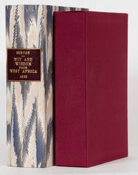
18653841London: Tinsley Brothers 1865. Second Edition. Hardcover. Good. or a book of proverbial philosophy idioms enigmas and Laconisms compiled by Richard F Burton Lake HM's Consul for the Bight of Biafra and Fernando Po. Second edition with the title Negro Wit and Wisdom on the spine. An important work. 455 pp. Penzer p 75 76 described this book as RARE especially if in good condition. Bound in brick red cloth with blind triple border enclosing design in blind on both covers. Burton wanted to give readers an insight into the Negro mind and thoughts. Clean and nice internally orig. endpapers lightly soiled. Recased in orig. cloth strengthened at spine tips. Orig. spine in fair condition with wear to gilt and relaid. Housed in a burgundy cloth case and then in a marbled paper slipcase with gilt leather spine label. Tinsley Brothers hardcover
1728BOOKS00671225144 contents and errata2 pages with 2 folding maps lacks frontispiece. Small Quarto 10" x 7 3/4". Rebacked in the 19th century leather retaining the original spine with raised bands and gilt decorative stamping and lettering to spine. Translated from the original Portuguese manuscripts by Jackim le Grande. First edition.<br /><br />Born in Lisbon he entered the Order of Jesus at the age of sixteen. In 1621 he was ordered as a missionary to India and in 1622 he arrived at Goa. With the intention of proceeding to Abyssinia whose Negus emperor Segued had been converted to Roman Catholicism by Pedro Páez he left India in 1624. He disembarked on the coast of Mombasa and attempted to reach his destination through the Galla country but was forced to return. In 1625 he set out again accompanied by Mendez the patriarch of Ethiopia and eight missionaries. The party landed on the coast of the Red Sea and Lobo settled in Abyssinia as superintendent of the missions in Tigre. He remained there until death deprived the Catholics of their protector the emperor Segued. Forced by persecution to leave the kingdom in 1634 Lobo and his companions fell into the hands of the Turks at Massawa who sent him to India to procure a ransom for his imprisoned fellow-missionaries. In this he was successful but could not induce the Portuguese viceroy to send an armament against Abyssinia. Intent upon accomplishing this cherished project he embarked for Portugal and after he had been shipwrecked on the coast of Natal and captured by pirates arrived at Lisbon. Neither at this city however nor at Madrid and Rome was any countenance given to Lobo's plan. He accordingly returned to India in 1640 and was elected rector and afterwards provincial of the Jesuits at Goa. After some years he returned to his native city and died there January 29 1678.<br /><br />Lobo wrote an account of his travels in Portuguese which appears never to have been printed but is deposited in the monastery of St. Roque Lisbon. Balthazar Telles made large use of the information therein in his Historia geral da Ethiopia a Alta Coimbra 1660 often erroneously attributed to Lobo see Machado's Bibliotheca Lusitana. Lobo's own narrative was translated from a manuscript copy into French in 1728 by the Abbe Joachim le Grand under the title of Voyage historique d'Abissinie. In 1669 a translation by Sir Peter Wyche of several passages from a manuscript account of Lobo's travels was published by the Royal Society translated in Melchisédech Thévenot<i>Relation des voyages</i> in 1673. An English abridgment of Le Grand's edition by Dr. Johnson was published in 1735 reprinted 1789. In a <i>Mémoire justificatif en réhabilitation des pères. Pierre Paëz et Jérôme Lobo</i> Dr. C. T. Beke maintains against Bruce the accuracy of Lobo's statements as to the source of the Abai branch of the Nile. See A. de Backer <i>Bibliothèque de la Compagnie de Jésus</i> edited by C. Sommervogel iv. 1893.<br /><br /><b>Condition:</b><br /><br />Old stamp and inscription on title page first folding map conspicuously restored second map tear restored else a very good copy notes to front end paper in period pen else about very good. La Veuve d'Antoine-Urbain Co hardcover books
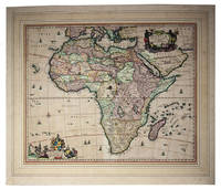
1680I24G435YONN5Amsterdam: Nicolas Visscher 1680. In passepartout 56 x 66 cm. Engraved double-page map image size: 43.5 x 54 cm; leaf size: 51 x 60 cm coloured by a contemporary hand. With title in a decorated cartouche on the top right flanked by two Africans and two putti and dedication to Gerardus Schaap in a decorated cartouche on the bottom left with Schaaps coat of arms on top and flanked by mythical figures. Further illustrated with small ships and African animals including lions monkeys rhinoceros and ostriches. Second state of Visscher's engraved map of Africa with the privilege added to the bottom right. It shows the whole continent of Africa the southern Mediterranean coast and a substantial part of the Arabian Peninsula. Primarily the coastline is accurately depicted with great detail to the South African coastline in particular - the interior of Africa was not accurately mapped until the 19th century. This map was based on Willem Blaeu's map of 1608 and used in atlases by the Visscher family up to 1696.With the centrefold strengthened at the back; paper browned and with a few small smudges but the colouring still bright.l Koeman Vis 86; V.d. Krogt & De Groot 35:04 first state; Norwich Africa 55. Nicolas Visscher, unknown
185689632Sans nom d'éditeur | Villelouet (Chailles, Loir-er-Cher) 1856 | 19 x 24.5 cm | Relié
Ensemble de 371 plaques photographiques (gélatino-bromure d'argent, iodo-bromure d'argent ou lactate d'argent) conservées (hormis 8 plaques) sous 22 boîtes, à savoir 354 plaques au format 9 x 12 cm, 12 au format 13 x 18 cm (boîte 13) et 5 au format 9 x 6,5 cm. Boîte 1 (la numérotation servant d'index est la nôtre ; les titres indiqués entre guillemets sont ceux du photographe, indiqués sur le papier protégeant la plaque) : 12 plaques dont "Vanillerie à Nossi Bé" , porteurs, hommes entravés, cheval, etc.. ; Boîte 2 : 23 plaques dont : "inauguration d'un nouveau marché couvert à Ambositra 28 février 1903", "l'apéritif à la résidence d'Ambositra Mr et Madame Fontfreyde 1902", "Tombeaux d'Ambohipia près Ambositra october 1902", "Square devant la résidence d'Ambositra" ; "travail des rizières à Tafaina sur l'Ikopa (janvier 1903)", "Rivière l'Hobemay sur la route de Finsarivo", "Finsarivo chef-lieu du District décembre 1903", "Notre maison à Ambositra", convoi vers escorteur, "Chutes de la Kelilandsy 22 avril 1904", "bœuf destiné à une corrida", etc... ; Boîte 3 : 17 plaques : "Forêt de Ravinaly (Arbre du Voyageur) Mai 1903", "Pipo cheval entier malgache janvier 1904", "Réparation à la grande route de Mananjary", "Chute d'eau dans la forêt sur la grande route de Mananjary", "Traversée de la Mania février 1903", "Tananarive marché d'Analakely 1903", "L'Hobemay novembre 1903", etc. ; Boîte 4 : 17 plaques : "Rivières et pont Manankazo novembre 1904", "Rivière et chute Manakazo", "Rivière Manankazo", "Rivière Manankazo", "Métisse malgache fille d'un colon français juillet 1904", Statue ou Totem, "Rivière Andobodavaka novembre 1903" ; Boîte 5 : 18 plaques : "Le bureau des postes et télégraphes septembre 1903", "Inauguration du marché à 19 km Ankazobe 21 mai 1904", "Chutes de la Kolilanpsy 12 avril 1904", "Chutes de Filosopona 12 mai 1904", "Briquetiers malgaches le long de la rivière du Manakazo 20 octobre 1904", "Fête des enfants à Ankazobe. Députation des petites filles venant adresser un compliment et offrir des fleurs aux chefs de la Province 7 avril 1904", etc... ; Boîte 6 : 14 plaques : dont cavalier ; Boîte 7 : 13 plaques ; Boîte 8 : 15 plaques : "Poste de Manakago 18 juin 1904", "Poste de Manerinerina 19 juin 1904", "Avenue Lyautey Ankazobe 13 juillet 1904", "Pont du Manankazo 18 juin 1904", "Logement du Docteur Monfort à l'hôpital d'Ankazobe février 1904", "Arrivée du Général Galliéni à Ankazobe 2 mai 1904", "Inauguration d'un marché à Ahé Danpinana", etc. ; Boîte 9 : 7 plaques : Manankazo octobre 1904, etc. ; Boîte 10 : 14 plaques ; Boîte 11 : 8 plaques : joli pont, embarcadère, bateau ; Boîte 12 : 14 plaques : dont 2 beaux bivouacs ; Boîte 13 : 12 plaques : belles vues et chevaux, etc. ; Boîte 14 : 11 plaques : "Muraie du Fansarivo de Vahalafotsy boutures mises en place en décembre 1903 (un an)", Village, Pilon, "Village de Mahazarivo (Vahalfosty) Village fortifié entouré de fossés (janvier 1905)", "Travail des rizières à Maharidaza (concession Hartmann) 29 décembre 1904", "Kiangara décembre 1904", "Pilons à décortiquer le riz à Ankazola juin 1904", "Cascade et village de Vohinzanitra" ; Boîte 15 : 20 plaques : divers paysages ; Boîte 16 : 15 plaques ; Boîte 17 : "Suzanne et Pierre à Farafangana octobre 1901" ; Boîte 18 : 13 plaques ; Boîte 19 : 12 plaques : "Arbre à la Résidence d'Ankazobe qui a donné son nom à la ville (24 juin 1904)", "Le grand marché du lundi à Ankazola juin 1904" ; Boîte 20 : 16 plaques : "Fête du 14 juillet 1903 à Ambositra", "Rivière Mahakamba débordée novembre 1903", "Convoi sur la route de l'Ouest 14 aoû 1904", "Halte de la colonne sur les bords de la rivière d'Andobodarako novembre 1903", "Ankazoke le kiosque de la musique au jardin public septembre 1903, , Finsarivo", "Fête des enfants à Ankazihe arrivé des légions d'enfants (7 avril 1904)", etc. ; Boîte 21 : 22 plaques : "Danses malgaches à Faranfangana 1901", "Traversée de la rivière Mananbavana devant Farafangana sur un radeau formé d'un sac de toile imperméable remplié de paille 1901", "Randriamifidy sous gouverneur d'Ankazobe juin 1904", etc. ; Boîte 22 : 12 plaques : "Rivière l'Hobemay décembre 1903. Le dimanche au jardin public d'Ankazobe septembre 1903", "Casernement de la Milice à Finsarivo", "Marché couvert en construction à Finsarivo octobre 1903", etc.; Boîte 23 : 18 plaques dont chaise à porteur ; Boîte 24 : 19 plaques dont Tananarive ; Boite 25 : 18 plaques (13 9 x 12 et 5 9 x 6,5 cm) dont Palais du Gouverneur (Palais d'Ambohitsorohitra) Important : nous vendons uniquement les plaques ; les photos visibles sur le site sont seulement le développement photographique informatique du contenu de ces plaques. De nombreux clichés se situent soit dans la région d'Ankazobe (80 km au nord de Tananarive) et de Manankazo (40 km au nord-ouest d'Ankazobe) soit dans la région d'Ambositra (180 km au sud). Remarquable ensemble en bon état (trois plaques cassées, quelques-unes passées mais la plupart en très bon état, et pour un grand nombre (plus d'un tiers), situées par une mention manuscrite sur le papier de protection emballant la plaque. Prix du lot de cet ensemble ethnographique remarquable, en l'état. Français
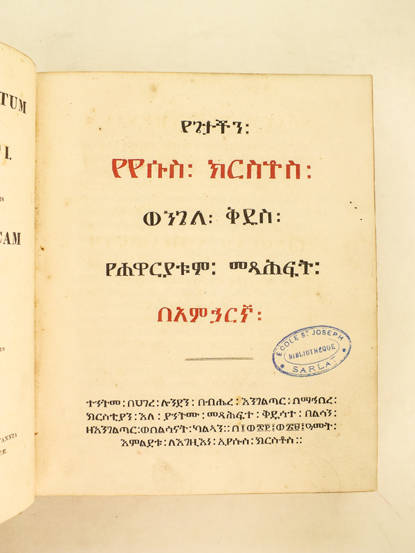
182937035Edidit Thomas Pell Platt A.M., 1 vol. petit in-4 reliure de l'époque pleine basane marron estampée à froid, impression en deux couleurs, Impensis Societatis Ad Biblia sacra in Britannia et apud exteras gentes evulganda Institutae, Impressit Ricardus Watts [Richard Watts ], Londini [ Londres, London ], 1829, [-]2, B-Z4 2A-2Q4, 2R2, B*-Z*4, AA*-ZZ*4, AAA*-DDD*4, DDD**4.
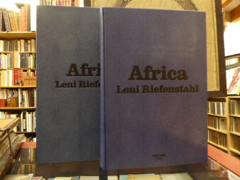
795963Taschen Cologne 2002 Grand et fort in-folio ( 500 X 345 mm ) de 564 pages, pleine reliure bleue à l'imitation du galuchat sous coffret. Magnifiques photographies de l'Afrique en couleurs et en noir hors-texte ( Nuba de Cau, Masaï, Samburu, Dinka... ) de Leni RIEFENSTAHL. EDITION ORIGINALE numérotée, et signée à la main par Leni RIEFENSTAHL ( Tirage limité à 2500 exemplaires ). Très bel exemplaire de ce livre hors-norme de 17,00 kg.***** ATTENTION, VU LE POIDS IMPORTANT DE CET OUVRAGE ( 17,00 kg ), DES FRAIS DE PORT PARTICULIERS SERONT APPLIQUES.***
1873bn1533London, Sampson Low, Marston Low, and Searle Reliure d'éditeur 1873 Rare édition originale de la traduction en anglais de ce fameux voyage, imprimé pour la première fois en Allemagne en 1874 chez le même éditeur anglais et chez F.A. Brockhaus à Leipzig, on notera qu'en 1874 il sort également une édition New-Yorkaise chez Harper & Brothers (Le décor du cartonnage est différent), ce qui fait de l'édition anglaise la véritable édition originale de ce texte important. 2 volumes In-8° reliés pleine percaline verte de l'éditeur décors dorés et estampés à froid sur les premiers plats et les dos. Premier volume : XVI pages (errata) 559 pages, 1 carte hors-texte dépliante à la page VII deuxième volume : X pages 521 pages, 1 carte hors-texte après la page X, nombreuses gravures in et hors texte (26 planches hors-texte), reliure de l'époque, bon exemplaire. Livraison a domicile (La Poste) ou en Mondial Relay sur simple demande.
187182314Hoddesdon Herts 28 février 1871 | 13.50 x 21 cm | 4 pages sur un double feuillet et un simple
186352623London: Tinsley Bros 1863. First edition 2 volumes small 8vo pp. viii 2 303; 6 295; folding map frontispiece in volume II; very slight rubbing but still a fine bright copy largely unopened in original purple-brown cloth author's name and title gilt-lettered direct on spine. This is the second state of the binding with Burton's name on the spine. Penzer pp. 71-2; Casada 70. Tinsley Bros unknown
186352623London: Tinsley Bros 1863. First edition 2 volumes small 8vo pp. viii 2 303; 6 295; folding map frontispiece in volume II; very slight rubbing but still a fine bright copy largely unopened in original purple-brown cloth author's name and title gilt-lettered direct on spine. This is the second state of the binding with Burton's name on the spine. Penzer pp. 71-2; Casada 70. <br/><br/> Tinsley Bros hardcover books
185865098Gotha, Justus Perthes, 1857-1858. Gr.-8°. Mit 152 Textholzstichen, 60 farb. lithogr. Tafeln (von E. Emminger u. J. Wölffle nach Umzeichnungen von Skizzen H. Barths durch J. M. Bernatz), 16 (4 teilkolor.) gefalt. Karten u. einem Holzstichplan. Zus. ca. 3.600 S., Blindgepr. OLwd.-Bde. m. goldgepr. Rückentiteln.
1 vol. in-folio (35,5 x 28 cm) cartonnage éditeur demi-percaline noire, Armand Colin et Cie, Paris, 1899, 3 ff. et 24 planches dont 2 dépliantes et 5 doubles, auquel l'on joint une très grande carte manuscrite dépliante de la Province de l'Itasy au 1/250000e (format 75 x 87 cm), deux croquis (Tournée de Mai 1902 district de Mahanoro format 20 x 31 cm et croquis au 1/40.000 format 40 x 31,5 cm du trajet d'Amboudinanga à Amboudihiara) et un Plan directeur d'aménagement et d'extension de la Ville de Tananarive (33 x 21 cm) dédicacé par Geo Cassaignes en 1926 Rare ensemble réunissant l'introuvable atlas du guide de l'immigrant (atlas seul, dos arraché et couv. fort. frottée et très faible, fentes en plis partiellement restaurées au grandes cartes dépliantes, ex-libris ms. Carney Verron, qq. annotations manuscrites de l'époque, dont une signalant le projet d'un lazaret en septembre 1901), un très grande carte manuscrite en couleurs de la Province de l'Isaty (avec correction de l'emplacement de certains villages, et temps de trajet du rédacteur lors d'une tournée d'exploration - temps correspondant manifestant à un trajet à un cheval), levée vraisemblablement vers 19002-1903, deux croquis (Tournée de Mai 1902 dans le district de Mahanoro et trajet d'Amboudinanga à Amboudihiara) et le plan d'aménagement de Tananarive dédicacé par Geo Cassaigne (fente à la pliure centrale). Prix de l'ensemble. Français
185814097Gotha, Perthes, 1857 - 1858. 5 Bde. Mit zahlr. Textxylographien. 60 chromolithograph. Tafeln. 16 teils farb. gefalt. Landkarten in Kupferstich und 1 gefalt. Plan in Holzstich. 8°. OLwd. (Rückengelenke teils angeplatz, etw. bestoßen und leicht fleckig).
- A. Lévy, Paris 1882, 28x37cm, reliure de l'éditeur. - First edition in French, printed on vergé paper. Publisher's Arabesque yellow paper binding by A. Lenègre, spine with gilt, black, and turquoise Arabic decorative motifs (head- and tail-pieces slightly rubbed), upper cover richly ornamented with Arabic decorative motifs in gilt, black and turquoise with a frame of gilt and black fillets, turquoise paper pastedowns and endpapers (corners slightly bumped), all edges gilt, a few small insignificant spots to lower cover. Text by Alfred Edmund Brehm & Johannes Dumichen. The work is illustrated with 24 watercolors after nature by Charles Werner. A few small spots, mostly affecting endpapers. Rare.% [FRENCH VERSION FOLLOWS] Edition originale de la traduction française imprimée sur vergé. Reliure de l'éditeur en plein cartonnage sable, dos lisse passé agrémenté de motifs décoratifs arabisants dorés, noirs et turquoises, coiffes légèrement frottées, premier plat richement orné de motifs décoratifs arabisants dorés, noirs et turquoise, le tout encadré d'un jeu de filets dorés et noirs, gardes et contreplats de papier turquoise, coins légèrement émoussés, toutes tranches dorées, quelques petites taches sans gravité sur le deuxième plat, reliure arabisante de l'époque signée de A. Lenègre. Texte de Alfred Edmund Brehm & Johannes Dumichen. Ouvrage illustré de 24 aquarelles d'après nature de Charles Werner. Quelques petites rousseurs affectant essentiellement les gardes. Rare exemplaire.
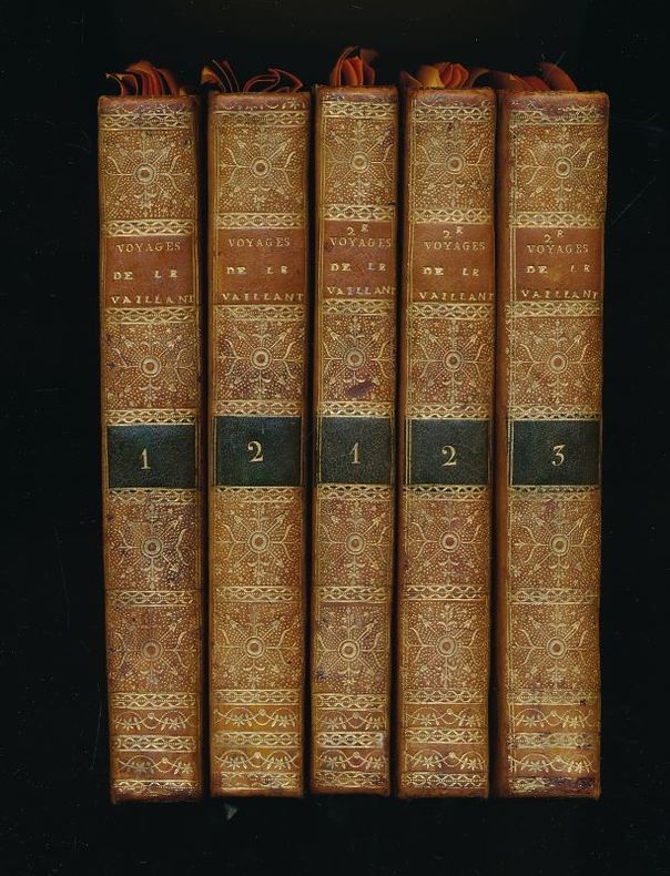
1797149534de l'Imprimerie Crapelet Paris, de l'Imprimerie Crapelet, 1797, an VI. 2 volumes reliés pleine basane blonde de l'époque, dos lisses très ornés de filets et fleurons dorés, pièce de titre de maroquin rouge et de tomaison de maroquin vert, plats à encadrement de triples filets dorés, roulette dorée intérieure, toutes tranches dorées, gardes de papier orangé. XXXII + 383 + 403 pages.+ 3 volumes reliés à l'identique (pour le Second voyage), Paris, Jansen, An 3 de la République, XLIV + 304 + 426 + 525 pages. Infimes petits défauts d'usage aux reliures sans aucune gravité. Rare et bel ensemble des 2 voyages de LE VAILLANT en reliure identique. Description des 38 gravures qui illustrent ces 2 voyages et se décomposant comme suit : 1er Voyage : 20 gravures, certaines dépliantes. Campement dans le pays des grands Namaquois, vue des montagnes du Cap de Bonne-Espérance, couvertes des nuages du Sud Est (dépliante). Le manchot aigrette. Camp à Duywen-Hock rivière (dépliante, déchirée sur 5cm sans manque de papier, sans gravité). Le Touraco ... Camp de Pampoen-Kraal (dépliante). Klaas, jeune Hottentot... Camp à l'entrée du port. Grande chasse d'éléphants (dépliante). Camp à Jager-Kraal dans le pays d'Auteniquois (dépliante). Camp sur les bords de la grande rivière des poissons (dépliante, trois taches marginales sans gravité). Narina, hjeune Gonaquoise. Jeune Hottentot Gonaquoi. La Hottentote. Le porte lambeau (présente une petite déchirure marginale sans manque de papier, sans gravité). Jeune caffre. Femme caffre. Camp à une horde de caffres détruits (dépliante). Hottentote à tablier (gravure qui manque fréquemment, mais bien présente dans notre exemplaire, en raison des attributs sexuels de la jeune femme jugés choquants). Girafe male. Girage femelle. 2me Voayge : 18 gravures, certaines dépliantes : Vue du cap de Bonne-Espérance prise en rade (Montagne du Diable, Montagne de la Table, Tête du Lion, Croupe du Lion, Pointe des Pendus), avec, en cartouches Vue du ca prise de l'ile Robin et Montagnes du cap vue en mer du côte de l'ouest. Anhinga male. Campement au Heere logement (dépliante). Passage de la rivère des élephants. Campement. Euphorbe-concombre. Tête d'hippopotampe male. Hippopotame femelle. Tête de girafe. Camp de la girafe sur le bord de la rivière d'Oirange (dépliante). Loup Tachete. Grand Namaquois. Euphorbe à côté de Melons. HOuzouana. Houzouana (en portrait). Femme Houzouana. Sanglier à large groin. Le singe noir. L'oricou. Toutes les gravures sont de très belle qualité, gravées par Hulk, Boutelou, Mariage, Bovinet, Amélie Coiny. François Le Vaillant, né en 1753 en Guyane, décédé en 1824, explorateur, collectionneur et ornithologue français. On lui doit la première description de la girafe.
Paris, de l'Imprimerie Crapelet, 1797, an VI. 2 volumes reliés pleine basane blonde de l'époque, dos lisses très ornés de filets et fleurons dorés, pièce de titre de maroquin rouge et de tomaison de maroquin vert, plats à encadrement de triples filets dorés, roulette dorée intérieure, toutes tranches dorées, gardes de papier orangé. XXXII + 383 + 403 pages.+ 3 volumes reliés à l'identique (pour le Second voyage), Paris, Jansen, An 3 de la République, XLIV + 304 + 426 + 525 pages. Infimes petits défauts d'usage aux reliures sans aucune gravité. Rare et bel ensemble des 2 voyages de LE VAILLANT en reliure identique. Description des 38 gravures qui illustrent ces 2 voyages et se décomposant comme suit : 1er Voyage : 20 gravures, certaines dépliantes. Campement dans le pays des grands Namaquois, vue des montagnes du Cap de Bonne-Espérance, couvertes des nuages du Sud Est (dépliante). Le manchot aigrette. Camp à Duywen-Hock rivière (dépliante, déchirée sur 5cm sans manque de papier, sans gravité). Le Touraco ... Camp de Pampoen-Kraal (dépliante). Klaas, jeune Hottentot... Camp à l'entrée du port. Grande chasse d'éléphants (dépliante). Camp à Jager-Kraal dans le pays d'Auteniquois (dépliante). Camp sur les bords de la grande rivière des poissons (dépliante, trois taches marginales sans gravité). Narina, hjeune Gonaquoise. Jeune Hottentot Gonaquoi. La Hottentote. Le porte lambeau (présente une petite déchirure marginale sans manque de papier, sans gravité). Jeune caffre. Femme caffre. Camp à une horde de caffres détruits (dépliante). Hottentote à tablier (gravure qui manque fréquemment, mais bien présente dans notre exemplaire, en raison des attributs sexuels de la jeune femme jugés choquants). Girafe male. Girage femelle. 2me Voayge : 18 gravures, certaines dépliantes : Vue du cap de Bonne-Espérance prise en rade (Montagne du Diable, Montagne de la Table, Tête du Lion, Croupe du Lion, Pointe des Pendus), avec, en cartouches Vue du ca prise de l'ile Robin et Montagnes du cap vue en mer du côte de l'ouest. Anhinga male. Campement au Heere logement (dépliante). Passage de la rivère des élephants. Campement. Euphorbe-concombre. Tête d'hippopotampe male. Hippopotame femelle. Tête de girafe. Camp de la girafe sur le bord de la rivière d'Oirange (dépliante). Loup Tachete. Grand Namaquois. Euphorbe à côté de Melons. HOuzouana. Houzouana (en portrait). Femme Houzouana. Sanglier à large groin. Le singe noir. L'oricou. Toutes les gravures sont de très belle qualité, gravées par Hulk, Boutelou, Mariage, Bovinet, Amélie Coiny. François Le Vaillant, né en 1753 en Guyane, décédé en 1824, explorateur, collectionneur et ornithologue français. On lui doit la première description de la girafe.
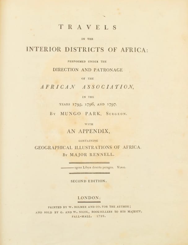
179942750London, Printed By W. Bulmer And Co. For The Author; And Sold By G. & W.Nicol, 1799. In-4 de XXVIII-372-XCII pp., (5) pp. (A Negro song, texte et musique), veau caramel, dos à nerfs, filet doré sur les plats (reliure de l'époque).
Rarissima carta geografica dell'Africa Occidentale, con gli arcipelaghi delle Canarie e Azzore.La mappa è tratta dal 'Geografia di M. Livio Sanuto : distinta in XII libri : ne quali, oltra l'esplicatione di molti luoghi di Tolomeo, e della Bussola, e dell'Aguglia, si dichiarano le Prouincie, Popoli, Regni... dell'Africa. Con XII tauole di esse Africa in dissegno di rame / aggiuntiui de piu tre Indici da M. Giouan Carlo Saraceni... ; [aiutato a ciò da Giulio suo fratello, che di propia mano tagliò tutti li Rami'.Si tratta del primo atlante dedicato esclusivamnete all'Africa, con le tavole disegnate da Livio Sanuto e finemente tradotte in rame dal fratello Giulio. L'opera venne pubblicata postuma a Venezia nel 1588, da Damiano Zenaro ed a cura di Carlo Saraceni.Incisione in rame, restauri perfettamente eseguit alla piega centrale ed a dei fori di tarlo presenti nella parte superiore ed inferiore, per il resto in ottimo stato di conservazione.Rara ed affascinante mappa dell'Africa. A very rare map of Western Africa, showing the Canary Islands & Azores.The map is taken form 'Geografia di M. Livio Sanuto : distinta in XII libri : ne quali, oltra l'esplicatione di molti luoghi di Tolomeo, e della Bussola, e dell'Aguglia, si dichiarano le Prouincie, Popoli, Regni... dell'Africa. Con XII tauole di esse Africa in dissegno di rame / aggiuntiui de piu tre Indici da M. Giouan Carlo Saraceni... ; [aiutato a ciò da Giulio suo fratello, che di propia mano tagliò tutti li Rami'.First printed atlas of Africa, published postumously by Sanuto's friend Saraceni who added the tables of contents and the preface on the life of the author.The maps were drawn by Sanuto and finely engraved by his brother Jules. The atlas is divided into twelve books, the first containing notes on scientific observation, the declination of the magnetic needle and corrections to the work, the second explains the divisions of Sanuto's prospective description of the world, and the other ten on Africa which was the only section he completed before his death.Livio Sanuto (c.1520-1576), was a Venetian cosmographer, mathematician and maker of terrestrial globes. Sanuto was one of the so-called Lafreri school of engravers, whose output signalled the transition between the maps of Ptolemy and the maps of Mercator and Ortelius. Livio and his brother Giulio, planned a massive and comprehensive atlas to include maps and descriptions of the whole world, which he believed would be more accurate than any previously published. Unfortunately, he died in 1576 having only completed 12 maps of Africa. The 12 maps were eventually published in 1588 by Livio's brother Giulio, under the title "Geografia Di M. Livio Sanuto..." . In the compliation of this and the other African maps, Sanuto relied on Gastaldi's 1564 map and Portuguese sea charts for the mapping of the coasts and for information about the interior, used accounts by Duarte Barbosa and João de Barros. After its publication in 1588, this work was copied by other leading map makers for nearly a century afterwards.Seas are decorated with contemporary sailing vessels and monsters.Etching with engraving, some expert repairs at the central folds and at worm holes along the upper and lower edge, otherwise in good condition. Betz, The Mapping of Africa, p. 145; Norwich, 15; Almagià 1946.
188943593ABBerlin, Weidmann, Wiegandt, Hempel & Parey, 1879-1881, und Leipzig, Brockhaus, 1889. Gr.-8vo. XXII, 748 S., 10 Bll. Tabellen; XXIV, 790 S., 1 Bl.; XXII, 1 Bl., 548 S., 1 Bl. Mit 95 teils ganzseitigen Holzschnitt-Illustrationen, 5 Schrifttafeln auf 6 Blatt und 7 gefalt. farblithographischen Karten. Braune Orig.-Leinwandbände, Rücken mit Gold- und Blindprägung, Vorderdeckel jeweils mit goldgeprägter Illustration.
1890STLB0014Wien u. Olmütz, Eduard Hölzel 1888 und 1890. 8°. IX(1), 150 S. mit 1 kl. Titelvign., 16 Illustr. im Text, auf Tafelseiten sowie auf 1 doppelblattgr. Tafel v. Hans Fischer u. Franz Zimerman, nach Skizzen des Verfassers sowie 1 mehrf. gef., farb. Karte und VIII, 224 S. mit 18 Illustr. v. Ludwig Hans Fischer u. Franz Zimerman nach Skizzen des Verfassers, sowie nach Photographien, und einer (mehrf. gefalteten) farbigen Originalkarte. Leinenbd. d. Zt. m. goldgepr. Rückentit. u. blindgepr. Deckelrahmen. Unteres Kapital u. Ecken bestoßen u. berieben, Text papierbedingt gebräunt u. z. Tl. fingerfleckig, im hint. Falz aufgeplatzt. Henze I, 200 ff. Die überaus seltene Promotionsarbeit des bedeutenden österreichischen Afrika-Forschers Oscar Baumann (1864-1899). Seine gründlichen Aufnahmen über die Besteigung des Durmitors, während einer Reise durch Montenegro im Jahr 1883, bewegten Oskar Lenz, der 1885 die österreichisch-ungarische Kongo-Expedition vorbereitete, ihn einzuladen, die Expedition als Topograph zu begleiten. B. erkrankte jedoch nahe Stanley Falls, und wurde in einem Lager zurückgelassen, wo er während seines Aufenthaltes die Swahili-Sprache erlernte. Seine Rekonvaleszenz verbrachte er auf der Insel Fernando Póo, von deren Hauptstadt aus er eine zweimonatige Rundreise antrat und mit seinen Beobachtungen wertvolle Beiträge zur Kenntnis der Insel und ihrer Bewohner, der Bube, von deren Sprache er zwei Vokabularien zusammenstellte, lieferte. - 1887 promovierte B. in Leipzig mit dem 'Versuch einer Monographie von Fernando Póo', einer Vorarbeit zu vorliegendem Werk. In dem angebundenen Werk beschreibt B. eine Reise, die ihn als Begleiter des deutschen Forschungsreisenden Hans Meyer 1888 nach Ostafrika führte, um den Kilimandscharo zu bezwingen. Die Expedition durchquerte - von der Ostküste ausgehend - die damals noch völlig unbekannte Gebirgslandschaft zwischen den Flüssen Pangani und Umba. Wegen an der Küste ausgebrochener Araber-Unruhen sahen sie sich am südlichen Pare-Gebirge zur Umkehr gezwungen. Das Ergebnis dieser Expedition war die erste topographische Aufnahme von Usambra. Seine kartografischen und ethnologischen Aufzeichnungen waren für die schnell folgende wirtschaftliche Erschließung des Landes von unschätzbarem Wert. (vgl. dazu: Ausstellungskat. ?Abenteuer Ostafrika?. S.147).