ZURNER Adam Friedrich (1679 - 1742)MareMagnum

30 547 résultats
Incisione su rame con colorazione antica tratta dell'Atlante Contractus sive Mapparum Geographicarum Sansoniarum auctarum et correctarum Nova Congeries.In basso a sinistra cartiglio decorativo con titolo e le figure di abitanti e fauna locale, tra cui un coccodrillo, un leone e un elefante.Bellissimo esemplare di questa non comune carta. Copper engraving old coloured from Atlas Contractus sive Mapparum Geographicarum Sansoniarum auctarum et correctarum Nova Congeries. Amsterdam, P. Schenk, c. 1700.An attractive and detailed map of Africa drawn up by Adam Freidrich Zürner (1680-1742) which first appeared in the "Atlas Contractus" published in 1709 by Schenk. With a very impressive decorative cartouche to the bottom left hand corner, with the title inscribed on a masonry block surmounted by a lion which snarls at an enormous crocodile on its right. Also depicted in the title cartouche are a native holding a cornucopia whilst riding an elephant, pyramids, a woman milking a cow and a fat-tailed sheep. On the lower left, decorative cartouche with title and figures of habitants and local fauna, including a crocodile, a lion and an elephant. Norwich " Maps of Africa" Map 66.
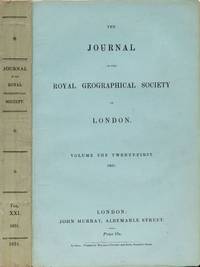
18514746London: John Murray 1851. First Edition. Soft cover. VG. Volume the Twenty-First. CII pp 1-248 pub list of books in rear. 6 folding maps Caucasus Middle Island of New Zealand Kumaon Central America Canal S Peru and a Mission to Central Africa by Dr. Barth. Interesting articles on all these places incl. a letter from David Livingston. Text uncut. VG in orig. printed wrappers. Intended for purchase to bind to their taste. John Murray unknown
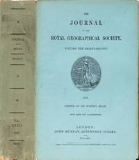
18624751London: John Murray 1862. First Edition. Soft cover. VG. Volume the Thirty-Second. CLXXII pp. 1-586. 16 folding maps & illustrations. Yang.Tse Fiji Islands Harran North Palestine Borneo Africa Trans-Indus frontier of British India Wuzeristan sic Zulu countries North-west coast of Australia Lake of Issuk-kul. VG in orig. printed wraps. Text uncut. Intended to be bound by orig. purchase. John Murray unknown
189436380London: Richard Bentley and Son 1894. Third Edition. Illustrations by James Wolf and J. B. Zwecker. 1 vols. 8vo. Three quarter brown morocco and marbled boards. Spine sunned else fine. Third Edition. Illustrations by James Wolf and J. B. Zwecker. 1 vols. 8vo. The Second European to Reach the Falls of the Zambesi. "Mr. Baldwin's experiences are written in a simple and unostentatious manner but he went through more adventures than almost all of the great South Afriican travellers and hunters." Mendelssohn. Mendelssohn I 73-74 for 1863 second ed. Richard Bentley and Son unknown books
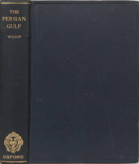
19282232Oxford: Clarendon Pres 1928. First. Hardcover. VG. An historical sketch from the earliest times to the beginning of the twentieth century. 322 pp ill lengthy bibliography glossary large pull out folding map in pocket inside rear cover and index. Long respected work on the Gulf. VG and maybe even a little better than that in original blue cloth. Clarendon Pres hardcover
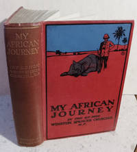
1908056947<p>London: Hodder & Stoughton. Very Good-. 1908. 1st Edition; 1st Printing. Hardcover. Hardcover no jacket 224 pages 16 pages of ads "with sixty-one illustrations from photographs by the author and Lieutenant-Colonel Gordon Wilson and three maps" the red cloth spine is faded to brown spine-title a bit dulled but nice front cover remains bright two small areas of wear on the rear edge of the spine as well as the bottom corner-tips moderate cock to the spine and a short crack to the front hinge binding is secure foxing to the blank end-papers mild foxing to to the fore-edge more than half of the text pages are fine but several have rather mild foxing the illustrations and maps are in nice shape a few corner-creased pages short edge-tear to the illustrated page opposite page 114 the illustration itself is ok .</p> Hodder & Stoughton hardcover
1 tapuscrit de 182 feuillets thermocollés, s.n. [circa 1970-1975 ] avec qq. corrections manuscrites Tapuscrit apparemment inédit et proposant des "passages marqués en rouge" qui "peuvent être supprimés en tout ou partie selon les besoins". Né en 1916, Henri Vignes (qui écrit ici comme à son habitude sous le pseudonyme de Jean Destieu) fut deux années durant le speaker de la France combattante à radio Le Caire. Attaché en qualité d'expert à l'UNESCO, il accomplit d'innombrables missions au Mexique, à Cuba, en Algérie, en Bolivie, en Iran et Côte d'Ivoire. L'auteur évoque ici les exploration du naturaliste franco-américain Paul du Chaillu (1831-1903), qui à partir de 1855 mène d'étonnants voyages au coeur de l'Afrique inconnue ; Jean Destieu expose ces aventures d'une manière romancée, à la fois exacte et très plaisante. Il le cite en épigraphe : "J'ai fait, à pied et sans être accompagné d'aucun autre homme blanc, environ 2700 lieues. J'ai tué, empaillé et rapporté plus de 2000 oiseaux, dont plus de 60 espèces toutes nouvelles, et j'ai abattu plus e 1000 quadrupèdes dont j'ai empaillé et rapporté 200, avec plus de 80 squelettes. Parmi ces quadrupèdes, il n'y en a pas moins de 20 espèces jusqu'alors inconnues de la science". Français
18747698Prag, Mercy, 1874. 6 Bll., 400 S. mit 34 Textxylographien. 30 xylographierte Tafeln und 1 separates gefalt. farbiges Panorama. 4°. OLwd. (bestoßen, etw. beschabt, Rücken unter Verwendung der Reste des alten Materials erneuert)
0006099London: Richard Bentley 1852. First edition. Hardcover. Very Good. chromolithograph of Mount Barkal Nubia folding map of the Nile River and a monochromatic plate. Octavo 455 pages; blue embossed publisher's cloth with the tag of Remnant & Edmonds of London at rear pastedown unopened untrimmed repaired tear at top of spine inked name on title-page light dampstain on fore-edge of the top cover. Note: publisher's cloth binding tag at rear from Remnant & Edmonds. <br/><br/>Lepsius was the foremost Prussian Egyptologist. His three-year expedition to Giza in 1842 established him as the Father of the scientific discipline of Egyptology. He was also a prominent scholar in African languages. This is a translation of his Briefe aus Aegypten Aethiopien und der Halbinsel des Sinai. His 12-volume work on the pyramids DENKMALER AUS AEGYPTEN UND AETHIOPIEN especially remains essential. Chromolithograph of Mount Barkal Nubia folding map of the Nile River and a monochromatic plate Richard Bentley hardcover
189352561Edinburgh & London: William Blackwood and Sons 1893. First edition 2 volumes 8vo pp. xix 1 563 1; gravure frontispiece portrait 13 maps 9 in color 5 folding 2 in cover pockets 2 other maps in the text 54 plates 75 illustrations in the text; Geography Prize bookplate in vol. I dated Dec. 19 1900; original pictorial red cloth stamped in black and gilt; spines rather sunned and spine extremities a bit rubbed but the bindings are sound with no cracked hinges. <br/><br/> William Blackwood and Sons hardcover books
189352561Edinburgh & London: William Blackwood and Sons 1893. First edition 2 volumes 8vo pp. xix 1 563 1; gravure frontispiece portrait 13 maps 9 in color 5 folding 2 in cover pockets 2 other maps in the text 54 plates 75 illustrations in the text; Geography Prize bookplate in vol. I dated Dec. 19 1900; original pictorial red cloth stamped in black and gilt; spines rather sunned and spine extremities a bit rubbed but the bindings are sound with no cracked hinges. William Blackwood and Sons unknown
25202LONDON J. WILKIE 1776. WITH A TOUR THROUGH PART OF THE NORTHERN COUNTIES IN THE YEARS 1773 AND 1774. FIRST EDITION REBOUND IN BOARDS LEATHER SPINE WITH 19 FOLDING PLATES. A VERY GOOD COPY. LONDON, J. WILKIE, 1776 hardcover
189213571ABWien, Hölder, 1892. XVIII + 877 S. OLwd. St. a. Schmutztitel, tlw. leicht stockfleckig, Ebd. etw. berieben, leichte Gbrsp.
1796P2-6DParis, Jansen, 1796. 2volumes in-4° (270x220mm), cartonnage d’attente d’époque, manques au dos , plat du tome 2 détaché. TOME 1: 9ff., 224pp., manque pp. 224-228, illustré de 7 planches Hors-Texte dont 4 dépliantes. TOME 2 : 373pp., 1f., 18 planches. Exemplaire non rogné, bon état intérieur, page de titre du T.2 effrangé. Rare édition in-4 du second voyage de LEVAILLANT.
- Béthune & Arthus Bertrand 1840, 302pp., relié. - Edition originale, très rare, on la confond souvent avec la réédition chez le même éditeur de 1860, plus courante. Une grande carte dépliante du nord-ouest de l'Afrique avec les stations de pêche et les pêcheries projetées ; un plan. Reliure en demi chagrin noir grainé d'époque. Dos à caissons à froid et filets dorés. Une partie de la coiffe de tête arrachée. Légeres traces de frottements. Ensemble très frais imprimé sur beau papier avec quelques rares rousseurs. Découpe au coin droit du faux-titre et à de la page de titre, sans atteinte au texte. Bon exemplaire. Etude sur la pêche en Afrique occidentale, avec les migrations des poissons, les espèces, le type de pêche en Afrique, les sécheries, l'économie de la pêche. NB : Cet ouvrage est disponible à la librairie sur demande sous 48 heures. [ENGLISH DESCRIPTION ON DEMAND]
- Hachette et Cie, Paris 1892, Grd. in-8 (18,5x27cm), 513pp. et 416pp., 2 tomes en 2 volumes reliés. - Edition originale, illustrée, de nombreux croquis de détail et cent soixante-seize gravures sur bois d'après les dessins de Riou, dont 26 hors-texte, 5 cartes, sans la grande carte générale annoncée. Reliures en demi basane chocolat d'époque. Dos lisse ornés de filets. Titres dorés. Chiffre en queue DB. Plats de papier rouge et noir. Frottements en coiffes et bordures. Extrémités des coins dénudés de papier. Rousseurs sur les tranches et sur les premiers feuillets, assez rares sur l'ensemble, sur un papier demeuré frais. Dos du premier tome légèrement éclairci uniformément. Bon exemplaire. Mission d'exploration de l'Afrique équatoriale ordonnée par le général Faidherbe ; partant de Bamako en 1887, Bigner parcourut les états de Saory et de Tieba, puis la Volta et explora le pays Mossi pour la première fois. La narration de voyage est extrèmement complète et ne manque aucun domaine, botanique, géographique, moeurs, coutumes... A l'issue de ce voyage, la Côte d'Ivoire deviendra officiellement une colonie française en 1893 dont Binger sera nommé gouverneur. [ENGLISH DESCRIPTION ON DEMAND]
- Librairie Hachette, Paris 1895, In-4 (24x31,5cm), 436pp., relié. - Edition abondamment illustrée de 167 gravures sur bois dont 37 hors-texte et 3 cartes en dont une en couleurs. Reliure en demi maroquin noir à coins d'époque. Dos à nerfs orné de 5 fleurons caissonnés. Titre doré. Filets sur les plats. Tête dorée. Couvertures conservées. Exemplaire non rogné. Les 2 coins bas légèrement émoussés, les couvertures portent des rousseurs. Très bel exemplaire, d'une belle fraîcheur, dans une splendide reliure. Le docteur Louis Caltat fut chargé en 1888 d'une mission scientifique d'exploration à Madagascar par le ministère de l'instruction publique. Il parcourut 8000 km durant trois voyages. A son retour, il rédigea ce livre très riche de descriptions, tant sur les moeurs, la géographie, les peuplades, le commerce... Ce voyage avait primitivement paru dans la fameuse revue Le tour du monde sur plusieurs numéros. [ENGLISH DESCRIPTION ON DEMAND]
- Imprimerie Impériale, Paris 1809-1829, 70x51,5cm, une feuille. - Original, unshaved, full-page etching from the "Imperial edition" of the Description de l'Égypte, or 'Recueil des observations et recherches faites en Égypte pendant l'expédition française, publié par les ordres de Sa Majesté l'Empereur Napoléon le Grand [A Collection of the observations and research carried out in Egypt during the French expedition, published on the orders of his Majesty the Emperor Napoleon the Great]'. Produced between February 1802 and 1830 on the orders of Naopleon Bonaparte and published between 1809 and 1828, 1,000 copies were printed and distributed to institutions, on vergé paper with an 'Égypte ancienne et moderne' watermark, visible when held up to the light. Light marginal spotting not touching image, otherwise in very fresh, fine condition. An engraving from the Description de l'Egypte, one of the masterpieces of French printing and the birth of a new field: Egyptology. A gigantic survey of Egypt at the time of Bonaparte's conquests in 1798 and 1799, the work is divided into 13 volumes of engravings making up 892 plates, of which 72 colored, as well as presenting the splendors of the Egypt of the Pharaohs in 9 volumes. The other volumes discuss natural history and present a fascinating portrait of Coptic and Islamic Egypt as it was seen by Bonaparte's Eastern Armies. The 'Egyptian campaign', militarily a disaster, demonstrates, through the engravings of the Description d'Egypte, the scientific success it nonetheless became thanks to the 167 expert members of the Commission of the Sciences and Arts of the Institut d'Egypte [Egyptian Institute] who followed Napoleon's army. The Institut gathered together in Egypt the mathematician Monge, the chemist Berthollet, the naturalist Geoffroy Saint-Hilaire as well as numerous artists, engineers, architects and doctors. They were tasked with re-discovering modern and ancient Egypt and displaying its natural treasures as well as the know-how of its inhabitants. This edition, the so-called "Imperial" edition of the plates for the Description de l'Egypte was printed in four large formats, two of which were specially created for it and christened "Moyen-Egypte" and "Grand-Egypte". A special press was built to print it, the process extending over 20 years, from 1809 to 1829. The "Imperial" edition proved so popular that a second edition, this time in black and white and without the "Egypte ancienne et moderne" watermark - known as the "Royal Edition" - was published during the Restoration by the printing house of C.-L.-F. Panckoucke (Paris). The engravings of the Description d'Egypte owe a great deal to Baron Dominique-Vivant Denon, illustrator, diplomat, collector and later Director of the Musée Napoléon (the Louvre). His exploration of the South of Egypt gave Bonaparte the idea of sending the experts of the Institut there, thus creating a faithful and complete portrait of the area. This was the research gathered together from 1802 in the mammoth Description de L'Egypte. Denon embarked on this story of archeological exploration at the age of 51, reaching first Alexandria and then Cairo before exploring Upper Egypt. Along with the members of the Institut d'Egypte, the Natural History Museum's painter H.J. Redouté (brother of Pierre-Joseph Redouté, author of Roses), the mineralogist Dolomiue, and the draughtsman Joly, Denon then explored the Nile Delta and Lower Egypt. When, however, he joined the 21st Light Infantry Regiment as it marched across Upper Egypt in pursuit of the retreating Mameluks in November 1798, he found himself the only civilian. In the very midst of the battle itself, he reeled off sketches of the works of art that peppered his path right up to the threshold of the Sudan. He said that he had crossed "a country that is, apart from its name, entirely unknown to Europeans, and therefore everything was worth describing" (Voyages dans la Basse et la Haute Egypte pendant
- C. F. Winter'sche Verlagshandlung, Leipzig & Heidelberg 1873, 18,5x26,5cm, relié. - Edition originale. Nach dem von Dr. Kersten während der v. d. Decken'schen Ost-Afrikanischen Expedition im Jahre 1862 und von C. Cooke auf der Insel Sansibar im Jahre 1864 gesammelten Material bearbeitet von A. Gerstaecker. Mit 10 colorirten Kupfertafeln (und nicht 18 wie gesagt), eine von dem mit einem fehlenden Stück). Etabli par A. Gerstaecker d'après les observations recueillies par le Dr. O. Kersten durant l'expédition en Afrique de l'est en 1862 et par C. Cooke sur l'île de Zanzibar en 1864. Comprend 10 planches au lieu de 18, dont une en partie découpée. [ENGLISH DESCRIPTION ON DEMAND]
- Imprimerie Impériale, Paris 1809-1829, 70x51,5cm, une feuille. - Original, unshaved, full-page etching from the "Imperial edition" of the Description de l'Égypte, or 'Recueil des observations et recherches faites en Égypte pendant l'expédition française, publié par les ordres de Sa Majesté l'Empereur Napoléon le Grand [A Collection of the observations and research carried out in Egypt during the French expedition, published on the orders of his Majesty the Emperor Napoleon the Great]'. Produced between February 1802 and 1830 on the orders of Naopleon Bonaparte and published between 1809 and 1828, 1,000 copies were printed and distributed to institutions, on vergé paper with an 'Égypte ancienne et moderne' watermark, visible when held up to the light. Light marginal spotting not touching image, otherwise in very fresh, fine condition. An engraving from the Description de l'Egypte, one of the masterpieces of French printing and the birth of a new field: Egyptology. A gigantic survey of Egypt at the time of Bonaparte's conquests in 1798 and 1799, the work is divided into 13 volumes of engravings making up 892 plates, of which 72 colored, as well as presenting the splendors of the Egypt of the Pharaohs in 9 volumes. The other volumes discuss natural history and present a fascinating portrait of Coptic and Islamic Egypt as it was seen by Bonaparte's Eastern Armies. The 'Egyptian campaign', militarily a disaster, demonstrates, through the engravings of the Description d'Egypte, the scientific success it nonetheless became thanks to the 167 expert members of the Commission of the Sciences and Arts of the Institut d'Egypte [Egyptian Institute] who followed Napoleon's army. The Institut gathered together in Egypt the mathematician Monge, the chemist Berthollet, the naturalist Geoffroy Saint-Hilaire as well as numerous artists, engineers, architects and doctors. They were tasked with re-discovering modern and ancient Egypt and displaying its natural treasures as well as the know-how of its inhabitants. This edition, the so-called "Imperial" edition of the plates for the Description de l'Egypte was printed in four large formats, two of which were specially created for it and christened "Moyen-Egypte" and "Grand-Egypte". A special press was built to print it, the process extending over 20 years, from 1809 to 1829. The "Imperial" edition proved so popular that a second edition, this time in black and white and without the "Egypte ancienne et moderne" watermark - known as the "Royal Edition" - was published during the Restoration by the printing house of C.-L.-F. Panckoucke (Paris). The engravings of the Description d'Egypte owe a great deal to Baron Dominique-Vivant Denon, illustrator, diplomat, collector and later Director of the Musée Napoléon (the Louvre). His exploration of the South of Egypt gave Bonaparte the idea of sending the experts of the Institut there, thus creating a faithful and complete portrait of the area. This was the research gathered together from 1802 in the mammoth Description de L'Egypte. Denon embarked on this story of archeological exploration at the age of 51, reaching first Alexandria and then Cairo before exploring Upper Egypt. Along with the members of the Institut d'Egypte, the Natural History Museum's painter H.J. Redouté (brother of Pierre-Joseph Redouté, author of Roses), the mineralogist Dolomiue, and the draughtsman Joly, Denon then explored the Nile Delta and Lower Egypt. When, however, he joined the 21st Light Infantry Regiment as it marched across Upper Egypt in pursuit of the retreating Mameluks in November 1798, he found himself the only civilian. In the very midst of the battle itself, he reeled off sketches of the works of art that peppered his path right up to the threshold of the Sudan. He said that he had crossed "a country that is, apart from its name, entirely unknown to Europeans, and therefore everything was worth describing" (Voyages dans la Basse et la Haute Egypte pendant
- Librairie de Guillaumin, Paris 1983, 13x21,5cm, relié. - Edition originale. Reliure de l'éditeur en plein cartonnage noir, dos lisse orné de filets et de caissons à froid, encadrement de filets à froid sur les plats, gardes et contreplats de papier jaune, toutes tranches dorées. Quelques rousseurs, il semblerait que le cartonnage était initialement prévu pour un autre ouvrage dont le nom a été proprement gratté, avant réemploi pour notre exemplaire, au milieu du premier plat. [ENGLISH DESCRIPTION ON DEMAND]
- Louis Desessart, Paris 1840, 13,5x22cm, 2 volumes reliés. - Edition originale. Reliures en plein chagrin aubergine, dos lisses décolorés et éclaircis ornés d'arabesques romantiques dorées, filets dorés en têtes et en queues des dos, roulettes dorées sur les coiffes, encadrement d'un filet doré sur les plats ornementés d'arabesques romantiques estampées à froid, premiers plats frappés en leurs centres de feuilles de laurier dorées entourant la mention dorée "Pension Membré à Versailles", gardes et contreplats de papier à la cuve, tranches marbrées, liserés dorés en tête et en pieds des coupes, trois coins émoussés, élégantes reliures romantiques de l'époque. Quelques rousseurs, mention manuscrite à l'encre par un ancien propriétaire en tête d'une garde. Notre exemplaire est incomplet de sa carte. [ENGLISH DESCRIPTION ON DEMAND]
- Alfred Mame & fils, Tours 1896, In-4 (26x35,5cm), 288pp., relié. - Edition originale illustrée de 4 aquarelles, 19 photographies et 70 bois gravés dont 17 à pleines pages. Reliure en cartonnage de l'éditeur. Demi veau maroquiné crème. Plats de papier à décor orientalisant or et crème. Les 2 coins du haut émoussés. Très bel exemplaire, au papier immaculé d'une lumineuse blancheur, sur papier couché épais. Récit de voyage du dessinateur, voyageur et ethnographe Gaston Vuillier. [ENGLISH DESCRIPTION ON DEMAND]
199359012BB2 Vol. Geneva, The Barbier-Mueller Museum 1993. 31,5x24,5 cm. 422 S. mit vielen farbigen Abbildungen; 229 S., 1 w. Bl. mit farbigen Abbildungen. Originalleinwandbände mit Schutzumschlägen, in Schuber.
41547TEDDINGTON RICHMOND 1931. A LIMITED EDITION FOR PRIVATE CIRCULATION N.D. 1931. QUARTO BOUND IN FULL RED MOROCCO ALL EDGES GILT GILT LETTERING TO THE FRONT COVER FOLIATE ROLLED DENTELLES MARBLED ENDPAPERS 95 PAGES 26 CAPTIONED SILVER GELATIN PHOTOGRAPHIC PRINTS A TWO-PAGE MAP. SLIGHT WEAR TO THE LEATHER. CLEAN AND TIGHTLY BOUND. A VERY GOOD COPY. VERY SCARCE. TEDDINGTON, RICHMOND, [1931] hardcover