34 274 résultats
2025Adhya-9781003863984T&F/ROUTLEDGE 2025. Hardcover. New. T&F/ROUTLEDGE hardcover
163519446Amsterdam, Blaeu, ca. 1635. Willem J. und Joan Blaeu, Novus Atlas, Das ist Weltbeschreibung. Ca. 41 cm x 55,5 cm.
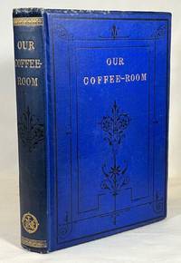
187824897London: James Nisbet & Co. 1878. A very collectible copy inscribed and signed in ink by Florence Nightingale to 'Miss Johnson' on the half-title page dated Jan/78 January 1878; Original flat brown endpapers separated at the front and rear gutters with hinges strong and intact. Textblock slightly aged but very clean and tight; Bound in blue cloth with gilt embossed titling and characteristic bevel-edged boards worn and scuffed at the corners and along the edges and spine tips; Former owner's signature on ffep verso; On the recto of the rear free endpaper is an undated ink notation concerning the Coffee Public House Assoc. Grosvenor Square; President - Duke of Westminster / Chairman Hon. W.F. Cowper Temple; Elizabeth Reid Coffin was one of Scotland's greatest social reformers and advocated total abstinence from alcohol. She founded the first Coffee-Room in 1869 where food and non-alcoholic drinks were served; Her friend and fellow activist Florence Nightingale established her own Coffee Room in her home village of Whatstandwell Derbyshire and distributed and signed copies of this book; Elizabeth Cotton became Lady Hope when she married British evangelist Sir James Hope in 1877; 247p. plus 16 pages of ads. Additional photos available upon request. From the collection of John Calder Pearson ardent bibliophile former member and one-time president of the Rowfant Club of Cleveland Ohio a celebrated literary society. . Signed by Florence Nightingale. Eleventh Thousand. Embossed Blue Cloth. Very Good. Illus. by Frontispiece Engraving. 12mo - over 6¾" - 7¾" tall. Hardcover. James Nisbet & Co. Hardcover
2025__1003863981Routledge 2025. Hardcover. New. 89 edition. 2492 pages. 11.00x8.25x5.28 inches. Routledge hardcover
186189114Imprimerie de Louis Perrin | Lyon 1861 | 35.5 x 27.2 cm | Relié
Acquaforte e bulino, 425x520 mm, firmata in lastra nel cartiglio in basso al centro: Tot Amsterdam. By Hendrick Donker inde Nieubrug:steedg.Bellissimo esemplare con magnifica coloritura coeva. Edizione molto rara.Secondo stato della carta nautica basata sul portolano di W. J. Blaeu del 1621, ridotto a formato atlante in-folio, con la data An°. 1665 nel cartiglio che viene abrasa. La mappa è per la prima volta inserita nello Zee-Atlas of Water-Waerelt - una delle quattro carte aggiunte all’originale corpus di 27 tavole nautiche - stampato con imprint t’Amsterdam By Hendrick Donker, Boeckverkooper, en Graat-boog-maker, in de Nieuwe-brug-streegh, in ‘t Stuurmans Gereetschap, Anno 1665. Lo Zee-Atlas of Water-Waerelt viene ristampato in più lingue ed edizioni, ampliate ed aggiornate. La carta dell’Europa rimane inalterata - con la data An°. 1665 - fino al 1705, quando Hendrick Donker jr. la inserisce, cancellando la data, nel De Nieuwe Groote Vermeerdere Zee-Atlas ofte Water-Werelt Vertoonende alle de Zee-Kunsten des Aerdtrycks, Seer dienstigh voor Schippers, Stuur-lieden en Liefhebbers der groote Zee-vaert. Non è chiaro se il figlio Hendrick jr. (1664 -1739 circa) aiutò suo padre nella libreria. Dopo la morte del padre nel 1699, sposò Johanna Maria Blasius e si stabilì nella casa dei suoi genitori. Continuò a pubblicare lo Zeeatlas e lo Zeespiegel fino al 1708 (ultima data che troviamo su un frontespizio). Lo Zee-Atlas of Water-Waerelt (1659) di Hendrick Doncker, tra il 1659 e il 1669, aumentò progressivamente il numero di carte, prima da 19 a 30 e poi a 50. Seguì un’edizione con mappe di grande formato: il Nieuwe Groote Vermeerderde Zeeatlas, anch’esso composto da 50 carte, che venne migliorato e ampliato per oltre 25 anni. Dopo la morte di Hendrick Doncker nel 1699, suo figlio Hendrick jr. continuò la pubblicazione e addirittura ingrandì la raccolta anche con delle carte a latitudine crescente. Bibliografia: C. Koeman, Atlantes Neerlandici: Bibliography of Terrestrial, Maritime and Celestial Atlases and Pilot Books Published in the Netherlands up to 1880 Vol. IV, Amsterdam 1970, pp. 152-189, Don 8A (28), Don 29 (3). Etching and engraving, 425x520 mm, signed in the cartouche center below: Tot Amsterdam. By Hendrick Donker inde Nieubrug: steedg.Beautiful example with magnificent old colouring. Very rare edition.Second state of the nautical chart based on the 1621 W. J. Blaeu’ pilot book, reduced to in folio format; the date An°. 1665 in the cartouche that is abraded.The map is for the first time included in the 1665 edition of the Zee-Atlas of Water-Waerelt - one of the four maps added to the original corpus of 27 nautical tables - printed with imprint t'Amsterdam By Hendrick Donker, Boeckverkooper, en Graat-boog-maker, in de Nieuwe-brug-streegh, in 't Stuurmans GereetschapThe Zee-Atlas of Water-Waerelt was reprinted in many editions and languages, increased and updated. The map of the Europe remains unchanged - with the date An °. 1665 - until 1705, when Hendrick Donker jr. inserts it, deleting the date, in the De Nieuwe Groote Vermeerdere Zee-Atlas ofte Water-Werelt Vertoonende at the de Zee-Kunsten des Aerdtrycks, Seer dienstigh voor Schippers, Stuur-lieden en Liefhebbers der groote Zee-vaert.Bibliografia: C. Koeman, Atlantes Neerlandici: Bibliography of Terrestrial, Maritime and Celestial Atlases and Pilot Books Published in the Netherlands up to 1880 Vol. IV, Amsterdam 1970, pp. 152-189, Don 8A (28), Don 29 (3). S. Bifolco, "Mare Nostrum, Cartografia nautica a stampa del Mar Mediterraneo" (2020), pp. 164-165, tav. 71.
Titolo originale: "L'EUROPE / DIVISÉE SUIVANT L'ESTENDUE / DE SES PRINCIPALES PARTIES / SUBDIVISÉES EN LEURS PRINCIPALES PROVINCES / sur les Memoires les plus nouveaux / DEDIÉE / A MONSEIGNEUR LE DUC DE BOURGOGNE / Par son tres humble et tres obeissant Serviteur / HUMBERT IAILLOT Geographe du Roy / 1718." Grande carta murale in 6 fogli edita da Jaillot a Parigi nel 1718. Basata sulla cartografia di Nicolas Sanson, l'opera è un ingrandimento delle carte inserite negli atlanti di Sanson prima e Jaillot poi.Incisione in rame, coloritura coeva con ritocchi, sei fogli uniti e montati su tela, difetti minori ai margini, nel complesso in ottimo stato di conservazione.Scala di: 300.000 passi geometrici, 250 miglia d'Inghilterra, 60 leghe di Svezia, 125 leghe di Francia, 75 leghe di Germania, 100 leghe di Polonia, 90 leghe di Spagna, 300 miglia d'Italia, 50 leghe d'Ungheria, 400 leghe di Mosca, 100 leghe d'un'ora di cammino, 10 diete o giornate = cm. 11,4.Ottimo esempalrae di questa rarissima carta murale dell'Europa. "L'EUROPE / DIVISÉE SUIVANT L'ESTENDUE / DE SES PRINCIPALES PARTIES / SUBDIVISÉES EN LEURS PRINCIPALES PROVINCES / sur les Memoires les plus nouveaux / DEDIÉE / A MONSEIGNEUR LE DUC DE BOURGOGNE / Par son tres humble et tres obeissant Serviteur / HUMBERT IAILLOT Geographe du Roy / 1718." Large wall map in 6 sheets published by Jaillot in Paris in 1718. Based on the cartography of Nicolas Sanson, the work is an enlargement of the maps inserted in the atlas of Sanson and Jaillot before then. Copper engraving, contemporary colouring with touches, six sheets joined together and mounted on canvas, minor defects to margins, otherwise in excellent condition. Great esemple of this rare wall map of Europe.
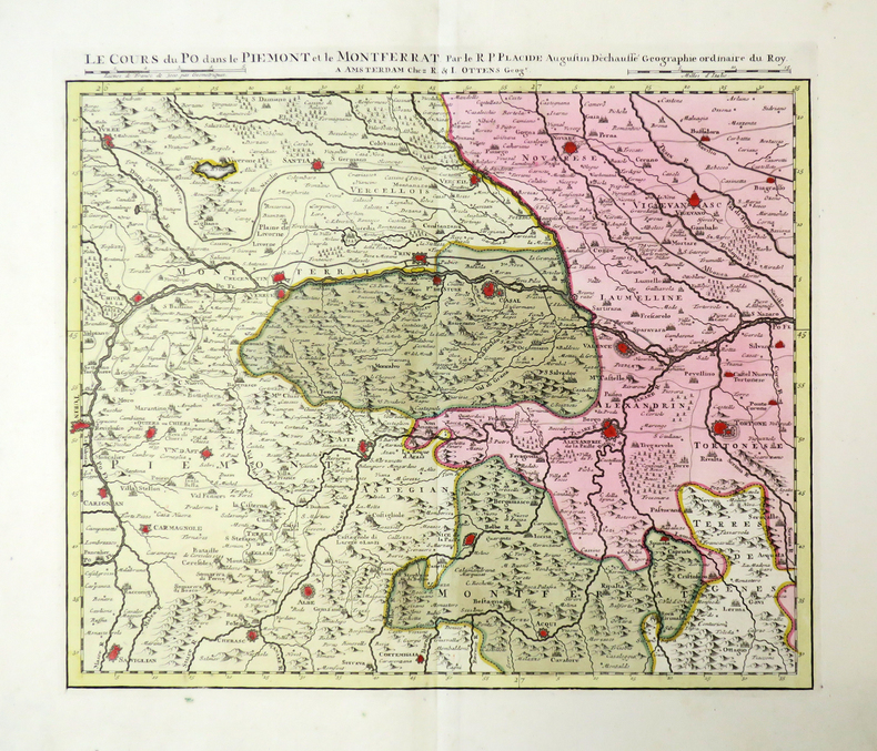
1735LBW-4481Amsterdam, R. & I. Ottens, [circa 1735]. En 5 feuilles pouvant être jointes pour former une carte de 0,42 x 2,48 m.
2025__1032982241Routledge 2025. Hardcover. New. 66 edition. 5022 pages. 11.00x8.25x11.25 inches. Routledge hardcover
2024__1032620099Routledge 2024. Hardcover. New. 65 pck edition. 5022 pages. 12.00x10.00x10.00 inches. Routledge hardcover
2023__1032411872Routledge 2023. Hardcover. New. 64 pck edition. 4979 pages. 11.25x8.50x8.00 inches. Routledge hardcover
- s.l. 1836, 22x27cm, relié. - Complete and unpublished handwritten manuscript entitled "Cinq semaines de vacances - Journal d'un voyage en Suisse et dans le Sud de l'Allemagne avec les élèves de mon bien cher et regretté institut" s.l1836, 22 x 27 cm, bound Complete and unpublished 240-page manuscript neatly handwritten in black ink and entitled "Cinq semaines de vacances - Journal d'un voyage en Suisse et dans le Sud de l'Allemagne avec les élèves de mon bien cher et regretté institut" Our manuscript is filled with a herbarium sheet, an original colour watercolour, an original pencil drawing and 25 engravings including one erased and in colour. The engravings illustrate the different stages of the journey: Tharandt, Nuremberg, Munich, Füssen, Grisons... Contemporary binding in half emerald green shagreen, spine in five false compartments decorated with dentelles and gilt fleurons, green paper plates, caillouté marbled endpapers, comb-patterned edges. Open joints at the foot of the upper board. This manuscript, which is full of details about life at the time in these countries is the work of Jules Malignon, professor of French at the Blochmann Institute in Dresden, and was produced on the occasion of a trip, whose participants are listed at the beginning of the volume. The engineer and entrepreneur Rudolf Sigismond Blochmann, founder of the Dresden institute founded in 1828 and bearing his name, was one of the pioneers of gas lighting in Germany. [FRENCH VERSION FOLLOWS] Manuscrit autographe inédit et complet de 240 pages rédigées d'une écriture soignée à l'encre noire et intitulé "Cinq semaines de vacances - Journal d'un voyage en Suisse et dans le Sud de l'Allemagne avec les élèves de mon bien cher et regretté institut". L'auteur, Jules Malignon, fut aussi professeur de français à Boston. Notre manuscrit est truffé d'une planche d'herbier, d'une aquarelle orginale en couleurs, d'un dessin original au crayon et de 25 gravures dont une gommée et en couleurs. Les gravures illustrent les différentes étapes du voyage : Tharandt, Nuremberg, Munich, Füssen, Grisons... Reliure de l'époque en demi chagrin vert émeraude à coins, dos à cinq faux nerfs orné de dentelles et filets dorés, plats de papier vert, gardes et contreplats de papier caillouté, toutes tranches peignées. Mors ouvert en queue du plat supérieur. Ce manuscrit qui fourmille de détails sur la vie de l'époque dans ces contrées est l'oeuvre de Jules Malignon, professeur de français à l'Institut Blochmann de Dresde, et fut réalisé à l'occasion d'un voyage dont les participants sont listés en début de volume. L'ingénieur et entrepreneur Rudolf Sigismond Blochmann, fondateur de l'institut de Dresde fondé en 1828 et portant son nom, fut l'un des pionniers de l'éclairage au gaz en Allemagne.
2024Adhya-9781032532141T&F/ROUTLEDGE 2024. Hardcover. New. T&F/ROUTLEDGE hardcover
164889512ABFrankfurt am Main, Matthaeus Merian, 1648. 33,5x20,5 cm. Gestoch. Titelbl., Titelbl., (2) Bl., 927 S-. (19) S. Register. Mit Mit 46 (+ 1) Kupfertafeln, 30 gestoch. Porträts und 3 gestoch. Abb. im Text. Pergamentband der Zeit.
Paskaert van 't Westelycke deel Der Middelandsche Zee. Nieulycx gedruckt en uytgegeven T’ Amsterdam, By Hendrick Doncker Boekverkoper en Graadboogh maker inde Nieuw brugsteegh In ‘t Stuurmans gereedschap. A°. 1664 & Paskaert van 't Oostelycke deel Der Middelandsche Zee. Nieulycx gedruckt en uytgegeven T’ Amsterdam, By Hendrick Doncker Boekverkoper en Graadboogh maker inde Nieuw brugsteegh In ‘t Stuurmans gereedschap. A°. 1664Opere tratte da: De Zee-Atlas Ofte Water-Waereld, Vertoonende all de Zee-kusten Van het bekende Deel des Aerd-Bodems, Met een generale beschryvinge van dien. Seer dienstigh voor alle Schippers en Stuurlieden; mitsgaders Koop-lieden om op ‘t Kantoor gebruykt te werden. Nieuwelijks aldus uytgegeven. t’ Amsterdam, By Hendrick Doncker, Boekveerkooper, en Graat-boog-maker, in dee Nieuwe-brug-steeg, in ‘t Stuur-mans Gereetschap. Anno. 1665.Due tavole incise ad acquaforte e bulino, rispettivamente di dimensioni 405x510 e 410x510 mm, firmate nel cartiglio in alto. Magnifiche prove, impresse su carta vergata coeva e finemente colorate in epoca, in ottimo stato di conservazione.Sebbene rechino la data 1664, le due carte vengono pubblicate solo nell’edizione dello Zee-Atlas of Water-Waerelt del 1665, che comprende quattro nuove carte e otto delle precedenti aggiornate. Le due tavole sostituiscono la rappresentazione antecedente del Mar Mediterraneo di Doncker (1660), con l’area suddivisa in due parti stampate sullo stesso foglio. La necessità di rappresentare il vasto bacino del Mediterraneo con due fogli era stata per la prima volta intuita da Theunis Jacobsz nel 1648. Le due tavole furo utilizzate per tutte le numerose edizioni dello Zee-Atlas of Water-Waerelt, rimanendo inalterate - con la data An°. 1664 - fino al 1705, quando Hendrick Doncker jr. le inserisce, cancellando la data, nel De Nieuwe Groote Vermeerdere Zee-Atlas ofte Water-Werelt Vertoonende alle de Zee-Kunsten des Aerdtrycks, Seer dienstigh voor Schippers, Stuur-lieden en Liefhebbers der groote Zee-vaert.Raro portolano del Mediterraneo.Bibliografia: C. Koeman, Atlantes Neerlandici: Bibliography of Terrestrial, Maritime and Celestial Atlases and Pilot Books Published in the Netherlands up to 1880 Vol. IV, Amsterdam 1970, pp. 152-189, Don 8A (30, 31); National Maritime Museum, Catalogue of the Library - Vol. Three, Atlas & Cartography, Londra, 1971, p. 77, n. 86 (nn. 51-52); cfr. R. Shirley, Maps in the Atlases of the British Library, Londra, 2004, pp. 1161-1163. Paskaert van 't Westelycke deel Der Middelandsche Zee. Nieulycx gedruckt en uytgegeven T’ Amsterdam, By Hendrick Doncker Boekverkoper en Graadboogh maker inde Nieuw brugsteegh In ‘t Stuurmans gereedschap. A°. 1664 & Paskaert van 't Oostelycke deel Der Middelandsche Zee. Nieulycx gedruckt en uytgegeven T’ Amsterdam, By Hendrick Doncker Boekverkoper en Graadboogh maker inde Nieuw brugsteegh In ‘t Stuurmans gereedschap. A°. 1664From: De Zee-Atlas Ofte Water-Waereld, Vertoonende all de Zee-kusten Van het bekende Deel des Aerd-Bodems, Met een generale beschryvinge van dien. Seer dienstigh voor alle Schippers en Stuurlieden; mitsgaders Koop-lieden om op ‘t Kantoor gebruykt te werden. Nieuwelijks aldus uytgegeven. t’ Amsterdam, By Hendrick Doncker, Boekveerkooper, en Graat-boog-maker, in dee Nieuwe-brug-steeg, in ‘t Stuur-mans Gereetschap. Anno. 1665.Etching and engraving, 405x510 e 410x510 mm, signed in the upper cartouche.Magnificient proofs, printed on contemporary laid paper, old hand-colors, in very good condition.Although they bear the date 1664, the two charts are published only in the 1665 edition of the Zee-Atlas of Water-Waerelt, which includes four new charts and eight of the previous ones updated.These two charts replace the first general chart of the Mediterraenan, divided into two sections, published by Doncker in 1660; they were used for all the numerous editions of the Zee-Atlas of Water-Waerelt, remaining unchanged - with the date An °. 1664 - until 1705, when Hendrick Doncker jr. inserts them, deleting the date, in the “De Nieuwe Groote Vermeerdere Zee-Atlas ofte Water-Werelt Vertoonende at the de Zee-Kunsten des Aerdtrycks, Seer dienstigh voor Schippers, Stuur-lieden en Liefhebbers der groote Zee-vaert”.Extremely rare charts.Bibliografia: C. Koeman, Atlantes Neerlandici: Bibliography of Terrestrial, Maritime and Celestial Atlases and Pilot Books Published in the Netherlands up to 1880 Vol. IV, Amsterdam 1970, pp. 152-189, Don 8A (30, 31); National Maritime Museum, Catalogue of the Library - Vol. Three, Atlas & Cartography, Londra, 1971, p. 77, n. 86 (nn. 51-52); cfr. R. Shirley, Maps in the Atlases of the British Library, Londra, 2004, pp. 1161-1163. S. Bifolco, "Mare Nostrum, Cartografia nautica a stampa del Mar Mediterraneo" (2020), pp. 126-127, tav. 49.
Parte Occidentale Del Mediterraneo Dedicato All’Illustrissimo Sig. Conte Fabrricio Antonio Monsignani Dal P. Cosmografo Coronelli MDCLXXXXVII e Carta Maritima Della parte Orientale Del Mare Mediterraneo Con i nomi di tutti li Porti Capi e Isole che in quelle si Contengono. Opere tratta da: Prima parte dello specchio del Mare, Nel quale si descrivono tutti i Porti, Spiaggie, Baje, Isole, Scogli, e Seccagni, del Mediterraneo, colle Dimostrationi di Terreni, Cambiamenti di Corse, Distanze, et il facilissimo modo di adoperare il Balestriglio, e l’Astrolabio, non mai più così ampiamente descritto. Arricchito di Carte Marine, costrutte dal Famoso Capitano Francesco Maria Levanto, e Nuovamente pubblicate dal Padre Maestro Coronelli, cosmografo della Serenissima Repubblica di Venezia. Senza alcuna benchè minima alterazione. Ricorretto bensì coll’originale, coll’aggiunta di numerose Postille nel margine, ed accresciuto nella Seconda Parte, e di copioso Indice, necessarie all’Architettura Navale, et alla Navigatione Scientifica, Teorica et Pratica. Ad uso dell’Accademia Cosmografica degli Argonauti, di Generali, Ammiragli, Officiali, Piloti, Marinari, e d’ogni altra Persona, Direttrice, Comandante, o Servente nelle Armate, Galce, e Navigli differenti, Venezia, 1698.Ristampa, con piccole varianti, curata da Vincenzo Coronelli della carta portolano di Francesco Maria Levanto, edita per la prima volta nel 1664. Nel cartiglio della carta del Mediterraneo Occidentale compare la dedica al conte Fabrizio Antonio Monsignani, erudito forlivese e membro dell'Accademia dei Filergiti. La carta è contenuta nell’ultimo volume dell’Atlante Veneto del 1698 in cui Coronelli stampa le 25 lastre dello Specchio del Mare di Levanto. Il frontespizio della raccolta reca un titolo parzialmente modificato; scompare la dedica a Giovan Battista della Rovere, sostituita da quella al portoghese Pietro Manuel Colon, discendente di Cristoforo Colombo. “Com’è noto, il volume di Levanto fu poi ristampato da fra’ Vincenzo Coronelli a Venezia, all’interno del suo Atlante Veneto […]. La dedica, datata «primo Genaro 1698», è rivolta a un discendente di Cristoforo Colombo signore di Tor Quemada […]. Proprio come annunciato nel frontespizio, Coronelli ripropone l’opera di Levanto tale e quale, però senza procedere ad alcun tipo di correzione nemmeno elementare sui vocaboli olandesi presenti in alcune carte che, tra l’altro, avrebbero dovuto insospettire anche i contemporanei sull’effettiva paternità levantiana delle stesse. Sostituisce le premesse originale con due pagine di dedica personale, poi però ripropone le stesse prime dieci pagine sulla bussola e la declinazione magnetica e sul calcolo dei bisestili, nonostante fossero trascorsi 34 anni. Non ci sono tracce delle «numerose postille» cui accenna nel frontespizio. Coronelli ristampa tali e quali anche i pochi passaggi autobiografici di Levanto, come quello relativo alla propria nascita in Genova”. A pagina 138 Coronelli dichiara (due righe a stampa, probabilmente sovrapposte alla lastra della stampa originale) che si tratta di: «Il Fine della Prima parte dello Specchio del Mare, ristampato à lettera dall’Originale pubblicato in Genova nel 1664; non dell’altre Edizioni, ripiene di errori». Il passo è piuttosto oscuro. Non risultano esserci mai state altre edizioni pubblicate da Levanto, quindi le ipotesi possibili sono due: o Coronelli conosceva altre edizioni a noi ignote (e «ripiene di errori»), oppure si riferisce alle opere consimili di produzione olandese, che presentano le stesse carte marittime e le stesse tavole con i profili delle coste. In effetti Coronelli non accenna minimamente a questa produzione alloglotta. La pagina si conclude con la scritta «PARTE SECONDA», quasi come se il fascicolo prevedesse un seguito, come peraltro Coronelli aveva promesso nel proprio frontespizio, comprendendo tra l’altro un «copioso indice» di cui non c’?... Two large maps of Mediterranea sea - one for the western area and one for the eastern area, prepared in the Portolano style, by Francesco Maria Levanto, in the edition by Vincenzo Maria Coronelli.The two Levanto's maps, were published in his "Lo Specchio del Mare" (The Mirror of the Sea) the portolan atlas of Mediterranean published in its first edition in Genoa in 1664 ,and the second edition in 1679.Despite the atlas didn't has a great success at the time, perhaps because it was recognized as unoriginal by contemporary cartographers, Coronelli - who almost certainly did not know the model and the Nordic plates - wanted to include the atlas as the last volume in the 1698 edition of his Atlante Veneto.The cartouche of the western part bears the dedicated to Count Fabrizio Antonio Monsignani, a member of the Academy of Filergiti.Each plater, consisting of two sheets joined together, measuring 510 x 402 mm.Magnificient examples, in perfect condition. S. Bifolco, "Mare Nostrum, Cartografia nautica a stampa del Mar Mediterraneo" (2020), pp. 50-51, tav. 14.
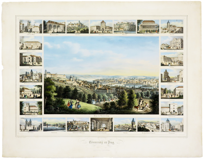
LBW0247dDresden, J. Braunsdorf, [circa 1850]. 420 x 535 mm.
- Chez Samuel Fauche, A Neuchatel 1778, In-4 (19x25cm), (4) iv, 454pp. (2) et (4) 391pp. (2), 2 volumes reliés. - Première et unique édition in-4, la plus recherchée car considérablement augmentée, l'édition originale in-8 de 1730 ayant été refondue, corrigée et agrémentée des nouvelles découvertes par Baron ; en outre Baron a complété l'édition de Ruchat par l'ouvrage d'Abraham Stanyan, Account of Switzerland (Londres, 1714). 81 gravures et cartes d'après Merian, 2 frontispices allégoriques, 68 planches de vues de villes et curiosités et 11 cartes. Un feuillet d'avis au relieur in fine de chaque volume. Reliure en pleine basane blonde marbrée d'époque. Dos à nerfs orné. Pièce de titre et de tomaison en maroquin beige. Double filet d'encadrement sur les plats. Un manque de cuir en tête du tome II. Mors inférieur du tome I fendu en tête avec manque et fendu en queue le long du dernier caisson. 2 coins émoussés. Quelques estafilades sur le plat supérieur du tome II. Un manque en marge basse, planche 5 du tome I ; p. 428, planche notée 33, manque de 1,5 sur 3 cm dans la gravure. Frottements. Au dos de certaine planches et sur les pages de titre, tampon : Bibliothèque Jules Barotte. Bons exemplaires, bien frais. Monographie géographique, historique et politique célèbre et détaillée sur la Suisse. [ENGLISH DESCRIPTION ON DEMAND]
2021__0367698714Routledge 2021. Hardcover. New. 62 new edition. 5018 pages. 11.50x9.00x10.00 inches. Routledge hardcover
242328À Paris, Strasbourg, Treuttel et Würtz, An X-1801 in-8, VIII-234 pp., grande carte dépl., demi-basane brune, dos lisse orné, armes en pied (rel. de l'époque). Mors un peu frottés.
Pascaarte van't westlyckste deel vande Middelandsche-Zee: waer in vertoont wort de ware gelegenthe den van alle rivieren, haven, Capen droogte en bayen alles synde op hare streckingen en distantien geleyt = Tabula Hydrographica de partibus Occidentalioribus Maris Mediterranei In qua veri situs omnium flumium, portium, promontorium, vadorum, sinuumque secundum longitudinem suam positi exhibendi. Pascaarte Van't oostelyckste deel vande Middelandsche Zee: vertonende in sich de ware gelegentheden van alle capen, havens, rivieren, bayen en droogtē, zynde alles op zyn behoorlycke streckingen en distantiē geleyt = Tabula hydrographica de partibus or Orientalioribus Maris Mediterranei. Exhibens verum situm omnium Promontorium, portium, fluminium, finuum, vadorumque secundum excatam cujusque longitudem et distantiam descriptorum. Coppia di incisioni all’acquaforte e bulino, dimensioni rispettivamente mm 420x495 (parte occidentale) e mm 420x540 (parte orientale). Imprint editoriale nei due cartigli: Amstelodami Apud Ioan. Ianssonium.Bellissime prove, impresse su carta vergata coeva e finemente colorate in epoca. Tracce di usura ed ossidazioni, nel complesso in buono stato di conservazione.Opera tratta da: Atlantis Majoris Quinta Pars, Orbem Maritimum Seu Omnium Marium totius Orbis Terrarum Navigationibus hodierno tempore frequentatorum descriptionem accuratissimam continenes; Cui adjunctus est Orbis Antiquus Et Graeciae Parallela. Sive Antiquorum & Hodiernorum locorum in Graecia collatio. Amstelodami, Apud Ioannem Janssonium. 1650.Coppia di carte nautiche del Mediterraneo pubblicate da Johannes Janssonius nel quinto volume del suo Atlantis Majoris, per la prima volta stampato con testo latino nel 1650 e replicato, a partire dallo stesso anno, con testo olandese, francese e tedesco fino al 1659. Si tratta del primo e vero atlante nautico stampato in Olanda - nel senso stretto del termine atlante, non di guida nautica - una collezione di carte nautiche stampata a corredo di un progetto più grande, quale è l’immenso Atlantis Majoris, maestosa raccolta di 12 volumi di carte. Janssonius aveva già pubblicato guide nautiche; nel 1620, approfittando della scadenza del privilegio quindicennale, stampa una sorta di copia pirata del portolano di Willem J. Blaeu, con il titolo di Het Licht der Zee-vaert - noto anche per le edizioni inglese e francese dal titolo The Light of Navigation e Le Noveau Flambeau de la Mer. Nel 1626, acquistando le lastre da Cornelis Cleasz. pubblica la Description De la Mer Mediterranée, una ristampa con testo francese delle tavole nautiche utilizzate da Willem Barentsz nel Caertboeck vande Midlandtsche Zee del 1595.Le due carte del Mediterraneo appaiono però per la prima volta nella raccolta nautica dell’Atlantis Majoris (1650). Nel 1651, in collaborazione con Pieter Goos, stampa con proprio imprint il De Lichtende Columne ofte Zee-Spiegel, una raccolta nautica composta essenzialmente dalle matrici già pubblicate in precedenza da Theunis Jacobsz Lootsman. Nel 1654 viene alla luce il Descriptio Maris Mediterranei per tabulas hydrographicas & geographicas, un’ulteriore ristampa - questa volta con molte modifiche e alcune carte nuove - delle tavole nautiche di Barentsz.Bibliografia: C. Koeman, Atlantes Neerlandici: Bibliography of Terrestrial, Maritime and Celestial Atlases and Pilot Books Published in the Netherlands up to 1880 Vol. II, Amsterdam 1969, pp. 492-498, Me 164 20, 22 (666, 668) - Vol. IV, Amsterdam 1970, pp. 272-275; Mare Nostrum, a historic voyage across the Mediterranean Sea, Lussemburgo, 2003, pp. 20-21; National Maritime Museum, Catalogue of the Library - Vol. Three, Atlas & Cartography, Londra, 1971, pp. 92-100, n. 102 (nn. 385, 387). Pascaarte van't westlyckste deel vande Middelandsche-Zee: waer in vertoont wort de ware gelegenthe den van alle rivieren, haven, Capen droogte en bayen alles synde op hare streckingen en distantien geleyt = Tabula Hydrographica de partibus Occidentalioribus Maris Mediterranei In qua veri situs omnium flumium, portium, promontorium, vadorum, sinuumque secundum longitudinem suam positi exhibendi. Pascaarte Van't oostelyckste deel vande Middelandsche Zee: vertonende in sich de ware gelegentheden van alle capen, havens, rivieren, bayen en droogtē, zynde alles op zyn behoorlycke streckingen en distantiē geleyt = Tabula hydrographica de partibus or Orientalioribus Maris Mediterranei. Exhibens verum situm omnium Promontorium, portium, fluminium, finuum, vadorumque secundum excatam cujusque longitudem et distantiam descriptorum.Etching and engraving, respectively mm 420x495 e mm 420x540. Imprint in both cartouche: Amstelodami Apud Ioan. Ianssonium.Magnificent proofs, printed on contemporary laid paper, old colours, light foxing, generally in good condition.Two nautical charts from Atlantis Majoris, Quinta Pars Orbem Maritimum Seu Omnium Marium totius Orbis Terrarum Navigationibus hodierno tempore frequentatorum descriptionem accuratissimam continenes; Cui adjunctus est Orbis Antiquus Et Graeciae Parallela. Sive Antiquorum & Hodiernorum locorum in Graecia collatio. Amstelodami, Apud Ioannem Janssonium. 1650.Jansson's Atlantis Majoris was the first widely disseminated sea atlas of the world published in the Netherlands. Intended to be one of the book's in Jansson's Atlas Maior, the maps are now among the earliest obtainable sea charts of the regions covered, preceding the work of Colom, Theunisz, Lootsman, Goos, Roggeveen and Van Keulen, whose sea atlases came to dominate the market in the second half of the 17th Century.Bibliografia: C. Koeman, Atlantes Neerlandici: Bibliography of Terrestrial, Maritime and Celestial Atlases and Pilot Books Published in the Netherlands up to 1880 Vol. II, Amsterdam 1969, pp. 492-498, Me 164 20, 22 (666, 668) - Vol. IV, Amsterdam 1970, pp. 272-275; Mare Nostrum, a historic voyage across the Mediterranean Sea, Lussemburgo, 2003, pp. 20-21; National Maritime Museum, Catalogue of the Library - Vol. Three, Atlas & Cartography, Londra, 1971, pp. 92-100, n. 102 (nn. 385, 387). S. Bifolco, "Mare Nostrum, Cartografia nautica a stampa del Mar Mediterraneo" (2020), pp. 98-99, tav. 34.
1797000142Erfurt, Hennings, 1797. Titelblatt, 2 Blatt, VI, 148, 212 S. Kleinformatiger Halblederband der Zeit mit dekorativer ornamentaler Goldprägung. Auf dem Vorsatzpapier mit montiertem kleinem eigenhändigen Briefchen, datiert Stuttgard 25. Jun. 1819 (1 Seite, 11 Zeilen Text), mit eigenhändiger Unterschrift Jean Pauls. An "Frau Legazionsräthin von Matthison: Hier send ich Ihnen Ihr Paquet zurück, aber nicht mit Vergnügen, da mir das Schiksal nicht einmal die Freude auch des kleinen Dienstes für sie vergönnt. Graf Kuefstein schrieb mir früh die Reise ab, weil die Herzogin selber in die Stadt eine macht zur Vorbereitung der großen. Mit Achtung u. Liebe Ihr JeanPaulFr. Richter." Adressatin ist wohl Luise von Matthison (geb. Schoch), die zweite Frau des Dichters Friedrich von Matthison, der bis 1825 als Legationsrat im Dienste Herzog Friedrichs II. von Württemberg stand. Die Schrift enthält das hochgestimmte Gespräch über die Unsterblichkeit, ergänzt um einen satirischen Anhang, in dem Jean Paul darauf verfiel, einen Bildkommentar zu den einfachen Holzschnitten des Bayreuther Katechismus in der Art Lichtenbergs zu schreiben. Dieses Exemplar hat etwas stärkere Gebrauchsspuren, insbesondere ist der Einband deutlich verzogen, die Deckel haben Knickspuren und die Seiten unten im Bund einen schwachen kleinen Wasserrand außerhalb des Textes. Trotz dieser Gebrauchsspuren handelt es sich um ein insgesamt noch ordentliches, weitgehend fleckenfreies und durch den Brief getrüffeltes Exemplar. Dritter der von Berend 10 genannten 3 Paralleldrucke der Ersten Ausgabe.
Acquaforte, stampata su due fogli di carta poi uniti, dimensioni 470x1170 mm.Doppio imprint editoriale in basso, in entrambi i fogli: Sold by Will.m Mount & Tho.s Page on Tower Hill London. Nel cartiglio con il titolo sono presenti diverse abrasioni, comprese le cifre della data 1730.Bell'esemplare, finemente colorato a mano, alcune ossidazioni in basso, nel complesso in buono stato di conservazione. Tavola nautica tratta da: The English pilot. Part III: Describing the Sea-coasts, Capes, Head-lands, Bays, Roads, Harbours, Rivers and Ports; together with the Soundings, Sands, Rocks and Dangers in the whole Mediterranean Sea, likewise the Courses and Distances from one Place to another. The Setting of the Tides and Currents. The Ebbing and Flowing of the Sea. The Bearing, Distance and Prospect of the Land, and how thwy shew themselves at Sea. Carefully corrected, with new Additions of several Ports, Harbours, Bays, and Prospects of Land, never before made Public, London, Printed for J. Mount, and T. Page.Grande carta nautica del Mar Mediterraneo, arricchita da cartigli contenenti piani nautici di Civitavecchia, Livorno, Nettuno e delle baie di Tunisi e Alessandretta. La carta è firmata da William Mount e Thomas II Page, rispettivamente figlio di Richard e Thomas I. Un esemplare della tavola, con la data 1730 è conservato in una raccolta di carte - senza titolo e data - di Charles Price nella collezione della British Library (Maps C.8.b.16, cfr. Shirley p. 1270, M.PRI-1a, 19). Charles Price finì in prigione (1731) per non aver onorato i propri debiti economici; probabile quindi che la lastra passò nelle mani della tipografia Mount & Page. La troviamo inclusa nel volume III del The English Pilot, curata dagli editori John Mount e Thomas II Page tra il 1730 ed il 1771 (cfr. Shirley, p. 1260, M.M&P-8°, 6). La data “1730” viene abrasa nelle tirature successive dell’opera. Il terzo volume dell’English Pilot, è noto in 19 diverse edizioni, a partire dal 1703 e fino al 1803. Basato sulle carte del Mediterraneo stampate da John Seller nel 1677, viene in seguito aggiornato da nuove e migliori carteBibliografia: cfr. National Maritime Museum, Catalogue of the Library - Vol. Three, Atlas & Cartography, Londra, 1971, pp. 460-462; R. Shirley, Maps in the Atlases of the British Library, Londra, 2004, pp. 1257, M.M&P-7c, (1, 2); p. 1260, M.M&P-8a (6); pp. 1263-1264, M.M&P-13b (11); p. 1270, M.PRI-1a (19); cfr. The Compleat Plattmaker: essays on Chart, Map and Globe Making in England in the Seventeenth and Eighteenth Centuries, Berkeley, 1978. Great sea chart of the Mediterranean sea, decorated with cartouches depicting the plans of the harbours of Civitavecchia, Livorno, Nettuno and the bays of Tunis and Scanderoon. The map, which has been realized by Thornton, was published in the English Pilot, a monumental collection of sea charts realized by different authors, mainly English, published by Mount & Page between 1738 and 1787. Copper engraving, printed on two sheets afterwards joined together, fine hand colour, light oxidations on lower part otherwise in excellent condition. Rare. S. Bifolco, "Mare Nostrum, Cartografia nautica a stampa del Mar Mediterraneo" (2020), pp. 218-219, tav. 100.