Olivier François (attivo 1746-1782)MareMagnum

34 274 résultats
Atlante nautico del Mar Mediterraneo dell'idrografo francese François Olivier.In-folio (405x570 mm), cartonato coevo con titolo manoscritto sul piatto contenente 4 carte geografiche a doppia pagina, raffiguranti l coste atlantiche dell'Europa, la carta generale del Mediterraneo (2 fogli) e il Mar Egeo. Cartone leggermente liso, carte in buono stato di conservazione.Atlante nautico di soli quattro fogli, destinato alla navigazione nel Mediterraneo.Comprende:- Nouvelle Carte de la Mer Méditerranée jusques au Cap S. Vincent et Cap Cantin. Dédiée à Monseigneur le Comte de Maurepas, Ministre et Secretaire d’Etat, par Son tres humble et tres Obeissant Serviteur F. Olivier, pilote vice-amiral au departemt de toulon, Corrigée sur Ses Observations, Sur Celles de Son frère et autres pilotes entretenus du Roy, et Cap.nes Marchands. 1746. Dressée par Ordre. (carta in due fogli del Mediterraneo, dimensioni 555x780 mm ciascuno. Sotto al cartiglio allegorico troviamo la firma dell’incisore della lastra: Faure Sculpxit, Doumet inv.)- Carte de l'Archipel aussi Corrigée par F. Olivier Pilote Vice-Amiral au Department de Toulon (carta dell'Egeo, dimensioni 550x790 mm)- Nouvelle Carte Conténant les Isles Canaries […] Cette Carte est Corrigée par Francois Olivier Pilote Vice Amiral à ce department de Toulon […] 1754 (carta delle coste atlantiche dell'Europa, dimensioni 790x555 mm).Seconda edizione dell'atlante nautico di Olivier. Sotto al cartiglio della carta del Mediterraneo, in alto a sinistra nel foglio occidentale, viene aggiunto: A. P. D. R. 1782 (avec privilege du Roy). Nel riquadro in basso, dove ci sono le avvertenze per i lettori, viene aggiunto l’imprint Chez Boéry Libraire Et Papetier Sur Le Port A Toulon. 1775. Nel foglio occidentale, in un riquadro posto in basso, si legge: Comme lòn ne Saurois prendre trop de precaution pour Rendre la Navigation plus Assuree, je me Suis attaché a Coriger Cette Carte, les grandes Obs.tions que je ay faites provveront Mon aplication. Et Veulant la mettre en plus grand point, et plus fidelle Sil et possible, je, prie Messieurs les Marins de me favoriser de leurs Remarques. Jay marqué tous le dangers qu’on ma donnés, je Souhaite de tout mon Coeur qu’ il ny en ait point tant, mais il faut toujours Sen mesier. Les points Marquées pres les Ilses de S.t Pierre ce Sont de fonds blanc on peut y passer dessus.Le uniche notizie relative a François Olivier (attivo 1746-1782) sono quelle dedotte dalle sue rarissime carte nautiche. sappiamo che era un pilota di vascello, Vice Ammiraglio della regione di Tolone perché in questa carta si definisce Vice amiral au Departement de Toulon. Intorno alla metà del XVIII sec. Tolone era diventata una delle basi navali più importanti della Francia, sede della più grande flotta mediterranea. Questa tavola viene dedicata a Jean-Frédéric Phélypeaux, conte de Maurepas e Segretario della Marina. Se escludiamo le tavole iniziali di Henry Michelot & Laurent Bremond, si tratta della prima pubblicazione nautica indipendente realizzata nel periodo di egemonia del Dépôt des cartes et plans de la Marine, che dal 1720 in poi aveva assunto il controllo della produzione cartografica. Non abbiamo reperito notizie su Julien Boéry; nell’opera Leçons de navigation di M. Deulage (Rouen 1784), prima del frontespizio, si legge: Ce livre se vend a Toulon chez Julien Boéry; possiamo ipotizzare, quindi, che Boéry, fosse un piccolo editore, tipografo e libraio specializzato nella vendita di carte, libri e strumenti nautici, con sede sul porto di Tolone che, in quel periodo era - insieme a Marsiglia - il più importante porto francese sul Mediterraneo, sede della Marina Militare. La carta del Mediterraneo è parte di un atlante nautico da bordo, composto da solo 4 carte, che consentiva al navigatore di potersi spostare dalle coste atlantiche dell’Europa sino al Mar Egeo.Bellissimo esemplare di questo raro atlante nautico.Bibliografia: cfr. O.... Nautical Atlas of the Mediterranean Sea by the French hydrograph François Olivier.In-folio (405x570 mm), original cardboard with manuscript title on the plate containing 4 double-page chartes, depicting the Atlantic coasts of Europe, the general map of the Mediterranean (2 sheets) and the Aegean Sea. Slightly worn cardboard, maps in good condition.Nautical Atlas of only four sheets, intended for navigation in the Mediterranean.Include:- Nouvelle Carte de la Mer Méditerranée jusques au Cap S. Vincent et Cap Cantin. Dédiée à Monseigneur le Comte de Maurepas, Ministre et Secretaire d’Etat, par Son tres humble et tres Obeissant Serviteur F. Olivier, pilote vice-amiral au departemt de toulon, Corrigée sur Ses Observations, Sur Celles de Son frère et autres pilotes entretenus du Roy, et Cap.nes Marchands. 1746. Dressée par Ordre. (2 sheets chart of the Mediterranean Sea, size 555x780 mm each one. Signed: Faure Sculpxit, Doumet inv.)- Carte de l'Archipel aussi Corrigée par F. Olivier Pilote Vice-Amiral au Department de Toulon (chart of Aegean Sea, size 550x790 mm)- Nouvelle Carte Conténant les Isles Canaries […] Cette Carte est Corrigée par Francois Olivier Pilote Vice Amiral à ce department de Toulon […] 1754 (chart of the Atlantic Coast of Europe, size 790x555 mm).Second edition of Olivier's nautical Atlas. In the Mediterranean chart, at the top left of the western sheet, is added: A. P. D. R. 1782 (avec privilege du Roy). In the lower cartouche of the map the imprint: Chez Boéry Libraire Et Papetier Sur Le Port is added to Toulon. 1775.In the western sheet, in a box at the bottom, we read: Comme lòn ne Saurois prendre trop de precaution pour Rendre la Navigation plus Assuree, je me Suis attaché a Coriger Cette Carte, les grandes Obs.tions que je ay faites provveront Mon aplication. Et Veulant la mettre en plus grand point, et plus fidelle Sil et possible, je, prie Messieurs les Marins de me favoriser de leurs Remarques. Jay marqué tous le dangers qu’on ma donnés, je Souhaite de tout mon Coeur qu’ il ny en ait point tant, mais il faut toujours Sen mesier. Les points Marquées pres les Ilses de S.t Pierre ce Sont de fonds blanc on peut y passer dessus.The only news related to François Olivier (active 1746-1782) are those deduced from his very rare nautical charts. We know that he was a vessel pilot, Vice Admiral of the Toulon region because he defines himself as Vice amiral au Departement de Toulon. Around the middle of the 18th century Toulon had become one of the most important naval bases in France, home of the largest Mediterranean fleet. This chart is dedicated to Jean-Frédéric Phélypeaux, count de Maurepas and Secretary of the Navy. If we exclude the initial charts of Henry Michelot & Laurent Bremond, this is the first independent nautical publication made in the hegemonic period of the Dépôt des cartes et plans de la Marine, which from 1720 onwards had assumed control of cartographic production.We did not find out any notice about Julien Boéry; in the work "Leçons de navigation" by M. Deulage (Rouen 1784), before the title page, we read: Ce livre se vend a Toulon chez Julien Boéry; we can therefore hypothesize that Boéry was a small publisher, typographer and bookseller specialized in the sale of nautical charts, books and instruments, based in the port of Toulon which, at that time was - together with Marseille - the most important French port on the Mediterranean, home of the Navy. The Mediterranean chart is part of a nautical Atlas, of only 4 plates, which allowed the navigator to move from the Atlantic coasts of Europe to the Aegean Sea.Beautiful example of this rare Atlas.Bibliografia: cfr. O. Chapuis, A la mer comme au ciel: Beautemps-Beaupré & la naissance de lhydrographie, Parigi, 1999, pp. 151-2; National Maritime Museum, Catalogue of the Library - Vol. Three, Atlas & Cartography, Londra, 1971, p. 313, n. 260 (1, 2). S. Bifolco, "Mare Nostrum, Cartografia nautica a stampa del Mar Mediterraneo" (2020), pp. 278-279, tav. 130.
Acquaforte e bulino, 1619, firmata in lastra - nel cartiglio in basso a destra – con l’imprint editoriale Iustus Sadeler excudit Venetijs. Magnifica prova, impressa su carta vergata coeva, con margini, in eccellente stato di conservazione. Carta geografica dell'Europa pubblicata separatamente, stampata da Iustus Sadeler a Venezia. Basata sul lavoro di Pieter van den Keere (Petrus Kaerius) del 1614 [cfr. Schilder, MCN, vol. VI, Map 25, pp. 158-160; Van der Heijden (1995), n. 6]. Copia fedele della carta à figure dell'Europa di Kaerius stampata a Venezia da Justus Sadeler nel 1619. L’opera, apparentemente sconosciuta alla bibliografia, non si trova in nessuno dei repertori elencati in basso da noi consultati. Incisore e mercante di stampe appartenente alla seconda generazione della dinastia dei Sadeler, celebre famiglia di incisori e stampatori fiamminghi attiva in tutta Europa per tre generazioni. Unico figlio maschio di Jan Sadeler, capostipite della dinastia Justus raggiunse il padre in Italia e visse con lui a Venezia, dove probabilmente lo aiutava nella gestione della bottega e lo accompagnò anche durante il suo viaggio a Roma. Dopo la morte di Jan Sadeler, Justus rimase a Venezia dove continuò, probabilmente insieme allo zio Raphael I, l’attività paterna di incisore ed editore. Ha eseguito soggetti di riproduzione sia di artisti olandesi e fiamminghi sia di artisti italiani: Federico Zuccari, Antonio Tempesta, Odoardo Fialetti. Le notizie riguardanti la sua data di nascita non sono certe, così come il luogo della sua morte. Secondo alcuni studiosi sarebbe morto a Venezia nel 1620, secondo altri accompagnò l'ambasciatore veneziano in Olanda, morendo improvvisamente di febbre a Leida (cfr. P. Sénéchal, Justus Sadeler Print Publisher and Art Dealer in Early Seicento Venice). Un bell'esemplare con margini pieni (non tagliati). Bibliografia Johannes Keuning, Pieter van den Keere (Petrus Kaerius), in Imago Mundi, Vol. 15 (1960), pp. 66-72; Philippe Sénéchal, Justus Sadeler Print Publisher and Art Dealer in Early Seicento Venice, in Print Quarterly, Vol. 7, No. 1 (MARCH 1990), pp. 22-35; G. Schilder, Monumenta Cartographica Neerlandica, vol. VI (2000) pp. 158-160; H.A.M. van der Heijden, De Oudste gedrukte kaarten van Europa, Utrecht1992. UNKOWN Map of Europe by Justus Sadeler. Etching and engraving, 1619, signed on the plate - in the cartouche at lower right - with the editorial imprint Iustus Sadeler excudit Venetijs. Magnificent proof, printed on contemporary laid paper, with margins, in excellent condition. Separately published map of Europe, printed by Iustus Sadeler in Venice. Based on the work of Pieter van den Keere (Petrus Kaerius) of 1614 [see Schilder, MCN, vol. VI, Map 25, pp. 158-160; Van der Heijden (1995), no. 6]. Faithful copy of Kaerius's map à figure of Europe printed in Venice by Justus Sadeler in 1619. The work, apparently unknown to the bibliography, is not found in any of the repertories listed below that we consulted. Justus was and engraver and print dealer belonging to the second generation of the Sadeler dynasty, a famous family of Flemish engravers and printers active throughout Europe for three generations. The only son of Jan Sadeler, founder of the Justus dynasty, he joined his father in Italy and lived with him in Venice, where he probably helped him in the management of his workshop and also accompanied him during his trip to Rome. After the death of Jan Sadeler, Justus remained in Venice where he continued, probably together with his uncle Raphael I, the paternal activity of engraver and publisher. He executed reproductions of Dutch and Flemish artists as well as Italian artists: Federico Zuccari, Antonio Tempesta, Odoardo Fialetti. The news regarding his date of birth is not certain, as well as the place of his death. According to some scholars he died in Venice in 1620, according to others he accompanied the Venetian ambassador to Holland, dying suddenly of fever in Leiden (cf. P. Sénéchal, Justus Sadeler Print Publisher and Art Dealer in Early Seicento Venice). A beautiful example with full (uncut) margins. Bibliografia Johannes Keuning, Pieter van den Keere (Petrus Kaerius), in Imago Mundi, Vol. 15 (1960), pp. 66-72; Philippe Sénéchal, Justus Sadeler Print Publisher and Art Dealer in Early Seicento Venice, in Print Quarterly, Vol. 7, No. 1 (MARCH 1990), pp. 22-35; G. Schilder, Monumenta Cartographica Neerlandica, vol. VI (2000) pp. 158-160; H.A.M. van der Heijden, De Oudste gedrukte kaarten van Europa, Utrecht 1992.
Acquaforte e bulino, prima del 1573, firmata in lastra nel cartiglio da Joannes e Lucas Doetecum. Esemplare nel secondo stato, pubblicato nella prima edizione del 1578. Magnifica prova, con bellissima coloritura coeva, con margini, in perfetto stato di conservazione. Al verso, testo latino e numero di pagina in carattere romano, V. Gerard de Jode, era cartografo, incisore, tipografo ed editore nella città di Anversa, attivo all’incirca nello stesso periodo di Ortelius. Nel 1547 ottenne il privilegio per l’attività editoriale, tuttavia non fu mai in grado di rappresentare un’effettiva minaccia per il suo rivale in affari. Per ironia della sorte, pubblicò il famoso Mappamondo del rivale, in otto fogli, nel 1564. Il suo atlante più importante, lo Speculum Orbis Terrarum, oggi estremamente raro, non poté essere pubblicato fino al 1578, ovvero otto anni dopo il Theatrum Orbis Terraum di Ortelius, che aveva ottenuto il monopolio per l’editoria cartografica ad Anversa. Le carte del De Jode furono finemente tradotte su rame nel tipico stile fiammingo dai fratelli Joannes e Lucas van Doetecum, i migliori intagliatori di mappe del tempo. Alla morte di Gerard, il figlio Cornelis pubblicò, nel 1593, una ristampa accresciuta dell’atlante. - FIRST EDITIONS WITH CONTEMPORY COLOUR -Etching with engraving, before 1573, signed on plate in the title by Joannes and Lucas Doetecum. Example in the second state, published in the first edition of 1578. Magnificent proof, contemporary colour, with margins, in perfect condition. In verse, Latin text and page number in roman font, V. Gerard de Jode, was a cartographer, engraver, printer and publisher in Antwerp, active around the same period of Ortelius. In 1547 he obtained the privilege for the publishing business, but was never able to represent a real threat to his business rival. Ironically, he published a major rival of the Globe, in eight sheets, in 1564. His most important atlas, Speculum Orbis Terrarum, now extremely rare, could not be released until 1578, ie eight years after the Theatrum Orbis Terraum of Ortelius, who had obtained a monopoly for the Cartographic Publishing Antwerp. The maps of De Jode were finely translated copper in typical Flemish brothers Joannes and Lucas van Doetecum, the best engravers of maps of the time. On the death of Gerard, the son Cornelis published in 1593, a reprint of the atlas increased. The New Hollstein, The Doetecum Family part III, p. 37, 561.
2025Adhya-9781032982243T&F/ROUTLEDGE 2025. Hardcover. New. T&F/ROUTLEDGE hardcover
2025Adhya-9781032982243T&F/ROUTLEDGE 2025. Hardcover. New. T&F/ROUTLEDGE hardcover
161116494Chambéry, Geoffroy Dufour, [1611]. In-12 de (6)-219 pp., 1 f.bl., maroquin rouge, dos à nerfs, dentelle intérieure, tranches dorées sur marbrure (Hardy).
18904984DB664 Exemplare. Zürich, Orell Füssli, ca. 1890–1920. 8°. Orig.-Broschuren.
Acquaforte, 1646, firmata e datata in lastra in basso. Esemplare nel rarissimo primo stato di quattro, avanti il gallo sopra il campanile della chiesa di San Germain de L’Auxerrois. Magnifica prova, ricca di toni, impressa su carta vergata coeva, rifilata al rame o con sottilissimi margini, piccole abrasioni visibili al verso, per il resto in ottimo stato di conservazione. La veduta di Parigi presa dal Ponte Neuf rappresenta uno dei capolavori di Stefano della Bella. La tavola, la più grande dell’autore, è straordinariamente animata da centinaia di personaggi e animali in un grande intreccio di scene di vita quotidiana. Massar descrive solo due stati dell’opera, ampliati a quattro da Silverio Salamon. Il primo stato, indicato come raro, si riconosce per l’assenza del piccolo gallo sul campanile della chiesa indicata nella legenda con il numero 8, cosa che, secondo Massar, potrebbe non essere causata direttamente dalla stampa ma da qualcuno che avrebbe “grattato” l’opera. Etching, 1646, signed and dated in the plate at the bottom. Rare example of the first state of four, before the cock on the steeple of the church of St. Germain L' Auxerrois. Magnificent proof, rich in shades, printed on contemporary laid paper, trimmed to the copperplate or with very thin margins, small abrasions visible on the verso, otherwise in excellent condition. The view of Paris taken from the Pont Neuf is one of the masterpieces of Stefano della Bella and his biggest plate. The table is extraordinarily animated with hundreds of characters and animals, a great mix of scenes of everyday life in a grid. The Massar describes only two states of the work expanded to four by Silverio Salamon. The first state, referred to as rare, it is recognized by the absence of the small cock on the steeple of the church indicated in the legend with the number 8. The Massar warning collectors to verify that the absence of the cock has not been caused directly in printing, scratching the work. Magnificent example of this rare and spectacular engraving. De Vesme-Massar 850 I/II; Salamon, Stefano della Bella, 169-71 I/IV.
Rara ed importante carta della penisola, tratta dalla prima edizione della Geographie Opus Novissima Traductione e Grecorum Archetypis curata dal Waldseemuller ed edita da Johannes Schott nel 1513.L’opera è considerata come il primo atlante moderno, preparato usando la traduzione dal greco di Mathias Ringmann; si tratta di una delle più importanti edizioni del Tolomeo, contenente molte nuove mappe della regioni. Sono 20 le carte aggiunte, basate sulle nuove scoperte e conoscenze, oltre al consueto corpo di 27 carte che compongono la Geografia di Tolomeo, basate sull’atlante edito a Ulm nel 1482.Xilografia, con pieni margini, in perfetto stato di conservazione.Splendido esemplare di un'opera rara ed importante. A rare and important map of the peninsula, taken from the first edition of the Geographie Opus Novissima Traductione e Grecorum, 1513. The first modern atlas, prepared by Martin Waldseemuller using the translation of Mathias Ringmann.This is one of the most important editions of ptolemy, containing many new regional maps. Twenty new maps based on contemporary knowledge were included in addition to the traditional body of twenty - seven Ptolemaic maps derived from the 1482 Ulm edition. Schott's edition was commenced by the most famous of all early sixteenth - century cosmographers, Martin Waldseemuller and his associate Mathias Ringmann, partly at the expense of Duke Rene of Lorraine. It was brought to completion by Jacobus Eszler and Georgius Ubelin.Woodcut, with full margins, very fine condition.
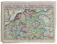
173017253Haarlem 1730. Small 8vo 16 x 10 cm. Bernardus Cleynhens Half textured red cloth ca. 1860 sewn on 2 tapes chemical-marbled sides in brown and blue. With 25 double-page engraved maps 2 overview maps the second serving as a key to the 23 numbered detail maps and an engraved plate with 8 scales all hand-coloured partly in outline. The 2 overview maps slightly wider than the others have a flap folded in at each side. Further with 1 rococo woodcut tailpiece 1 woodcut decorated initial and a fleuron on the title-page. 40 23 1 blank pp. plus maps and plate of scales. A surprisingly rare pocket atlas illustrating the theatre of the "tegenwoordigen" present war probably meaning the War of the Austrian Succession 1740-1748 but possibly the Seven Years' War 1756-1763. The title-page notes that it is suited for officers travellers and lovers of geography to carry in a pocket. The text in Dutch gives a geographic description only of "Duytsland" Germany including Austria Bohemia and a few other areas whereas the maps also cover the Low Countries the English Channel northwest France and to the east as far as Warsaw Krakow and Belgrade. The 23 detail maps were designed so that they could be assembled with the key map to make a single wall map whose cartographic image would measure 53 x 90 cm.With a contemporary owner's bookplate embossed stamp and library labels. With the text leaves somewhat browned not affecting the maps or the plate with scales and the first 2 leaves slightly worn but generally in good condition. A rare pocket atlas from the War of the Spanish Succession.l Koeman I Cle 1; STCN 2 copies; WorldCat 2 copies. hardcover
1620546Amsterdam, Hondius, 1621 (Am Ende: Elzevier für Hondius, 1620). 6 Bll., 1075 (recte 1065) S., 1 Kupfertitel mit 57 kleinen Kupferstichkarten im Text und 1 Textholzschnitt. 4°. Blindgeprägtes Schweinsleder der Zeit (stark bestoßen, beschabt und etw. verzogen, Schließbänder fehlen). [5 Warenabbildungen]
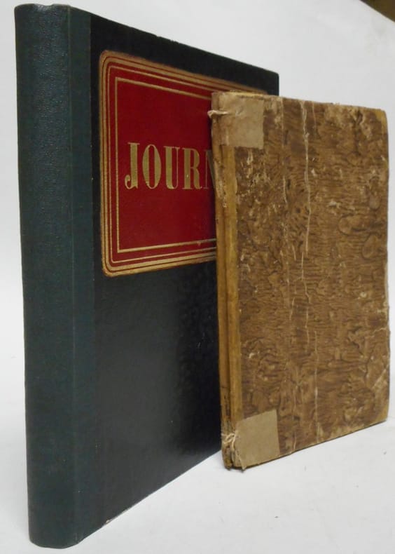
222702S.l., s.d. (1807-1812) petit in-8, [2] ff. n. ch. (initium : Journal commencé le 2 mars 1807. 1807, 1808, 1809, 1810, 1811 ; un f. vierge), 80 pp., couvertes d'une écriture fine, très lisible (environ 25 lignes par page), quelques biffures et corrections, certains paragraphes entièrement rayés, [7] ff. n. ch. d'un autre jet, contenant des ajouts pour 1812, ainsi qu'une table, demi-vélin rigide à coins, dos muet (reliure de l'époque). Restaurations aux coiffes, coupes abîmées.
New York City, Frankfurt, Stockholm, etc., 1961-1966. Substantial archive of documents concerning the publication and production of several notable literary works and theatrical plays by Peter Ulrich Weiss, including correspondence, draft agreements, contracts signed with leading publishers and producers, as well as some programmes and peer reviews, being the working files of his New York agent, Joan Daves. Together with 3 LP record box sets of the first and complete Broadway original cast music recording for the Marat/Sade play. Octavo and Folio documents and letters, ranging in size and number of pages, some signed in the original. Most are in English; some are in German; the lot neatly contained in four ring binders. The vast majority of the documents date to the 1960s, with a scant few being later including a letter regarding a special television production in 1979 with NBC. Occasional wear to extremities, otherwise in very good condition, beautifully preserved, clean and bright. A generous and comprehensive archive chronicling the work and partnership of a leading literary agent in the rise of German-American publishing, and one of her notable German writers. Provenance: From the desk of Weiss' literary agent for the US, Joan Daves. Joan Daves (1919-1997) was a leading literary agent with her own agency in New York, whose client list boasts six Nobel Prize winners including Martin Luther King, Jr. Daves had a profound effect on the very existence of German literature in America. Born Liselotte Davidson in Berlin, she escaped Nazi Germany by fleeing to Paris and England before emigrating to the United States in 1940. Her agency, established in 1948, handled the original works of several American authors. She handled Martin Luther King, Jr.'s literary property from 1957 until her death. Of great emphasis with her firm was the representation of several major German publishers, such as Suhrkamp, Piper, S. Fischer Verlag and others. It was the prime time of German writers such as Peter Weiss, Uwe Johnson, Max Frisch, Heinar Kipphardt, Hans Magnus Enzensberger, and Hermann Hesse. In the mid-1960s, communication with German publishers was quite different from today. A shipment of galleys was prepared with a 'by sea mail' label. When the New York Times printed the date and time the next ship would leave the harbor, delivery of the parcels of documents to that specific ship was requested. Peter Ulrich Weiss (1916-1982) was a German author, playwright, and experimental filmmaker, who gained celebrity fame on Broadway in the 1960s. He is particularly known for his plays "Marat/Sade" of 1963/65 which is largely represented in the present archive and which was enormously successful, for "The Investigation" of 1965, and for his later novel "The Aesthetics of Resistance" (1971-81). In the 1960s Weiss also embraced and promoted politically controversial groups, standing for revolutionary Cuba, standing against US intervention in Vietnam, and joining Sweden's eurocommunist party. Manuscript
1735129298La Haye ; Bruxelles, Charles et Jean-Baptiste De Vos 1735 3 volumes grand in-folio, veau marbré, dentelle doree, dos orne, tranches rouges Reliure hollandaise de l'époque. Troisième édition de la plus célèbre description topographique de l'ancien comté de Flandres. Sanderus confia la remarquable illustration de cet ouvrage cartes, plans des villes, vues cavalières et dessins de monuments remarquables à un grand nombre de dessinateurs-arpenteurs dont le plus doué était Vedastus du Plouich. Elle comprend 247 planches hors texte et 15 dans le texte gavées sur cuivre, dont 90 portraits et de nombreuses vues, cartes et plans de chateaux et d'abbayes. Charnières fendillées, coins émoussées, légère humidité marginale éparse.
1834809Edinburgh: Waugh and Innes 1834. First edition. Hardcover. Very Good. 8vo green cloth boards with gilt tiles on spine. Library rebound with name in gilt on front cover. Scarce first edition of this treatise on superstitions their origins and the customs associated with them. Contents include chapters on Evil Eye Invocations and Maledictions; Occult Infection and Cure of Maladies; Miscellaneous Remedies or Antidotes to Disease; Amulets; Analogies to Propitiatory Sacrifice; Propitiatory Charms; Faculties Ascribed to Sorcerers; Superstitions Relative to Marriage; Doctrine of Sympathy; Ingredients and Instruments Superstition and Sorcery; Mystical Plants; Mystical Animals; Mystical Mankind; Prognostication Divination; Imaginary Beings; Spectral Illusions; The Tongues; Tests Trial Conviction and Punishment of Sorcery. With errata Addenda and index. A fascinating book. Ex reference library with minimal markings pictorial bookplate on front pastedown handwritten library number to reserve of title page and single stamp to rear endpaper. Very occasional marks to inner book generally in excellent clean condition. Waugh and Innes hardcover
161320961Tübingen, Cellius, 1613. Prachtvoller Kupfertitel von Lucas Kilian mit dem Porträt von Kaiser Matthias I. auf einer Prunkarchitektur als Denkmal. 4 n.n. Bll. Widmung an den Kaiser Matthias I., 744 SS., 2 n.n. Bll., das letzte weiß. 4°, Violetter Samtband der Zeit. Goldschnitt aufwendig und reich gepunzt mit rautenförmigem-linearem Netzwerk.
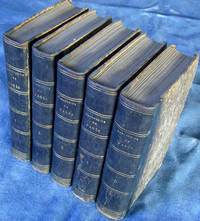
1856000938Amiens: Alfred Caron 1856-1862. First edition. Quarter Leather. Very Good . 5 volumes 12mo 5 x 7 about 550 pages each. Jean Pages historian master of the community of merchants of Amiens and Consul in 1706 was born in Amiens in 1655 and died in 1723. His "Mansuscrits" were written at the turn of the century ca 1700 and were published by Louis Douchet in five volumes in 1856-1862. The original manuscripts are conserved in the Amiens Public Library consisting of 10 folio volumes with the title �Notes on the City of Amiens.� All Five volumes tightly bound marbleized board with black leather gold-stamped spine. Beautifully preserved. Alfred Caron hardcover
Nouvelle Carte Generalle de la Mer Mediterranée Dediée a Monseigneur Le Grand Prieur General des Galeres de France. Par ses tres humbles Servoteurs Michelot Hidrographe et Pilot Real des Galeres du Roy et Bremond Hidrographe du Roy et de la Ville. Avec Privilege du Roy.Acquaforte, stampata su tre fogli, rispettivamente di dimensioni 499x711 mm, 700x490 mm e 468x693 mm. Imprint editoriale nel cartiglio: Ce Vend chez Laurent Bremond sur le Port a Marseille au Coin de Reboul; in basso a destra, la firma dell’incisore: Gravéè par P. Starckman.Bell'esemplare, in ottimo stato di conservazione.Carta del Mediterraneo, che viene suddiviso in tre parti. Nel foglio occidentale, in basso, un riquadro contiene le scale metriche (ripetute nel foglio centrale, in basso a destra, e in quello orientale, in alto a destra): Echelle de Lieues Françoises et Angloises, a 20 pour Degré; Echelle de Lieues d'Hollande, a 15 pour un Degré; Echelle de Lieues d'Espagne, à 17 1/2 pour un Degré; Echelle de Milles, a 75 pour un Degré, Selon l'usage de la Mediterranée. In basso, in un riquadro, troviamo i Noms des Isles et de quelques Ports contenues dans cette Carte, un elenco di 56 toponimi. Nel foglio centrale, il secondo riquadro riporta i Noms des Isles et de quelques Ports contenues dans cette Carte, lista di ulteriori 64 toponimi; in alto a destra, in un cartiglio, è rappresentato il piano nautico di Tripoli. Nel foglio orientale, un riquadro riporta i Noms des Isles et quelques Caps contenues dans cette Carte, lista di 80 toponimi sul Mar Egeo. La carta è dedicata a Jean Philippe d’Orleans (1702 - 1748), bâtard d’Orléans, chiamato le Chevalier d’Orléans o le Grand Prieur d’Orléans, figlio illegittimo di Filippo d’Orléans, nipote e genero di Luigi XIV. La carta era la seconda tavola dell’atlante nautico che Michelot e Bremond realizzarono nel primo ventennio del Settecento. La tecnica adottata per il disegno costiero e la disposizione dei toponimi provano la derivazione di questa carta direttamente da modelli manoscritti. Il foglio centrale mostra insolitamente il nord a sinistra, a differenza degli altri due fogli, pertanto, sviluppandosi in verticale non è sovrapponibile agli altri due.Henry Michelot, dopo il successo riscosso con la pubblicazione della sua guida nautica Le Portulan de Partie de la Mer Méditerranée, ou Le vray Guide des Pilotes Costiers (1703), cercò di capitalizzarlo unendosi a Laurent Bremond. All’inizio del XVIII secolo Henry Michelot e Laurens Bremond pubblicarono due importanti atlanti nautici del Mediterraneo e piani nautici ampiamente utilizzati dai naviganti costieri. Le carte sono interessanti e importanti per l’attendibilità derivata dall’esperienza di Michelot che, a differenza dei successivi “geografi del Dépôt des cartes et plans de la Marine” come Jacques-Nicolas Bellin ha avuto una lunga esperienza in mare. Il primo atlante prodotto contiene 16 carte, su piccola scala, del Mediterraneo e della costa atlantica in prossimità dello stretto di Gibilterra, integrate da una o più profili costieri. Le date delle carte sono comprese tra il 1715 e il 1726; in questo periodo Michelot si firmava come Hydrographe et Pilote Real des Galères du Roy (idrografo e pilota della cambusa reale per il corpo della galea dei re). Poco si sa del co-creatore dell’opera Laurent Bremond. Nella raccolta nautica il suo nome succede sempre a quello di Michelot, e viene qualificato come Hydrographe du Roy et de la Ville (idrografo del re e della città). Bremond sembrerebbe essere stato l’editore e il venditore della raccolta nautica, la forza commerciale della società; titolare di una sorta di negozio vicino al porto. Tutte le carte sono chiaramente contrassegnate: Ce vendent a Marseille chez Laurens Bremond sur le Port au coin de Reboul (venduto a Marsiglia da Laurens Bremond nel porto all’angolo di Reboul).Bibliografia: National Maritime Museum, Catalogue of the Library - Vol. Three,... Nouvelle Carte Generalle de la Mer Mediterranée Dediée a Monseigneur Le Grand Prieur General des Galeres de France. Par ses tres humbles Servoteurs Michelot Hidrographe et Pilot Real des Galeres du Roy et Bremond Hidrographe du Roy et de la Ville. Avec Privilege du Roy.Etching, printed on three sheets, respectively 499x711 mm, 700x490 mm and 468x693 mm. Imprint in the cartouche: Ce Vend chez Laurent Bremond sur le Port in Marseille au Coin de Reboul; bottom right, the engraver's signature: Gravéè par P. Starckman.Beautiful example, in excellent condition.Mediterranean Sea charts, which is divided into three parts. In the western sheet, at the bottom, a box contains the metric scales (repeated in the central sheet, bottom right, and in the eastern one, top right): Echelle de Lieues Françoises et Angloises, a 20 pour Degré; Echelle de Lieues d'Hollande, a 15 pour un Degré; Echelle de Lieues d'Espagne, à 17 1/2 pour un Degré; Echelle de Milles, a 75 pour un Degré, Selon l'usage de la Mediterranée. Below, in a box, we find the "Noms des Isles and those Ports contenues dues cette Carte", a list of 56 toponyms. In the central sheet, the second box shows the "Noms des Isles and those Ports contenues dans cette Carte", list of further 64 toponyms; in the upper right, in a scroll, the nautical plan of Tripoli is represented. In the eastern folio, a box shows the "Noms des Isles et quelques Caps contenues dans Cette Carte", list of 80 place names on the Aegean Sea. The chart is dedicated to Jean Philippe d’Orleans (1702 - 1748), bâtard d’Orléans, called le Chevalier d’Orléans or le Grand Prieur d’Orléans, illegitimate son of Philip d’Orléans, nephew and son-in-law of Louis XIV.The work was the second plate of the nautical atlas that Michelot and Bremond made in the first twenty years of the eighteenth century. The technique adopted for the coastal design and the placement of toponyms prove the derivation of this chart directly from manuscript models. The central sheet shows unusually the north to the left, unlike the other two sheets, therefore, developing vertically, it cannot be joined on the other two.Henry Michelot, after his success with the publication of his nautical guide "Le Portulan de Partie de la Mer Méditerranée, ou Le vray Guide des Pilotes Costiers" (1703), tried to capitalize it by joining Laurent Bremond. At the beginning of the 18th century, Henry Michelot and Laurens Bremond published two important nautical atlases of the Mediterranean and nautical plans widely used by coastal mariners.The charts are interesting and important for the reliability derived from the experience of Michelot who, unlike the subsequent "geographers of the Dépôt des cartes et de la Marine" like Jacques-Nicolas Bellin had a long experience at sea. The first atlas produced contains 16 maps, on a small scale, of the Mediterranean and the Atlantic coast near the Strait of Gibraltar, supplemented by one or more coastal profiles. The dates of the charts are between 1715 and 1726; in this period Michelot signed himself as Hydrographe et Pilote Real des Galères du Roy (hydrographer and pilot of the royal galley). Little is known about the co-creator of the work Laurent Bremond. In the nautical collection his name always happens to that of Michelot, and he is qualified as Hydrographe du Roy and de la Ville. Bremond seems to have been the publisher and seller of the nautical collection, the commercial strength of the company; owner of a sort of shop near the port. All charts are clearly marked: Ce vendent a Marseille chez Laurens Bremond sur le Port au coin de Reboul (sold in Marseille by Laurens Bremond in the port at the corner of Reboul).Bibliografia: National Maritime Museum, Catalogue of the Library - Vol. Three, Atlas & Cartography, Londra, 1971, pp. 262-263, n. 219 (2-4); R. Shirley, Maps in the Atlases of the British Library, Londra, 2004, pp. 1233-1234, M.MICH-1a. S. Bifolco, "Mare Nostrum, Cartografia nautica a stampa del Mar Mediterraneo" (2020), pp. 260-261, tav. 121.
Nieuwe Paskaart van ‘t Eerste Gedeelte der Middelansche-Zee tusschen ‘t I. Cadix en ‘t I. Malta = Nouvelle Carte Marine pour la Premier Partie de la Mer-Mediterranee (...) = The New Sea Map of the First Part of the Midland-Sea (...) = Nueva Carta Maritima la Primera Parte del Mar-Mediteraneo (...) = Nuova Carta Maritima la Prima Parte del Mar- Mediteraneo & Nieuwe Paskaart van ‘t Tweede Gedeelte der Middelandsche-Zee Tusschen ‘t I. Malta en Alexandretta = The New Sea Map of the Seconde Partie of the Midland-Sea (...) = Nouvelle Carte Marine pour la Deuxiesme Partie de la Mer-Mediterranee (...) = Nuova Carta Maritima la Seconda Parte del Mar-Mediteraneo (...).Acquaforte e bulino, stampata su due fogli, rispettivamente di dimensioni 600x990 mm e 595x1000 mm. Rappresentazione nautica del Mar Mediterraneo, suddiviso nella parte occidentale ed in quella orientale.Il titolo della parte occidentale, contenuto nel grande cartiglio decorativo a sinistra, è ripetuto in ben 5 lingue: olandese, francese, inglese, spagnolo e italiano. In basso al centro è riportato l’imprint editoriale: t’ Amsterdam by Ioannes van Keulen Boek Zeeekard Verkooper en Graad boog maker aan de Oost Zyde Vande Nieuwe Brug inde Gekroonde Lootsman met privilegie Nieuwelycks op Gestel door G: v: Keulen. Il titolo della parte orientale, nel grande cartiglio in alto a destra è riportato in 4 lingue ma non in spagnolo. In basso al centro si legge: t’ Amsterdam by Ioannes van Keulen Boek-Zeeekard Verkooper en Graad boog maker aande Oost Zyde van de Nieuwe brug inde Gekroonde Lootsman Opgestelt door G: v: Keulen. met Privilegie.Si tratta di una variante della carta precedente della tipografia Van Keulen - firmata da Johannes I Van Keulen e dal figlio Gerard e databile al 1709 - che vede le lastre emendate e leggermente ridotte (di circa 10 mm): vengono aggiunti degli elementi decorativi nel foglio di destra, dove è disegnato un gruppo di figure in abiti orientali che circonda il cartiglio; nel mare compaiono due navi collocate a largo di Malta e Cipro. Secondo Nils Persson (cfr. Loose printed Sea Charts published by Van Keulen, p. 177) le carte non sono parte di nessuna raccolta nautica, ma venivano vendute singolarmente.Nell’angolo superiore sinistro della tavola occidentale troviamo, fuori scala in un cartiglio, la rappresentazione del Mar Adriatico; nel foglio orientale, in basso a destra, troviamo il particolare della costa libica: Barbaria van I. Zerby tot Tripoli. La prima versione della carta appartiene al terzo volume dello Zee-Fakkel, del quale è una delle tavole aggiunte nel 1709 da Gerard van Keulen. Firmata da Johannes Van Keulen (1654 - 1715), la carta è completata e stampata dal figlio Gerard (1678 - 1726), il cui nome è riportato in entrambi i cartigli. Sebbene, secondo Koeman, la carta sarebbe stampata solo nel 1734 (cfr. AN, IV, p. 341, Keu 95 e V, p. 203), Irene Jacobs conferma che la carta appartiene all’aggiornamento dello Zee-Fakkel del 1709 (cfr. Charts in Zee-Fakkel and Zee-Atlas, p. 204). Il primo atlante Van Keulen nel quale abbiamo riscontrato la presenza della carta è il terzo volume dello Zee-Fakkel, edizione francese del 1723: Le Nouveau & Grand Illuminant Flambeau de la Mer (…) par Nicolas Jansz Vooght, & Gerard van Keulen, Geomêtre, & Maistre en Mathematiques. Imprime a Amsterdam: par Jean Van Ceulen, Marchand Libraire de Cartes Marines. A° 1723. Conservato alla Biblioteca Nacional di Madrid, il volume è citato ma non descritto da Koeman (cfr. AN, IV, p. 345, Keu 103 D). Le raccolte nautiche di Johannes van Keulen non erano composte da carte progettate intenzionalmente per questo tipo di opere: una quarantina di carte furono pubblicate per la prima volta nel 1680, ma il numero delle tavole aumentò sin da subito; nel 1683 - quando furono pubblicate le parti I, II, III, e IV - il numero aumentò a 116 mappe. L’atlante più voluminoso, apparso nel 1695, comprende 160 mappe di Johannes v... Neuwe Paskaart van ‘t Eerste Gedeelte der Middelansche-Zee tusschen ‘t I. Cadix en ‘t I. Malta = Nouvelle Carte Marine pour la Premier Partie de la Mer-Mediterranee (...) = The New Sea Map of the First Part of the Midland-Sea (...) = Nueva Carta Maritima la Primera Parte del Mar-Mediteraneo (...) = Nuova Carta Maritima la Prima Parte del Mar- Mediteraneo & Nieuwe Paskaart van ‘t Tweede Gedeelte der Middelandsche-Zee Tusschen ‘t I. Malta en Alexandretta = The New Sea Map of the Seconde Partie of the Midland-Sea (...) = Nouvelle Carte Marine pour la Deuxiesme Partie de la Mer-Mediterranee (...) = Nuova Carta Maritima la Seconda Parte del Mar-Mediteraneo (...).Etching and engraving, printed on two sheets, respectively 600x900 and 595x1000Nautical representation of the Mediterranean Sea, divided into the western and eastern parts.The title of the western part, contained in the large decorative cartouche on the left, is repeated in 5 languages: Dutch, French, English, Spanish and Italian. At the bottom of the page is the editorial imprint: t 'Amsterdam by Ioannes van Keulen Boek Zeeekard Verkooper en Graad boog maker aan de Oost Zyde Vande Nieuwe Brug inde. The title of the eastern part, in the large cartouche at the top right, is shown in 4 languages but not in Spanish. At the bottom center reads: t 'Amsterdam by Ioannes van Keulen Boek-Zeeekard Verkooper en Graad boog maker aande Oost Zyde van de Nieuwe brug inde Gekroonde Lootsman Opgestelt door G: v: Keulen. met Privileges.It is a variant of the previous map of the Van Keulen's - signed by Johannes I Van Keulen and by his son Gerard and datable to 1709 - which sees the changes and slightly reduced plates (of about 10 mm): decorative elements are added to the sheet on the right, where a group of figures in oriental clothes is drawn surrounding the cartouche; in the sea two ships appear off the coast of Malta and Cyprus. According to Nils Persson (see Loose printed Sea Charts published by Van Keulen, p. 177) the maps are not part of any nautical collection, but were sold individually.In the upper left corner of the western map we find, out of scale in a scroll, the representation of the Adriatic Sea; in the eastern sheet, below on the right, we find the detail of the Libyan coast: Barbaria van I. Zerby tot Tripoli. The first version of the maps belongs to the third volume of the Zee-Fakkel, of which it is one of the tables added in 1709 by Gerard van Keulen. Signed by Johannes Van Keulen (1654 - 1715), the map is completed and printed by his son Gerard (1678 - 1726), whose name is shown in both cartouches. Although, according to Koeman, the map would be printed only in 1734 (see AN, IV, p. 341, Keu 95 and V, p. 203), Irene Jacobs confirms that they belongs to the Zee-Fakkel update of 1709 ( see Charts in Zee-Fakkel and Zee-Atlas, p. 204). The first atlas Van Keulen in which we found the presence of paper is the third volume of the Zee-Fakkel, French edition of 1723: Le Nouveau & Grand Illuminant Flambeau de la Mer (...) par Nicolas Jansz Vooght, & Gerard van Keulen, Geomêtre , & Maistre en Mathematiques. Imprint in Amsterdam: par Jean Van Ceulen, Marchand Libraire de Cartes Marines. A ° 1723. Preserved at the Biblioteca Nacional in Madrid, the volume is quoted but not described by Koeman (see AN, IV, p. 345, Keu 103 D). Johannes van Keulen's nautical collections were published for the first time in 1680, but the number of plates increased immediately; in 1683 - when parts I, II, III, and IV were published - the number increased to 116 maps. The most massive atlas, which appeared in 1695, includes 160 maps by Johannes van Keulen. Later, around 1709, Gerard van Keulen increased the number of plates to 185: the most obsolete ones were replaced by others; the tables were given a new numbering. The book tradition foresaw that a nautical atlas should start with a map of the world; Van Keulen, not being in possession of a copper plate depicting the plani... S. Bifolco, "Mare Nostrum, Cartografia nautica a stampa del Mar Mediterraneo" (2020), pp. 178-179, tav. 79.
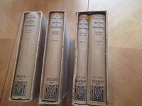
1924048236Macmillan And Co. 1924 1930 1924. 1st Edition 1st Printing. Hardcover. Fine/Fine. Colored And Supplementary Plates Figures In Text Plans Tables. Four Volumes An Incomplete Set In Original Blue Cloth Gilt With Dust Jackets And Slipcases. First Printings. Volume I: Fine In Fine Dust Jacket Slipcase With Wear At Open Corners Mostly At The Right Open Corners. Volume Ii: Lacking Volume Ii Parts I And Ii. Volume Iii: The Great Transitional Age In The Northern And Eastern Sections Of The Palace ; The Most Brilliant Records Of Minoan Art And The Evidences Of An Advanced Religion. Fine In Fine Dust Jacket In Lightly Used Slipcase With Wear At Open Corners. Vol. IvPart I Emergence Of Outer Western Enceinte. With New Illustrations Artistic And Religions Of The Middle Minoan Phase ; Chryselephantine 'Lady Of Sports' 'Snake Room' And Full Story Of The Cult : Late Minoan Ceramic Evolution And "Palace Style". Volume IvPart.2 'Camp-Stool' Fresco ; Long Robed Priests And Beneficient Genii Chryselephantine Boy-Pod And Ritual Hair-Offering ; Intaglio-Types Mmiii-Lmii ; Late Hoards Of Sealings ; Deposits Of Inscribed Tablets And The Palace Stores ; Linear Script B And Its Mainland Extension ; Closing Palatial Phase ; 'Room Of The Throne' And Final Catastrophe. With Epilogue On The Discovery Of 'Ring Of Minos' And "Temple Tomb. Volume Iv Parts I And Ii Both Fine In Fine Dust Jackets In A Quite Worn Slipcase Frayed And Bumped At Center Of Left Open Edge And With Top Right Long Edge Detached But Complete. International Shipping Not Available Due To Lack Of Fully Insurable Shipping Options For The Set. <br/> <br/> Macmillan And Co. 1924, 1930 hardcover
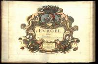
164775287Paris Uten år. 1647-1665. 4to. Samtidig helskinnbind med opphøyde ryggbånd og ryggforgylling. Ryggen rebacked med bruk av den gamle ryggstripen. Håndkolorert gravert dobbeltsidig tittelblad og dedikasjonsblad. Upaginert. 30 bl. Med 12 dobbeltsidige håndkolorerte kart. 4to. Contemporary full calf with raised bands spine gilt. Spine rebacked by using of the old spine. Handcoloured doublepage title and handcoloured doublepage dedication. Not paginated. 30 leaves. With 12 doublepage handcoloured copper engraved maps. Chez Pierre Mariette. Fransk. <br/><br/><em>“Nicolas Sanson le fils 1625 - 1648. Son of Nicolas and his intended heir prevented by his premature death from gunshot wounds. Only three known works. L’Europe 12 maps ca. 1648 compiled by N. Sanson fils engraved by A. Peyrounin theoretically published by Nicolas fils himself but may have been published posthumously by his father republished by Mariette 1660 1665. Tooley’s Dictionary of mapmakers. Revised edition. </em> hardcover
188084907Adolphe Braun & Cie | s. l. (Luzern) s. d. [ca 1880] | 44 x 56 cm | reliure de l'éditeur
A New Chart of the Mediterranean Sea Composed from the Draughts of the Pilots of Marseilles Corrected by Astronomical Observations: By Order M. GR Le Comte de Maurepas. To which are annexed by the Editor A Draught of the Streight Mouth including the Bays of Cadism Gibraltar and Malaga: also Ports of Leghorne, Naples, Mahon, Smyrna, Salonichi, Scandaroon and Alexandria: with the Course of the Nile from the last place to Cairo.Acquaforte, stampata su tre fogli di carta vergata e applicate su un supporto di carta blu, dimensioni totali 580x1280 mm. Firmata con imprint editoriale in alto a sinistra, sotto al titolo: Sold by William Mount & Tho.s Page Tower Hill. London.Grande carta del Mediterraneo - su tre fogli - basata sulla carta del Dépôt des cartes et plans de la Marine, stampata a Parigi nel 1737 ed incisa da Guillaume Dheulland, o, più probabilmente, sulla replica inglese pubblicata da John Senex nel 1738. Se l’originale francese, infatti, è la fonte delle informazioni nautiche, la versione di Senex è il modello per i piani nautici dei diversi porti del Mediterraneo, perfettamente replicati in questa tavola. La carta è firmata da William Mount e Thomas II Page, rispettivamente figlio di Richard e Thomas I, primi esponenti della tipografia che stampò il The English Pilot fino all’inizio del XIX secolo.La carta appartiene alle cosiddette “blueback charts” che iniziarono ad apparire a Londra nella seconda metà del XVIII secolo; erano carte nautiche di grande o grandissimo formato, così denominate per il loro particolare supporto in carta blu. Il supporto - un foglio blu comunemente disponibile e usato tradizionalmente dagli editori per contenere opuscoli a stampa non rilegati - fu adottato come un modo pratico per rafforzare la carta di bassa qualità utilizzata dagli editori di carte nautiche nel tentativo di ridurre i costi. Le prime carte blueback conosciute sono quella pubblicate dalla tipografia Mount & Page intorno al 1750 e successivamente da Robert Sayer (1787). La tradizione decollò all’inizio del XIX secolo, quando gli editori britannici come John Hamilton Moore, Robert Blachford, James Imray, William Heather, John William Norie, Charles Wilson, David Steel, RH Laurie e John Hobbs iniziarono a dominare il commercio della cartografia nautica. Le bluebacks diventarono così popolari da essere adottate dagli americani Edmund March Blunt e George Eldridge, così come da cartografi scandinavi, francesi, tedeschi, russi e spagnoli. Le carte blueback rimasero popolari fino alla fine dell’800, quando organizzazioni sovvenzionate dal governo, come la British Admiralty Hydrographic Office e la United States Coast Survey, iniziarono a pubblicare le proprie tavole nautiche su carta di alta qualità che non richiedeva rinforzi.Bibliografia: cfr. S. Fisher, The Blueback Charts, in “The Map Collector” n. 31, Londra 1985, pp. 18-23; S. Fisher, The Makers of the Blueback Charts, History of Imray Laurie Norie & Wilson Ltd, Londra 2001; cfr. National Maritime Museum, Catalogue of the Library - Vol. Three, Atlas & Cartography, Londra, 1971, pp. 460-462; cfr. R. Shirley, Maps in the Atlases of the British Library, Londra, 2004, pp. 1236-1266; cfr. The Compleat Plattmaker: essays on Chart, Map and Globe Making in England in the Seventeenth and Eighteenth Centuries, Berkeley, 1978. A New Chart of the Mediterranean Sea Composed from the Draughts of the Pilots of Marseilles Corrected by Astronomical Observations: By Order M. GR Le Comte de Maurepas. To which are annexed by the Editor A Draught of the Streight Mouth including the Bays of Cadism Gibraltar and Malaga: also Ports of Leghorne, Naples, Mahon, Smyrna, Salonichi, Scandaroon and Alexandria: with the Course of the Nile from the last place to Cairo.Etching, printed on three sheets of laid paper and applied on a blue paper support, total dimensions 580x1280 mm. Signed with editorial imprint at the top left, under the title: Sold by William Mount & Tho.s Page Tower Hill. London.Large map of the Mediterranean - on three sheets - based on the work of the Dépôt des cartes et plans de la Marine, printed in Paris in 1737 and engraved by Guillaume Dheulland, or, more probably, on the English copy published by John Senex in 1738. If l the French original, in fact, is the source of the nautical information, the version of Senex is the model for the nautical plans of the different harbours of the Mediterranean, perfectly replicated in this work.The map is signed by William Mount and Thomas II Page, respectively son of Richard and Thomas I, first exponents of the typography who printed "The English Pilot" until the beginning of the nineteenth century.The map belongs to the so-called "blueback charts" which began to appear in London in the second half of the 18th century; they were nautical charts of great or very large format, so named for their particular blue paper support. The media - a blue sheet commonly available and traditionally used by publishers to contain unblocked printed pamphlets - was adopted as a practical way to reinforce the low quality paper used by nautical charts publishers in an effort to reduce costs. The first known blueback cards are the ones published by Mount & Page typography around 1750 and later by Robert Sayer (1787).Tradition took off in the early 19th century, when British publishers such as John Hamilton Moore, Robert Blachford, James Imray, William Heather, John William Norie, Charles Wilson, David Steel, RH Laurie and John Hobbs began to dominate the cartography trade boating. The bluebacks became so popular as to be adopted by the Americans Edmund March Blunt and George Eldridge, as well as by Scandinavian, French, German, Russian and Spanish cartographers. The blueback cards remained popular until the end of the 1800s, when government-subsidized organizations, such as the British Admiralty Hydrographic Office and the United States Coast Survey, began to publish their own nautical tables on high-quality paper that did not require reinforcements.Bibliografia: cfr. S. Fisher, The Blueback Charts, in “The Map Collector” n. 31, Londra 1985, pp. 18-23; S. Fisher, The Makers of the Blueback Charts, History of Imray Laurie Norie & Wilson Ltd, Londra 2001; cfr. National Maritime Museum, Catalogue of the Library - Vol. Three, Atlas & Cartography, Londra, 1971, pp. 460-462; cfr. R. Shirley, Maps in the Atlases of the British Library, Londra, 2004, pp. 1236-1266; cfr. The Compleat Plattmaker: essays on Chart, Map and Globe Making in England in the Seventeenth and Eighteenth Centuries, Berkeley, 1978. S. Bifolco, "Mare Nostrum, Cartografia nautica a stampa del Mar Mediterraneo" (2020), pp. 226-227, tav. 105.
Pascaerte Van ‘t Westelyckste deel vande Middelandesche Zee; Waer in vertoont de ware gelegentheden van alle Capen, Havens, Rivieren, Bayen, Anckergronden en droogten, alles op haer rechte strecklingen en verheyt, nu Nieuwelyx int licht gebracht Pascaerte van ‘t Ooestelyckste deel vande Middelandesche Zee; Waer in vertoont de ware gelegentheden van alle Capen, Havens, Rivieren, Bayen, Anckergronden en droogten, alles op haer rechte strecklingen en verheyt, nu Nieuwelyx int licht gebracht. Coppia di incisioni all’acquaforte e bulino, di dimensioni mm 315x455 entrambe. Imprint editoriale nei due cartigli: ’t Amsterdam, Door Iohannes van Loon Zeecaert-maker, op de S. Lucia burgwal in ‘t Sloterdycks steegie.Magnifiche prove, impresse su carta vergata coeva e finemente colorate a mano in epoca, con margini, in ottimo stato di conservazione.Opera tratta da: Klaer Lichtende Noort-Ster Ofte Zee Atlas; Waer in vertoont wordt De gelegentheydt van alle de Zee-kusten des geheelen Aerdtbodems, Nieuwelicks uyt-gegeven door Joannes van Loon. ‘t Amsterdam, By Ioannes van Loon, Plaet-snijder, buyten de S. Anthonis Poort, achter de Blancken Ham, in de 3. Vijsels, ofte by Gillis van Loon, achter de Hal, in de 3, Kemphaentjes, Anno 1661.Johannes van Loon era un noto matematico che lavorò per un lungo periodo per vari librai e produttori di carte di Amsterdam. Ci sono alcuni dubbi intorno alle identità di Jan e Johannes van Loon poiché entrambi i nomi circolavano nel periodo 1649 - 1685. Tuttavia, poiché entrambi i nomi ricorrono nei registri notarili, in relazione ad un impiego presso Johannes Janssonius van Waesbergen, si può supporre che Jan e Johannes siano la stessa persona. Non conosciamo la sua data di nascita ma la sua morte dovrebbe essere avvenuta nel 1686. Il suo nome compare per la prima volta nella guida nautica pubblicata da Theunis Jacobsz ad Amsterdam nel 1649, il Practitioner in the Sciences of Astronomy, Geometry and the Mathematiques. In seguito, il suo nome compare in un libro scritto da Peter Ruelle intitolato Voorlooper des Zee-quadrants ofte Ruitkaert, in the het licht gebracht door J. van Loon, stampato da Hendrick Doncker nel 1651. Oltre alla professione di matematico, firmò le carte per il noto atlante marino intitolato Klaer-Lichtende Noort Ster pubblicato da lui e dal fratello Gilles nel 1661; prima di questa data aveva contribuito alla composizione delle guide nautiche pubblicate da Johannes Janssonius quali Le Nouveau Flambeau de la Mer (1650), il De Lichtende Columne (1651/52) e il The Lighting Columne (1654). Nel 1666 le lastre del Klaer-Lichtende Noort Ster furono vendute a J. Janssonius van Waesbergen, il quale, a sua volta, ristampò l’opera, in collaborazione con Van Loon, dopo averla arricchita di dodici nuove carte, tutte firmate da entrambi i cartografi. Le edizioni delle carte che recano la seconda parte dell’imprint editoriale - op de S. Lucia burgwal in ‘t Sloterdycks steegie - abraso, sono da ritenersi pubblicate dopo il 1666 (cfr. Koeman, IV, pp. 406-408 che descrive ulteriori otto edizioni della raccolta, impresse dal 1666 al 1706 circa). Quando Johannes I van Keulen intraprese il gigantesco progetto di una nuova guida nautica in cinque volumi, lo Zee-Fakkel, furono van Loon e Class Jansz Vooght, considerato come l’autore principale dell’opera, ad aiutarlo. Il contributo di Jan van Loon fu, tuttavia, modesto; venne menzionato soltanto nel titolo della seconda parte, pubblicato per la prima volta nel 1681. La sua attività si estende per un periodo di 40 anni, insolitamente lungo per il tempo. Raro portolano del Mediterraneo.Bibliografia: C. Koeman, Atlantes Neerlandici: Bibliography of Terrestrial, Maritime and Celestial Atlases and Pilot Books Published in the Netherlands up to 1880 Vol. IV, pp. 403-408, Loon 1 (13, 14); cfr. R. Shirley, Maps in the Atlases of the British Library, Londra, 2004, pp. 1223-1224. Pascaerte Van ‘t Westelyckste deel vande Middelandesche Zee; Waer in vertoont de ware gelegentheden van alle Capen, Havens, Rivieren, Bayen, Anckergronden en droogten, alles op haer rechte strecklingen en verheyt, nu Nieuwelyx int licht gebracht Pascaerte van ‘t Ooestelyckste deel vande Middelandesche Zee; Waer in vertoont de ware gelegentheden van alle Capen, Havens, Rivieren, Bayen, Anckergronden en droogten, alles op haer rechte strecklingen en verheyt, nu Nieuwelyx int licht gebracht.Etching and engraving, 315x455 each one. Imprint in the cartouches: ’t Amsterdam, Door Iohannes van Loon Zeecaert-maker, op de S. Lucia burgwal in ‘t Sloterdycks steegie.Rary early pair of sea charts of The Mediterranean Sea.Magnificent examples, printed on contemporary laid paper, with margins, old hand-colors, in excellent condition.From: Klaer Lichtende Noort-Ster Ofte Zee Atlas; Waer in vertoont wordt De gelegentheydt van alle de Zee-kusten des geheelen Aerdtbodems, Nieuwelicks uyt-gegeven door Joannes van Loon. ‘t Amsterdam, By Ioannes van Loon, Plaet-snijder, buyten de S. Anthonis Poort, achter de Blancken Ham, in de 3. Vijsels, ofte by Gillis van Loon, achter de Hal, in de 3, Kemphaentjes, Anno 1661.Johannes van Loon was a well-known mathematician who worked for a long time for various booksellers and map producers in Amsterdam. There are some doubts about the identities of Jan and Johannes van Loon because both names were circulated in the period 1649 - 1685. However, since both names appear in the notarial registers, in relation to a job with Johannes Janssonius van Waesbergen, it can be assumed that Jan and Johannes are the same person.We do not know his date of birth but his death should have taken place in 1686. His name appears for the first time in the nautical guide published by Theunis Jacobsz in Amsterdam in 1649, the Practitioner in the Sciences of Astronomy, Geometry and the Mathematiques. Later, his name appears in a book written by Peter Ruelle entitled Voorlooper des Zee-quadrants ofte Ruitkaert, in the het licht gebracht door J. van Loon, printed by Hendrick Doncker in 1651. Besides the profession of mathematician, he signed the maps for the famous marine atlas entitled Klaer-Lichtende Noort Ster published by him and his brother Gilles in 1661; before this date he had contributed to the composition of the nautical guides published by Johannes Janssonius such as Le Nouveau Flambeau de la Mer (1650), De Lichtende Columne (1651/52) and The Lighting Columne (1654). In 1666 the plates of the Klaer-Lichtende Noort Ster were sold to J. Janssonius van Waesbergen, who, in turn, reprinted the work, in collaboration with Van Loon, after having enriched it with twelve new maps, all signed by both cartographers.Bibliografia: C. Koeman, Atlantes Neerlandici: Bibliography of Terrestrial, Maritime and Celestial Atlases and Pilot Books Published in the Netherlands up to 1880 Vol. IV, pp. 403-408, Loon 1 (13, 14); cfr. R. Shirley, Maps in the Atlases of the British Library, Londra, 2004, pp. 1223-1224. S. Bifolco, "Mare Nostrum, Cartografia nautica a stampa del Mar Mediterraneo" (2020), pp. 120-121, tav. 46.
2025Adhya-9781003863984T&F/ROUTLEDGE 2025. Hardcover. New. T&F/ROUTLEDGE hardcover