LA MOTRAYE, Aubry deAntiquariat.de

34 270 résultats
17271098-19A la Haye, Johnson & J. van Duren 1727. Vol. 1 (of 2) apart. gr.-4°. 8 ll., 472, 23 pp. with 1 frontispiece, 31 planches hors-texte dont 6 dépliantes et 10 à double-page. - Mit Frontisp. (v. B. Picart), 29 tlw. gefalt. Kupfertaf. (dav. 16 doppelbl.-gr.) und 2 doppelbl.-gr. gefalt. Karten. Ldr. d. Zt. Mit Rückengoldpräg. Kap. u. Kanten berieb. EA. [5 Warenabbildungen]
003395Paris, Firmin Didot, 1827 8 livrets in-12 (15,5 x 9,7 cm), cartonnages gaufrés d'éditeur de différentes couleurs, nom de chaque ville inscrit au centre du premier plat, 36 pages chacun, illustrés d'une lithographie au début, soigneusement coloriée à la main à l'époque.
Carta murla di tutta l'Europa che si estende da est a includere l'Armenia e la Russia occidentale. La mappa ha un grande cartiglio decorativo con il titolo in alto a sinistra, circondato dai stemmi dei principali paesi e sostenuto da due putti con un globo, su uno sfondo di attrezzi militari. La mappa è una versione modificata della carta di Guillaume de L'Isle (1723) pubblicata a Parigi da Maurille Antoine Moithey e Crépy. Moithey (1732-1810) è stato un ingegnere e cartografo per il Re di Francia ed ha collaborato con Crépy dal 1769 fino al 1777. Incisione in rame, stampata su due foglii, finemente colorata a mano, alcuni strappi e pieghe di carta perfettamente restaurati, tracce di colore sul Mare del Nord, per il resto in buone condizioni.Rara. A fine and uncommon separately issued wall-map of all Europe extending east to include Armenia and western Russia. The map which is attractively coloured has a large decorative title piece at top left surrounded by the coats of arms of major countries and supported by two cherubs examining a globe against a background of military implements.Printed on two joined sheets, paper folds and tears perfectly repaired, otheriwise good condition. In full body colours. Tooley, Mapmakers I, 314 u. III, 266
LBW0028e[circa 1660]. 343 x 511 mm.
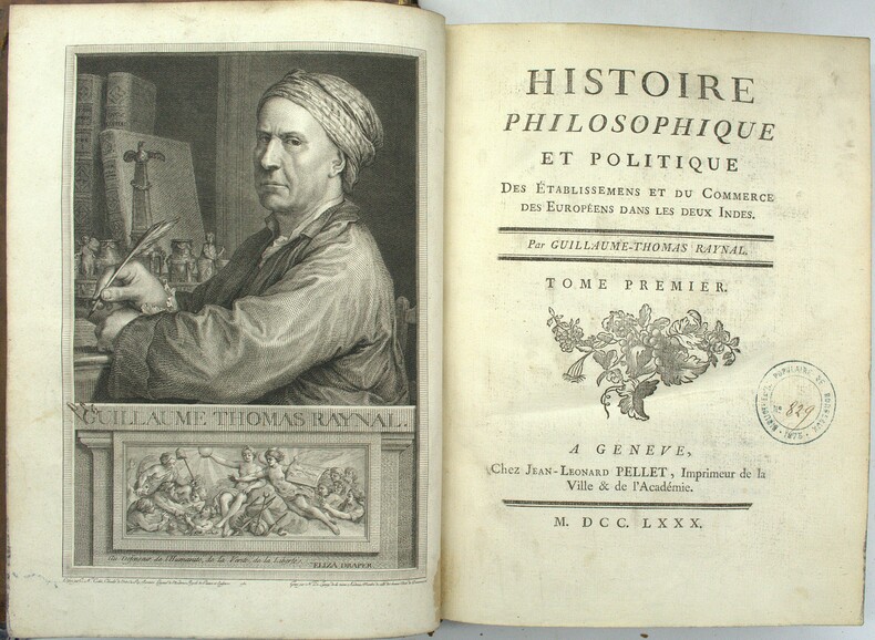
1780PHO-1926Genève, Pellet, 1780, 5 volumes in-4, 4 de texte et un atlas in-4, Texte ; portrait, XVI, 741 pp., 1 pl.; front., (2 ff.), VIII, 485 pp.; front., XV, 629 pp.; front., (2 ff.), VIII, 770 pp., (1 f.), Atlas ; 2f., 28pp. ; illustré complet des 50 cartes (chiffrées 1-49 et 17 bis) ; quelques cartes mal chiffrées et 23 tableaux de statistiques in fine, la plupart dépliants. Rousseurs éparses, feuillets légèrement brunis par places. Tampons humides "Bibliothèque populaire de Bordeaux". Reliure Texte ; Basane fauve marbrée de l'époque, dos à nerfs ornés, triple filet doré encadrant les plats, Atlas ; veau brun marbré de l'époque, dos à nerfs orné, fleurons tulipes entre caissons, tranches marbrées, filet à froid encadrant les plats, double filet doré sur coupes 2 coiffes arasées, une arrachée, petits chocs à 2 autres, frottements et épidermures, coins très émoussés, mors fendillés aux entrées, coins émoussés, tranches marbrées (atlas).
1640LBW-1382Paris circa 1640 367 x 516 mm.
Acquaforte e bulino, 530x590 mm, firmata in lastra nel cartiglio: T’ Amstredam By Iohannes van Keulen Boeckverkooper aende Nieubrugh in de geckroonide Lootsman Mer Privilegie voor 15 Iaaren.Magnifica prova, coloritura coeva, in ottimo stato di conservazione.Carta tratta da: De Nieuwe Groote Lichtende Zee-Fakel, ‘t Derde Deel. Verhoonde de Kunsten van Granaden, Catalonien, Provence, Italien, Dalmatien, Grieken, Thracien, Natolien, Syrien, Egyptne, en de geheele Noordkust van Barbaryen, met alle haer onderhoo rende en tussschen leggende Eylanden. (…) Door Claas Jansz. Vooght, Geometra Leermeester der Wis-konst. Die geen voor de sijnen en kent, als die by Johannes van Keulen gedrukt zijn. t’ Amsterdam, Gedruckt voor Johannes van Keulen, Boeck en Zee-Kaert-verkoper, aen de Nieuw-brugh, in de gekroonde Lootsman. 169[…] . Met Privilegie voor 15 Jaren.Variante della precedente carta del Mediterraneo di Johannes I Van Keulen del 1682, che compare per la prima volta nell’edizione olandese del De Nieuwe Groote Lichtende Zee-Fakel. La lastra viene emendata e aggiornata: in basso a sinistra, le scale metriche sono ora 4 per l’aggiunta della scala grafica in miglia italiane. La carta è presente anche nella versione italiana dello Zee-Fakel, pubblicata nel 1705 con il titolo di Nuova, E Grande Illuminante Face del Mare (cfr. Koeman, AN, IV, p. 346, Keu 108).Bibliografia: C. Koeman, Atlantes Neerlandici: Bibliography of Terrestrial, Maritime and Celestial Atlases and Pilot Books Published in the Netherlands up to 1880 Vol. IV, Amsterdam 1970, pp. 338-347, Keu 88 A (3) 99; Mare Nostrum, a historic voyage across the Mediterranean Sea, Lussemburgo, 2003, p. 22; cfr. R. Shirley, Maps in the Atlases of the British Library, Londra, 2004, pp. 1200-1213; cfr. D. de Vries, G. Schilder, W. Morzer Bruyns, P. van Iterson, I. Jacobs, The Van Keulen Cartography Amsterdam 1680-1885, Alphen aan den Rijn, 2005. Etching and engraving, 530x590 mm, signed in the cartouche: T’ Amstredam By Iohannes van Keulen Boeckverkooper aende Nieubrugh in de geckroonide Lootsman Mer Privilegie voor 15 Iaaren.Magnificient example, contemporary old coloured, very good condition.From: De Nieuwe Groote Lichtende Zee-Fakel, ‘t Derde Deel. Verhoonde de Kunsten van Granaden, Catalonien, Provence, Italien, Dalmatien, Grieken, Thracien, Natolien, Syrien, Egyptne, en de geheele Noordkust van Barbaryen, met alle haer onderhoo rende en tussschen leggende Eylanden. (…) Door Claas Jansz. Vooght, Geometra Leermeester der Wis-konst. Die geen voor de sijnen en kent, als die by Johannes van Keulen gedrukt zijn. t’ Amsterdam, Gedruckt voor Johannes van Keulen, Boeck en Zee-Kaert-verkoper, aen de Nieuw-brugh, in de gekroonde Lootsman. 169[…] . Met Privilegie voor 15 Jaren.Variant of the Mediterranean map by Johannes I Van Keulen of 1682, which appears for the first time in the Dutch edition of De Nieuwe Groote Lichtende Zee-Fakel. The plate is amended and updated: at the bottom left, the metric scales are now 4 for the addition of the graphic scale in Italian miles. The map is also present in the Italian version of the Zee-Fakel, published in 1705 with the title of Nuova, E Grande Illuminante Face del Mare (see Koeman, AN, IV, p. 346, Keu 108).Bibliografia: C. Koeman, Atlantes Neerlandici: Bibliography of Terrestrial, Maritime and Celestial Atlases and Pilot Books Published in the Netherlands up to 1880 Vol. IV, Amsterdam 1970, pp. 338-347, Keu 88 A (3) 99; Mare Nostrum, a historic voyage across the Mediterranean Sea, Lussemburgo, 2003, p. 22; cfr. R. Shirley, Maps in the Atlases of the British Library, Londra, 2004, pp. 1200-1213; cfr. D. de Vries, G. Schilder, W. Morzer Bruyns, P. van Iterson, I. Jacobs, The Van Keulen Cartography Amsterdam 1680-1885, Alphen aan den Rijn, 2005. S. Bifolco, "Mare Nostrum, Cartografia nautica a stampa del Mar Mediterraneo" (2020), p. 166, tav. 72.
Acquaforte e bulino, 530x590 mm, firmata in lastra nel cartiglio: T’ Amstredam By Iohannes van Keulen Boeckverkooper aende Nieubrugh in de geckroonide Lootsman Mer Privilegie voor 15 Iaaren.Bellissimo esemplare in coloritura d'epoca.Carta tratta da: De Nieuwe Groote Lichtende Zee-Fakel, ‘t Derde Deel. Verhoonde de Kunsten van Granaden, Catalonien, Provence, Italien, Dalmatien, Grieken, Thracien, Natolien, Syrien, Egyptne, en de geheele Noordkust van Barbaryen, met alle haer onderhoo rende en tussschen leggende Eylanden. […] Door Claas Jansz. Vooght, Geometra Leermeester der Wis-konst. T’ Amsterdam, Gedruckt voor Johannes van Keulen, Boeck en Zee-Kaert-verkoper, aen de Nieuw-brugh, in de gekroonde Lootsman. 1682. Met Privilegie voor 15 Jaren.Carta nautica del Mediterraneo, suddiviso in due parti, disegnata da Claes Jansz Vooght; viene per la prima volta inserita nel terzo volume del Nieuwe Lichtende Zee-Fakkel (1682) sul Mediterraneo. La tavola viene ristampata e inclusa in numerose edizioni, anche in altre lingue, dell’opera. A partire dal 1695, la tavola del Mediterraneo è inserita anche nell’altra guida nautica degli editori di Amsterdam, il De Groote Nieuwe Vermeerderde Zee-Atlas ofte Water-werelt (cfr. Koeman, AN, vol. IV, p. 293, Keu 20 B). La dinastia Van Keulen di editori, stampatori mercanti di libri e cartografi produsse i più completi e aggiornati atlanti nautici olandesi. Johannes van Keulen (1654 - 1715) nel 1678 fondò un’attività di vendita di libri e strumenti ad Amsterdam e nel 1680 ottenne il privilegio dall’Olanda e dalla Frisia occidentale di stampare guide e atlanti nautici. La sua prima grande opera fu il Nieuwe Lichtende Zee-Fakkel, illustrato da Jan Luyken, con mappe disegnate da Claes Jansz Vooght; ne furono pubblicati cinque volumi tra il 1681 e il 1684. Van Keulen produsse anche uno Zee-Atlas ofte Water-werelt. L’attività dei Van Keulen continuò per quasi due secoli; Gerard (1678 - 1726) produsse nuove edizioni delle opere del padre, numerose carte manoscritte e nel 1706 fu nominato idrografo della Compagnia olandese delle Indie Orientali (VOC); suo figlio Jan II van Keulen (1704 - 1770) rilevò l’attività nel 1726 e pubblicò una nuova edizione del volume asiatico dello Zee-Atlas; fu nominato cartografo del VOC nel 1743. Dopo la morte di Jan II, i suoi figli Cornelis Buijs e Gerard Hulst van Keulen gestirono l’attività di famiglia. Gerard (1733 - 1801) aggiunse un ulteriore volume allo Zee-Fakkel contenente materiale sulle Indie Orientali derivato dalla VOC. Gerard, oltre ad avere anche pubblicato il primo almanacco nautico in olandese nel 1788, fu uno dei tre membri originari della commissione istituita dal governo olandese nel 1787 per risolvere il problema di trovare la longitudine in mare. Il figlio di Gerard, Jan III, è stato l’ultimo van Keulen a dirigere l’azienda. Bibliografia: C. Koeman, Atlantes Neerlandici: Bibliography of Terrestrial, Maritime and Celestial Atlases and Pilot Books Published in the Netherlands up to 1880 Vol. IV, Amsterdam 1970, pp. 338-347, Keu 87 A (1) 99; National Maritime Museum, Catalogue of the Library - Vol. Three, Atlas & Cartography, Londra, 1971, pp. 110-114, n. 107 (104); cfr. R. Shirley, Maps in the Atlases of the British Library, Londra, 2004, pp. 1200-1213; cfr. D. de Vries, G. Schilder, W. Morzer Bruyns, P. van Iterson, I. Jacobs, The Van Keulen Cartography Amsterdam 1680-1885, Alphen aan den Rijn, 2005. Etching and engraving, 530x590 mm, signed in the cartouche: T ’Amstredam By Iohannes van Keulen Boeckverkooper aende Nieubrugh in de geckroonide Lootsman Mer Privilegie voor 15 Iaaren.Beautiful example in old coloring.Map taken from: De Nieuwe Groote Lichtende Zee-Fakel, ‘t Derde Deel. Verhoonde de Kunsten van Granaden, Catalonien, Provence, Italien, Dalmatien, Grieken, Thracien, Natolien, Syrien, Egyptne, en de geheele Noordkust van Barbaryen, half the haer onderhoo makes en tussschen legends Eylanden. [...] Door Claas Jansz. Vooght, Geometra Leermeester der Wis-konst. T 'Amsterdam, Gedruckt voor Johannes van Keulen, Boeck en Zee-Kaert-verkoper, aen de Nieuw-brugh, in de gekroonde Lootsman. 1682. Met Privilegie voor 15 Jaren.Nautical chart of the Mediterranean, divided into two parts, designed by Claes Jansz Vooght; it was first included in the third volume of the Nieuwe Lichtende Zee-Fakkel (1682) devoted to the Mediterranean. The plate is reprinted and included in numerous editions, also in other languages, of the atlasStarting from 1695, the Mediterranean table is also included in the other nautical guide of the editors of Amsterdam, the De Groote Nieuwe Vermeerderde Zee-Atlas ofte Water-werelt (see Koeman, AN, vol. IV, p. 293, Keu 20 B).Bibliografia: C. Koeman, Atlantes Neerlandici: Bibliography of Terrestrial, Maritime and Celestial Atlases and Pilot Books Published in the Netherlands up to 1880 Vol. IV, Amsterdam 1970, pp. 338-347, Keu 87 A (1) 99; National Maritime Museum, Catalogue of the Library - Vol. Three, Atlas & Cartography, Londra, 1971, pp. 110-114, n. 107 (104); cfr. R. Shirley, Maps in the Atlases of the British Library, Londra, 2004, pp. 1200-1213; cfr. D. de Vries, G. Schilder, W. Morzer Bruyns, P. van Iterson, I. Jacobs, The Van Keulen Cartography Amsterdam 1680-1885, Alphen aan den Rijn, 2005. S. Bifolco, "Mare Nostrum, Cartografia nautica a stampa del Mar Mediterraneo" (2020), p. 153, tav. 65.
Pascaerte Van ‘t Westelyckste deel vande Middelandesche Zee; Waer in vertoont de ware gelegentheden van alle Capen, Havens, Rivieren, Bayen, Anckergronden en droogten, alles op haer rechte strecklingen en verheyt, nu Nieuwelyx int licht gebracht Acquaforte e bulino, imprint editorialei: ’t Amsterdam, Door Iohannes van Loon Zeecaert-maker, op de S. Lucia burgwal in ‘t Sloterdycks steegie.Magnifiche prova, impressa su carta vergata coeva e finemente colorate a mano in epoca, con margini, in ottimo stato di conservazione.Opera tratta da: Klaer Lichtende Noort-Ster Ofte Zee Atlas; Waer in vertoont wordt De gelegentheydt van alle de Zee-kusten des geheelen Aerdtbodems, Nieuwelicks uyt-gegeven door Joannes van Loon. ‘t Amsterdam, By Ioannes van Loon, Plaet-snijder, buyten de S. Anthonis Poort, achter de Blancken Ham, in de 3. Vijsels, ofte by Gillis van Loon, achter de Hal, in de 3, Kemphaentjes, Anno 1661.Johannes van Loon era un noto matematico che lavorò per un lungo periodo per vari librai e produttori di carte di Amsterdam. Ci sono alcuni dubbi intorno alle identità di Jan e Johannes van Loon poiché entrambi i nomi circolavano nel periodo 1649 - 1685. Tuttavia, poiché entrambi i nomi ricorrono nei registri notarili, in relazione ad un impiego presso Johannes Janssonius van Waesbergen, si può supporre che Jan e Johannes siano la stessa persona. Non conosciamo la sua data di nascita ma la sua morte dovrebbe essere avvenuta nel 1686. Il suo nome compare per la prima volta nella guida nautica pubblicata da Theunis Jacobsz ad Amsterdam nel 1649, il Practitioner in the Sciences of Astronomy, Geometry and the Mathematiques. In seguito, il suo nome compare in un libro scritto da Peter Ruelle intitolato Voorlooper des Zee-quadrants ofte Ruitkaert, in the het licht gebracht door J. van Loon, stampato da Hendrick Doncker nel 1651. Oltre alla professione di matematico, firmò le carte per il noto atlante marino intitolato Klaer-Lichtende Noort Ster pubblicato da lui e dal fratello Gilles nel 1661; prima di questa data aveva contribuito alla composizione delle guide nautiche pubblicate da Johannes Janssonius quali Le Nouveau Flambeau de la Mer (1650), il De Lichtende Columne (1651/52) e il The Lighting Columne (1654). Nel 1666 le lastre del Klaer-Lichtende Noort Ster furono vendute a J. Janssonius van Waesbergen, il quale, a sua volta, ristampò l’opera, in collaborazione con Van Loon, dopo averla arricchita di dodici nuove carte, tutte firmate da entrambi i cartografi. Le edizioni delle carte che recano la seconda parte dell’imprint editoriale - op de S. Lucia burgwal in ‘t Sloterdycks steegie - abraso, sono da ritenersi pubblicate dopo il 1666 (cfr. Koeman, IV, pp. 406-408 che descrive ulteriori otto edizioni della raccolta, impresse dal 1666 al 1706 circa). Quando Johannes I van Keulen intraprese il gigantesco progetto di una nuova guida nautica in cinque volumi, lo Zee-Fakkel, furono van Loon e Class Jansz Vooght, considerato come l’autore principale dell’opera, ad aiutarlo. Il contributo di Jan van Loon fu, tuttavia, modesto; venne menzionato soltanto nel titolo della seconda parte, pubblicato per la prima volta nel 1681. La sua attività si estende per un periodo di 40 anni, insolitamente lungo per il tempo. Raro portolano del Mediterraneo.Bibliografia: C. Koeman, Atlantes Neerlandici: Bibliography of Terrestrial, Maritime and Celestial Atlases and Pilot Books Published in the Netherlands up to 1880 Vol. IV, pp. 403-408, Loon 1 (13, 14); cfr. R. Shirley, Maps in the Atlases of the British Library, Londra, 2004, pp. 1223-1224. Pascaerte Van ‘t Westelyckste deel vande Middelandesche Zee; Waer in vertoont de ware gelegentheden van alle Capen, Havens, Rivieren, Bayen, Anckergronden en droogten, alles op haer rechte strecklingen en verheyt, nu Nieuwelyx int licht gebracht Etching and engraving. Imprint in the cartouche: ’t Amsterdam, Door Iohannes van Loon Zeecaert-maker, op de S. Lucia burgwal in ‘t Sloterdycks steegie.Rary early chart of The Mediterranean Sea, western part.Magnificent example, printed on contemporary laid paper, with margins, old hand-colour, in excellent condition.From: Klaer Lichtende Noort-Ster Ofte Zee Atlas; Waer in vertoont wordt De gelegentheydt van alle de Zee-kusten des geheelen Aerdtbodems, Nieuwelicks uyt-gegeven door Joannes van Loon. ‘t Amsterdam, By Ioannes van Loon, Plaet-snijder, buyten de S. Anthonis Poort, achter de Blancken Ham, in de 3. Vijsels, ofte by Gillis van Loon, achter de Hal, in de 3, Kemphaentjes, Anno 1661.Johannes van Loon was a well-known mathematician who worked for a long time for various booksellers and map producers in Amsterdam. There are some doubts about the identities of Jan and Johannes van Loon because both names were circulated in the period 1649 - 1685. However, since both names appear in the notarial registers, in relation to a job with Johannes Janssonius van Waesbergen, it can be assumed that Jan and Johannes are the same person.We do not know his date of birth but his death should have taken place in 1686. His name appears for the first time in the nautical guide published by Theunis Jacobsz in Amsterdam in 1649, the Practitioner in the Sciences of Astronomy, Geometry and the Mathematiques. Later, his name appears in a book written by Peter Ruelle entitled Voorlooper des Zee-quadrants ofte Ruitkaert, in the het licht gebracht door J. van Loon, printed by Hendrick Doncker in 1651. Besides the profession of mathematician, he signed the maps for the famous marine atlas entitled Klaer-Lichtende Noort Ster published by him and his brother Gilles in 1661; before this date he had contributed to the composition of the nautical guides published by Johannes Janssonius such as Le Nouveau Flambeau de la Mer (1650), De Lichtende Columne (1651/52) and The Lighting Columne (1654). In 1666 the plates of the Klaer-Lichtende Noort Ster were sold to J. Janssonius van Waesbergen, who, in turn, reprinted the work, in collaboration with Van Loon, after having enriched it with twelve new maps, all signed by both cartographers.Bibliografia: C. Koeman, Atlantes Neerlandici: Bibliography of Terrestrial, Maritime and Celestial Atlases and Pilot Books Published in the Netherlands up to 1880 Vol. IV, pp. 403-408, Loon 1 (13, 14); cfr. R. Shirley, Maps in the Atlases of the British Library, Londra, 2004, pp. 1223-1224. S. Bifolco, "Mare Nostrum, Cartografia nautica a stampa del Mar Mediterraneo" (2020), pp. 120-121, tav. 46.
Europa Uyt gegeven door Lowys Vlasbloem 't AmsterdamOpera tratta, con molta probabilità, dal Nieuwe Lees-Kaert dati s, de gheheele nieuwe Nord-See beschrijvende de custen der Suyderzee, Vlie-stroom, het Watt, ende de Iutsche custen, tot aen Schaghen toe. t’ Amsterlredam. Gedruckt by Louis Vlasbloem Boeckvercoper, 1656.Acquaforte e bulino, 254x178 mm, firmata in lastra nel cartiglio in basso al centro.Rarissima carta nautica di Europa e Mediterraneo di Louis Vlasbloem; esemplare con coloritura coeva, in perfetto stato di conservazione.Le uniche notizie biografiche di Louis Vlasbloem - libraio, stampatore e mercante di carte – si ricavano esclusivamente dalle sue rarissime opere a stampa. Iniziò l’attività probabilmente nella città di Harlingen, in Frisia, stando all’indirizzo riportato sul suo libretto più antico, il Nieu Wadt-Boexk, “Tot Harlingen. Door Louis Hessels-Vlasbloem, Boeckvercoper by de Haven-poor t in de Zee-Colom, Anno 1646”; l’insegna tipografica - Zee-Colom – è la medesima utilizzata da Jacob Aertsz. Colom ad Amsterdam. Si ricava poi che si trasferì a Dokkum dove stampò un’edizione del Viaggio di Schouten e Lemaire (1649), per stabilirsi ad Amsterdam nel 1650, secondo quanto risulta dall’indirizzo riportato nelle sue guide nautiche. Vlasbloem pubblicò diverse guide nautiche per i mercati olandese e inglese, dal 1646 al 1660 circa. Le sue opere erano apparentemente utilizzate dai marinai comuni che lavoravano nei mari tra l’Olanda e le Isole Britanniche, poiché tutte sono oggi estremamente rare, molto usurate e spesso parzialmente incomplete. Dal punto di vista cartografico Vlasbloem si basava sui maggiori atlanti nautici del periodo, e le sue poche carte nautiche - in tutto 11 - risultano essere delle accurate riduzioni di opere già stampate. Ad esempio, il Christianus Orbis, sive Europa Marina Accommodata jam ad Usum Atlantis (1658), contiene nove carte piegate, raccolte dalle guide nautiche del Vlasbloem. Questo piccolo atlante nautico imita i più grandi portolani stampati da Jacob Aertsz. Colom. Poiché la maggior parte delle sue opere sono conosciute solo in uno o due esemplari, non è possibile conoscere l’opera di provenienza di ciascuna delle mappe.È possibile che la presente mappa sia stata inclusa nel Nieuwe lees-kaert di Vlasbloem (1656), una guida nautica composta da 5 diverse parti - divise da altrettanti frontespizi - e contenente le 11 carte prodotte dal tipografo. Della prima edizione, l’unico esemplare completo è quello conservato alla University Library di Leida, mentre dell’opera è nota una variante successiva presso il Maritime Museum di Rotterdam. Altri esemplari, non completi, sono quelli della Library of Congress e della British Library.Bibliografia: C. Koeman, Atlantes Neerlandici: Bibliography of Terrestrial, Maritime and Celestial Atlases and Pilot Books Published in the Netherlands up to 1880 Vol. IV, Amsterdam 1970, pp. 460-462, Vl 4 (1); cfr. R. Shirley, Maps in the Atlases of the British Library, Londra, 2004, p. 1315. Etching and engraving, 254x178mm, signed in the lower centre cartouche. Magnificient example, original colors, in perfect condition.Extremely rare sea chart of the foma; approach to Amsterdam by sea from the North, beginning with the southern part of Vrieslant and West Vrieslandt, passing the towns of Taveren, Enckusen and Hoorn and finally to Amsterdam in the South. showing the final part of the crossing from England and the British Isles to Amsterdam from the North Sea, published by Louis Vlasbloem in Amsterdam.Vlasbloem's published several books of Sea Charts for the Dutch and English Markets, from about 1646 to 1660. His works were available to and apparently heavily used by common mariners working the seas between Holland and the Bitish Isles, asall of his works are extremely rare and most survive in various states of damage and disrepair. For example, there are only 3 or 4 known examples of his North Zea . . . , none of which is complete. It is possible that the present map was included in Vlasbloem's Nieuwe lees-kaert, dat is de westersche schipvaert, ofte loots-mans wegh-wijser, inhoudende; alle de zee-custen van de Zuyder-Zee, Hollandt, Zeelandt, ... However, because most of his works are known in only 1 or 2 examples, it is not possible to know the appearnces of each of the maps. The only complete copy of the first edition is the one kept at the University Library of Leiden, while a later variant is known at the Rotterdam Maritime Museum. Other examples, not complete, are those of the Library of Congress and the British Library.Bibliografia: C. Koeman, Atlantes Neerlandici: Bibliography of Terrestrial, Maritime and Celestial Atlases and Pilot Books Published in the Netherlands up to 1880 Vol. IV, Amsterdam 1970, pp. 460-462, Vl 4 (1); cfr. R. Shirley, Maps in the Atlases of the British Library, Londra, 2004, p. 1315. S. Bifolco, "Mare Nostrum, Cartografia nautica a stampa del Mar Mediterraneo" (2020), p. 104, tav. 37.
1955613Jerusalem: S.n. 1955. First edition. Mimeographed typescript. In original cardboard wrappers. In fine condition. First edition. Mimeographed typescript. In original cardboard wrappers. 1 13 1 leaves. <p><br /> Extremely scarce pamphlet uses the Kastner case as a weapon to attack the Attorney General of Israel the governing Mapai party and the entire Government of Israel. The Kastner case was one of the greatest political scandals of Israel in the 1950s that led to the resignation of the Prime Minister Moshe Sharett and the collapse of his cabinet. <br /> <p><p><br /> The brochure delineates the Kastner case and uses the trial’s The Attorney-General of the Government of Israel versus Malchiel Gruenwald verdict against Kastner to question the independence and neutrality of the Attorney General of Israel who did not put Kastner on trial and also the righteousness of the Government that is “prepared to sacrifice even the sanctity of the Courts in its desire to shield Kastner†and goes even further saying that “this shielding of Kastner can only mean that the revelation of the truth will harm some vested interest in Israel or will cast light on the actions of this or that prominent individual in the war-years.†<br /> <p><p><br /> It was issued by the “Public Committee Investigating the Genocide of the Jewish People in Europe†made up mainly of members of the right-wing nationalist Herut party and revisionist Zionists to investigate the actions of Jewish leaders during the Holocaust however they were not that active in any other cases but this one.<br /> <p><p><br /> The Committee used the “Israeli Nazi and Nazi Collaborators Law†and the ongoing Kapo-trials as a basis for an a fortiori argument against Kastner by stating that he “was not a petty kapo but the leader or one of the leaders of Hungarian Jewry during world war IIâ€. <br /> <p><p><br /> The text goes through the entire affair starting the Gruenwald-newsletter in 1952 the allegation made by Melchior Gruenwald which was the trigger of the Kastner case. In his “Letter to Friends in the Mizrachi†Gruenwald accused Kastner “with behaviour and actions that facilitated the destruction of Hungarian Jewry with top-level collaboration with the Nazi Occupiers of Hungary in 1944 and giving testimony in favour of a Nazi war criminal and thus saving him from the punishment due to himâ€. As a response to the “Letter†the Israeli government sued Gruenwald on Kastner's behalf. The judge ruled in Gruenwald’s favour found that Kastner had collaborated with the Nazis and his motive was to “save a small number of Jews including his relatives and colleagues he had knowingly facilitated the destruction of the rest of Hungarian Jewryâ€. Beside this Kastner “had engineered the surrender to the Nazis of two parachutists sent from Palestine to organize resistanceâ€; had failed to intervene for the life of the third the legendary Chana Senesh Hanna Szenes; given false testimony in the case of Kurt Becher during the Nuremberg trials thus allowing him to escape prosecution for war crimes. Benjamin Halevy the judge accused Kastner of having “sold his soul to the devilâ€. This part is followed by the allegation of the Attorney General and the Government. <br /> <p><p><br /> Rudolf Israel Kastner or RezsÅ‘ Kasztner; 1906–1957 was a Jewish-Hungarian journalist and lawyer who helped Hungarian Jews to escape the Holocaust during the German occupation of Hungary. He was one of the leaders of the “Aid and Rescue Committee†Budapest Jewish Rescue Committee the “Vaada†Va'adat Ha-Ezrah ve-ha-Hatzalah be-Budapesht in this position he negotiated with Adolf Eichmann to allow 1684 Jews to leave to Switzerland instead of being deported to Auschwitz on 35 cattle trucks what became known as the Kastner train in exchange for money gold and diamonds. <br /> <p><p><br /> After the war Kastner moved to Israel becoming a spokesman for the Ministry of Trade and Industry. In 1953 he was accused by Malchiel Gruenwald of having been a Nazi collaborator in a self-published pamphlet. The Israeli government sued Gruenwald for libel on Kastner’s behalf but the judge ruled in Gruenwald favour. His decision led to the collapse of the Israeli Cabinet and Kastner also resigned his governmental position. In early March 1957 he was shot as he arrived at his Tel Aviv home he died of his injuries two weeks later. The attack was carried out by a three-man squad of veterans of the pre-state right-wing militia the Lehi. The Supreme Court of Israel overturned most of the judgements in January 1958 stating that the lower court had “erred seriouslyâ€. Recently documents relating to the assassination has been released that confirm that Israel's internal security service the Shin Bet was involved in the murder of Kastner.<br /> <p><p><br /> Very less is known about the “Public Committee Investigating the Genocide of the Jewish People in Europeâ€. The Secretary General of the Committee was Jeremiah Halpern 1901–1962 and the presidium consisted: Joseph Klausner 1874–1958 Joseph J. Rivlin 1889–1971; Joseph Schechtman 1891–1970 Isaac Levinson 1896–1971 formerly all of them were associates of Ze'ev Jabotinsky Halpern as his aide de camp in Haganah Levinson as his secretary. Jabotinsky’s legacy was carried by the Herut party.<br /> <p><p><br /> Extremely scarce we could trace only one copy worldwide.<br /> <p>. (S.n.) unknown
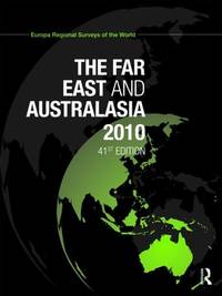
2010Atlantic-9781857435368Routledge 2010. 12. Hardcover. New. Routledge hardcover
2010Atlantic-9781857435368Routledge 2010. 12. Hardcover. New. Routledge hardcover
2009Atlantic-9781857435337Routledge 2009. 41. Hardcover. New. Routledge hardcover
2009Atlantic-9781857435337Routledge 2009. 41. Hardcover. New. Routledge hardcover
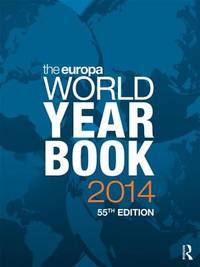
2025__1041058772Routledge 2025. Hardcover. New. 72 edition. 1300 pages. 11.00x8.25x2.44 inches. Routledge hardcover
2025__1041052871Routledge 2025. Hardcover. New. 55 edition. 1628 pages. 11.00x8.25 inches. Routledge hardcover
2025__1041058179Routledge 2025. Hardcover. New. 57 edition. 1314 pages. 11.00x8.25x2.05 inches. Routledge hardcover
18162221846<p>First edition. 4" x 2 1/4". Red straight-grain morocco gilt the upper cover with a crowned monogram of Louis XVIII wrought of gilded  metal affixed covers with gilt rolls with a fleur-de-lys motif spine with gilt vines all edges gilt. Enclosed in a slipcase of full red morocco similarly tooled the spine with two crowns and two fleurs-de-lys. Fine. 349 pages.</p><p>Illustrated with three engraved plates:</p><p>1. "Vue du Port Cette" depicting two sailing ships.</p><p>2. "Vue Interieure du Port de Brest"</p><p>3. "Vue de la Ville et du Port de Bayonne"</p><p>Printed by J. M. Eberhart rue du Foin-St. Jacques.</p><p>Book plate of the bookbinder and collector Leon Gruel.</p> Le Feuil hardcover books
2018__185743921XRoutledge 2018. Hardcover. New. 59 new edition. 5064 pages. 11.75x9.25x8.25 inches. Routledge hardcover
2014__1857437144Routledge 2014. Hardcover. New. 55 revised edition. 5168 pages. 11.75x9.50x5.75 inches. Routledge hardcover
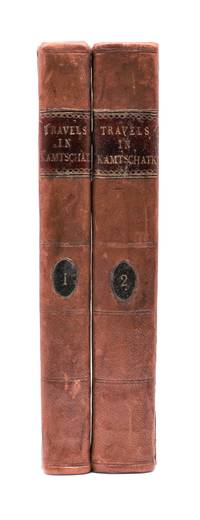
1790029884<p>London: J. Johnson 1790. Volume I: folding map xvi 283 pages; volume 2: viii 408 pages. De Lesseps accompanied La Perouse on the first part of his attempted circumnavigation of the globe. After investigation of the west coast of North America La Perouse sent de Lesseps overland to take the journals and maps of the expedition to Paris. La Perouse and his ships subsequently were lost after they left Australia and the journals carried by de Lesseps assumed great historical significance when published. Even more scarce than those records today are de Lesseps' report of his own overland travels through the Kamtschatka peninsula. The report also includes 25 pages of vocabulary translating common English words into Russian Kamtschadale Koriac Tchouktchi and Lamont languages. Internally clean with only minor foxing the two volumes in 3/4 leather over marbled paper covered boards have recently been sympathetically rebacked original title and volume patches retained. Very attractive example of a quite scarce title. Howes L269 Howes & Hartley rate this item dd "superlatively rare". First English Language Edition. Hardcover. Collectible-Very Good . 8vo - over 7¾" - 9¾" tall. Book.</p> J. Johnson hardcover
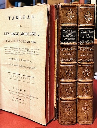
18039983Levrault frères Paris, Strasbourg An XI - 1803 3 vol. 3 vol. in-8 de 2 ff.n.ch. VIII 398 pp., 2 ff.n.ch. 410 pp. et 2 ff.n.ch. 374 pp.; demi-veau à petits coins de l'époque, dos à nerfs orné, pièces de titre, tranches rouges.
Hardcover In-folio de 10 ff. et 347 pp, plats en bois, dos cuir à 5 nerfs Dos fortement usage avec manques importants [BU-2] LIVRE RARISSIME
2017Adhya-9781857438321T&F/ROUTLEDGE 2017. Paperback. New. T&F/ROUTLEDGE paperback