Europa Publications (Edited by)Biblio.com

34 274 résultats
2012__1857436628Routledge 2012. Hardcover. New. 44 revised edition. 1584 pages. 11.18x8.58x1.77 inches. Routledge hardcover
2021x-036769476XRoutledge 2021. Hardcover. New. 18 edition. 758 pages. 11.06x8.31x1.89 inches. Routledge hardcover
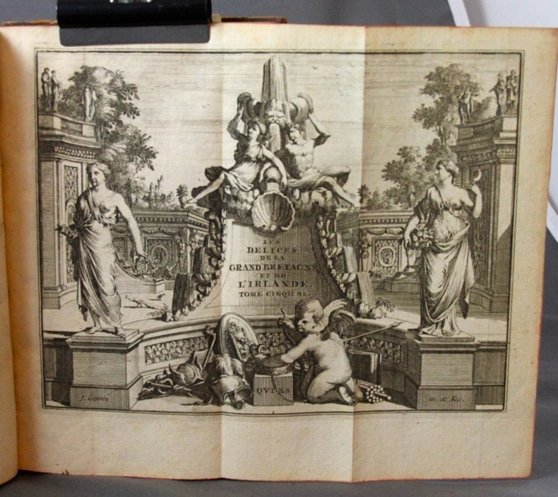
Acquaforte e bulino, priva di firma. Bellissima prova, impressa su carta vergata coeva, consueta piega centrale, piccole ossidazioni, per il resto in ottimo stato di conservazione.La mappa, appartiene agli atlanti editi dalla cosiddetta Scuola Cartografica di Colonia. Per circa mezzo secolo, Colonia fu il centro più importante nella produzione cartografica cinquecentesca, dovuta principalmente a rifugiati fiamminghi ed olandesi che fuggivano dalle persecuzioni religiose. Tra i principali esponenti della Scuola, citiamo Matthaeus Quad, Johannes Metellus, Giovanni Botero e Frans Hogenberg, che ne fu il fondatore. Gli atlanti spesso venivano pubblicati in forma anonima o con l’utilizzo di alcuni pseudonimi proprio a causa dei problemi politici e religiosi che caratterizzavano il periodo storico. Jan Matal o Metellus, francese di nascita è attivo a Louvaine ed a Colonia, dove si rifugia proprio per sfuggire alle persecuzioni dei regnanti cattolici e dove muore nel 1597. Fu tra i maggiori cartografi del tempo e, insieme al Quad e al Hogenberg stesso, il principale esponente della scuola coloniese. Giovanni Botero (1544 – Torino 1617) è stato un presbitero, scrittore e filosofo italiano, autore delle Relazioni universali, un trattato di geografia politica pubblicato per la prima volta a Roma nel 1591 senza illustrazioni cartografiche. L’opera divenne subito molto importante ed oggetto di studio in tutta Europa, dando inizio praticamente allo studio della demografia. Lambert Andreas (attivo tra il 1590 ed il 1598) fu principalmente editore, tuttavia, alcune delle mappe nelle sue pubblicazioni sono a lui stesso attribuite, sebbene in maniera dubitativa. Dal punto di vista cartografico le mappe sono una derivazione delle carte pubblicate ad Anversa da Abraham Ortelius, per la prima volta nel 1570. L’intaglio delle mappe viene attribuito a Frans Hogenberg. La carta che presentiamo è tratta dall’edizione tedesca delle opere di Giovanni Botero, denominata Theatrum oder Shawspiegel, edita nel 1596 da Lambert Andreas, che nello stesso anno pubblica anche l’edizione con testo latino. La grandissima rarità dell'opere della scuola di Colonia, insieme alla scarsità di informazioni su queste mappe “segrete”, contribuisce al fascino di questa importante carte, caposaldo di ogni collezione cartografica. Bibliografia: Meurer, Atlantes Colonienses Die Kolner Schule der Atlas Kartographie 1570-1610, pp. 74/78, BOT 2; Ginsberg, Printed Maps of Scandinavia and the Arctic, pp.150/153, 35 & 36; Suarez, Early Mapping of Southeast Asia, pp. 186/7, 104; Burden, The Mapping of North America, p. 115, 90; Shirley, Early Printed Maps of the British Isles, p. 83, 189; Borri, L’Italia nelle antiche Carte, p. 95, 106; Walter, Japan a Cartographic Vision, 20; Tibbets, Arabia in Early Maps, p. 57, 50. Etching with engraving, without signature. Beautiful impression, printed on contemporary laid paper, showing the usual center fold, small spots, otherwise in excellent condition.The map belongs to the so-called atlases published by the Cartographic School of Cologne. For nearly half a century, Cologne was the most important mapmakers center in the XVI century, mainly due to Dutch and Flemish refugees fleeing religious persecution. Among the principal members of the School, include Quad Matthaeus, Johannes Metellus, Giovanni Botero and Frans Hogenberg, who was its founder. The atlases were often published anonymously or using pseudonyms precisely because of some political and religious problems that characterized the era. Jan Matal or Metellus, French-born Louvaine and is active in Cologne, where he took refuge just to escape persecution from the Catholic monarchs and where he died in 1597. He was one of the major cartographers of the time and, together with the Quad and Hogenberg itself as the leader of the Cologne school. Giovanni Botero (1544 - Turin 1617) was a priest, Italian philosopher and writer, author of universal relations, published a treatise on political geography for the first time in Rome in 1591 without cartographic illustrations. The work quickly became very important and studied throughout Europe, beginning almost to the study of demography. Andreas Lambert (active between 1590 and 1598) was primarily a publisher, however, some of the maps in its publications are attributed to himself, albeit in doubt. From the point of view cartographic maps are a derivation of the papers published by Abraham Ortelius in Antwerp, for the first time in 1570. The carving of the maps is attributed to Frans Hogenberg.The present work is taken by the German edition of the works of Giovanni Botero, Theatrum oder Shawspiegel, published in 1596 by Andreas Lambert, that same year also publishes the edition with Latin text. The great rarity of the works of the school of Cologne, together with the paucity of information on these maps "secret", contributes to the charm of this important works, the cornerstone of any collection mapping. Meurer, Atlantes Colonienses Die Kolner Schule der Atlas Kartographie 1570-1610, pp. 74/78, BOT 2.
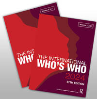
2024__1032621168Routledge 2024. Hardcover. New. 88 pck edition. 2492 pages. 11.00x8.25x4.41 inches. Routledge hardcover
2021__0367694727Routledge 2021. Hardcover. New. 51 edition. 1584 pages. 11.06x8.31x2.60 inches. Routledge hardcover
2021__0367699036Routledge 2021. Hardcover. New. 53 edition. 1290 pages. 11.06x8.31 inches. Routledge hardcover
2021__0367699362Routledge 2021. Hardcover. New. 24 edition. 882 pages. 11.06x8.31x1.18 inches. Routledge hardcover
2021__0367694743Routledge 2021. Hardcover. New. 22 edition. 828 pages. 11.06x8.31x2.01 inches. Routledge hardcover
2021__0367699257Routledge 2021. Hardcover. New. 19 edition. 720 pages. 11.06x8.31x1.89 inches. Routledge hardcover
2021__0367699338Routledge 2021. Hardcover. New. 24 edition. 642 pages. 11.00x8.25x1.50 inches. Routledge hardcover
2021__0367696029Routledge 2021. Hardcover. New. 22 edition. 760 pages. 11.50x8.50x1.75 inches. Routledge hardcover
17272311A Leide, Chez Pierre Vander, 1727. 7 vol. (sur 8) in-8 de 1506-[2] (Pagination continue : [17 ff.], [278] + [299] + [164] + [128] + [198] + [177] + [131] pp.), plein veau havane moucheté, dos à nerfs ornés de fleurons dorés, étiquettes de titre bordeaux, tranches rouges. Dos et coins frottés, coiffes sup. des vol. 1, 4, 5 et 8 manquantes, coiffes inf. du vol. 8 manquante, accroc à la coiffe sup. vol. 6 et à la coiffe inf. vol. 4, mors 1er plat légèrement fendu aux vol. 1, 2, 4 et 5 (env. 1 cm.), quelques rousseurs sur les cartes et pl.
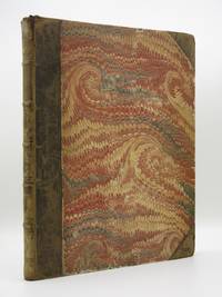
18101203E028London: T. Payne 1810. 1st Edition . Hardback. Printed pages: Large 4to. Half Title Engraved Title xvii 1 blank 1 List of plates 1 blank pp19-171 1 blank 5 Index 1 Errata. Very Good. 9.5 x 12 inches 24 x 31 cm. Half leather binding with marbled boards. Leather perished but binding is firm and strong. Rubbing and chipping to boards. Spine has five raised bands and blind tooling lacking the title label. Scattered light foxing offsetting from some of the plates to facing page. Complete with all 28 plates including the engraved title page and five fold-outs. A well illustrated early guide to the antiquities of the Argolis region on the Peloponnese peninsula. A nice solid example. Scarce. Overall condition is Very Good. Size: 9.5 x 12 inches 24 x 31 cm. T. Payne hardcover
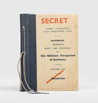
1944152575Perhaps Versailles: Supreme Headquarters Allied Expeditionary Force December 1944. The Allies prepare to take over Germany First edition initially classified "restricted" but subsequently stamped as "secret" on the front cover. Chapter VI concerns the control disarmament and disbandment of "para-military and police organizations" including the SS and other forces of the Nazi Party. It outlines Allied plans to ban the wearing of Nazi insignia detain implicated personnel and co-opt commanders of military districts Wehrkreis to take over the administration of liberated concentration camps and preserve vital evidence. Other chapters address the disarmament of Wehrmacht forces the seizure of communications infrastructure and relations with civilians as well as intelligence work the broader preservation of German state and army documents and the repatriation of Allied POWs. The two maps record the proposed division of Berlin into three international zones and the boundaries of the Wehrkreis. Chapter XIII correctly anticipates that the Nazi leadership will fight on even amid a hopeless situation and stresses the importance of capitalizing on any brief window between the final collapse of Hitler's regime and the emergence of an organized resistance to occupation. Distribution was ultimately intended to be as follows: "Army down to lieutenant-colonel's commands; Navy down to Commanders in Command on shore and all Commanding Officers of Men of War under the orders of the Supreme Commander; Air Forces down to Unit Commanders of the occupying Air Forces and of the air disarmament organization" p. 1. A revised edition appeared in April 1945. Octavo. With 2 folding colour maps at rear. Original black half cloth boards tied through punch holes with black cord as issued front cover lettered in black and red. Light wear and bumping brown mark at head of title page a little creasing to second map: very good. hardcover
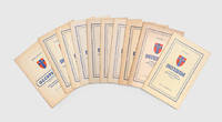
1945162758Europe: Printing and Stationery Services 21 Army Group later British Army of the Rhine 1945-46. An informative classified military publication First and only editions classified "secret" up to Issue 12 of Interim and "confidential" thereafter. The scope encompasses conditions in Germany and broader current affairs discussion of military strategy and tactics in the war and findings from the interrogation of German prisoners or seized enemy documents. The volumes of Interim include numbers 5 13 August 1945 6 27 August 1945 8 24 September 1945 10 22 October 1945 11 5 November 1945 12 19 November 1945 14 17 December 1945 17 5 February 1946 and 19 4 March 1946. The earliest two were issued in the name of Montgomery's 21st Army Group before its reorganization as the British Army of the Rhine in August 1945. The issue of Occupation is dated 1 May 1946. The Australian War Memorial Library appears to have a complete run of both titles in total 23 issues published between June 1945 and July 1945. One or more issues are also held by the German Army's Militärgeschichtliches Forschungsamt at Potsdam the Konrad-Adenauer-Stiftung and Edinburgh University Library. 10 issues octavo. With 13 maps 11 folding. Original buff card wrappers wire-stitched as issued front covers lettered in blue and with army group badge in red and blue. A little toned and creased more so to one issue: a very good collection. unknown
170219249paris BENAVEN 1702 -in-4 plein-veau 2 volumes, reliure d'époque plein veau havane raçiné (binding full calfskin) in-folio (26 x 38,2 cm), dos à nerfs (spine with raised bands) décoré or (gilt decoration) filets or (gilt line) et filets à froid (blind-stamping line decoration) entre-nerfs à compartiments à fleurons dans un encadrement à double filet or avec rinceaux aux angles , filet à froid de part et d'autre des nerfs, titre frappé or (gilt title), pièce de titre et pièce de tomaison sur fond marron clair (label of title and volume numbering) avec filet or (label of title with gilt line) deux coiffes restaurées (restauration ancienne faite trés proprement), plats muets, toutes tranches lisses rouges (all edges reds), Ex-libris : "DOCTORIO TINEL ROTOMAGENSIS" (Dr TINEL célèbre collectionneur de ROUEN) imprimé en noir sur une étiquette de papier blanc, texte seulement au premier volume avec de trés nombreux tableaux in et hors-texte dont certains "double page" et ou dépliants, planches au second, orné de deux titres-frontispice différent par Meunier, gravé sur bois en noir par Zaverio +173 feuillets de planches de Monnaies imprimés d'un seul côté (153 planches de monnaies + pages de classification seulement imprimée) + 14 pages de Tables (de la page 175 à 188), 1787 Lyon sans Editeur,
2016__1857438191Routledge 2016. Hardcover. New. 57 edition. 5080 pages. 13.78x11.02x9.84 inches. Routledge hardcover
2006__1857433629Europa Pubns 2006. Hardcover. New. 47 edition. 4928 pages. 13.25x10.75x6.00 inches. Europa Pubns hardcover
196858918Council of Europe; Musee Du Louvre. As New. 1968. Paperback. FREE UPGRADE to Courier/Priority Shipping Upon Request IN STOCK AND IMMEDIATELY AVAILABLE FOR SHIPMENT - AS NEW THE TEXT BLOCK IS PRISTINE CLEAN UNMARKED AND IN EXCELLENT CONDITION - - Text in French. 576 pp. With 158 ills. 22 x 15 cm. -- with a bonus offer-- . Council of Europe; Musee Du Louvre paperback
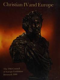
198867048Foundation for Christian IV Year 1988. New. 1988. Paperback. 8798284320 . FREE UPGRADE to Courier/Priority Shipping Upon Request IN STOCK AND IMMEDIATELY AVAILABLE FOR SHIPMENT - Flawless copy brand new pristine never opened -- 608 pp. With 438 ills. 72 col. . 27 x 21 cm. -- with a bonus offer-- . Foundation for Christian IV Year 1988 paperback
2023__1032412941Routledge 2023. Hardcover. New. 87 pck edition. 2514 pages. 11.00x8.25x2.13 inches. Routledge hardcover
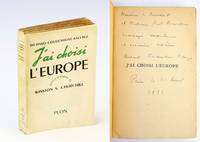
1952345j2020Paris: Librairie Plon. Good. 1952. First French Edition. Paperback. Signed and inscribed by Coudenhove-Kalergi to French statesman Paul Ramadier and his wife upon half-title page. Ramadier 1888-1961 took part in the Resistance in WWII and became the first Prime Minister January-November 1947 of the Fourth Republic of France. Presents the memoirs of Count Richard Coundenhove-Kalergi whose entire life appears as a relentless effort to realize the dream of the 'United States of Europe'. Le Monde archives In recent years Coudenhove-Kalergi has risen to prominence as a result of his 1925 prediction that the man of the future would be of mixed race. Thus has arisen speculation of a 'Kalergi Plan' a.k.a. 'The Coudenhove-Kalergi Conspiracy' a plan to destroy the European peoples. Text in French. Translated from the 1949 German first edition. 356 p. Frontis portrait of author. Unmarked with average wear and moderate tanning to contents. Binding intact. A sound and special signed example. ; 12mo; Signed by Author . Librairie Plon paperback
1860000944Paris: Librarie de L. Hachette et Cie. n. d. ca. 1860. Half leather. Very Good. 12mo 4.5 x 7 l roman numeral 50 458 plus four index pages and one very large fold-out map. Librarie de L. Hachette et Cie. hardcover
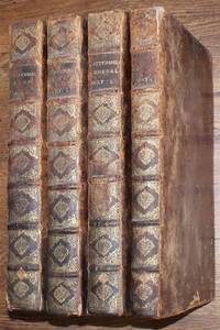
168104418071046Iean Jean Girin & Barthelemy Riviere Lyons 1681. Second Edition. Hardcover. Very Good Condition/No Dust Jacket. Deux Tomes complete bound as 4 volumes in matching full-leather bindings with banded gilt-decorated spines. Volume I first part of Tome I has half-title frontis title in black and red dedication to the King elaborate header and capital. Each new letter has a simple decorated header and a decorated capital. Volume III first part of Tome 2 has red and black title-page. Leather is well rubbed with some wear at spine-ends leather over joints has split at the ends binding is sound. All four volumes have a bookplate for "Ampleforth Abbey" on inside of front cover together with a small library label at the lower edge small plain glued labels fixed to upper edge of rear end-papers. Text block edges are speckled red and brown upper block edges are darkened lower block edges have a 5-digit reference number written on them. Rear end-paper of Volume I is damaged. Weight of books is approx. 14kg. Full Title: Le Grande Dictionaire Historique ou Le Me'Lange Curieux de L'Histoire Sacre'e et Profane Qui Contient en Abbrege: Les Vies de Patriaches Des Iuges et Des Rois de l'Ancien Testament ; de Souverains Pontifes de l'Eglise; des saints Peres & Docteurs Orthodoxes des Eveques des quatre Eglises Patriarchales des Cardinaux des Prelats celebres; & des Heresiarques: Celles Des Empereurs de Rome de Grece D'Alemagne Chretiens Payens et Ottomans: des Rois des Princes Illustre et des grands Capitaines; des Auteurs Grecs et latin anciens et modernes; des Philosphes des Inventeurs des Arts et des autres Personnes de toute Sorte de Profession renommees par leur Erudition par leurs Ouvrages ou par quelque actions eclatante. Il Fait Aussi Remarquer Les Plus Importans Traites des Auteurs; les Opinions particuleres des Philosophes; & les principaux Dogmes des Heresiarques etc. Seconde Edition Divise'e en Deux Tomes. Size: Folio. Tome 1: 10 712 713 to 1359Tome II: 8 708 709 to 1263. 4-volume set complete. Text is in French. No dust jacket as published. Quantity Available: 1. Shipped Weight: over 4 kg. Pictures of this item not already displayed here available upon request. Inventory No: 04418071046. All our books music and maps are sent by a tracked mail service. These books are much heavier than 1kg and may incur significant additional delivery charges to some delivery services to some locations. Iean (Jean) Girin, & Barthelemy Riviere hardcover
Four manuscript court documents pertaining to an American merchant ship captured in 1801 by a Spanish Privateer while on a voyage to Barcelona and Malaga with valuable cargo, the subsequent recapture by the American crew, and claim for compensation from the salvage of her cargo. Three folio, one octavo, all single-leafs. Two documents are split at folds, one of which has very minor loss to text, otherwise the lot in very good condition, clean and legible, a most interesting record of the event and proceedings in the Admiralty Court. The American Brig Eliza, formerly Schooner Maria, whose homeport was Charleston and master was Captain Joseph Michael, was destined for Barcelona and Malaga in June 1801, with a cargo belonging to an American merchant named John Seamy. Near Tarifa, in Cádiz Province, on 10 July she was seized by Spanish privateers and ordered to the Port of Algeciras. While at anchor there, Captain Michael, with the help of his crew, in particular a Benjamin Hubble, managed to re-take the ship from the Spanish. They immediately proceeded across the Bay to Gibraltar with the intention of selling the ship and cargo for personal gain. Refusal to acquiesce to the Spanish privateers would have resulted in extreme retribution for the American captain and crew if they had not succeeded in their escape, as mentioned in the documents as a reason to disallow the captain of any monetary gains for the recovered vessel. There was also intense fighting around Gibraltar, involving the French, Spanish, and British, therefore the Spanish were well-positioned and well-armed. It was the Battle of Algeciras Bay taking place, having begun only 4 days earlier on 6 July 1801. (It would end on the 12th). Adding to the eminent danger for the Americans, when the United States had declared independence, British diplomats were quick to inform the Barbary States that U.S. ships were open to attack. In May 1801, some 6 weeks before the incident described in the present documents, the First Barbary War had begun, a war between the alliance of the United States and several European countries, against the Northwest African Muslim states known collectively as the Barbary States. Prior to independence, American colonists had enjoyed the protection of the British Navy. The British no longer offered protection. The Mediterranean Sea was now a precarious place for Americans to sail. On 4 December 1801, four members of the crew, Benjamin Huddle, Robert Sherington, Thomas William, William Sesten, engaged a proctor to recover the ship and her cargo. His compensation would be half of the value of the salvage. Following the recovery voyage, accusations flowed freely and, a few months later, in December 1801, a trial in the Admiralty Court ensued. The proctor presented his case for the claimants. The result of the trial is not identified herein, but can be assumed in favour of the claimants, based on the final document, which is a "release of all claims" by the ship's new captain, Nathan Ells, who was a mate under Captain Michael, employed on the ship during the event in question.