BELLEFOREST Francois de (1530 - 1583)MareMagnum

34 272 résultats
Carta tratta dalla celebre Cosmographie Universelle de tout le Monde, traduzione francese della Cosmographia di Sebastian Muenster. La carta deriva da quella contenuta nella prima edizione del Theatrum Orbis Terrarum di Ortelius, 1570. A differenza del Muenster, questa opera è pubblicata in una sola edizione, e risulta pertanto molto rara. Le carte incluse sono differenti, e derivano da Ortelius, Braun & Hogenberg oltre che dal Muenster. Alcuni legni sono invece ripresi utilizzando le matrici pubblicate per la prima volta nel 1552 nella Cosmografia di Lione da Guèroult & Balthazar Arnoullet (1517-1556), nel Premier livre des figure set pourtraitz des villes plus illustre set renommées d’Europe.Silografia, in buone condizioni. Rara. In 1575 Sebastian Münster's Cosmographia was translated into French and published in Paris by François de Belle-Forest. The Europe map being a folding woodcut copy of Ortelius' 1570 plate. With an additional title in French.Woodcut, cut in the right side, in good condition.
1657LBW-3186[Amsterdam, 1657]. 306 x 438 mm.
1588LBW-3308[Cologne, 1588]. 324 x 500 mm.
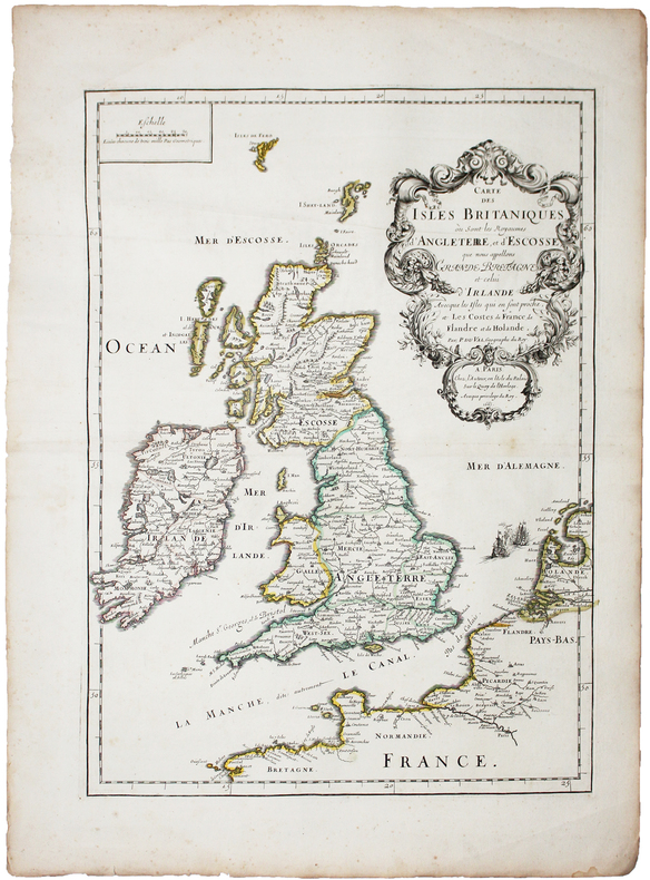
1753rx1272Paris, Merigot, quai des Augustins, à la descente du Pont S. Michel, près de la rue Gille-Coeur, Paris, Grange, au Palais, Paris, Hochereau, l'aîné, quai de Conti, vis-à-vis la Descente du Pont-Neuf, au Phénix, Paris, Robustel, quai des Augustins, près la rue Pavée, Paris, Le Loup, quai des Augustins Relié 1753 "Huit volumes in-4 (20,5 x 26,5 cm), reliure plein veau, dos à 5 nerfs ornés de caissons doré, pièce de titre et de tomaison, triple filet d'encadrement sur les plats, liseré doré sur les coupes, tranches jaspées, ""Introduction à l'histoire moderne, générale et politique de l'univers"" commencée par le Baron de Pufendorff, augmentée par M. Bruzen de la Martinière, et revue et considérablement augmentée par M. de Grace, série complète ornée de 26 cartes et 2 tableaux dépliants ; TOME I (xxij-194+464 pp.) : frontispice / tableau général des principaux états de l'Europe / l'Asie divisée en ses grandes régions / l'empire d'Alexandre le Grand / l'Espagne / Mappa galliarum / carte de France ; TOME II (56+558 pp.) : Duchés de Lorraine et de Bar / 2 cartes de l'Italie ; TOME III (434+168 pp.) : Carte des Iles Britanniques / carte de l'Angleterre / carte du Royaume du Danemark, de Norvège et de Suède / carte de la partie de l'Ile d'Albion remise aux Romains ; TOME IV (488+57 pages) : Carte du Royaume du Danemark, de Norvège et de Suède (identique au tome 3) / carte de la Russie en Europe / carte des Etats de la Pologne / carte du Royaume de Bohème / carte du Royaume de Hingrie / carte des 13 cantons suisses ; TOME V (vij-380+382 pp.) : Germanie ancienne / l'Empire d'Allemagne / tableau général de la diete de l'Empire / carte des Pays-Bas / tableau général des principaux états de l'Europe 2e partie ; Tome VI (669 pp.) : La Judée, nommée à présent Palestine et Terre Sainte / carte de l'ancienne Grèce ; TOME VII (736 pp.) : L'Asie / l'empire d'Alexandre le Grand ; TOME VIII (612 pp.) : L'Afrique divisée en ses grandes régions / Amérique méridionale / Amérique septentrionale ; quelques frottements et épidermures un peu blanchies aux plats, quelques incidents courants pour ce type de reliure aux mors, coiffes et coupes, par ailleurs bel exeamplaire., Livraison a domicile (La Poste) ou en Mondial Relay sur simple demande."
LBW-4771Lorient, 6 floréal an 12 [26 avril 1804]. 3 pp. in-4 (24,4 x 19,4 cm), adresse et marques postales.
Acquaforte e bulino, prima del 1573. Esemplare pubblicato nella prima edizione del 1578. Magnifica prova, con bellissima coloritura coeva, con margini, in perfetto stato di conservazione. Al verso, testo latino e numero di pagina in carattere romano, XX. Gerard de Jode, era cartografo, incisore, tipografo ed editore nella città di Anversa, attivo all’incirca nello stesso periodo di Ortelius. Nel 1547 ottenne il privilegio per l’attività editoriale, tuttavia non fu mai in grado di rappresentare un’effettiva minaccia per il suo rivale in affari. Per ironia della sorte, pubblicò il famoso Mappamondo del rivale, in otto fogli, nel 1564. Il suo atlante più importante, lo Speculum Orbis Terrarum, oggi estremamente raro, non poté essere pubblicato fino al 1578, ovvero otto anni dopo il Theatrum Orbis Terraum di Ortelius, che aveva ottenuto il monopolio per l’editoria cartografica ad Anversa. Le carte del De Jode furono finemente tradotte su rame nel tipico stile fiammingo dai fratelli Joannes e Lucas van Doetecum, i migliori intagliatori di mappe del tempo. Alla morte di Gerard, il figlio Cornelis pubblicò, nel 1593, una ristampa accresciuta dell’atlante. Etching with engraving, before 1573. Exemple of the first edition published in 1578. Magnificent impression, with great contemporary coloring, with margins, in perfect condition. Latin text and page number in roman font, XX. Gerard de Jode, was a cartographer, engraver, printer and publisher in Antwerp, active around the same period of Ortelius. In 1547 he obtained the privilege for the publishing business, but was never able to represent a real threat to his business rival. Ironically, he published a major rival of the Globe, in eight sheets, in 1564. His most important atlas, Speculum Orbis Terrarum, now extremely rare, could not be released until 1578, ie eight years after the Theatrum Orbis Terraum of Ortelius, who had obtained a monopoly for the Cartographic Publishing Antwerp. The maps of De Jode were finely translated copper in typical Flemish brothers Joannes and Lucas van Doetecum, the best engravers of maps of the time. On the death of Gerard, the son Cornelis published in 1593, a reprint of the atlas increased .
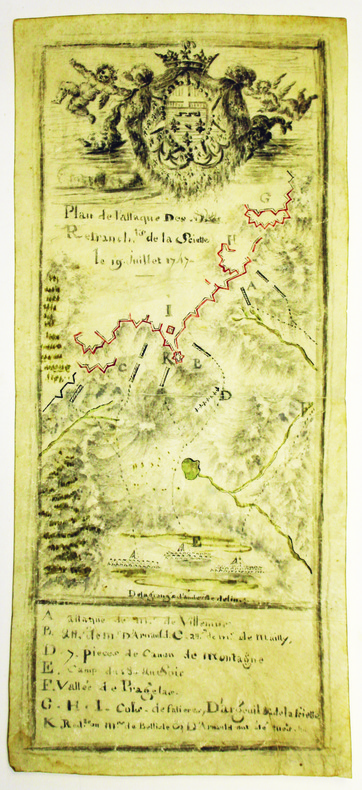
1747LBW-42191747. 220 x 98 mm, sur parchemin.
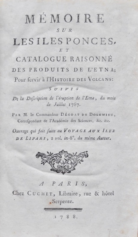
178815637Paris, Cuchet, 1788. In-8 de (2)-VI-525 (3) pp., 1 tableau et 4 plans repliés, table, basane fauve, dos orné à nerfs, pièce de titre en maroquin fauve (reliure de l'époque).
Carta tratta dal rarissimo "Plantz, pourtraitz et descriptions de plusieurs villes et forteresses, tant de l'Europe, Asie, & Afrique, que des Indes, & terres neuves: Leurs fondations, antiquitez, & manieres de vivre: Avec plusieurs cartes generales & particulieres, servans à la Cosmographie, iointes à leurs declarations: deux tables fort amples, l'une des chapitres, & l'autre des matieres contenues en ce present livre. Le tout mis par ordre, region par region, par Antoine du Pinets" stampato a Lione dall’editore Jean d’Ogerolles. L'opera, che contiene 55 tavole silografiche - molte dele quali derivanti da Muenster - include il mondo cordiforme sul modello di Appiano, le mappe di europa e Germania e 18 vedute a doppia pagina delle primcipali città del tempo.Orientata con il nord in basso, la carta deriva da quella pubblicata a Basilea da Sebastian Munster. Xilografia, in perfetto stato di conservazione. Rarissima. Map taken from the very rare "Plantz, pourtraitz et descriptions de plusieurs villes et forteresses, tant de l'Europe, Asie, & Afrique, que des Indes, & terres neuves: Leurs fondations, antiquitez, & manieres de vivre: Avec plusieurs cartes generales & particulieres, servans à la Cosmographie, iointes à leurs declarations: deux tables fort amples, l'une des chapitres, & l'autre des matieres contenues en ce present livre. Le tout mis par ordre, region par region, par Antoine du Pinets" printed in Lyon by Jean d’Ogerolles. The work include 55 woodcuts, many after Munster, comprising 3 double-page maps (cordiform world after Apianus, Europe and Germany), 7 half-page maps, 18 double-page views (including Lyon, Bordeaux, Geneva, Frankfurt, Florence, Venice, Rome, Constantinople, Jerusalem, Cusco and others), and 27 illustrations (including Mexico city).Woodcut, very good condition. Rare.
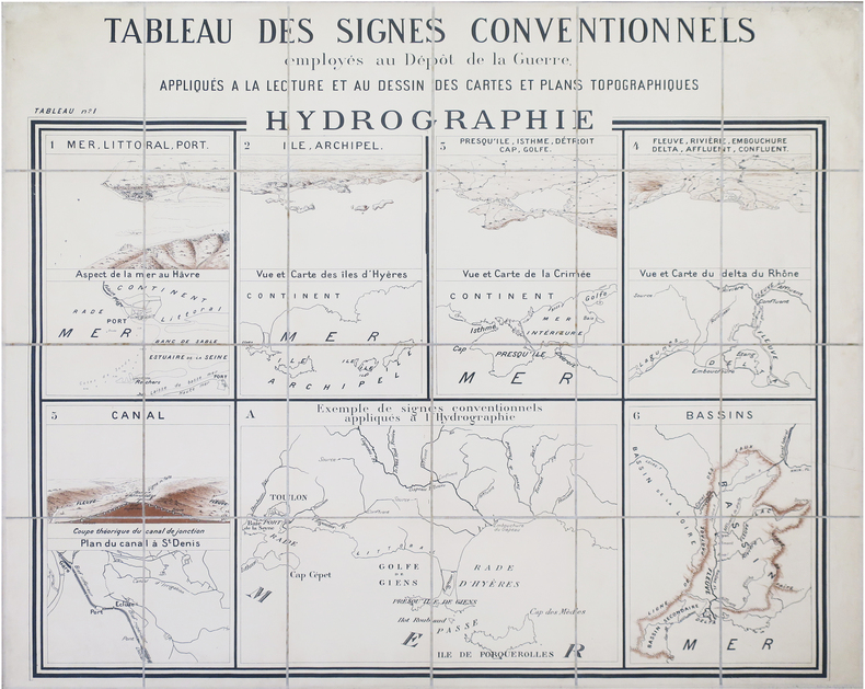
1880LBW-8467Dépôt de la Guerre, [circa 1880]. En 24 sections montées sur toile et repliées, formant une carte de 0,94 x 1,13 m.
186741Pise, Giacomo Grazzoli, 1784 2 tomes en un vol. in-4, VIII-233-[3]-399 pp., maroquin cerise, dos à nerfs, double filet doré sur les coupes, tranches dorées sur marbrure, large dentelle intérieure (Pagnant).
Bell'esempio della versione realizzata da G. B. Flinckh, della celeberrima mappa di Baviera di Apian, del 1563. La mappa della Baviera di Apian è considerata un monumento pionieristico della cartografia moderna. Nel 1554, il duca Alberto di Baviera commissiona a Philip Apian (figlio del famoso matematico e cosmografo Pietro Apian) la realizzazione di una mappa geografica di Baviera per la Bairische Chronik di Johannes Aventinus scritta tra il 1526 e il 1533 Per i successivi 7 anni, Apian viaggiò attraverso l’Alta e Bassa Baviera, effettuando un rilievo del paesaggio basato sui metodi della trigonometria e triangolazione, creando così la prima mappa di un intero Paese con questo sistema. Trascorse poi i due anni successivi per realizzare il suo capolavoro, pubblicato nel 1563: una mappa di dimensioni 5 x 5 metri. in scala 1: 45.000, che è stato poi colorato da Bartel Refinger. Philip Apian (1531-1589) è stato successore di suo padre Pietro alla cattedra di matematica presso l'Università di Ingolstadt e il primo cartografo a produrre una mappa dell’intera Baviera. Una versione più piccola del territorio dell’intera Baviera, basata sulla carta Apian 1563, fu redatta nel 1568 Le mappe successive di Baviera erano di solito versioni diverse dell’opera di Apian, modificate nelle iscrizioni e/o negli elementi decorativi, di volta in volta aggiornati. La mappa era così precisa che non sono stati effettuati ulteriori rilievi del territorio fino agli inizi del XIX secolo. Inoltre, l’autore riporta anche anche il luogo dove suo fratello morì, dopo essere caduto da cavallo, indicato da una croce vicino alla città di Ainhaus. La mappa mostra una grande vignetta con un ritratto di Massimiliano I "Il Grande", l'Elettore di Baviera (regnò, 1597-1651), considerato uno dei migliori sovrani del Paese. Lo stemma di Baviera, affiancato da leoni, occupa l'angolo in alto a destra della mappa, sopra la veduta di Monaco, mentre la parte inferiore della mappa è decorata da putti con un strumenti di rilevamento. Fine example of G.P. Finckh's version of Philip Apian's 1568 map, the first printed map of Bavaria, Engraved by Ainling.Apian's map of Bavaria is considered to be a pioneering monument of modern cartography. In 1554, Duke Albrecht of Bavaria ordered Philip Apian (son of the famous mathematician and cosmographer Peter Apian) to create a map of Bavaria for the Bairische Chronik of Johannes Aventinus written 1526 to 1533. For the next 7 years, Apian travelled through Oberbayern and Niederbayern, Oberpfalz, Archbishopric Salzburg and Bishopric Eichstätt, conducting survey of the landscape based on methods of trigonometry and triangulation, creating the first map of an entire country by this method. He then spent the next two years creating his masterwork, a 5 x 5 meter sized map in scale 1:45.000, which was later colored by Bartel Refinger.Philip Apian (1531-1589) was successor to his father Peter as the professor of mathematics at Ingolstadt University and the first cartographer to produce a complete map of Bavaria.The map remained in the same Library, until it was destroyed by a fire in 1782.A smaller Bairische Landtafeln, based on the 1563 Apian map, was prepared in 1568. The map was so precise that Bavaria did not conduct any other large scale land survey until the early 19th century. Later maps of Bavaria were usually merely updated versions of Apian's map with more elaborate writing or decorative frames. The map is so detailed that even the spot where his brother died, after falling from his horse, is recorded. It is marked by a cross near the town of Ainhaus.The map features a large vignette with a portrait of Maximilian I "The Great", the Elector of Bavaria (reigned, 1597-1651), widely considred to be the country's finest ruler. The arms of Bavaira, which are flanked by lions, occupy the upper-right corner of the map, above a view of Munich, while a view near the bottom of the map shows putti with an assortment of surveying equipment. An attractive holdover from Renaissance era cartorgraphy are the windheads which surround the map.Dissected and laid on linen, as issued.
Carta geografica tratta dal celebre Fortsetzung der Algemeinen Welthistorie grande opera storica edita ad Halle dal 1750 al 1780 circa, contenente le copie delle più famose carte edite nel periodo. La carta della Corsica deriva da quella di Thomas Phinn pubblicata nel 1768. Incisione in rame, leggere gore d'acgqua, per ill resto in ottimo stato di conservazione. Rara. Map taken from the famous Fortsetzung der Algemeinen Welthistorie, a superior history masterpiece published in Halle between 1750 and 1780, containing the copies of the most famous mpas published at the time. The map of Cosrsica derives from Thomas Phinn’s, published in 1768. Copper engraving, in excellent condition. Rare.
183590694Auguste SEMEN | Moscou 1835 | 14 x 22.2 cm | 2 volumes brochés
Acquaforte, stampata su carta vergata coeva, con margini, consuete pieghe di carta per il resto in ottimo stato di conservazione.Tavola tratta da: D. Paulus Apostolus in mari quod nunc venetus Sámus dicitur maufragus et Melitae Dalmatensis insulae post naufragium hospes sive de genuino significatu duorum locorum in Actibus Apostolicis 27 27 Navigantibus nobis in Adria et 28 M Tunc cognovimus quod Medita insula vocabatur inspectiones anticriticae auctore D Ignatio Georgi Benedictino e Congregatione Melitensi Ragusina Adjicitur brevis dissertatio ejusdem auctoris de Catellis Melitaeis Venetiis apud Christophorum Zane 1730.Carta del Mediterraneo, racchiuso in una splendida cornice formata da una rosa dei venti, decorata da putti che soffiano contrassegnti dal nome del vento. Si tratta di una tavola storica, legata all'illustrazione del viaggio in mare di San Paolo, ricostruite dal ragusano Ignazio Giorgi, meglio conosciuto con il nome croato di Đurđević. Rara.Bibliografia: G. Valentinelli, Specimen Bibliographicum De Dalmatia Et Agro Labeatium Auctore Josepho Valentinelli Pro Praefecto Bibi Iothecae S Marcivenetiaru M Venetiis Typis Caecinianisetso CM DCCC XILII, pp. 75-76, n. 225; Heinz Warnecke - Die tatsächliche Romfahrt des Apostels Paulus. Stoccarda, 1989; Ignjat Ðurdevic: Sveti Pavao apostol brodolomac, Zagabria, 2008. Etching, printed on contemporary laid paper, with margins, usual folds of paper for the rest in excellent condition.Taken from: D. Paulus Apostolus in mari quod nunc venetus Sámus dicitur maufragus et Melitae Dalmatensis insulae post naufragium hospes sive de genuino significatu duorum locorum in Actibus Apostolicis 27 27 Navigantibus nobis in Adria et 28 M Tunc cognovimus quod Medita insula vocabatur inspectiones anticriticae auctore D Ignatio Georgi Benedictino e Congregatione Melitensi Ragusina Adjicitur brevis dissertatio ejusdem auctoris de Catellis Melitaeis Venetiis apud Christophorum Zane 1730.Map of the Mediterranean, enclosed in a splendid frame formed by a wind rose, decorated with putti (marked by the name of the wind) that blow. It is a historical plate, linked to the illustration of St. Paul's voyage, reconstructed by Ignazio Giorgi from Ragusa, better known by the Croatian name of Đurđević.Rare.
1799LBW-5390Paris, Bance, le jeune An 7 [1799]. 515 x 612 mm.
Guillaume Guéroult (1507-1569) dirigeva a Lione la stamperia del cognato Balthazar Arnoullet (1517-1556), presso il quale stampò nel 1552 il "Premier livre des figure set pourtraitz des villes plus illustre set renommées d’Europe", contenente 9 immagini urbane, perlopiù copiate dalla "Cosmographia" di Sebastian Muenster. Questo esemplare proviene dall’opera che il Guéroult e Arnouellet pubblicarono l’anno seguente, nel 1553, con il titolo di "Epitome de la Corographie d’Europe, illustré de pourtraitz des villes plus renomées d’icelle". Le vedute urbane furono incrementate a 21 e aggiunte alcune carte geografiche. Le matrici furono ristampate poi da Bonhomme (1557), Dupinet (1564) e Belleforest (1575). Xilografia, in buono stato di conservazione. Rarissima. Taken from the very rare "Epitome De la Corographie d'Europe, illustre des pourtraitz des Villes plus renommees d'icelle" published by Arnoullet in 1553. The plate are copied form the Munster's Cosmographia and was reprinted by Dupinet (1564) and Belleforest (1575). Woodcut, good condition. Very rare.
1896LBW-8231Paris, Le Petit Journal, [1896. 0,91 x 1,06 m.
Ampia incisione (54 x 38 cm.) satirica, che presenta allegoricamente gli sviluppi della guerra per la successione Palatina e la guerra con la Turchia: i regnanti europei sono rappresentati come pazienti (ipocondriaci) curati da un dottore tedesco. Ogni personaggio, nell’illustrazione, è numerato, e il rimando numerico trova riferimento nel testo in basso: il dottore (1) tiene in mano un campione di urine e un libro e nella cintura ci sono biglietti di carta con scritti i nomi di località tedesche: gli altri sono Luigi XIV (2), Guglielmo III (3), Egon Von Fürstenberg (4), Maria di Modena (8). Testo in olandese, in due colonne. A wide satirical etching, showing an allegory about the consequences of Palatine succession. The European monarchs are represented as patients (hypocondriac) cared by a German doctor. Between the figures you can distinguish Louis XIV, Egon Von Fürstenberg, Whilem the III. Dutch text on two columns. British Museum 1855,0114.198
Nouvelle Carte Marine de tous les Ports de l’Europe sur l’Océan et la Méditerranée. Gravée et présentée à Monseigneur Phelypeaux, Conseiller du Roy en tous ses conseils, Secrétaire d’Estat, et des Commandemens de sa Maiesté, avant le Département de la Marine. Acquaforte, dimensioni 520x765 mm, firmata in lastra nel cartiglio per il titolo Par son tres humble et tres obeissant Serviteur Berey. In basso a sinistra, la firma dell’incisore, Gravée par Berey, e sotto l’imprint editoriale, A Paris Chés le S.r Jaillot Géographe ordinaire du Roy sur le Quay et a coté des grands Augustins.Bellissimo esemplare, con coloritura coeva dei contorni, nel primo stato di tre.Carta tratta da: Atlas François, contenant les cartes géographiques dans lesquelles sont très exactement remarquez les Empires, Monarchies, Royaumes et Estats de l’europe, de l’Asie, de l’Afrique et de l’Amerique […] à Hubert Jaillot, geographe ordinaire de sa Majesté.Carta nautica dell’Europa, incisa da Claude Auguste Berey, la cui firma appare sia nel cartiglio che nell’angolo in basso a sinistra. L’opera è dedicata a Jérôme Phélypeaux de Pontchartrain (1674 - 1747), segretario di Stato del Re e segretario di Stato della Marina dal 6 settembre 1699 al 1 di ottobre 1715. Alla morte di Nicolas II, a capo della tipografia Berey si insediò Alexis Hubert Jaillot. Questo abile uomo d’affari nacque verso il 1632 ad Avignon-lès-Saint-Claude. Dall’infanzia Jaillot aveva mostrato un buon talento per l’arte e il disegno e da suo fratello Pierre-Simón aveva imparato la scultura. Durante il conflitto franco-spagnolo la loro città natale fu devastata, e così i due fratelli si trasferirono a Parigi nel 1657. Lì acquisirono presto una certa reputazione e il titolo di “Sculpteur du Roy”. Nel 1665, Jaillot si sposò con Jeanne Berey, figlia di Nicolas I Berey. La fortuna di Jaillot fu di entrare nel mercato cartografico in un momento particolarmente favorevole. All’inizio del 1668, sotto Luigi XIV, per la Francia iniziò un periodo particolarmente fecondo, come conseguenza della costante espansione territoriale c’era una grande richiesta di mappe che rappresentassero le conquiste francesi e le nuove frontiere. In seguito, Jaillot si associò con i figli di Nicolas Sanson, e fu in grado di commercializzare nuove carte con il prestigioso nome Sanson. Il suo atlante del 1681, l’Atlas Nouveau, divenne un tale successo commerciale che fu copiato illegalmente da altri editori. Jaillot non può essere annoverato tra i cartografi dell’epoca come i Sanson e Duval, fu però un abile incisore che seppe intelligentemente sfruttare le risorse che aveva ereditato, facendone opere mirabili. La sua fama crebbe al punto che il 20 luglio 1686 fu nominato “Géographe du Roy” e gli fu assegnata una cospicua pensione annuale; il titolo gli consentì di difendersi dai numerosi contraffattori. Una delle sue opere più belle fu Le Neptune François, o Atlas Nouveau des Cartes Marine. Dall’inizio del diciottesimo secolo la sua produzione di carte diminuì: erano richieste mappe sempre più aggiornate che non era in grado di offrire. D’altronde, i concorrenti più giovani erano geografi del calibro di Guillaume Delisle. Jaillot (m. 1712) cedette, quindi, l’azienda a suo figlio Bernard Jean-Hyacinthe.Claude Auguste Berey (1651 - 1732) era un maestro scrittore calligrafo, incisore e commerciante di stampe francesi; secondo figlio di Nicolas I Berey e della sua seconda moglie Marie Trémison e fratellastro di Nicolas II Berey (1640 - 1667), lavorò in seguito per Alexis-Hubert Jaillot. Attivo tra il 1690 e il 1730, Claude Auguste stesso incise diverse tavole per le carte geografiche del Le Neptune François, o Atlas Nouveau des Cartes Marine. Intorno al 1697 aveva una bottega di stampe in rue Saint-Jacques, all’insegna della Principessa di Savoia. La carta è databile al 1699 - 1700, appena Phélypeaux venne incaricato; alcune p... Nouvelle Carte Marine de tous les Ports de l’Europe sur l’Océan et la Méditerranée. Gravée et présentée à Monseigneur Phelypeaux, Conseiller du Roy en tous ses conseils, Secrétaire d’Estat, et des Commandemens de sa Maiesté, avant le Département de la Marine. Etching, signed in the cartouche by the engraver Nicolas Berey II: Par son tres humble et tres obeissant Serviteur Berey. At lower left we find again the engraver's signature and the imprint A Paris Chés le S.r Jaillot Géographe ordinaire du Roy sur le Quay et a coté des grands Augustins.A fine impression, of the first state of three, with contemporary outline colour, very good condition.Taken from: Atlas François, contenant les cartes géographiques dans lesquelles sont très exactement remarquez les Empires, Monarchies, Royaumes et Estats de l’europe, de l’Asie, de l’Afrique et de l’Amerique […] à Hubert Jaillot, geographe ordinaire de sa Majesté.Nautical chart of Europe, engraved by Claude Auguste Berey, whose signature appears both in the cartouche and in the lower left corner. The work is dedicated to Jérôme Phélypeaux de Pontchartrain (1674 - 1747), Secretary of State of the King and Secretary of State of the Navy from 6 September 1699 to 1 October 1715.On the death of Nicolas II, Alexis Hubert Jaillot took over as head of the printing house Berey. This skilled businessman was born around 1632 in Avignon-lès-Saint-Claude. Since childhood Jaillot had shown a good talent for art and drawing and had learned sculpture from his brother Pierre-Simón. During the Franco-Spanish conflict their hometown was devastated, and so the two brothers moved to Paris in 1657. There they soon acquired a certain reputation and the title of "Sculpteur du Roy". In 1665, Jaillot married with Jeanne Berey, daughter of Nicolas I Berey. Jaillot's fortune was to enter the cartographic market at a particularly favorable time. At the beginning of 1668, under Louis XIV, a particularly fruitful period began for France, as a consequence of the constant territorial expansion there was a great demand for maps that represented French conquests and new frontiers.Later, Jaillot joined forces with the sons of Nicolas Sanson, and was able to market new maps with the prestigious Sanson name. His Atlas of 1681, the "Atlas Nouveau", became such a commercial success that it was illegally copied by other publishers. Jaillot cannot be counted among the cartographers of the time such as the Sansons and Duval, but he was a skilled engraver who was able to intelligently exploit the resources he had inherited, making them wonderful works. His fame grew to the point that on 20 July 1686 he was named "Géographe du Roy" and was given a large annual pension; the title allowed him to defend himself against numerous counterfeiters. One of his most beautiful works was "Le Neptune François, or Atlas Nouveau des Cartes Marine". From the beginning of the eighteenth century its map production decreased: more and more updated maps were required which it was not able to offer; Jaillot (d. 1712) ceded, therefore, the company to his son Bernard Jean-Hyacinthe.Claude Auguste Berey (1651 - 1732) was a master calligrapher writer, engraver and dealer of French prints; second son of Nicolas I Berey and his second wife Marie Trémison and half-brother of Nicolas II Berey (1640 - 1667), he later worked for Alexis-Hubert Jaillot. Active between 1690 and 1730, Claude Auguste himself engraved several plates for "Le Neptune François, or Atlas Nouveau des Cartes Marine".Around 1697 he had a print shop in the rue Saint-Jacques, under the banner of the Princess of Savoy.Themap can be dated to 1699 - 1700, as soon as Phélypeaux was commissioned; some examples of the work show, in the lower left corner, the imprint: Se Vend a Paris chez Iaillot le fils sur le Quay de l'Orloge du Palais; these are the runs of Bernard Jean-Hyacinthe Jaillot. The map had a further reprint from Louis Denis's typography.B... S. Bifolco, "Mare Nostrum, Cartografia nautica a stampa del Mar Mediterraneo" (2020), pp. 248-249, tav. 115.
Nouvelle Carte Marine de tous les Ports de l’Europe sur l’Océan et la Méditerranée. Gravée et présentée à Monseigneur Phelypeaux, Conseiller du Roy en tous ses conseils, Secrétaire d’Estat, et des Commandemens de sa Maiesté, avant le Département de la Marine. Acquaforte, dimensioni 520x765 mm, firmata in lastra nel cartiglio per il titolo Par son tres humble et tres obeissant Serviteur Berey. In basso a sinistra, la firma dell’incisore, Gravée par Berey, e sotto l’imprint editoriale, A Paris Chés le S.r Jaillot Géographe ordinaire du Roy sur le Quay et a coté des grands Augustins.Bellissimo esemplare, con coloritura coeva dei contorni, nel primo stato di tre.Carta tratta da: Atlas François, contenant les cartes géographiques dans lesquelles sont très exactement remarquez les Empires, Monarchies, Royaumes et Estats de l’europe, de l’Asie, de l’Afrique et de l’Amerique […] à Hubert Jaillot, geographe ordinaire de sa Majesté.Carta nautica dell’Europa, incisa da Claude Auguste Berey, la cui firma appare sia nel cartiglio che nell’angolo in basso a sinistra. L’opera è dedicata a Jérôme Phélypeaux de Pontchartrain (1674 - 1747), segretario di Stato del Re e segretario di Stato della Marina dal 6 settembre 1699 al 1 di ottobre 1715. Alla morte di Nicolas II, a capo della tipografia Berey si insediò Alexis Hubert Jaillot. Questo abile uomo d’affari nacque verso il 1632 ad Avignon-lès-Saint-Claude. Dall’infanzia Jaillot aveva mostrato un buon talento per l’arte e il disegno e da suo fratello Pierre-Simón aveva imparato la scultura. Durante il conflitto franco-spagnolo la loro città natale fu devastata, e così i due fratelli si trasferirono a Parigi nel 1657. Lì acquisirono presto una certa reputazione e il titolo di “Sculpteur du Roy”. Nel 1665, Jaillot si sposò con Jeanne Berey, figlia di Nicolas I Berey. La fortuna di Jaillot fu di entrare nel mercato cartografico in un momento particolarmente favorevole. All’inizio del 1668, sotto Luigi XIV, per la Francia iniziò un periodo particolarmente fecondo, come conseguenza della costante espansione territoriale c’era una grande richiesta di mappe che rappresentassero le conquiste francesi e le nuove frontiere. In seguito, Jaillot si associò con i figli di Nicolas Sanson, e fu in grado di commercializzare nuove carte con il prestigioso nome Sanson. Il suo atlante del 1681, l’Atlas Nouveau, divenne un tale successo commerciale che fu copiato illegalmente da altri editori. Jaillot non può essere annoverato tra i cartografi dell’epoca come i Sanson e Duval, fu però un abile incisore che seppe intelligentemente sfruttare le risorse che aveva ereditato, facendone opere mirabili. La sua fama crebbe al punto che il 20 luglio 1686 fu nominato “Géographe du Roy” e gli fu assegnata una cospicua pensione annuale; il titolo gli consentì di difendersi dai numerosi contraffattori. Una delle sue opere più belle fu Le Neptune François, o Atlas Nouveau des Cartes Marine. Dall’inizio del diciottesimo secolo la sua produzione di carte diminuì: erano richieste mappe sempre più aggiornate che non era in grado di offrire. D’altronde, i concorrenti più giovani erano geografi del calibro di Guillaume Delisle. Jaillot (m. 1712) cedette, quindi, l’azienda a suo figlio Bernard Jean-Hyacinthe.Claude Auguste Berey (1651 - 1732) era un maestro scrittore calligrafo, incisore e commerciante di stampe francesi; secondo figlio di Nicolas I Berey e della sua seconda moglie Marie Trémison e fratellastro di Nicolas II Berey (1640 - 1667), lavorò in seguito per Alexis-Hubert Jaillot. Attivo tra il 1690 e il 1730, Claude Auguste stesso incise diverse tavole per le carte geografiche del Le Neptune François, o Atlas Nouveau des Cartes Marine. Intorno al 1697 aveva una bottega di stampe in rue Saint-Jacques, all’insegna della Principessa di Savoia. La carta è databile al 1699 - 1700, appena Phélypeaux venne incaricato; alcune p... Sea chart of the Mediterranean sea, published by da Jaillot. Nicolas Berey (1606-1665), famous for his skills as painter of maps, became also engraver and, for a short period, he was also a publisher. He worked mainly in close contact with Nicolas Sanon’s workshop, his daughter married Alexis Hubert Jaillot. Copperplate, contemporary colour on the outlines, signs of humidity on upper part which partly damaged the engraving, in general in good condition.Very rare. S. Bifolco, "Mare Nostrum, Cartografia nautica a stampa del Mar Mediterraneo" (2020), pp. 248-249, tav. 115.
187392157Bibliothèque d'Education et de Récréation J. Hetzel | Paris s. d. [1873] | 11.2 x 18 cm | relié
237508In Firenze, A spese di Gaetano Cambiagi Libraio, 1782 - 1783 6 volumes in-4, vélin ivoire, titre et tomaison dorés (reliure de l'époque). Certains plats un peu tachés.