Europa Publications (Corporate Author)Biblio.com

34 270 résultats
2016__1857438523Routledge 2016. Hardcover. New. 19 revised edition. 680 pages. 11.50x8.75x2.00 inches. Routledge hardcover
A numbered (278) and printed document granting financial compensation to a slave owner in Suriname, by the Dutch government, signed in the original by numerous parties including the Gouverneur de Kolonie Suriname [Governor of Suriname] Van Lansberge, the Administrateur van Financienvan Het Ministerie van Kolonien te s-Gravenhague [Finance Administrator for the Ministry of the Colonies, at The Hague], and the recipient of the funds who is not only a slave owner but well-known chirurgeon A.D. Charlouis. Text is in Dutch. With steel engraved colonial coat of arms, official ink stamps, the embossed stamp of the "Klein Kolonie Suriname" government. Single leaf measuring approximately 26,5 x 13 cm. Very good condition, beautifully preserved, a scarce and historical slavery document with notable signature. The present document is interesting, as is was made almost two years after the official abolition of slave ownership in Suriname, which reveals the lengthy time period over which this process was stretched. The government's primary concern was not the freedom of the enslaved people; it was the preservation of the plantation economy, lest there be a mass exodus of workers leaving the plantations. The latter was cited as the reason and justification for the mandatory employment contract which accompanied 'free status' of a slave. Chirurgeon Andries Daniel Charlouis (Emden, Lower Saxony 1820 - Paramaribo, Suriname 1880) is the recipient of this compensation. Historical evidence reveals that he had more slaves than what is represented with this document, and that he released them gradually. He was well-known in the field of medical science, particularly for his studies on medicinal matters and the indigenous people of South America; his name appears in numerous medical journals of the period. Reinhart Frans Cornelius van Lansberge (1804-1873), whose signature authorizes this document, was the Governor-General of Suriname from 1 August 1859 to 29 June 1867. Slavery was abolished in the Dutch West Indies during his governorship. Previous to this post, he was Governor of Curacao from 1855 to 1859, and formerly Dutch Consul-General Venezuela. Doctor Charlouis, whose original signature is found to verso, received 1935 guilders with this promissory note effective 15 August 1865. This figure represents the release of approximately 6 slaves. A manuscript annotation to upper left margin, penned in a West Germanic language, refers to the abolition act: "Opheffing der slavernij... 1863" [Elimination of slavery... 1863]. Red ink annotations reveal that this document was registered on 16 September 1865, and signed by a Geregistreerde referendaris J.C. Jaunen [registered secretary]. Additional annotations to the upper margin suggest that the funds were cashed in on 16 October 1865 "Betaalbaar te Amsterdam" [paybale to Amsterdam]. Also interesting to note, two of the signed annotations to verso, those of Charlouis and a witness, make reference to German plantation owner, banker Wilhelm Eduard Ruhmann at Paramaribo. As such, this transaction was most likely transacted at Surinaamsche Bank which had been founded earlier the same year, and the funds dispatched from there to the Dutch government in The Netherlands. The Netherlands abolished the Atlantic slave-trade in 1814. However, localized slavery continued for over half a decade. Slavery was finally abolished in Suriname and the Dutch West Antilles on 1 July 1863 with the Emancipation Act. On that day, about 35,000 slaves in Suriname and 12,000 slaves on the Dutch islands in the Caribbean were given their freedom, or rather a modified version of freedom. Freed men in Suriname come under state supervision for ten years with a mandatory employment contract on the plantations. The slave owners received financial compensation from the government upon releasing their slaves to this system. The Dutch government paid 300 guilders per slave to the owner for the "lost property". (In the Dutch East Indies, payments were far lower, 50 to 350 guilders depending on the age of the slave). The abolition of slavery was referred to as 'emancipation'. Parties were organized in which King William III was presented as a key figure and benefactor of the freed slaves.
This handsome eighteenth century Spanish binding features gilt tooled motifs to boards and spine, four raised bands, gilt and gauffered edges, two brass clasps. Text is in Latin, black and red ink. With 7 fine allegorical woodcut engravings, two title pages also illustrated with woodcuts. Contemporary ownership signature to verso of title page. Volume measures approximately 21,5 x 15 x 8 cm. Slight wear to boards with some creasing at spine, fracture to one clasp, otherwise in very good condition, well preserved for its age. The Roman Breviary (Breviarium Romanum) is the liturgical book of the Latin liturgical rites of the Catholic Church containing the public or canonical prayers, hymns, the Psalms, readings, and notations for everyday use, especially by bishops, priests, and deacons in the Divine Office. The Breviary rightly so called, only dates from the 11th century; the earliest manuscript containing the whole canonical office is of the year 1099 and is in the Mazarin library. Undergoing several reforms through the centuries, the volume containing the daily hours of Roman Catholic prayer was published as the Breviarium Romanum until the reforms of Paul VI, when it became known as the Liturgy of the Hours.
Switzerland, 5-27 August, 1899. Manuscript fair journal recording a three week alpine adventure of mountain climbing, trekking, and exploring remote villages in the Pennine Alps, which features one ascent made to the summit of the Sasseneire with British reverend and mountaineer James Outram whom is best known for his pioneering ascents in the Canadian Rocky Mountains. Also with mention of the fatal climbing expedition of Owen Glynne Jones which took place only days after the writer was climbing in the same mountain range in Valais. 8vo. 122 pages. Original black morocco binding and marbled endpapers, recent spine. Wear to extremities of boards, otherwise in very good condition, a pleasing and entertaining volume. A splendidly descriptive mountaineer's account of his adventures and explorations in the Pennine Alps and Saas Valley of the Canton of Valais, Switzerland, through majestic passes and quaint villages seldom visited by foreigners, and reaching at least two summits. The mountaineer is unidentified, although he is from England, possibly a reverend like Outram, and certainly a skilled writer. Text reveals that he had made a journey to Lake Geneva in 1897 and to Moutier in 1896. Some of the places visited include Évolène, Valais, Rhone Valley, Brig, Martigny, St. Maurice, Montreux, Glion, Vevey, Lausanne, Neuchâtel, Bâle, Saint Bernard (Mont Blanc), Trient, Visp, Sasseneire (mountain of the Swiss Pennine Alps), Villeneuve, Lake Geneva, Chillon, and Arolla, where he observes the nuances of local custom including dress and festivities. Of particular interest is the detailed account of summiting the Sasseneire with Reverend James Outram (1864-1925), a British clergyman, renowned mountaineer who made the first ascents of the Canadian Rockies. [Outram began climbing in the Swiss Alps, and went to Canada in 1900 with his brother, also a reverend, William Outram, only shortly after this journal was penned.] Whilst reflecting on his climb with Outram on the 19th of August 1899, amidst the peaks of Valais, he reflects on the fatal mountain climbing accident of famous Welsh mountaineer Owen Glynne Jones, who died on the 28th of August on the Ferpècle arête of the Dent Blanche. [Jones' guides Elias Furrer, Clemenz Zurbriggen and Jean Vuignier were also killed. The four men fell about 1,650 feet (500 m). Mr. F. W. Hill was the party's only survivor.] The diary begins with the adventurer's departure from London 5 August 1899, and provides captivating detail of the journey from urban centers, to vast open regions, first through the Italian Alps, then through the Lepontine Alps, where in the valley of the Wasenhorn crews were busy excavating for railway construction in the Simplon Pass. By 12 August the writer is climbing and trekking in the Saas Valley. He includes pleasing descriptions of the villages Saas-Gund, Saas-Fee and others, the Rossbodenhorn and a "little cabaret on the very edge of the rocky cliff" to which the party climbed up, interesting historical events, ruins, magnificent scenes, and so forth. Ending rather abruptly on 27 August, his final entry is made at Bâle. Excerpts from the manuscript: August 9. "Brig the terminus of the Jura-Simplon Railway at present is a busy little town of 1200 inhabitants situated on the Rhone... Being the starting point of the Simplon route to Italy gives it some importance. The town has a somewhat Italian element in it... has an old castle... Berisal, the 3º refuge 500 y’ we took however... Berisal is very beautifully situated high on a promontory rock, with a fine view. It is a good health resort. There we had lunch and while we were at it the diligences came in and changed horses..." August 10. "...Iselle. Here is the Italian custom house, they seem to be most particular about tobacco in Italy... Just beyond Iselle is the south entrance of the great Simplon Tunnel now in course of construction... commenced in 1898, and will be the largest in the world, 12 1/2 miles... It is to be completed in 1903, and the estimated cost will be £2.780.000..." August 12. "... The whole upper part of Monte Moro is a snowfield... the scene at the top of the pass is unsurpassed... absolute perfection. The amphitheatre of mountains consists of the majestic Monte Rosa group, flanked by the Punta delle Loecie, Pizzo Blanco, and Fallarkuppe.... the Saas Valley with the Bietsthorn of the Bernese Apls in the distance... The descent... also on snow for some distance but we glissaded a good deal to get down quickly... the descent is by the way of the Thalliboden glacier over huge masses of rock and boulder... 1200 ft takes about 3/4 hour... this valley is a rough and barren, desolate place... shows the effect of recession of the glaciers during recent times... There are 3 which have shrunk..." August 15. "Descended the Saas-Thal to Visp... Stalden is very picturesquely situated at the junction of 2 valleys... Sion the chief town of the Valais... ruined castle of Tourbillon" August 17. "... Vex is seen ahead... views behind of Sion & the Rhone are good... with the Dents de Veisivi & Pic d'Arzinol... Tête Blanche, the Dent Blanche & the Dent d'Hérens. The growth of vines, walnuts, chestnuts & maize extends as far as Vex." August 18. "Went to Arolla. Day most glorious. The Val d’Herens in which Evolene lies divides at Haudères 1 hour to the south of the village into two branches... Between them forming the projecting mass of mountains are the Grande & Petite Dents de Veisivi - the former 11.237’ is memorable as the mountain from which the Hopkinson fell in 1898. The father, eminent electrician, the son and 2 daughters, they fell and went dashed to pieces. They had no guide but were roped together... in the morning we saw the funeral procession of this poor woman who was killed by the land slip. The body was placed on one of the village carts and covered with a cloth, no coffin..." August 19. "Started at 5.45 am with Mr Outram & Mr Gall for the Sasseneire, 10,693, the mountain lying to the East of Evolena. The route early in the morning lies in shade for the first half. At first the path to Villa is taken. It then ascends the Alp Cotter in long zigzags & taking a wind bend to the N. We however did not keep to this but took a straight line up the mountain side, very steep in places... whether we saved time was doubtful, but Mr O had a large map with all the contour lines down & a compass and struck this way. After having got over the Alp with its grassy surface we had nothing but rough slatey debris to traverse till we got to the Col de Sarrent 9563... nothing but a narrow ridge all the way not wide enough for two persons... In 2 or 3 places it is broken... at the foot of one was a hole or chasm over which we had to jump. The actual peak was reached in this way... we rested some time till we got somewhat cold... The ascent took 5 1/2 hours. We then descended to the Col where we again waited... Mr. O. went along the opposite ridge towards the Pointe de Preylet like a goat and we saw him climbing a small rocky peak... Mr. Outram, the elder brother was English Chaplain at Evolena for the month of August. He is a great climber and experienced. Thursday he ascended the Dent Blanche - with a friend and 2 guides... The evening of following day I saw him arrive, he was very tired... very well however... It was only a few days after this that the fatal accident occurred when Mr. Jones & 3 guides were killed, and Mr. Hill his companion returned alone to Zermatt after hours... a very dreadful occurrence." [Also in the Arolla district, six days later, August 25, brothers James and William Outram accompanied by Jean Maitre, reached the summit of the Grande Dent de Veisivi by way of the unclimbed south ridge.] August 20. "Sunday is a good day for studying the natives - who are very distinctive in the Val d'Herens... more intelligent that the peasants in other parts of the Canton de Valais... " August 25. "...Another fine day, after breakfast we looked at Villeneuve, a small walled town dating from Roman times... as it is not a place for visitors we had equally good accommodation & food at much lower charge... The castle of Chillon dates from at latest the 9th century & was much added in the 13th century. It was the residence of the Counts of Savoy and then a state prison - now it is being restored... It is unnecessary to describe it further now, as I did so in 1897 except that its renovation.... There is an electric tram from Chillon..." August 27. "... Lausanne... took the 2 pm train for Bâle [Basel] via Yverdon & Neuchâtel... "The large Cocoa Factory of Suchard is near the station..." End Excerpts. Manuscript
Manuscript accounts ledger kept by Scottish farmer Daniel Collyer, Esq., (1776-1824), and subsequently continued by his widow Elizabeth, concerning a sizeable historical farming estate upon which today stands the old Cormiston Farm Cottage, providing a very detailed record of the setup, daily undertakings, and commerce of an early nineteenth century farmstead. Folio. 317 pages in manuscript, watermarked leafs, with a rough manuscript plan of the farm drawn on the front endpaper, and a second more detailed plan drawn on a separate leaf loosely placed within. Green boards representative, simple red label to spine, original marbled endpapers. In a patented account book made by John Williams of London, stationer to the Royal family, with original bookbinder's label to front pastedown, dated 1806. Front board bowing, partial separation at front hinge, otherwise in very good condition, binding remaining firm, interior crisp and clean, a very thorough record of early Scottish farming practices and rural life. This volume is replete with detail, a treasury of information, not only about the Collyer family connection to historic Cormiston, but also about local activities including trade, market fairs, social interests, nineteenth century households and the workings of Scottish farming practices. On the lands described herein, there still stands today an old farmhouse, now operating as a family run bed and breakfast called "Cormiston Farm Cottage" [Biggar ML12 6NS, some 2 miles from the town of Biggar]. The farmhouse was built in the 1790's and is still retains many of the original Georgian and Victorian features. The house and large Georgian steading to the rear are B Listed (Grade II) by Historic Scotland, identified by the Canmore National Record of Historic Environment as "Cormiston Towers Farm" ID number 47484, site number NS93NE 29. Manuscript
Manuscript of religious interest, concerning the Protestant Reformation in Switzerland and drawing strictly from the work of reformer and author Johann Zschokke. Manuscript entitled, "Neuere Geschichte vom Beginn der kirchlichen Trennung 1519 bis auf die heutigen Tage. Auszug aus Zschokke. 1833-34." [Recent History from the Beginning of the Ecclesiastical Separation 1519 to the Present Day. Short Excerpt from Zschokke. 1833-1834.] The writer only identifies himself as "Bernhard" on the title page. Text is in German, in a fine hand. 8vo. 129 pages, plus title page. Brown continental boards. Volume measures approximately 12 x 18 cm. Slight wear to boards at extremities, otherwise in very good condition, internally very crisp and bright, a beautifully preserved document. Zschokke is widely remembered for writings of history and fiction. As the present volume transcribes from a religious treatise, it preserves parts of a little-known and more scarce work, while also providing insight into his perspective as a religious reformer. The present volume contains highlights from Zschokke's history of Switzerland during the religious reformation era, a subject of great importance to him as a Protestant reformer himself. Manuscript
Manuscript letter by Sir Richard Croft, Physician to King George III and the Royal Family, accoucheur (obstetrician), and British peer, describes complications of a pregnancy four years before the "triple obstetrical tragedy" Princess Charlotte which has become his unfortunate infamy. 8vo. 2 pages in manuscript. Double leaf measuring approximately 12 x 18,5 cm, watermarked with the year 1811, with integral address, two postal ink stamps and a lovely red wax seal. Very faint age-toning only to sections of the leaf exposed for mailing, otherwise in very good condition, beautifully preserved and highly relevant to the writer's occupation as a manmidwife and the complications of pregnancy and birthing in the early nineteenth century. "Sir Richard Croft (1762-1818) physician and man-midwife gained notoriety after his involvement in the labor of Princess Charlotte, which resulted in her death. He never shook off the shame of the tragedy, and shot himself three months later." (Oxford DNB). Manuscript signed letter from the Royal Physician and Male Midwife to the late Princess Charlotte, Sir Richard Croft, who is remembered for causing the "Triple Obstetrical Tragedy" of 1817, in which is a primary source account of early nineteenth century complications and precepts surrounding pregnancy and child deliveries. The writer is Sir Richard Croft, 6th Baronet (9 January 1762 - 13 February 1818), English physician to the British Royal Family and the obstetrician to Princess Charlotte, who is famed for his role in "the triple obstetrical tragedy" of her death in 1817. He received his medical training from, among others, his father-in-law, Dr. Thomas Denman, a preeminent obstetrician in London whose textbook on childbirth had been first published in 1788. He graduated with his MD from the University of Oxford in 1789. Croft was appointed the personal physician of King George III. He was also a member of the Medical and Chirurgical Society of London, and Physician to the Lying-in Charity on Old Burlington Street. He was the primary accoucheur or midwife to Princess Charlotte, granddaughter of the reigning King George III. Manuscript
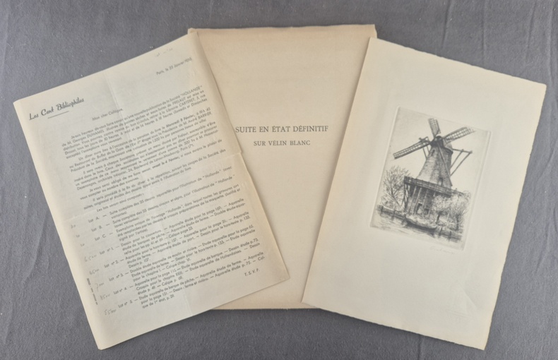
1949141181949 P., Les Cent Bibliophiles, 1949, 1 vol. in-4° (283 x 195 mm) en feuilles sous couverture rempliée, plat supérieur illustré d'une eau-forte, chemise et étui cartonnés, de 173 pp. - (3) ff. (liste des publications dont sont issus les texte de cet ouvrage, table et achevé d'imprimer).Chemise et étui très légèrement frottés, très bel exemplaire.
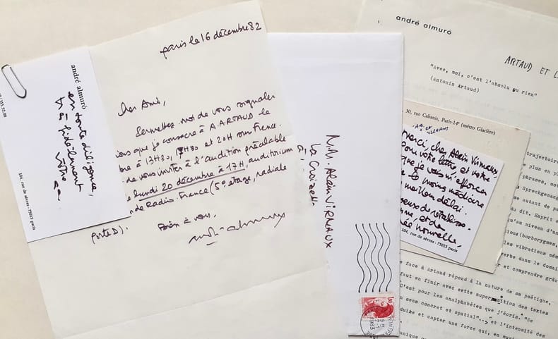
47915Important ensemble de documents tapuscrits et manuscrits réunis par Odette et Alain Virmaux, qui, en fins spécialistes d'Antonin Artaud dirigeaient ce second numéro d'Europe consacré au poète. Documents classés sous 20 chemises. 1. Correspondance et articles parus : Alain VIRMAUX : Une génération après. Manuscrit et tapuscrit corrigé - Laure ROLLAND (Rolande Prevel) : En compagnie d’Antonin Artaud. Tapuscrit corrigé par A. Virmaux - Yves BENOT : Crier sans fin. 2 lettres manuscrites signées et copie du manuscit de l’article. Réponse de A. Virmaux. Copie de l’article Entendre le cri d’Artaud, d’Yves Benot, paru dans La Pensée, n°188, août 1976 - Alain JOUFFROY : Salut, première personne : Artaud. Deux lettres manuscrites signées d’Alain Jouffroy avec réponses manuscrites et tapuscites des Virmaux - Odette VIRMAUX : Artaud et le Surréalisme. Tapuscrit corrigé - Alain VIRMAUX : Artaud et la violence. Tapuscrit corrigé - Jacques GARELLI : Les inventions d’Artaud. Tapuscrit corrigé et signé et 2 cartes manuscrites signées de J. Garelli avec réponses tapuscrites des Virmaux - Lothar BAIER : Lire Artaud, Notes sur une lecture obtuse. 4 lettres tapuscrites signées et tapuscrit corrigé par A. Virmaux. Réponse signée de A. Virmaux - Nicole GEBLESCO : Les Enfants de la mise en scène, principe. 2 lettres manuscrites signées et tapuscrit corrigé, daté et signé. Réponse signée de A. Virmaux - Umberto ARTIOLI : Production de «réalité» ou faim d’impossible ? 4 lettres tapuscrites signées. Tapuscrit et copie de l’article en français, tous deux portant des corrections. Réponses manuscrites et tapuscrites signées des Virmaux - Francesco BARTOLI : Le travail de la peinture. Deux tapuscrits de l’article traduit, corrigé par A. Virmaux. Copie de lettre tapuscrite de A. Virmaux, signée - Josep PALAU Y FABRE : Ci-gît et Guernica. Echange de correspondance : 8 lettres tapuscrites et manuscrites signées. Note manuscrite de Virmaux sur l’auteur. Joint copie de l’article Antonin Artaud, par Luis Cardoza Y Aragon, paru dans Plural, n°19, avril 1973 à Mexico - André ALMURO : Artaud et la musique. Tapuscrit de l’article corrigé et annoté. Une lettre signée et deux cartes manuscrites. Note manuscrite de A. Virmaux - Odette et Alain VIRMAUX : Chronologie bio-bibliographie - Un manuscrit de trois feuillets : Repères biographiques + 2 Tapuscrits du texte largement augmenté et corrigé. - Tapuscrit : Repères bio-biblio-theatro-filmographiques. - Tapuscrit : Parcours bibliographique. 2. Correspondance et projets d’articles, non publiés : Bettina KNAPP. 3 lettres manuscrites et 2 tapuscrites signées. Article tapuscrit corrigé : Le Mexique - Le mythe de la Renovatio. Lettres tapuscrites signées de A. Virmaux. Cet article n’a finalement pas été retenu pour le numéro d’Europe - Jean-Clarence LAMBERT. 3 lettres manuscrites signées. 1 tapuscrit : Tarahumara (3 feuillets) et 1 tapuscrit sur Luis Cardoza y Aragon (2 feuillets) et 6 lettres tapuscrites signées de Alain Virmaux - Sabine Robert ARON. 6 lettres manuscrites signées. Tapuscrit Robert Aron et le théâtre Alfred Jarry, corrigé. 5 lettres tapuscrites signées de A. Virmaux. Notes manuscrites de A. Virmaux et documents (copies) sur le théâtre Alfred Jarry - Jacques BAILLON. 3 lettres tapuscrites signées. 6 lettres tapuscrites signées de A. Virmaux. Doubles des lettres tapuscrites signées des VIRMAUX adressées à : J.M.J. Le Clezio, Michel de Grèce, Jean-Louis Barrault, Luis Cardoza y Aragon, Gérard Troussier, Célia Bertin (x2), Jacques Baron, Claude Lafaye (x2), Antoine Vitez (avec réponse tapuscrite signée du metteur en scène), Michel Carassou, Alvita Rojo, Rolande Ibrahim (épouse de Jacques Prevel), avec réponse manuscrite signée, Jean Dreville, avec réponse manuscrite signée, Robert Poulaille et Kenneth White. 3. Correspondance avec Charles Dobzynski, rédacteur en chef d’Europe - Alain VIRMAUX : 12 lettres tapuscrites signées - Charles DOBZYNSKI : 3 lettres manuscrites et 2 tapuscrite, signées.
Carta nautica del Mediterraneo centrale.- le carte edite dal Depot de la Marine -Per contrastare lo strapotere navale della flotta inglese re Luigi XIV comprese la necessita di dotare le sue navi di carte nautiche in grado di renderle competitive con la marina antagonista. Un primo tentativo si ebbe con il Neptune Francais del 1693, ma solo agli inizi del diciottesimo secolo iniziò una grande campagna di rilievo delle coste del Mediterraneo e di altri mari, che portò alla realizzazione di numerose mappe, raccolte nel Dépot des Cartes et Planes de la Marine del 1720. Tuttavia il fondatore dell’idrografia francese può essere considerato a tutti gli effetti Jacques Nicolas Bellin (1703-1772) che per oltre cinquant’anni fu al servizio della Marina quale ingegnere e cartografo, tanto che gli venne assegnato il titolo quale primo “Ingegnere Idrografo della Marina” e quindi addirittura quello di “Idrografo Reale”. Durante il suo servizio gli furono commissionati i rilievi delle coste francesi prima e successivamente quelle di praticamente tutto il mondo conosciuto. La sua produzione fu immensa e le sue carte nautiche, di grande qualità, apparvero in più edizioni fino oltre la fine del diciottesimo secolo. Questo grande fondo cartografico diede vita alla produzione ed alla vendita di carte navali, prima basate su quelle del Bellin, successivamente ampliate e migliorate da altri ingegneri di marina, sia francesi che non. Le carte nautiche venivano vendute separatamente e recavano tutte l’inconfondibile timbro con l’ancora e le corone (quando regnava la monarchia) del Depot Generale de la Marine. Raccolte delle stesse carte venivano invece pubblicate sotto il nome di Neptune Francois, monumentale opera che ebbe numerosissime ristampe fino alla metà del secolo successivo. Il seguente gruppo di carte è tratto da un volume denominato Neptune de la Méditerranée, riguardante il Mediterraneo. Incisione in rame, finemnete colorata a mano, in otimo stato di conservazione, salvo controindicazioni. To fight against the powerful English fleet, king Louis XIV decided to endow his ships with nautical charts that could enable them to compete with the enemy. The Neptune Francais, in 1693, can be considered a first attempt, but it was only at the beginning of the Eighteenth century that a campaign of study of the Mediterranean coasts and sea was started, leading to the realization of maps, collected in the Dépot des Cartes et Planes de la Marine in 1720. Nevertheless, the real founder of French hydrography can be considered Jacques Nicolas Bellin (1703-1772), who served for more than fifty years the navy as engineer and cartographer, which win him first the title of "Hydrographer Engineer of the Navy" and then of "Royal Hydrographer". His first commitment was to study the French coasts fisrt, and then of the whole world. His production was massive and his nautical charts, due also to their quality, were published in many edition until the end of the XVIII century. This allowance led to the production and the selling of sea charts, at first based on those from Bellin, then developed by other navy engineers. The sea charts were sold separately, all bearing the stamp with the anchor and the crowns of the Depot Generale de la Marine. Collections of the same charts have been published under the name of Neptune Francois, a monumental work which has been reissued many times until the half of the following century. The following group of charts is taken from a volume entitled Neptune de la Méditerranée, about the Mediterranean sea. Where possible, there is the name of the cartographer, very often the captain of the ship, and the date of the chart. Engravings, in excellent condition.
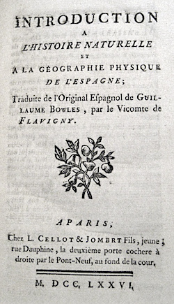
177614781Cellot & Jombert Paris 1776 1 vol. In-8 de XII 516 pp., plein veau marbrée de l'époque, dos à nerfs orné, pièce de titre, tranches rouges.
- EDIZIONE ORIGINALE, COLORITURA COEVA -Importante e decorativa mappa in 6 fogli dei Balcani tratta dal "Nuovo Atlante Geografico Universale delineato sulle ultime osservazioni", edito a Roma dal 1792 fino al 1801, opera che la Calcografia Camerale commissionò al Cassini al fine di sostituire l’ormai obsoleto "Mercurio Geografico".Giovanni Maria Cassini, Chierico Regolare Somasco fu geografo e cartografo, ma anche intagliatore di architetture e prospettive - uno dei migliori discepoli di Giovanni Battista Piranesi - Cassini fu uno degli ultimi sferografi italiani del Settecento ed i suoi globi ebbero una notevole diffusione, come pure questo "Nuovo Atlante Geografico".Incisione in rame, coloritura coeva dei contorni, leggere bruniture, per il resto in ottimo stato di conservazione. Dimensioni mm. 500x370 ogni foglio.L'Atlante del Cassini fu ristampato dalla Calcografia Camerale nel primo quarto del XIX secolo, prima del 1839. Solo gli esemplari di prima edizione come questo sono stampati su carta vergata coeva e sono colorati a mano in epoca. Le tirature del XIX secolo sono già su carta meccanica, priva di vergelle, e generalmente in bianco e nero. - FIRST EDITION, CONTEMPORARY OUTLINE COLOUR -The Italian painter and engraver, Giovanni Maria Cassini, produced this splendid 6 sheets wall map of Balkans of as part of his epic three-volume atlas. Published in: Nuovo atlante geografico universale delineato sulle ultime osservazioni. Roma, Calcografia camerale, 1792-1801.Cassini was geographer and cartographer but he was also good at engraving architectural items and perspectives – he was one of the best disciples Giovanni Battista Piranesi had. Moreover, Cassini was one of the last artists to engrave spheres in the XVIII century and his globes were quite famous and widespread, and realized the most important Italian Atlas of the XVIII century; his maps always bear a cartouche, extremely rich in colours and details. Copperplate with fine original hand colour, some foxing, otherwise in very good condition.The Cassini's Atlas was reprinted by the Calcografia Camerale in the first quarter of XIXth century (before 1839). Only the first edition of the atlas is printed on contemporary laid paper, while the late issue are on XIXth century paper and often without colour.
Acquaforte e bulino, datata e firmata in lastra in basso al centro. Buona prova, impressa su carta vergata coeva, con margini, alcuni restauri perfettamente eseguiti, tracce di colla al verso, per il resto in buono stato di conservazione. La tavola deriva da uno dei celebri dipinti di Joseph Vernet ed è incisa a quattro mani da Cochin e Jacques Philippe Le Bas. Grazie al patrocinio di M. de Martigny, Direttore degli Belli Arti e fratello di Madame de Pompadour, che aveva a quel tempo tutte il favore di Luigi XV, Vernet ottenne dal Re un ordine per 24 dipinti dove poteva dare tutta la misura del suo talento: la rappresentanza dei porti della Francia. Nel 1753, l'artista dipinse due vedute del porto di Marsiglia, grazie alle quali, l’anno successivo, verrà ammesso all'Accademia Reale di Parigi. Terminò il suo lavoro nel 1765, dopo ben 12 anni di viaggio per le città francesi. Etching with engravings, signed and dated at lower center. A good impression, printed on contemporary laid paper, with margins, some expert repairs at the back, otherwise in good condition. This plate is engraved by Cochin & Jacques Philippe Le Bas, after a painting by Joseph Vernet. Vernet was commissioned by Louis XV in 1753 to paint fifteen views of the main ports of France, and given the exceptional title of peintre des marines de sa majesté. He spent twelve years travelling around the Mediterranean, Atlantic and Channel coasts with his family and servants in tow. The country was at war with England at the time, and Louis specifically requested that the artist show off the economic activities and maritime strength of France, which Vernet did to much acclaim. The majority of the paintings are in the Musée de la Marine in Paris.
Acquaforte e bulino, datata e firmata in lastra in basso al centro. Buona prova, impressa su carta vergata coeva, con margini, alcuni restauri perfettamente eseguiti, tracce di colla al verso, per il resto in buono stato di conservazione. La tavola deriva da uno dei celebri dipinti di Joseph Vernet ed è incisa a quattro mani da Cochin e Jacques Philippe Le Bas. Grazie al patrocinio di M. de Martigny, Direttore degli Belli Arti e fratello di Madame de Pompadour, che aveva a quel tempo tutte il favore di Luigi XV, Vernet ottenne dal Re un ordine per 24 dipinti dove poteva dare tutta la misura del suo talento: la rappresentanza dei porti della Francia. Nel 1753, l'artista dipinse due vedute del porto di Marsiglia, grazie alle quali, l’anno successivo, verrà ammesso all'Accademia Reale di Parigi. Terminò il suo lavoro nel 1765, dopo ben 12 anni di viaggio per le città francesi. Etching with engravings, signed and dated at lower center. A good impression, printed on contemporary laid paper, with margins, some expert repairs at the back, otherwise in good condition. This plate is engraved by Cochin & Jacques Philippe Le Bas, after a painting by Joseph Vernet. Vernet was commissioned by Louis XV in 1753 to paint fifteen views of the main ports of France, and given the exceptional title of peintre des marines de sa majesté. He spent twelve years travelling around the Mediterranean, Atlantic and Channel coasts with his family and servants in tow. The country was at war with England at the time, and Louis specifically requested that the artist show off the economic activities and maritime strength of France, which Vernet did to much acclaim. The majority of the paintings are in the Musée de la Marine in Paris. Arlaud 243; IFF 309.II.
Acquaforte e bulino, datata e firmata in lastra in basso al centro. Buona prova, impressa su carta vergata coeva, con margini, alcuni restauri perfettamente eseguiti, tracce di colla al verso, per il resto in buono stato di conservazione. La tavola deriva da uno dei celebri dipinti di Joseph Vernet ed è incisa a quattro mani da Cochin e Jacques Philippe Le Bas. Grazie al patrocinio di M. de Martigny, Direttore degli Belli Arti e fratello di Madame de Pompadour, che aveva a quel tempo tutte il favore di Luigi XV, Vernet ottenne dal Re un ordine per 24 dipinti dove poteva dare tutta la misura del suo talento: la rappresentanza dei porti della Francia. Nel 1753, l'artista dipinse due vedute del porto di Marsiglia, grazie alle quali, l’anno successivo, verrà ammesso all'Accademia Reale di Parigi. Terminò il suo lavoro nel 1765, dopo ben 12 anni di viaggio per le città francesi. Etching with engravings, signed and dated at lower center. A good impression, printed on contemporary laid paper, with margins, some expert repairs at the back, otherwise in good condition. This plate is engraved by Cochin & Jacques Philippe Le Bas, after a painting by Joseph Vernet. Vernet was commissioned by Louis XV in 1753 to paint fifteen views of the main ports of France, and given the exceptional title of peintre des marines de sa majesté. He spent twelve years travelling around the Mediterranean, Atlantic and Channel coasts with his family and servants in tow. The country was at war with England at the time, and Louis specifically requested that the artist show off the economic activities and maritime strength of France, which Vernet did to much acclaim. The majority of the paintings are in the Musée de la Marine in Paris. Arlaud 250; IFF 316. II.
Acquaforte e bulino, datata e firmata in lastra in basso al centro. Buona prova, impressa su carta vergata coeva, con margini, alcuni restauri perfettamente eseguiti, tracce di colla al verso, per il resto in buono stato di conservazione. La tavola deriva da uno dei celebri dipinti di Joseph Vernet ed è incisa a quattro mani da Cochin e Jacques Philippe Le Bas. Grazie al patrocinio di M. de Martigny, Direttore degli Belli Arti e fratello di Madame de Pompadour, che aveva a quel tempo tutte il favore di Luigi XV, Vernet ottenne dal Re un ordine per 24 dipinti dove poteva dare tutta la misura del suo talento: la rappresentanza dei porti della Francia. Nel 1753, l'artista dipinse due vedute del porto di Marsiglia, grazie alle quali, l’anno successivo, verrà ammesso all'Accademia Reale di Parigi. Terminò il suo lavoro nel 1765, dopo ben 12 anni di viaggio per le città francesi. Etching with engravings, signed and dated at lower center. A good impression, printed on contemporary laid paper, with margins, some expert repairs at the back, otherwise in good condition. This plate is engraved by Cochin & Jacques Philippe Le Bas, after a painting by Joseph Vernet. Vernet was commissioned by Louis XV in 1753 to paint fifteen views of the main ports of France, and given the exceptional title of peintre des marines de sa majesté. He spent twelve years travelling around the Mediterranean, Atlantic and Channel coasts with his family and servants in tow. The country was at war with England at the time, and Louis specifically requested that the artist show off the economic activities and maritime strength of France, which Vernet did to much acclaim. The majority of the paintings are in the Musée de la Marine in Paris.
Acquaforte e bulino, datata e firmata in lastra in basso al centro. Buona prova, impressa su carta vergata coeva, con margini, alcuni restauri perfettamente eseguiti, tracce di colla al verso, per il resto in buono stato di conservazione. La tavola deriva da uno dei celebri dipinti di Joseph Vernet ed è incisa a quattro mani da Cochin e Jacques Philippe Le Bas. Grazie al patrocinio di M. de Martigny, Direttore degli Belli Arti e fratello di Madame de Pompadour, che aveva a quel tempo tutte il favore di Luigi XV, Vernet ottenne dal Re un ordine per 24 dipinti dove poteva dare tutta la misura del suo talento: la rappresentanza dei porti della Francia. Nel 1753, l'artista dipinse due vedute del porto di Marsiglia, grazie alle quali, l’anno successivo, verrà ammesso all'Accademia Reale di Parigi. Terminò il suo lavoro nel 1765, dopo ben 12 anni di viaggio per le città francesi. Etching with engravings, signed and dated at lower center. A good impression, printed on contemporary laid paper, with margins, some expert repairs at the back, otherwise in good condition. This plate is engraved by Cochin & Jacques Philippe Le Bas, after a painting by Joseph Vernet. Vernet was commissioned by Louis XV in 1753 to paint fifteen views of the main ports of France, and given the exceptional title of peintre des marines de sa majesté. He spent twelve years travelling around the Mediterranean, Atlantic and Channel coasts with his family and servants in tow. The country was at war with England at the time, and Louis specifically requested that the artist show off the economic activities and maritime strength of France, which Vernet did to much acclaim. The majority of the paintings are in the Musée de la Marine in Paris.
Acquaforte e bulino, datata e firmata in lastra in basso al centro. Buona prova, impressa su carta vergata coeva, con margini, alcuni restauri perfettamente eseguiti, tracce di colla al verso, per il resto in buono stato di conservazione. La tavola deriva da uno dei celebri dipinti di Joseph Vernet ed è incisa a quattro mani da Cochin e Jacques Philippe Le Bas. Grazie al patrocinio di M. de Martigny, Direttore degli Belli Arti e fratello di Madame de Pompadour, che aveva a quel tempo tutte il favore di Luigi XV, Vernet ottenne dal Re un ordine per 24 dipinti dove poteva dare tutta la misura del suo talento: la rappresentanza dei porti della Francia. Nel 1753, l'artista dipinse due vedute del porto di Marsiglia, grazie alle quali, l’anno successivo, verrà ammesso all'Accademia Reale di Parigi. Terminò il suo lavoro nel 1765, dopo ben 12 anni di viaggio per le città francesi. Etching with engravings, signed and dated at lower center. A good impression, printed on contemporary laid paper, with margins, some expert repairs at the back, otherwise in good condition. This plate is engraved by Cochin & Jacques Philippe Le Bas, after a painting by Joseph Vernet. Vernet was commissioned by Louis XV in 1753 to paint fifteen views of the main ports of France, and given the exceptional title of peintre des marines de sa majesté. He spent twelve years travelling around the Mediterranean, Atlantic and Channel coasts with his family and servants in tow. The country was at war with England at the time, and Louis specifically requested that the artist show off the economic activities and maritime strength of France, which Vernet did to much acclaim. The majority of the paintings are in the Musée de la Marine in Paris. Arlaud 253; IFF 319.II.
Carta nautica dell'Europa occidentale, con le coste dell'oceano Atlantico. Seconda edizione con data 1677.Incisione in rame, coloritura coeva dei contorni, in ottimo stato di conservazione. Very handsome chart by a famous 18th century cartographer, Pierre Du Val (1618-1683) shows the North Atlantic Ocean and the coast of western Europe from Scandinavia and Great Britain down to North Africa. The chart depicts all harbors around the coastlines with no inland detail. The chart includes a rare reference to the Kimmen Line, which indicates a depth of 100 fathoms from Denmark to just west of the Shetland Isles, north of Scotland. Two compass roses with radiating rhumb lines fill the ocean and the Mediterranean. The decorative title cartouche is ornamented with two fighting ships and is topped with a figurehead and scrolls. Copperplate with original outline colour, very good condition.
Carta nautica dell'Europa occidentale, con le coste dell'oceano Atlantico. Prima edizione con data 1666.Incisione in rame, coloritura coeva dei contorni, in ottimo stato di conservazione. Very handsome chart by a famous 18th century cartographer, Pierre Du Val (1618-1683) shows the North Atlantic Ocean and the coast of western Europe from Scandinavia and Great Britain down to North Africa. The chart depicts all harbors around the coastlines with no inland detail. The chart includes a rare reference to the Kimmen Line, which indicates a depth of 100 fathoms from Denmark to just west of the Shetland Isles, north of Scotland. Two compass roses with radiating rhumb lines fill the ocean and the Mediterranean. The decorative title cartouche is ornamented with two fighting ships and is topped with a figurehead and scrolls. Copperplate with original outline colour, very good condition.
Carta politica dell'Europa, ai lati topografie delle principali città europee: Parigi, Londra, Vienna, Sanpietroburgo, Costantinopoli, Roma, Napoli, Madrid, Lisbona, Berlino, Varsavia e Copenaghen. Intelata
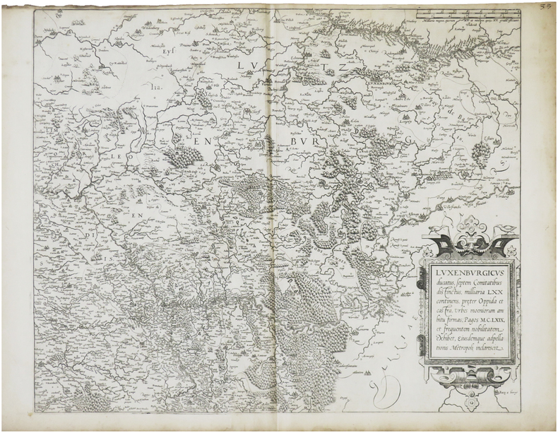
1619LBW-8689[Paris, Jean Le Clerc, 1619]. 342 x 511 mm.
1690LBW-5455Paris, [circa 1690]. 420 x 320 mm.
Delineata sulla scia della più grande veduta di Jeremias Wolff, l’opera offre quaranta riferimenti topografici. Il Leopold, era un modesto incisore ed editore di Augsburg; la sua serie di vedute di città, da cui questa incisione è tratta, venne pubblicata con pochissima tiratura, rendendo quindi le opere particolarmente rare. Incisione in rame, in ottimo stato di conservazione. In the wake of Jeremias Wolff’s bigger view, this work presents many topographical references. Leopold was a modest engraver and publisher in Augsburg; the series of city views, from which this one is taken, has been published in a very limited circulation, which means these works are very rare. Copperplat, in excellent condition.