MAIRE (Nicolas).Livre Rare Book

34 270 résultats
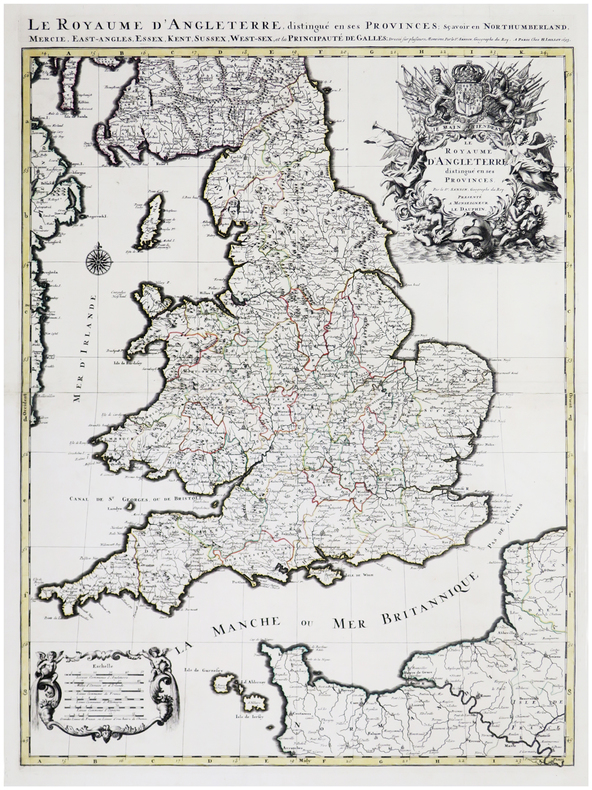
1817LBW-8960Paris, chez l'auteur, 1817. En 32 sections montées sur toile et repliées, formant une carte de 0,77 x 1,13 m.
Mappa tratta dal Cl. Ptolemaei Alexandrini, Geographiae Libri Octo, pubblicata prima a Colonia da Gottfried von Kempen (1578) e poi ristampata dallo stesso editore nel 1584 (Van der Krogt 1, 502) e poi da Isaac Elsevier per il Theatrum Geographiae veteris di Petrus Bertius (Leyden 1618). Di tutte le edizioni di Tolomeo, quella di Gerard Kremer (Mercatore), pubblicata nel 1578, e forse tecnicamente la più bella. A questo punto la Geografia di Tolomeo perdeva però ogni pretesa di “attualità”, laddove lo scopo di Mercatore era quello di produrre un atlante del mondo classico che servisse da complemento al suo atlante moderno (per tale ragione egli aveva tentato di recuperare la forma originale dell’atlante tolemaico, scartandone le moderne accrezioni). L'interpretazione di Mercatore del testo tolemaico, per le 28 carte che illustrano la sua Geographia è stata, quindi, una delle più veritiere. Egli aveva passato 13 anni a ricercare, disegnare e incidere le carte, rinunciando anche alla pubblicazione delle sue carte “moderne”. Questo esemplare proviene dal Theatrum Geographia Veteris di Petrus Bertius edita a Leida nel 1618, che combina il Tolomeo di Mercator, le 8 tavole del Moretus per rappresentare la Tabula Peutingeriana e 14 mappe storiche delle regioni d'Europa derivate dal Parergon di Ortelius. Acquaforte su rame, in buone condizioni. Ptolemaic map of British Isles. Showing landmarks, major cities and towns, rivers and parks. The map is decorated with a strapwork title cartouche, a sea monster and a fishing scene in the North Sea. Map taken from the Cl. Ptolemaei Alexandrini, Geographiae Libri Octo, first published in Cologne by Gottfried von Kempen (1578) and then reprinted by the same publisher in 1584 (Van der Krogt 1, 502) and then by Isaac Elsevier for the Petrus Bertius’ Theatrum Geographiae veteris (Leyden 1618). Mercator's interpretation of the 28 Ptolemaic text was possibly one of the truest undertaken up until that time. He had spent 13 years researching, drawing and engraving the maps at much commercial sacrifice to himself, having seen Ortelius's Theatrum and De Jodes Speculum published, to become both technical and commercial successes. In later life he devoted himself to his edition of the maps in Ptolemy's Geographia, reproduced in his own engraving as nearly as possible in their original form. This example comes from the Theatrum Geographia Veteris of Petrus Bertius published in Leiden in 1618, which combines Mercator's Ptolemy, the 8 plates of Moretus to represent the Tabula Peutingeriana and 14 historical maps of the regions of Europe derived from the Parergon of Ortelius. Copperplate, in good condition.
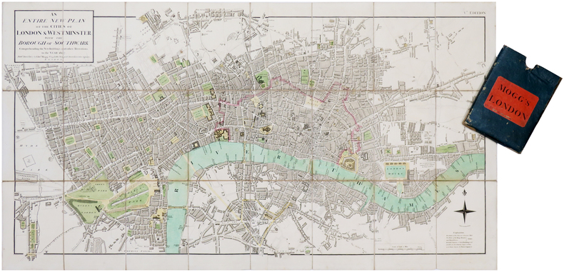
1807LBW-7019London, Edw.d Mogg, 1807. En deux feuilles coupées en 24 sections montées sur toile et pliées, formant une carte de 482 x 906 mm ; étui de papier bleu de l'époque avec pièce de titre de papier rouge.
Esemplare finemente colorato d’epoca della mappa di Munster dell'Italia, della Corsica e delle isole vicine, basata sulle informazioni della Geographia di Tolomeo. Carta tratta dalla Geographia universalis, vetus et nova, complectens. Claudii Ptolemaei Alexandrini Ennarationis libros VIII, pubblicata per la prima volta nel 1540 a Basilea da Heinrich Petri, figliastro di Münster e suo fidatissimo stampatore. Il volume è illustrato da 27 carte costruite seguendo le indicazioni di Tolomeo, a cui si affiancano 21 carte “moderne”, delineate in base alle recenti scoperte geografiche. La Geographia di Münster ebbe un notevole successo, e Petri la ristampò l'anno seguente (1541) e quello successivo ancora. Aumentate di sei le carte moderne, tra le quali la Carta Marina di Olao Magnus descrittiva della Scandinavia, l'editore la ristampò ancora nel 1545, nel 1551 e infine nel 1552, sempre con 54 carte geografiche, ma con la sostituzione della Pomerania al posto del Lago di Costanza. Alla scomparsa di Münster l’opera non venne più ristampata; alcune delle carte furono invece utilizzate da Heinrich Petri per le edizioni postume della Cosmographiae Universalis. Le matrici lignee, debitamente emendate, furono poi utilizzate per il Rerum Geographicarum dello Strabo, edizione stampata a Basileae: Ex Officina Henricpetriana, 1571 Mense Augusto. Silografia, meravigliosa coloritura coeva, in ottimo stato di conservazione. Esemplare tratto dall’edizione del 1545. Map taken from the Geographia universalis, vetus et nova, complectens. Claudii Ptolemaei Alexandrini Ennarationis libros VIII, published for the first time in 1540 in Basel by Heinrich Petri, stepson of Münster and his trusted printer. Finely original colour example of of Munster's map of Italy, Corsica and neighboring Islands, based on Ptolemy. The book is illustrated by 27 maps built following the indications of Ptolemy, which are flanked by 21 "modern" maps, outlined on the basis of recent geographical discoveries. The Geographia of Münster was a great success, and Petri reprinted it the following year (1541) and then in 1542. Having increased the number of modern maps by six, including the Carta Marina of Olao Magnus describing Scandinavia, the publisher reprinted it again in 1545, in 1551 and finally in 1552, still with 54 maps, but with the substitution of Pomerania in place of Lake Constance. At the death of Münster the work was not reprinted; some of the maps were instead used by Heinrich Petri for the posthumous editions of the Cosmographiae Universalis. The woodblock of the maps, duly amended, were used for the Rerum Geographicarum of Strabo, edition printed in Basileae: Ex Officina Henricpetriana, 1571 Mense Augusto. Woodcut, with fine original colouring, in excellent condition. Example form the 1545 edition.
1693LBW-6390Paris, H. Jaillot, 1693. En deux feuilles jointes formant une carte de 785 x 584 mm.
Acquaforte, dimensioni 505x610 mm. Bellissimo esemplare, finemente colorato a mano.Opera tratta da: Atlas maritimus & commercialis, or, A general view of the world, so far as relates to trade and navigation: describing all the coasts, ports, harbours, and noted rivers ... : to which are added sailing directions for all the known coasts and islands on the globe, with a set of sea charts, some laid down after Mercator, but the greater part according to a new globular projection adapted for measuring distances...by scale and compass...the use of the projection justified by Dr. Halley. To which are subjoin'd two large hemispheres on the plane of the equinoctial containing all the stars in the Britannic catalogue: of great use to sailors for finding the latitude in the night. London: For J. & J. Knapton, W. & J. Innys [Etc.], 1728.Questo lavoro molto raro è nato dalla collaborazione di alcuni dei principali cartografi e scienziati del periodo, tra i quali Sir Edmund Halley, John Senex, Nathaniel Cutler, Steven Parker e Daniel Defoe. L’Atlas maritimus & commercialis venne ideato da Senex e Harris nel tentativo di competere con il popolarissimo The English Pilot di Mount & Page; tuttavia, nonostante la collaborazione fosse di altissimo livello scientifico, l’atlante non ebbe grande successo commerciale. Bibliografia: Mare Nostrum, a historic voyage across the Mediterranean Sea, Lussemburgo, 2003, p. 33; National Maritime Museum, Catalogue of the Library - Vol. Three, Atlas & Cartography, Londra, 1971, pp. 400-401, n. 341(22); R. Shirley, Maps in the Atlases of the British Library, Londra, 2004, pp. 1177-78, M.Hall -1a (22); cfr. The Compleat Plattmaker: essays on Chart, Map and Globe Making in England in the Seventeenth and Eighteenth Centuries, Berkeley, 1978. Etching, with fine later hand colour, very good condition.Taken from: Atlas maritimus & commercialis, or, A general view of the world, so far as relates to trade and navigation: describing all the coasts, ports, harbours, and noted rivers ... : to which are added sailing directions for all the known coasts and islands on the globe, with a set of sea charts, some laid down after Mercator, but the greater part according to a new globular projection adapted for measuring distances...by scale and compass...the use of the projection justified by Dr. Halley. To which are subjoin'd two large hemispheres on the plane of the equinoctial containing all the stars in the Britannic catalogue: of great use to sailors for finding the latitude in the night. London: For J. & J. Knapton, W. & J. Innys [Etc.], 1728.This very rare work was born from the collaboration of some of the leading cartographers and scientists of the period, including Sir Edmund Halley, John Senex, Nathaniel Cutler, Steven Parker and Daniel Defoe. The Atlas maritimus & commercialis was designed by Senex and Harris in an attempt to compete with Mount & Page's hugely popular The English Pilot; however, despite the collaboration was of the highest scientific level, the atlas did not have great commercial success.Bibliografia: Mare Nostrum, a historic voyage across the Mediterranean Sea, Lussemburgo, 2003, p. 33; National Maritime Museum, Catalogue of the Library - Vol. Three, Atlas & Cartography, Londra, 1971, pp. 400-401, n. 341(22); R. Shirley, Maps in the Atlases of the British Library, Londra, 2004, pp. 1177-78, M.Hall -1a (22); cfr. The Compleat Plattmaker: essays on Chart, Map and Globe Making in England in the Seventeenth and Eighteenth Centuries, Berkeley, 1978. S. Bifolco, "Mare Nostrum, Cartografia nautica a stampa del Mar Mediterraneo" (2020), p. 215, tav. 98.
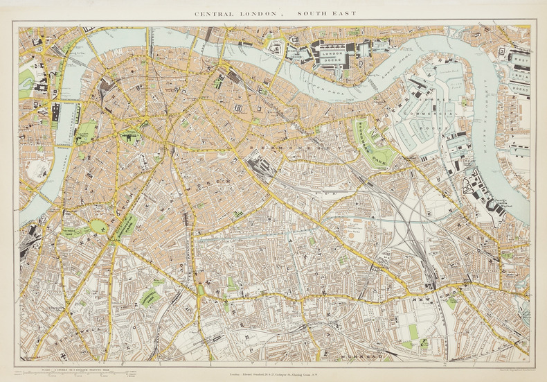
1896LBW-2866London, Edward Stanford, [1896]. En quatre feuilles séparées, chacune environ 350 x 505 mm.
185087803Virtue and co | London 1850 (S.d) | 21.50 x 27.80 cm | 2 volumes reliés
2021__9004508414Martinus Nijhoff 2021. Hardcover. New. bilingual edition. 952 pages. French language. 9.50x6.50x2.00 inches. Martinus Nijhoff hardcover
xxxvi + 640, xvi + 552 pages. Balance of title reads as follows: "Containing an Account of the Cruel Civil Wars Between the Houses of Orleans and Burgundy; of the Possession of Paris and Normandy By the English; Their Expulsion Thence; and of Other Memorable Events That Happened in the Kingdom of France, as well as in other Countries. A History of Fair Example, and of Great Profit to the French. Beginning at the Year MCCCC., Where that of Sir John Froissart Finishes, and Ending at the Year MCCCCLXVII., and Continued by Others to the Year MDXVI." Illustrated with woodcuts. Bookplate of Reginald Hibbert Tupper upon each front free endpaper. Mr. Tupper was the son of the Canadian Prime Minister of the same name. Ink signature upon verso of front blank leaf of volume I. Some foxing to colour title page of volume I. Faded marbling to edges. Back hinge of Volume I starting. Somewhat above-average external wear. Both volumes tight and square. Book
4to [28 x 21.5 cm]; vii, xvi, [17] - 460 pp, 20 hand colored plates including frontis, uncolored plate of ploughs, other illus, 2 engraved maps, tables, half-title page is present. contemporary half red morocco, gilt spine title lettering, covers worn and rubbed, spine head chipped, interior has slight foxing of some leaves, mostly unfoxed, interior is very good and unmarked, nice wide margins. A picture of this book is available up Tooley 286. Hardie 141. Abbey Travel 15. Nerhood 164: 'British scholar journeys from St. Petersburg through Moscow to Smolensk, shortly after Napoleon passed there, June-October 1814. Friendly to Russia, he laments the destruction of Moscow'. The maps are the northwest part of Russia and the northwest part of Europe (including Baltic). The attractive colored plates are mostly views and people including Copenhagen, Hamburg, Stralsund, Tilsit, Hermitage, Moscow, Kremlin, Borodino, Smolensko, Lithuanian Jewess, Cronstadt Boatmen, village scene, etc.
4to [28.5 x 23 cm]; xx, 491, [i, directions to binder] pp, 3 maps, including frontis, another folding & hand colored, 4 folding tables, 14 plates including 8 hand colored aquatints, some foldout, other engravings , sheet of music, complete, index. contemporary leather boards with newer leather spine, gilt title lettering on red leather spine label, corners repaired with leather, lightly foxed on few leaves, mainly marginal and on tissue guards, very good sound and solid copy. A picture of this book Abbey Travel 160. The attractive hand colored plates are aquatints and are mounted as issued (see Abbey). Tooley (English Colour Plate Books) 313. The plates include views, caldron of boiling mud, geysers, costume, view of Reikiavik, other towns, etc. The author travelled with Henry Holland and Richard Bright, who each contributed chapters. The text includes narratives of three excursions, descriptions of the state of education, literature, laws, government, religion, commerce, as well as zoology, botany, mineralogy, mineral waters, with several appendices giving further details. The second edition of 1812 was somewhat abridged.
20111857436245Routledge 2011. New/New. <p><strong>Author:</strong> Europa Publications</p><p><strong>Publisher:</strong> Routledge</p><p><strong>ISBN:</strong> 9781857436242</p><p><strong>Release Date:</strong> 2011</p><p><strong>Languages:</strong> English</p><p><strong>Binding:</strong> Hardcover</p><p><strong>Number Of Pages:</strong> 848</p><p><strong>Details:</strong> About the Author Europa Publications</p> Routledge hardcover
20277197-nnew. unknown
2025__9004758054Martinus Nijhoff 2025. Hardcover. New. bilingual edition. 9.45x6.30x9.45 inches. Martinus Nijhoff hardcover
1857437381New. Brand new and still unused unknown
1847KART0258Wien, Militär-Geographisches Institut 1845-1847. 29 Blatt (=25 Teilkarten, 3 Supplementkarten, 1 Skelett (Übersichtskarte, 25 x 41 cm). Grenzkolorierte Lithographien, Format meist 40x50 cm, in je 8 Segmenten auf Leinen aufgezogen. In stabiler zeitgen. Halbleder-Kassette mit RüSch., diese mit mäßigen Gebrauchsspuren, die Karten sehr gut erhalten. Frühe Ausgabe der grossen Wandkarte von Europa, mit mehreren eingefügten Stadtplänen und Spezialkarten. Enthalten sind: Plan von Paris (55 x 75 cm), Plan von St. Petersburg, Umgebung von Wien, die Pläne von Berlin und von München (haben hier in der Sahara Platz gefunden...), Plan von Neapel, Plan von Rom, Plan von London. Weiters die (zumeist fehlende) geognostische Farbkarte des österreichischen Kaiserstaates. Blatt I (Titel) mit Lithographie von Nepomuk Geiger.- Beiliegend das lithographierte Handschreiben von J. Scheda : "Program zur General-Karte von Europa", dat. 1. September 1845, 4 Seiten. - Engelmann I,265; ÖBL X,56; Austria Picta, S. 347/44,1.
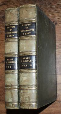
181825217101139J P Neale and sold by Longman Hurst Rees Orme and Brown; Hurst Robinson & Co London 1818. First Edition. Hardcover. Very Good Condition/No Dust Jacket. Illustrator: John Preston Neale. Two matching volumes bound in green decorated leather banded spines with simple decoration. Black spine labels with gilt lettering. Both volumes have a bookplate on inside of front cover for Michael Marcus Sleight of Binbrook. Volume I was published in 1818; volume II was published in 1823. Volume I contains: Dedication to King George IV; List of Subscribers; Preface; History of St Peter's Church Westminster Abbey - 227pp; Chronological Table of Abbots Priors etc. 3; An Historical Account of King Henry the Seventh's Chapel - 72pp; Various indices. Volume II contains: History of St Peter's Church or Westminster Abbey - 304pp; Various indexes and appendices. Leather is lightly worn and is scuffed at corners. Sound binding. Foxing to end-papers and engraved titles. Light foxing to some plates mostly confined to margins. Clean pages. List of plates has a tick against each title. 2-volume set complete. No dust jacket as published. Illustrator: John Preston Neale. Quantity Available: 1. Shipped Weight: over 4 kg. Pictures of this item not already displayed here available upon request. Inventory No: 25217101139. All our books music and maps are sent by a tracked mail service. These books are much heavier than 1kg and may incur significant additional delivery charges to some delivery services to some locations. J P Neale, and sold by Longman, Hurst, Rees, Orme, and Brown; Hurst, Robinson & Co hardcover
2017__1857438752Routledge 2017. Hardcover. New. 47 new edition. 1600 pages. 11.50x9.00x2.75 inches. Routledge hardcover
2014__1857437217Routledge 2014. Hardcover. New. 1st edition. 1776 pages. 14.33x9.53x3.86 inches. Routledge hardcover
2017__1857438809Routledge 2017. Hardcover. New. 20 new edition. 926 pages. 11.50x9.00x2.00 inches. Routledge hardcover
9004136479New. Brand new and still unused unknown
2017__1857438833Routledge 2017. Hardcover. New. 20 new edition. 680 pages. 11.25x8.75x1.50 inches. Routledge hardcover
2007__1857434218Routledge 2007. Hardcover. New. 37 edition. 1510 pages. 11.25x8.50x1.75 inches. Routledge hardcover
168012944Amsterdam, Justus Danckerts, 1680. Kupferstich, altkoloriert. Blattgröße: 53,5 x 62,5 cm, Druckspiegel: 49,5 x 58 cm. [2 Warenabbildungen]