Società CALCOGRAFICA (1799 - 1805)MareMagnum

34 272 résultats
La carta in esame appartiene a un progetto di atlante – in ambito antiquario noto come “Zattone” – mai portato a compimento, della così denominata Societè Calcographique, un’operazione commerciale messa su da due editori leader del mercato veneto del XVIII secolo, Antonio Zatta (1722-1804) e Giuseppe Antonio Remondini (1747-1811). La denominazione dell’impresa editoriale è nota attraverso una carta del mondo che, nella parte bassa del cartiglio, reca l’iscrizione a` Venise Chez la Societè Chalcographique 1799. (Sicilia 2014: 287). Il progetto sembra non sia stato portato a compimento poiché nessun atlante, con un proprio titolo, indice e frontespizio, contenente queste mappe, è noto in bibliografia. Probabilmente le carte venivano vendute singolarmente o a fascicoli come era comune per imprese editoriali di un certo costo. Le carte a tutt’oggi note sono realizzate mediante l’utilizzo di rami più antichi, appositamente modificati. Le matrici originali hanno molteplici origini: alcune appartengono a un altro sconosciuto Atlante d'Italia dedicato alli Augusti Viaggiatori il Conte, e la Contessa, Del Nort stampato con imprint Venezia MDCCLXXXII presso Vincenzo Formaleoni. Nessun esemplare completo di questa raccolta ci è noto, alcune di queste carte fanno parte di una raccolta fattizia conservata alla Biblioteca Nazionale Marciana di Venezia [284. c. 86], altre sono comparse di tanto in tanto nel mercato antiquario. Il frontespizio dell’atlante di Vincenzo Formaleoni (1752-1797) – che qui pubblichiamo e che ci ha consentito di formulare questa ipotesi – è recentemente apparso in una vendita all’asta Cambi di Genova. Altre mappe dello “Zattone” derivano da lastre di Paolo e Francesco Santini, riusate da Remondini per l’Atlas Universel nell’edizione degli anni 1782/84; altre da matrici impiegate da Antonio Zatta per il Nuovo Atlante pubblicato nel 1796. Le carte dei Santini sono abilmente arricchite, tramite la sovrapposizione di cartigli realizzati, nel classico stile di Zatta, su piccole lastre di rame le cui impronte calcografiche sono chiaramente visibili sulle mappe. I cartigli, realizzati dagli stretti collaboratori di Zatta Pasquali, Zuliani e Pitteri, spesso contengono brevi descrizioni storiche, e le mappe furono realizzate probabilmente per illustrare i notevoli cambiamenti geo-politici cui fu soggetta la penisola italiana durante il periodo napoleonico. Le 60 mappe di questa raccolta a tutt’oggi note, datate tra il 1795 e il 1805, sono principalmente dedicate a illustrare la penisola, ma anche altre regioni europee, i continenti e la già menzionata carta del mondo che riporta l’imprint editoriale della Societè Calcographique. Alcune di queste carte, raffiguranti la Repubblica Cisalpina, sono state descritte come parte di un Atlas très Nouveau del solo Remondini, edito a partire dal 1800: “In sostanza siamo di fronte a una semplice operazione commerciale che pensiamo sia stata operata dal Remondini, sebbene egli non si firmi come editore, poiché proprio nel 1799 egli stava acquisendo i rami dello Zatta” (Terre di Langobardia 2005:14). È molto più probabile che i due editori abbiano collaborato in questa avventura editoriale almeno fino alla morte di Antonio Zatta nel 1804, e che il progetto di un atlante completo non sia stato portato a termine anche per la morte, di pochi anni successiva, di Giuseppe Antonio Remondini. Acquaforte, finemente colorata a mano in epoca, in perfetto stato di conservazione. Bibliografia Il Piemonte nella Cartografia del Cinquecento e Seicento 1991, 75; Terre di Langobardia 2005:14; Le Grandi Alpi nella cartografia 2005: 147, 148; Sicilia 2014: 287. Zeno Davoli, Roberto Sanfelici, Terre di Langobardia - La "Lombardia" e il Ducato Estense nella cartografia a st... This very rare map belongs to a never finished project for the atlas of the so called Società Calcografia, a simple commercial trade realized by the two main Venetian publishers of the XVIII century, Antonio Zatta and Giuseppe Antonio Remondini. The term Società Calcografica has been deduced from the map of the world, which is part of the collection and bears in the lower cartouche the French writing “à Venise Chez la Societè Chalcographique 1799”. As already stated, the project was never finished for no atlas containing these maps has ever been listed in any bibliography. Very likely, then, the maps have been sold individually, or maybe as part of smaller, custom collections. The maps of the collection derive from Paolo and Francesco Santini’s plates, used by Remondini in his 1782/4 “Atlas Universelle”, and from the plates of Antonio Zatta’s “Nuovo Atlante”, published in 1796. Santini’s maps have been beautifully enriched, using the system of small, masked plates which can be perceived through the platemarks on the paper, with great cartouches according to the classical style of Zatta and have been probably engraved by the members of his staff, Pasquali, Zuliani and Pitteri. The cartouches bear very often historical descriptions and maybe the maps have been realized to depict the great geographic changes of the peninsula during the Napoleonic period. The modern bibliography Terre di Langobardia describes some of the maps depicting the Repubblica Cisalpina, presenting them as part of Remondini’s “Atlas très Nouveau”, which was printed starting from 1800. In our opinion, the two publishers worked together to the realization of the project until Antonio Zatta died (1804), and the complete atlas was never finished because Giuseppe Antonio Remondini also died in 1811. I personally know 61 maps which were part of the project. Copper engraving, fine hand color, good condition.
Litografia tinta acquarellata a mano, circa 1840/50, firmata in basso a destra.Magnifica prova, impressa su carta coeva, con margini, diverse abrasioni restaurate visibili al verso, per il resto in buono stato di conservazione. Le opere appartengono alla serie denominata Ports de Mer d’Europe, realizzata in collaborazione tra il Deroy e André Chapuy. Le vedute venivano pubblicate dall’editore Turgis sia a Parigi che a New York. Tinted lithograph with watercolor, about 1840/50, signed at the bottom right.Magnificent proof, printed on contemporary paper, numerous restored abrasions on the verso, otherwise in good condition.The works belong to the series called Ports de Mer d'Europe, created in collaboration between Deroy and André Chapuy.The views were published by the publisher Turgis both in Paris and in New York.
Nuova e revisionata carta delle isole britanniche di Frederick De Wit. Estremamente decorativo il cartiglio del titolo e le armi reali di William e Mary (1689-94) sopra la scala miliare in basso a sinistra. Esemplare nel primo stato. Incisione in rame, finemente colorata a mano, sapiente lavoro di restauro alle estremità dei margini e sulla piega centrale, altrimenti in ottime condizioni. Fine decorative map of Britain that includes an inset of the Faro, Shetland and Orkney Islands. The cartography of Ireland follows Petty's surveys and the map is fully engraved with political information. The title cartouche is surrounded by clouds in which putti display the coats of arms of England, Scotland and Ireland. The scale of miles is further embellished with the royal coat of arms during the reign of William and Mary (1689-94) and several figures. This is the second state. This example appears to be state 1. Original color with some light spots and two cracks due to the oxidation of the green pigment, although paper is otherwise supple. Shirley, Mapping of the British Isles 1650-1750, De Wit 6
2020__9004449450Martinus Nijhoff 2020. Hardcover. New. bilingual edition. 80 pages. French language. 9.50x6.75x2.25 inches. Martinus Nijhoff hardcover
191520076Hamburg, Gräfe, 1915. Mehrfach gefalt. farblithographierte Landkarte. Ca. 70 cm x 55 cm. Ohne Einband, verso der vorderer OU aufgeklebt).
1857431383New. Brand new and still unused unknown
1857431324New. Brand new and still unused unknown
1857433254New. Brand new and still unused unknown
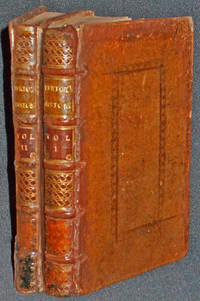
1722007782London: Printed for W. Taylor J. Pemberton E. Symon W. Chetwood J. Lacy and J. Clarke 1722. Hardcover. Very Good. 2 volumes: 2 vi 356 p.; 4 243 1 p.; 19 cm. 8vo Signatures: v. 1. A4 B-Z8 Aa2 -- v. 2. A2 B-Q8 R2. Contemporary speckled calf with blind-tooled decoration on each board with six spine compartments between raised bands. Leather label in second compartment of each volume with gilt-tooled title: Vertot's History Gilt-tooled volume number in third compartment of each with gilt-tooled decoration in remaining compartments. All page edges speckled red. Titles in double line borders. Woodcut head pieces tailpieces and initial articles. Translation of Histoire critique de l'établissement des Bretons dans les Gaules. Dedication signed by the translator John Henley. Engraved armorial bookplate on each fixed endpaper: "Strickland Freeman Esqr. Fawley Court Bucks 1810." Strickland Freeman d. 1821 inherited Fawley Court from his uncle Sambrooke Freeman in 1782. He wrote works on horsemanship and botany. Although his will was probated in 1822 and some sources state that he died that year he died in Nov. 1821 according to Debrett's. Circular red stamp on title page verso of each volume of Pennsylvania State University Library. In Very Good Condition: minor loss at spine ends; vol. 2 has modern repair of joints with Japanese tissue; vol. 1 lacking back free endpaper; both volumes have modern repair of hinges with Japanese tissue; pages are clean and tight. Printed for W. Taylor, J. Pemberton, E. Symon, W. Chetwood, J. Lacy, and J. Clarke hardcover
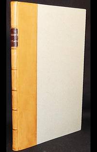
1684003505London: Bennet Griffin 1684. Near Fine. Printed for by Bennet Griffin and sold by Christ. Wilkinson and by Sam. Keble. 8 140 12 4 p. 1 double-leaf plate: genealogical tables 1 map Comitatus Rotelandiae Tabula Nova & Aucta 19 in-text and full-age engraved illustrations of buildings tombs and monuments 30 engraved coats of arms: 33 cm. Signatures: A-S4 B1 missigned A1 T2 A6 V2. Simple attractive modern calf spine with seven spine compartments between raised bands; gilt-tooled leather label in second compartment with title "Wright's Rutland." Light grey paper over boards. All page edges speckled red. Wing W-3696 & 3691. Bound with: Additions to The History and Antiquities of Rutlandshire Colophon: London printed for the author by Edw Jones 1687. Index The Table is bound following Additions; Errata is at the foot of the last page of the index. The title page is not printed in red and black. Small oval armorial stamp on last page. In Near Fine Condition: light soiling to boards; 2-cm. tear from upper edge of pp. 93-94 without loss; clean and bright. Bennet Griffin unknown
2023x-1032469749Routledge 2023. Hardcover. New. 24 edition. 338 pages. 9.19x6.13x0.96 inches. Routledge hardcover
2003DADAX1857432177Routledge 2003-06-19. 1. hardcover. New. 10.74x2.52x13.84. Buy with confidence. Excellent Customer Service & Return policy. Routledge hardcover
2015__1857437438Routledge 2015. Hardcover. New. 79 edition. 2449 pages. 11.50x9.00x5.00 inches. Routledge hardcover
1836385-nnew. unknown
2012__1857436377Routledge 2012. Hardcover. New. 76 edition. 2412 pages. 11.85x9.02x3.03 inches. Routledge hardcover
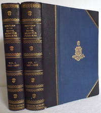
1927010451Aldershot: Gale and Polden. First edition. 2 volume set Edition de Luxe in 3/4 leather limited to 114 numbered copies. Number 15. Published Aldershot: Gale and Polden 1927. 4to. 8" x 10" viii254p. ix305p. illus. 8 color plates 58 illustrations and 41maps - many folding some in color. 3/4 bound blue leather with raised bands gilt spine titles and decorations over blue cloth with gilt crest blue marbled endpapers all edge gilting sewn-in ribbon marker. Thee page publisher's announcement of De Luxe Edition recipients printed at the front of each volume. This copy issued to Colonel C.H. Jardine. Small chipping to the leather at the lower hinge/edge of volume 2 else near fine no foxing pages fine - bright white maps and plates fine. . Near Fine. Leather. 1st. 1927. Gale and Polden hardcover
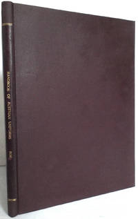
1934010546Wien: Österreichische Monographien. First edition. Original wrappers fully bound in hardcover. Published Wien: Österreichische Monographien 1934. 4to. 9 1/4" x 12 1/4" 66 pages with 146 pictures and 22 drawings. Text in German. A standard work for uniforms of the era includes army civil servants executive and military associations. Bound in brown pebbled cloth with spine titles in gilt laid endpapers and preliminaries. Fade to the cloth around edges scattered light foxing age toning to the lesser paper used for the advertisements bookplate on pastedown. Very good. Scarce. . Very Good. Hard. 1st. 1934. Österreichische Monographien unknown
126810aafLyon, Jean-Marie Bruyset, Père et fils, M. DCC. LXXXIV., (1784), pt. in-8°, frontispice gravé (Atlas porteur du globe terrèstre) + XII + 331 p. (+ 1 blanche) + 24 planches dépl. coloriées, dont une montrant la sphère et une montrant 3 figures de notre système solaire, ex libris enlevé reliure en veau raciné, dos orné en or.
2013x-1857436776Routledge 2013. Hardcover. New. 15 revised edition. 686 pages. 11.22x8.54x1.81 inches. Routledge hardcover
2014__1857437349Routledge 2014. Hardcover. New. 12 revised edition. 832 pages. 11.00x8.50x2.00 inches. Routledge hardcover
2014__1857437403Routledge 2014. Hardcover. New. 15 edition. 836 pages. 11.26x8.50x2.01 inches. Routledge hardcover
2006DADAX1857433696Brand: Routledge 2006-10-26. 36. hardcover. New. 8.50x1.75x11.00. Buy with confidence. Excellent Customer Service & Return policy. Brand: Routledge hardcover
2014__1857437292Routledge 2014. Hardcover. New. 15 revised edition. 912 pages. 10.75x8.25x2.00 inches. Routledge hardcover
2016__1857438388Routledge 2016. Hardcover. New. 10 revised edition. 1134 pages. 10.98x8.31x11.02 inches. Routledge hardcover
181512826Paris Nepveu, 1815. XIV S. + 326 S. 12° Duodez Ldr. 2 Bände