[Canada; Alaska; Railroad]Biblio.com
1 282 résultats
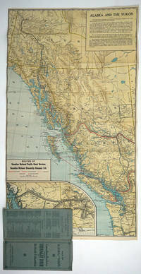
192726808Canada: Canadian National Railways 1927. Pamphlet. Very good condition. Double sided map of the railroad routes of the Canadian National Pacific Coast Services and the Canadian National Steamship Company Ltd. The map covers the area from Dawson Alaska to Portland Oregon. The verso is a pictorial map of the Triangle Tour of British Columbia Jasper National Park and Mount Robson Park with text about Jasper. <br /> <br /> Color map 17 x 30" folding 4 x 9 1/4" blue card wraps with green titles. Sml closed tear at one fold. Canadian National Railways unknown
189060273St. Paul MN: W.C. Riley Publisher Engraved by Charles Frey Franfurt Germany ca. 1890. Oblong 8vo. 9.75 x 6.25 in. 30 leaves unnumbered. sepia-tinted leporello accordion-style format. With 30 lithograph plates including 1 double-leaf plate w/ 2 birds-eye views of Minneapolis & St. Paul 1 birds-eye panoramic views of Northern Pacific train & Duluth Harbor many sepia-tinted views on remaining. Quarter-black cloth over elaborately decorated & embossed burgundy-coloured covers gilt lettering & decoration front cover minor scuffing edgewear small discrete paper repair to a few hinges hinge still a VG copy. Third edition “30000†of this nicely executed souvenir book issued in the same size as the popular “Boudoir†albumen souvenir photos for the Northern Pacific as its route opened through the Northern United States railroad lands for development across the West and expanding upon the much smaller original 1888 “Northern Pacific Tour.†These lithographs were created by hand-drawn images from photographs and printed using the Glaser/Frey lithographic process using five or more stones to lay down a series of separate shades offering a varnished look. The NP RR souvenir view book includes images of Dakota wheat fields Custer Battlefield monument Crow Indians at Yellowstone Montana cattle roundups and gold mining along the Columbia River with birds-eye views of Butte & Helena MT Spokane WA and salmon fishwheel as well as early birds-eye view of Portland OR. Views of Alaska include Sitka Juneau Totem Poles on Wrangel Island and the glaciers. The piece concludes with birds-eye view of San Francisco. W.C. Riley Publisher, [Engraved by Charles Frey, Franfurt, Germany], hardcover
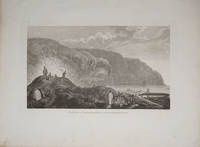
178522404London 1785. Very good condition. Copper engraved view of natives in traditional garb tending their kayaks at the water's edge. Drawn by John Webber and published in James Cook's third voyage around the world. 15 x 9 1/2" on large paper. unknown
20192-1698166214Independently published 2019. Paperback. New. 686 pages. 10.00x8.00x1.72 inches. Independently published paperback
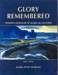
199241004Seattle WA: University of Washington Press. NF. 1992. Paperback. Paperback in Near Fine condition. . 11 X 8.40 X 0.50 inches. 176 pages. Previous owners bookplate. . Quick Shipping All Books Mailed in Boxes Free Tracking Provided . University of Washington Press paperback
187111339Paris, Librairie Hachette, 1871. In-8 de [6]-II-412 pages, demi-chagrin rouge, plats de percaline, dos orné d'encadrements et titre dorés, tranches dorées. Rousseurs.
ML275Ducrocq 1875, gr in8 1/2 chagrin rouge,tranches dorées ,VI-308pp , 62 gravures et 1 carte dépliante Langue: Français
A reproduction of the original 1909 edition of the Alaska - Yukon - Pacific Exposition Number of the Centralia Daily Chronicle. Slight edge wear to cover. 10"w x 14 1/8"h. Unpaginated.
Boards a bit darkened and with light wear to extremities; Collected diary entries from a trip to Alaska in 1918-19 undertaken by Kent and his son. Illustrated by the author. Kent's first book; B&W Illustrations; 4to 11" - 13" tall; 217 pages
199786238Graz, Leopold Stocker Verlag, 1997.
1905144857Skagway Alaska: Edw. H. Mitchell for Case & Draper ca. 1905. Oblong 12mo 22 X 15 cm. Illustrated with 16 tinted plates from photos including scenes of Skagway Summit of White Pass Lawton Glacier and Totem Poles at Sitka. Original black wrappers with white lettering on front cover and brown tie strings on spine. Minor chips to front edge of covers. A very good copy with clean and bright photos. Not in Tourville or Kurutz. For some reason seems very scarce. 1905 Edw. H. Mitchell, for Case & Draper unknown
122173Skagway Alaska: Edw. H. Mitchell for Case & Draper. Softcover. very good. 1st Edition. unpaginated. Oblong 12mo 22 X 15 cm. Illustrated with 16 tinted plates from photos including scences of Skagway Summit of White Pass Lawton Glacier and Totem Poles at Sitka. Original black wrappers with white letterng on front cover and brown tie strings on spine. Minor chips to front edge of covers. A very good copy with clean and bright photos. very good Not in Tourville or Kurutz. Seems very scarce. Probably considered more of a Skagway item based on the photos. Edw. H. Mitchell, for Case & Draper paperback
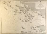
56397London: British Admiralty 1895 1925. . An engraved chart on heavy stock uncolored sheet size 20 x 27.5 inches. Published 30th Sept. 1895; Large Corrections Jan. 1898; Small corrections printed to 1925 and mss. to 1927. Some dust soiling at lower edge in general a nice clean copy a few additions in red pen. In lower right: "Engraved by Edwd. Waller". Chart number is 2348. Small typed label on verso giving chart & folio info. Published under the Superintendence of Rear Admiral W.J.L. Wharton. A detailed chart of the islands and coastal area around Sitka; the Sitka town plan indicates the Wireless Telephone Stn. Astronomical Stn. Indian Village and Mission. <br/><br/> London: British Admiralty, 1895 (1925). unknown
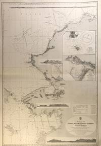
56407London: British Admiralty 1907 1928. An engraved chart on heavy stock uncolored sheet size 27.5 x 40 inches. Published 17th April 1907; New Edition Jan. 1923. Large Corrections 1st June 1928. Original horizontal fold a clean and attractive copy some small additions in red pen. Engraved shorelines in vignette. In lower right: "Malby & Sons". Chart number is 593. Small typed label on verso giving chart & folio info. Published under the Superintendence of Rear Admiral A. Mostyn Field. A large and detailed chart with inset maps of Chamisso and Port Clarence with an additional detailed inset of Port Clarence. From the Yukon River north to the Bering Strait Kotzebue Sound as far as Point Barrow on the coast of Alaska here designated as West Georgia. <br/><br/> London: British Admiralty, 1907 (1928). unknown
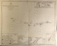
56421London: British Admiralty 1890 1928. . An engraved chart on heavy stock uncolored sheet size 34 x 27 inches. Published 9th July 1890; New Edition 28th Sept. 1928. Clean and attractive original vertical fold. In lower right: "Engraved 1890" and "Zc 1928". Chart number is 1501. Small typed label on verso giving chart & folio info. Published under the Superintendence of Captain W.J.L. Wharton. A detailed chart of the Aleutian islands including the Near Islands Rat Islands and Andreanof Islands groups. Included are nine small inset maps of harbours and anchorages on the various islands: Bay of Islands Korovin Bay Nazan Bay Bay of Waterfalls Suchikof Bay McDonald Bay Constantine Hr. Kiska Hr. and Chichagof Hr. Included in this chart are Attu Island and Kiska Island which were occupied by the Japanese during WW II. Two inset maps provide details of these islands: Chichagof Harbour on Attu Island and Kiska Harbour on Kiska Island. <br/><br/> London: British Admiralty, 1890 (1928). unknown
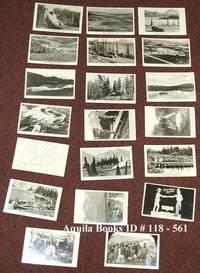
1941118561c1941-1949. Softcover. near fine. Complete set of 20 different real photo postcards: 18 from photos one cartoon facsimile and one map with route indicated. Cards printed on AZO post card photo paper. near fine 8 postcards printed "Permission Wartime Information Board" being numbers 1 2 3 4 14 15 1 6 and 17 9 postcards printed by "Permission of Public Roads Administrations" being numbers 5 6 7 8 9 10 11 12; no. 18 by the Canadian Post Card Co. Toronto Uncle Sam shaking hands across the border with a Mountie; and nos. 19 and 20 by "Permission of the National Film Board". 1941 paperback
190028458Washington, Government Printing Office, 1900. Orig. full cloth. Light discolouring to back. 169 pp., 168 photographic plates and 1 large folded map.
190028458Washington Government Printing Office 1900. Orig. full cloth. Light discolouring to back. 169 pp. 168 photographic plates and 1 large folded map. <br/><br/><em>First edition. </em> hardcover
6242Boston, D. Lothrop and company., [sans date]. In-12 de VIII-333-[9]p. pleine percaline chocolat, titre doré au dos, répété sur le premier plat dans deux cartouches dorées.
ria9780323995825_inpPaperback / softback. New. New Book; Fast Shipping from UK; Not signed; Not First Edition; N/A paperback
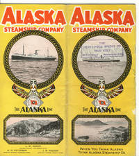
192839103Chicago: Poole Bros. Inc. 1928. 1928. ALASKA. First edition. 8vo. 9" x 8" color pictorial wrappers folded to 9" x 4" 24 pp. including covers illustrated map deck plans. Map outlines the route of the Alaska Steamship Company and connections from Seattle to various ports in Alaska in red. The remainder of the booklet provides information on various trips from one Alaskan point to another along with the steamship used a deck plan of the steamship accommodations and rates for travel and sailing schedules. Agent stamp on cover panel covers lightly soiled rubbed along spine panel and lower spine split about four inches from the bottom else a good copy. Poole Bros. Inc., 1928]. unknown
Lot of 8 four-page menus from the S.S. Yukon Star, each measuring 8.5" x 5.5" and featuring a charming color cover illustrations of a notable Alaskan dog, with brief write-ups of each dog on back page. Dogs include: Blizzard - owned by Slim Williams; Two Husky puppies; Wolf - raced by Mary Joyce in the Alaska Dog Derby; Cheechako - owned by Lieutenant Colonel Francis E. Maslin; Rye - given to the Army at Chilkoot Barracks by Mary Joyce; Mageik - Father Hubbard's famous sled dog; Jack - racing dog owned by Grover Bayless of Fairbanks; and Smokey - a favorite among forty army dogs formerly stationed at Chilkoot Barracks. Undated, possibly late 1940s. Clean and unmarked with light wear. A lovely collection. Book
208 pages. Index. Footnotes. "A unique collection of over 320 original maps of explorers and navigators from four centuries of voyages and overland treks of exploration and discovery to the northwest coast, plus native maps, and a host of others selected for their interest and historical significance." - dust jacket. Clean, bright and unmarked with very light wear. An excellent example of this wonderful work. Book
82 pages. Features: Harry Shuler Dent; An ABM Primer; Alaska Wildfires; The impoverished Havasupai tribe; Las Vegas reaches a new pinnacle of preposterousnous; Rockefeller's tour of Central and South America; The Lesson of Ben Het in Vietnam; Land for South Vietnam's peasants; Ad for the VW Squareback sedan; Heroin deaths in NYC; Oriole pitcher Dave McNally; Are courts more severe with black defendants; Reinforcement Therapy; Singer Tom Jones - article with photo; The Jackson brothers hog hollering in Spivery's Corner NC; Diagram illustrates bioaccumulation of toxins; The Art of Henry Tanner; Sex as a Spectator Sport - changing sexual attitudes in the U.S.; Conversations on the new Eroticism - article which includes photo of Billy Graham in Times Square smut shop; Article on bank credit cards; Copycat ads; Oakland Raider Art Powell starts successful business Black & Brown Trading Stamp Co.; and much more. Unmarked with moderate wear. A sound vintage copy. Book
1999Q-1566610478Alaska Geographic Society 1999-12-01. Paperback. New. In shrink wrap. Looks like an interesting title! Alaska Geographic Society paperback