Alaska Geographic AssociationBiblio.com
1 282 résultats
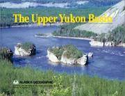
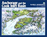
0882401874New. paperback. New. Satisfaction Guaranteed or your money back. paperback
0882401831New. paperback. New. Satisfaction Guaranteed or your money back. paperback
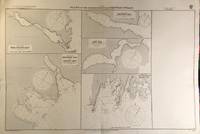
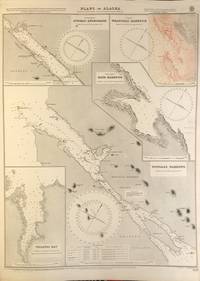
56412London: British Admiralty 1907 1921. . An engraved chart on heavy stock uncolored sheet size 40 x 27.5 inches. Published 2nd April 1907; Small corrections printed to 1921. Original vertical fold. A nice clean copy some small additions in red pen. In lower right: "Engraved by Davies & Company.". Chart number is 3637. Small typed label on verso giving chart & folio info. Published under the Superintendence of Rear Admiral A. Mostyn Field. Plans of anchorages in Chatham Strait and Frederick Sound: Red Bluff Bay Herring Bay and Chapin Bay Hoggatt Bay Gut Bay and Surprise Harbour and Murder Cove. Murder Cove was so named for the killing of two gold prospectors in retaliation for the killing of two Tlingit tribesmen which precipitated the fighting between the Tlingit and the US Government known as the Kake War. <br/><br/> London: British Admiralty, 1907 (1921). unknown
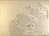
56398London: British Admiralty 1900 1929. . An engraved chart on heavy stock uncolored sheet size 27.5 x 20 inches. Published 13th July 1900; New Edition - Large Corrections 15th November 1929. Clean and attractive never folded. In lower right: "Engraved 1900" and "Zc 1929". Chart number is 3132. Small typed label on verso giving chart & folio info. Published under the Superintendence of Rear Admiral Sir W.J.L. Wharton. Saginaw Bay has recently 2019 been renamed to Skanax Bay following a petition from Tlingit tribal leaders complaining of its association with the 1869 Kake War during which a U.S. warship The Saginaw destroyed three Tlingit communities. <br/><br/> London: British Admiralty, 1900 (1929). unknown
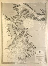
56389London: British Admiralty 1895 1925. An engraved chart on heavy stock uncolored sheet size 20 x 27.5 inches. Published 26th Aug. 1895; Large corrections to Nov. 1900; Small corrections printed to 1925 and mss. to 1930. Clean and attractive never folded some small additions in red pen. In lower right: "Engraved by Edwd. Weller". Chart number is 2337. Small typed label on verso giving chart & folio info. Published under the Superintendence of Rear Admiral W.J.L. Wharton. Sitka Sound was named Ensenada de Susto by Juan de la Bodega on 15 August 1775. It was later named Norfolk Sound by James Cook. In 1801 Fleurieu published a map naming it Baie Tchinkîtâné in an attempt to use Tlingit toponyms. <br/><br/> London: British Admiralty, 1895 (1925). unknown
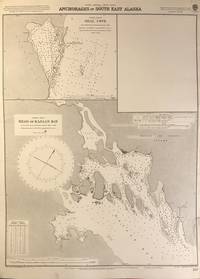
56402London: British Admiralty 1898 1925. An engraved chart on heavy stock uncolored sheet size 20 x 27.5 inches. Published 2nd Aug. 1898; New Edition Nov. 1921; Small corrections printed to 1925 and mss. to 1926. Clean and attractive never folded short tears to margin at lower right some small additions in red pen. In lower right: "Engraved by Davies & Company". Chart number is 837. Small typed label on verso giving chart & folio info. Published under the Superintendence of Rear Admiral Sir W.J.L. Wharton. Two maps: Seal Cove Gravina Island and Head of Kasaan Bay at Prince of Wales Island. <br/><br/> London: British Admiralty, 1898 (1925). unknown
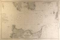
56409London: British Admiralty 1911 1924. An engraved chart on heavy stock uncolored sheet size 40 x 27.5 inches. Published 11th April 1911; New Edition 30th May 1921; Small corrections printed to 1924 and mss. to 1927. Original vertical fold clean and attractive some small additions in red pen. In lower right: "Engraved by Davies & Company". Chart number is 3754. Small typed label on verso giving chart & folio info. Published under the Superintendence of Rear Admiral H.E. Purey-Cust. Good detail of the northern end of Graham Island in the Haida Gwaii formerly Queen Charlotte Islands. The Dixon Entrance remains a contentious area today with ongoing disputes about the precise location of the boundary line between Canada and the USA. This 1924 map shows a dotted line just south of Prince of Wales Island with the text: "Approximate Boundary between British Columbia and Alaska". <br/><br/> London: British Admiralty, 1911 (1924). unknown
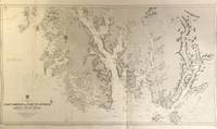
56418London: British Admiralty 1896 1925. . An engraved chart on heavy stock uncolored sheet size 46 x 28 inches. Published 15th Dec. 1896; Large Corrections to July 1907; Small corrections printed to 1925 and mss. to 1929. Original vertical folds a clean and attractive copy some small additions in red pen. In lower right: "Engraved by Davies & Compy.". Chart number is 2458. Small typed label on verso giving chart & folio info. Published under the Superintendence of Rear Admiral W.J.L. Wharton. A large and detailed chart extending from the Dixon Entrance north to Wrangell Island; the chart extends east to the Portland Canal and the edge of British Columbia including Observatory Inlet and Salmon Cove visited by Captain Vancouver in 1793 and so named because he set up his observatory there in order to calibrate the chronometers. Good detail of Prince of Wales Island and Clarence Strait. Originally published in 1896 this is a 1925 printing. <br/><br/> London: British Admiralty, 1896 (1925). unknown
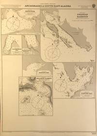
56401London: British Admiralty 1898 1920. An engraved chart on heavy stock uncolored sheet size 20 x 27.5 inches. Published 11th Nov. 1898; Large corrections to April 1904; Small corrections printed to 1920. Clean and attractive never folded some small additions in red pen. In lower right: "Engraved by Edwd. Weller". Chart number is 3008. Small typed label on verso giving chart & folio info. Published under the Superintendence of Rear Admiral Sir W.J.L. Wharton. Maps of seven anchorages at Lynn Canal Glacier Bay and Chatham Strait: Fritz Cove Swanson Harbour William Henry Bay Barlow Cove Anchorage Bartlett Bay Killisnoo Harbour and Funter Bay. <br/><br/> London: British Admiralty, 1898 (1920). unknown
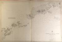
56420London: British Admiralty 1903 1929. . An engraved chart on heavy stock uncolored sheet size 40 x 27.5 inches. Published 23rd April 1903; New Edition 1st March 1929. Clean and attractive original vertical fold some small additions in red pen. In lower right: "Engraved 1903" and "Zc 1929". Chart number is 3336. Small typed label on verso giving chart & folio info. Published under the Superintendence of Rear Admiral Sir W.J.L. Wharton. A detailed chart of the Fox Islands Group in the Eastern Aleutians. <br/><br/> London: British Admiralty, 1903 (1929). unknown
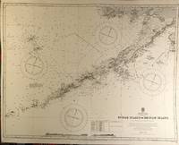
56422London: British Admiralty 1890 1924. . An engraved chart on heavy stock uncolored sheet size 34 x 27 inches. Published 9th July 1890; New Edition 19th Jan. 1917. Small corrections printed to 1924 and mss. to 1929. Clean and attractive original vertical fold some additions in red pen. In lower right: "Engraved by Davies & Company". Chart number is 1500. Small typed label on verso giving chart & folio info. Published under the Superintendence of Captain W.J.L. Wharton. A detailed chart of the Aleutian Islands chain from Alaska to Seguam Island. Several engraved vignettes of shorelines at the bottom. Originally published 1890 this is a 1924 printing. <br/><br/> London: British Admiralty, 1890 (1924). unknown
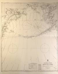
56408London: British Admiralty 1884 1928. . An engraved chart on medium stock uncolored sheet size 27 x 34 inches. Published 28th Oct. 1884; New Edition 15th Jan. 1923. Large Corrections 14th Sept. 1928. Original horizontal fold a clean and attractive copy some small additions in red pen. In lower right: "Engraved by Davies & Company". Chart number is 2460. Small typed label on verso giving chart & folio info. Published under the Superintendence of Captain W.J.L. Wharton. Good details of the Aleutian Islands and Bering Sea Eastern Siberia and the Bering Strait at the top. <br/><br/> London: British Admiralty, 1884 (1928). unknown
56396London: British Admiralty 1898 1924. . An engraved chart on heavy stock uncolored sheet size 20 x 27.5 inches. Published 22nd March 1898; Small corrections printed to 1924 and mss. to 1927. Unfolded. A nice clean copy. In lower right: "Engraved by Edwd. Weller". Chart number is 1524. Small typed label on verso giving chart & folio info. Published under the Superintendence of Rear Admiral Sir W.J.L. Wharton. Maps of Juneau Anchorage Wrangell Harbour Ratz Harbour Tongass Narrows and Tolstoi Bay. Upper right map Wrangell Harbour is corrected with a paste-over printed in black & red. <br/><br/> London: British Admiralty, 1898 (1924). unknown
1910113798Seattle Washington: Printed by the Pacific Press Inc. nd c1910. Softcover. very good. 1st Edition. 157pp. 2pp. indexpp. Octavo. Illustrations from photos. Original black cloth taped backed blue wrappers minor fading. very good Tourville 156. Illustrated report giving a history of the commission detailed statement of all disbursements summary of receipts and disbursements and description and costs of buildings and major exhibits. 1910 Printed by the Pacific Press, Inc. paperback
1983Q-0882401726Graphic Arts Books 1983-01-01. Paperback. New. In shrink wrap. Looks like an interesting title! Graphic Arts Books paperback
1989Q-0882401866Alaska Northwest Books 1989-03-01. Paperback. New. In shrink wrap. Looks like an interesting title! Alaska Northwest Books paperback
1982Q-0882401696Graphic Arts Books 1982-01-01. Paperback. New. In shrink wrap. Looks like an interesting title! Graphic Arts Books paperback
1972Q-0882401750Alaska Northwest Books 1972-01-01. Paperback. New. In shrink wrap. Looks like an interesting title! Alaska Northwest Books paperback
1980ABE-1636753462650Commission on History and Culture North Slope Bureau 1980 Cloth oversized 9x11 1st. ed. 209pp. Shelf wear to DJ with small tape repair at top edge spine & back panel beige boards. Many B&W photos maps interviews bibliography. Book is clean & tight. 1st Edition. Hardcover. Near Fine/Good. Commission on History and Culture, North Slope Bureau hardcover
1980Q-0882401424Alaska Geographic Society 1980-01-01. Paperback. New. In shrink wrap. Looks like an interesting title! Alaska Geographic Society paperback
2003Q-1566610060Alaska Geographic Society 2003-06-01. Paperback. New. In shrink wrap. Looks like an interesting title! Alaska Geographic Society paperback
Incisione inserita nell'opera "A New, Royal, Authentic and Complete System of Universal Geography, Ancient and Modern: Including All the Late Important Discoveries Made by the English, and Other Celebrated Navigators .. History and Description of the Whole World... Likewise the Essence of the Voyages of the Most Enterprising Navigators..." edita a Londra da J. Cooke nel gennaio del 1787
Incisione inserita nell'opera "A New, Royal, Authentic and Complete System of Universal Geography, Ancient and Modern: Including All the Late Important Discoveries Made by the English, and Other Celebrated Navigators .. History and Description of the Whole World... Likewise the Essence of the Voyages of the Most Enterprising Navigators..." edita a Londra da J. Cooke nel gennaio del 1787
193118041931 Ed. Georges Crès et Cie, Paris, 1931. Petit in-8 broché, couverture illustrée. 271 pages. Traduction de Louis Postif.
Carta geografica raffigurante il tratto di costa dell'Alaska esplorato dal Capitano Cook durante il suo terzo viaggio a bordo della Resolution il giorno 12 maggio del 1778. Nell'angolo in basso a destra in riquadro graduato particolare della baia di Samgano Odha.Rigobert Bonne (1727-1795) fu uno dei più importanti cartografi del tardo XVIII secolo. Nel 1773 succedette a Jacques Bellin come cartografo reale in Francia.