[Louisiana]Biblio.com

1 546 résultats
192041173Washington D.C.: Published by the United States Coast and Geodetic Survey 1920. Large folding nautical chart printed on heavy paper stock. Colored. A rare original coastal survey of the Texas-Louisiana border area from Sabine Pass to Calcasieu Lake and Pass and includes Mud Lake Holly Beach Johnson Bayou and Sabine National Wildlife Refuge.<br/> <br/> Established by President Thomas Jefferson in 1807 as the Survey of the Coast the U.S. Coast and Geodetic Survey was the United States' first civilian scientific agency. This agency has followed its mission to survey the U.S. coastline create nautical charts of the coast and help increase maritime safety since its founding and has often played fascinating roles in significant chapters of U.S. history. It served in all theaters of the Civil War in the service of the Union Army and Navy pioneered acoustic exploration in the wake of the sinking of the Titanic and during WWI it worked to detect enemy submarines. In addition this agency worked to survey and produce detailed maps and renderings of the U.S. coast. These nautical survey maps commonly referred to as "T-sheets" provide fascinating insights into the history of the United States coastline which has and will continue to shift. These maps are the most important data source for understanding the physical and ecological characteristics of the U.S. shoreline. The present map is a highly detailed and accurate sea chart of the Texas-Louisiana southern border and an important historical view of the developing Louisiana. Published by the United States Coast and Geodetic Survey unknown
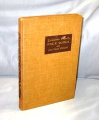
193927182Baton Rouge:: Louisiana State University Press 1939. First Printing of the First US Edition. A Very Good plus copy in brown cloth binding with some rubbing to the spine lettering though still readable. The author worked both alone and with Allan Lomax collecting songs "in the field". Some of the lyrics in this rare volume are in Cajun French some in "regular" French and some in a curious combination of the two. All of which is to say that they are typical folksongs. Includes a Bibliography and an Index of Songs. Louisiana State University Press, hardcover
192041174Washington D.C.: Published by the United States Coast and Geodetic Survey 1920. Large folding nautical chart printed on heavy paper stock. Uncolored. A rare original coastal survey of the Atchafalaya Basin area including Marsh Island Cote Blanche Bays Atchafalaya Bay and River.<br/> <br/> Established by President Thomas Jefferson in 1807 as the Survey of the Coast the U.S. Coast and Geodetic Survey was the United States' first civilian scientific agency. This agency has followed its mission to survey the U.S. coastline create nautical charts of the coast and help increase maritime safety since its founding and has often played fascinating roles in significant chapters of U.S. history. It served in all theaters of the Civil War in the service of the Union Army and Navy pioneered acoustic exploration in the wake of the sinking of the Titanic and during WWI it worked to detect enemy submarines. In addition this agency worked to survey and produce detailed maps and renderings of the U.S. coast. These nautical survey maps commonly referred to as "T-sheets" provide fascinating insights into the history of the United States coastline which has and will continue to shift. These maps are the most important data source for understanding the physical and ecological characteristics of the U.S. shoreline. The present map of the Louisiana coastline is notable for the inclusion of the Atchafalaya Basin the nation's largest river swamp containing 1 million acres of America's most significant bottomland hardwoods swamps bayous and backwater lakes. It also is home to a diverse wildlife population containing 65 species of reptiles and amphibians 100 species of fish and 250 species of birds containing the largest nesting concentration of bald eagles in the south central United States. The map also notes Marsh Island which was deeded to the state in 1920 the year this map was produced. It is a highly detailed and accurate sea chart of the Atchafalaya Basin and an important historical view of the developing Louisiana. Published by the United States Coast and Geodetic Survey unknown
1890WRCAM49909New Orleans: L. Soards Publisher 1890. 338pp. Publisher's blue cloth gilt. Some insect damage light soiling spine ends and corners a bit frayed. Endpapers stained. Text toned but clean. A good copy. An early directory and guide book for the city of New Orleans. Includes address listings for both private residences and businesses advertisements for a wide variety of retailers a section for "Hints on Etiquette" floor plans for various opera houses and theaters and more. Illustrated with an occasional stock image in the advertisements. Rare with only two copies in OCLC at the New Orleans Public Library and the University of Texas at Austin. A delightful guide to the Big Easy. L. Soards, Publisher hardcover books
Pages 90-176 plus 16 pages of ads. Features: The Slacker - a young Californian deserts the Army and his lady to flee to Mexico where great misery follows, but he eventually atones; The Mysterious Witch Doctors of Siberia - disguised as a Russian peasant, the author penetrated into little-known Siberia to investigate the uncanny doings of the native Shamans - article with photos; My Island of Dreams - Part II - the adventures of Amateur Robinson Crusoe, J.W. Frings (with photos); Through Central America on Horseback - Part V - riding through Costa Rica, Nicaragua, Salvador, and Guatemala - story with photos of earthquake damage in Guatemala City; Mountain Mysteries - the strange story of Mr. Crump who was lost for 18 days in the Lakeland crags, plus other cases of mysterious disappearances; Cheating Death - John Edwin Hogg recounts his most harrowing experience; A Bear-Hunt in Lousiana - interesting and successful hunt in the Louisiana Marsh - with photos; My Burglar - a Singapore encounter with a Chinese burglar, stripped naked and greased from head to foot, with fish-hooks in his pigtail and a double-edged sword between his teeth; The Rajah's Lift - the tragic story of a home-made hydraulic lift; The New Moon - information in a diary saves the lives of two men; A Man's Luck - Part III of Hjalmar Hutzebeck's story of life and love in the Far North; Photo and brief write-up of the world's most northerly police post; Photo of the smallest business house in the world in Duncan, Oklahoma; 'House of Gold' built by a wealthy miner in the California's Mojave Desert; and more. Somewhat above-average wear. Back cover almost loose. Unmarked. Binding intact. A worthy copy of this great vintage issue. Book
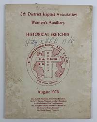
19764649Shreveport La 1976. Good. 34pp. Original pictorial cream wrappers stapled. Moderate staining and noticeable insect damage to wrappers some pen notations on covers. A few ink notations and underlinings in the text but mostly clean with center gathering detached. An unrecorded pamphlet containing numerous "historical sketches" of the various groups within the 13th District Baptist Association Women's Auxiliary in Shreveport Louisiana. The work contains a history of the Antioch Baptist Church Missionary Society which began in 1889 and sketches on the women of the Broadway Missionary Church Mission Band the Lakeside Baptist Church the Little Union Missionary Baptist Church Mission Society and Woman's Missionary Union and many many more groups from area churches. The text is illustrated throughout with dozens of photographs of notable officers members and other figures within the groups various churches and more. An excellent snapshot of Shreveport-area women's church groups with no copies in OCLC. unknown
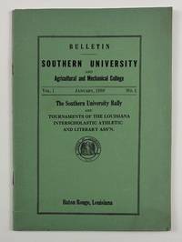
19384099Baton Rouge La: January 1938. Very good. 32pp. Original green printed wrappers stapled. Minor wear and dust-soiling. Pencil notations to a few pages otherwise internally clean. The rare first issue of the bulletin of Southern University in Baton Rouge. The issue was devoted to the Southern University Rally and printed rules and regulations for the tournaments of the Louisiana Interscholastic Athletic and Literary Association. These events included the state football championship basketball games music and literary contests the state dramatic festival and the state track meet. The work also includes the "Aims and Purposes of the Association" which are "adapted from the Texas Interscholastic League for Colored Schools" a history of interscholastic activities "among Negro Schools in Louisiana" and lists of the officers of the organization. The previous owner of the present copy of the bulletin had a keen interest in the section on the rules for music contests with numerous light pencil notes written in the outer margins of the first two pages of that section. January unknown
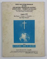
19784648Shreveport La 1978. Very good. 56pp. Original pictorial wrappers stapled. Moderate foxing creasing light edge wear with a few pen notations to rear wrapper. Light occasional foxing to text. A wonderful combination of souvenir program for a notable women's religious organization and overall celebration of African-American church life in Shreveport in the late-1970s. Chiefly the program contains the schedule of events for the 1978 conference of the 13th District Missionary Baptist Association Women's Auxiliary which took place over five days in August. The work also opens with a Dedication "In memory of The Black Mother" by the auxiliary's president Sister Eddie Jones and includes photographic collages of the organization's officers "Some Past President of the 13th District Association and Pioneers of Faith" other photo-collages of "Pioneers of Faith" a group photograph of the Baptist Men's Council of Louisiana" and much more. The text is supplemented with a wealth of greetings and well wishes from a legion of local citizens and religious organizations along with a number of advertisements for local businesses. One greeting that also doubles as an advertisement for the African-American newspaper The Shreveport Sun is printed in memory of the founder of the paper M.L. Collins. No copies in OCLC. unknown
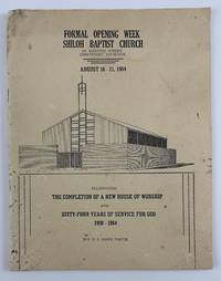
19644637Shreveport La 1964. Good. 48pp. Quarto. Original pictorial wrappers stapled. Noticeable staining and edge wear head of spine chipped. The very rare if not unrecorded program issued by the Shiloh Baptist Church "celebrating the completion of a new house of worship and sixty-four years of service for God 1900-1964." The work contains a schedule of events for the week-long service and dedication of the new building as well as a wealth of information on the Shiloh church along with numerous photographs of groups within the church including the Deaconess Board the Matrons Officers Sunday School classes the "Angelic Choir" and many more. The material on the church is supplemented by dozens of congratulatory messages and advertisements for local businesses supportive of the African-American community in Shreveport. No copies listed in OCLC. unknown
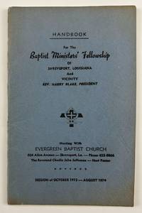
19744634Shreveport La 1974. Very good. 29pp. Original blue printed wrappers stapled. Minor discoloration around edges minor wear. Previous owner's signature on inside front cover ink notation on first page. An unrecorded pamphlet containing the details of Baptist church events in Shreveport for 1974. The work includes a listing of the ministers in charge of the Fellowship as well as the program calendar of events order of events the schedule for the Christian Doctrine Lectures assignments of Sunday School teachers listings of committees and members of each and the Constitution and By-Laws of the Fellowship. The final eleven pages are comprised of a Membership Directory of the Baptist Ministers' Fellowship listing each minister's name home address church affiliation and the address and phone numbers for the church. We could locate no other copies of this rare handbook which offers ample study of the African American religious community in Shreveport in the early-1970s. unknown
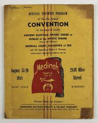
19484638St. Louis Mo 1948. Good plus. 40pp. Original yellow wrappers printed in red and black. Some uneven sunning a few ink notations moderate dust-soiling and edge wear to wrappers soft central vertical crease throughout. Minor dust-soiling to most of text a few ink notations. The official souvenir program for the 1948 national convention of the Imperial Council Ancient Egyptian Arabic Order of Nobles of the Mystic Shrine an African-American shriner's organization. The program begins with a Foreword by the group's Imperial Potentate Raymond E. Jackson followed by photographic portraits of the Imperial Council portraits of the women of the Imperial Court greetings and notices with photographic portraits from dozens of chapters and two pages of greetings from the Grand Chapter of Missouri. The two-page centerfold prints the schedule of events for the convention which took place from August 15-20 and included dozens of sessions run by the Imperial Council and Court as well as the Heroines of Jericho Eastern Stars and Royal Arch Masons. Among the more casual events held during the convention were a "Shriners Bathing Suit & Talent Pageant" held in Kiel Auditorium a baseball game at Sportsman's Park and a tour of the Anheuser-Busch brewery. The last half of the program as well as the inside rear cover and back cover are comprised of advertisements from local Black-owned businesses and those who catered to the Black community. unknown
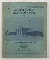
19654642Shreveport La 1965. Good. 64pp. Original pictorial light blue wrappers printed in dark blue stapled. Text printed in blue. Moderate staining and soiling to wrappers and text minor insect damage to wrappers. An unrecorded program celebrating the anniversary and the dedication of a new building for the African-American-owned J.S. Williams Funeral Home & Burial Association in Louisiana. Williams is described on the front wrapper as "Shreveport's Oldest Negro Business." The celebration took place Sunday April 11 1965 and the program includes a schedule of events for the day. The present work contains a history of the business portraits of the company's embalmers and other staff memorial messages addressed to some deceased former employees and more. Most of the work is taken up with advertisements largely from the African-American community in and around Shreveport. The advertisers include other Black churches local African-American schools like George Washington Carver High School organizations such as the Supreme Colored Helpers Society of America and the Colored Association of Louisiana and businesses including Booker T. Washington Nursing Home Shreveport Mutual Funeral Home and the Mays Printing Company. The wealth of ads practically add up to a de facto African-American community directory of contemporary Shreveport. We could locate no other copies of this work in OCLC or elsewhere. unknown
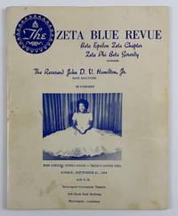
19754636Shreveport La 1975. Very good. 36pp. Original cream pictorial wrappers printed in blue stapled. Text printed in blue. Minor wear and some soiling to wrappers. A few blue pen marks to wrappers and a few text pages. An unrecorded program for a bass baritone performance by Reverend John D.V. Hamilton Jr. hosted by the Shreveport chapter of the Zeta Phi Beta Sorority. The program includes the schedule of events for the night of the performance which took place at the Shreveport Convention Theatre on September 21 1975 but also includes much more information on the African American community of the area. The program is profusely illustrated with photographs of sorority members Hamilton himself local Black political candidates and more and includes lists of the Blue Revue Committee the chapter members a biographical sketch of Hamilton and much more. In addition the work contains a great many well wishes from various parties and numerous advertisements for local businesses serving the Black community in Shreveport such as the Shreveport Sun newspaper the Benevolent Life Insurance Company Armanda's Beauty Salon J.S. Williams & Son Funeral Home and many others. Hamilton's musical performances included pieces by Handel Tchaikovsky Rodgers and Hammerstein Gershwin and one of his own compositions as part of a section of songs called "God in the Black Experience." We could locate no other copies of this program in OCLC or elsewhere. unknown
192041180Washington D.C.: Published by the United States Coast and Geodetic Survey 1920. Large folding nautical chart printed on heavy paper stock. Uncolored. A rare original coastal survey of Barataria Bay area and includes Grand Isle and other barrier islands Fifi island Grande Terre Island Port Fourchon and Terrebone Bay.<br/> <br/> Established by President Thomas Jefferson in 1807 as the Survey of the Coast the U.S. Coast and Geodetic Survey was the United States' first civilian scientific agency. This agency has followed its mission to survey the U.S. coastline create nautical charts of the coast and help increase maritime safety since its founding and has often played fascinating roles in significant chapters of U.S. history. It served in all theaters of the Civil War in the service of the Union Army and Navy pioneered acoustic exploration in the wake of the sinking of the Titanic and during WWI it worked to detect enemy submarines. In addition this agency worked to survey and produce detailed maps and renderings of the U.S. coast. These nautical survey maps commonly referred to as "T-sheets" provide fascinating insights into the history of the United States coastline which has and will continue to shift. These maps are the most important data source for understanding the physical and ecological characteristics of the U.S. shoreline. The present map of the Louisiana coastline is notable for the inclusion of Grand Isle the only inhabited barrier isle of Louisiana and for the Barataria Bay which was frequented by many pirates including Privateer Jean Lafitte. It is worth noting how much of the geography has shifted in this delicate environment in the 100 years since this map was produced. It is a highly detailed and accurate sea chart of the Barataria Bay Area and an important historical view of the developing Louisiana. Published by the United States Coast and Geodetic Survey unknown
192041172Washington D.C.: Published by the United States Coast and Geodetic Survey 1920. Large folding nautical chart printed on heavy paper stock. Uncolored. A rare original coastal survey of Caillou Bay area and including Isle Dernieres.<br/> <br/> Established by President Thomas Jefferson in 1807 as the Survey of the Coast the U.S. Coast and Geodetic Survey was the United States' first civilian scientific agency. This agency has followed its mission to survey the U.S. coastline create nautical charts of the coast and help increase maritime safety since its founding and has often played fascinating roles in significant chapters of U.S. history. It served in all theaters of the Civil War in the service of the Union Army and Navy pioneered acoustic exploration in the wake of the sinking of the Titanic and during WWI it worked to detect enemy submarines. In addition this agency worked to survey and produce detailed maps and renderings of the U.S. coast. These nautical survey maps commonly referred to as "T-sheets" provide fascinating insights into the history of the United States coastline which has and will continue to shift. These maps are the most important data source for understanding the physical and ecological characteristics of the U.S. shoreline. The present map of the Louisiana coastline is notable for the inclusion of Isle Derniere which translates to "last island" the westernmost of a string of islands along the basin of the Mississippi. This 24 mile stretch of land was Louisiana's southernmost outpost of civilization: a resort island for the wealthy complete with hotels ballrooms carousels and summer homes until an unnamed hurricane in 1856 flattened the island killing hundreds and fragmenting Isle Dernier into five smaller islands: East Trinity Whiskey Raccoon and Wine. These new names are not noted on this map still notated as Isle Dernier. This map is a highly detailed and accurate sea chart of the Caillou Bay and an important historical view of the developing Louisiana. Published by the United States Coast and Geodetic Survey unknown
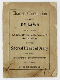
19014227New Orleans: A.M. Escudier Book and Job Printers 1901. About good. 19pp. Original printed front wrapper rear wrapper not present. Front wrapper a bit chipped and creased old adhesive repairs to closed tears bottom corner reinforced with tissue partially split along spine. Text block a bit toned foxed and creased. A seemingly unrecorded turn-of-the-20th century New Orleans imprint recording the founding and governing documents of the Ladies' Catholic Benevolent Association of the Sacred Heart of Mary of the Fifth District of New Orleans. The work contains the group's charter letters of support from various Louisiana officials the constitution and by-laws of the New Orleans chapter. The LCBA was organized in 1890 in Titusville Pennsylvania as a mutual aid society to provide insurance to women as most insurance companies of the time considered women uninsurable. The members of the association would pool their money together in order to cover various insurance needs as they arose from the membership. The group is actually still in operation today now known as the Loyal Christian Benefit Association. Though social action by Catholic women is more prevalent today it was uncommon in the 19th and early-20th century but the present group was strong-willed and often clashed with the hierarchy including some Bishops. No copies listed in OCLC. A.M. Escudier, Book and Job Printers unknown
192241168Washington D.C.: Published by the United States Coast and Geodetic Survey 1922. Large folding nautical chart printed on heavy paper stock. Colored. A rare original coastal survey of southwest wetlands from Calcasieu Pass to Constance Bayou and including Pecan Island and the Mermentau River.<br/> <br/> Established by President Thomas Jefferson in 1807 as the Survey of the Coast the U.S. Coast and Geodetic Survey was the United States' first civilian scientific agency. This agency has followed its mission to survey the U.S. coastline create nautical charts of the coast and help increase maritime safety since its founding and has often played fascinating roles in significant chapters of U.S. history. It served in all theaters of the Civil War in the service of the Union Army and Navy pioneered acoustic exploration in the wake of the sinking of the Titanic and during WWI it worked to detect enemy submarines. In addition this agency worked to survey and produce detailed maps and renderings of the U.S. coast. These nautical survey maps commonly referred to as "T-sheets" provide fascinating insights into the history of the United States coastline which has and will continue to shift. These maps are the most important data source for understanding the physical and ecological characteristics of the U.S. shoreline. The present map is a highly detailed and accurate sea chart of the wetlands from Constance Bayou to Calcasieu Pass and an important historical view of the developing Louisiana. Published by the United States Coast and Geodetic Survey unknown
192041176Washington D.C.: Published by the United States Coast and Geodetic Survey 1920. Large folding nautical chart printed on heavy paper stock. Colored. A rare original coastal survey of southern Louisiana coast and includes Pecan Island Lower Mud Lake the Rockefeller Wildlife Refuge and the Mementau River.<br/> <br/> Established by President Thomas Jefferson in 1807 as the Survey of the Coast the U.S. Coast and Geodetic Survey was the United States' first civilian scientific agency. This agency has followed its mission to survey the U.S. coastline create nautical charts of the coast and help increase maritime safety since its founding and has often played fascinating roles in significant chapters of U.S. history. It served in all theaters of the Civil War in the service of the Union Army and Navy pioneered acoustic exploration in the wake of the sinking of the Titanic and during WWI it worked to detect enemy submarines. In addition this agency worked to survey and produce detailed maps and renderings of the U.S. coast. These nautical survey maps commonly referred to as "T-sheets" provide fascinating insights into the history of the United States coastline which has and will continue to shift. These maps are the most important data source for understanding the physical and ecological characteristics of the U.S. shoreline. The present map is a highly detailed and accurate sea chart of the southern Louisiana coast from Pecan Island to the Mementau River and an important historical view of the developing Louisiana. Published by the United States Coast and Geodetic Survey unknown
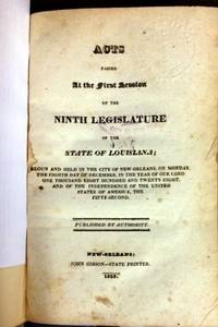
182932551New Orleans: John Gibson- State Printer 1829. 200 21 1 blank pp. Modern library cloth some soiling text with scattered spotting and light institutional marks on title page. Good. <br/><br/> "English and French on facing pages" Jumonville. With a List of Acts Index and the 1812 Constitution of Louisiana. Among the Acts passed are an 18-section slave registration statute; a state printing contract for Benjamin Levy; and various laws on the militia internal improvements land titles civil and criminal law. <br/>FIRST EDITION. Jumonville 665 3. AI 39326 3. John Gibson- State Printer unknown books
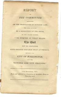
180320071Washington 1803. 5 3 blanks pp. Disbound some loosening Very Good. <br /> <br /> "The late cession of Louisiana by France to the United States renders it an object of primary importance to have the nearest and most expeditious mode of communication established between the city of Washington and the city of New Orleans the capitol of that province." The Committee thus urges a post road from Washington "to pass through or near the Tuckabachee settlement to the Tombigby settlement in the Mississippi territory and from thence to New Orleans. And further that a post road ought also to be established from the said Tombigby settlement to Natchez." <br /> FIRST EDITION. AI 5472 3. OCLC 54186405 1. unknown
180320071Washington 1803. 5 3 blanks pp. Disbound some loosening Very Good. <br/><br/> "The late cession of Louisiana by France to the United States renders it an object of primary importance to have the nearest and most expeditious mode of communication established between the city of Washington and the city of New Orleans the capitol of that province." The Committee thus urges a post road from Washington "to pass through or near the Tuckabachee settlement to the Tombigby settlement in the Mississippi territory and from thence to New Orleans. And further that a post road ought also to be established from the said Tombigby settlement to Natchez." <br/>FIRST EDITION. AI 5472 3. OCLC 54186405 1. unknown books
180425033Washington 1804. 6 2 blank pp. Disbound and lightly toned. Very Good. <br /> <br /> The Senate proposed these Amendments to the House Bill providing for extension of the laws of the United States to the Louisiana Territory purchased from France forming a part of the earliest legislation concerning this newly acquired expanse. <br /> AI 7428 1- DLC. OCLC locates three copies AAS Yale Cambridge under two accession numbers. Not in BEAL. unknown
180425033Washington 1804. 6 2 blank pp. Disbound and lightly toned. Very Good. <br/><br/> The Senate proposed these Amendments to the House Bill providing for extension of the laws of the United States to the Louisiana Territory purchased from France forming a part of the earliest legislation concerning this newly acquired expanse. <br/>AI 7428 1- DLC. OCLC locates three copies AAS Yale Cambridge under two accession numbers. Not in BEAL. unknown books
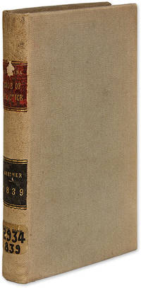
1839700551839. Greiner's Annotated Edition of the Louisiana Code of Practice Louisiana. Greiner Meinrad Editor. Code of Practice of the State of Louisiana Containing Rules of Procedure in Civil Actions; With an Abstract of the Decisions of the Supreme Court Placed Under the Appropriate Articles in the Code; To Which is Appended the Laws Creating the City Court And the Laws Relative to Justices of the Peace. New Orleans: M. Greiner 1839. xx 281 pp. Octavo 8-1/2" x 5-1/4". Later library cloth red and black calf lettering pieces and paper shelf label to spine endpapers added. Light shelfwear and soiling slight darkening to spine. Moderate toning to text slightly heavier in places light edgewear to preliminaries light soiling and library stamp to title page "8063" in tiny hand to verso. $350. First edition. Intended as a practical edition for lawyers Greiner's annotated edition of the code was somewhat overshadowed by Upton's edition which appear in the same year. It was well-received however and had a second edition in 1844. Not in Cohen. Jumonville Bibliography of New Orleans Imprints 1057. unknown books
190460900St. Louis MO: N.D. Thompson Publishing Co. 1904. Oblong folio. 13.75 x 11.25 in. 2 302 2 pp. Colour frontisp. over 300 photo plates. Burgundy-coloured cloth over beveled boards black lettering on front cover ruled embossed in blind on front cover minor rubbing edgewear expertly recased a few minor paper repairs gutter margin repair still VG bright copy from the library of Prof. Marvin Nathan. First “Library edition†of this photographic guidebook to the St. Louis Worlds Fair Louisiana Purchase Exposition offering a comprehensive illustrated tour to the famed event. Exterior views the Midway the Ferris Wheel interiors of all the exhibits sporting events and more. The Louisiana Purchase Exposition spread over 1200 acres and incorporated education into all aspects of the exhibitors including blacksmiths at work Native Americans living in their villages transplanted Philippine Moro natives elephant trainers lion tamers and more. Visitors to The Pike -- the mile long midway -- could scale the Tyrolean Alps visit Blarney Castle a Parisian fashion show dive under the sea or ride a burro to Cliff Dwellings. The 1904 St. Louis Fair also featured the first Airship races contest which offered a prize if the competing airships could complete the course three times at a speed of 15 m.p.h. A photo of Hippolyte Francis’s airship Ville de St. Mande depicts the airship in flight with a 100 foot long gasbag and 35 feet in diameter. Workmen had to dig a trench to get the ship out of the aerodrome and it later crashed into the concourse fence and did not fly again. N.D. Thompson Publishing Co., hardcover