[CHICAGO, MILWAUKEE & ST PAUL RAILWAY]Biblio.com
5 209 résultats
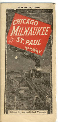
188137704Chicago: Camerion Amberg & Co. Printers and Engravers 1881. 1881. 16" x 37" sheet folded to 40 panels each 8 1/8" x 3 5/8" with attractive wrapper art of Kilbourn City and the Dells of Wisconsin. 20-panel detailed map of much of the United States their lines and connections in red from Chicago Green Bay Duluth to Kansas City Deadwood City Bismarck and up into Manitoba. Backed with 20 panels of time tables and information on connections and list of advantages of riding the Chicago Milwaukee and St. Paul Railway. Lightly worn at the extremities. Very good. Camerion, Amberg & Co., Printers and Engravers, 1881. unknown
185754076Chicago: Illinois Central Rail Road Office 1857. 8vo. 80 pp. plus 4 pp. of Illinois Central RR promotional ads printed on lavender-coloured paper promoting passage to St. Louis Kansas Nebraska the Michigan central Railway Line the Niagara Falls suspension bridge and St. Paul Minnesota via steamer and railroad line. With frontisp. maps 1 double-page of Illinois RR lands a bucolic farm scene in Illinois text woodcut engravings tables. Light tan printed & illustrated softcovers cover art of “typical†Illinois farm minor chipping head & foot of spine minor wear & bumping to corners faint soiling ex-library stamp on verso of title still G copy. First edition of this illustrated land promotion for Illinois extolling the advantages for prospective homesteaders and settlers for settling in Illinois rather than further west. The promotional work extolls the quality of the soil the advantages for buying land with direct access to the newly built railroads with pricing information on fuel fencing and other products. Selling the lands granted to them became a preoccupation of railroad companies as they pushed West with mixed strategies. Some the Illinois Central mortgaged to provide capital construction revenues while other lands were sold stipulating that the homesteaders or settlers needed to cultivate and occupy the land before sale in order to delay the amount of taxes owed by the Railroad. There were two different issues of this 1857 land promotion with one printed in Boston and the other scarcer version in Chicago. Ante-Fire Imprints 263; See: John Hall Patrimonialism in America: The Public Domain in the Making of Modernity In: Charrad & Adams Patrimonial Capitalism and Empire 2015 pp. 29-39. Illinois Central Rail Road Office, paperback
185638108New York: John W. Amerman Printer 1856. 1856. 9" x 5-1/2" tan printed wrappers. 64pp. Two black and white frontispiece maps. The first map is 9" x 5-1/2" and is entitled "OUTLINE MAP OF ILLINOIS." The second map covers 2 pages 10-1/2" x 6-3/4" and is entitled "RAILWAY GUIDE TO THE ILLINOIS CENTRAL RAIL ROAD LANDS." Everything you would want to know about settling down in Illinois is in this booklet to include railroad routes value of land for farming value of crops towns and villages. The Company owns valuable tracts of iron and lead ores also coal beds of immense richness. "Illinois Is now in the start of its great advance towards becoming the first producing State in the Union. Having Lake Michigan on one side furnishing a constant outlet for its produce the Mississippi to the west with its tributaries the Illinois and Rock Rivers both navigable streams running far into its interior the Wabash on its eastern borders and Ohio on the south the natural facilities would seem unequaled in the world." Several letters from successful farmers telling of the advantages and prospects of Illinois. Other subjects discussed are the climate soil health coal Illinois Central Railroad Lands the cost of opening a farm the population agriculture statistics of towns et. al. Light wear to the extremities along with chipping to spine lower fore-corner of front wrapper creased wrappers discolored else a good copy. John W. Amerman, Printer, 1856. unknown
185738092Boston: Geo. C. Rand & Avery Printers No. 3 Cornhill 1857. 1857. ILLINOIS. 9" x 5-1/2" pictorial wrapper. 84pp. including wrappers. Two black and white maps. The first map is 9" x 5-1/2" and is entitled "OUTLINE MAP OF ILLINOIS." The second map covers 2 pages 10-1/2" x 6-3/4" and is entitled "RAILWAY GUIDE TO THE ILLINOIS CENTRAL RAIL ROAD LANDS." Everything you would want to know about settling down in Illinois is in this booklet to include railroad routes value of land for farming value of crops towns and villages mechanical labor will continue to be in constant demand. The Company owns valuable tracts of iron and lead ores also coal beds of immense richness. "Illinois Is now in the start of its great advance towards becoming the first producing State in the Union. Having Lake Michigan on one side furnishing a constant outlet for its produce the Mississippi to the west with its tributaries the Illinois and Rock Rivers both navigable streams running far into its interior the Wabash on its eastern borders and Ohio on the south the natural facilities would seem unequaled in the world." Several letters from successful farmers telling of the advantages and prospects of Illinois. Other subjects discussed are the climate soil health coal Illinois Central Railroad Lands the cost of opening a farm the population agriculture statistics of towns et. al. The cove and first 2 pages are detached from spine overall chipping else a booklet full of information. Good copy. Geo. C. Rand & Avery Printers No. 3 Cornhill, 1857. unknown
185638884New York: John W. Amerman Printer 1856. 1856. 9" x 5-1/2" yellow printed wrappers. 64pp. Two black and white frontispiece maps. The first map is 9" x 5-1/2" and is entitled "OUTLINE MAP OF ILLINOIS." The second map covers 2 pages 10-1/2" x 6-3/4" and is entitled "RAILWAY GUIDE TO THE ILLINOIS CENTRAL RAIL ROAD LANDS." Everything you would want to know about settling down in Illinois is in this booklet to include railroad routes value of land for farming value of crops towns and villages. The Company owns valuable tracts of iron and lead ores also coal beds of immense richness. "Illinois Is now in the start of its great advance towards becoming the first producing State in the Union. Having Lake Michigan on one side furnishing a constant outlet for its produce the Mississippi to the west with its tributaries the Illinois and Rock Rivers both navigable streams running far into its interior the Wabash on its eastern borders and Ohio on the south the natural facilities would seem unequaled in the world." Several letters from successful farmers telling of the advantages and prospects of Illinois. Other subjects discussed are the climate soil health coal Illinois Central Railroad Lands the cost of opening a farm the population agriculture statistics of towns et. al. Ex-library copy. Wrappers lightly soiled and with light chipping to edges of front panel and with a 1" chip missing to bottom corner of rear wrapper along with chipping at tops and bottoms of spine. John W. Amerman, Printer, 1856. unknown
4013Los Angeles California:: The Company Copyright 1912 by D. W. Pontius. Corrected to November . Single sheet printed on one side only 19 23 7/8 inches folded to 9 6 1/8 inches OCLC shows two holdings at the Family Library in Utah. There are a small number of holdings for each of the updated maps. [Los Angeles, California:: The Company], Copyright 1912 by D. W. Pontius. Corrected to November, ,. unknown
1880102313<p> Folding time table and schedule unfolded 7" x 25 1/2" folded 3 1/2" x 7" reverse side shows map of route. Some splits at folds a couple of chips and folds at corners some browning aging and occasional soiling or staining; otherwise about very good. Somewhat scarce railroad time table OCLC locates one copy that provides time table information for trips from Chicago to San Francisco. Includes a map of the routes and stops made along with railroad announcements and advertisements. OCLC. </p> Spalding & La Monte,
194961244Denver Colorado:: Rocky Mountain Railroad Club 1949. embossed string-tied album. . Fine. Oblong 8vo. 16 photographs mounted with photo-corners each with a typed identifying caption. . With a hand-produced title leaf in red and black. This album appears to have produced in a very few copies for members of the Club. Rocky Mountain Railroad Club, unknown
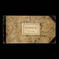
18877591Lakefield Ontario Canada: Grand Trunk Railway 1887-1897. First Edition. Hardcover. Oblong octavo 28 x 15 cm. Bound in three-quarters leather with marbled paper-covered boards. A printed paper title label reading "G. T. R. / Ticket Requisition Book" is affixed to the front board. The book consists of unnumbered leaves each perforated vertically to create a stub and a removable requisition form. The left-hand portion the stub which remained in the book is divided into five columns: To What Station Class Description Quantity Required Quantity Received. The right-hand portion which was detached and sent to the Audit Department is divided into seven columns for inventory and supply: To What Station Class Description Last Number Issued Last Progressive Number on Hand Tickets on Hand Quantity Supplied. Approximately three-quarters of the leaves have been used with the remaining quarter at the rear being clean and unused. Fair only though internally very good. Both front and rear boards are detached. The text-block however remains sound and tightly sewn. The three-quarters leather spine and corners are heavily worn rubbed and scuffed. The paper title label remains intact and legible. Internally the manuscript entries are clear and legible throughout with the final quarter of unused leaves are remaining remarkably clean and bright for their age. A complete and rich primary source document despite the binding flaws. <br/><br/>¶ A rare survival of the mundane yet essential paperwork which powered one of Canada's most important railway network vital for commerce tourism and settlement in the Kawartha Lakes region. The manuscript requisitions dating from January 20 1887 to April 5 1897 provide a remarkable ten year window into the station's activities. All are dated in manuscript with some requisitions marked "Nil" each tracking the regular flow of passengers along the line connecting the region to commercial centres such as Peterborough and Toronto etc. More significantly entries record period fares and charges for additional baggage among other details. A rare and highly ephemeral primary source for the history of the Kawartha region and to the railway line's role in connecting rural Canada. <br /> Grand Trunk Railway hardcover
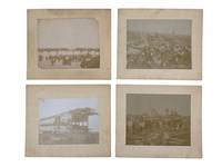
1896234211896. TransportationIndustrial Disasters Atlantic City railroad disaster photo archive likely documenting the July 30 1896 collision west of Atlantic City New Jersey one of the deadliest American railroad accidents of the 1890s. The wreck occurred when a West Jersey Railroad excursion train carrying members of the Improved Order of Red Men fraternal organization from Bridgeton and Salem crossed the Reading Railroad line and was struck by a Philadelphia express crushing loaded passenger coaches and leaving dozens dead and injured. The local Atlantic City photographer's stamp the beach and pier crowd the open rail junction the smashed wooden coachwork and the dense public gathering around the debris all support identification with the Atlantic City disaster rather than a more inland wreck. <br /> <br /> Photo archive of 4 albumen photographs each approx 7.5 x 8 inches mounted on boards measuring approximately 10 x 12 inches Atlantic City New Jersey likely 1896. At the wreck site men in suits caps work clothes and shirt sleeves stand among splintered timbers exposed wheel assemblies broken coach framing twisted metal and scattered railroad debris. A damaged passenger car remains partly upright with its roof torn open and side panels crushed while another wreck scene includes telegraph poles parallel tracks a railroad signal and a wide crowd gathered across the right of way. Workers and onlookers climb over the wreckage stand on overturned components and cluster around the remains of the coaches giving the scenes the character of both recovery work and public witnessing. The fourth view shows the community Atlantic City's shore economy with men women and children gathered along the beach and crowded across a pier many in formal summer dress hats and parasols. Verso stamp reads: "W. Crompton & Co. 132 N. South Carolina Ave. Atlantic City N.J. Duplicates can be furnished at Short Notice."<br /> <br /> By the 1890s Atlantic City had become a major East Coast resort town and railroad access was central to its growth; the same excursion system that filled its beaches also concentrated large numbers of passengers in wooden cars vulnerable to catastrophic collision. The presence of a local commercial photographer's stamp is significant indicating that these disaster scenes circulated as purchasable local views for an audience already accustomed to buying Atlantic City souvenirs. Mounts toned and soiled prints faded with some loss of contrast scattered surface wear and staining to mounts one with slight loss at upper right corner; overall in good condition. The archive preserves the immediate aftermath wreckage and response to a major Atlantic City disaster in the late 19th century. unknown
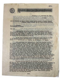
1944929931944. Good. Letter dated September 13 1946. 28 cm. Carbon copy on thin Atlantic Coast Line Railroad Company letterhead stationery. Substantial chipping around edges no loss of text on first leaf. Our unnamed Captain of Police reports on an incident which began when around 200 African American soldiers were changing trains. Local police arrested two of the soldiers for intoxication and took them to the local Police Station. When police returned to the railroad station they found six of the soldiers assaulting two military policemen and intervened to help the MPs using the butt end of a riot gun to break up the fight. When a large number of other soldiers came to join the fight they were stopped at gunpoint by the local policemen with assistance from the MPs and military officers. The African American soldiers marched in formation to local Police Headquarters where 133 soldiers were charged with disorderly conduct and five others differently charged. Almost all pleaded not guilty but all were found guilty the next day and remained in jail another night until their fines were paid -- $17 each for the 133 soldiers and up to $100 for the five who were differently charged. All 138 soldiers were then marched back the the train station and departed. One wonders how accurately the incident was described to our unnamed Captain by those he interviewed. There is nothing in his letter to suggest that he interviewed any of the African American soldiers. unknown
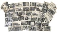
1974234571974. Railroad preservation photo archive depicting hand track labor narrow gauge steam restoration and surviving nineteenth-century rail infrastructure during the 1970s heritage railroad movement when volunteer groups museums and tourist railways across the United States began rebuilding lines and preserving steam locomotives that had narrowly escaped scrapping after the end of commercial steam service. Denver & Rio Grande Western No. 346 a Baldwin-built 1881 narrow gauge locomotive identified by the Colorado Railroad Museum as the oldest operating steam locomotive in Colorado appears repeatedly alongside work crews and rail operations tied to preservation-era reconstruction. The archive also includes Sept. 1974 views connected to the Baltimore & Ohio station at Oakland Maryland an 1884 Queen Anne depot whose construction reflected the expansion of rail tourism and resort travel into Garrett County during the late nineteenth century. Rather than polished excursion scenes the photographs center the physical labor that kept historic rail systems functioning: men replacing ties lifting rails by hand aligning track repairing rolling stock and maintaining steam-era equipment decades after most American railroads had abandoned steam operations.<br /> <br /> Photo archive of 62 silver gelatin photographs each measuring 5 x 3.5 inches various locations including Black Hills Central Railway and Oakland Maryland circa 1974-1977. Young railroad workers pose beside maintenance vehicles stacked ties and narrow gauge track under reconstruction; several scenes show crews driving spikes leveling ballast and maneuvering rails with pry bars and jacks. Multiple photographs depict Denver & Rio Grande locomotive No. 346 under steam including repeated appearances of the same rail worker also shown beside locomotive "444 R-1" suggesting a connected work or preservation crew documented across several locations and projects. Additional views show passenger cars rail yards interior shop work line-side maintenance scenes depots and tourist railroad operations including Sept. 1974 Oakland B&O station material with historical text describing the depot's role in regional resort development and its Queen Anne architectural design by Baldwin & Pennington. Numerous prints carry small sequential numerical markings at the lower edge indicating at least part of the archive functioned as an organized visual work record rather than casual railfan photography.<br /> <br /> The photographs belong to the decade when hundreds of steam locomotives narrow gauge branch lines and nineteenth-century railroad structures were disappearing across the United States following dieselization and widespread railroad abandonment in the 1950s and 1960s. Black Hills Central crews rebuilt and maintained rail infrastructure only a few years after the devastating 1972 Black Hills flood damaged track and bridges near Keystone while preservation groups in Colorado worked to keep surviving narrow gauge steam equipment operational for museums and tourist railroads. Light wear scattered creasing and minor silvering to several prints; overall in very good condition. unknown
185720287Albany:: Printed by C. Van Benthuysen 1857. original gilt-lettered cloth. Small printed address sticker on front free endpaper; slight wear at head and foot of backstrip: a very attractive clean copy. 8vo. 2 large folding maps and 46 plates and charts many folding. Printed by C. Van Benthuysen, hardcover
190039124Denver: Smith-Brooks Ptg. Co. n. d. ca 1900. 1900. COLORADO. First edition. 16 ice cream cone shaped panels folded into one cone approximately 7 1/8" x 4" with engravings printed in blue and orange as each cone represents a view of someplace in Colorado on a one-day trip in the Rockies on the way from Denver to the Loop. Views shown on each cone are Green Lake Bear's Cave Mother Grundy the Loop from Silver Plume Georgetown from Democrat Mountain Georgetown the Old Roadmaster Gray's Peak Rocky Point Inspiration Point Hanging Rock Idaho Springs Around the Bend Just Above the Forks and The Loop plus cover panels with some text. Small crease at the base of the cone light wear at the folds else a very good copy. Smith-Brooks Ptg., Co., n. d. (ca 1900). unknown
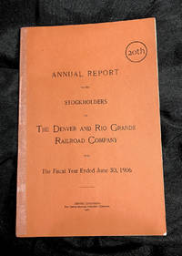
190674<p><strong>THE DENVER & RIO GRANDE RAILROAD.<br /><br />20th </strong><strong>ANNUAL REPORT </strong><strong>TO THE </strong><strong>STOCKHOLDERS </strong><strong>OF </strong><strong>THE DENVER and RIO GRANDE </strong><strong>RAILROAD COMPANY</strong><strong><br /></strong><strong>For </strong><strong>The Fiscal Year EndeD </strong><strong>June 30 1906</strong><strong><br /></strong><strong>Denver Colorado: </strong><strong>The Smith-Brooks Printing </strong><strong>Company </strong><strong>1906</strong><strong><br /></strong><strong>Original printed burnt orange </strong><strong>wrappers front and back</strong><strong><br /></strong><strong>Very good plus to near fine condition; </strong><strong>one small chips on lower margin </strong><strong>of back cover; spine reinforced </strong><strong>with special conservation tape; </strong><strong>interior pages and map very good </strong><strong>plus to near fine; several tiny splits </strong><strong>in map folds conserved.</strong><strong><br /></strong><strong>Publication dimensions:</strong><strong>6 inches by 8-7/8 inches</strong><strong>46 pages</strong><strong><br /></strong><strong>Map dimensions:</strong><strong>20 inches by 15 inches<br /><br />COLORADO ARTIFACTUAL</strong><strong><br /><br /></strong></p> The Smith-Brooks Publishing Co. paperback
1959235191959. Erie Railroad accident recovery photo archive depicting a freight train derailment at Newburg Yard on August 10 1959 most likely in the Cleveland Ohio Newburg or Newburgh industrial district. Newburg was an old industrial section of southeast Cleveland tied to railroads steel works and freight switching with the former Atlantic & Great Western later Erie running through the area. The location identification is strengthened by the yard name Erie equipment industrial overpass setting and the known Cleveland use of Newburg or Newburgh in railroad and steel district geography. The wreck occurred one year before the Erie Railroad merged with the Delaware Lackawanna & Western Railroad in 1960 placing the scene near the end of the independent Erie era.<br /> <br /> Photo archive of 8 silver gelatin photographs approximately snapshot to small-format prints Newburg Yard August 10 1959. Freight cars sit overturned and jackknifed across multiple yard tracks with Pennsylvania and Erie-marked cars visible among the wreckage. A crane works beside the damaged cars while railroad men stand along the ballast on the embankment and under a bridge or overpass watching the clearance operation from trackside. Several views show the same derailment from elevated and ground-level positions including a crushed cab or caboose area tipped hopper cars tangled rails scattered debris and crews working near the crane boom. Verso captions repeat "Aug. 10-1959" "Newburg Yard" "Walczak Cond." "Lyons Bachman" and "Kompura" with faint "Kodak Velox Paper" stamps on the backs.<br /> <br /> Railroad yard accidents in the 1950s were handled before modern centralized emergency-management practice relying on railroad wreck crews cranes section men conductors brakemen and yard personnel to reopen tracks quickly so freight could move. The repeated captions naming the conductor brakemen and additional crew members give the group stronger labor value than an anonymous wreck scene tying the damaged rolling stock to the men responsible for the train and its aftermath. Light curling handling wear minor creasing and light verso soiling; overall in good condition. The archive preserves a dated Erie Railroad freight accident with named crew visible wreck-clearance work and a probable Cleveland Ohio Newburg Yard setting. unknown
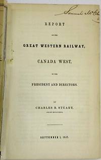
184727881Ontario 1847. 47 1 blank pp plus two folding maps as issued: 'Map and Profile of the Great Western Railway Canada West' 48 1/2 cm x 32 cm; 'Map of the Route of the Great Western Railway Shewing its Connection with other Public Works' 35 1/2 cm x 29 cm. Versos with expertly repaired closed tears short margin tear else Very Good.<br /> <br /> The railroad is "on the precise ground that will enable it to control the trade and travel of such a vast portion of the Canadas and the prosperous American States." <br /> TPL 2850. Sabin 28478n. unknown
188541697Chicago: Rand McNally & Co. Printers and Engravers 1885. 1885. DAKOTA TERRITORY. RAILROAD. First edition. 7 5/8" x 5 3/8" original stapled printed wrappers 16 pp. map of the Chicago & North-Western Railway system on the back cover. Primarily a series of signed testimonials solicited by the Railway to describe “the Dakota boom.” Farmers relate their experiences settling and cultivating the land detail their crop yields and profits from cattle ranching and encourage further settlement as land is still inexpensive and readily available. Several describe the settlers as “a most excellent class of people” who are educated industrious and and morally upright. And if that’s not incentive enough there’s the unsurpassed healthfulness of the air which is “free from malaria and full of inspiring oxygen and invigorating ozone.” 3 copies found in OCLC. Top corner of rear cover has been torn away but with minor influence on the railway system map else very good. Rand, McNally & Co., Printers and Engravers, [1885]. unknown
185331456Davenport: Sanders & Davis 1853. 24pp. Stitched lightly foxed. Very Good. <br /> <br /> This pamphlet provides "elaborate details of the projected road across the State from Davenport to Council Bluffs" 130 Eberstadt 311. The incorporators included the well known civil engineer John Jervis of New York. <br /> 130 Eberstadt 312. Graff 2828. Not in Sabin Moffit Decker or BRE. Sanders & Davis unknown
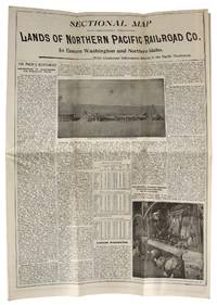
189546744St. Paul MN: s.i. 1895. Very Good. St. Paul MN: s.i. 1895. Land map folded into a bi-fold informational pamphlet 90x95 cm; 23x11 cm; 9 unpaginated panels. All panels generally toned and creased as expected with minor rubbing to extremities and one closed tear to top edge of map along middle fold. Overall a Very Good or better example. <br /> <br /> An information-packed pamphlet for farming colonists looking for "healthful and pleasant living" in the Pacific Northwest; folds out to a map of the region and available land advertised at $3 to $10 an acre which could be bought from the Northern Pacific Railroad Company. Rail tickets could be purchased following the "Yellowstone Park and Dining Car Route" which also offered "Free Colonist Sleeping Cars" and 150 pounds of baggage carried for free on each full fare. s.i. unknown
1849140260Hamilton Ont. 1849-51. Good. <br/><br/>1 Address of the Directors of the Great Western Rail Road Company read by the President R. W. Harris Esq. at a Public Meeting of the Inhabitants. nd. 4 p. 31 cm. Three horizontal folds. Stain and small fold top rear. Shareholder report gives progress report. 2 GILKISON J. T.; HARRIS R. W. Great Western Railroad. To the Inhabitants of Canada. Hamilton: The Railroad August 3 1849. 34 cm page printed one side only. Three horizonal folds. Ink notation on rear. Distance tables at bottom. Calls for stock subscriptions. 3 HARRIS Robert W.; GILKISON J. T. Great Western Rail-Road Company annual general meeting minutes June 1851. 4 p. 34 cm. First page printed only. Three horizontal folds two vertical some stains at top chip in rear. 4 Second copy of the former. Two vertical folds one horizontal fold lighter staining. unknown
188724219Paterson NJ 1887. Photography. An imposing photograph of a Mogul Locomotive made by the Rogers Locomotive Company laid onto a printed broadside. The photograph measures 28 3/4 x 13" the broadside 32 x 18". Rogers Locomotive was an important New Jersey maker of railroad steam locomotives founded in 1832 whose most famous engine was "The General". This locomotive was built in 1855 and was one of the principals of the "Great Locomotive Chase" an April 1862 military raid in Georgia in which Union volunteers commandeered "The General" and used it to damage the vital rail line between Atlanta and Chattanooga. <br /> <br /> Below the image at the left is "J. Reid Photographist". John Reid 1835 - 1911 was a noted local photographer who specialized in stereoscopic views and large format outdoor photography especially pictures of locomotives. Reid was commissioned by Rogers to produce images of trains for promotional purposes. He used Scovill's view boxes made by the American Optical Company with Morrison wide aperture lenses and Scovill's pearl paper for printing. Reid printed his own pictures and relied on his own emulsion a superior one which wasn't subject to the rapid deterioration common in photographs of the time. Reid exhibited at Philadelphia's Centennial Exhibition in 1876 and received medals at the Paris Exposition 1878 and Chicago's Columbian Exhibition 1893. The broadside can be dated 1887 because Reuben Wells was appointed shop superintendent in that year; his name is stamped below the other printed printed names below the image which read "J. S. Rogers Pres. Reuben Wells Supt. and R. S. Hughes Treasurer 44 Exchange Place New York". The locomotive in the albumen photograph is marked "St. P. M. & M." and is numbered 324. This was the St. Paul Minneapolis & Manitoba Railway Company which was organized in 1879. Small paper fault at the lower center otherwise very good condition. unknown
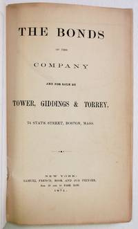
187129188New York: Samuel French 1871. Original green printed wrappers wrapper title: 'The First Mortgage Land Grant Sinking Fund Seven Per Cent Gold Bonds Principal and Interest Payable in Gold Free of Government Tax. Of the West Wisconsin Railway'. Stitched. 14 2 blanks pp. Folding 'Map of Wisconsin Rail Road and Its Connections' @14" x 16". Tear at bound edge of folding map repaired with short piece of scotch tape. Very Good. <br /> <br /> The Map by Henry Seibert of New York prominently shows the West Wisconsin line from St. Paul MN to Tomah WI; tracks other railroads in Minnesota Wisconsin and Iowa; and depicts Lakes Michigan and Superior and Green Bay. The Road is described and the investment recommended. A rare item OCLC locating only the copy at the University of Missouri. <br /> FIRST EDITION. OCLC 41200220 1 as of June 2021. Not in Eberstadt Decker Sabin Soliday Graff Modelski. Samuel French unknown
19272091502133701613Osaka Mainichi Shimbun 1927. Soft Cover. Fine. The book is in fine condition. Osaka Mainichi Shimbun paperback
42679Printed by: Detroit Rotary Gravure Co Nd. 1940. Artist Unknown printed size: 68.5x 55cm 25.5"x 21.5" Original B/W gravure photograph usual toning but a good clear image some slight chipping on the bottom margin not affecting the image without glass matt is present but is acidic and should be replace the mahogany stained oak frame has Canadian Pacific in block letters on the bottom of the frame. Printed by: Detroit Rotary Gravure Co, Nd. [1940?] unknown