5 209 résultats
21127801Nagoya n.d. ca 1920's Nagoya Tetsudoh K.K. A maroon vel- vet album string tied very good 49 x 37 cm. 12 photos 28 x 21 cm. mounted with English captions under each tipped in sharp clear well composed images minor damp to first page page in gutter area lower left corner of first photo slight damp mark all others clean bright. With tissue guards all edge gilt on heavy leaf album paper. Presentation slip tip- tipped on to first fly leaf in Japanese form the Company to Capt. Howard Kerry. Photo captions are: CASTLE OF INUYAMA LOOKING OUT ON THEKISO RIVER; THE CLEAR STREAM OF THE KISO BELOW THE CASTLE OF INUYAMA; BIRD'S-EYE VIEW OF THE LOWER REACHES OF THE KISO RIVER FROM THE CASTLE OF INUYAMA; A VIEW OF THE UPPER REACHES OF THE KISO RIVER FROM THE CASTLE OF INUYAMA; A SPLENDID VIEW OF THE LOWER REACHES OF THE KISO RIVER FROM THE TOP OF MT. TSUGAO; A PANORAMIC VIEW OF THE UPPER REACHES OF THE KISO RIVER FROM THE KANKA-KEI; A FINE VIEW OF THE UPPER REACHES OF THE KISO RIVER FROM THE "IWAYA- KANNON" OR GODDESS OF MERCY; VICINITY OF THE "DOSHIKI-IWA" THE FIVE-COLORED ROCKS; HUGE ROCKS IN THE VICINITY OF SA- KAHOGI; VICINITY OF THE "YUSEN-GA-OKA" OR THE "FAIRY LAND"; THE "LION" ROCK; THE BIRD'S-EYE VIEW OF THE RECREATION GROU- ND BELONGING TO THE NAGOYA RAILWAY COMPANY; with castle in the background atop the hill. The lovely photos document the fabled Kiso-gawa Kiso river with small sail boats ply- ing the river also showing the railroad its truss bridges. A poignant view of the river and castle seldom found docu- mented in other photographs of the area. The spectacular steep gorges unusual rock formations nicely photographed. Scans can be sent by email. unknown
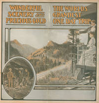
190153054Denver: Smith-Brooks n.d. ca 1901. ca 1901. 7 1/2" x 7" folded vertically at center. 24pp containing one page with an overview of the trip and history of the railway and also one pictorial cover page. The remaining 21 pages offer full-page sepia-toned photographs. Pictures include Point Sublime Silver Cascade Falls St. Peter's Dome Devil's Slide Cathedral Park Victor the Granite Mine Cripple Creek Underground at the Portland Mine Altman Battle Mountain Bull Hill etc. At center is a double-page photograph showing the Sangre De Cristo Range. Light soiling and with light scraping to fold and minimal wear to extremities. Very good. Rare. Smith-Brooks, n.d. (ca 1901). unknown
188038887Chicago: Rand McNally & Co. n. d. ca 1880. 1880. First edition. 5 3/4" x 4" oblong color pictorial wrappers 16 pp. black & white engraved view of the "Hotel Colfax at Colfax Springs Iowa 333 miles west of Chicago and 24 miles east of Des Moines on the Chicago Rock Island & Pacific Railway." "Accommodations for three hundred and fifty guests. On the site of the famous Magnesium Chalybeate and Colfax Mineral Springs. A sanitarium for invalids and fashionable Summer Resort." Descriptive paragraphs about all the fishing grounds along the routes mostly in Illinois and Iowa with some mention of Missouri Dakota and Minnesota. Small agent's stamp at bottom of title page light evidence of a fold crease to the front cover else a near fine bright clean copy. Rand, McNally & Co., n. d. (ca 1880). unknown
19602110502150901917Kinki Nippon Railway Co. Ltd. 1960. Soft Cover. Fine. Number of books: 10 Kinki Nippon Railway Co., Ltd. paperback
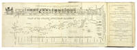
187937868Savannah: Morning News Steam Printing House 1879. 1879. FLORIDA GEORGIA. Sixth edition. 7 1/2" x 5" pictorial wrappers 80 pp. illustrated maps advertisements. A small green slip has been affixed to the title page advising the the Savannah Florida & Western Railway has purchased the Atlantic and Gulf Railroad Company and is now the successor. Folding map is of the Atlantic & Gulf Railroad and shows the lines from Savannah to Bainbridge spur to Albany and connections in Florida from Tallahassee to Baldwin and Jacksonville and to Cedar Key. The booklet describes stations and points of interest in southern Georgia and Florida as well as other railroads towns and points of interest in Florida and southern Georgia. Moderate wear to the spine rear cover becoming loose but still intact covers lightly soiled interior clean else a very good copy. Morning News Steam Printing House, 1879. unknown
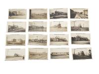
1932233221932. Trains and RailroadsUrbanization Nickel Plate Road photo archive documenting steam rail systems across New York and the Midwest with additional views of New York City subway yard and NYC Board of Transportation activity 1932-36. The photographs center the cross-country operation of the New York Chicago and St. Louis Railroad commonly known as the Nickel Plate Road with images showing freight trains leaving yards switchers handling cars passenger service enginehouse scenes and terminals. All stamped with dates between 1932 and 1936 and the imprint of photographer Cameron Blaikie of Englewood NJ with come bearing handwritten ink caption indicating copy recipients. The group records Midwestern mainline railroading and New York's subway system at a time when steam power electrified transit and large repair yards were essential American industrial and urban circulation.<br /> Photo archive of 16 silver gelatin photographs 2.5 x 4 inches Ohio Indiana and New York City1932-36 Twelve photographs are captioned for the New York Chicago & St. Louis Railroad or New York Chicago & Saint Louis Railroad and include a "Nickel Plate Limited westbound leaving Hammond Ind." a "Northbound freight train leaving yard at South Lima Ohio" an eastbound freight near Hammond a "Six-coupled 0-6-0 type locomotive switching cars at Lima Ohio" a "Six-coupled 0-6-0 type switcher Toledo Ohio" a "Six-coupled 0-6-0 type locomotive converted from 2-8-0 in yard at Toledo Ohio" "Mikado 2-8-2 type locomotive at South Lima Ohio enginehouse" and a "4-6-4 type locomotive." The captions identify both location and function distinguishing switching yard departure enginehouse activity locomotive class and passenger movement. Four photographs are captioned "City of New York N.Y. Board of Transportation" and show the Eighth Avenue subway system at 207th Street including "Shops and storage yard of the Eighth Ave. subway system Independent system at 207th Street" "Train entering 207th St. yard from tunnel" a broad terminal view described as "56 tracks wide not all in picture" and a work car "equipped with spools of electric cable which is attached to 3rd rail shoes of cars entering shop" an unusually specific record of shop procedure and third rail handling. Across the group recurring visual elements include multiple parallel tracks telegraph poles signals towers service buildings freight consists subway cars and engines shown in motion or in work settings rather than static display.<br /> The New York Chicago and St. Louis Railroad served as a major Midwestern carrier linking Buffalo Chicago St. Louis and intermediate industrial centers and these photographs fix that system at the level of daily operation through named trains locomotive classes yards and service points in Lima South Lima Toledo and Hammond. The Board of Transportation views extend that operational focus into New York's municipally run transit network where the Independent Subway's 207th Street facility handled car storage repair and electrical shop work on a large scale. Light surface wear mild curling and minor corner and edge wear; captions clear and photographs clean. The archive gives railroad labor and urban infrastructure collections a compact but sharply captioned record of how steam railroading and electrified rapid transit functioned in practice. unknown
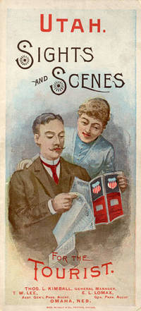
188852275Chicago: Rand McNally & Co. Printers 1888. 1888. UTAH RAILROAD. First Edition. 8vo. 21.5 x 10 cm. 8 1/2" x 4" color pictorial wrappers. 48 pp. illustrated from photographs fold-out map 'Tourist Map of Union Pacific and Connecting Lines' 20.5 x 59 cm. 8 1/4" x 23 1/2" present at the rear. The map is in nice condition and provides an excellent panorama of the Union Pacific Railway. Lines in red and run from Kansas City Atchison and Omaha to Denver and south to Gunnison or west through Cheyenne Granger and onto Portland with a spur up to Helena or west through Ogden and onto San Francisco with a spur down to Los Angeles. Blue shaded illustrations surround the lines which include a plowing scene Union Depot Salt Lake City Garfield Beach a mining scene Falls of the Yellowstone a ranching scene etc. Union Pacific produced guide for the would-be tourist of Salt Lake City including a description of the Mormons and their customs. Illustrated with nine full-page engravings from photographs by C.R. Savage. Also provided are List of Agents. Pullman Palace Car rates. Information on Salt Lake City tours Salt Lake City and the area surrounding "The Temple City" Beck's Hot Springs the Great Salt Lake Giant's Cave at Garfield Beach Echo Canon Weber Canon the Devil's Gate Ogden Ogden Canon etc. Detailed information on 9 different tours touting what the tourist might see and do. Covers lightly used light wear to fore-edges else a very good copy. Rand, McNally & Co., Printers, [1888]. unknown
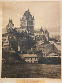
42578Artist Unknown. Quebec 1940. printed size: 68.5x 55cm 25.5"x 21.5"; frame is 90x 74cm 35.5" x 29.25" original B/W photograph some age toning as usual but a good clear image short tear on the upper right with a small puncture. . B/W historic photo of Chƒteau Frontenac an imposing hotel with five brick and stone wings and a central tower erected in seven stages between 1892 and 1993. It is prominently located on a cliff overlooking the St. Lawrence River within the Qu‚bec historic district. The Chƒteau Frontenac was designed by American architect Bruce Price as one of a series of "chƒteau" style hotels built for the Canadian Pacific Railway company during the late 19th and early 20th centuries. CPR'S policy was to promote luxury tourism by appealing to wealthy travellers. The Chƒteau Frontenac opened in 1893 five years after the Banff Springs Hotel which was owned by the same company and similar in style. Artist Unknown. Quebec, 1940 unknown
40187np. 1940. Artist Unknown. printed size: 68.5x 55cm 25.5"x 21.5"; frame is 90x 74cm 35.5" x 29.25" original B/W photograph some age toning as usual but a good clear image short tear on the upper right with a small puncture. B/W historic photo of Chteau Frontenac an imposing hotel with five brick and stone wings and a central tower erected in seven stages between 1892 and 1993. It is prominently located on a cliff overlooking the St. Lawrence River within the Qubec historic district. The Chteau Frontenac was designed by American architect Bruce Price as one of a series of "chteau" style hotels built for the Canadian Pacific Railway company during the late 19th and early 20th centuries. CPR'S policy was to promote luxury tourism by appealing to wealthy travellers. The Chteau Frontenac opened in 1893 five years after the Banff Springs Hotel which was owned by the same company and similar in style. np. 1940 unknown
19342111902160600463Not Available 1934. Soft Cover. Fine. The book is in fine condition. Not Available paperback
1871761New York 1871. Good plus. Folding pamphlet 6 x 17 inches. Separated along one fold. A few later pencil annotations. Light wear and tanning. A scarce advertisement for bond investment in the Northern Pacific Railroad issued in 1871 during the first great construction push on the line. Although the company was founded in 1865 ground was only broken on construction in 1870 after considerable backing by Jay Cooke. This pamphlet outlines the plans for the railroad to be built from St. Paul to Portland and Seattle the prospects for passenger and freight business upon completion and the extent of the land grants afforded the railroad by the federal government. The text goes on to describe the financial instruments on offer their advantages over Treasury bonds chiefly a greater yield at 7-8% vs. 5-6% and their security against the commercial and financial assets of the railroad as well as its land grants. With a map of the proposed route on the rearmost panel. A scarce call for investment in the Northern Pacific from its early history. unknown
1906013733Albany: Passenger Department of the Delaware and Hudson Railroad Corporation 1906. 1st Edition. Soft cover. VG-. Scarce passenger and tourist guide to resort and vacation destinations serviced by the Delaware and Hudson Railroad - both its rail and steamer lines - including Lake George Lake Champlain the Adirondacks Saratoga Sharon Springs Published in handbook format measuring 4.25 x 7.25" with pictorial cover front and back 316 pages illustrated with maps in three color and photos in duotone. Includes local listings for transport restaurants hotels spas and sites for sport fishing boating etc. Covers worn internals quite good. The book has been pierced in the upper right corner apparently to be hung by chain in a train station for use by the traveling public. There are several variant titles of this work issued by D&H Railroad located in OCLC; for this specific title there is only one edition published in 1930 for which there are only 4 copies. We could find no copies of this 1906 edition presumably the first or early edition of this tourist handbook. Owner name with Rensselaer NY address in juvenile hand on the free front endpaper. Passenger Department (of the Delaware and Hudson Railroad Corporation) unknown
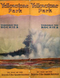
191553159Denver: Carson - Harper 1915. 1915. YELLOWSTONE NATIONAL PARK. 20" x 32" sheet printed on two sides and folded to 10" x 4." One side contains sixteen 10" x 4" panels with 8 panels in the center of a color map of Yellowstone National Park that shows topographical features stage roads and principal points of interest; two panels show a color map of the Grand Canyon of the Yellowstone as a side trip; two panels show a map of a side trip to the Mammoth Hot Springs; and four panels provide railroad information and fares to Yellowstone Station. The other side also contains sixteen 10" x 4" panels with 14 panels full of text and pictures of Yellowstone and its many attractions and sights. Information is provided regarding Marshall Pass Black Canon of Gunnison Eagle River Canon Tennessee Pass Grand Junction Green River Mammoth Hot Springs Yellowstone Lake etc. and many pictorial scenes of the area. The remaining two panels are the front and rear color covers. Covers are lightly rubbed at the spine else a very good clean copy of an attractive booklet. Carson - Harper, 1915]. unknown
189939127Denver: Denver and Rio Grande Railroad 1899. 1899. COLORADO NEW MEXICO UTAH. First edition. 8vo.8" x 4 1/2" color pictorial wrappers 57 3 pp. introduction index illustrated map. Information provided on destinations in Colorado New Mexico and Utah including the number of miles from Denver the elevation and a brief description of the destination. Many places are described with attractive views shown of Manitou Springs Palmer Lake Pike's Peak Santa Fe Indian pueblos Toltec Gorge Cliff Dwellings Glenwood Springs Castle Gate Salt Lake City Saltair Beach and much more. Also provided is a listing of hunting and fishing grounds mountain peaks and passes and a "Stage Lines Run in Connection with the Denver & Rio Grande System." This latter service provides the time of service availability point to point information the distance the fare for both one way and round trip and baggage allowed and cost. A few upper corner pages have been creased else a very good copy. Denver and Rio Grande Railroad, 1899. unknown
021154Washington: N/P Published 1895 to 1898; Volume I Part I LACKING Spanish text section and LACKING folding maps in rear pocket; Vol. I Part II; Vol. II; & Vol. III with English and Spanish Texts and all plates folding charts maps etc. and with accompanying Maps/Profiles volumes; Very slightly ex-library with library stamps on front paste down of all four text volumes and with NO other library markings; Text volumes are otherwise Good with general light wear rubbing on cloth edges and bumped corners; Text volumes remain tight and are complete except for Vol. I Part I; Slipcases for Maps/Profiles volumes are worn and show some small splits; Leather spine labels maintain lettering though shows chips and wear on edges; A few of the folding maps show light foxing though the majority are Fine. . First Edition. Cloth - Hard Cover. 4to. N/P
188034640New York: E. Wells Sackett & Bro. Printers 1880. 1880. NEW YORK STATE. First edition. 8vo. 8" x 5 1/4" pictorial wrappers 45 3 pp. illustrated map advertisements. The folding map is bound in at the very front and is a map of the New York Ontario & Western Railway and branches and shows the line running from New York City to Oswego and stations in between. There are 10 steel engraved full-page plates of New York towns and views and a brief sketch of all of the towns along the route to Oswego. An interesting advertisements promotes farms for sale priced from $15.00 to $40.00 an acre. A long list of hotels boarding houses and private families on or near the route of the New York Ontario and Western Railway is provided. Covers lightly soiled else a very good copy of an interesting an informative booklet. E. Wells Sackett & Bro., Printers], 1880. unknown
1856120572Washington D. C. A. O. P. : Nicholson Printer 1854-1856 1856. First Edition. Hardback. Very good copy in the original gilt-blocked cloth. Professionally recased with the original spine laid back; very impressively finished. Remains particularly well-preserved overall; tight bright clean and strong. Scans and additional detail on request. ; 1 pages; Physical desc. : 1 vol. various pagings : ill ; 30 cm. Subjects; Natural history - West U. S. . Indians of North America - West U. S. . Geology - California. Washington, D. C. , A. O. P. : Nicholson, Printer [1854-1856] hardcover
92036London and Birmingham J. Cornish 1837 . Second edition. Small 8vo 15 x 10 cm 172pp including adverts one engraved folding plan of the railway one folding table which comprises pages 11-14 in the collation publisher's maroon cloth gilt spine lacking; overall a good copy.<br /> Rare early railway guide.<br /> London and Birmingham J. Cornish 1837 hardcover
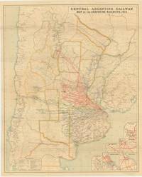
65755London: Waterlow & Sons 1913. FIRST EDITION. Original large-format colour-lithographed map 121 x 99.5 cm of Argentina showing the railways with inset maps of Tucuman Cordoba Rosario San Francisco Buenos Aires and Sante Fé. With a reference table to bottom left detailing upwards of 25 different railway lines. Numerous archival tape repairs to verso along folds the map itself in very good clean condition. The first issue of this map which would go on to be printed many times throughout the years. London: Waterlow & Sons, 1913. unknown
19218476London: Hanbury Tomsett & Co. Ltd 1921-4. Passenger map of the Metropolitan Railway 43 x 34 cms printed in colours with travel information on verso trivial wear to intersections of a couple of folds slight dustiness to cover and addtional horizontal crease; dark red covers print code G1608/100000 undated but c. 1921-4. In 1933 the Met became part of the LPTB in 1933. Here though the Tube and other railways fade into the background. The emphasis is on work/life balance commuting from Metro-land a term coined by the railway companys Publicity Department with its golf courses rapidly diminishing countryside and beauty spots such as Pinner and Ruislip a fragment of that older and more beautiful world. A panel on the verso extols the virtues of living in Metro-land purchasing from the Metropolitan Railway Country Estates Ltd: unlike any of their competitors the Met was directly involved in residential property development. Map Hanbury, Tomsett & Co., Ltd unknown
19089757London: Waterlow & Sons Ltd 1908. Folding map 66.5 x 10⁶ cms printed in colours laid on linen as issued trivial marginal spotting and minor wear folding into cloth-backed pictorial covers some wear to spine and extremities and with an ink stain to spine. The District Railway was one of the earliest underground lines: the stretch of track from South Kensington to Westminster was opened in 1868. The District companys lines are shown in red all other railways are shown in blue superimposed on a detailed street plan of London extending to Ealing in the west; shows site of the Franco-British Exhibition of 1908. The covers are illustrated with views of local landmarks: Tower Bridge St Pauls and Westminster Abbey. Hyde: Printed Maps of Victorian London 176 B 11. Map Waterlow & Sons Ltd hardcover
19792092902140600155Japan National Railways Hiroshima Railway Administration 1979. Soft Cover. Fine. Number of pages: 167p Size: B5 Japan National Railways Hiroshima Railway Administration paperback
19602090502124800184Railway Map Publication Association 1960. Soft Cover. Fine. Number of books: 5 Railway Map Publication Association paperback
19792092902144201690Hara shobo 1979. Soft Cover. Fine. The book is in fine condition. Hara shobo paperback
189637888New York: Phair & Co. Printers 1896. 1896. 9" x 6" in printed wrappers. 36 pp. appendix 3 pp. printed circular tipped in 3 pp. printed item laid in plus large folding map of the line by Coltons with pink outlining showing Illinois Wisconsin Minnesota Iowa and Missouri as far south as Cape Girardeau. Information includes the company's organization connections of the road condition of the work of construction cost of construction fiscal condition of the company earnings etc. Articles of incorporation of the railway company articles of consolidation of the Cedar Rapids and St. Paul Railway and the Cedar Rapids and Burlington Railroad Company etc. Fore-edges soiled and chipped; spine chipped and with split at foot; map in very nice shape. Phair & Co., Printers, [1896]. unknown