Danske StatsbanerAntiquariat.de

1 076 résultats
18792120Planer: 14. Mit Titelvign. nach Photographie u. 14 chromolithogr. Tafeln. Kopenhagen, 1879. Quer-Großfolio (51,0 x 69,0 cm). 1 Bl. u. Tafeln. Halblederband d. Zt. mit rotem goldgeprägtem Titelschild auf dem Vorderdeckel. [8 Warenabbildungen]
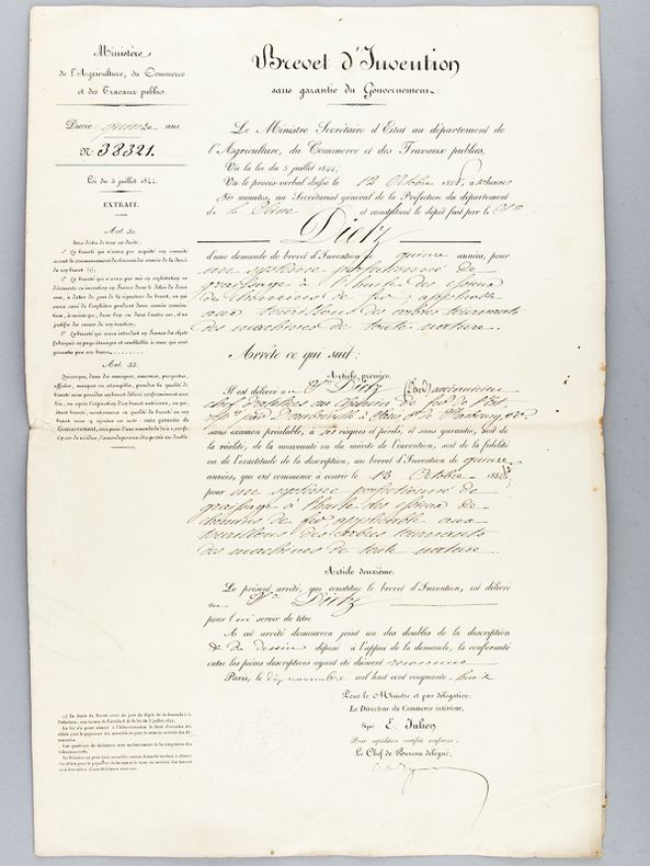
185856069Liasse de documents relatifs au dépôt du brevet d'invention, à savoir 3 formulaire pré-remplis in-folio, et les documents joints (récépissés, dessins techniques, mémoires descriptifs) et une petite notice nécrologique tirée du "Courrier de La Presse" du 8 novembre 1896. Rappel du titre complet : Brevet d'Invention accordé le 12 octobre 1858 à M. David Dietz, chef d'atelier au Chemins de Fer de l'Est, pour un système perfectionné de graissage à l'huile des essieux de chemins de fer applicable aux tourillons des arbres tournants des machines de toute nature (avec le Mémoire Descriptif et le dessin technique) [ On joint ] Brevet d'invention du 12 octobre 1858 [ Certificat d'addition introduisant quelques modifications avec le Mémoire Descriptif et le dessin technique ] [ On joint ] Notice nécrologique
1883WOC-1241Album delle Opera Principali. Compilato Per Cura Della Direzione Tecnica Governativa Di Genova. Giulio Toscani, Lit. Della Succursale Dei Giovi, 1883. In-folio (49,5x35cm) percaline marron éditeur, légende et Arme de la ville dorées dans un encadrement noir, quelques décolorations sur les plats.
18864015Eisenbahn- und Tunnelbau. Studienjahr 1885/6. Projecte des Joh. Waber. Programm Nr. 1 bis 5 in 8 Leporellos u. 3 handschriftlichen Kostenvoranschlägen (3 Bll., 37 S.). Mit 1 Karte (3 S.) sowie 41 S. farbig gezeichnete Profile, Pläne, Schnitte u. Detaildarstellungen in den Leporellos. 8 handschriftl. Titelseiten u. 4 (2 autographierte) S. mit dem Programmtext von Franz von Rziha. Wien 1885-1886. 34,0 x 21,0 cm. Lose in Original-Mappe mit handschriftl. Titelschild u. Bindebändern.
18634819Type No. 16. Mit 2 gefalt. in Segmenten auf Leinwand aufgezogenen lithogr. Tafeln u. zahlr. lithogr. Abb. Ohne Ort, Drucker u. Verlag, (Selbstverlag), 1863. 8vo. (20,6 x 13,3 cm). Titel, 287 S. (durchweg lithographiert), 3 leere Blatt. Halblederband d. Zt. mit montiertem handschriftl. Rückenschild.
187742208St. Louis: A. Gast & Co. Lith. 1877. 1877. IOWA NEBRASKA. First edition. 8vo. 21.6 cm x 13.3 cm. Original printed yellow wrappers 31 1 pp. illustrated from two full-page pictorial plates three maps on verso of front cover and recto and verso of rear cover. Front map is of the great South Platte region. Map on inside rear cover is a map of Southern Iowa showing lands of the Chicago Burlington & Quincy Railroad Company that are available for sale Map on outside of rear cover is a map showing the leading through routes to the West and the land grants in Iowa & Nebraska of the Chicago Burlington and Quincy R. R. and Burlington & Missouri River Railroad in Nebraska. A scarce and interesting promotional for the sale of 1000000 acres of land owned along the routes of the Burlington and Missouri River Railroad. The Burlington and Missouri put out some of the most interesting and compelling railroad land promotionals in the genre nicely illustrated with maps and plates and this example is no exception. The maps show the lands for sale along the line of the railroad from Monroe Iowa to Omaha; lands in Nebraska from Omaha to Kearney along the South Platte; and a map showing railroad routes from Chicago. The plates are entitled "Looking Southwest from Lincoln Neb." and "Valley of the Big Blue South of Seward Neb." The text is devoted to detailed descriptions of the land including natural resources soil climate stock raising and homesteading opportunities and prices for land and for goods. This publication enjoyed some success; another promotional issued the next year advertised only 750000 acres of land left for sale indicating that the Burlington and Missouri had sold off a quarter million acres of land the previous year. Laid into this copy is a four-page "Circular of Rates on Tickets and Freight" for several railroads including the Burlington & Missouri. Not in Railway Economics nor in the Eberstadt or Decker catalogues. OCLC locates three copies at the American Antiquarian Society Harvard Business School Library and the DeGolyer Library. There is also a copy at Yale. This scarce promotional booklet has covers lightly soiled small chips to the covers covers holding but loose internally quite serviceable. Overall a very good copy. A. Gast & Co. Lith., [1877]. unknown
1874M7548Montreal: Canadian Pacific Railway 1874. Very Good; laid down on acid-free tissue paper for long-term preservation. Notes: A very important and early working map of Alberta and British Columbia depicting existing and suggested railways.<br>There is a note written in period ink in the lower margin in reference to a contemporary marking of newly suggested routes in black ink:<br><br>"Note -- The Surveys made since the publication of the Report & Maps of 1874 shew the routes colored full black line and thus broken black line to be the best lines for railway construction that have been found to this date Oct 1875. Mr. Smith".<br><br>"Mr. Smith" is believed to be Donald A. Smith a major partner in the yet-to-be incorporated Canadian Pacific Railway Company in 1881. <br><br>The routes marked out in red as printed depict potential lines crossing the Rockies to the west of Edmonton at Yellowhead Pass. Almost none of the suggested routes depicted on this map were eventually used--CPR dismissed the use of Yellowhead Pass for a pass farther south in order to discourage competition from railway lines south of the border. They chose instead Kicking Horse Pass which is depicted on this map. Size : 608x779 mm 23.94x30.67 Inches Coloring: Hand Colored Category: Maps Railroad; Maps Canada West British Columbia;Maps Canada West Alberta; Canadian Pacific Railway unknown
1868WRCAM33573Washington 1868. 39pp. plus large color folding map. Modern maroon cloth gilt maroon morocco label. Minor dust soiling in text. Map bright and clean. Overall very good. An application to Congress by the Northern Pacific Railroad headed by Minnesota railroad magnate James J. Hill for federal aid to support the Railroad's expansion to the West Coast. The petition reviews the railroad's original charter and includes an impressive color folding map "Map of the Country from Lake Superior to the Pacific Ocean" which illustrates the railroad's route from Duluth to Seattle and Portland. This map was originally produced to accompany Edwin Johnson's report on the feasibility of the railroad. This is one of the finest maps of the region traversed to be issued up to this time and was produced by Colton in New York not by the government. Wheat devotes several pages to discussing it noting that "the detail of such a map defies cataloging." Above the map appears an elevation chart for the same distance. <br> <br> A fine account of railroad expansion in the Northwest. Rare. Not on OCLC. MIDLAND NOTES 68-164. WHEAT TRANSMISSISSIPPI 1169. hardcover books
18821204Portland Or: George H. Himes 1882. About very good. 328pp. plus photograph frontispiece. Original printed wrappers. Spine ends chipped; some light dust soiling and wear to wraps. Slight fading to frontispiece photo but a clear image. Light even tanning internally; three leaves with small patches of damp staining. A scarce 1882 promotional for potential excursions from Portland Oregon published in conjunction by the Northern Pacific Railroad and the Oregon Railway & Navigation Company. The work is illustrated with a real photograph of the Multnomah Falls east of the city on the Columbia River. The text prints itineraries for ten trips from Portland in the Pacific Northwest to the Cascades the Dalles Seattle Tacoma Olympia Ilwaco and even Alaska almost all via the steamers of the Oregon Railway & Navigation Company. The final four leaves of text contain numerous illustrated advertisements for Portland businesses. The frontispiece photograph of the Multnomah Falls is credited in print to Issac Grundy Davidson. "One of the Northwest's premier photographers Davidson published an extensive series of scenic photographs covering many aspects of life and scenes throughout Oregon Washington and Alaska. He operated portrait studios a traveling gallery and contracted with the Northern Pacific Railroad. A keen businessman who produced the finest photographic record of Oregon during the 1870s-80s" - Mautz. An excellent example of the collaboration between a pre-eminent photographer of the Pacific Northwest and the Northern Pacific Railroad as well as an unusual and scarce specimen of a rail and river travel promotional illustrated with a real photographic print. George H. Himes unknown books
187558911(No place, nor year, but Paris, presumably 1875). Folio. 32 plates (505 x 640) loosely incerted in two portfolios. A few plates with a few small nicks, otherwise fine and clean.
187558911No place nor year but Paris presumably 1875. Folio. 32 plates 505 x 640 loosely incerted in two portfolios. A few plates with a few small nicks otherwise fine and clean. <br/><br/><em>Fine collection of plates distributed to pupils at "Ecole des Ponts et Chaussées". ROUTES / ROADSSerie 2_Section A_PL. 1Serie 2_Section A_PL. 2Serie 2_Section A_PL. 3Serie 2_Section A_PL. 4CHEMINS DE FER / RAILROADSSerie 4_Section D_PL. 6Serie 4_Section D_PL. 7Serie 4_Section D_PL. 8Serie 4_Section D_PL. 9Serie 4_Section D_PL. 10.Serie 4_Section D_PL. 11.Serie 4_Section D_PL. 12.Serie 4_Section D_PL. 13Serie 4_Section D_PL. 14PORTS MARITIMES / SEAPORTSSerie 6 Section F PL. 10Serie 6 Section F PL. 11Serie 6 Section F PL. 12Serie 6 Section F PL. 13TRAVAUX D'ASSAINISSEMENT DES VILLES / TOWN SANITATION WORKSSerie 8 Section B PL. 1Serie 8 Section B PL. 11Serie 8 Section B PL. 12MOTEURS À VAPEUR / STEAM ENGINESSerie 10_Section B_PL. 1Serie 10_Section B_PL. 2Serie 10_Section B_PL. 3Serie 10_Section B_PL. 4Serie 10_Section B_PL. 5Serie 10_Section B_PL. 6Serie 10_Section B_PL. 7Serie 10_Section B_PL. 8Serie 10_Section B_PL. 9Serie 10_Section B_PL. 10Serie 10_Section B_PL. 11Serie 10_Section B_PL. 12 </em> unknown
1881372908Mexico 1881. Manuscript map pen-and-ink and wash on onion skin paper. 15-1/2 x 20 inches. Folds and creases. Manuscript map pen-and-ink and wash on onion skin paper. 15-1/2 x 20 inches. Depicts the route of a railroad from Mexico City to Puente de Ixtla then north west to Toluca and west to Tancitaro with proposed transecting routes to connect the railroad from Pazo on the Atoyac River to Gihuatenejo on the Pacific coast. Pawel Primer evidently served as an engineer on the proposed railroad and this manuscript map was likely an addenda to a report issued to solicit investment in the project. The BNF holds two manuscript plans by Primer relating to archaeological sites. unknown
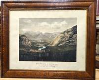
1900P5495Canada: Canadian Pacific Railway c.1900. Very Good . Notes: View of Banff Springs Hotel and Bow River Valley National Park-Rocky Mountains. It is framed in its original frame. <br>The Fairmont Banff Springs formerly and commonly known as the Banff Springs Hotel is a historic hotel in western Canada located in Banff Alberta. Image Size : 404x528 mm 15.91x20.79 Inches Platemark Size : Paper Size : 550x692 mm 21.65x27.24 Inches Coloring: Hand Colored Medium: Offset Lithograph Categories: Views Canada Alberta & British Columbia; Canadian Pacific Railway unknown
184829072New York: Van Norden 1848. The 1st annual report of the Hudson River Railroad not recorded on OCLC. Early reports authorizing the construction of the railroad from NY to Albany are dated 1848; the 2nd Annual Report of the Directors of the Hudson River Railroad is dated August 1849 <br /> The New York & Harlem Railroad NY&H was incorporated in 1831 to build a line in Manhattan from 23rd Street north to 129th Street between Third and Eighth Avenues the railroad chose to follow Fourth Avenue. At first the railroad was primarily a horsecar system but in 1840 the NY&H's charter was amended to allow it to build north toward Albany. In 1844 the rails reached White Plains and in January 1852 the NY&H made connection with the Western Railroad later Boston & Albany at Chatham New York creating a New York-Albany route. The Hudson was a busy river and the towns along it felt no need for a railroad - except during the winter when ice prevented navigation. Poughkeepsie interests organized the Hudson River Railroad in 1847. <br /> <br /> 8vo 24 page pamphlet. Printed paper wrappers one folding sheet of statistics tipped-in. Ex-lib with Hamilton College Library stamp and catalog numbers at front cover and slt foxing internally o/w very good. A fascinating first look at the Hudson River Rail line with the progress to date" now about 3000 men working between this city and Poughkeepsie the most of them between the city and Breakneck hill." p2. Van Norden unknown
1851406078New York: Wm. C. Locke & Co 1851. Wrappers chipped at edges professionally rebacked some unobtrusive offsetting on map. 8vo. 50 pages. Large folding map on three joined sheets 21 x 1788 cm; 8.25 x 61.75 inches. 11 woodblock illustrations in text and with 2 more not recorded in the index but always present. Original printed wrappers with woodblock vignette. SCARCE Hudson River Railroad travel guide published the first year in which the full line was completed. It covers points of interest along the route with woodblocks illustrating the text. Topics include: the history of the Hudson River the history of the construction of the Hudson River Railroad and the cities towns and villages along the Hudson from New York City all the way to Troy. Concerning the West Point Foundry at Cold Spring the guide states: "the iron foundry was established here by Gouverneur Kemble. The works are situated about a mile west of the village upon a small stream which tumbles rapidly down the mountains affording considerable water power. It is the largest establishment of its kind in the country employing nearly five hundred hands constantly." The building of the Hudson River Railroad is another topic in the guide. The project was considered highly impractical since much of the route had to be cut through extremely difficult rock and terrain. This section includes a description of the tunnels which had to be constructed. The railroad was opened in three stages. In September 1849 it allowed passengers to travel from New York to Peekskill. By that December 6 twenty-three additional miles were opened extending to New Hamburg. By the 31st of the month it was open the remaining distance of nine miles to Poughkeepsie. The Hudson River Railroad was an extension of the Troy and Greenbush Railroad which was chartered in 1845 connecting Troy South to Greenbush now Rensselaer on the east side of the Hudson. The Hudson River Railroad was chartered on May 12 1846 to extend this line south to New York City. The full line opened on October 3 1851 the same year in which this travel guide was published. WorldCat/OCLC records 25 copies but it is scarcely found complete with the map and the map is also excluded from the digitized versions available online. <br/><br/> Wm. C. Locke & Co unknown books
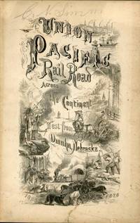
187044035Omaha: Land Department Union Pacific Railroad Company 1870. 1870. First edition. First edition. 8vo. 8 3/4" x 5 3/4" printed wrappers with map on back cover 44 pp. introduction illustrated maps. The rear cover features a map of portions of Idaho Utah Wyoming Colorado Dakota Nebraska Kansas Missouri and Iowa. States where land grant bonds are available from the Union Pacific Railroad Company. The frontispiece is a map of the United States that shows the Union Pacific Railroad and its connections. A third map shows counties in Nebraska in 1870 and the Union Pacific Railroad lands first 200 miles grants of 1862-64. A description of the Nebraska lands are provided county by county. The available lands are contained in alternate sections of one square mile each within a breadth of twenty miles on either side of the railroad and extend along the entire line. They extend through central Nebraska southern Wyoming and northern Colorado and Utah and include within their limits the splendid agricultural lands of the Platte Valley the great natural pastures of the Laramie Plains and the valleys of Lodge Pole Creek and Bear River and the rich iron and coal fields between the Black Hills and the Wahsatch Mountains. Description advantages water resources climate soil live stock raising farming markets timber minerals information about homesteads advantages of living in colonies etc. Both Adams' Herd and Graff list similar titles but different years and claim their listings to be "rare." A small bump to the top edges light wear to the spine ends else a near fine copy. Land Department Union Pacific Railroad Company, 1870. unknown
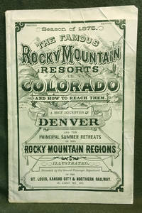
18757<b>A BRIEF DESCRIPTION </b><b>OF THE </b><b>FAMOUS ROCKY MOUNTAIN RESORTS </b><b>IN </b><b>COLORADO </b><b>and </b><b>HOW TO REACH THEM.</b><b><br />Compiled by the General Passenger and Ticket </b><b>Department of the St. Louis Kansas City &</b><b>Northern Railway</b><b><br />Season of 1875 </b><b>Illustrated </b><b><br /></b><b>COLORADO TERRITORY</b><b><br /></b><b>Publication dimensions: 4-3/4 inches by 7-3/8 inches; </b><b>52 pages </b><b><br /></b><b>Second Edition </b><b><br /></b><b>Including "Map of the Principal Resorts of Colorado" </b><b>on Page 22: </b><b>Supplement to "Guide Through Colorado" </b><b>Foldout engraving in front of publication by Arthur Lumley </b><b>"Famous Resorts in the Rocky Mountain Regions </b><b>Colorado" </b><b><br /></b><b>Dimensions: 17-1/2 inches by 11 inches </b><b><br /></b><b>Very good plus to near fine condition: some creasing on front cover; folded once vertically in distant past; interior pages clean bright and sturdy; folded engraving in near fine condition.<br />Historical Colorado railroad guide and map exhibited by: <b><b>COLORADO ARTIFACTUAL </b></b><b><b>& </b></b><b><b>MT. GOTHIC TOMES</b></b></b> General Passenger and Ticket Department of the St. Louis, Kansas City & Northern Railway
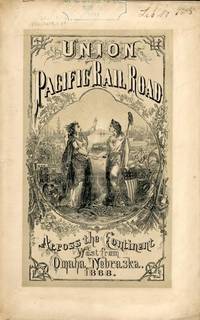
186854323New York: Published by the Company 1868. 1868. TRANSCONTINENTAL RAILROAD. First edition. Pamphlet edition. 8vo. Pictorial wrappers 40 pp. frontispiece Map of the Union Pacific Rail Road and its Connections introduction illustrated frontispiece map advertisement on rear cover for "First Mortgage Bonds at 102 principal and interest payable in gold with an annual income of "between eight and nine percent." This is an investment and advertising booklet for the first transcontinental railroad in the United States which was built by the Union Pacific Railroad and the Central Pacific Railroad in order to connect the Atlantic and Pacific coasts by rail for the first time. Begun in July of 1865 and built primarily by Civil War veterans the construction and completion of the Union Pacific line was one of the most significant technological and economic accomplishments of the 19th century creating the vital connection for commerce trade and travel and literally joining the eastern and western halves of the United States. Contents include the formation of the Union Pacific Railroad Company progress natural resources construction branch and connecting roads construction resources anticipated business & profits actual earnings and sale of first mortgage bonds. A list of officers of the company is provided. Top of front cover displays that this copy is mildly ex-library with stamp and number appearing at the upper right side a faint vertical fold to the center of the booklet tiny chips to bottom corner of front cover and a few preliminary pages. Overall a very good copy of an important railroad report. Published by the Company, 1868. unknown
186754322New York: Brown & Hewitt Printers 1867. 1867. TRANSCONTINENTAL RAILROAD. First edition. Pamphlet edition. 8vo. Pictorial wrappers 24 pp. frontispiece Map of the Union Pacific Rail Road and its Connections introduction illustrated frontispiece map advertisement on rear cover for "First Mortgage Bonds at six per cent. In gold at Ninety Cents on the Dollar. Light evidence of the entire booklet having been folded vertically penciled name to top of front cover covers lightly soiled and used small closed tear to the lower margin of the front cover Overall a very good copy of an important railroad report. Brown & Hewitt, Printers, 1867. unknown
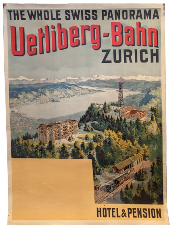
1895991DGZürich, Orell Füssli, 1895. Farb. Lithographie von 1895. Bildgrösse: 95 x 63 cm. Blattgrösse: 100 x 68 cm. + Wichtig: Für unsere Kunden in der EU erfolgt der Versand alle 14 Tage verzollt ab Deutschland / Postbank-Konto in Deutschland vorhanden +, 991DG
1895991DGZürich, Orell Füssli, 1895 Farb. Lithographie von 1895. Bildgrösse: 95 x 63 cm. Blattgrösse: 100 x 68 cm.
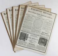
18563168Cincinnati 1856. Very good. Five issues and supplements totaling 72pp. Spines reinforced. Light tanning and dust soiling; scattered faint foxing. A lengthy extra issue of the Railroad Record with four additional eight-page supplements that together comprise a ringing endorsement from this industry periodical and its editors of the southern route through Texas and the Southwest for the American transcontinental railroad. The first two items of this extra published on October 4 1855 are by Texas Western Railroad owner and promoter Edgar Conkling who exhorts readers to examine the evidence supporting construction along the southern route and to invest in his railroad which was already sanctioned by the Texas state legislature as the text of two laws printed following his address demonstrate. Much of the issue is taken up by extracts from Secretary of War Jefferson Davis' positive report on the route through Texas and by a précis by Colonel A.B. Davis of his exhaustive survey of the proposed path through the recently completed Gadsden Purchase with a double-page map of the intended line. After several other attestations a subscription form is included at the rear for those who wish to purchase stock at $100 per share in the Texas Western Railroad Company. The additional four supplements dating from late 1855 and the first half of 1856 print more arguments in favor of the southern route including a lengthy letter from Thomas Butler King and lead articles with titles such as "What Shall Be Done for a Highway to the Pacific" and "Objections to the Construction of the Pacific Railroad reviewed." The Texas Western never built more than fifty miles of track connection Shreveport Louisiana and Marshall Texas and it was another twenty-five years before the Southern Pacific and Texas & Pacific Railroads connected near El Paso in 1881 to complete the "southern route" as it was originally conceived. unknown
1884280East Tennessee Virginia and Georgia Railway Company O'Brien John F. General Superintendent and Flippen T. D. Auditor. <i>East Tennessee Virginia and Georgia Railway Company List No. 14. List of Stations and Names of Agents. </i>ETV&G Railway Office of the Auditor Knoxville January 31 1884. A broadside directory listing the agents by name and by town for the East Tennessee Division and branches for the Alabama division the Atlanta division and the Brunswick division and branches. A broadside sheet 34 cm x 36 cm black ink on white paper fold creases otherwise very good. The ETV&G railway became part of the Southern Railway in 1894. The ETV&G made Knoxville Tennessee a wholesaling center as it provided both passenger and freight rail service to many small communities in Appalachia. East Tennessee, Virginia and Georgia Railway Company books
1881List1934BCarson 1881. Single sided receipt measuring 7 ¾ x 4 ½ inches. Near fine with a small tear to bottom of page. Near Fine. A receipt issued for passage from Carson to Badie Nevada in 1881 aboard the Virginia and Truckee Railroad issued with a note that reads “Chinamen†in the remarks section. The Virginia and Truckee was originally built to service the Comstock Lode area in Nevada. Chinese who represented ten percent of Virginia City during the period referred to Nevada as “Yin Shan†which translates to “Silver Mountain.†Chinese people in Nevada held varied jobs in the state perhaps more so than in other parts of the United States with an 1870 census listing Chinese merchants miners laborers laundrymen cooks gamblers and harlots. Despite the heavy involvement of Chinese in Nevada during the period few ephemeral records surface in the trade likely due to the drops in population caused by the Chinese Exclusion Act and perhaps also due to the overall population drop when miners left the region. unknown
19004711Tramways Electriques. Electric Tramways. Mit gefalt. Frontispiz, 3 gefalt. Tafeln u. Plänen sowie überaus zahlr., meist ganzseitigen fotografischen Abbildungen, Streckenplänen u. Zeichnungen. Berlin, (Druck von O. Elsner), 1900. Quer-4to. (24,5 x 33,3 cm). 6 Bl., 400 S. Orig.-Pappband mit gold- u. rotgeprägtem Deckeltitel, Vorsätzen in Braun- u. Golddruck sowie dreiseitigem Rotschnitt. [10 Warenabbildungen]