1 076 résultats
186810706S.l. (Paris), s.n. (gravé par Pouzadou, lithographié par Lanoue), 1868 ; grand in-folio en feuilles sous portefeuille muet ; (6) pp. de Titre, noms des Chemins de fer et table des planches imprimées en rouge et noir, 65 planches doubles, triples ou quadruples, ouvrage entièrement lithographié.
183742039Paris, P. Dufart, 1837. 2 vol. in-4 brochés de (4)-453 pp. ; titre et 29 planches repliées, couverture bleue imprimée.
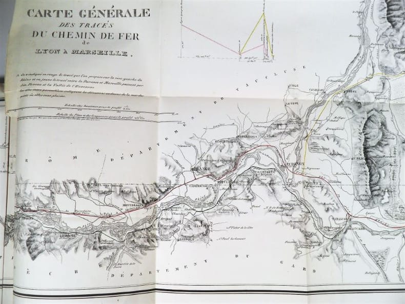
18372321Paris, Imprimerie Royale, 1837. In-4 – 22,5 x 29 cm. Broché. 172 pages, 1 carte dépliante en 2 parties. Edition originale. Ouvrage complet de sa grande « Carte Générale des tracés du Chemin de Fer de Lyon à Marseille » très détaillée (150 x 57cm). On découvre le tracé proposé sur la rive droite du Rhône, rehaussé en vert, et celui sur la rive gauche du Rhône, rehaussé en rouge, les deux se rejoignant à Tarascon puis poursuivant par Arles et les Martigues. Un tracé alternatif de la rive gauche, rehaussé en jaune, entre la Durance et Marseille, envisage une bifurcation à partir d’Avignon en passant par Orgon, Salon, Aix, Fuveau, Aubagne et la vallée de l’Huveaune. Mathurin François Kermaingant (1779-1856) est un ingénieur originaire du Nord de la France. Il intègre l'école des Ponts et Chaussées en 1800. Quatre ans plus tard, il est affecté au service de route de la Drôme. Il quitte ce département pour celui du Rhône en 1810, puis y revient en 1821, pour 3 années. C'est dans la Sarthe qu'il poursuit sa carrière à partir de 1824. A la demande du gouvernement, il pilote la commission d'étude sur un futur chemin de fer dans la vallée du Rhône en 1833. Il suggère de nombreuses variantes de tracés. En 1836, il est nommé ingénieur en chef. Il quitte le sud de la France puis s'occupe du chemin de fer de Paris à Versailles.
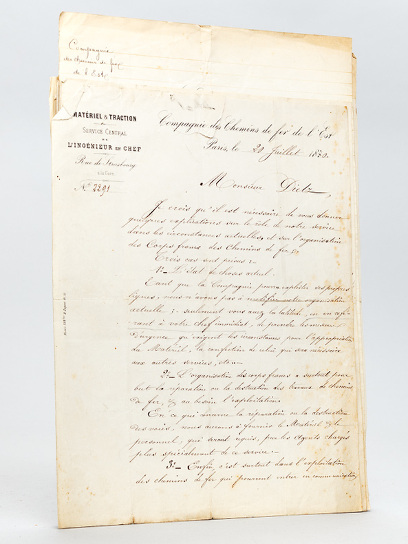
187056071Lot de 14 courriers dont 11 adressés à David Dietz, chef d'atelier à la Compagnie des Chemins de Fer de l'Est aux débuts de la Guerre franco-allemande de 1870, du 20 juillet 1870 au 5 août 1870 (en général 1 ou 2 pages par lettres) : I : Lettre signés de l'Ingénieur en Chef de la Compagnie Vuillemin, du 20 juillet 1870, précisant le rôle de leurs services et l'organisation des Corps Francs des Chemins de fer. M. Dietz est nommé dans ce cadre chef du matériel roulant, 2 pp. ; II : Lettre de nomination à ce poste signée du Directeur de la Compagnie M. Sauvage, 1 p. ; III : Lettre signés de l'Ingénieur en Chef de la Compagnie Vuillemin, du 30 juillet 1870 ; IV : Copie manuscrite de la décision de nomination d'un second, M. Doré ; IV : Lettre signés de l'Ingénieur en Chef de la Compagnie Vuillemin, du 30 juillet 1870 à M. Dietz, précisant les "divers travaux ou fournitures qu'exigent les transports militaires" qui sont de deux sortes, "les uns qui restent à la charge de la Compagnie, tels que confections de strapontins... les autres directement demandés par l'autorité militaire et restant à la charge de l'Etat" ; V : Lettre signés de l'Ingénieur en Chef de la Compagnie Vuillemin, du 2 août 1870 à M. Dietz, approuvant notamment les hamacs installés par Dietz [ pour le confort des blessés ] ; VI : Copie conforme signée par Vuillemin d'une réquisition de l'Armée du Rhin ; VII : Lettre du service central de l'Ingénieur en Chef à M. Dietz, datée du 3 août 1870, évoquant la livraison de bidons, d'urinoirs et de deux modèles de hamacs ; VIII : Lettre à en-tête de l'Exploitation de la Compagnie, datée du 4 août 1870 "J'ai immédiatement adressé à Messieurs les médecins de la Cie de l'Est une circulaire pour les inviter à prêter leur concours tant pour le transport que pour la visite des blessés de l'armée" ; IX : Lettre du service central de l'Ingénieur en Chef à M. Dietz, datée du 4 août 1870, relative à l'envoi d'un troisième modèle de hamac, de 30000 pitons, etc. ; X : Lettre du service central de l'Ingénieur en Chef à M. Dietz, datée du 5 août 1870 ; XI : Lettre du service central de l'Ingénieur en Chef signé de Vuillemin à M. Dietz, datée du 5 août 1870 : "J'ai remarqué que pour les transports des blessés militaires, sur vos hamacs dans les wagons N ou autres, il faut un temps assez long pour amener les blessés aux wagons et pour les placer sur les hamacs. En supposant que les gares dans lesquelles doit s'effectuer l'embarquement soient pourvues de hamacs avec les cordes et leurs pitons, nos hommes seraient en mesure de tout disposer dans le premier wagon venu, pour peu qu'ils soient prévenus quelques heures d'avance. Il ne serait donc pas nécessaire de garnir tous nos wagons de pitons, mais il faudrait toujours avoir aux gares d'embarquement des pitons que nos ouvriers placeraient dans les wagons..." ; XII : on joint 3 autres pièces
18396365... the company's charges for conveyance; time of starting each train. Mit 1 mehrfach gefalt. gest. Karte mit 3 Ansichten u. 1 gefalt. Fahrplan. London, S. Cornish, 1839. 12mo. (14,2 x 9,0 cm). V (recte IV), (3)-18, 65-72, (5)-90 S., 2 Bl. - Angebunden: Cornish's Guide and Companion to the Grand Junction and the Liverpool and Manchester Railways, containing also the stranger's guide to Liverpool and Manchester, and an account of Birmingham ... the company's charges from one station to another ... time of departure and arrival of each train. Third Edition, Enlarged and considerably Emproved. Mit 1 mehrf. gefalt. kolor. gest. Karte mit 2 Darstellungen u. 1 mehrfach gefalt. gest. Plan von Liverpool. Ebda. 1839. (V)-VIII, (5)-10, 15-60, 25-140 (recte 104), (141)-216 S. Orig.-Leinwandband mit goldgeprägtem Deckeltitel. [3 Warenabbildungen]
18671385[Hrsg. vom Schweizerischen Ingenieur- und Architektenverein.] Mit 12 doppelblattgr. (1 zusätzlich gefalt.) lithogr. Tafeln von Wurster, Randegger & Co. in Winterthur. Zürich, Meyer & Zeller, [1867]. Folio. (46,6 x 29,5 cm). Neuer Halbleinwandband mit montiertem Deckeltitel. [6 Warenabbildungen]
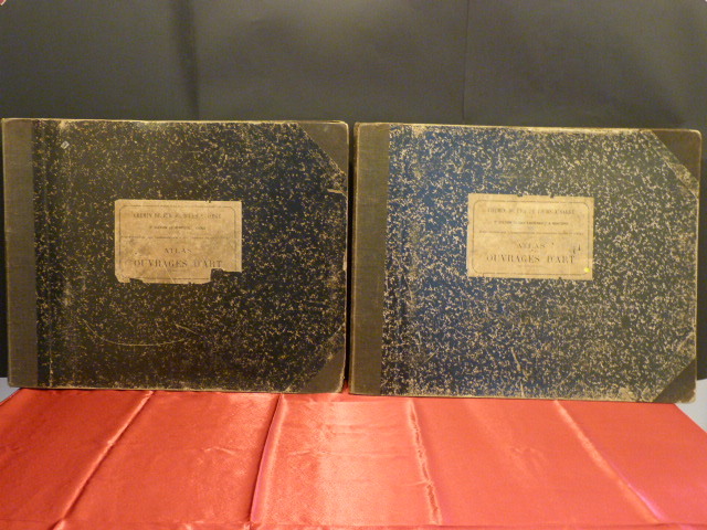
18951872S.l.[Tours], S.n. [Juliot], 1895. 2 volumes. In-Folio à l'Italienne, 59 x 47 cm. Reliures de l’époque en demi-toile noire à coins, dos lisses et muets, plats de papier marbré, étiquettes indicatives au centre des premiers plats. 2, 69 pl ; 2, 124 pl. Intéressants recueils de dessins d’exécution (plans, coupes, élévations) des ouvrages d’art présents sur ces deux tronçons de la voie ferrée qui relie Tours à Sargé : ponceaux, ponts voûtés ou métalliques, passages, viaducs, galeries, … Pour chacun, figurent des renseignements sur la construction de l’ouvrage et son prix de revient. Ce travail a été supervisé par deux Ingénieurs en chef, MM. Prompt et Faure, ainsi que par deux Ingénieurs ordinaires, MM. Mazoyer et Leroux, chargés, comme leurs supérieurs, des études et de la construction. Ouvrages bien complets de respectivement 69 planches (2e section) et 124 planches (3e section), dont la plupart doubles et plusieurs dépliantes.(l'atlas de la 1ère section, de Vouvray à Châteaurenault, est absent). Les deux lignes de chemin de fer ont été ouvertes à la circulation des trains en 1893, à partir du 2 janvier pour la section Sargé-Montoire-sur-le-Loir, et à compter du 15 octobre pour la section Montoire-Châteaurenault. Cette dernière reste en activité jusqu’en 1957, alors que l’autre est fermée dès 1942. Le déclassement puis la dépose des voies interviendront dans les années 1970. Rares documents liés au patrimoine ferroviaire et architectural de la vallée de la Braye, dans la région Centre, concernant une ligne de chemin de fer qui n’existe plus aujourd’hui.
1878428711 vol. in-4 reliure demi-basane verte, Revue Générale des Chemins de Fer, Juillet - Décembre 1878, 445 pp. avec 31 planches hors texte (le plus souvent sur double page, souvent dépliantes). Au sommaire notamment : Note sur quelques nouveaux appareils destinés à l'armement de secours ; Note sur le transport des petits paquets d'un poids égal et inférieur à 5 Kg ; Recherches sur la puissance de vaporisation des locomotives en relation avec le tirage ; Note du la nouvelle gare de Bologne (Italie) ; Note sur l'utilisation des déchets de boites à fulée des locomotives ; Note sur le système de décalque au papier sensible ; Note sur le règlements des signaux en vigueur sur les chemins de fer allemands ; Notes sur les essais du frein à vide système Smith ; Considérations théoriques sur l'arrêt d'une train au moyen d'un système de freins continus ; Note sur le pousse-wagon ; La voie ferrée à l'Exposition universelle de 1878 : Traverses mixtes et traverses métalliques ; De l'influence du profil de la voie sur les dépenses d'exploitation ; Note sur le frein automoteur à friction ; Note sur le wagon d'expériences du chemin de fer de l'Est ; Note sur les essais d'éclairage électrique faits à la Gare de La Chapelle ; Résumé d'une étude technique sur le chemin de fer de Festiniog ; Poids d'un vérin à manivelle ;Locomotives_tender à deux et à trois essieux accouplés de l'Exposition Universelle de 1878 ; Serrage des frein par l'air comprimé, système Westinghouse automatique.
1851406078New York: Wm. C. Locke & Co 1851. Wrappers chipped at edges professionally rebacked some unobtrusive offsetting on map. 8vo. 50 pages. Large folding map on three joined sheets 21 x 1788 cm; 8.25 x 61.75 inches. 11 woodblock illustrations in text and with 2 more not recorded in the index but always present. Original printed wrappers with woodblock vignette. SCARCE Hudson River Railroad travel guide published the first year in which the full line was completed. It covers points of interest along the route with woodblocks illustrating the text. Topics include: the history of the Hudson River the history of the construction of the Hudson River Railroad and the cities towns and villages along the Hudson from New York City all the way to Troy. <br /> <br /> Concerning the West Point Foundry at Cold Spring the guide states: "the iron foundry was established here by Gouverneur Kemble. The works are situated about a mile west of the village upon a small stream which tumbles rapidly down the mountains affording considerable water power. It is the largest establishment of its kind in the country employing nearly five hundred hands constantly."<br /> <br /> The building of the Hudson River Railroad is another topic in the guide. The project was considered highly impractical since much of the route had to be cut through extremely difficult rock and terrain. This section includes a description of the tunnels which had to be constructed. <br /> <br /> The railroad was opened in three stages. In September 1849 it allowed passengers to travel from New York to Peekskill. By that December 6 twenty-three additional miles were opened extending to New Hamburg. By the 31st of the month it was open the remaining distance of nine miles to Poughkeepsie. <br /> <br /> The Hudson River Railroad was an extension of the Troy and Greenbush Railroad which was chartered in 1845 connecting Troy South to Greenbush now Rensselaer on the east side of the Hudson. The Hudson River Railroad was chartered on May 12 1846 to extend this line south to New York City. The full line opened on October 3 1851 the same year in which this travel guide was published. WorldCat/OCLC records 25 copies but it is scarcely found complete with the map and the map is also excluded from the digitized versions available online. Wm. C. Locke & Co unknown
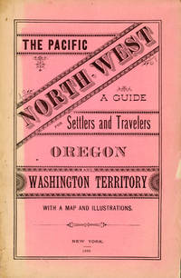
188250958New York: Land Dept. Northern Pacific Railroad Co. 1882. 1882. PACIFIC NORTHWEST. First edition. 8vo. Printed wrappers 81 pp. introductory illustrated large folding map at the rear. Scarce Western promotional travel guide to the Pacific North-West. Addressed to prospective settlers and travelers alike this guide consists of historical geographical and agricultural information and discusses at length matters such as commerce climate education taxes prices and the regions of the Pacific North-West. Each county is described and suggestions are provided to prospective emigrants such as "In mercantile pursuits the opening is good for men of enterprise and capital; but the chances for mere clerks are not good." Farm labor wages in these parts are recorded as being between $25 and $30 per month and lumber mills wages between $60 and $90 per month for first-class hands. It is also noted that "Chinamen work for the railroads and boards themselves at $1.00 a day and in winter take contracts for grubbing brush land." There are ten full-page illustrations which include a two-page "Bird's Eye View of Portland Oregon" "Saw Mill on Puget Sound W.T." "Astoria Oregon Entrance to Columbia River" "First Street Portland Oregon" and "Commercial Street Seattle W.T." with folding map of the region Unfolded 28 1/2 x 18 inches in the back. Spine and outer edges of wrappers sunned else very good copy. Land Dept., Northern Pacific Railroad Co., 1882. hardcover
1844GD012817okBC1S5Manchester: Wetmore & Wallace 1844. Manchester: Wetmore & Wallace Rare Americana 1844 First Printing. 8vo. 16 pages with folding map at rear of wrappers. The folding map titled :Plan and Profile of the Route Surveyed for the Northern Railroad from Concord to Lebanon N.H." measuring approxinately 28" long and 9" wide. The map is in extremely nice condition. The spine shows some wear but remains a very nice copy. A signature of S.Chase" appears on the front wrapper. There is an institional rubber stamp on the margin of page 3. Vermont Historical Society Montpelier Vermont. This report printed by Wetmore & Wallace Printers in Manchester New Hampshire presents the findings of an engineer's survey for the Northern Railroad route. It covers the planned railroad connections between Concord Franklin and complete with Lebanon along the Connecticut River. Published in 1844 this document provides historical insight into the development of New Hampshire early railroad infrastructure and the engineering challenges faced in the region at that time. Scarce copy last auction records 1930. First Printing. Paperback. Good/No Jacket. 8vo - over 7¾" - 9¾" tall. Manchester: Wetmore & Wallace
1850235001850. Slavery & Abolition Underground Railroad Fugitive Slave Signed letter mentioning threats of arson against an abolitionist community in Pennsylvania 1850. Lancaster stood on a volatile antislavery route in 1850 with fugitives moving west toward Columbia and the Susquehanna River while pro slavery men targeted communities accused of sheltering escapees. Mary Louisa Harbaugh the young wife of Rev. Henry Harbaugh of the German Reformed Church wrote to her mother that "a party of fellows from Phil. came up here and threatened to burn this place down" and that residents had kept watch after "a great many alarms of fire." Lancaster was the home of Thaddeus Stevens the lawyer and future Radical Republican congressman who defended fugitives and attacked slavery in public life. Columbia eleven miles west had a large free Black population and served as a crossing point for people escaping slavery before and after the Fugitive Slave Act of 1850. <br /> <br /> Harbaugh M. L. Autograph Letter Signed. Lancaster Pennsylvania June 15 1850. Three manuscript pages plus stampless address leaf addressed to her mother Mrs. Margaret A. Linn Lewisburg Pennsylvania. Harbaugh reports household matters children's clothing local health and the arson threat in one domestic letter writing that the city was "very healthy" except for "a few old people" before describing the men from Philadelphia who threatened to burn Lancaster. The address leaf preserves the Lewisburg destination manuscript postal markings and remains of the original red wax seal. The part concerning the arsonists reads as follows:<br /> <br /> "Dear Mother .This place is very healthy now. I know of no disease or sickness at all except among a few old people. We had a great many alarms of fire a few days ago a party of fellows from Phil. came up here and threatened to burn this place down but they were discovered too soon. They have had a watch out since and nothing is heard of them now. The place is not large enough for such persons to do any injury to it."<br /> <br /> Mary Louisa Harbaugh's husband Rev. Henry Harbaugh was a prominent German Reformed minister and writer who avoided public antislavery controversy while her family in Lewisburg was connected to abolitionist politics through her father's break with the Democratic Party for James G. Birney's Free Soil candidacy. Local newspapers such as the June 19 1850 issue of The Lancaster Examiner and Herald reportedly attributed the fire as "no doubt the work of incendiaries as two men were seen running from the Cooper Shop just as the alarm was given" in which they made their escape. It was reported that a young black man by the name of "Gilmore" was arrested and imprisoned on suspicion but was released the next day for insufficient evidence. Other newspapers reportedly minimized the incident without attribution to racial tension all while Columbia suffered a fire that destroyed nine houses and the offices of the Columbia Spy. Folded as mailed with light toning minor edge wear one small seal tear and clean legible manuscript throughout. Overall very good condition. unknown
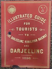
189675179London: McCorquodale & Co. Limited 1896. First edition of this elusive yet important publication. Quarto 7 x 9 7/8 inches. 46 2 ad for the photographer of the book Fred. Ahrle and printer's slug. pp. including 15 full page photographic illustrations by Ahrle and 5 double page plates the first one is a map printed in gold of the railway route used as a frontispiece and one is an gradient diagram and the remainder are plans. Publisher's flexible scarlet cloth with large gilt cover lettering along with the device of the railway. Aside from a couple of ink drops on the corner an exemplary copy. Only a handful of copies located by OCLC. and no copies have appeared at auction according to RBH.The Darjeeling Himalayan Railway is the first and foremost instance of a mountain passenger railway. Opened in 1881 it introduced bold and imaginative engineering approaches to the challenge of rail links on a hilly terrain of excellent beauty this is the first guide book to this fabled railway.The settlement at Darjeeling really began in 1828 with British interest. By 1835 it was separated from Sikkim for establishing a Sanatorium for the invalid servants of the East India Company. It then consisted of a monastery on observatory hill clustered with about 20 huts and a population of about 100 people. Planning began in 1839 to lay out the Darjeeling town and construct a hill road connecting Siliguri Pankhabari Kurseong and Darjeeling. At the same time evolution of hotels began the first being The Darjeeling Family Hotel’s followed by other hotels. By 1840 Darjeeling town had about 30 buildings and a few respectable houses.I n the year 1878 Franklin Prestage Agent of the Eastern Bengal Railway foresaw the utility of a rail link between the hills of Darjeeling and the plains. His scheme was mainly driven by hard economic considerations viz. the huge difference in the cost of essential commodities between Darjeeling and Siliguri the need to carry out tea for export and the inability of the existing road to handle the growing traffic. He submitted a scheme for the construction of a two feet gauge railway line from Siliguri to Darjeeling.In a detailed scheme submitted to the Government of Bengal and approved by the Lt. Governor Sir Ashley Eden he pointed out how a railway could substantially reduce the cost of transport between Darjeeling and the plains. Rice which sold at 98 a ton at Siliguri Cost 238 at Darjeeling! He was also convinced that the cost of construction of the 2 feet gauge rail-line would not be prohibitive and locomotives small but powerful enough to climb steep gradients could be designed Prestage received final sanction for his project on April 8 1879 and formed the Darjeeling Steam Tramway Co. However the idea of operating the line as a steam tramway was soon abandoned and on September 15 1881 the company adopted the designation of Darjeeling Himalayan Railway Co. DHR which remained effective until it was taken over by the Government of free India on October 20 1948. Throughout that period Gillanders Artbuthnot & Co. one of the oldest managing houses in Calcutta handled its financial legal and purchasing interests.abaa-ny-2022 McCorquodale & Co., Limited hardcover
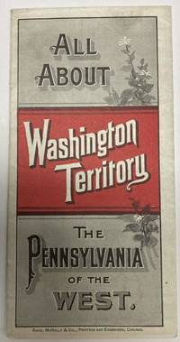
188853587Chicago: Rand McNally & Co. 1888. 1888. 20 3/4" x 13 1/2" sheet folded to 24 panels. Map. One cover panel; one panel showing N.P.R.R. route from Minneapolis to Washington Territory; and 10 panels of information to include information on the area's location and physical features climate agriculture stock raising manufacturing mining public schools cities and towns etc. Opposite 12 panels offer a map of Washington Territory printed in red and black. A rare promotional piece to encourage sales of Northern Pacific Railroad lands in Washington Territory. Light soling a few small splits to creases and with minor wear to the extremities. Very good. Rand, McNally & Co., 1888. unknown
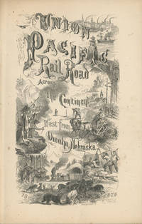
186849559New York: Published by the Union Pacific Railroad Company 1868. 1868. RAILROAD. First edition. 8vo. Original pictorial printed wrappers 32 pp. frontispiece Map of the Union Pacific Rail Road and its Connections introduction. Details the formation of the company and the progress of the work including the topography character of the country and distances along the line. Much information is provided regarding agricultural resources timber minerals etc. Branches and connecting roads along with the needed resources for construction are discussed as is information on actual earnings anticipated earnings and the issuance of the company's first mortgage bonds. A wonderful advertisement on the rear cover panel offers First Mortgage Bonds at par principal and interest Payable In Gold. A faint vertical crease and very lightly toned at the cover edges else a near fine bright copy. Published by the Union Pacific Railroad Company, 1868. unknown
1896WRCAM56242Chicago: Poole Bros. 1896. Chromolithographic broadside 24 x 9 inches. Old horizontal folds. Small tear at upper margin likely from posting no text affected. Very good. Rare and colorful broadside advertising "the Shortest and Quickest Route" to "all points West" on the Wabash Line connecting through St. Louis. The sheet features a full-color image of the famous Wabash flag as well as the seals of Colorado and California. Customers are promised that all trains feature "Free Reclining Chair Cars and Pullman Buffet Sleeping Cars" and are provided a name and address to acquire maps and timetables. <br> <br> At the time this broadside was issued Charles M. Hays was general manager and the Wabash railroad was under the control of financier Jay Gould who was working feverishly to establish a full coast-to-coast system. He had merged the St. Louis Kansas City & Northern Railroad with Wabash creating the Wabash St. Louis & Pacific Railroad. Then as with many other Eastern and Midwest railroads Wabash partnered with Union Pacific to provide service further west. By 1896 Gould's son George had taken over the railroad and proceeded to expand it further swallowing up the Missouri Pacific Western Pacific Denver & Rio Grande Western Western Maryland and Wheeling & Lake Erie railroads. Hays left in 1896 to become general manager and later president of the Grand Trunk Railway in Canada which helped extend the Wabash network north. <br> <br> An attractive artifact from one of the great American railroads. We could find no copies recorded in OCLC. Poole Bros. unknown books
1855EEzz81941KParis, 1840-1855. gr.-4°, mit zahlr. gestochenen, teils lith. Abb. im Text, schwarze HLdrbde. d. Zt., 4 Blindbünde, Rückenkanten leicht beschabt, Deckel etw. berieb., insges. sehr gutes Expl. In Französisch. - In dieser überaus wichtigen Architekturzeitschrift werden die verschiedendsten Themen bearbeitet, u.a. über Eisenbahnbau (Bahnhöfe, Bahngebäude etc. ), Aeronautik, Archäologie, Kunsthandwerk, Technik, Elektrizität, Gartenbau etc.
18514405), Olpe, Siegen, Wittgenstein, Biedenkopf, auf die Main-Weserbahn bei Marburg; als direckte (!) Verbindung Englands, Belgiens und Hollands, mit dem südlichen und mittleren Deutschland. Mit 2 gefalt. streckenkolorierten lithogr. Karten. Gummersbach, Druck von Fr. Luyken, 1851. 8vo. (21,8 x 13,5 cm). Titel, 42 S. Orig.-Umschlag.
1845619717London: Bradshaw's Railway Information Office 1845. Slender hard cover no jacket intended from the collection of the Worshipful Company of Clothworkers; their coat of arms is stamped to the FEP. In fine condition for its age showing some wear to boards and notable tanning to content however this remains clear and informative. Contains a number of unusual contemporaneous advertisements including Macassar oil; 'For The Hair The Skin & The Teeth' a number of 'Life Assurance Societies' and 'Cabburn's Oil' for the cure of Rheumatism and Gout. Small water mark at spine point of title page. Text block is notably tanned but remains firmly bound. Railways timetables all present including the Second Edition fold out timetable for the journey London to Ely and Norwich and return. A lovely historical piece. Please contact us for further information or additional pictures. CN. Hardcover. Very Good/No Dust Jacket. Bradshaw's Railway Information Office Hardcover
18346168Aufgesetzt, mit Beiträgen von neuern englischen Konstrukzionen vermehrt und herausgegeben von Franz Anton von Gerstner. 3 Bände u. Atlasband. Mit gest. Porträt, Tabelle (zu Bd. I, S. 478) u. 109 gest. Tafeln (plano, 2 mit Aquatinta). Prag, Gedruckt bei J. Spurny (1 u. 2), 1831-1832 u. Wien, Gedruckt bei J. P. Sollinger, 1834; Atlas: Prag, 1831-1832 u. Wien, 1834. 4to. (27,6 x 20,5 cm) u. Quer-Folio (32,5 x 46,0 cm). Marmorierte Halblederbände d. Zt. mit etwas Rückenvergoldung u. Halblederband d. Zt. (Rücken u. Ecken erneuert).
185245102 Abt. in 1 Band. Mit 4 gest. Tafeln, 4 (2 kolor.) lithogr. Tafeln sowie 6 ganzseitigen Holzstichen (davon 5 in der Paginierung von Teil 2). Braunschweig, Druck von F. M. Meinecke, (1852). Kl.-8vo. (12,4 x 10,1 cm). 1: 1 Bl., XVI S., 1 Bl., (11)-128 S. 2: 159 S., (1 S. Anzeige). Halbleinwandband d. Zt. (vorderer Orig.-Umschlag mit Holzschnitt-Vignette eingebunden).
18831076Mit 203 Abb. auf 84 (5 doppelblattgr.) Tafeln u. einigen Abb. im Text. New York, The Railroad Gazette, 1883. Folio (ca. 39,5 x 28,0 cm). 4 Bll., 46 S., 1 Bl. Zwischentitel, 1 Bl. Index. Halblederband d. Zt. [6 Warenabbildungen]
189132829St. Louis: Woodward & Tiernan Printing Co. n.d. 1891. 1891. First edition. Third edition. 12mo. Original orange wrappers printed in black ink 82 2 pp. illustrated map. advertising. Issued by the general passenger department of the Missouri Pacific Railway. A general description of the state and its place in history is provided. Plus soil rainfall churches schools higher educational opportunities newspapers population and wealth corn wheat oats stock farming wild flowers orchards and vineyards salt lead and zinc stone brick and lime coal gas hunting and fishing cities irrigation etc. Views are offered of farms and ranches parade grounds city parks etc. of various cities. Herd 1204 says "Issued by the Missouri Pacific Railway Company this book appeared in many editions though all are now rare." Prior to this copy the earliest edition of a similar booklet was a 13th edition and that was 15 years ago. Fine clean copy with a fine folding map. An exceptional copy of a rare item. Woodward & Tiernan Printing Co., n.d. (1891)]. unknown
185833688Chicago: Illinois Central Rail Road Office 1858. 8vo 5 p.l. pp. 5-80; full-page map of Illinois double-page map of the guide to the Illinois Central Railroad Lands wood-engraved frontispiece 6 wood-engraved illustrations in the text; slight nibble out of the fore-margin of the first 3 leaves else a near fine copy in original yellow pictorial wrappers. Another edition with same text has imprint: Boston G.C. Rand & Avery printers 1857. Byrd 2683; Ante-Fire Imprints 263. <br/><br/> Illinois Central Rail Road Office unknown books
18972111902153000232Hakubunkan 1897. Soft Cover. Fine. Number of pages: 502 pages Size: approx. 20 x width approx. 13 cm Hakubunkan paperback