10 875 résultats
18992111902160201349Tenshodo soil steel Taro 1899. Soft Cover. Fine. Volume: 1 Tenshodo soil steel Taro paperback
19102091502135420447Not Available 1910. Soft Cover. Fine. Number of books: 1 Not Available paperback
2091502135500258press eisenbahn N.A. Soft Cover. Fine. Pages: 112p Insertion 4p Size: 29x29cm press eisenbahn paperback
19222091502135501138South Manzhou Railway 1922. Soft Cover. Fine. Number of pages: 193 pages Size: 19x26 cm South Manzhou Railway paperback
19242091502135405434Manchuria Cultural Association 1924. Soft Cover. Fine. Number of books: 1 Manchuria Cultural Association paperback
2081002109000859Railway Education Society N.A. Soft Cover. Fine. Number of pages: 484p Size: 18cm Railway Education Society paperback
19242091502135500235Not Available 1924. Soft Cover. Fine. Number of pages: 40 Size: Horizontal 22x14.5 cm Not Available paperback
19182090202120601164Not Available 1918. Soft Cover. Fine. The book is in fine condition. Not Available paperback
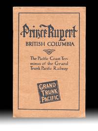
19114499Montreal QC: The Grand Trunk Pacific Railway Company 1911. Paperback. Fine. With "Fourth Edition April 1911" printed at foot of the "Announcements" page giving a good indication of the amount interest that the new terminal town and surrounding areas were generating at the time. Includes two fold-out maps one tipped in at title page and the other a real lithographic beauty and excellent promotional map is in color and tipped in at the rear with an additional two insert maps in it's corners. Both maps are in very fine condition. Brown printed wraps 8vo size 9.25 inches tall pp. 24 illustrated w. B&W photo reproductions showing the current stage of development of the town harbor and their surrounds with some images dated "September 1910" table of summit elevations and rwy grades on verso of terminal leaf. Volume w. a touch of rust to staples one leaf w. two light creases and a 1/4 inch closed tear at fore-edge else clean and unmarked throughout. The large color map at rear 33.5 x 26 inches wide is titled "Map Of The Grand Trunk Pacific Railway In British Columbia Showing Terminus At Prince Rupert" plate mark "4824" at lower left and has a copyright date of 1907 by Poole Bros. An additional date of "4-10-'11" is printed at the lower edge matching the pub. date of "Fourth Edition April 1911" printed on the "Announcements" page. These matching dates would have confirmed for potential investors and settlers that the map and pamphlet had the most up to date information available at the time. The two insert maps are "Map Of Price Rupert And Vicinity" and "Latitude Map". The frontis map 9x17 inches wide is titled "General Plan for the Development of Prince Rupert B.C. and was executed by Brett & Hall Landscape Architects Boston who used "City Beautiful" principles with success in Smithers and Fort Prince George as well. Evidently most of the Prince Rupert today is based upon this Brett & Hall plan. OCLC finds no copies of this 1911 edition of this GTPR pamphlet. Rumsey's copy of the large color map lacking the pamphlet and the frontis map is dated "3-28-'10 The Grand Trunk Pacific Railway Company paperback
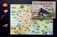
19203220195<i>Two-fold chromolithograph playing board measuring approximately 85.5 × 61.5cm 6 metal Locomotive playing pieces 30 counters two shakers a dish and two dice one a later replacement; all contained within the original box 45 x 33cm lid with pictorial scene of a locomotive outside Paris the Eiffel tower visible in the distance with the printed rules pasted to underside of lid some rubbing to extremities but overall in very good original condition.</i><br /><br /><br />A wonderful railway game beautifully illustrated taking players from Paris space 1 on route's through France her neighbours and beyond.<br /><br />The mechanic is roll and move as in the Goose-type games. If you land on a red space you are penalised but landing on green you get some assistance. The publisher reports the game will be most instructive not only for learning about French towns but also about the towns in neighbouring countries.<br /><br />The toy and games maker Saussine were established in 1860 by Léon Saussine after he had acquired the prolific children's bookseller and publishers Hugues-Marie Duru at the rue du Cloitre Saint-Jacques in Paris. Saussine developed the business making board games card games and puzzles but also began producing shadow theatres under the mark 'LS edit Paris'. Like most such enterprises Saussine thought up ideas for his wares and employed various specialist manufacturers in France Belgium and Germany to construct them. After Léon's death in 1896 his widow continued to run the business until her sons George and Maurice were able in their turn to take over the reigns in 1916. They were then succeeded by a grandson of the founder in 1944 the company continued to supply the marketplace until around 1964.<br /> Saussine Ed.
19302111902153101092China-Japan Cultural Association/South Manzhou Railway Co. Ltd. 1930. Soft Cover. Fine. Volume: 1 China-Japan Cultural Association/South Manzhou Railway Co., Ltd. paperback
0227601st Edition 1st Printing. Soft cover. Near Fine. Down East Latch-Strings or Seashore Lakes and Mountains by the Boston & Maine Railroad. Descriptive of the tourist region of New England. First Printing 1887 with 7 Maps 6 are large folding maps side-bound in along the specific area of interest 1 Frontispiece Bird's-eye map of the Boston & Maine system 6 larger folding color-printed maps as follows: 2 Boston & Maine Railroad and Connection; 3 Boston and Maine Railroad; 4 Lake Winnipesaukee; 5 Mount Desert; 6 Hunting and Fishing Resorts of Maine; repaired and 7 White Mountains. Maps printed by Rand Avery Supply Co. Engravers and Printers of Boston. 256 pages with numerous illustrations within the pages;photos engravings etchings and wood-cuts in black line. This example has moderately worn/chipped edges and spine paper of the covers which are printed on light baby-blue wrappers illustrated and titled in black and white. The 6 folding maps are in generally VG condition with one having a professional archival repair along an edge where it was removed improperly/quickly They were printed on very thin map paper 8-10 wt but have remained quite nice. Very scarce only a few actual copies on the net though several are advertised at high prices none of which are this very scarce paper wrappers binding. Photos available. <br/> <br/> paperback
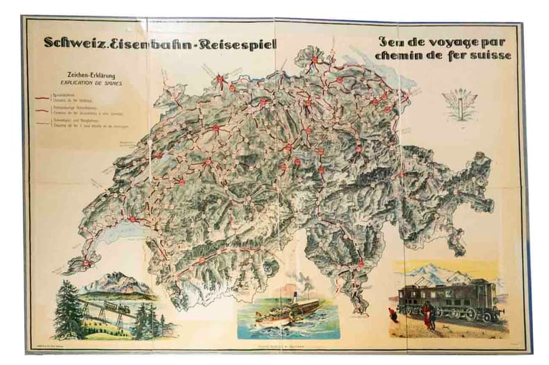
140861aafBiel-Bienne, Hertig & Cie, (1915), 1 Planche de jeu en carton (Ill. de M. Weber) (49 x 71.5 cm) / 6 pions en bois de diff. couleurs / 2 dés / règles du jeu montée derrière le couvercle de la boîte / Cartes de jeu: Sont présent de la série 1) - 6 cartes voyage / 2) - 6 cartes Reise / 3) - 6 cartes Reise / 4) - 6 cartes / 5) - 4 cartes (compl.) / 6) 1 - carte (compl.) / 7) - 6 cartes. Boîte en carton avec illustration (20 x 31 x 2.5 cm),
116806aafFirenze (Florence - Florenz), Pineider e Smorti Litografi-Editore, , s.d. ca 1871, in-4to, (16:26 cm), leporello dépl. de 29 éléments de 15x25.5 cm (longueur totale 435 cm), ill. avec 3 grandes vues en couleurs (Suza , Modane et Torino) et 25 petites vues, avec texte en français - italien et anglais, qqs rousseurs, exlibris Peter E, Obergfell couverture lithographiée devant avec 4 vues, au verso la machine et les travailleurs perçant le tunnel. Dos en toile.
77893aaf34 illustrated publicity + LVIII (58 p.) + 820 p. + 79 p. illustr. publicity, with a book-plate by ‘Mayor Alfredo F. Sears’ from Peru, original green cloth with gilt title, some stains on covers but a sound copy
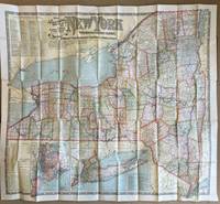
1901013098Boston: National Publishing Company 1901. Hardcover. As New. Amazingly preserved 1901 map of all railroads in New York State in almost new condition. We unfolded it just once to take image and get measurement approx 48 x 42". 55 panels 11 arcoss 5 down with middle outer panel affixed - as issued - to panel folder which itself is as new - brown paper over board with gilt titles. In color as bright as issued. The only blemish are two small brownish curved spots that occur on close examionation in the middle of Lake Ontario. A collectible copy. National Publishing Company hardcover
190648393Chicago: Privately printed 1906. 1906. 9" x 8" colorful pictorial wrappers. 61 pp. illustrations maps. "The purpose of this booklet is to describe the various groups of outing places their location their chief points of attraction their hotel facilities and the train service by which they are reached." The first 30-32 pp. offers an overview of the area serviced by the Chicago and North Western Line as well as numerous black and white photographs of the area. These pages are followed by charts listing hotels and boarding houses at the various summer resorts and fishing and hunting grounds reached by the Chicago and North Western Line together with rates capacity distance from train station proprietors etc. Includes resorts mostly in Wisconsin but also resorts in Illinois Minnesota South Dakota Iowa and Michigan. 3 fold-out maps printed in black and green. The first map measuring 25" x 20" is entitled "Lake Region of Northern Illinois and Southern Wisconsin." The second map measuring 25" x 18" is entitled "Hunting and Fishing Resorts of Northwestern Wisconsin Reached by the Chicago and Northwestern Railway." The final map measuring 19" x 16 1/2" is entitled "Hunting and Fishing Resorts of Northern Michigan Reached by the Chicago & Northwestern Railway." All maps are in fine condition with the exception of the first map that has a 1" closed tear to bottom edge at fold. Rubbing and wear to spine along with 1 1/2" split to bottom of spine and light wear to the extremities. Privately printed, 1906. unknown
18851099Chicago: Geo. F. Cram 1885. Good plus. Large folding pamphlet approximately 20 x 41.5 inches. A few small chips and short closed tears at edges; several short separations and very minor losses along folds. Contemporary agent's ink stamp on cover panel. Tape repair across portion of horizontal fold; one panel with patches of light staining. A scarce colorful promotional for the Rock Island Route as well as its national and international connections with a fascinating stamp of an Australian sales agent. One side of the sheet prints an extensive promotional text and timetables for the various routes and services of the Chicago Rock Island & Pacific Railway. The main side of the sheet prints a map of the United States with state borders shaded in four colors highlighting the principal routes of the Rock Island from Chicago to Minnesota Iowa and Kansas and its connections to points on both the East and West Coasts. An inset map at lower right promotes the Rock Island as part of a transcontinental route between the United Kingdom Ireland and Australia. Most interestingly this copy is stamped on the cover panel with the information of a George. H. Hibbard "Australian Passenger Agent America's Cons'd Trans-continental Railways 6 Bridge Street Sydney N.S.W." Hibbard was evidently the agent in charge of distributing information about the trans-America route in Sydney one of its end points.<br /> <br /> Several issues of this map were published during the 1880s all scarce. We locate copies of the present 1885 issue at Stanford SMU and the Library of Congress. Geo. F. Cram unknown
18571004304to 11 ½ x8 ¾ original law calf morocco illustrated 4 134 85102 114 2 iv 64 pp. Some scuffing and wear to covers slight gouge to front joint chipping to edges. Two plates detached one with a chipped corner. Overall very good. Organized by the War department under the direction of Jefferson Davis who was Secretary of War at that time a collection of volumes was produced in the quest for the best route for a railroad to the West. Jefferson Davis wrote part of the introduction to this series and outlines the goals of the project. This report is on routes explored in Northern California and Oregon. Specifically the expedition was to look for a railroad route crossing the Sierra Nevada near the source of the Carson River and to see if it was feasible to connect the Sacramento valley with the Oregon Territory. Most of the color plates in this volume are located in the first three parts of the publication which is focused on topography geology and botanical subjects. This volume includes 23 color lithographs of scenery and botanical subjects 2 hand colored plates of birds and 24 steel engraved plates. Wagner-Camp 264a. Beverly Tucker, unknown
18561006214to leather spine and tips with marbled boards 36 Illustrations include 21 tinted/color lithographs one folding diagram two folding maps and a couple of black and white plates 36 14 136 127 175 pp. Binding with some wear at the spine and extremities hinges cracked some pages are a bit loose plates all present but probably not bound in correct order folding maps have a few tears some staining to front endpapers but not into the balance of the text plates and text show some aging foxing and browning but most plates resonably are clean. One of the great sources of information on the west the Pacific Railroad Reports also contains some great illustrations. This installment Vol. III is no exception. Included are some interesting and colorful pictures of the Mojave Indians and their territory. This report contains intelligence on an expedition near the 35th parallel which took the southern route due west to the Pacific Ocean from Fort Smith Kansas that was conducted by Lieutenant A.W. Whipple and assisted by Lieutenant J.C. Ives. Ives would make his own mark on western expansion a few years later in his travels on the Colorado River. The substantial amount of information on various Indain tribes makes this installment an important one. Since many of these volumes are broken for the plates they are getting somewhat scarce. Beverly Tucker, hardcover
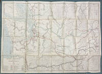
190751929Chicago: Rand McNally & Co. Engravers 1907. 1907. 34" x 47 1/2" sheet folded to 6" x 8 3/4" featuring a partially colored map of Washington with a legend identifying with various colored lines the routes of twenty-five railroads operating and/or under construction in the state. The Pacific Ocean Puget Sound and rivers are colored blue. Printed on back side is a "Counties and Towns Index to Railroad Commissioners' Map of Washington." The map shows the state of Washington from the Pacific east to just across the Idaho border and from the northern border with British Columbia south to just beyond the Columbia River and the Oregon state border. It includes town names county borders and outlines Indian reservation lands. Railroads shown include Northern Pacific Railway; Washington & Columbia River Railway; Columbia River & Northern Railway; Port Townsend Southern Railroad; Washington Idaho & Montana Railway; Portland & Seattle Railway under construction; Great Northern Railway; Spokane Falls & Northern Railway; Columbia & Red Mountain Railway; Washington & Great Northern R’y under construction; Oregon Railroad & Navigation Co; Ilwaco Railway & Navigation Co; Oregon & Washington Railway under construction; Columbia & Puget Sound Railroad; Spokane & Inland Railway electric; Coeur d’Alene & Spokane Railway electric; Puget Sound Electric Railway; Spokane & British Columbia Railway; North Coast Railway under construction; Chicago Milwaukee & St. Paul Railway under construction; Bellingham Bay & British Columbia Railroad; Tacoma Eastern Railroad; Spokane International Railroad; and North Yakima Valley Railway. The Commissioners of the Washington Railroad Commission in 1907 were H. A. Fairchild Jesse S. Jones and John C. Lawrence. O. O. Calderhead was the Secretary of the Commission. Several small closed breaks at intersecting corners else very good plus. Rand, McNally & Co., Engravers, 1907. unknown
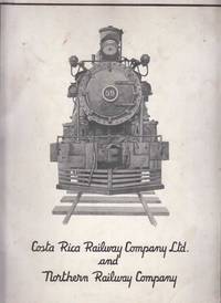
1953459Costa Rica Railway Company Ltd and Northern Railway Company San Jose Costa Rica 1953. 1st Edition. Softcover. Good Condition. Promotional publication focusing on the history of the RR w/ many b&w photos. In Spanish and English. Size: 9 1/4 x 12". 200 pages. Text is in multiple languages. Wraps a bit smudged worn. Uncommon . Quantity Available: 1. Category: Railroad; Costa Rica; Main Picture: front wrapper. Picture 2: rear wrapper. Pictures of this item not already displayed here available upon request. Inventory No: 459. . Costa Rica Railway Company Ltd and Northern Railway Company paperback
188530584np 1885. 299 12 100 52 32 20 47 8 6 pp. Pleadings and other court documents bound together in contemporary red morocco with decorated borders gilt-lettered spine and front cover. Raised spine bands and gilt rules. Binding with a bit of extremity scuffing Very Good.<br/><br/> The Railway an Iowa corporation entered into agreements to finance the construction of a railroad from Burlington to a point near Mankato Minnesota a distance of 270 miles. The Railway defaulted and the mortgage holders began a foreclosure action which is the subject of these documents. This book a series of separate printings collects the Complaint and other pleadings Exhibits Amendments to the Complaint the stipulated facts and the briefs and arguments of counsel. The claims of various lienholders rendered the case quite complicated; aspects of the case arrived at the U.S. Supreme Court reported at 159 U.S. 278 1895. unknown books
1882WRCAM46974N.p. but Chicago 1882. 24pp. Narrow octavo. Original printed pictorial wrappers. Light soiling and wear vertical crease to center of pamphlet. Minor internal soiling. Just about very good. Promotional pamphlet for the Burlington & Missouri River Railroad Company advertising lands for sale in Nebraska. The cover claims "No state offers greater advantages in soil climate rail roads market facilities or grand opportunities to the farmer and stock raiser than Nebraska." The text commences on a high note: "This is the State whose latch string is out and offers homes and promises of prosperity to all who will come." The emphasis is agriculture and stock raising with glowing essays including "Great Grazing District" "Livestock in the State" "Orchards and Groves Planted" "The Pure Air of the Prairies" "The Herd Law - No Fences Allowed" "The Cheapest Lands in America" "Sheep Raising in Nebraska" "Education the Birthright of Every Nebraska Child" etc. OCLC lists two similar items each in a single copy: one at Yale with the imprint of Lincoln: State Journal Co. 1881; and one at the Huntington with the imprint of St. Louis: A. Gast 1881 The present copy has no imprint. A. Zeese & Co. the Chicago engraving firm who is attributed on the first map specialized in half tones zinc etching relief-line lithogravure and photoelectric type. Chicago seems to us the most likely place of printing for all the editions noted above. unknown books
18851099Chicago: Geo. F. Cram 1885. Good plus. Large folding pamphlet approximately 20 x 41.5 inches. A few small chips and short closed tears at edges; several short separations and very minor losses along folds. Contemporary agent's ink stamp on cover panel. Tape repair across portion of horizontal fold; one panel with patches of light staining. A scarce colorful promotional for the Rock Island Route as well as its national and international connections with a fascinating stamp of an Australian sales agent. One side of the sheet prints an extensive promotional text and timetables for the various routes and services of the Chicago Rock Island & Pacific Railway. The main side of the sheet prints a map of the United States with state borders shaded in four colors highlighting the principal routes of the Rock Island from Chicago to Minnesota Iowa and Kansas and its connections to points on both the East and West Coasts. An inset map at lower right promotes the Rock Island as part of a transcontinental route between the United Kingdom Ireland and Australia. Most interestingly this copy is stamped on the cover panel with the information of a George. H. Hibbard "Australian Passenger Agent America's Cons'd Trans-continental Railways 6 Bridge Street Sydney N.S.W." Hibbard was evidently the agent in charge of distributing information about the trans-America route in Sydney one of its end points. Several issues of this map were published during the 1880s all scarce. We locate copies of the present 1885 issue at Stanford SMU and the Library of Congress. Geo. F. Cram unknown books