11 476 résultats
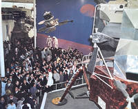
197063284Osaka Japan: n.p. 1970. Folio. 12 x 13 in. 30 leaves unnumbered. With 12 colour and 11 black & white photographs mounted sized 8 x 9.5 in. all w/ tissue guards. Padded white leather post-binder leather ties at gutter margin a.e.g. gilt lettering & Expo ‘70 logo stamped on front cover slight shelfwear very slight bumping to corners still NF exemplar. This nicely appointed souvenir album chronicles the official trip by Washington State Governor Dan Evans his wife Nancy Bell Evans and the State delegation to the Japan World Exposition “Expo ‘70†featuring the motto “Progress and Harmony for Mankind’ held in Osaka from March 15 to Sept. 13 1970. Washington State was one of only three states to host a pavilion at the Fair along with Hawaii and Alaska and focused on the region’s natural environment and resources. Evans’s visit was part of a trade delegation to Asia and includes photos of him offering his speech on “Washington Day†May 9 1970. The album opens with a night panoramic vista shot of the 820 acre site which hosted 78 countries in total and displayed moving walkways prototype cordless phones a 230-foot sculpture with a gold mask looking toward the future all in celebration of Japan’s rebirth 25 years after the end of World War II. Other photos show Dan & Nancy Evans arriving off their Northwest Orient Airlines jet meeting various dignitaries a formal welcome dinner Evans delivering his speech from the outdoor “Festival Plaza†grandstand traditional celebratory Japanese dance teams and two with Motohiko Kanai governor of Hyogo Prefecture meeting with Gov. Evans in the Washington Pavilion. Of particular interest are the two photos showing Gov. Evans and his party touring the Apollo 12 exhibit with Saturn V rocket engine behind space capsule and a Lunar lander completing the exhibit which at the time included a Moon rock returned to Earth by the Apollo 12 mission. This album captures a moment of exuberance and optimism in Japan as the economy was one of the fastest growing in the World and featured over 68 million visitors. Now 55 years later Osaka is once again holding a World’s Fair which is expected to feature perhaps 28 million visitors. [n.p.], hardcover
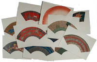
1900164294No date. circa1900. 11 original hand painted fan designs approximately 40 x 15cm laid down on archival sheets 51 x 38cm. Each design is unique some are brightly coloured whilst others are more sombre and some have a lacquer or metallic overprinting and silver flecking. Each of the designs has been backed with Japanese paper. Undated and in very good condition apart from some very minor spotting to the backing sheets not affecting the image they appear to be early 1900s. The collection is housed in a custom-made clamshell case. The earliest recorded sighting of the Japanese fan was in the 6th century CE where burial tombs were adorned with pictures of fans. Drawing on the fan began around the Heian period 794-4485 and became such a hit that laws were created to restrict their use to particular social classes. Historically Japanese hand fans were tools of aristocrats and the samurai class. They were a way to signify social standing and even communicate messages. Japanese fan designs enchanted westerners when they first became exposed to them. Those influenced include the Australian artist Charles Conder who in the 1890s inspired by Japanese fan designs made a speciality of painting them on silk. <br> <br>Various images painted on these fans have symbolic or seasonal meanings. One shows an array of golden origami cranes on a red background symbolizing long life. Another is decorated with peonies symbols of fertility and nobility whose flowering marks the end of spring and beginning of summer. A third is decorated with images of pine bamboo and plum blossom - a combination representing health and longevity because all three plants can withstand cold weather. Others have more abstract images based on the flow of rivers the sheen of silk and other themes. . unknown
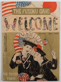
1908178293東京. Tokyo.: 東陽堂. Tōyōdō. Meiji 41 1908. Four double page colour plates a double page and a full page illustration in green ink black and white photographic illustrations. 25.5 x 18.5cm illustrations 23pp text: 50 13 36pp captions and text in Japanese and English. Original colour illustrated wrappers. Text evenly browned upper wrapper and first leaves a little insect damaged but still a very attractive souvenir issue. This fascinating magazine special issue was published to commemorate the Atlantic Fleet's the Great White Fleet visit to Japan in October 1908. The issue was published in November 1908 and reports all the activities of welcoming the fleet in Yokohama. Fuzoku Gaho was the first illustrated magazine which covered Japanese culture and was published between between 1889 and 1916. This special issue shows the enthusiasm Japanese government and the public displayed to the visiting US naval officers and sailors. <br> <br>The US Atlantic Fleet which consisted with 16 war ships went around the world between 1908 and 1909. As the ships were painted in white the fleet was also known as the Great White Fleet. In Japan they were called white ships 白船 in contrast to the black ships of Matthew Perry. This US naval exercise was to show off the American naval power to the world particularly in the Pacific after the Russo-Japanese War. The Japanese government decided to invite the fleet to Japan and welcome the ships with heightened enthusiasm. The contemporary social atmosphere and details of numerous events are covered extensively in this issue. Text is both in Japanese and English. The issue includes some pages of cartoon illustrations of American sailors on shore leave in Yokohama. With a title of "Jackass in Yokohama" and "U.S Jackies on the Spree" the sailors' experiences in Yokohama are illustrated with humour. . 東陽堂. [Tōyōdō]. unknown
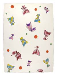
194033730Suzuka Japan et al. 1940. Very Good . Suzuka Japan: n.d. ca. 1940-1960. Nineteen original hand-stenciled designs ca 48x35cm; thirteen examples with rubber-stamp from two different craft shops the remaining six unattributed. Light wear and soil else a Very Good to Near Fine collection.<br /> <br /> Colorful multi-decade sampling of designs for the Japanese casual summertime cotton kimono known as yukata. The designs were almost certainly designed for children's outfits decorated as they are with baby birds puppies ducklings circus elephants bunnies musical instruments and teddy bears. The ten earliest examples all hail from the same shop and all use the same color scheme of navy blue slate blue and orange-brown. Later examples expand the color palate to much more vibrant and neon colors. One design in particular of a small child in a red bunny costume anticipates both the manga and the Hello Kitty aesthetic that became a global phenomenon beginning in the 1970s and 1980s. unknown
19812090502113714872Not Available 1981. Soft Cover. Fine. The book is in fine condition. Not Available paperback
191058819Tokyo Japan: Bureau of Forestry Dept. of Agriculture and Commerce 農林çœå±±æž—å±€ 1910. 8vo. 6 127 3 pp. With 12 collotype photo plates all preserving original tissue guards. Dark green silk publisher’s cloth gilt lettering stamped on front cover minor ink stain to back cover minor warping to boards edgewear at corners minor rubbing still VG copy. First edition of this scarce work examining forest zones forestry practices and lumber and wood available in Japanese forests and tree farms at the end of the Meiji Era. In addition to discussion of forestry resources and the practices for Imperial Public and Private forests there are also discussions of conservation for certain forests either for aesthetic reasons or in maintaining environmental diversity and fish stocks. The collotype photographs are particularly well done and are reminiscent of the images produced by Kazumasa Ogawa 1860-1929 a pioneer in Japanese photography and photomechanical printing who had introduced collotype printing to Japan in the 1890s. Bureau of Forestry, Dept. of Agriculture and Commerce, 農林çœå±±æž—å±€, hardcover
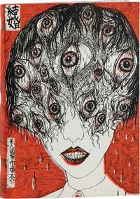
200786634Marseille: Le Dernier Cri 2007. First Limited Edition. Folio. 36cm. Limited to a run of 200 copies only. Publisher's original illustrated heavy card wraps. Unpaginated 72pp. Light wear and creasing to corners and extremities a little soiling to the white portions of the card wraps strong and bright; internally clean and fresh lavishly illustrated. A very good strong copy. <br /> <br /> Described as both violent and beautiful Daisuke Ichiba's visual art style borrows from manga and anime Japanese body horror Asian folklore and the supernatural and a hefty dose of queasy eroticism often placed in direct opposition to the grotesque nature of the composition. "Mariage" is one of his limited edition book form pieces for the outsider art studio "Le Derneir Cri" in Marseilles. "Pakito" resident artist at Dernier Cri and the celebrated manga artist Takashi Nemoto have both served as patrons of Ichiba's art over the years and Takashi Nemoto in particular has been a staunch supporter of Daisuke's often controversial and divisive work.<br /> <br /> "Humans simultaneously combine tenderness and violence. If you peel back the face of a beautiful woman you see it is clogged with viscera. Choosing to create work that is only beautiful feels artificial. Thus I paint both. You cannot sever the two. The expression that results is a natural chaos. In my work I project chaos anarchy anxiety the grotesque the absurd and the irrational. By doing so I attain harmony. This is my art. Put simply I paint humanity the spirit." - Daisuke Ichiba. Le Dernier Cri unknown
1914213058Imperial Japanese Government Railways. Tokyo. 1914. Folding maps illustrations including colour plate frontispiece cciv 370pp index cloth rubbed at head and tail of spine and lightly at other extremities top edge gilt map endpapers browned rear map endpaper has two closed tears prior owner name on the title page. Does not include the image of Shimabara Harbour but this appears not to have ever been included as it is a text illustration and included in the pagination. Lettering on spine dull but nonetheless a good copy and complete. 16 x 10.5cm. Great care has been taken in preparing the maps and in selecting the illustrations. it is hoped that by supplying useful reliable and up to date information that it will satisfy a long-felt want and prove to be a really useful guide to those numerous strangers who annually visit these islands. Tokyo June 1914. From the preface. . Imperial Japanese Government Railways. Tokyo. hardcover
1893163107No place of publication.: 天眞堂. Tenshindō. Meiji 26 1893. A beautifully illustrated colour manuscript Meiji period "house geomancy" 家相 plan folded scale 1:50. On heavy good quality Japanese paper. Pop-up walls gate and some buildings turnable geomantic compass. Some creasing light soiling or browning but generally very good. 179 x 95cm. House divination originated in ancient China and became popular in Japan from the 19th century on. The idea of the house divination remains popular in Japan to this day. <br> <br>This beautiful sheet gives a detailed floor plan of a traditional Japanese house designed for a person of high status. This house was possibly on the grounds of Tenshindō in Yamanashi near Tokyoas Tenshindō is mentioned in the text. The 24 red lines which represent 24 hexagrams diverge from the central movable paper geomantic compass indicating 24 directions. The geomantic compass its range taking in the entire plan enables the planner to be certain that rooms and objects will be placed in such a way as to benefit the residents. By the same token the compass serves to make sure that planning does not work to the detriment of the residents. . [天眞堂]. [Tenshindō] unknown
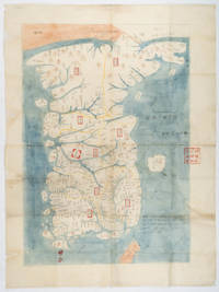
218441Tokyo. No date. Late Edo. Folding manuscript map ink and watercolour 82 x 61 cm red chop at one edge. Evidence of worming mainly affecting the edges and central fold professionally strengthened with archival washi tide-mark to the verso of the map and the wrappers but an appealing example of this delicately executed and sought-after map of the Korean peninsula. A late Edo period hand-painted colour copy of one five maps produced by Japanese scholar Hayashi Shihei to accompany his famous 1785 banned work "Sangoku Tsuran Zusetsu" "An Illustrated Description of the Three Countries" - the three countries in question being Japan's neighbours Korea the Ryukyu Kingdom now Okinawa Prefecture and Ezo now Hokkaido Sakhalin and the Kuril Islands. <br> <br>This detailed map of "The Eight Provinces of Korea" was probably based on Korean maps but Hayashi added details including the existence of the residence in Busan maintained by envoys from the Japanese Domain of Tsushima which had a relationship with Korea throughout most of the Edo period. He also adds text showing the distance between this residence and the Korean capital in both Japanese and Korean measurements and includes latitude lines though these are somewhat inaccurate - placing the 38th parallel south of the Korean capital. His map interestingly gives the Korean words for the four cardinal directions written in Korean script. Unlike Hayashi's "Illustrated Description of the Three Countries" this map does not show the contentious Takeshima/Dokdo/Liancourt Rocks which are too far out from the coast to fall within the frame of the map although it does include the island of Ulleungdo closer to the east coast of Korea. <br> <br>This copy is undated but inscribed with the words "Map by Hayashi Shihei of Sendai". A red chop in the lower middle shows that the map was owned by the Iijima Family in Matsushiro Domain Nagano Prefecture. The family were known as historians of the domain. . unknown
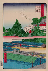
1858218370Tokyo.: 魚屋栄吉. Uoya Eikichi. Post-1858. Colour woodblock print 38 x 26 cms title cartouches publisher's stamp and artist's signature but without the censor's date stamp sheet a little toned old paper repair at the lower margin not affecting the image but in very good bright condition. Number 41 from the series "One hundred famous views of Edo" Meishō Edo Hyakkei which Hiroshige worked on between 1856 and 1858. This print of Hachiman Shrine in Ichigaya was published a month after his death in 1858 and it was most likely that Hiroshige II contributed to this work. Hachiman Shrine in Ichigaya was founded in the15th century and during the Edo period it attracted many visitors. It still stands on the original site. <br> <br>From the collection of the late John Caiger lecturer in Asian studies ANU. . 魚屋栄吉. [Uoya Eikichi]. unknown
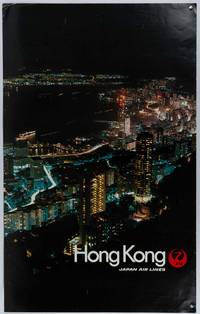
1978207772Japan.: Japan Air Lines. July1978. Vintage colour photographic poster 99.3 x 62.5cm creases to upper corners and some soft creases to the surface and edgewear otherwise very good condition. A dramatic view of Hong Kong at night looking down from the mid-levels on Hong Kong island across to Kowloon. . Japan Air Lines. unknown
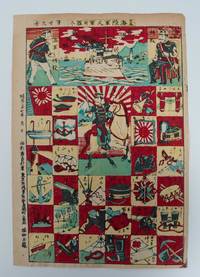
1904164282Meiji 37 1904. Colour woodblock showing 30 examples of military service equipment 24.3 cm x 35 cm Woodblock print showing the equipment used by the Japanese army and navy. Floats are called Ukifukuro and you can see the difference from the present day. It is an interesting example of both a ”zukushi-e" or series picture and a Omocha-e a toy picture which were enjoyed by both children and adults. . unknown
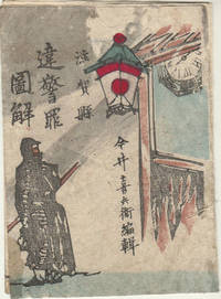
1518170899今井喜兵衛. Imai Kichibē. Meiji 15 1882. Woodblock Japanese printed booklet containing 3 folded leaves. Text accompanied by small handcoloured illustrations showing the minor criminal offences described above. 7 x 3cm section of loss upper section of colour woodblock upper cover stain lower cover upper cover and first two leaves lacks lower cover but contents are complete neatly rethreaded. Still an attractive copy of a fascinating and scarce item. A fascinating insight into crime and punishment in 1880s Japan this little booklet provides colour-illustrated explanations of minor crimes with details of the punishments which apply to them in Shiga Prefecture. It appears to have been designed for distribution to the public - perhaps to shops small businesses etc. From it we learn amongst other things that you could be imprisoned for between 3 and 10 days or fined a sum between 1 and 1.95 yen for giving lodging to a foreigner without recording their address properly. A sentence of 2 to 5 days imprisonment or a fine applied to people who sold raw fugu highly poisonous without proper treatment sold the meat of diseased animals offered photos or woodblock prints of the Emperor and Empress for sale or cremated the dead without official permission or in a place other than the officially approved cremation sites while a sentence of between 1 and 12 days applied to crimes which included flying paper kites near overhead telegraph lines. . 今井喜兵衛. [Imai Kichibē]. unknown
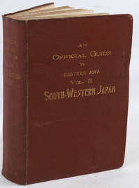
191418288Tokyo: Imperial Japanese Government Railways. 1914. Hardcover. Very Good. Boards with light rubbing to extremities. Slightest bumping to one corner. Maps a bit darkened. Rear hinge a bit gapping but holding strong. ; Top edge gilt. Numerous fold-out maps in color. ; Trans-Continental Connections between Europe and Asia; B&W Photographs; 16mo 6" - 7" tall; x 488 pages . Imperial Japanese Government Railways hardcover
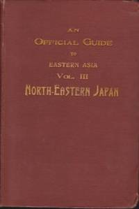
191412324Tokyo: Imperial Japanese Government Railways. 1914. Hardcover. Very Good. Boards with light rubbing to extremities. Small closed tear to first map else in unusually nice condition. Endpapers a bit browned; Detailed guide to NE Japan on the eve of WWI. Top edge gilt; 16mo 6" - 7" tall; 488 pages . Imperial Japanese Government Railways hardcover
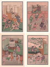
214282Japan. Late 19th Century. Set of four Japanese woodblock prints of the original series of twelve prints. Approx 26 x 18 cms preserved in modern window mounts 40.5 x 30.5 cms images in very good condition. These delightful scenes of children's play were originally depicted by Ishikawa Toyomasa in the mid-18th century as a series of 12 scenes for a year. Each print here shows how children play for the particular time of the year; May July October and December. Ishikawa was a talented artist who died very young. . unknown
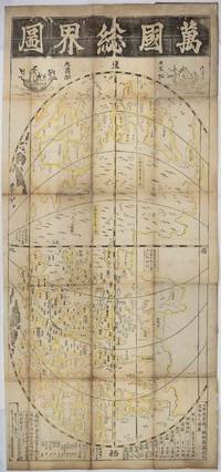
1708219243東京. Tokyo.: 須原屋茂兵衛. Suwaraya Mohei. Hoei 5 1708. Black and white woodblock map with yellow outlining in original hand colour 55.8 x 127cm map; 59.5 x 131cm sheet folding into the original Japanese wrappers chipped and rather worn 26.4 x 17.4cm the map with old repairs laid down on washi rather browned and wormed at the folds but with no serious loss the sheet age-toned and a little dusty but overall in remarkably good condition. Preserved in a modern blue linen Japanese case with toggle-closures. A famous woodblock-printed Japanese map of the world by renowned Edo Period map-maker Ishikawa Tomonobu who is also known as Ishikawa Ryūsen. This is a revised version of an earlier map produced by Ishikawa in 1688. <br> <br>The map appears to draw on Chinese and Portuguese geographical knowledge. The Chinese production of world maps had been transformed by the influence of the Italian Jesuit Matteo Ricci who collaborated with Chinese cartographers to produce a 1584 map of the world. In Japan the production of maps of "the myriad countries" or "the international countries" bankoku had been inspired by contact with Portuguese missionaries and with the Dutch in the 16th century. <br> <br>Ishikawa's map broadly resembles the Ricci map in being placed in an oval frame with the Pacific and thus also China and Japan at the centre. The content though is different. While Ricci's map is oriented to the north Ishikawa's is oriented to the east with America at the top of the page and the sketchy outlines of Europe including 'Ikiresu' England and a large and clearly marked Holland and Africa 'Kafuri' at the bottom. This orientation apparently influenced by the first world map in Japan "Bankoku Sōzu" 万国総図 which was published in 1645. Interestingly although Ishikawa had earlier produced a quite detailed and fairly accurate map of Japan the Japan shown on this world map is a rather loosely outlined collection of islands in which for example Ryūkyū the Ryukyu Kingdom now Okinawa and Hachijōjima appear much larger than they are in reality. Japan is also unusually oriented making it appear as though Ezo now Hokkaido is in the middle of the Pacific. It seems that the cartographer's interest here was less in outlining Japan in detail than in broadly setting out the country's place in relation to the land masses to the east and west. <br> <br>Like other Japanese world maps of the Edo period and like Ricci's map Ishikawa's image of the world includes imagined countries such as 'The Land of Giants". The continuing centrality of China in Japanese thought is indicated by the fact that Ishikawa's map contains a very clearly marked depiction of the Great Wall and that the map is decorated at the top with depictions of a Japanese and a Chinese sailing ship. The text at the bottom gives estimated distances between Hizen Province where the port of Nagasaki provided Japan's main official outlet to the world in this age of seclusion and various places in China and between Hizen and the Ryūkyū Kingdom. It also gives the estimated distance from Korea to Tsushima Island which served as Japan's gateway for diplomatic and trade relations with Korea. <br> <br>Engelbert Kaempfer a German physician and explorer brought back the 1688 edition of this map printing to Europe after his stay in Japan between 1690 and 1692. The map was introduced to European audiences in the 17th century and impacted on later European cartographic endeavours. <br> <br>Copies of this rare and historically significant map are held only in a handful of major collections: the British Library National Diet Library NDL of Japan the Staatsbibliothek of Berlin University of California Berkeley's Japanese Historic Maps Collection and the University of British Columbia. . 須原屋茂兵衛. [Suwaraya Mohei]. unknown
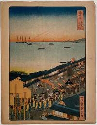
1863205102Tokyo. 1863 but a modern reprint. Colour lithographic print 26.5 x 18 cms; 28.5 x 22 cms sheet a few sealed short edge tears sheet toned overall in good condition preserved in a window mount. . unknown
185663919Washington D.C.: Beverley Tucker Senate Printer 1856. Thick 4to. xvii 1 537 1 pp. With 88 lithographs some colour others colour-tinted 2 large folding colour lithograph reproductions of colour Japanese woodblocks numerous woodcut-engraved text illustrations & plates numerous maps 2 large folding. Contemporary full sheep rebacked w/ red & gilt morocco spine label minor scuffing edgewear slight bumping to corners still VG bright copy w/ admonishment on front cover in MS advising “Do not touch the plates.†First edition of Volume I of this account published for the U.S. Senate and without the suppressed bath house plate. This fascinating historical and travel document chronicles Perry’s voyage to St. Helena Cape Town Mauritius Ceylon Singapore Hong Kong Shanghai Japan for half a year where he opened the isolated country to commerce with the Western World by sailing into Edo Bay. Beverley Tucker, Senate Printer, unknown
193856764Portland OR: Heathman Hotel 1938. Oblong folio. 18.5 x 16.25 in. 18 leaves unnumbered. on thick beige-coloured paper w/ 101 silver gelatin photos mounted sized from 4.25 x 6 in. up to 6.25 x 8.5 in. all identified and labeled below in neat draftsman’s hand some ruling as well two images removed by family members and 1 leaf w/o lower 3rd of leaf. Recent black cloth post-binder gilt lettering stamped on front cover still VG exemplar all images with bright strong contrast from the library of Harry Heathman 1906-1962 owner and manager of the historic Heathman Hotel in Portland OR. This interesting photo album chronicles the 1938 “Entente cordiale†trip of many noted U.S. hotel managers and owners to Japan and Manchukuo China against the backdrop of continued Japanese incursions into China including the bombing of civilians in Canton and diplomatic conflicts with the U.S. Intended by Japanese officials to entice American tourists to visit Japanese hotels the hotel execs including Harry Heathman of the Heathman Hotel Charles Baad of the Los Angeles Biltmore John Ramboz of the Los Angeles Ambassador Carl Stanley of the Hotel Del Monte and others all sailed on the N-Y-K ocean liner Tatuta Maru newly renamed in 1938. The photos show the first class lounge dances and sightseeing in Japan the Tosyogu Shrine at Nikko where they stayed at the Kanaya Hotel other temples and the Buddha at Kamakura and gifts presented at the Imperial Hotel in Tokyo. Other stops included the famed Fujiya Hotel with photos of the owner Mr. Yamaguchi and manager M. Arai a visit to the Nagoya Castle and more. Carl Stanley and his wife are shown riding the “Asia†Express in Manchukuo the Mukden Yamato Hotel the Yamato hotel near Dairen formerly Port Arthur and photos at the Port Arthur monument in Manchukuo. The Tatuta Maru sailed originally as the Tatsuta Maru including transporting Olympic athletes from Japan in 1932 and was the last passenger liner to travel between Japan and the U.S. with stop in Honolulu H.T. in Oct. 1941. She was used by the Japanese Navy as a feint supposedly to pick up another load of repatriating Japanese departing Yokohama on Dec. 2nd but reversed course the night of Dec. 6/7 and returned to Japan. See: Hotel Executives to Visit Japan Los Angeles Times Oct. 15 1938 Part II p. 22; Hotel Group Due Back From Japan San Francisco Examiner Dec. 19 1938 p. 25. Heathman Hotel, hardcover
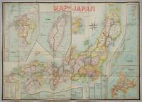
1906197908Kobe Japan.: Fuku-In-Kwan. 1906. Printed colour folding map on two conjoined sheets laid down 73.8 x 10⁵ cms foxing on verso not affecting map single pinhole in each corner scant spotting small fold splits no loss a few soft fold creases but in good condition. Very rare striking map of Japan published for the Western market. <br> <br>Created under the direction of Takachika Okishio featuring 10 inset maps: Chishima Kurile Islands Hokushu Hokkaido Ogasawara-Jima Bonin Islands Hachijo-Shima Ioshima Okinawa Saki-Shima Kyushu Saikaido Taiwan Formosa and Eastern Asia. The insets of Taiwan and Kyushu are the largest and centrally positioned. A Glossary and Explanation of Signs is printed at the foot of the map which list Towns Railway Stations Boundaries of Prefectures Notable Places Hot Springs Water-falls rapids Volcanoes Light-Houses Gold Silver and Coal-Oil fields. The Japanese Government Railway series of Travellers' Maps of Japan appear to have been modelled after this design. . Fuku-In-Kwan. unknown
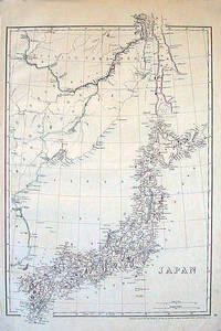
1852185246London.: Cassell Petter & Galpin. circa1852. Map with outline handcolour 42.5 x 30.1 cms; 49.2 x 34.3 cms sheet margins a little toned small corner crase but in very good condition. Very detailed map of the Japanese islands with Sakhalin above and the coast of Manchuria and Korea. . Cassell, Petter & Galpin. unknown
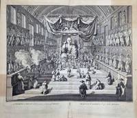
1740196135London.: William Jackson for Claude du Bosc. circa1740. Double-page copper-plate engraving image 30.5 x 41 cms; 39.3 x 44 cms sheet including plate-mark and captions edges chipped sheet age-toned with several patches noticeably darkened mainly outside the image area several repaired short tears to edges no loss to the image in sound condition. Bernard Picart's dynamic rendering of worshippers in a Japanese temple the Sanjūsangen-dō Buddhist temple in Kyoto first published in his landmark work "Ceremonies et Coutumes Religieuses de tous les Peuples du Monde" between 1723 and 1737 a history of religious ceremonies manners and dress from all countries of the world this from volume 4 of the first complete English edition 1733-1739. . (William Jackson, for Claude du Bosc) unknown
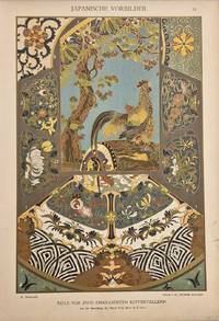
1886206917Stuttgart.: Jul. Hoffmann. 1886-7. Chromolithograph highlighted in gilt 33.5 x 23.5 cms sheet light edge wear and age toning; very good condition. An exquisitely detailed Japanese cloisonne design from a 19th Century German study of Japanese decorative arts "Japanische Vorbilder" published in 15 parts over two years. . Jul. Hoffmann. unknown