236 résultats
1866M2-Et2Paris, Arthus Bertrand, sd. In-4 (290x220mm), relié demi-veau, dos frotté, 200pp. Illustré de 4 cartes dépliantes.
188473300Washington: Government Printing Office 1884. First edition. Octavo. 75 1 pp. plus folding map of the Lena Delta in Russia and four full page heliotypes. Original blue printed wrappers. Small piece missing from outer edge of front wrapper three small and excellent paper repairs to wrappers. A very good and very clean copy in the original wrappers.The heliotypes in this publication are particularly interesting as they show Russian soldiers guarding the graves of the Jeannette crew. The final photograph shows all the coffins loaded into a Russian train."In February 1882 Secretary Thompson had despatched naval lieutenants Giles Harber and William Schuetze to the delta to search for any traces of the lost explorers particularly of Chipp's party. They were unsuccessful but in November received orders from the secretary to supervise the return of the bodies of De Long and his comrades to the United States. Weather and bureaucracy delayed them for a year; finally in November 1883 the bodies were taken from Yakutsk by train to Moscow Berlin and finally Hamburg. Here they were placed on board the U.S. steamer Frisia which arrived in New York in February 1884. The funeral cortège was escorted by naval and military detachments to the Church of the Holy Trinity on Madison Avenue for a memorial service. Afterwards the bodies of Ambler Collins and Boyd were claimed for private burial; those of De Long and six others were taken to Woodlawn Cemetery in the Bronx and buried together there. In October 1890 a large monument to the expedition's dead was unveiled at the United States Naval Academy in Annapolis. Its design is based on the original cairn and cross raised at the burial site on the Lena Delta." Wiki [Government Printing Office] unknown
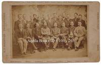
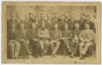
1885WRCAM54151Newburyport Ma.: S.C. Reed 1885. Cabinet photograph mounted on card 5 x 8 inches. Minor edge wear two later presentation inscriptions and photographer's studio stamp on verso. Very good. A rare cabinet card photograph picturing the members of the ill-fated Greely Arctic Expedition. Greely led a scientific expedition aboard the Proteus to Lady Franklin Bay in 1881. He and his crew were stranded at Fort Conger on Ellesmere Island without supplies. Nineteen of the twenty- five crew members would perish in the Arctic and one more would die on the journey home after Greely's party was rescued near Cape Sabine. Rumors of cannibalism would haunt the survivors of the expedition for the rest of their lives. Pictured here are several of the expedition members including Adolphus Greely just before they departed. The standing men are identified as follows: D. Schneider D. Cross D. Linn S. Long S. Frederick D. Henry S. Connell D. Bender D. Salor S. Bierdersack D. Gardner D. Ellis and D. Ralston; and the men seated are identified from left to right as: S. Brainard D. Keslingbury S. Greeley leader D. Lockwood D. Israil D. Jewell and D. Rice. S.C. Reed unknown books
1894013931St. Louis: N.D. Thompson Publishing Co 1894. 1st Edition. Hardcover. Near Fine/No Jacket. Folio - over 12 - 15" tall. Half morocco burgundy cloth over board. Marbled endpapers and edges. 2 pp. 80 ff. half-tone portraits. Recently professionally rebacked new leather spine and spine label. Light wear to original leather corners. Spots of scuffing and staining to cloth. Gold paint to ffep. Damp stain to lower corner of text block. Several short marginal tears mostly at tail edges. Else a nice copy of a fascinating collection of portraits from various ethnic backgrounds including American and Mexican cowboys Egyptian cowherds German military leaders several Javaneese people and French peasant women. N.D. Thompson Publishing Co hardcover
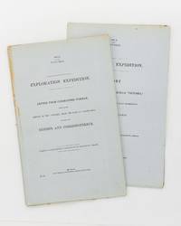
186257939Melbourne: Government Printer 1862. First Edition. Paperback. Melbourne Government Printer 1862 and 1862. Foolscap folio two papers 51 and 31 pages. Title-wrappers stab-sewn as issued; a few uncut edges a little foxed; an excellent pair. Victorian Parliamentary Papers Number 108 and 109 of 1861-2. The expedition was 'for the purpose of rendering relief if possible to the missing explorers under the command of Mr Burke; and directing the movements of the two land parties organized and despatched on the same mission of humanity from Brisbane and Rockhampton' under Landsborough and Walker respectively. Paper 109 gives Norman's account of the activities of his own party; Paper 108 in spite of its prosaic title is almost exclusively devoted to detailed accounts by Landsborough 33 pages and Walker 16 pages. Landsborough's reports include an account of the voyage and wreck of the hired transport 'Firefly'; two on the Albert River and the surrounding country and the journal of his south-western expedition 20 pages. Walker's reports include the journal of his expedition from Rockhampton to the Albert River 12 pages; its first and only publication. Three maps are referred to in the list of contents of Paper 108; these maps are rarely seen and were apparently issued only in copies made available to Victorian Members of Parliament. 2 items. Government Printer paperback
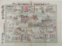
1893214562大阪. Osaka.: 福井榮之助. Fukui Einosuke. Meiji 26 1893. Handcoloured folding engraving 37.5 x 51cm. A prior owner's name is recorded in brush strokes down the left margin. Few small washi repaired tears two old repaired tears on the reverse some occasional browning particularly at centre fold light staining upper margin intruding a little into the printed image. Overall an attractive copy. Scarce. Lieutenant Colonel Fukushima Yasumasa 1852 – 1919 undertook a remarkable solo horseback expedition across Eurasia in 1892. Starting in Poland he traversed Russia and Siberia on his journey. Stationed in Berlin as a military attaché in 1887 he was tasked with researching the Trans-Siberian Railway under construction by Russia. His successful expedition was followed by further explorations in India and the Balkan Peninsula.<br><br>This sheet divided into 24 illustrated panels narrates Fukushima's story from his youth to his triumphant return after the expedition. Filled with adventure the story depicts his encounters with both danger and excitement. The narrative unfolds in a clockwise direction starting from the bottom right corner similar to a sugoroku game which this may be but it is uncertain. The central panel featuring a newly erected statue represents the final goal of his journey. Each panel is accompanied by a caption that furthers the story. . 福井榮之助. [Fukui Einosuke]. unknown
18811002651881. Cabinet photo. fine. Horizontal albumen cabinet photo on white mount 4 7/8" X7 7/8" image:4 1/8" X6 1/8". Nice group portrait of members of the expedition - Standing from left to right: D. Schneider D. Cross D. Linn S. Long S. Frederick D. Henry S. Connell D. Bender D. Salor S. Bierdersack D. Gardner D. Ellis and D. Ralston - Seated from left to right: S. Brainard D. Keslingbury S. Greeley leader D. Lockwood D. Israil D. Jewell and D. Rice. fine Rare. Portrait of members of the U.S. International Polar Year Scientific Expedition to Lady Franklin Bay Ellesmere Island sponsored by the U.S. Signal Service and other government agencies. After two winters and the failure of relief expeditions in 1882 and 83 Greeley abandoned Fort Conger and moved to Cape Sabine as per his orders. Eighteen men would die that winter including one by suicide and one execution - Pvt. Charles B. Henry Seven survivors were rescued by Schley's relief expedition on the June 22 1883 but Elison would perish before they reached St. John's on July 17. 1881 unknown
1826P2-6A-5Paris, Delaforest, Arthhus Bertrand, 1826. In-8 (215x130mm), relié demi-basane, tranches rouge, cachet de bibliothèque. IXV-432pp, illustré d’une carte reliée et 8 lithographies. Bon état. Edition originale. LAING fut le premier Européen à atteindre Tombouctou.
1824113477Jena: in der Bran 'schen Buchhandlung, 1824. 18,5 cm ; Pp.
18694478London: MacMillan. Near Fine. 1869. xi 271pp 53 pg list of publisher's adverts dated 1869 at rear. Rebound in 1/4 leather marbled sides leather spine with raised bands gilt dec & title pieces. 1cm piece missing to top corner pg 72 date pencilled onto preface pg contents otherwise very good.; 225 x 150mm . MacMillan hardcover
1857324349New Haven 1857. Separately-issued offprint from the American Journal of Science and Arts 2nd series Vol. xxiv July 1857. 21-38 pp. plus folding map. 8vo. Period plain green wrappers stitched. Separately-issued offprint from the American Journal of Science and Arts 2nd series Vol. xxiv July 1857. 21-38 pp. plus folding map. 8vo. "Redfield's last contribution to meteorological science was a memoir upon the cyclones or typhoons of the north Pacific Ocean prepared at the request of Commodore Perry to accompany his Narrative of the United States Expedition to Japan; and was printed in the second volume of that work . He showed that the hurricanes of the Pacific followed the same general laws as those of the Atlantic and traced the paths of several remarkable storms among which was one of great force encountered by the steamer 'Mississippi' one of the vessels of Commodore Perry's squadron on route from Simoda to the Sandwich Islands in October 1854" Recollections of John Howard Redfield p. 302. Page 37 includes a description of the Kona or southerly winds of Hawaii as well as the effects of cyclones on the Hawaiian islands.<br /> <br /> Following its publication within Perry's Narrative in 1856 the work was issued in a slightly more condensed form within the July 1857 issue of the American Journal of Science and Arts. The present separately-issued offprint from the AJSA is the only separately-issued edition of the work. Scarce. Sabin 68512. Not in Forbes unknown
1835SB-24720Leipzig, J. J. Weber, 1835. XL, 398 S., 1 Bl.; 462 S., 1 Bl. Braune Original-Halblederbände mit goldgeprägten Rükentiteln auf hellgrünen Rückenschildern, farbiger Wappenprägung und goldgeprägten Ornamentbänden an den Kapitalen; ferner mit Lederecken und dreiseitigem Rotschnitt. Mit einer großformatigen, mehrfach gefalteten Karte im Format 61 x 50 cm, zwei ganzseitigen Bildtafeln in Stahlstich sowie gestochenem Porträt des Verfassers als Frontispiz. Der britische Marineoffizier John Ross (1777 - 1856), von 1812 an im Range eines Commanders, wurde 1818 mit dem Kommando einer Expedition zur Suche nach der Nordwestpassage betraut, in deren Verlauf er in dem von ihm entdeckten grönländischen Thulebezirk zum ersten Mal in der Geschichte der westlichen Zivilisation Kontakt zu den Polareskimos aufnehmen konnte. Eine weitere 1829 mit einem Dampfschiff unternommene, von Ross privat organisierte und auch mit Privatmitteln finanzierten Expedition in die Nordpolregion blieb im Packeis stecken, wodurch die Crew zur viermaligen Überwinterung in der Eisregion gezungen wurde, bevor ihre Rettung durch den Walfänger Isabella erfolgte. Ein Erfolg der Expedition waren unter anderem die Entdeckung des magnetischen Nordpols durch Ross' Neffen James Clark Ross auf der Boothia-Halbinsel. in dem hier vorliegenden zweibändigen Expeditionsbericht [5 Warenabbildungen]
1825W1883New York: Collins and Hannay 1825. 459 pages fold-out map of the "western country" and 3 engraved plates missing is the sketch of the lead mine district. First printing. Octavo. 3/ leather over marbled paper-covered boards. According to Wikipedia Henry Rowe Schoolcraft 1793-1864 was an American geographer geologist and ethnologist noted for his early studies of Native American cultures as well as for his 1832 expedition to the source of the Mississippi River. He is also noted for his major six-volume study of Native Americans published in the 1850s. The book offered here is his report on an 1821 expedition from Missouri through Illinois and Indiana into Michigan. There is heavy emphasis on lead mining in Missouri and on treatymaking with the Chippewa and Potawatomi tribes. Howes S196. Quite scarce. The book is in about very good condition: sympathetically rebacked in gilt-ruled tan leather with new brown leather title patch; clean and tight; foxing throughout; previous owners' names and date on front endpaper. First Edition. Hardcover. Collectible-Very Good. 8vo - over 7¾" - 9¾" tall. Book. Collins and Hannay Hardcover
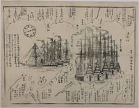
1854215028Japan. Circa1854. Black and white woodblock map with illustrations 32.2 x 41.5cm. Laid down on thick paper. Printed black border line at lower corner and occasionally in other areas along the border not printed otherwise good. This woodblock print map shows the defence layout around Tokyo Bay against the arrival of the American fleet. Names of lords who are responsible for defending particular areas are written with their rankings in terms of wealth sizes. In the centre the American ships are illustrated in detail. There are five sailing ships painted in red and three steam ships. These eight ships entered the bay on 6 February 1854. Thus this map most likely depicts the scene around that time. A caption on the left reads: 'The United States of America founded by Washington 77 years ago sent Matthew Perry with the President's letter in 1853; Perry revisited Edo in 1854.' . unknown
187661115030126John Murray London 1876. First Edition. Hardcover. Good Condition/No Dust Jacket. Report to the Admiralty of the expedition that left Upernivick on 22 July 1875 and returning in October 1876. This is an ex-library copy with flaws as described. Black half-leather binding with banded spine and dark blue covers are lightly rubbed at edges binding is sound with strengthened inner hinges. Crossed and stamped large library label is pasted to the inside of the front cover additional end-papers darkened no half-title-page frontis map has been pasted to previous end-paper with resultant wrinkles on both surfaces and a stamp of "Free Public Library Westminster S.W." on the obverse of the frontis shows through the pasted end-paper although not visible from the map. Title-page is darkened has a crossed out reference number in the upper leading corner and a psted paper rectangle covering a "Free Public Library Westminster S.W." stamp small feint stamp on reverse and short closed tear approx 1cm on leading edge. Pages are little darkened with some smudge marks mainly in margins page 84 to 91have a very small ink mark on the lower corner "Free Public Library Westminster S.W." stamp acorss the bottom of the final page. Quantity Available: 1. Shipped Weight: under 1 kg. Pictures of this item not already displayed here available upon request. Inventory No: 61115030126. All our books music and maps are sent by a tracked mail service. John Murray hardcover
189531933København 1895-96. Alle 3 bind i originale bogtrykte omslag ubeskårede og uopskårede. Omslagene lettere falmede og med et par smårifter ellers aldeles frisk eksemplar. 8374;8513;8272 pp. talrige tekstillustrationer 40 plancher heriblandt farvelitograferede plancher kort m.v. <br/><br/><em>First edition of one of the first scientific expedition to Greenland lead by The Greenlandic Commission. It contains the first scientific survey of the huge areas around Scoresby Sound. Meddelelser om Grønland Bind 17-19. </em> unknown
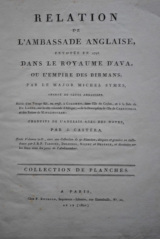
1804P1-4D-4Paris, Buisson, 1804. In-folio (37x28 cm) cartonnage orangé, non rogné (Reliure de l’époque). 2ff- 2 cartes dépliantes – 28 planches. Atlas seul, contenant deux cartes dépliantes et 28 planches de costumes, vues et histoire naturelle, gravées en taille-douce par Tardieu, Delignon, Niquet et Delvaux. Cartonnage un peu frotté, dos manquant, mais intérieur bien frais. Non rogné, sans les 3 volumes de texte. Atlas of the French translation “an account of an embassy to the kingdom of Ava”, 2 folding maps and 28 plates bound in contemp. board, binding worn, the plates are very clean, no foxing or water stain. Size folio (37x28 cm).
1878W1292London: C. KEGAN PAUL & CO. 1878. x 237 pages. First printing of Stevenson's first book a description of his experiences traveling in Belgium and France. The edition is reported to have been limited to only 750 copies and few copies in collectible condition come on the market. In an early twentieth century 3/4 blue morocco binding by Riviere & Son; gilt ruled spine with 5 raised bands; gilt spine decoration and lettering; top edge gilt;. The book is clean and tight with very minor rubbing of leather and slight toning of pages. First Edition. Hardcover. Collectible-Fine-/No Dust Jacket as Issued. Illus. by Walter Crane. 12mo - over 6¾" - 7¾" tall. Book. C. KEGAN PAUL & CO. Hardcover
189677993Washington: Printed by the Journal Publishing Company in Meriden Conn 1896. 1st ed. Hardcover. Very Good. frontis photos folding map 125p. Original cream-colored cloth. 21cm. Moderate soil and creasing on covers. Old paper clip mark. Clara Barton's report as President and treasurer appears at pages 3-44 of this scarce report; George H. Pullman reports as Financial Secretary at pages 45-55; and various other reports on relief field work in Anatolia are found at pages 57-96 and then followed by the text of various telegrams. <br/><br/> Printed by the Journal Publishing Company in Meriden, Conn hardcover books
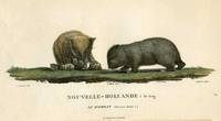
180718812Paris: Imprimerie de Langlois 1807. Very good condition. One of the most attractive prints of wombats a pair of wombats with 4 offspring clambering about. This is plate XXVIII from the work illustrating Nicolas Baudin's expedition. At the time the French were the most progressive at sending teams of artists & scientists around the world with their explorers. Copper engraving with original hand color. Platemark measures 12 1/2 x 9 1/2'' with small margins. A large early representation of the infrequently depicted wombat. Imprimerie de Langlois unknown
1848E0530<p> 614 pages illustrated with 64 lithographed or engraved plates 3 battle-plans plus some figure drawings within the text. Octavo 8¾x5¼" bound in original publisher's black cloth and paper spine label. Thirtieth Congress - First Session. Ex. Doc. NO. 41. Cowan page 195; Graff 1249; Howes E145; Wagner-Camp 148:5; Zamorano Eighty 33 First edition House of Representatives issues of the report containing the reports of Lieutenant Abert Colonel Cooke and Captain Johnson as well as that of Emory; the Senate issue only contained the Emory report.</p><p><br />In 1844 Emory served in an expedition that produced a new map of Texan claims westward to the Rio Grande. He came to public attention as the author of the <i>Notes of a Military Reconnaissance from Fort Leavenworth in Missouri to San Diego California</i> published by the Thirtieth United States Congress in 1848. This report described terrain and rivers cities and forts and made observations about Indians Mexicans primarily in New Mexico Territory Arizona Territory and Southern California. It was and is considered one of the important chronicles and descriptions of the historic Southwest particularly noted for its maps. Emory was a reliable and conscientious cartographer. There is a story of testament as to Emory's dedication to accuracy that says John Bartlett his supervisor in the Corps of Topographical Engineers made him sign off on a misplaced boundary marker creating a sweet revenge for Emory who replaced him as Head of the International Boundary Commission in 1855. So accurate were his maps that when topographical engineers were surveying possible routes for the transcontinental railroad the most Southern route did not need to be surveyed thanks to the outstanding work by William H. Emory. But William H. Emory did more than just map the terrain; he also made notes about the plant life as well as the people who inhabited the sparsely populated southwest. Notating the social relations of some of the Native American people he wrote: "Women when captured are taken as wives by those who capture them but they are treated by the Indian wives of the capturers as slaves and made to carry wood and water; if they chance to be pretty or receive too much attention from their lords and masters they are in the absence of the latter unmercifully beaten and otherwise maltreated. The most unfortunate thing which can befall a captive woman is to be claimed by two persons. In this case she is either shot or delivered up for indiscriminate violence.<br /><br /><b>Condition:</b><br /><br />Binding worn at edges and spine ends cloth splitting along front joint; occasional light foxing lacking the two maps as noted very good.</p> Wendell & Van Benthuysen, Printers hardcover books
185514056London: Smith Elder & Co. 1855. Book. Poor / Fair. Hardcover. First Printing of the First Edition. Volume 1has a broken and separating binding wear and bumping to extremities and a little foxing throughout. Complete with Folding map and lithographed frontis. Vol. 2 has worn extremities cracked front hinge still attached prev. owner name on back of frontis and some light scattered foxing throughout. Original embossed boards could easily be re-cased. Scarce. Smith, Elder & Co. Hardcover
186454080Berlin Decker 1864-73. Lex8vo. 3 contemp. hcalf. Gilt spines and with gilt lettering. Spines slightly rubbed. XXII4352;VI4375;XI4426 pp. 24 engraved plates and 3 folded maps. Faint brownspots to margins in volume 1. <br/><br/><em>First edition. The offered volumes contains the general description of the expedition which relates to Japan and China. They do not comprise the scientific parts zoology botany of the expedition and not the landscape plates published as "Ansichten aus Japan China und Siam". </em> unknown
186454080Berlin, Decker, 1864-73. Lex8vo. 3 contemp. hcalf. Gilt spines and with gilt lettering. Spines slightly rubbed. XXII,(4),352VI,(4),375"XI,(4),426 pp., 24 engraved plates and 3 folded maps. Faint brownspots to margins in volume 1.
186153686Wien Kaiserlich-königl. Hof-und Staatsdruckerei 1861-62. Small 4to. Bound in 3 orig. full pictorial cloth. Vol. 1 rebacked preserving orig. spine. Vol.2 with a tear in backhinge. Vol. 3 a bit loose first inner hinge weak. Small stamp on title-pages. Lithographed tinted frontispiece. X368;VI434;IX436 pp. Each vol. with Beilagen 42207 music etc. 34 lithographed folded maps in colour 42 plates mostly tinted woodcuts profusely textillustrated with woodcuts. Internally clean and fine. <br/><br/><em>First edition. - Sabin 77625. </em> hardcover