502 résultats
180272327London: A. Arrowsmith 1802. A fine and high quality facsimile of this seminal map commissioned in 2001 by renown Lewis & Clark collector Roger Wendlick. Backed on canvas and measuring 150 x 58 inches in color Wendlick commissioned the firm of Ford Graphics of Portland to make this map. Only 21 copies were made and this is the last one with a letter from Wendlick attesting to this fact. Fine. "The 1802 revision of the map of North America on display delineates the complete length of the Missouri River as well as Mackenzie's journey to the Pacific in 1793. The depiction of the Missouri headwaters which Arrowsmith studied from Peter Fidler's drawing of a map by the Blackfoot Indian Ac Ko Mo Ki shows several streams joining into two branches of the Missouri which flow almost due east. The southern branch of the Missouri appears to be the main branch of the river and connects to the Knife River; the northern branch is a good representation of the actual course of the Missouri.Although the revised map still shows a single ridge of mountains in the west a note near the southern sources of the Missouri states: "Hereabout the Mountains divide into several low Ridges." This note which was based on the reports of Fidler Mackenzie and Thompson was more encouraging to Jefferson and Lewis than the note about the Stony Mountains on the 1795 map which unfortunately turned out to be more accurate. Arrowsmith's map situates the Great Lake River on the western slopes of the mountain range and connects this river to the Columbia River with a dotted line. Since another note claims that this river can be descended to the sea in eight days the Arrowsmith map supported the erroneous belief in a convenient route to the Pacific Ocean.Both the 1795 and 1802 versions of Arrowsmith's map served as resources that Nicholas King consulted as he prepared his map for the Lewis and Clark Expedition. Lewis and Clark in fact carried the 1802 Arrowsmith map along on the expedition. Thomas Jefferson owned the 1802 map as well as an 1802 edition of Arrowsmith's map of the United States. Arrowsmith's 1802 map of North America was the most comprehensive map of the West available to Jefferson and Lewis and it was probably the most important map used in the planning of the expedition." University of VirginiaAaron Arrowsmith's 1802 map was the most current and accurate cartographic representation of the American West available to Lewis on the eve of the journey. Lewis studied this edition closely during the summer of 1803 and even carried a copy on the first leg of the expedition. Among Arrowsmith's sources were Indian maps reports and manuscript maps from the British fur trade and British Navy exploration reports and charts of the Pacific Coast. But various elements in the map reinforced Jefferson's misconceptions of western geography among these were depictions of the Rocky Mountains as a single long chain and the headwaters of the upper Missouri River at the eastern edge of the Rockies suggesting those mountains were readily portaged. A. Arrowsmith unknown
1928000893SAN PEDRO CALIFORNIA CA. Good. 1928. On offer is a fascinating vintage collection autograph materials an ALS clippings and maps of Congressional Medal of Honor winner Admiral Richard Byrd's First Antarctic Expedition 1928-30. Included are original newspaper clippings from The New York Times including a full page from May 19 1929 headline "What Byrd's Men Do In The Antarctic Night" with photographs of one of Byrd's planes his two ships the Headquarters Hut the setting sun and radio equipment and antennas. Also included; an 8pp rotogravure section from May 4 1930 illustrating "Admiral Byrd's Great Adventure in the Antarctic" with numerous photographs of Little America including the expedition members landscapes polar life and much more; also a column-length article relating to his second expedition headlined "Byrd's Ship Bear To Sail Tomorrow" 1933-35; two color maps approx 28"x20" one a 1930 Geographic Society detailed lithograph of the "Antarctic Regions" with insets of "Byrd's South Pole Flight" "King Edward VII Land" "Part of Marie Byrd Land" and "Antarctic Archipelago" indicating routes of various explorers including Admunsen and Shackleton; and the other a 1933 "Little America Aviation and Exploration Club Map Used by Admiral Byrd exclusively on both of his Antarctic Expeditions" courtesy of "The Tide Water Oil Co." Also present is letterhead of the Freeport NY Order of Elks signed by eight members of both the first and second expeditions with second page penned in another hand adding further information; plus an ALS by expedition member ARTHUR B. CREAGH San Pedro CA Sep 28 1930 to Albin Johnson "Part Exalted Ruler" of the Order of Elks in Freeport. Creagh thanks him "for the wonderful time you and your brother Elks gave us that night at Freeport Long Island on our return from the Byrd's South Pole Expedition " accompanied by original mailing envelope. Lastly a lengthy printed Washington Bureau biographical printed pamphlet 4pp 7"x8½" by Ruth Robertson entitled "A Brief Account of Read Admiral Byrd's Flights Over the North and South Poles and Other Achievements". The newspaper clippings are generally toned and brittle the photogravure in particular is fragile. All evidence usual folds with occasional partial fold separations with only small paper loss. Letter is in excellent condition. All have been preserved in large vintage envelope. This period collection of historic content remains an important reflection of the early exploration of Antarctica by America's foremost explorer of the time. G.; English; 4to - over 9¾" - 12" tall; ANTARCTIC EXPLORATION TRAVEL CONGRESSIONAL MEDAL OF HONOR EXPLORER AMUNDSEN SHACKLETON ELKS HANDWRITTEN MANUSCRIPT DOCUMENT LETTER AUTOGRAPH WRITER HAND WRITTEN DOCUMENTS SIGNED LETTERS MANUSCRIPTS HISTORICAL HOLOGRAPH WRITERS AUTOGRAPHS PERSONAL PERSONAL HISTORY RELIGION ROYALTY NOBILITY CALLIGRAPHY PAPAL VATICAN CATHOLIC ROMAN CATHOLIC ECCLESIASTICantiquité contrat vélin document manuscrit papier Antike Brief Pergament Dokument Manuskript Papier oggetto d'antiquariato atto velina documento manoscritto carta antigüedad hecho vitela documento Manuscrito . unknown
1843E01482 volumes. xxxvii23878 ad pages with frontispiece woodcuts in text and 7 steel-engraved plates; vi2474 pages with frontispiece woodcuts in texts and 10 steel-engraved plates. Royal octavo 9¼x5½" in publisher's original green cloth spine lettered in gilt covers decorative blind stamped. First Edition.<br /><br />In 1825 Edward Belcher accompanied Frederick William Beechey's expedition to the Pacific and Bering Strait as a surveyor. In 1836. he commanded a surveying ship on the north and west coasts of Africa and in the British seas. Belcher took up the work which Beechey had left unfinished on the Pacific coast of South America. He was on board the bomb vessel HMS Sulphur which was ordered to return to England in 1839 by the Trans-Pacific route. Belcher made various observations at a number of islands which he visited having been delayed by being dispatched to take part in the war in China in 1840. On 26 January 1841 the then Commander Belcher landed on Possession Point at the north shore Hong Kong Island and made the first British survey of Hong Kong harbor. After the war's end in 1842 he reached home and for his services was made a Knight Bachelor in the following year. He was then engaged in HMS Samarang in surveying work in the East Indies the Philippines Geomun-do Port Hamilton and other places until 1847. In 1852 Belcher led the last and largest Admiralty expedition to rescue Sir John Franklin. He was also to look for his former surveying officer in Hong Kong Richard Collinson and Robert McClure whose ships had not been seen after entering the Bering Strait. He did a great deal of sledge exploration rescued McClure and abandoned four of his five ships in the ice. He had five ships: Assistance Belcher Resolute Henry Kellett second mate George Nares the steam tenders PioneerSherard Osborn and Intrepid Leopold McClintock and the depot ship North Star William Pullen. Belcher and one tender were to enter Wellington Channel where Franklin was thought to be while Kellett was to go west to Melville Island and look for Collinson and McClure. North Star was to stay at Beechey Island as a supply base. He left the Nore in April 1850. By early winter Assistanceand Pioneer were frozen in at Northumberland Sound to the north of Wellington Channel while Resolute and Intrepid were frozen in off Melville Island Arctic—the first ships this far west since William Edward Parry in 1819. A great deal of exploration was done by man-hauled sledges. In April 1853 Leopold McClintock and others left the Resolute on sledges and returned 105 days later having covered 1400 miles and discovered Prince Patrick Island. Another party went west and discovered Robert McClure whose ship was frozen in at Mercy Bay. Belcher went north by sledge and found a channel at the northern tip of Devon Island hinting that Franklin might have used it to escape to Baffin Bay. When the ice broke up that summer he pushed his ships up Wellington Channel and became trapped again. By February 1854 Belcher was becoming increasingly worried about the safety of his ships and men. In April he ordered Kellett to abandon his ships and return by sledge to North Star. Belcher abandoned his two ships in late July. Aided by two ships that showed up at Beechey Island Phoenix and Breadalbane the whole party returned to England. Belcher went through a court martial which was automatic for any captain who had lost a ship. He was exonerated but his sword was returned to him 'without observation'. He never again received an active command. Curiously Resolute broke free of the ice and drifted all the way to Davis Strait where it was picked up by an American whaler.<br /><br />Condition:<br /><br />Some staining and wear to covers spines a bit faded ends chipped and worn rear joint of Vol. I with chipping and loss; hinges repaired at endpapers some light foxing and occasional mostly marginal damp staining within the three folding maps which should be loose in a pocket not present; overall good uncommon in the original cloth. Henry Colburn hardcover
177432872NY: James Rivington. Good with no dust jacket. 1774. Hardcover. 18th Century; Maritime; 12mo 7" - 7½" tall; 2 17 1 4 2 260p pages; A New Voyage Round The World In The Years 1768 1769 1770 And 1771; Undertaken by Order of his present Majesty performed by Captain James Cooke In the Ship Endeavour Drawn up from his own Journal and form the Papers of Joseph Banks Vol I of 2. Contemp leather. Covers scuffed edgeworn lacking eps and both plates though small part of folding map is present. Foxed some stains. Upper blank margin of 2nd leaf roughly removed list of subscribers losses to printed area of pp67-68 amounting to a dozen words the normal tears to printed area of a few dozen leaves pencil sketches to rear flyleaf and inside of rear cover. Various old ink markings to title page. JCB Annuel Report for 1931 pp. 12-15; Sabin 30936; Evans 13324 Mitchell Library Cook 656; Holmes 9. 2 . Withal a rare and important American edition of Cook's first voyage. Rivington pirated this American edition to undercut the price of the London First Edition in the American market. . James Rivington hardcover
1787E0052<p>Two volumes: xv462 pages with two folding maps; xv430 pages with three folding plates. Octavo 8 1/4" x 5 1/4" bound in original full leather with black and red labels to spine lettered in gilt. translated from the French by an English gentleman who resided in America at that period ; with notes by the translator. Translated by G. Grieve Watt and Sabin ascribe the translation to J. Kent. Sabin 12229 First Irish edition.<br /><br />Chastellux was a military officer who served during the War of American Independence as a major general in the French expeditionary forces led by general Comte de Rochambeau. Being on general Rochambeau's staff for the duration of the war Chastellux acted as the principal liaison officer between the French commander in chief and George Washington. However the Chevalier de Chastellux was also widely recognized at the time of his campaigns in America as a highly talented man of letters and a member of the French Academy. After arriving in America in July 1780 Chastellux participated to the American Revolutionary War as Major General in the French expeditionary force led by general Rochambeau. During the following year he was third in command of the French forces engaged at the decisive Siege of Yorktown in 1781 where the British were ultimately defeated. Major General de Chastellux was fluent in English and with his strong ideological support of the American cause he served the alliance well. During the latter part of the campaign he was the principal liaison officer between George Washington and French general Rochambeau. Thereafter Chastellux remained a personal friend of George Washington for life. Furthermore the College of William and Mary and the University of Pennsylvania also awarded Chastellux with honorary degrees. After his return to France Chastellux also remained in contact with Thomas Jefferson now the American representative in Paris whom he had previously visited on his Virginia estate at Monticello.<br /><br /><strong>Condition:</strong><br /><br />Title page clipped at top corner first fold out map repaired map edges repaired hinges repaired previous owner's names on front paste downs and content pages else a good set.</p> Printed for Messrs. Colles, Moncrieffe, White, H. Whitestone, Byrne, Cash, Marchbank, Heery, and Moore hardcover
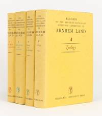
1956144270Carlton: Melbourne University Press 1956. First Edition. Hardcover. Very Good/Very Good. Carlton Melbourne University Press 1956 1960 1958 and 1964 all first - and only - editions. Quarto four volumes xxx 513 pages with 68 figures and 157 plates plus 2 colour plates; xiv 515 pages with 7 graphs 281 maps and illustrations and 47 plates plus a colour plate; xvi 522 pages with 81 maps and illustrations and 17 plates; and xviii 533 pages with a map and 100 plates plus 5 colour plates. Cloth; minimal signs of age and use; an excellent set with the lightly used dustwrappers. Charles Mountford was the leader of the expedition; he was also the author of the first volume the editor of the second and co-editor of the third with R.L. Specht who edited the fourth volume. 4 items. Melbourne University Press hardcover
1717E01353559index pages 36 of 37 maps and copper cuts of the coasts harbor cities plants and other curiosities comprising: 14 plates 3 folding 22 maps charts or plans 14 folding. title page printed in red and black. Printed from the author's original plates inserted in the Paris edition. Lacks the frontispiece map. Royal octavo 9 3/4" x 7 3/4" bound in leather with raised spine bands and red label with gilt lettering. Postscript by Dr Edmund Halley and an account of the settlement commerce and riches of the Jesuits in Paraguay. Palau 94965 Sabin 25926 Nissen ZBI 1433 Hill p117 First English edition.<br /><br />Frézier was educated in Paris and served as lieutenant of infantry from 1702 til 1707 when he entered the engineer corps. In 1712 the government sent him to examine the condition of the Spanish colonies in America. After visiting the principal points in Peru Chili and Brazil he returned to Marseilles. He pointed out several mistakes in the "Relation" of Father Feuille and this led to a bitter controversy between the two travelers. Frézier introduced the large Chili strawberry into France. First published in France in 1714. The first edition into English is preferable to the French original "because it contains Halley's. postscript which corrects certain geographical errors made by Frézier" Hill. "The first part of this book gives an interesting account of the voyage from France around Cape Horn. The second part relates to the voyage along the coasts of Chile and Peru describing the chief towns and cities. Frézier a man of observation brought back information of considerable geographical and scientific value. Much data is included about the native inhabitants.<br /><br />Condition:<br /><br /> Rebacked with original spine label laid down; lacking frontispiece map and binder's leaf free endpapers renewed intermittent foxing else a very nice copy. Jonah Bowyer hardcover
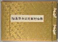
1918880611918. SIBERIAN EXPEDITION. Teikoku Gunjin Kyoiku-kai editors. SHIBERI JIHEN KINEN SHASHIN-CHO. Tokyo Taisho Tsushinsha Taisho 7 1918 Oblong folio bound western-style in cloth gilt. Illustrated throughout in collotype. Photos and cations on the International Siberian Expedition in support of the Whites against the Red Army in which the Japanese played a prominent role. 4 page folding panorama of Vladivostok harbor and views of the cities the countryside troops inhabitants diplomats war preparations etc. etc. One can feel the Winter coming. Very good condition throughout. Very scarce. unknown
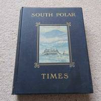
41Smith Elder London 1914. First Edition. Hardcover Original Cloth. Good Condition/No Dust Jacket. 1st Edition: Number 35 of a limited edition of 350. Original covers page edges gilt no dust jacket. PLEASE NOTE: Pages 16 3342434493125 and 148 are PHOTOCOPIES. Contents clean. Volume 1 & 2 were Scott's 1st "Discovery Expedition" whilst Volume 3 is from his 2nd "Terra Nova" Expedition. Although often sold as a set Volume 3 is a complete book in its' own right. The original broadsheets were produced at Cape Evans to amuse the men on the 'Terra Nova' Expedition. It was designed to be published separately from Volume 1 & 2. Cherry-Garrard was the Editor and typist and Wilson the main illustrator. The 1st issue was presented on Midwinter's Day 1911 the 2nd on 8th September and the 3rd on 15th October. Content included poetry humorous articles illustrations of sledging flags and caricatures. Includes Wilson's moving poem 'The Barrier Silence'. Copiously illustrated drawings in the text and full-page plates from sketches and paintings by E. Wilson H. Ponting and others. Spine shaken gutta-percha binding delicate some pages loose as is usual with the 1st Edition. This copy is still bright and handleable with care Gutta Percha was used as the binding glue in many early books it is not a difficult job to remove and reback using modern glues The South Polar Times was a magazine written and printed by the members of Antarctic Expeditions during the various voyages they undertook and forms what is perhaps the most personal of the printed documents to have come out of that most remarkable of periods of Antarctic adventures revealing so many often contradictory aspects of these men's various personalities. It contains a diary of the events of each month a record of the proceedings of the local Debating Society a monthly acrostic humorous notes besides articles of a more solid nature as well as stories sketches of various kinds and poems. One of the corner stones of an Antarctic collection. Quantity Available: 1. Shipped Weight: Under 5 kilogram. Category: Arctic & Antarctic; Exploration. Pictures of this item not already displayed here available upon request. Inventory No: 41. . This book is extra heavy and may involve extra shipping charges to some countries. Smith Elder hardcover
1823040517John Murray. Good with no dust jacket. 1823. First Edition. Hardcover. Hardcover; Hardcover. Brown leather boards with gold design at board edges. Title in gold over black leather label on gold decorated spine. Boards are noticeably scuffed and worn. Frayed edges some sunning. Marbleized edges match marbleized endpapers. Occasional foxing throughout. 4 maps 30 plates of which 11 are hand colored. All are in nice condition some light foxing/soil. Always carefully wrapped and shipped in cardboard boxes to protect your purchase.; B/w Illus; 4TO . John Murray hardcover
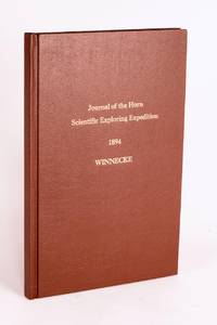
189658059Adelaide: C.E. Bristow Government Printer 1896. First Edition. Hardcover. Fine. Adelaide C.E. Bristow Government Printer 1896. Foolscap folio 32 pages including Appendix B: Report of the Physical Geography of Central Australia by Professor R. Tate and J.A. Watt plus 24 plates on 13 leaves printed rectos only and a folding meteorological chart 2 folding maps a topographical map of Mount Watt and a Survey of Hermannsburg Mission Station and a very large folding colour map 1210 × 1210 mm. Modern cloth lettered in gilt on the front cover; blank bottom margin of the main map slightly creased with one tiny tear expertly sealed; a fine copy. South Australian Parliamentary Paper 19 of 1896: only 650 copies printed. Winnecke was the leader of the expedition and in 'the natural order of things these journals and maps should have been published in connection with the scientific and other records of the Horn Expedition as both supplementary and complementary to them'. After a financial disagreement with W.A. Horn the organiser and backer of the venture this did not occur and this first edition was published under the auspices of the South Australian branch of the Royal Geographical Society of Australasia in conjunction with the Department of the Minister for the Northern Territory and the Survey Department. McLaren 16973; an octavo edition was published the following year see McLaren 16969 - not noting the very large map. C.E. Bristow, Government Printer hardcover
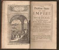
1695E0561xxiv21612 pages with frontispiece folding map and eight engraved costume plates. Duodecimo 6 ¼" x 3 ½" early full calf later spine label. First Edition in English. First published in French the prior year which was published without the plates.<br /><br />François Pidou de Saint Olon was a French diplomat under Louis XIV. In 1682 he was nominated as the first French resident envoy to the Republic of Genoa following the Bombardment of Genoa. He was then sent as an envoy to Madrid. In 1689 François Pidou was appointed ambassador to the court of Sultan Moulay Ismail for the signing of a commercial treaty and to release prisoners now slaves of Barbary corsairs of Salé for 233 including 29 bedridden Moroccan prisoners held by the French. His mission was not successful however he continued to stay more than three weeks more in Morocco. The book gains particular interest through its author's position as ambassador giving him access not always voluntary to areas of Moroccan society previously unrecorded by travelers. There are detailed descriptions of Moroccan dress and the book is beautifully illustrated with eight engraved plates of Moroccan men and women in traditional costume.<br /><br />Condition:<br /><br />With the fine copper engraved frontispiece of the overall state of Morocco which is quite rare and is often found missing in most copies. Joints cracking spine chipped at edges; foxing else very good. R. Bently hardcover
191384790May 24 1913. The Sphere. London. 1913. May 24. The Complete Magazine including original coloured cover and all adverts. Folio. Pagination: Coloured front cover iv 1 - b/w second cover with portrait of Scott publishing details of this issue - see second photo. 182 182a - 220 v- xxii. Includes double page photo 182b-183 of Captain Scott in his Antarctic Home by Herbert Ponting taken at Cape Evans. This famous portrait shows the space allotted to Scott and you can see all the photos of Lady Scott and baby Peter that he put up on the wall above his desk. This issue contains very good prints of many photographs not previously seen and also of a much higher quality than when reproduced in future publications. There are also diary entries. This publication predates the Strand Magazine which used some of the same photos. Front cover creased and worn and lacks small portions along spine. Close tears to edges of rear cover. VERY SCARCE. unknown
1831E0132<p>2 volumes. xxi472 pages with three maps two folding and one double page figures and 13 plates; iv452 pages with 10 plates some folding tables and appendices. Octavo 9 1/2" x 5 1/2" Bound in contemporary half leather with marbled boards and gilt lettering to spine. Ferguson 1418; Hill I p. 19; Howes B309; Lada-Mocarski 95; Sabin 4347. Second edition published after quarto edition of the same year.<br /><br />Frederick William Beechey 17 February 1796 – 29 November 1856 was an English naval officer and geographer. He was the son of Sir William Beechey RA and was born in London. 1806 he entered the Royal Navy and saw active service during the wars with France and America. In 1818 he served under Lieutenant afterwards Sir John Franklin in David Buchan's Arctic expedition of which at a later period he published a narrative. In the following year he accompanied Lieutenant W. E. Parry in HMS Hecla. In 1821 he took part in the survey of the Mediterranean coast of Africa under the direction of Captain afterwards Admiral William Henry Smyth. He and his brother Henry William Beechey made an overland survey of this coast and published a full account of their work in 1828 under the title of Proceedings of the Expedition to Explore the Northern Coast of Africa from Tripoly Eastward in 1821-1822. In 1825 Beechey was appointed to command the HMS Blossom. His task was to explore the Bering Strait in concert with Franklin and Parry operating from the east. In the summer of 1826 he passed the strait and a barge from his ship reached 71°23'31" N. and 156°21'30" W. near Point Barrow which he named a point only 146 miles west of that reached by Franklin's expedition from the Mackenzie river. The whole voyage lasted more than three years and in the course of it Beechey discovered several islands in the Pacific and an excellent harbor near Cape Prince of Wales. In July 1826 he named the three islands in the Bering Strait. Two were the Diomede Islands that Vitus Bering had named in 1728: "Ratmanoff Island" Big Diomede and "Krusenstern Island" Little Diomede. Beechey called the uninhabited third islet "Fairway Rock" which is still its contemporary name. One of his crew Petty Officer John Bechervaise gave a detailed account of the voyage in his Thirty Six Years if a Seafaring Life by an Old Quartermaster published privately in 1839. In 1831 there appeared his Narrative of a Voyage to the Pacific and Beering's Strait to Co-operate with the Polar Expeditions 1825-1828. In 1835 and the following year Captain Beechey was employed on the coast survey of South America and from 1837 to 1847 carried on the same work along the Irish coasts. He was appointed in 1850 to preside over the Marine Department of the Board of Trade. In 1854 he was made rear-admiral and in the following year was elected president of the Royal Geographical Society. Beechey Island where Sir John Franklin wintered is named after him.<br /><br /><strong>Condition:</strong><br /><br />Name neatly excised from head corner of titles small inconspicuous stamp to last pages. Inner hinges beginning marble to boards rubbed some stains to map. some toning to some plates some plates not bound in order to the printer but are all accounted for corners gently bumped else about a very good set.</p> Henry Colburn and Richard Bentley hardcover
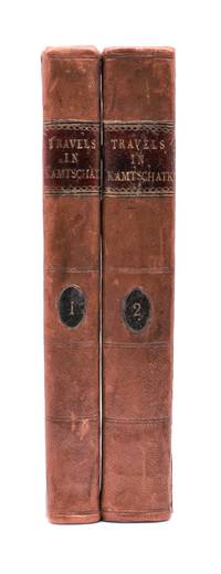
1790029884<p>London: J. Johnson 1790. Volume I: folding map xvi 283 pages; volume 2: viii 408 pages. De Lesseps accompanied La Perouse on the first part of his attempted circumnavigation of the globe. After investigation of the west coast of North America La Perouse sent de Lesseps overland to take the journals and maps of the expedition to Paris. La Perouse and his ships subsequently were lost after they left Australia and the journals carried by de Lesseps assumed great historical significance when published. Even more scarce than those records today are de Lesseps' report of his own overland travels through the Kamtschatka peninsula. The report also includes 25 pages of vocabulary translating common English words into Russian Kamtschadale Koriac Tchouktchi and Lamont languages. Internally clean with only minor foxing the two volumes in 3/4 leather over marbled paper covered boards have recently been sympathetically rebacked original title and volume patches retained. Very attractive example of a quite scarce title. Howes L269 Howes & Hartley rate this item dd "superlatively rare". First English Language Edition. Hardcover. Collectible-Very Good . 8vo - over 7¾" - 9¾" tall. Book.</p> J. Johnson hardcover
1733E0553<p>2 volumes. 8xxiv616471 pages with 4 maps ad view one folding and 3 plates one folding; 2693892 pages with 1 map and 6 plates. Quarto 10 1/4" x 10 1/4" bound in half leather with raised spine bands and gilt lettering to spine over marbled boards. Borba de Moraes page I:453; European Americana 733/146; Sabin 38591 First edition.<br /><br />Joseph-François Lafitau was a French Jesuit missionary ethnologist and naturalist. He is best known for his use of the comparative method in the field of scientific anthropology the discovery of ginseng and his writings on the Iroquois. Lafitau was the first of the Jesuit missionaries in Canada to have a scientific point of view. Lafitau is considered the first of the modern ethnographers and a precursor of scientific ethnology for his work on the Iroquois. He developed a model of studying peoples that involved describing existing cultures on their own terms—not in comparison to European society. He distinguished generic and specific traits transforming the "generic savage" into specific tribal groups. He explained that "only from specific identities can genetic relations be inferred." Furthermore he was the first to declare "contemporary primitive cultures throw light upon the culture of ancient people and vice versa. Lafitau is remembered for applying the comparative method with a greater level of competency than any of his contemporaries. Through original field observations he was able to critique the works of earlier writers on Primitive peoples. By using the Comparative Method Lafitau rejected all theories of social and cultural change and instead used his study to demonstrate the similarities in customs practices and usages of the Native North Americans with diverse peoples from different continents and centuries. He consistently relied on the doctrine of degeneration: all men originally shared one religion with one God but over time as people migrated to separate margins of the earth where they then lost touch with the values and traditions of this one true religion and culture. Therefore Lafitau believed in the "psychic unity of mankind" and the doctrine of primitive monotheism. His major work written in French was first published in 1724 in Paris. It is entitled <em>Customs of the American Indians Compared with the Customs of Primitive Times</em> <em>Moeurs des Sauvages Amériquains Comparées aux Moeurs des Premiers Temps</em> and is 1100 pages in total. In 1974 William Fenton and Elizabeth Moore made the first translation into English available.</p><p>Lafitau published two other works. One <em>Histoire de Jean de Brienne Roy de Jérusalem et Empereur de Constantinople</em> Paris 1727 was released before he returned to Canada; it is little known and seldom seen. A two-volume <em>Histoire des découvertes et conquestes des Portugais dons le Nouveau Monde . . .</em> 1733 appeared after he came home to France. Frequently found in libraries it is not just a compilation of original sources but an attempt to make available to French readers a story of exploration and adventure otherwise denied to them; in the chronicles he sees a long development of customs hitherto unnoticed such as he had reported in the <em>Mœurs</em>; from them understood only he says in the original languages of the people who practice them he builds his "system" or philosophy of history and once more he is concerned too with the relation between custom and natural history or ecology.<br /><br /><strong>Condition:</strong><br /><br />Beautifully rebound in half leather. Faint dampening to second volume; early owner's signatures on title pages inked stamps of St Charles Borromeo Seminary on front paste-downs and first title page lacks frontispiece else a very good to fine set.</p> Chez Saugrain pere, quai des Augustins, au coin de la rue Chez Saugrain pere, quai des Augustins, au coin de la rue Pavee, a la hardcover
1855E0558<p>2 volumes. xx383 pages with hand colored frontispiece 3 maps in pockets plates many colored; vii41923 ad pages with color frontispiece and plates some colored. Small quarto 10 1/2" x 6 3/4" bound in original publisher's pictorial brown cloth with blind-stamped cover with gilt pictorial in gilt. Notes on the Natural History by John Richardson. Abbey Travel 645; Arctic Bibliography 1241; Books on Ice 5.8a; Hill 106; Sabin 4389; TPL 3409 First edition.<br /><br />Belcher's five-ship 1852-54 expedition in search of Franklin would be the last official British attempt. On the HMS Assistance Belcher successfully navigated through the Wellington Channel but beset by ice was unable to return to Lancaster Sound and was forced to abandon the ship. This account of the expedition also includes several essays on the natural history of the region by Richardson Owen Bell Salter and Reeve.<br /><br /><strong>Condition:</strong><br /><br />Minor wear re-backed with parts of original back-strips laid down; minor foxing short separations at folds to the largest map; inked stamps on title pages Edinger bookplates else a good set internally very good.</p> Lovell Reeve hardcover
1700E0566xxiii43313 table pages with two folding maps of the Marsianes and Guam. Duodecimo 6 1/2 x 3 1/4" bound in contemporary full sheep with red label in gilt spine and five raised spine bands speckled red end pages. Brunet 28230 Cioranescu 41783 First edition.<br /><br />Charles Le Gobien was a French Jesuit writer founder of the <i>Lettres édifiantes et curieuses</i> a collection of reports from Jesuit missionaries in China. It is a major source of information for the history of Catholic missions and life in China in those times. Le Gobien was born at Saint-Malo Brittany. He entered the Society of Jesus on 25 November 1671. As professor of philosophy and especially while procurator of the Franco-Chinese mission he sought in a series of papers to awaken interest in the work of Christianizing Eastern Asia. In 1697 appeared at Paris his Lettres sur les progréz de la religion à la Chine. Apropos of Chinese Rites controversy he published among other things <i>Histoire de l'édit de l'empereur de la Chine en faveur de la religion chrétienne avec un éclaircissement sur les honneurs que les Chinois rendent à Confucius et aux morts</i> Paris 1698; and in the year 1700: <i>Lettre à un Docteur de la Faculté de Paris sur les propositions déférées en Sorbonne par M. Prioux</i>. Under the same date there appeared in Paris the<i> Histoire des Isles Mariannes nouvellement converties à la religion chrétienne</i>. The second part translated into Spanish by J. Delgado is found in the latter's <i>Historia General de Filipinas</i> Manila 1892. In 1702 Père Le Gobien published <i>Lettres de quelques missionnaires de la Compagnie de Jésus écrites de la Chine et des Indes Orientales</i>; this was the beginning of the collection soon to become celebrated under the title of <i>Lettres édifiantes et curieuses écrites des missions étrangéres par quelques missionnaires de la Compagnie de Jésus</i>. The first eight series were by Le Gobien the latter ones by Fathers Du Halde Patouillet Geoffroy and Maréchal. The collection was printed in thirty-six volumes duodecimo Paris 1703–76 and reissued in 1780-81 by Fathers Yves de Querbeux and Brotier in twenty-six volumes duodecimo omitting the prefaces. New editions appeared in 1819 1829–32 and 1838-43. One abridgment in four volumes octavo was entitled <i>Panthéon Littéraire</i> by L. Aimé Martin 1834–43. A partial English translation came out in London in 1714. The publication incited the Austrian Jesuit Stöcklein to undertake his <i>Neuer Welt Bott</i> about 1720 at first considered merely a translation but soon an independent and particularly valuable collection five volumes folio in forty parts substantially completing the <i>Lettres Edifiantes</i>.<br /><br />This is a history of the Christian missions in the Marianas or Ladrones Islands in the north-western Pacific the principal island of which is Guam. Reprinted in the text are several letters from early missionaries Medina Clain Sanvitores &c. The Jesuit mission was established there by Diego Luis de Sanvitores. Father Le Gobien never visited the Mariana islands but based his account chiefly on the relations and letters of missionaries sent to him from Rome Spain the Netherlands etc. Includes a letter by P. Clain about the discovery of the Caroline Islands.<br /><br /><b>Condition:</b><br /><br />Rebacked with original spine laid down provenance: Jesuit College library with old stamps to front free endpaper half title and title page else about very good. Nicolas Pepie hardcover
1799biblio160<p><strong>First French edition of Bartram's</strong><strong> Travels which chronicled his explorations of the southern British colonies in North America from 1773–1777</strong><br /><br />2 volumes. 457 pages with frontispiece engraved portrait by Bovinet Mico Chlucco Grana King of the Seminoles and one folding plate; 436 pages without title with large folding map by J.B. Poirson engraved by Alexandre Blondeau and folding plate. Octavo 8 1/4" x 5 1/4" bound in half leather with six spine compartments with red and black labels in gilt over original marbled boards. Translated by Pierre Vincent Benoist. Sabin 3871; Palau 251346; Howes B223; Field 94 First French edition.<br /><br />William Bartram was an American naturalist. The son of the naturalist John Bartram. As a boy he accompanied his father on many of his travels to the Catskill Mountains the New Jersey Pine Barrens New England and Florida. In 1773 he embarked upon a four-year journey through eight southern colonies. Bartram made many drawings and took notes on the native flora and fauna and the native American Indians. In 1774 he explored the St. Johns River where he had memorable encounters with aggressive alligators and also visited a principal Seminole village at Cuscowilla where his arrival was celebrated with a great feast. He met Ahaya the Cowkeeper chief of the Alachua band of the Seminole tribe. When Bartram explained to the Cowkeeper that he was interested in studying the local plants and animals the chief was amused and began calling him Puc Puggy the flower hunter. Bartram continued his explorations of the Alachua Savannah or what is today Paynes Prairie. William Bartram wrote of his experiences exploring the Southeast in his book Travels through North & South Carolina East & West Florida the Cherokee Country the Extensive Territories of the Muscogulges or Creek Confederacy and the Country of the Chactaws Containing an Account of the Soil and Natural Productions of Those Regions Together with Observations on the Manners of the Indians published in 1791 and which is today simply known as Bartram's Travels. It was considered at the time one of the foremost books on American natural history. Many of Bartram's accounts of historical sites were the earliest records including the Georgia mound site of Ocmulgee. In addition to its contributions to scientific knowledge Travels is noted for its original descriptions of the American countryside. Bartram's writing influenced many of the Romantic writers of the day. William Wordsworth Samuel Taylor Coleridge and François René de Chateaubriand are known to have read the book and its influence can be seen in many of their works. Ephraim George Squier and Edwin Hamilton Davis in their book <em>Ancient Monuments of the Mississippi Valley</em> name Bartram as "the first naturalist who penetrated the dense tropical forests of Florida."<br /><br /><strong>Condition:</strong><br /><br />Some rubbing to original boards page 143 of volume one has small burn mark affecting text half title bound upside down in back old water stain to plate of volume two. Fold-out map has repair to first fold internally pages are clean and free of toning and foxing else a very good copy.</p> Chez Carteret et Brosson and Dogour Duran hardcover
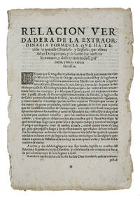
1625ABC_46574Lisbon: Pedro Craesbeeck 1625. Not bound. Folio. With a small woodcut decorated initial opening the text. Rare Spanish propagandistic news publication emphasizing the success of the Spanish fleet against the English and Dutch during the Anglo-Spanish and Eighty Years' War discussing the heavy losses of the Anglo-Dutch fleet on their way to Cádiz in 1625. In 1624 negotiations for the marriage between Charles Prince of Wales son of King James I and the Spanish infanta Maria sister of Philip IV broke down and war broke out because the Spanish court could not accept a marriage as long as Charles refused to convert to Catholicism. In 1625 the English prepared a fleet to sail to Spain more specifically Cádiz an important trading port of the Spanish silver fleet. In October 1625 approximately 100 ships including 15 Dutch warships sailed for Cádiz. Soon the ships were plagued with difficulties especially storms. Many ships were left barely seaworthy and it caused major delays. On 1 November 1625 fleet entered the Bay of Cádiz but in the end the mission failed.The present publication can be seen as Spanish propaganda presented as "news" emphasizing their victories. While sailing to Cádiz the Anglo-Dutch fleet came in heavy weather near Dunkirk. The text describes in great detail how ships went down or how they were captured but also the drowning of many people on board. The present publication in Spanish was printed in Lisbon in 1625 still under the rule of the Spanish monarchs the Crown of Portugal was united with the Crowns of Castile and Aragon from 1580 to 1640. It is an outstanding example of the Spanish annus mirabilis praising the Spanish victories during the wars with England and the Dutch Republic.Edges frayed and slightly browned with a few spots the two leaves nearly separated at the fold some minor foxing and a small jagged tear in the second leaf with minor loss of text. Otherwise in good condition. A rare piece of news and propaganda on the successes of the Spanish fleet against the Dutch and English ships.l Ensayo de bibliografía marítima Española 2467; Palau 257848; Pohler Bibliotheca Historico-Militaris p. 246; USTC 5025988 9 copies; Wilkinson & Lorenzo eds. Iberian Books 55774; WorldCat 1 copy noting no place of publication or publishers name. Pedro Craesbeeck, unknown
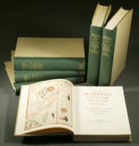
1957E0551<p><strong>From the Spanish discovery to the opening of the Civil War</strong><br /><br />5 volumes in 6. Volume One: The Spanish Entrada to the Louisiana Purchase 1540-1804 xiv264 pages with color frontispiece map and 275 maps many folding and index; Volume Two: From Lewis and Clark to Fremont 1804-1845 xiii281 pages with colored frontispiece map 143 additional maps some folding and index. Volume Three: From the Mexican War to the Boundary Surveys 1846-1854 xiii349 pages with colored frontispiece map 322 additional maps and index; Volume Four: From the Pacific Railroad Surveys to the Onset of the Civil War 1855-1860 xiii260 pages with color frontispiece map an additional 127 maps some folding and index; Volume Five From the Civil War to the Geological Survey Part One: xviii222 pages with color frontispiece map and an additional 152 maps; Volume Five From the Civil War to the Geological Survey Part Two: 223-487 pages with 124 maps and index. Folio 14 1/2" x 10 1/2" bound in quarter green leather with gilt lettering to spines. volume I printed by the Grabhorn Press; volumes II-V printed by Taylor & Taylor and James Printing based on the designs of Edwin and Robert Grabhorn. First edition limited to 1000 copies.<br /><br />Carl Wheat's Mapping of the Trans-Mississippi West is a comprehensive and readable cartographic history of the American West. The first three volumes of the work are by necessity bulky and out sized to accommodate the many maps contained with their covers. These beautifully printed books present a truly graphic picture of the exploration and peopling of the vast unknown land west of the Mississippi. The author does not merely present a catalog of significant maps of each era but tells the exciting story of many facets of history that resulted in their making-of the hard journeys the hazardous exploits the motivation the mysticism the misunderstandings and the strange blend of fact imagination false geographic concept and political necessity which were consummated in the engraver's work. These volumes will provide exciting text for the casual reader and have become eminent source book for the student and scholar.<br /><br /><strong>Condition:</strong><br /><br />A near fine set. Due to the size and/or weight of this lot extra shipping and/or handling charges may apply.</p> Institute of Historical Cartography hardcover
1802E0151<p>2 volumes with Atlas. 4xxiv385 pages with xxii-xxiv lists books of voyages available from the publisher; 4418 pages with appendix containing vocabularies of the languages of Yukagir Yakut Tungoose Kamchatka the Aleutian Islands and Kadiak and inex. Atlas with title list of plates 14 engraved plates & large folding engraved map. Text volumes are small octavo 7¾" x 4½" 19th century quarter calf & boards spines tooled in gilt morocco lettering pieces; atlas is quarto 11" x 7½" in period tree calf spine tooled in gilt. Translated by J Castéra. Howes S-117 First French Edition.<br /><br />Martin Sauer was an English civil servant who knew Russian French and German. He became acquainted with Joseph Billings in St Petersburg in the 1780s. He agreed to join Billings expedition as his secretary and interpreter. It was agreed that he would write the official account but there is some controversy about his actives when he returned to St Petersburg in 1794. It has been suggested that he left hurriedly for England with much of the important archival material from the voyage including diaries and secret reports so that he could publish a record of the expedition before Russian authorities and scholars in the Academy of Sciences could review its details. Sauer's <em>An account of the Geographical and Astronomical Expedition to the Northern Parts of Russia</em> was published in London in 1802. It contains an abundance of detail about eastern Siberia and the Aleutian Islands and records the expeditions visits to Kodiak Island Prince William Sound and the coast south as far as Yakutat Bay. <br /><br />The chart was made by Aaron Arrowsmith from Sauer's notes and Billings observations and the whole complements well the other contemporary accounts of the expedition by the cartographer Gavriil Sarychev and the naturalist Carl Heinrich Merck. Aaron Arrowsmith 1750–1823 was an English cartographer engraver and publisher and founding member of the Arrowsmith family of geographers. He moved to Soho Square London from Winston County Durham when about twenty years of age and was employed by John Cary the engraver and William Faden. He became Hydrographer to the Prince of Wales ca. 1810 and subsequently to the King in 1820. In January 1790 he made himself famous by his large chart of the world on Mercator projection. Four years later he published another large map of the world on the globular projection with a companion volume of explanation.<br /><br /><strong>Condition:</strong><br /><br />Some rubbing and wear to coves of both atlas and text volumes some chipping to spine ends small gouge at back of atlas and stamp to front end paper else in very good condition.</p> Chez F Buisson hardcover
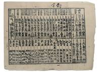
1853347481853. Three woodblock-printed sheets on mulberry paper. Mild edge wear old folds. A detailed revealing group of late Tokugawa samurai reference sheets recording the names ranks stipends heraldry standards and service obligations through which the shogunate and Edo public understood military readiness at the moment of Perry's arrival.<br/> <br/> Commodore Matthew C. Perry anchored off Uraga at the entrance to Edo Bay in July 1853. His arrival made visible the vulnerability of the Tokugawa capital and produced an immediate demand for information about coastal defence domain strength and the lords responsible for guarding the approaches to Edo. Kawaraban and related broadsides answered that demand in compressed visual form combining names crests military symbols income figures and geographical or administrative data. The first printed sheet appears to be an earlier roster of Edo office-holders or guard personnel. Its tabular format with names offices crests and standards records the recognitional system already in place within Tokugawa administration before the Perry crisis sharpened the public appetite for such information. The manuscript sheet is ruled into a large grid with headings formed from the twelve zodiac signs and the four seasons including Rat Ox Tiger Hare and the seasonal headings. The entries appear to record named houses Lords or retainers against recurring seasonal and cyclical categories probably for service attendance or ceremonial obligation. The third sheet is headed "Rekko yushinroku" here translated as "Register of Valiant Retainers of the Lords." It lists major daimyo houses and their principal retainers with domain or house headings names titles stipend figures in koku family crests standards and related insignia. Visible regional or house designations include "Kaga" "Owari" "Kii" "Satsuma" "Higo" and "Tosa." The sheet gives a graphic register of the daimyo world mobilised or imagined as mobilised around the defence of Edo Bay. Together the sheets preserve the administrative and visual language of Tokugawa defence at a moment of acute pressure. They are not formal shogunal orders and the first sheet may predate Perrys arrival but they show how late Edo Japan translated rank obligation military identity and coastal defence into portable tabular form. Their compression the names of Lords and retainers the scale of domains the crests and standards by which armed households could be recognised and the bureaucratic habits of a regime suddenly forced to account for its capacity to defend the country reveals these documents' immediacy and importance. unknown
18932712376Adelaide: C.E. Bristow 1893. Wrappers torn at edges but well repaired as are the boards of the map section. Octavo complete with maps; original wrappers and boards preserved in a brown morocco bookform box. <p><p>First edition: one of 500 copies printed of the narrative of one of the last great Australian exploring expeditions written by the leader of the expedition and complete with its maps.</p> <p>Lindsay led this extensive expedition - it ran to eight men forty-four camels and five Afghan camel drivers - organised by the South Australian Branch of the Royal Geographical Society and equipped by Sir Thomas Elder to explore the unknown interior between South Australia and the west coast and to look for Leichhardt. Lindsay's exhaustive report includes the surveyor L.A. Wells's journal of the expedition. Also included is an extensive Aboriginal vocabulary collected by Wells from the Pidong tribe at the head of the Murchison River the Minninng tribe at Fraser Range from the Everard Ranges at Mount Illbillee and from the "Wallawe" tribe at Yarragabie Station Western Australia. He states "Appended is a list of native names which I have collected from four tribes met with during the expedition.".</p> <p>The separate large folding maps are original lithographs coloured to illustrate geological changes. Compiled and drawn by both Lindsay and Wells these maps show in great detail the earlier discoveries of Giles Gosse Forrest and Hunt as well as the route taken by the Elder explorers.</p> </p> . C.E. Bristow unknown
185546629Gotha Julius Perthes 1855-1874. 4to. Bound in 18 contemp. hcalf some wear to the first 10 vols. some a bit rubbed. Some scattered brownspots to the first volumes. Gilt spines. Wear to top of spines. With a huge amount of original maps plates profiles etc. lithographed and engraved large and folded and mainly in colour. This set does not include the "Ergänzungsbände". <br/><br/><em>The first 19 lacking vol. 14 volumes of this importent periodical from its "Golden Period". "Petermann's Mittheilungen" became the leading geographic publication of the world and remained so until World War I. All the new geographical discoveries all the reports from the latest exploratory expeditions were published and flowed into Petermann's Geographische Anstalt and he took care to see that it was translated into cartographic form as quickly as possible. The maps soon came to have a reputation for containing the latest and the most accurate information available. Not only German but international readers as well came to see the 'Mitteilungen' as an indispensable organ for the world of geographical research. </em> unknown