RUTLEDGE, Jean Jacques (1742-1794)Biblio.com
502 résultats
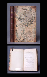
1777BB0796London: printed for T. Durham at Charing-Cross; and G. Kearsly at No. 46 in Fleet-Street 1777. First Edition. Quarter-bound Leather. Near Fine. First Edition in English of this novelized first-person account of a young English lord's debauched sojourn—prostitutes gambling horse-racing drink—in the French capitol. Crown 8vo 206 x 121mm: 2x222pp. Contemporary leather spine in six compartments between raised bands recent red morocco lettering piece gilt marbled sides and end papers. Joints skillfully reinforced marbled sides heavily rubbed top of title page including word 'The' supplied in excellent facsimile. Internally a Fine bright copy pages fresh and free of foxing browning and stains. ESTC Citation No. N31079 distinct from ESTC T131522 which Durham and Kearsly brought out the same year in duodecimo and which does not have the following note below the date on the title page present in our copy: "This work may be had of the above booksellers in French printed from the Paris edition which was suppressed in that country.". Translated by the author from his La quinzaine angloise à Paris first published the previous year. Rutledge was the grandson of an Irish Jacobite who settled in France and son of Walter Rutledge a banker and ship owner at Dunkirk who assisted the Pretender in his expedition of 1715 and in consequence was named a baronet. "This sketch which depicts the rapidity with which a ‘plunger’ may be reduced to destitution by the harpies of Paris and purports to be a posthumous work by Sterne to whose works it bears no sort of resemblance . . . The writer states that attempts had been made to suppress the work in Paris. A species of sequel entitled ‘Le Second Voyage de milord ——’ appeared in 1779." DNB N. B. With few exceptions always identified we only stock books in exceptional condition carefully preserved in archival removable mylar sleeves. All orders are packaged with care and posted promptly. Satisfaction guaranteed. Fine Editions Ltd is a member of the Independent Online Booksellers Association and we subscribe to its codes of ethics. printed for T. Durham, at Charing-Cross; and G. Kearsly, at No. 46, in Fleet-Street unknown
1857324349New Haven 1857. Separately-issued offprint from the American Journal of Science and Arts 2nd series Vol. xxiv July 1857. 21-38 pp. plus folding map. 8vo. Period plain green wrappers stitched. Separately-issued offprint from the American Journal of Science and Arts 2nd series Vol. xxiv July 1857. 21-38 pp. plus folding map. 8vo. "Redfield's last contribution to meteorological science was a memoir upon the cyclones or typhoons of the north Pacific Ocean prepared at the request of Commodore Perry to accompany his Narrative of the United States Expedition to Japan; and was printed in the second volume of that work . He showed that the hurricanes of the Pacific followed the same general laws as those of the Atlantic and traced the paths of several remarkable storms among which was one of great force encountered by the steamer 'Mississippi' one of the vessels of Commodore Perry's squadron on route from Simoda to the Sandwich Islands in October 1854" Recollections of John Howard Redfield p. 302. Page 37 includes a description of the Kona or southerly winds of Hawaii as well as the effects of cyclones on the Hawaiian islands.<br /> <br /> Following its publication within Perry's Narrative in 1856 the work was issued in a slightly more condensed form within the July 1857 issue of the American Journal of Science and Arts. The present separately-issued offprint from the AJSA is the only separately-issued edition of the work. Scarce. Sabin 68512. Not in Forbes unknown
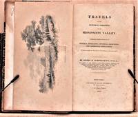
1825W1883New York: Collins and Hannay 1825. 459 pages fold-out map of the "western country" and 3 engraved plates missing is the sketch of the lead mine district. First printing. Octavo. 3/ leather over marbled paper-covered boards. According to Wikipedia Henry Rowe Schoolcraft 1793-1864 was an American geographer geologist and ethnologist noted for his early studies of Native American cultures as well as for his 1832 expedition to the source of the Mississippi River. He is also noted for his major six-volume study of Native Americans published in the 1850s. The book offered here is his report on an 1821 expedition from Missouri through Illinois and Indiana into Michigan. There is heavy emphasis on lead mining in Missouri and on treatymaking with the Chippewa and Potawatomi tribes. Howes S196. Quite scarce. The book is in about very good condition: sympathetically rebacked in gilt-ruled tan leather with new brown leather title patch; clean and tight; foxing throughout; previous owners' names and date on front endpaper. First Edition. Hardcover. Collectible-Very Good. 8vo - over 7¾" - 9¾" tall. Book. Collins and Hannay Hardcover
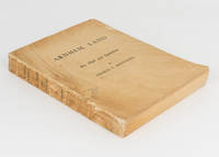
1956110549Carlton: Melbourne University Press 1956. First Edition. Paperback. Very Good. Carlton Melbourne University Press 1956. Quarto xxx 513 pages with 68 figures and 157 plates plus 2 colour plates. Original textured card covers with the title 'Arnhem Land. Art Myth and Symbolism' and the author's name on the spine and front cover; spine sunned cracked and chipped with minor loss; minimal expert conservation to the front joint; front and rear covers marked and unevenly discoloured with a few minor surface blemishes; edges a little marked and foxed with occasional foxing elsewhere; a decent copy internally in very good condition. The first and most important of the four volumes in the series published between 1956 and 1964. This copy is inscribed on the front free endpaper 'To Mr and Mrs W. McCaffrey with all good wishes from Charles P. Mountford 1960'. The standard binding is green cloth with a dustwrapper. We have handled a number of presentation copies of the first volume in wrappers and presume these less-expensive versions were provided to the author for this purpose. Melbourne University Press paperback
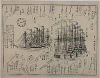
1854215028Japan. Circa1854. Black and white woodblock map with illustrations 32.2 x 41.5cm. Laid down on thick paper. Printed black border line at lower corner and occasionally in other areas along the border not printed otherwise good. This woodblock print map shows the defence layout around Tokyo Bay against the arrival of the American fleet. Names of lords who are responsible for defending particular areas are written with their rankings in terms of wealth sizes. In the centre the American ships are illustrated in detail. There are five sailing ships painted in red and three steam ships. These eight ships entered the bay on 6 February 1854. Thus this map most likely depicts the scene around that time. A caption on the left reads: 'The United States of America founded by Washington 77 years ago sent Matthew Perry with the President's letter in 1853; Perry revisited Edo in 1854.' . unknown
236TLS Typed Letter Signed . Very Good Condition. TLS Typed Letter Signed Very Good Condition Signed by Author Dear Dr Daugherty: I was much interested in the newspaper account of your work with connective tissues/ I had considerable correspondence with Goldblatt who I believe carried on the same type of investigation as that conducted by Bogomolets I would appreciate any information you can give me concerning this matter I refer to the subject of tissues/ I have had to study medicine considerably due to the fact that I have been on detached duty in the far places so many times without doctors that I have had to act as doctor myself Also I have had to make a study of diet/ You see our expeditions generally last two years and during that time there's no fresh food available Exceptions to this are whale meat and seal meat/ I hope I am not imposing on you I got your address from the science editor of the Associated Press/ Incidentally I expect to go to the Antarctic next season/ With best of good wishes/ Sincerely signature in manuscript Richard E Byrd/ Below this is address of Dr Daughtery - University of Utah Salt lake City Utah REB:dmw -- A signed letter with exceptionally good content -- Very good condition Quantity Available: 1 Category: Arctic & Antarctic; United States; 1950s; EXPLORATION; Exploration Signed by Author Pictures of this item not already displayed here available upon request Inventory No: 000236. unknown
1785BOOKS0033095 volumes: 520 pages with frontispiece tables and six plates; 492 pages with tables 479 pages 587 pages 504 pages with nine plates. Octavo 8" x 5" bound in leather with raised spine bands and black labels with gilt lettering to spine. Complied by John Kent principally from Campbell's Lives of the Admirals Hill page 358 First Dublin edition.<br /><br />A London man of letters Campbell was quite successful with his numerous works of an historical and biographical nature. He collect a large and valuable library. He first published his Lives of the Admirals in four volumes in the years 1742 to 1744. There were several later editions. From 1744 to 1748 he compiled and published what became known as Campbell's enlarged edition of John Harris's Complete collection of voyages and travels originally published in 1702-1705. Campbell also made numerous important contributions to the Biographia Britannica under the signatures E and X including his own noble Scottish ancestors the Campbells. A memoir of him was inserted by Andrew Kippis in this same work. Campbell was an expert on the histories of Spain Portugal France and the British and the Dutch. In 1765he was appointed the royal agent for the province of Georgia and held that office until his death. There are many interesting references to him in James Boswell's Life of Johnson. John Kent published only tow editions of his compilation; this one and one published in London in 1776-1777.<br /><br />Condition:<br /><br /> New spines with original leather boards. Volume one closed page edge tears with occasional page edges chipped only affecting margins. volume two damp stain to title gutter some occasional foxing. Some pages stained else a good to very good set Printed for J Williams hardcover
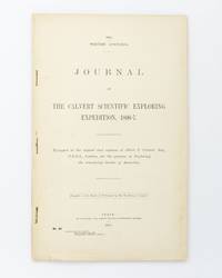
190225076Perth: Wm. Alfred Watson Government Printer 1902. First Edition. Paperback. Very Good. Perth Wm. Alfred Watson Government Printer 1902. Foolscap folio 62 pages with 4 illustrations plus a very large folding map 625 × 865 mm. Title-wrappers relatively recently bound in half calf and cloth lettered in gilt on the spine; title leaf slightly marked with trifling loss to the bottom corner-tip; minimal signs of age and use; an excellent copy. Western Australian Parliamentary Paper Number 46 of 1902; only 1200 copies were printed. The 'expedition was fitted out to explore the remaining unknown regions of Australia on similar lines to the Elder expedition'. Lawrence Allen Wells third in command on the ill-fated Elder expedition of 1891-92 was leader. The party set out from Mullewa east of Geraldton on 13 June 1896; lack of water and the gruelling conditions brought the official expedition to an end on 6 November at Noonkanbah Station on the Fitzroy River with two men unaccounted for. It was not until late May of the following year that Wells located the bodies of the missing men his cousin Charles Wells and George Lindsay Jones nephew of the explorer David Lindsay. The detailed accounts of the three search expeditions undertaken by Wells accompanied by Nat Buchanan George Keartland and Sub-Inspector Ord respectively are included. Not least strong on contemporary race relations. Wm. Alfred Watson, Government Printer paperback
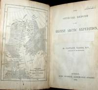
187661115030126John Murray London 1876. First Edition. Hardcover. Good Condition/No Dust Jacket. Report to the Admiralty of the expedition that left Upernivick on 22 July 1875 and returning in October 1876. This is an ex-library copy with flaws as described. Black half-leather binding with banded spine and dark blue covers are lightly rubbed at edges binding is sound with strengthened inner hinges. Crossed and stamped large library label is pasted to the inside of the front cover additional end-papers darkened no half-title-page frontis map has been pasted to previous end-paper with resultant wrinkles on both surfaces and a stamp of "Free Public Library Westminster S.W." on the obverse of the frontis shows through the pasted end-paper although not visible from the map. Title-page is darkened has a crossed out reference number in the upper leading corner and a psted paper rectangle covering a "Free Public Library Westminster S.W." stamp small feint stamp on reverse and short closed tear approx 1cm on leading edge. Pages are little darkened with some smudge marks mainly in margins page 84 to 91have a very small ink mark on the lower corner "Free Public Library Westminster S.W." stamp acorss the bottom of the final page. Quantity Available: 1. Shipped Weight: under 1 kg. Pictures of this item not already displayed here available upon request. Inventory No: 61115030126. All our books music and maps are sent by a tracked mail service. John Murray hardcover
189531933København 1895-96. Alle 3 bind i originale bogtrykte omslag ubeskårede og uopskårede. Omslagene lettere falmede og med et par smårifter ellers aldeles frisk eksemplar. 8374;8513;8272 pp. talrige tekstillustrationer 40 plancher heriblandt farvelitograferede plancher kort m.v. <br/><br/><em>First edition of one of the first scientific expedition to Greenland lead by The Greenlandic Commission. It contains the first scientific survey of the huge areas around Scoresby Sound. Meddelelser om Grønland Bind 17-19. </em> unknown
190431978Kjøbenhavn Reitzel 1904-11. Ubeskårede og delvist uopskåret i originale bogtrykte omslag bagomslaget til første bind mangler. 12372;446;463;XIII431 pp. talrige tekstillustrationer 7 litograferde foldekort 32 plancher heraf flere i farvelitografi. <br/><br/><em>Ekspeditionens resultater var meget omfattende både de geografiske opmålinger de zoologiske og botaniske men særligt må nævnes de betydningsfulde etnografiske samlinger som hjembragtes og som er beskrevet her Thalbitzer og Amdrup. - Meddelelser om Grønland Bd. 27-30. </em> unknown
1779BOOKS000337<p>4282 pages lacking the map. Small quarto 10" x 7½" rebound in ¾ morocco & marbled boards spine lettered in gilt top edges gilt. Sabin 22572 First edition.<br /><br />Rare account of travels into the arctic most notably Nova Zemblya to the north of Europe. Twelve years earlier Engel wrote his notable work on explorations on the other side of the Arctic Circle Memoires et observations geographiques et critiques sur la situation des pays septentrionaux de l'Asie et de l'Amerique. Lausanne 1765. <br /><br /><strong>Condition: </strong>Rubbing to joints and extremities; some minor staining and soiling within hinge professionally repaired else a very good copy. Only five copies found on worldcat.</p> F Sanuel Fetscherin hardcover
1799biblio153<p>a1-42 binders direction8 subscribers4c-4204 additional subscribers pages with 7 maps 5 folding and 6 plates. Quarto 11 3/4" x 9 1/2" with new spine in six compartment with red label in gilt over original decorative blind stamped calf boards. Ferguson 329; Sabin 104.633 First edition first printing.<br /><br />Captain James Wilson brought the first British missionaries to Tahiti on ship <em>Duff </em>in 1797. Wilson was a deeply religious man. The missionaries he brought were from the London Missionary Society. There were thirty men six women and three children. Wilson on the <em>Duff </em>also explored and visited many islands in the Pacific some of which had never had any recorded visit by a European. Among these the most important are Mangareva in the Gambier Islands and Pukarua in the Tuamotus. <em>Duff</em> paid a visit as a missionary ship to Tahiti during 1796 as a result Missionary Society has first been established in Tahiti. Three years after the establishment the directors of the Society appointed a committee to consider a suitable memorial for presentation to Wilson for his services in helping to establish the first mission in the South Seas.<br /><br />Wilson fought with the British army during the American War of independence and then served nine years with the East India company. While in India he was captured by Hyder Ali and after a daring bid for escape was imprisoned in the black hole of Seringapatam. After his release he continued service as a captain and despite illness and further dangerous missions accumulated sufficient sources to retire. throughout it all Wilson remained fast in his irreligious opinions. While living in England with his niece however he was converted to an evangelical faith. he felt called to volunteer for missionary service after reading the <em>Evangelical Magazine</em>. Haweis did not know Wilson before receiving a letter volunteering his services in the Pacific. his skills and newfound devotion seemed perfectly suited to the situation and Haweis saw him as "God's man." the <em>Duff </em>arrived at Tahiti on march 5 1797. the settlement at Tahiti of twenty of the missionaries five of them with wives and two children gives further examples of the role of the missionary captain. A pattern of intercourse had already been established by other voyagers according to which the captain of a vessel would take the leading role in meetings. It is therefore not surprising that the focus of the chapter describing the arrival is on meetings between significant island figures and Captain Wilson. For example Manemane a "high priest" Frommo'orea sought Wilson as a tayo or friend not Jefferson the president of the missionaries.<br /><br />The official account of the first mission appeared in 1799 under the lengthy title <em>A missionary voyage to the southern Pacific Ocean performed in the years 1796 1797 1798 in the ship Duff commanded by Captain James Wilson compiled from the journals of the officers and the missionaries; and illustrated with maps charts and views drawn by Mr William Wilson.</em>.it was placed firmly within the tradition of the voyages of discovery by an introduction compiled by Samuel Great heed that described previous European contacts with the islands and an appendix "including details never before published of the natural and civil state of Otaheite." the main narrative was taken from Wilson's journal with additions from his son and a journal kept by the missionaries during the period when the <em>Duff </em>was away from Tahiti at Tonga. Wilson dominated the events recorded in the narrative.<br /><br /><strong>Condition:</strong><br /><br />Some offset toning from maps occasional foxing water mark to upper margin on some leaves two leaves miss-bound at back re-backed with contemporary blind stamped calf boards.</p> S Gosnell for T Chapman hardcover
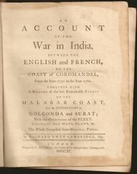
1761E6754xxxiii270215148xix1 pages 14 of 18 engraved plates maps many folding and index. Quarto 10 1/4" x 8 1/4" in original leather binding. First edition.<br /><br />Richard Owen Cambridge was a British poet. He was educated at Eton and at St John's College Oxford. Leaving the university without taking a degree he took up residence at Lincolns Inn in 1737. Four years later he married and went to live at his country seat of Whitminster Gloucestershire. In 1751 he removed to Twickenham where he enjoyed the society of many notable persons. Horace Walpole in his letters makes many jesting allusions to Cambridge in the character of news-monger. His chief work is the <i>Scribleriad</i> 1751 a mock epic poem the hero of which is the Martinus Scriblerus of Alexander Pope John Arbuthnot and Jonathan Swift. The poem is preceded by a dissertation on the mock heroic in which he avows Cervantes as his master. The satire shows considerable learning and was eagerly read by literary people; but it never became popular and the allusions always obscure have little interest for the present-day reader. He made a valuable contribution to history in his <i>Account of the War in India on the Coast of Coromandel from the year 1750 to 1760</i> 1761. He had intended to write a history of the rise and progress of British power in India but this enterprise went no further than this one work as he found that Robert Orme who had promised him the use of his papers contemplated the execution of a similar plan. The Works of Richard Owen Cambridge includes several pieces never before published. It contains an <i>Account of his Life and Character</i>by his Son George Owen Cambridge 1803 the Scribleriad some narrative and satirical poems and about twenty papers originally published in Edward Moore's paper The <i>World</i>. His poems are included in Alexander Chalmers' English Poets 1816.<br /><br /><b>Condition:</b><br /><br />Previous owner's name in neatly written dated 1806 on front end paper with his book plate on front past down with his library stamp. Lacks rear free end paper. Front hinge separated back hinge cracked. Lacks the Mongol on horse back plate map of Maratta County view of the attack on Geriah and view of Surat. Front worn spine ends and corners reinforced and repaired new spine label else about very good. Printed for T Jefferys hardcover
1878W1292London: C. KEGAN PAUL & CO. 1878. x 237 pages. First printing of Stevenson's first book a description of his experiences traveling in Belgium and France. The edition is reported to have been limited to only 750 copies and few copies in collectible condition come on the market. In an early twentieth century 3/4 blue morocco binding by Riviere & Son; gilt ruled spine with 5 raised bands; gilt spine decoration and lettering; top edge gilt;. The book is clean and tight with very minor rubbing of leather and slight toning of pages. First Edition. Hardcover. Collectible-Fine-/No Dust Jacket as Issued. Illus. by Walter Crane. 12mo - over 6¾" - 7¾" tall. Book. C. KEGAN PAUL & CO. Hardcover
1707BB0368Amsterdam: Chez Thomas Lombrail marchand libraire dans le Beurs-Straat 1707. Full Calf. Near Fine. First French-language Edition another French language edition was printed in Orleans but bearing a Paris imprint the same year with no priority definitively established translated from the English of the first history of the Virginia colony "and the best contemporary account of its aboriginal tribes and the life of its early settlers." Howes 12mo 159 x 92mm: 643316pp with engraved title page featuring coat of arms of Virginia14 finely executed numbered plates based on engravings from De Bry's Grand Voyages and folding table p. 433. Contemporary calf spine richly gilt in six compartments between raised bands red morocco lettering piece gilt. A handsome well-preserved copy tightly bound and clean throughout. This edition was in Thomas Jefferson's library at Monticello. Sabin 5116. Howe B-410. Church 821. JCB I 93. Goldsmiths'-Kress 4396. Geology Emerging 212. European Americana V p. 436. While in London in 1705 Robert Beverley wrote and published The History and Present State of Virginia one of the earliest printed English-language histories about North America by an author born there. Beverley was a scion of Virginia's planter elite at odds with royal governors in the colony. As a native-born American—most famously claiming "I am an Indian"—he provided English readers with the first thoroughgoing account of the province's past natural history Indians and current politics and society. Sabin calls Beverley the "best authority" affording the "most vivid comprehensive instructive and entertaining picture of Virginia at the date of his writing." N. B. With few exceptions always identified we only stock books in exceptional condition carefully preserved in archival removable mylar sleeves. All orders are packaged with care and posted promptly. Satisfaction guaranteed. Fine Editions Ltd is a member of the Independent Online Booksellers Association and we subscribe to its codes of ethics. Chez Thomas Lombrail, marchand libraire, dans le Beurs-Straat unknown
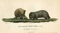
180718812Paris: Imprimerie de Langlois 1807. Very good condition. One of the most attractive prints of wombats a pair of wombats with 4 offspring clambering about. This is plate XXVIII from the work illustrating Nicolas Baudin's expedition. At the time the French were the most progressive at sending teams of artists & scientists around the world with their explorers. Copper engraving with original hand color. Platemark measures 12 1/2 x 9 1/2'' with small margins. A large early representation of the infrequently depicted wombat. Imprimerie de Langlois unknown
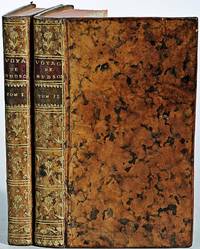
1790E00534 of 6 volumes. Volume 1: i-ix-372 pages with 23 plates including frontispiece plate of Cook and 4 folding maps; Volume II lacking; Volume III: 793-1184 pages with 11 plates including frontispiece of Possession Bay and 5 fold out maps; Volume IV: 1185-1546 pages with 26 plates including frontispiece of Woman Child and Man of Van Diemen's Land and 6 folding maps; Volume V: 1547-1938 pages with 30 plates including frontispiece of A View of Huaheine and 8 folding maps; Volume VI lacking. Octavo 8 1/2" x 5 1/2" bound in original full leather with red labels to spine with gilt lettering. Abridged by George William Anderson. An earlier Large folio edition by Anderson was published earlier. This edition originally issued in 80 weekly parts and also called the Large octavo edition. M K Beddie: 39 First edition of the bound edition.<br /><br />Captain James Cook RN was a British explorer navigator and cartographer ultimately rising to the rank of Captain in the Royal Navy. Cook made detailed maps of Newfoundland prior to making three voyages to the Pacific Ocean during which he achieved the first European contact with the eastern coastline of Australia and the Hawaiian Islands as well as the first recorded circumnavigation of New Zealand. Cook joined the British merchant navy as a teenager and joined the Royal Navy in 1755. He saw action in the Seven Years' War and subsequently surveyed and mapped much of the entrance to the Saint Lawrence River during the siege of Quebec. This helped bring Cook to the attention of the Admiralty and Royal Society. This notice came at a crucial moment both in his personal career and in the direction of British overseas exploration and led to his commission in 1766 as commander of HM Bark Endeavour for the first of three Pacific voyages. Cook charted many areas and recorded several islands and coastlines on European maps for the first time. His achievements can be attributed to a combination of seamanship superior surveying and cartographic skills courage in exploring dangerous locations to confirm the facts for example dipping into the Antarctic Circle repeatedly and exploring around the Great Barrier Reef an ability to lead men in adverse conditions and boldness both with regard to the extent of his explorations and his willingness to exceed the instructions given to him by the Admiralty. Cook was killed in Hawaii in a fight with Hawaiians during his third exploratory voyage in the Pacific in 1779.<br /><br />Condition:<br /><br />Lacks volume II and VI. First signature of volume one loose inner hinges cracked some interior soiling spine ends and corners of leather rubbed some scuffing to leather else a good set. Printed for A Millar, W Law, and R Cater hardcover
1749E0529<p>2 volumes. 182 pages with fold out frontispiece map and three additional folding engravings; 319 pages with seven folding engravings. half-titles in each title pages improperly marked first volume as second and vice versa. Duodecimo 6 1/2" x 3 1/2" bound in original publisher's full uniform contemporary French sponged calf with gilt-tooled spines. First French edition after the 1748 English edition.<br /><br />Henry Ellis was a traveler hydrographer and colonial governor returned from Italy in 1746 just in time to find an expedition to search for a north-west passage on the point of sailing. He appears to have been in easy circumstances; his name stands in the list of subscribers to the north-west expedition and he had sufficient interest to get attached to it nominally as agent for the committee and really as hydrographer surveyor and mineralogist the expedition consisting of two vessels the <em>Dobbs</em> galley of 180 and <em>California</em> of 150 tons left Gravesend on 20 May 1746 joined the Hudson's Bay convoy in Hollesley Bay and finally sailed from Yarmouth on the 31st. They parted from the convoy on 18 June made Resolution Island on 8 July and after a tedious passage through Hudson's Straits rounded Cape Digges on 8 August and on the 11th 'made the land on the west side the Welcome in latitude 64° N.' Bad weather drove them to the southward and prevented their doing anything more that season. They wintered in Hayes River in a creek about three miles above Fort York where a quarrel with the agent of the Hudson's Bay Company gave an unwonted piquancy to the dark and weary days. They suffered much from scurvy the prevalence of which Ellis attributes to their having got two kegs of brandy from Fort York for their Christmas merrymaking and in a minor degree to the 'governor' not permitting the Indians to supply them with fresh provisions. On 29 May 1747 the ice broke up and they were able to warp to the mouth of their creek; on 9 June they got down to Fort York. There they were allowed to get some provisions and stores and on the 24th cleared the river and 'stood to the northward on the discovery'. On 1 July each of the two ships sent away her long-boat but owing apparently to some ill-feeling between the two captains without any prearranged plan for working in concert. The consequence was that they separately went over the same ground discovering naming and examining the several creeks and inlets on the west side of Hudson's Bay the double examination perhaps compensating for the confusion arising from the double naming. Before the season closed in they had satisfied themselves that the only possible exit from Hudson's Bay on the west must be through the Welcome and that very probably there was no way out except that on the east by which they had come in. The result may not seem much; but as it served to put an end to the idea that the passage must lie through Hudson's Bay it was at least so much gain to accurate knowledge. After 21 August the weather broke and they decided in council 'to bear away for England without further delay.' On the 29th they entered Hudson's Straits passed Resolution Island on 9 September and arrived at Yarmouth on 14 Octivwe. Ellis's share in the work of the expedition had really been very slender but the reputation of it has been commonly assigned to him by reason of the narrative which he published the following year under the title <em>A Voyage to Hudson's Bay by the DobbsGalley and California in the years 1746 and 1747 for Discovering a North-West Passage</em> 1748; a work which with many valuable observations on tides on the vagaries of the compass and on the customs of the Eskimos a people then practically unknown mingles a great deal of speculation on the certain existence of the passage on magnetism on fogs on rust and other matters all more or less ingenious but now known to be wildly erroneous. Such as it was the book commended its author to the scientific workers of the day and on 8 February 1748-9 he was elected a fellow of the Royal Society. Possibly in acknowledgment of his scientific labors but more probably by some family interest he was afterwards appointed successively governor of Georgia and of Nova Scotia from which employment he retired about 1770. He seems to have spent his later years as a wanderer on the continent was at Marseilles in 1775 and died at Naples on 21 January 1806.<br /><br /><strong>Condition:</strong><br /><br />Some dark spots to spine else a very good copy.</p> Ballard Fils hardcover
185514056London: Smith Elder & Co. 1855. Book. Poor / Fair. Hardcover. First Printing of the First Edition. Volume 1has a broken and separating binding wear and bumping to extremities and a little foxing throughout. Complete with Folding map and lithographed frontis. Vol. 2 has worn extremities cracked front hinge still attached prev. owner name on back of frontis and some light scattered foxing throughout. Original embossed boards could easily be re-cased. Scarce. Smith, Elder & Co. Hardcover
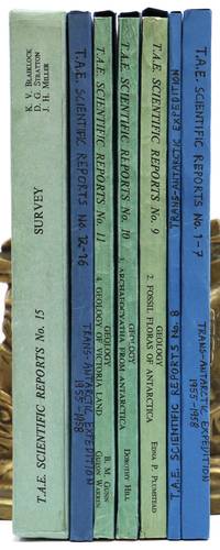
1960144913London: The Trans-Antarctic Expedition Committee 1960-1. Large quarto. 14 volumes. Original printed wrappers string-bound. Edges of wrappers slightly sunned. Fifteenth part comprises 15 folding maps and the written report housed in a slipcase. Front board of slipcase bowed-in with a few creases to the spine. All volumes complete tightly-bound and clean internally. Most parts in modern blue card slip cases. A beautiful set. Spence 1213. The complete scientific reports from the Commonwealth Trans-Antarctic Expedition 1955-1958 lead by Dr. Vivian Fuchs who was knighted for his efforts and Sir Edmund Hillary. The TAE was the first complete overland crossing of Antarctica and the third expedition ever to reach the South Pole overland after Amundsen in 1911 and Scott in 1912. The expedition conducted a variety of oceanographic glacial geological meteorological and biological sampling the results of which are presented here and illustrated by hundreds of figures from photographs folding maps and tables. Although the reports were issued in 15 parts #6 was never printed. Uncommon to find this set complete and in fine condition. 1960 The Trans-Antarctic Expedition Committee unknown
186454080Berlin Decker 1864-73. Lex8vo. 3 contemp. hcalf. Gilt spines and with gilt lettering. Spines slightly rubbed. XXII4352;VI4375;XI4426 pp. 24 engraved plates and 3 folded maps. Faint brownspots to margins in volume 1. <br/><br/><em>First edition. The offered volumes contains the general description of the expedition which relates to Japan and China. They do not comprise the scientific parts zoology botany of the expedition and not the landscape plates published as "Ansichten aus Japan China und Siam". </em> unknown
186153686Wien Kaiserlich-königl. Hof-und Staatsdruckerei 1861-62. Small 4to. Bound in 3 orig. full pictorial cloth. Vol. 1 rebacked preserving orig. spine. Vol.2 with a tear in backhinge. Vol. 3 a bit loose first inner hinge weak. Small stamp on title-pages. Lithographed tinted frontispiece. X368;VI434;IX436 pp. Each vol. with Beilagen 42207 music etc. 34 lithographed folded maps in colour 42 plates mostly tinted woodcuts profusely textillustrated with woodcuts. Internally clean and fine. <br/><br/><em>First edition. - Sabin 77625. </em> hardcover
1716BB0841Paris: chez Jean-Geoffroy Nyon quay de Conti au coin de la rue Guenegaud au Nom de Jesus Etienne Ganeau rue Saint Jacques aux Armes de Dombes vis-à-vis la Fontaine de S. Severin Jacque Quillau imprimeur-juré-libraire rue Galande aux Armes de l'Université 1716. First Edition. A defective first edition missing one map and one plate of this classic in the literature of Pacific voyages of exploration. 4to: xiv2982pp with 35 of 37 maps plans and plates 18 of which are folding; ornamental engraved vignettes and woodcut musical notation in the text never bound in were the map of Détroit de le Maire no. v and the plate of Indiens en habits simples no. ix; plate xvi was bound in twice. Contemporary calf spine richly gilt in six compartments brown leather lettering piece gilt "Caissotti" in gilt script on upper board all edges stained red marbled end papers red silk page marker. An exceptional wide-margined copy text maps and plates fresh and clean marred only by a stain in the gutter of first three leaves. Provenance: copper-engraved bookplate "Il Cittadino / Carlo Giac. Caissotti." Sabin 25924. Borba de Moraes 328. Hill p. 115. Leclerc 1736. Palau 94964. Gibson's Library p. 128. Item #BB0841. Frézier set sail in 1712 with a French commission to assess the strength of Spanish settlements on the Pacific coast and to revise existing charts. According to Hill he "brought back information of considerable geographical and scientific value" to later navigators and his account is today appreciated for its keen observations of the customs commerce and natural history—including the cotton and strawberry plants—of Chile Peru and Tierra del Fuego. It's interesting to note that Frezier's surname was itself derived from fraise the French for strawberry. The chapters on Indian and Creole life include descriptions of costume and architecture as well as musical instruments. The folding plans of cities visited are often enhanced by panoramic views as in the case of Callao Concepción Valparaíso La Serena Salvador de Bahía and Angra Azores. Amongst the most important plates are the general map of the expedition the Strait of Lemaire Valdivia Bahía de an Vicente Santiago de Chile Lima and Bahía de Todos los Santos. An immediate success the work was soon translated into English and German and republished several times in the eighteenth century. N. B. With few exceptions always identified we only stock books in exceptional condition with dust jackets carefully preserved in archival removable mylar sleeves. All orders are packaged with care and posted promptly. Satisfaction guaranteed. Fine Editions Ltd is a member of the Independent Online Booksellers Association and we subscribe to its codes of ethics. chez Jean-Geoffroy Nyon, quay de Conti, au coin de la rue Guenegaud, au Nom de Jesus, Etienne Ganeau, rue Saint Jacques, aux Arm unknown
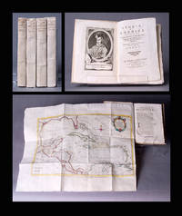
1783BB0692In Venezia Venice: Nella stamperia Gatti a spese di Leonardo e Giammaria Fratelli Bassaglia 1783. Original Wraps. Fine. Second Venice Edition of Antonio Pillori's translation of Robertson's standard work on the discovery of America and the conquest of Mexico and Peru. Demy 8vo 202 x 136mm: xxiv240pp with frontispiece portrait of Columbus and large folding map of Gulf of Mexico showing Florida Cuba Jamaica and farther Caribbean islands; 25-328pp with frontispiece portrait of Bartolomé de las Casas and folding map of South America; 23-359 p. 181 misnumbered "281"; p. 304 "204"1pp with frontispiece portrait of Cortés and folding map of Mexico; 42951pp with frontispiece portrait of Pizarro and large folding map of Middle America. Original paper-case bindings with yapped edges manuscript titles and volume numbers to spines text block sewn on tawed tongs vol. iv with modern replacements. Worming to upper cover portrait title page and map margins of vol. iv now expertly restored by a paper conservationist. A remarkably fresh wide-margined set in original paper-case bindings complete in four volumes eight books as issued with all four folding maps colored in outline by a contemporary hand as the John Carter Brown Library copy. Borba de Moraes p. 740-41 first edition. Sabin 71997 noting the Venice editions of 1778 and 1802 only. Originally published in two volumes in 1777 by Strahan and Cadell in London and Balfour in Edinburgh "to a very positive reception" ODNB; first Venice edition published in 1778. "Its success" according to the ODNB "was even more marked on the continent where it was considered Robertson's masterpiece . . . With its dramatic sweep of narrative combined with a provocative confrontation of two very different stages of civilization Spanish and Native American and a prose that was more flexible and evocative than that of his earlier books the History of America is often regarded as Robertson's most interesting original and even Romantic work. However it also shows the Eurocentric limits of his stadial thinking because it presents an unsympathetic account of Native Americans and glosses over Spanish atrocities." Borba de Moraes credits Roberston with writing the "first history of the discovery and Spanish conquest of America based on ample bibliographical information and documents in the Simancas archives. . . . The bibliography at the end of the second volume is remarkable for the time." Franklin D. Roosevelt owned the first Venice edition. N. B. With few exceptions always identified we only stock books in exceptional condition carefully preserved in archival removable mylar sleeves. All orders are packaged with care and posted promptly. Satisfaction guaranteed. Fine Editions Ltd is a member of the Independent Online Booksellers Association and we subscribe to its codes of ethics. Nella stamperia Gatti a spese di Leonardo e Giammaria Fratelli Bassaglia unknown