4 751 résultats
Folio (212 x 333 mm). Publisher's original blue printed boards, black cloth spine hand-lettered. Appendices to the annual "Administration Report" on the Gulf region which the British Political Residents submitted to the Indian Viceroy and Governor. The bland official title belies the true value of the series, which has been called "a mine of information on the development of the modern Gulf" (Cambridge Archive Editions). Regularly the reports contain political details of the local sheikhdoms as well as trade information. - The present appendix volume contains the meteorological tables for the year 1896/97 as well as, crucially, the year's trade reports for the entire Gulf region. The issue notes widespread lower trade revenues, which it diagnoses as due to an Indian plague and subsequent quarantines of port cities, as well as ongoing political unrest in Qajar Iran following the assassination of the Shah, Naser al-Din Shah Qajar, the previous year. The volume provides carefully detailed charts of imports and exports for Bushire, Lingah, Bunder Abbas, Bahrain, the Arab Coast of the Gulf, and Shiraz. Though most exports dropped, the value of Bahrain's in fact had gone up since the previous year, with its most valuable exports being coffee, rice, and printed cottons to Turkey and the especially valuable export of pearls to India. On the Arabian Gulf Coast, principal exports were, again, pearls, though these were largely bound to "Persian ports". Those on the Arab Coast also benefitted from the mother o' pearl shell trade, one of the least impacted by the upheavals of India and Qajar Iran. - The "Administration Report on the Persian Gulf" was published under various titles annually between 1875 and 1957. Original specimens are almost unobtainable in the trade. - Provenance: removed from the London Library, with their printed label on the upper cover and their stamps (in blind and printed) on title-page and final leaf, accompanied by cancel stamps. Macro, p. xii (s.v. "RAPA": Report on the Administration of the Persian Gulf Political Residency and Muscat Political Agency). OCLC 224558510. ZDB-ID 768652-3. Cf. the 1989 Cambridge Archive Editions reprint.
Standard issue, 700 x 1024 mm. Scale 1:50,000. Detailed nautical chart of the approaches to Mina Salman, the primary cargo port and customs point of Bahrain, prepared by the British Admiralty. Undoubtedly one of the better antiquarian maps of northern Bahrain. - The chart details the approaches to Mina Salman as well as the Sitra anchorage. Approach channels to Mina Salman were built in 1954, and a pier was constructed in 1956, mainly used by dhows. In 1958 it became a free port, and in 1962 a deep water wharf composed of six berths was constructed. The wharf allowed cargo to be directly loaded onto the port for the first time. In the 1960s, the port had refrigeration, storage facilities and equipment for handling large ships. - The map includes the cities of Muharraq and Manama, showing numerous minarets. Bahrain Fort, the Portuguese Fort, Abu Mahur Fort, and the Sheikh's palace are labelled. Another prominent site is Muharraq Airfield, a military base established by the Royal Air Force in April 1943 as RAF Bahrain (later RAF Muharraq) that remained in use until 1971, when Bahrain declared independence. - The British Admiralty has produced nautical charts since 1795 under the auspices of the United Kingdom Hydrographic Office (HO). Its main task was to provide the Royal Navy with navigational products and service, but since 1821 it has also sold charts to the public. The present chart was composed after Admiralty surveys from 1932 to 1960. The 1951 first edition saw revisions and corrections in 1962-65. - Very well preserved with a single fold. Provenance: stamps of Maria K. Iatrou, seller of nautical charts, books and instruments in Piraeus, Greece.
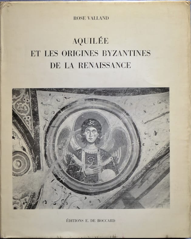
566888Paris, E. De Boccard, 1963. In-4, rel. d'éditeur pleine toile bordeaux sous jaquette illustrée en noir, 86 pp., 33 pl. en noir, bibliogr., index.
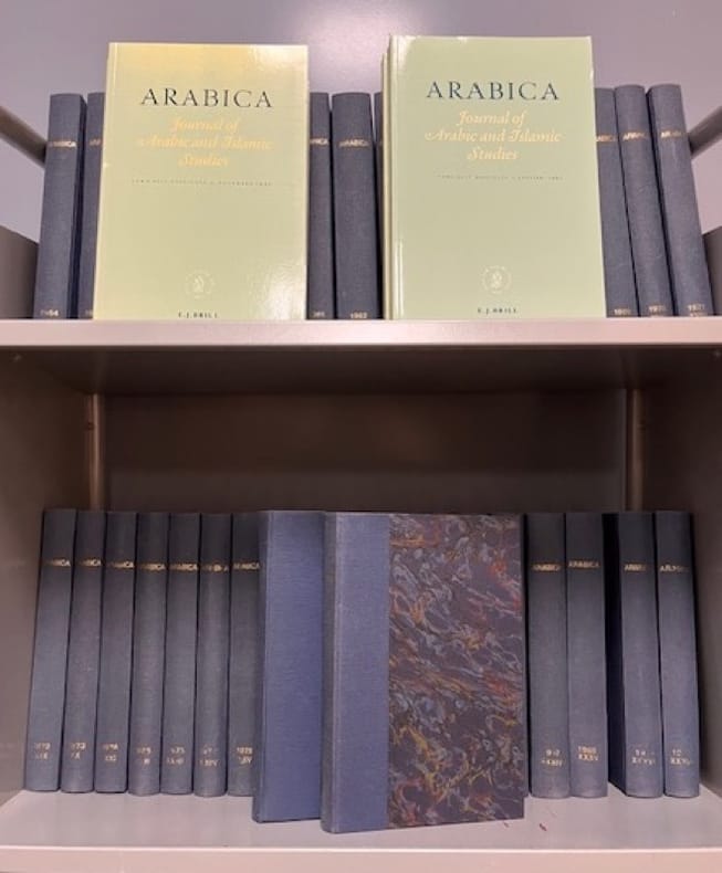
601657Leiden, Brill, 1954-1997. Rare tête de série, complète des tomes I à 43. Soit 39 volumes in-8 reliés demi-toile marine avec titre et date dorés au dos + 12 fascicules brochés (T. 40 à 43). Nous joignons les fasc. 1 & 2 du T. 44 (1997).
16622,Lausanne, La Guilde du Livre 1961, 139 pp., 1 vol. in 4 relié cartonnage éditeur illustré, nombreuses illustrations hors-texte.
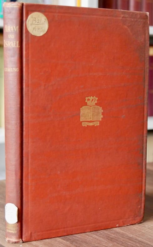
557341New-York, Columbia Univ. Press, 1918. In-8, brown buckram binding, gold gilt on the first cover plate (book with a crown), library label at spine foot, XVI-155pp, 3 maps in frontispiece, first edition. index of the bible passages, index of geographical names, general index.
8vo., First Edition; black cloth, gilt back, a near fine copy in unclipped dustwrapper.
388 x 470 mm. Framed and glazed. Needlepoint picture after Théodore Géricault.
Very Good Paperback. Clean copy. xiv + 272p
4to. X, 188 pp. Publisher's cloth. Dustjacket. Traces Arab awareness of the West, which began in embryonic form when the French forces under Napoleon occupied Egypt in 1798. Examines the works of Arab writers who helped to formulate a new image of the West and to shape Arab response to the challenge raised by cultural contact between disparate worlds. Treats developments up to 1870. - Excellent copy in very good price-clipped dustjacket.
Half-tone photographic postcard. A beautiful image of sail-makers labouring over a large sheet of sailcloth, stretched out before a picturesque backdrop of beach, dhows and ocean. The Times Press, alongside the main business of printing newspapers, issued a number of postcards of Western India and Mesopotamia in the first decades of the 20th century. The present postcard is one of the few illustrated with photographs of Kuwait. - Very light rounding to corners, otherwise very good.
8vo. X, 273, (1 blank) pp. With two black and white maps on the endpapers. Brown cloth with publisher's illustrated dust jacket. First and only edition of a thorough description of the history of the nine Arab states of the Lower Gulf, that gained independence in 1971, just four years before the publication of this book. The author has managed to discuss the individual politics of each state and that of the bigger picture, making this a handbook for all who wish to learn more about Bahrain, Qatar and the United Arab Emirates (Ajman, Dubai, Fujairah, Ras Al Khaimah, Sharjah and Umm Al Quwain). The several infographics that are used to explain the political structures are very helpful in this respect. Oil plays a key role in the relationship between the individual states and this is intricately laid out by the American author. Because this book was written in such a key moment in the history of the region, it has gained much importance. The author Dr. John Duke Anthony is a leading figure in United States-Arab relations and has held many influential government positions in this field. Amongst others, he is the founder and president of the National Council on U.S.-Arab Relations and he is part of the United States Department of State Advisory Committee on International Economic Policy's Subcommittee on Sanctions. He holds a Ph.D. in International Relations and Middle East Studies at the School of Advanced International Studies. In the years leading up to this publication the author has conducted first-hand research on the Lower Gulf region's political and socio-economic structures, obviously with oil playing a major role. The fruits of this research are presented in this book, offering the reader a comprehensive overview of a complex subject. This book was published in The James Terry Duce Memorial Series, which started in 1966. The first and second volumes were on North Africa and Jerusalem respectively, this is the final volume of the series. - Ink annotations in the margins throughout. A good copy with the original dustjacket well preserved. OCLC 1700964.
Folio (212 x 335 mm). (2), 276, IX, (1) pp., final blank, with one folding plate (counted as p. 152). Contemporary half cloth with original printed boards, issued thus. Gertrude Bell's personal copy of this excessively rare manual on the social, political and economic structures of the Arab tribes living in the Baghdad Vilayet (Province) as drawn up in July 1918, only months before the partitioning of the Ottoman Empire ended the old administrative divisions and led to the formation of several new states - indeed, to the creation of the modern Arab world. - Arranged alphabetically by the names of the tribes, this handbook - essentially a carefully compiled and redacted British intelligence file printed for the use of British Political Officers and their assistants in a region then undergoing dramatic upheavals - offers surprisingly detailed information on the tribes' origins, loyalties and internal quarrels, the locations of their settlements, strength of their possessions, economic and bargaining power, as well as their kinships, often including genealogical tables. The names of the tribes' leaders are given in full, frequently also in the original Arabic. - Gertrude Bell (1868-1926), who had firsthand experience among the tribes, signed her name in pencil ("Gertrude Lowthian Bell") on the front free endpaper. Several neatly pencilled additions to some of the entries are likewise in her hand: next to the name Fahad ibn Hadhdal she notes that he died and the name of a "rival" (this underlined), apparently a "bin Dughaiyin" (p. 16). In another entry she notes that Jazza' ibn Mijlad "blockaded Turks in North for allies in 1st war" (p. 17) and that the A'marat prefer to winter near al-Hafan. There are several references to her fellow political officer, St John Philby, and a correction that the Al-Dulaim are "all Sunnis" (p. 265), and none Shi'ahs. - Gertrude Bell was a traveller, political actor, and archaeologist who was a key player in the nation-building after World War I, especially in Iraq. She founded the Iraq Museum, translated Persian poetry, and advised the British government's foreign policy at nearly the highest level. It is little surprise that she would have owned one of the few copies of this important source, containing otherwise nearly unobtainable population statistics as well as details on the political history of a region in which traditional tribal feuds became mingled with international high politics. Considering the limited scope of intended distribution and the sensitive nature of the information contained, it is safe to say that this invaluable compendium never had more than a very limited press-run; indeed; only three copies are known today in libraries worldwide, and none with such unique provenance. - Covers rubbed, title-page brittle and reinforced with two library stamps carefully removed but still faintly visible. A closed tear to the folding map. Later in the collection of the American missionary turned political biographer Harry J. Almond (1918-2007), with his handwritten ownership in ink next to Bell's own. In all very well preserved. No copy in auction records. OCLC: 921927074, 729268761.
42 x 100 cm. Five-tone lithographic map with illustration by Harraz. Constant ratio linear horizontal scale 1:7,500,000. Road map also showing railways, populated places, boundaries, rivers, wadis, and possible flood areas. Includes inset map: Diagrammatic map of the Arab world. Folded. First edition of this large, decorative map, showing the highways that linked countries under Arabian influence in the early 1970s. It stretches as far north as Turkey, south to the Sudan, west to Mauritana and east beyond the Strait of Hormuz, capturing the whole of the Arabian Gulf including Kuwait, Bahrain, Muscat, Oman, Saudi Arabia and the People's Republic of Southern Yemen. The verso contains an index of main travel routes through these various countries. - The United Arab Republic, as it is here referred to, was formed through a political union of Egypt and Syria. It was instigated by the Egyptian Prime Minister Gamal Abdel Nasser (1918-1970) and was seen as an expression of pan-Arab sentiment. Syria broke aways from the union in 1961 (and is here shown as an independent country), but Egypt continued to use the name until 1972. The People's Republic of Yemen, the only communist state to be established in the Arab world, was formed in late 1967, to last until 1990. - Some nicks and small tears, a single mark to the covers, a 1 cm tear on the left side of the map. In very good condition for a fragile map. Scarce: LibraryHub does not locate any holdings whilst Worldcat adds just eight institutional copies worldwide. OCLC 5403988.
189944243New York: MatbaÕat Jaridat al-Ayyam 1899 . Hardcover. Very good/No jacket issued. New York: MatbaÕat Jaridat al-Ayyam 1899 . A number of b/w plates mostly portraits of world leaders and rulers. 308 pp. Text in Arabic. Hardcover. 4to. Dark blue cloth. The text of this book is in Arabic only the dedication to President William McKinley is in English. The overall theme of the work is the Lebanese Diaspora but a large part of the book consists of short biographical pieces on world leaders and rulers including Queen Victoria and other rulers of Europe Sultan Abdul Hamid of Turkey Abbas Pasha of Egypt Muzaffar ad-Din of Persia and Melelik of Ethiopia. Other biographical sketches include the reform politicians of the Ottoman Empire Lebanese and Syrian politicians and intellectuals and the patriarchs of the Eastern Christian churches. Also included is a short preview of the Paris Exhibition of 1900. Because of the cheap paper used both free endpapers are separated at the hinge otherwise the book is tight and clean. Nonetheless the textblock paper is extremely brittle and therefore fragile. Very good/No jacket issued. Insurance required to ship this item. MatbaÕat Jaridat al-Ayyam hardcover books
Fine English Paperback. Pbo. Roy. 8vo. (24 x 17 cm). In French. 349, [2] p., 1 folding map. Arabes de langue, juifs de religion: L'evolution du judaisme sicilien dans l'environnement latin, XIIe-XVe siecles.
16°, pp.270 (16), br. ed. Dall'indice: La guerra del 5 giugno; Il risvegliodegli arabi; Nascita di una nazione; Il regime mandatario; Islamismo, arabismo, socialismo; Ammaina bandiera; Prima che domani diventi ieri; La questione dei luoghi santi.
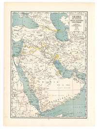
1936L6CG5IA5ETO8Chicago: Geographical publishing company 1936. Colour printed map 54 x 40 cm. Map of the Arabian Peninsula and parts of the USSR Turkey Iran and the British French and Italian colonies in Africa possibly coming from an edition of the Commercial atlas of the world. Printed in yellow are oil fields and pipelines including the legendary Kirkuk-Haifa/Tripoli oil pipeline. Detailed maps of Iran and of British controlled Palestine are printed on the other side.With a few small holes near the inner margin. Geographical publishing company, unknown
Colour printed map, 540 x 400 mm. Map of the Arabian Peninsula and parts of the USSR, Turkey, Iran and the British, French and Italian colonies in Africa, possibly coming form an edition of the "Commercial atlas of the world". Printed in yellow are oil fields and pipelines, including the legendary Kirkuk-Haifa/Tripoli oil pipeline. Detailed maps of Iran and of British controlled Palestine are printed on the other side. - With a few small holes near the inner margin.
Large folding heliozincographed colour map, 2 (of 4) sheets, each measuring 940 x 700 mm (lacking the eastern sections). Both sections with original printed covers. Two sections of Hunter's large and extremely detailed map of the Arabian Peninsula and Gulf, showing the Red Sea coast of Saudi Arabia with the 'Asir, Hejaz and Nejd regions, as well as most of Yemen, with Kuwait and Southern Iraq. The two eastern sections, which covered Oman, the UAE, Qatar, Bahrain and part of eastern Saudi Arabia, are not present. - The Canadian-born Hunter later became a major figure in British India's Intelligence Service. He initially compiled the map between 1905 and 1908, to accompany J. G. Lorimer's "Gazetteer of the Persian Gulf". As the author recalls in his 1919 "Reminiscences", "a great deal of the information on the map was from sources considered secret at the time" (p. 357). Special surveys of the country's interior areas were carried out to achieve a hitherto unprecedented degree of accuracy: "The map was a distinct advance on anything which existed, as in 1908 no general map of Arabia on such a large scale existed" (p. 360). The "Hunter" map was used (and praised) by St John Philby during his journey across Arabia. - Such was the detail of Hunter's map that the Survey of India reissued it, with corrections, several times during the First World War and interwar period. As the maps were issued in parts and used on active service it is not unusual for sections to be missing. Many of the surviving copies show signs of official use; this issue bears a flight route, sketched out in red ink, along the southern Gulf coast to Baghdad. - Some light browning, several small tears to folds, otherwise very good. - Scarce. OCLC locates complete copies at the Library of Congress, University of Wisconsin, National Library of Israel and the BNF. Cf. Macro 1228.
Large folding heliozincographed colour map, 1 sheet (of 4), measuring 940 x 700 mm. Original printed covers. Separate section of Hunter's large and extremely detailed map of the Arabian Peninsula and Gulf, showing southern Oman with the eastern tip of Yemen. - The Canadian-born Hunter later became a major figure in British India's Intelligence Service. He initially compiled the map between 1905 and 1908, to accompany J. G. Lorimer's "Gazetteer of the Persian Gulf". As the author recalls in his 1919 "Reminiscences", "a great deal of the information on the map was from sources considered secret at the time" (p. 357). Special surveys of the country's interior areas were carried out to achieve a hitherto unprecedented degree of accuracy: "The map was a distinct advance on anything which existed, as in 1908 no general map of Arabia on such a large scale existed" (p. 360). The "Hunter" map was used (and praised) by St John Philby during his journey across Arabia. - Such was the detail of Hunter's map that the Survey of India reissued it, with corrections, several times during the First World War and interwar period. As the maps were issued in parts and used on active service it is not unusual for sections to be missing. Many of the surviving copies show signs of official use; this issue bears a flight route, sketched out in red ink, from Ghaidhah (Al Ghaydah) in southeast Yemen toward Muscat. - Some light browning, several small tears to folds, otherwise very good. Ownership inscription in red ink to cover, "H. R. Tidd. F/O", by Flight Officer Herbert Richard Tidd (1912-42), proving that the maps were still issued to RAF personnel in the early 1930s. - Scarce. OCLC locates complete copies at the Library of Congress, University of Wisconsin, National Library of Israel and the BNF. Cf. Macro 1228.
230:325 mm. Engraved map. "A blown-up copy of the map designed by Gastaldi in 1548" (Al Ankary). The Gastaldi map "was the first modern map of the Arabian peninsula"; for the first time it "clearly shows the island of Bahrain and Qatar" (ibid.). Al Ankary 136.Tibbetts 27. Cf. Sultan Bin Muhammad Al-Qasimi 19 (the small version only).
190 x 260 mm. Ruscelli's modern map of Arabia from his 'La Geographi di Claudio Tolomeo'. A feature of this first state is that no map has a platemark at top: two maps were engraved on the same plate and the resulting sheet halved. Tibbetts 27.
8vo. XXIX, (3), 397, (1) pp. With 2 maps, 74 photo illustrations on plates, and 7 text illustrations. Publisher's gilt red cloth with dustjacket. First American edition, published simultaneously with the London one. The preface was contributed by T. E. Lawrence. Among the many photograph illustrations is one of the earliest portraits of the Qatar royal family (facing p. 298). "In this book, Bertram Thomas relates some aspects of his journey in which he crossed the Rub' Al Khali (Empty Quarter) from Oman to Qatar, and provides geographical information about the peninsula of Qatar, especially the southern part. He also recorded his observations of the region stretching from the Gulf of Salwa to Al-Rayyan, where he met Sheikh Abdullah bin Jassim Al Thani, Emir of Qatar at the time (1930). The book includes photographs he took of Sheikh Abdullah, Mohamed bin Abdul-Latif bin Mani', and his brother Saleh bin Abdul-Latif bin Mani'. He gives some concise information about Al-Nuaija, Doha towers, and the castle" (Fikri). - Inscribed "to Crosby" by "the Shorts" (12 March 1933) on the flyleaf. A fine copy. Macro 2185. M. H. Fikri, Qatar in the Heart and in History (2011), p. 46f. (illustrated).
8vo. XXIX, (3), 397, (1) pp. With 3 maps (one a large folding map of the Empty Quarter at the end of the volume), 74 photo illustrations on plates, and 7 text illustrations. Publisher's brown cloth with title in gilt to spine. First edition, published simultaneously with the New York one. The preface was contributed by T. E. Lawrence. Among the many photograph illustrations is one of the earliest portraits of the Qatar royal family (facing p. 298). "In this book, Bertram Thomas relates some aspects of his journey in which he crossed the Rub' Al Khali (Empty Quarter) from Oman to Qatar, and provides geographical information about the peninsula of Qatar, especially the southern part. He also recorded his observations of the region stretching from the Gulf of Salwa to Al-Rayyan, where he met Sheikh Abdullah bin Jassim Al Thani, Emir of Qatar at the time (1930). The book includes photographs he took of Sheikh Abdullah, Mohamed bin Abdul-Latif bin Mani', and his brother Saleh bin Abdul-Latif bin Mani'. He gives some concise information about Al-Nuaija, Doha towers, and the castle" (Fikri). - Provenance: armorial bookplate of Arthur Garrard to front pastedown. Later in the collection of the Dutch traveller Ruud Verkerk. Macro 2185. M. H. Fikri, Qatar in the Heart and in History (2011), p. 46f. (illustrated).