COLITTO Tarco -MareMagnum

4 751 résultats
Subiaco, 1927, 8vo br. pp. 194. Intonso.
4to (170 x 227 mm). Arabic manuscript on polished paper. 42 written pp., 19-24 lines, per extensum, black and occasional red ink with red underlinings. With several astronomical diagrams in the text. Modern brown cloth binding with the original 18th century blindstamped leather covers pasted on the boards. An Arabic astronomical manuscript on quadrants in three parts, comprising: 1. Muhammad ibn al-Sheikh al-Hamid, Risalat al-kura (dhat al-kursi). - 2. Sabat Al-Mardini, Risalat mukhtasirat fi aleamal bialrabe alshamalii almaqtue (A brief treatise on the work in the northern quadrant). - 3. Sabat Al-Mardini, Risalat fi aleamal bialrabe almajib al-risalat al-fathiat fi al'aemal al-jibia (A treatise on work in the responding quadrant). All parts include detailed astronomical tables and diagrams in ink. - Well preserved manuscript in a professionally restored modern binding.
Small folio (205 x 282 mm). Turkish manuscript on paper. 113 pp., per extensum, with half-page illustrated headpiece and numerous tables. Black and occasional red ink on paper, text ruled in red and green ink throughout. Contemporary black half calf over cloth boards. Decorated paper pastedowns. A "brief account of knowledge of some constants" by Hussein bin Ibrahim Al-Kitbi Al-Falak, written in accurate penmanship and containing numerous astronomical tables in black and red ink. - Paper a little browned and brownstained. Bookplate on front flyleaf with printed portrait, dated 1342.
4to (154 x 194 mm). Arabic manuscript on paper. 120 pp. Black and red ink, 25 lines, per extensum, with several pen-and-ink diagrams in the text, some full-page. Bound in 19th century full leather with blindstamped borders and ornaments. Two works in a single manuscript by a single scribe: one a book on astronomy by Ahmad bin Abdullah bin Yaqoub al-Samlali (d. 1093 H), the other a commentary on Al-Senussi the younger. The astronomical work, extensively illustrated with detailed diagrams, also contains horoscopes and information on the best times of the year for cultivating the soil. - Binding rubbed; extremeties bumped, chipped and frayed; some traces of worming to upper cover; old repairs to spine. Paper browned and brittle; some brownstaining and occasional worming (mainly confined to margins), a few paper repairs in the margins.
1020 x 710 mm. Scale 1:500,000. In good condition.
556103Ankara, Turk Tarih Kurumu Basimevi, 1982. In-8, broché, XV-480 pp., 2 portraits photogr. en noir, texte anglais (Turk Tarih Kurumu Yayinlari, XVI. Dizi - Sa. 39I). Second printing.
Very Good English Ataturk Universitesi ilahiyat fakultesi dergisi No. 5, Ataturk Universitesi basimevi, Erzurum, 1982. Paperback. Pbo. Very good. Roy. 8vo. (24 x 17 cm). 257 p. + 1 folding plan. In Turkish. Articles: Islam hukuku acisindan sehircilik ve aile meskeni problemi =[Urbanism and family residence problem for Islamic law.], Ali Safak. Kelami acidan fiat artis ve dususleri =[Increases and decreases in prices for Kalam.], Serafeddin Golcuk. Hz. Peygamberin sunnetinde yeme ve icme adabi =[Manners of eating and drinking in The Prophet's circumcision.], Sadik Cihan. Sia'nin Kur'an-i Kerim ve tefsiri hakkindaki gorusleri =[Shia's (shiism) opinions about Kur'an-i Kerim's commentary.], Sakib Yildiz. Din ve toplumsal farklilasma =[Religion and the social differentiation.], Unver Gunay. Din psikolojisinin arastirma alanlari =[Research areas of the religional psychology.], Kerim Yavuz. Turk edebiyatinda dini cocuk siirleri ve terbiye bakimindan degeri =[Religional poems in the Turkish literature and their educational values.], Onder Gocgun. Ramazanogullari mimari eserlerinden Adana Ulu Camii =[Adana Ulu mosque as a Ramadanogullari's architectural work.], Nusret Cam. Ka'b. B. Zubeyr ve Kaside-i Burde'si uzerine notlar I =[Notes on Ka'b. B. Zubeyr and his Kaside-i Buride I.], Suleyman Tulucu. Imla usulu ve es-Sem'ani'nin 'Edebu'l-imla ve-l'istimla''i, Abdullah Aydinli. Nefs kelimesinin Kur'an'da kullanilisi hakkinda bazi notlar =[Some notes about usage of 'nefs' word in Kur'an.], Sadik Kilic. Seyhulislamlik makami =[Sheikhulislam authority.], Ekrem Sarikcioglu, Kindi'de ilimlerin siniflandirilmasi I =[Classification of sciences in Kindi I.], Emrullah Yuksel. Merhum prof. M. Tayyib Okic'in eserleri uzerine =[On the works of the late professor M. Tayyib Okic.], Suleyman Tulucu.
Very Good English Ataturk Universitesi ilahiyat fakultesi dergisi No. 7, Aksiseda matbaasi, Istanbul, 1986. Paperback. Pbo. Very good. Roy. 8vo. (24 x 17 cm). 536 p. In Turkish. Articles: Mecusi Dinin'nde Mehdi inanci, E. Saikcioglu. Kur'an'da hicret, S. Golcuk. L'hegire du point de Vue de l'enseignement, de' l'education, et de la tactique politique, I. Canan. Ayet ve sureler arasindaki munasebet, S. Yildik. Hazreti Muhammed'in getirdigi ahlakin cihansumullugu, E. Yuksel. Kur'an-i Kerim'de hidayet ve dalalet anlayisi, E. Yuksel. Iktisadi ahlak ve din, U. Gunay. Dini inancin gelismesinde nativizm ve tecrubecilik problemi, K. Yavuz. Bursa'da Sehzade Ahmet turbesi, H. Onkal. Ihvanu's-Safa'ya gore ilimlerin siniflandirilmasi, E. Yuksel. Din psikolojisinde metod meselesi ve yeni gelismeler, K. Yavuz. Ebu Hayyan el-Endelusu ve tefsirindeki metodu, H. A. Celik. Kur'an-i Kerim'e gore inkar ve inkar amilleri, V. Uluturk. Genclik, sevgi, terbiye ve olgun insan, H. Varol. Islam hukukunda hidane, M. Baktir. Malazgirt Savasi'na istirak eden Turk beyleri ve hal tercumeleri, S. Tulucu. Seyh Muhammed Nazmi ve bazi tasavvufi gorusleri, O. Turer. Islam'da ruh tasavvuru, I. Yoruk. Ebu Hilal el-Askeri, dort eseri Arap edebiyatinda darb-i meseleler ve onemi, H. Varol. Nisapurlu Sagir Muhaddis, S. C¿han. Aynalarin oyunlari ve medeniyetlerin krizleri 'Islami/Islamoloji munasebetinin reoriyantasyonlar'!, U. Gunay. Islamin Senegel'de tekamulu, S. Cihan. Islamiyet uzerine bir din sosyolojisinin epistemolojik onculeri, U. Gunay. Islam'da asli gunah kavrami var midir?, S. Kilic. Abbasi idaresi altindaki islam toplumunda serfler, S. Tulucu.
Very Good English Paperback. Pbo. Roy. 8vo. (24 x 17 cm). In Turkish. 365-394 pp. Atebetü'l-Ketebe'ye göre Sancar Imparatorlugunun yönetimi. [Separatum]. Translated by N. Kaymaz.
2010193251Perrin Perrin, 2010. In-8 relié à l'italienne, en plein cartonnage éditeur illustré, de 175 pages. Cartes en et hors-texte. Bon état
4to (174 x 260 mm). 16 pp. Includes 34 (of 70) loose albumen photographs, images approximately 130 x 100 mm each, mounted separately and numbered, housed in a modern album. Text volume in original paper wrappers. Rare anthropological publication, with original photographic documentation, of the inhabitants of the Fergana region in the extreme east of Uzbekistan, near Kyrgyzstan and Tajikistan. - Born in Transylvania, Károly Jenö (Charles Eugene) Ujfalvy de Mezokövesd (1842-1904) was a noted Austro-Hungarian ethographic researcher and linguist of Central Asia and the Himalayas. He settled in France, where he was trained by the noted anthropologist Paul Broca, and taught Asian history and geography at the School of Oriental Languages. The Ministry of Education sent him on a mission to Russia, Siberia, Turkestan and Uzbekistan in 1876, on which journeys he recorded these images of locals in the region. (Ujfalvy would also travel to Samarkand and Bokhara and lead an expedition to the Kashmir in 1880.) This is the fourth of a total of six volumes concerning the French expedition to Central Asia. In his preface, Ujfalvy develops the aims of his enterprise and outlines the principles by which one may obtain anthropologically useful portraits: subjects are to be photographed in the nude, from the front and in profile, against a white background and using a light metre. The individuals, whose portraits measure exactly one-eighth of their natural size, are identified by name, race, sex, height, and age, as well as by the colour of the skin, the hair, and the eyes. The photographs were realised with the aid of one photographer "Kazlowski, le plus habile de Tachkend"; the present album likely constitutes his only published work. - Text volume chipped at edges with some repairs, otherwise good; photos well preserved. OCLC 698467635.
1995AH-1Ministry of Information: Atlas Est. State of Kuwait 1995. Contains descriptive and cartographic sections on War Crimes brief statistics of the invasion maps of mass destruction maps of different areas of Kuwait. Outlines the locality where war crimes were committed during Aug.21990 and Feb.261991. Text in English French and Arabic. Dustjacket in mylar. Minimal shelfwear. NOTE: Heavy Item. First Edition. Hard Cover. Very Good/Very Good. Folio - over 12" - 15" tall. Atlas Est. State of Kuwait Hardcover
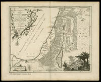
17571443Utrecht Paddenburg 1757. 1st Edition . Print. . ~ ~ NOTE: THE PRICE OF THIS BOOK IS CURRENTLY REDUCED! ~ ~ . Original single-sheet map in copperplate engraving of fine quality. Overall size ca. 400 x 510 mm. Plate mark ca. 365 x 445 mm. Image size ca. 340 x 420 mm. Engraved illustration at lower right corner. Handsome illustrated cartouche encloses engraved title and colophon. Scale within illustrated frame. Fine strong impression on heavy handmade paper with ample margins all round. First original state unaltered by later colouration. Preserved flat in acid-free pH-balanced buffered archival paper. In fine condition. A touch of browning to centrefold. ~ FIRST EDITION. Willem Albert Bachiene 1712-1783 Dutch clergyman later a professor of geography and astronomy at the Illustere School Maastricht. Well known cartographer. The 3-volume "Heilige geographie of aardrijkskundige beschryving van het Joodsche land alsmede andere landen in de H. Schrift voorkomende" is considered among his most important works. It was published in Utrecht between 1763-1768 and included a suite of 12 fine geographical maps of the Holy Land and its neighbouring lands which Bachiene made during a period of ten years the first in as early as 1758. The map offered herewith is taken from this suite. Other important cartographic works of the Holy Land by Bachiene were included in the so-called "Jehovah Bible" i.e. "De Gansche H. Schrift Vervattende alle de regelmatige Boeken des Ouden en Nieuwen Testaments . Gods Gedenk-Naam Jehovah onvertaald gehouden" published in 1762 by N. Goetzee of Gorinchem shortly before the present map first appeared in book form. Whereas other single-sheet maps by Bachiene are in relative abundance the works from "Heilige geographie of aardrijkskundige beschryving van het Joodsche land" are very scarce seldom found in any state practically unavailable in their original uncoloured state. FOLIO <br/> <br/> Utrecht, Paddenburg unknown
17581444Utrecht Paddenburg 1758. 1st Edition . Print. . ~ ~ NOTE: THE PRICE OF THIS BOOK IS CURRENTLY REDUCED! ~ ~ . Original single-sheet map in copperplate engraving of fine quality. Overall size ca. 400 x 510 mm. Plate mark ca. 360 x 445 mm. Image size ca. 345 x 425 mm. With Inset Map "Der Verdeelinge van Israels Land" measuring ca. 150 x 110 mm presented by two finely engraved cherubs. Engraved illustration depicting Joshua's men about to embark on the entry into the Promised Land. Illustrated cartouche encloses engraved title and colophon. Fine strong impression on heavy handmade paper with ample margins all round. First original state unaltered by later colouration. Preserved flat in acid-free pH-balanced buffered archival paper. In a very fine condition. - - FIRST EDITION. Willem Albert Bachiene 1712-1783 Dutch clergyman later a professor of geography and astronomy at the Illustere School Maastricht. Well known cartographer. The 3-volume "Heilige geographie of aardrijkskundige beschryving van het Joodsche land alsmede andere landen in de H. Schrift voorkomende" is considered among his most important works. It was published in Utrecht between 1763-1768 and included a suite of 12 fine geographical maps of the Holy Land and its neighbouring lands which Bachiene made during a period of ten years the first in as early as 1758. The map offered herewith is taken from this suite. Other important cartographic works of the Holy Land by Bachiene were included in the so-called "Jehovah Bible" i.e. "De Gansche H. Schrift Vervattende alle de regelmatige Boeken des Ouden en Nieuwen Testaments . Gods Gedenk-Naam Jehovah onvertaald gehouden" published in 1762 by N. Goetzee of Gorinchem shortly before the present map first appeared in book form. Whereas other single-sheet maps by Bachiene are in relative abundance the works from "Heilige geographie of aardrijkskundige beschryving van het Joodsche land" are very scarce seldom found in any state practically unavailable in their original uncoloured state. FOLIO <br/> <br/> Utrecht, Paddenburg unknown
17682187Utrecht Paddenburg 1768. 1st Edition . Print. . ~ ~ NOTE: THE PRICE OF THIS BOOK IS CURRENTLY REDUCED! ~ ~ . Original single-sheet map in copperplate engraving of fine quality. Overall size ca. 400 x 800 mm with 2 flapped wings. Image size within plate mark ca. 340 x 740 mm. Handsome ornate cartouche encloses engraved title and colophon. Fine strong impression on heavy handmade paper with ample margins all round. First original state unaltered by later colouration. Preserved flat in acid-free pH-balanced buffered archival paper. In fine condition. - - FIRST EDITION. Willem Albert Bachiene 1712-1783 Dutch clergyman later a professor of geography and astronomy at the Illustere School Maastricht. Well known cartographer. The 3-volume "Heilige geographie of aardrijkskundige beschryving van het Joodsche land alsmede andere landen in de H. Schrift voorkomende" is considered among his most important works. It was published in Utrecht between 1763-1768 and included a suite of 12 fine geographical maps of the Holy Land and its neighbouring lands which Bachiene made during a period of ten years the first in as early as 1758. The map offered herewith is taken from this suite. Other important cartographic works of the Holy Land by Bachiene were included in the so-called "Jehovah Bible" i.e. "De Gansche H. Schrift Vervattende alle de regelmatige Boeken des Ouden en Nieuwen Testaments . Gods Gedenk-Naam Jehovah onvertaald gehouden" published in 1762 by N. Goetzee of Gorinchem shortly before the present map first appeared in book form. Whereas other single-sheet maps by Bachiene are in relative abundance mostly with added colouration for purely decorative purpose the works from "Heilige geographie of aardrijkskundige beschryving van het Joodsche land" are very scarce seldom found in any state. They are practically unavailable in their original unaltered uncoloured state. FOLIO <br/> <br/> Utrecht, Paddenburg unknown
2185Utrecht Paddenburg 1750. 1st Edition . Print. . ~ ~ NOTE: THE PRICE OF THIS BOOK IS CURRENTLY REDUCED! ~ ~ . Original single-sheet map in copperplate engraving of fine quality. Overall size ca. 400 x 510 mm. Plate mark ca. 350 x 445 mm. Image size ca. 325 x 410 mm. Incorporates a detailed Plan of the City of Jerusalem within a general delicately illustrated topographical view of its environs. Plain cartouche encloses title and colophon. Fine strong impression on heavy handmade paper with ample margins all round. First original state unaltered by later colouration. Preserved flat in acid-free pH-balanced buffered archival paper. In fine condition. Single outer corner finger-soiled well away from image and plate mark. - - FIRST EDITION. Willem Albert Bachiene 1712-1783 Dutch clergyman later a professor of geography and astronomy at the Illustere School Maastricht. Well known cartographer. The 3-volume "Heilige geographie of aardrijkskundige beschryving van het Joodsche land alsmede andere landen in de H. Schrift voorkomende" is considered among his most important works. It was published in Utrecht between 1763-1768 and included a suite of 12 fine geographical maps of the Holy Land and its neighbouring lands which Bachiene made during a period of ten years the first in as early as 1758. The map offered herewith is taken from this suite. Other important cartographic works of the Holy Land by Bachiene were included in the so-called "Jehovah Bible" i.e. "De Gansche H. Schrift Vervattende alle de regelmatige Boeken des Ouden en Nieuwen Testaments . Gods Gedenk-Naam Jehovah onvertaald gehouden" published in 1762 by N. Goetzee of Gorinchem shortly before the present map first appeared in book form. Whereas other single-sheet maps by Bachiene are in relative abundance the works from "Heilige geographie of aardrijkskundige beschryving van het Joodsche land" are very scarce seldom found in any state practically unavailable in their original uncoloured state. FOLIO <br/> <br/> Utrecht, Paddenburg, (1750). unknown
2206Utrecht Paddenburg 1757-67. 1st Edition . Print. . ~ ~ NOTE: THE PRICE OF THIS BOOK IS CURRENTLY REDUCED! ~ ~ . Lot of 5 original single-sheet maps in copperplate engraving of fine quality. Fine strong impressions on heavy handmade paper with ample margins all round. First original state unaltered by later colouration. Preserved flat in acid-free pH-balanced buffered archival paper. In fine condition. - - Full individual descriptions are available on request. - - FIRST EDITION. Willem Albert Bachiene 1712-1783 Dutch clergyman later a professor of geography and astronomy at the Illustere School Maastricht. Well known cartographer. The 3-volume "Heilige geographie of aardrijkskundige beschryving van het Joodsche land alsmede andere landen in de H. Schrift voorkomende" is considered among his most important works. It was published in Utrecht between 1763-1768 and included a suite of 12 fine geographical maps of the Holy Land and its neighbouring lands which Bachiene made during a period of ten years the first in as early as 1758. The map offered herewith is taken from this suite. Other important cartographic works of the Holy Land by Bachiene were included in the so-called "Jehovah Bible" i.e. "De Gansche H. Schrift Vervattende alle de regelmatige Boeken des Ouden en Nieuwen Testaments . Gods Gedenk-Naam Jehovah onvertaald gehouden" published in 1762 by N. Goetzee of Gorinchem shortly before the present map first appeared in book form. Whereas other single-sheet maps by Bachiene are in relative abundance the works from "Heilige geographie of aardrijkskundige beschryving van het Joodsche land" are very scarce seldom found in any state practically unavailable in their original uncoloured state. - - Note regarding this lot: Each of the 5 maps in this lot is offered also separately. Descriptive text Copyright Librarium The Hague FOLIO <br/> <br/> Utrecht, Paddenburg, 1757-67. unknown
8 jigsaw puzzles, 302 x 228 mm each: lithographs in original hand colour, laid down to wood panels. Relief shown by hachures. Stored in decorative box (320 x 250 x 55 mm). Charming hand-coloured geographical puzzle set, manufactured by Logerot in Paris, rarely encountered complete and with eight maps: World, North America, South America, Europe, Asia, Africa, Oceania, and France. Puzzles of this type were first produced in London by John Spilsbury in the 1760s, but the style passed to the continent and became a popular educational tool in France and Germany in the early to mid 19th century. Logerot issued his puzzles from the 1850s onwards; the European borders of this set point to a production date between 1878 and 1880. The puzzle maps are stored in the box fully assembled, each resting on a paper mat with cloth tabs for easy retrieval. - In excellent condition. Cf. OCLC 56131950. Tooley III, p. 148 ("99 jugsaw puzzles, c. 1850").
Libri Illustrati Rizzoli - Traduzione di Liliana D'Agostina - La formazione del Pakistan - La magia delle terre di frontiera - Il fiume e le pianure - La citt? e il deserto 1 31,5x23,5 cm., legatura in piena tela, titolo impresso in oro al dorso, sopraccoperta a colori, pp. 254 (1), numerose stupende illustrazioni a colori, prima edizione, italiana, buone condizioni Il Pakistan si trova in quel bivio del mondo dove le culture del Medio Oriente e dell'Asia si incontrano e diventano una cosa sola. Qui la storia antica esercita una profonda influenza nel mitigare la maniera in cui le tecnologie e gli atteggiamenti di questo secolo ventesimo vengono accolti, interpretati e utilizzati. Qui religione e nazionalismo convergono nella societ? verso un punto ottimale di sentimenti comuni e di valori condivisi. Qui il lungo nastro di un fiume unisce caratteristiche geografiche disparate, legando le montagne al mare e i deserti alle verdi e fertili pianure...
Milano, Genio, 1936, 8vo tutta tela editoriale, pp. 188 con tav. fot. f.t.
191315734Plon | Paris 1913 | 12 x 19.50 cm | broché
190847967Armand Colin | Paris 1908 | 11.50 x 18.50 cm | relié
183089751Truchy | Paris 1830 | 13.7 x 21.7 cm | Broché
10984hors-texte - Préface du général Ed. Brémond,Paris, Victor Attinger 1936, 192 pp., 1 vol. in 8 br. couverture fatiguée, dos cassé, intérieur bon état (qq. rouss.)
193961723Grasset | Paris 1939 | 12 x 19 cm | broché