Livre Rare Book
3 551 résultats
44433Paris, Imprimerie Nationale 1874-1876, 270x170mm, VI- 656 + 650pages, reliure demi-chagrin. Dos à nerfs, titre doré, quelques rousseurs. Bon état.
138591aafParis, Librairie Hachette, 1885, in-4°, XII (dont le portrait gravé de l'auteur et le titre en rouge et noir) + 481 p. / VI (dont le portrait gravé d'Oscar II et le titre en rouge et noir) + 478 p., très abondamment illustré de vignettes, de planches et de cartes, papier très frais, avec signet, Ex libris Peter E. Obergfell, doublures et gardes en beau papier marbré solides et élégantes reliures en demi-chagrin rouge aux coins, dos à cinq nerfs doré, pièce de titre et de tomaison vert, bas du dos avec Paris 1885 R. T. Bel ensemble, très bon exemplaire.
127378aafParis, Arthus Bertrand, Librairie maritime et scientifique, s.d. (1873), gr. in-8°, 164 p. avec 1 planche (sur papier mince) ‘Rose des vents’ (en partie déchirée, mais complète) + 14 planches dépliantes (croquis et cartes), pte. découpe en-tête du titre (un nom coupé), solide reliure artisanale en demi-maroquin brun foncé, dos à quatre nerfs sobrement décoré, monogramme doré ‘A.H.’.
2 Vols., folio, [2], 460; [2], [441]-990, [2, directions to the binder], [4, list of subscribers]pp., lacks most plates and maps, text age-toned and with occasional staining, cont. red morocco, rubbed and worn. With 8 plates and 3 torn and defective maps: Vol. I. Plate. p. 157. Plate. p. 203. Plate. p. 407. Vol. II. Frontispiece. Map. p. 541. Map. p. 580. Plates x 2. p.685. Map. p. 906. Plates x 2. p. 920.
First edition, 8vo (200 x 130 mm), vii, [1], 30pp., coloured folding map frontis., cont. half calf, marbled boards, spine defective at foot, gilt lettered red morocco label on upper cover. A poetical celebration of the opening of the port of Norwich by William Cole (1769-1835), Suffolk farmer, later clerk at the Norwich and Lowestoft Navigation Works. The plan for making Norwich a Port was first submitted by Crisp Brown on the 3rd of May, 1814, in which year William Cubitt, Civil Engineer, took a survey of the Navigation. The Royal Assent was granted on the 28th of May, 1827. Rare: Copac locating the BL and Oxford copies only.
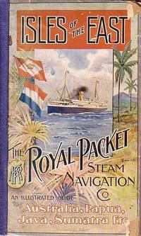
65033KPM / Royal Packet Steam Navigation Company. Batavia. 1912. . Deluxe edition of January 1912. Edited by W. LORCK. LII adverts 244 PP followed by LIII-CXXI adverts and b/w and colour illustrations plus 1 b/w plate : portrait of Her Majesty the Queen of the Netherlands; 1 plate "Time Table 1912; 1 folded plate "Accommodation plan of KPM Steel Screw Steamer "Tasman" and 2 colour plates: painting by C. H. Hoyt "Middle Harbour Sydney from Mosman Heights and "Samples of Javanese Art Work." . Papered boards with a colour illustration on front board by Tindall cloth spine. Front cover with small pieices missing at corners of front edge. Spine has been reinforced crudely. The first few pages up to VIII are somewhat damaged at the gutters without loss and most of Page III/IV has been torn off. The guide was published on superior glossy paper thus conserving its clarity and brightness. A very good copy of quite a rare item. 25.3 x 15.5. KPM / Royal Packet Steam Navigation Company. Batavia. 1912. hardcover
2021DADAX981334668XSpringer 2021-03-24. 1st ed. 2021. hardcover. New. 6.14x0.81x9.21. Buy with confidence. Excellent Customer Service & Return policy. Springer hardcover
189677014Washington DC: U.S. Department of the Navy Bureau of Navigation Hydrographic Office 1896. Presumed First Edition First printing thus. Map. Good. This was published at the Hydrographic Office in Washington D.C. in February 1896. No. 1530. Charles D. Sigabee Commander U.S. N. Hydrographer. Format is approximately 26 inches by 17 inches folded. This map is disbound from Volume I of the Commercial Directory of the American Republics compiled by the Bureau of American Republics International Union of American Republics Joseph P. Smith Director 1897 Title page from Directory is present. Taped to top right of map in margin is the statement "This chart is intended solely to show tracks of steam vessels on the ocean and no authority is assumed for the boundary lines as drawn between the countries." Map has some color differentiation and several inserts presenting distance information between major ports of call. Map has been folded with approximately the top third folded down. It is also folded into four sections of different lengths to fit as the frontis to the Directory. Map has some wear and soiling/staining. This is similar to the large-scale and detailed World chart on Mercator's projection produced by the British Admiralty under the "Superintendence of Captain Wharton R.N. F.R.S Hydrographer" engraved by Edward Weller and sold by J. D. Potter chart agent. The map has no internal landmass detail unless relevant to steam ship routes thus the Suez and Panama canals are marked as is the Canadian Pacific Railway. Panels along the lower edge list major ports and give distances dependent on routes taken and average knots-per-hour speeds with daily distances covered in miles. The world's major ports are linked by ship-routes each track with its relevant distance and so on. An interesting chart at the time steam took over from sail. Charles Dwight Sigsbee 1845 - 1923 was a Rear Admiral in the United States Navy. In his earlier career he was a pioneering oceanographer and hydrographer. He is best remembered as the captain of the USS Maine which exploded in Havana harbor Cuba in 1898. U.S. Department of the Navy, Bureau of Navigation, Hydrographic Office unknown
Very Good French A fine original chromo-lithograph print from "Souvenirs de Constantinople" by Brindesi, printed in 1845. Framed, but will be sent no frame. 52x49 cm / 39x 44 cm print area. Stains on right bottom margins of the paper. The Ottoman navy, stationed in front of the Tophane Artillery barracks, is preparing to sail under the leadership of Kapudan Pasha's ship "Amiraute". Jean Brindesi was born in 1826 and worked primarily as a watercolour artist. During the Abdulmecid period (1831-1861), he worked on scenes involving soldiers in Istanbul. Two albums of lithographs after his drawings were produced by Lemercier in Paris: Elbicei Atika - Musee des Anciens Costumes Turcs de Constantinople, 1855, and Souvenirs de Constantinople, 1860; these two works are collections of picturesque views of the city of Constantinople. The originals are kept at the Istanbul Topkapi Palace Museum and at the University of Istanbul. (Source: Levantine Heritage).
2016__4431563318Springer 2016. Paperback. New. reprint edition. 260 pages. 9.25x6.10x0.62 inches. Springer paperback
ORD-1233Avec l'examen des Documens qui établissent ou contestent leur existence; suivi 1° d'une Table exacte des déclinaisons de la boussole, avec les dates des époques où elles ont été observées; 2° D'une Série d'Expériences qui tendent à prouver qu'en vérifiant de temps en temps le profondeur de la mer, et sa chaleur relative, au moyen du thermomètre, on peut être averti des dangers sur la route d'un vaisseau, assez à temps pour les éviter, quoique le mauvais temps empêche de reconnaître la nature du fonds ou de faire des observations astronomiques; 3° D'un Tableau de faits propres à constater le cours des îles de glace du Groënland vers Terre-Neuve, etc. Traduit de l'anglais d'Edmond BLUNT. Paris. Mme Seignot. 1822. In-8 (130 x 198mm), VIII, 208 pages. Dos lisse basane brune, orné de frises et fleurons or, pièce de titre maroquin rouge, tranches marbrées. Les VIII premières pages lgt brunies sinon bon exemplaire. Peu courant (Polak, 898; Sabin, 6027; Quérard I, 361.)
204457 pages autographes ,IN4 broché,sans couvertures,ecriture lisible
280pp, index, 19pp + 2 plates, 332pp + table VG/none First edition, in French. Contemporary binding green hardback with gilt decoration and lettering on spines, binder’s and owner’s labels on pastedown of vol. I, previous owner presentation on preliminary, slightly offset on title, occasional light foxing inside, nice volumes overall in G-to-VG conditions. First two volumes of a 5-volume series printed between 1855 and 1860, each independent. Included in the first volume two plates containing maps (folded in the photos) of the Isthmus of Suez and of the Navigation Routes between European and American ports and the Indies. Prima edizione, in francese. Rilegatura coeva copertina rigida verde con decorazioni e scritte dorate al dorso, etichetta rilegatore e ex-libris sul retro della copertina, scritta proprietario al foglio preliminare leggermente trasmessa al frontespizio, sporadiche fioriture all'interno, nel complesso in condizioni piu' che buone. Primi due volumi, a se' stanti, di una serie di cinque pubblicata tra il 1855 e il 1860. Nel vol. I incluse due mappe ripiegate (Istmo di Suez e Rotte di Navigazione tra i porti europei ed americani e le Indie).
1878188051878 Paris, Dunod, 1878, - 1 vol. grand in-4 de 128 planches sur 129 planches sur double page (dont 19 dépl. et ) pour l’atlas;reliure demi velin,dos muet. 19e fascicule du Manuel de l'ingénieur des Ponts et Chaussées rédigé conformément au programme annexé au décret du 7 mars 1868 réglant l’admission des conducteurs des Ponts et Chaussées au grade d’ingénieur. Edition originale. Rare.
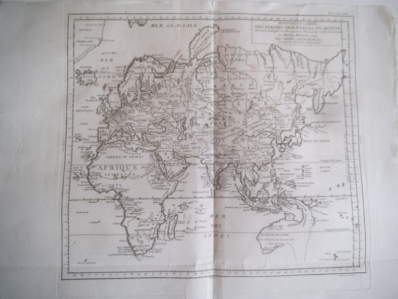
14520Nouvelle carte des parties orientales du Monde servant à indiquer les navigations, découvertes et établissements des Hollandois dans les Indes orientales suivant la dernière observation. Gravé par LATTRE gravure 370x350(coupé à la cuvette 500x350mm avec marges Rare carte avec l’Australie, océan pacifique, traces des nombreux explorateurs
2 tomes: 348 + 392pp., 27cm., reliures cart. uniformes (plats marbrés, dos en toile avec titre doré, charnière sup. de t.2 restaurée), bon état, Publication du ministère des travaux publics (direction des travaux hydrauliques), tome 2 contient principalement des tableaux (avec indication de: désignation du port et du bassin et des biefs, distance kilométrique, niveau du couronnement, cote absolue, niveau au-dessus des fondations, longueur, ponts, etc…], B89650
Paris, chez Didot, Libraire, 1746. Folio; portada, XVII pp., XIV pp., 563 pp., 1 h., y 30 magníficas láminas grabadas por Chedel sobre dibujos de Cochin, 17 de ellas plegadas, en su mayor parte mapas. Las últimas cien páginas presentan ligeros rastros antiguos de humedad. Encuadernación de época en piel marbreada, fatigada, con lomera perdida en gran parte.
12123Paris, Librairie scientifique-industrielle de L. Mathias (Augustin), 1847, fort in-8° de 2 ff.n.ch. (fx-titre, titre)-944 pages, relié demi-chagrin bleu d'époque, titre or sur dos lisse orné de filets or et à froid, gardes de papier caillouté ; rousseurs fortes à plusieurs cahiers, pour autant très bon exemplaire de ce livre qui semble fort rare.
1943000693Paris Moulin De Pen-Mur 1943
993Barcelone, impresor Manuel Texéro/imp. de Bosch y Comp., 1851/1856 - 2 t. in-8 : 1 f., 38 pp., 224 ff. / 1 f., 70 pp., 274 ff. (rousseurs habituelles, qqs mouill.) - en 2 vol. chag. marine, dos à faux nerfs, plat sup. portant une très large inscription dédicatoire au duc de Montpensier agrémenté de petits fers, aux plats inf., encadrement de filets et de petits fers à froid et dorés, double filet sur les coupes et les chasses, tr. dorée (plats très légèrement frottés, un coin lég. plié) - rel. P. Domenech)
248791882. Printed. One page 33 x 25cm small chip off one corner fold marks discreet repair to edges and fold just noticeable shadow caused by exposure to sun good condition. See Image. On otherwise blank version there is the small stamp of the Webster Collection no. '1569'. Note: In "Orient Line Guide: Chapters for Travellers by Sea and by Land" W.J. Loftie pubd 1890 i.e. a later edition the relevant plate only shows the outward journey not the homeward. I have found no other copy of the White/Hull edition 1882 on viaLibri. 1882. unknown
Madrid, Juan Vidal, Editor, 1880. Dos volúmenes en folio; I: 68 pp. + 160 pp. + 180 pp. + 176 pp., 2 hs. .II: 2 hs., 151 pp. + 172 pp. + 199 pp., 2 hs. Además 192 pp. que contiene los números 1 a 12 de la "Revista Geográfica". Impresión a doble columna. Con numerosas ilustraciones entre el texto, algunas a toda plana, 67 láminas fuera de texto y 7 mapas dobles, impresos en color, dibujados y grabados por Daniel (Urrabieta) Vierge. Encuadernación de época en media piel, con pequeñas faltas de la misma en lomera. Contiene el "Viaje a Nueva Guinea" de Achille Raffray, el "Viaje en el vapor Vega para realizar el Pao del Nordeste" de Adolf Erik Nordenskiöld, el "Paseo alrededor del mundo" del Barón Alexander Joseph von Hübner, el "Viaje a la Australia" de Désiré Charnay, traducido " y aumentado con importantes datos de excursiones hechas en el interior del pais" por Adolfo Suarez de Figueroa, y "Exploraciones de los Istnos de Panamá y de Darien" de Armand Reclus.
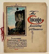
190922859Chicago: Chicago Association of Commerce 1909. First Edition. Quarto; 8pp. Four string-tied and stapled leaves with ten 3 1/2" x 5 1/2" mounted colored illustrations each titled in red along with a map of the route. Near Fine copy in grey cardstock titled and color photograph tipped to front cover. Rare promotional piece; we fine only 1 copy at University of Michigan. This booklet was prepared by the Oregon Railroad & Navigation Company the Oregon Short Line Railroad the Union Pacific Railroad and the Chicago & Northwestern Railway as an itinerary for the approximately 40 Chicago merchants' return trip ". calling your attention to a few of the points of interest in a country of marvellous scenes wonderful accomplishments and a still more wonderful future." Lists 38 members of the Chicago Association of Commerce making the return trip. Uncommon attractive & elaborate promotional piece. Chicago Association of Commerce unknown
19397103Np: Matson Navigation Company 1939. 1st. Paperback. First Edition. Folio. Vol. 1 No. 1 - 4 Jan. 1941-June 1941 Complete. Each issue 14pp. Numerous photo-illustrations; ads. Original photo-illustrated wrappers. Minor soiling and wear to extremities; front cover of No. 2 partially separated; otherwise near fine. Four numbers issued during the 4 day voyage on the Matson Line cruise ship from California to Hawaii California-Hawaii-Samoa-Fiji-New Zealand-Australia. Each number features a special theme-the first Hawaii's History; the second Scenic Attractions; the third Island Sports and Recreation; and fourth Native Life and Folklore. Matson Navigation Company paperback
New English Original very decorative full leather bdg. with mystical sun gilded. Folio. (33 x 24 cm). In English, Turkish and Ottoman Turkish. 1 atlas (40 pages; 426 leaves, that is, 852 pages) color illustrations, color maps. Piri Reis's Kitab-i Bahriyye. Facsimile, Topkapi Palace Museum Library, Treasury Collection, number 642.= Kitab-i Bahriyye. Topkapi Sarayi Müzesi Kütüphanes Hazine Koleksiyonu. Printed to 2000 copies.